

Hello there,
There are already multiple suggestions on how to improve France in general, but this one is about the map in particular. So, without further addo, my proposition for France:
 Black dots obviously indicate the capital-cities of the respective provinces. Some have been changed in terms of location, because they are not in the correct spot in the base-game. I generally used Google Maps for that. A disclaimer: This is a suggestion; a piece of advice, so it's by no means definitive. Province-shapes, in particular, can be much more aesthetic than shown here. I explain certain 'design'-choices down here. I added 9 fully new provinces in the French region; most of them in the south and middle portions.
It would be hard to actually talk about all the new provinces if they aren't numbered, so here we go:

EDIT: The latest dev-diary showed us the new French setup, I was quite sad to see that old provinces haven't been properly adjusted, even though this thread was made roughly 5 months before the dev-diary. Anyway, I hope the developers will still look at this map and adjust the cities.

1: Moved the capital and it should be renamed to Brest.
2: Moved the capital.
3: Moved the capital and it should be renamed to Saint-Malo.
4: Moved the capital (Angers, which is in the Maine-province) to the correct bank of the river, as the current capital is in the location of Saumur.
5: Moved the capital.
6: Moved the capital and it should be renamed to Rouen. Caux was a geographical entity without Rouen.
7: Moved the capital.
8: Moved the capital.
9: Moved the capital to the correct bank of the river.
10: Moved the capital (Soissons) to the correct position above the river and in the current Reims-province. The current capital is in the position of Compiegne.
11: Moved the capital.
12: Moved the capital.
13: Moved the capital.
14: Moved the capital to the correct bank of the river.
15: Auxerrois currently has a fortress as capital, but it should have Auxerre as capital; the city it was named after in the first place and more important.
16: Moved the capital.
17: Moved the capital to the correct bank of the river.
18: Moved the capital.
19: Moved the capital.
20: Moved the capital.
21: Moved the capital of Gueret and reshaped the province.
22: Moved the capital of Limoges (should be above that river) and reshaped the province.
23: Moved the capital to the correct bank of the river.
24: Moved the capital.
25: Moved the capital.
26: Moved the capital to the correct bank of the river.
27: Moved the capital closer to the river.

1: Annecy, although sizable nowadays, is barely located in the province and thus should be renamed to either Bugey (with the capital of Belley, which is already in the correct position) or to Bresse (with the capital of Bourg-en-Bresse, which is indicated by the red dot). The latter has my preference, as it was more important within the timeframe of EU4.
2: Geneve should be next to the lake.
There are already multiple suggestions on how to improve France in general, but this one is about the map in particular. So, without further addo, my proposition for France:
It would be hard to actually talk about all the new provinces if they aren't numbered, so here we go:
The first state is Brittany:
1: Brest or Cornouaille: with either Brest or Quimper as capital. I would personally go for Brest, as it's already the capital of the province in the base-game, but it's in the location of Quimper. Brest quickly gained importance within EU4's timeframe as an important harbor-city. The current name for the province, Finistère, was introduced after the French Revolution, so it's anachronistic.
2: Saint-Malo: Armor, while a Breton name, is anachronistic; also created after the French Revolution. It should just be called after its capital; Saint-Malo. The location should also be shifted, as it's currently in the location of the city of Dol.
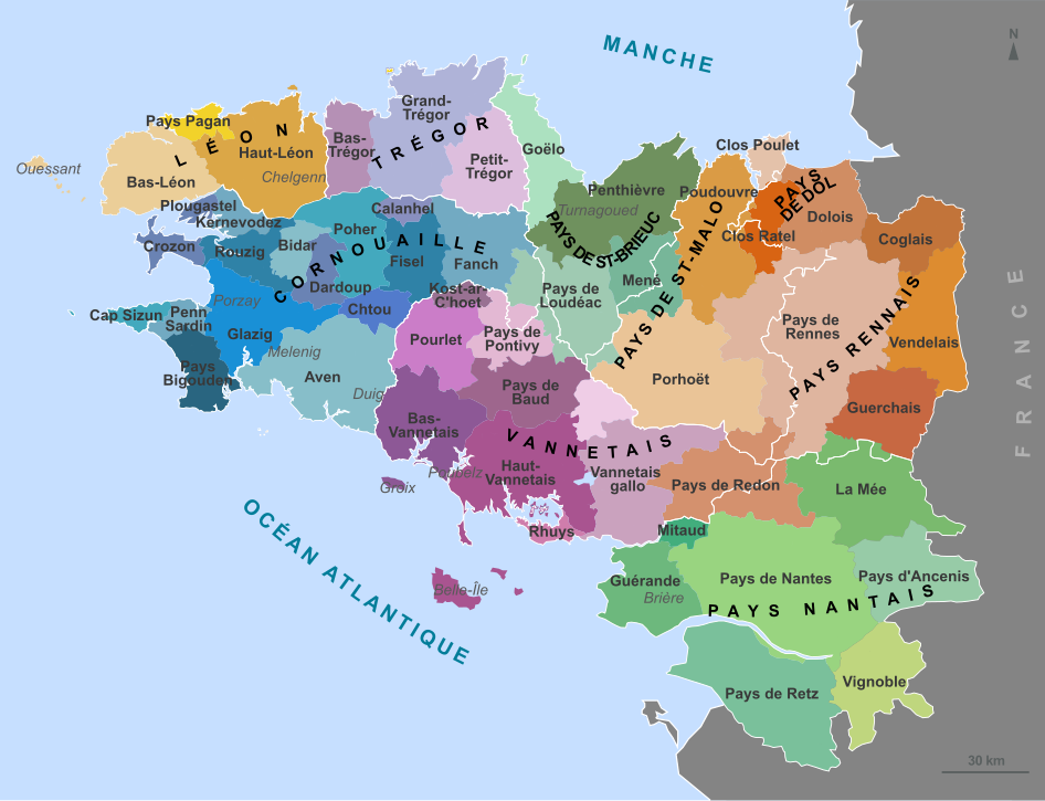 3: Vannetais: Only the location of the city of Vannes has been corrected.
4: Rennais: Nothing has changed here.
5: Nantais: Nothing has changed.
The second state is Normandy:
6: Cotentin: Nothing has changed here.
7: Caen: Nothing has changed here.
8: Rouen: The name has been changed to its capital, Rouen. This is because Caux is a geographical entity which didn't encompass the city of Rouen itself. Neither was it some kind of duchy or county. The location of Rouen is also corrected, as it was placed too much to the north. A small part of this province has been given to Chartres, that's because the city of Evreux was already under French control in 1444.
 9: Alençon: Nothing has changed here.
The third state is Ile-de-France:
10: Valois: The capital of Soissons has been shifted to the correct location, it was way off.
11: Chartres: As mentioned earlier, the city of (2) Evreux has been given to this province. (1) Chartres itself is obviously still the provincial capital, its placement has been corrected slightly, though.
12: Paris: Nothing has changed here.
13: Nemours: Not much has changed, only a small part has been given to Troyes. More about that later.
The fourth state is Champagne:
14: Rethelois: The capital of Rethel has been moved to the correct location; a minor change.
15: Reims: Nothing has changed here.
16: Troyes: The city of Troyes has been moved to the correct location, but in order to do that, a part of Nemours had to be given to the province. It should be in an almost direct line beneath Reims, but this isn't the case in the base-game.
The fifth state is Loire (the Loire-river Valley):
17: Maine: The capital of Le Mans has been shifted to the correct location.
18: Anjou: The capital of Angers has been moved more to the north, so the shape of the river has to be changed a little, too. It was in the incorrect location.
19: Touraine: Nothing has changed here. I really wanted to squeeze Blois between Touraine and Orleanais, but it would result in a true mini-province, sadly. If you guys find a way, make it happen! It was a very important and populated region.
20: Orleanais: Nothing has changed here.
21: Berry: The location of the capital, Bourges, was way off. So, it has been changed to the correct location. A very small part of the province has been given to the new province of La Marche. A very subtle change, though.
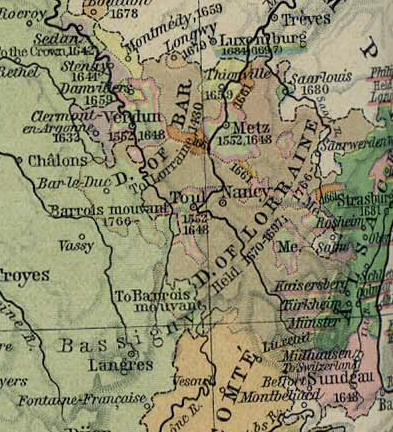
The sixth state is Lorraine, Metz and Lorraine are also a part of this state, but not shown on this map:
22: Verdun: First new province. Part of the new Verdun/Trois Eveches (Three Bishoprics) tag. It was an independent bishopric, conquered by France in the 16th century alongside Toul and Metz. This would mean that the current in-game province of Trois Eveches gets renamed to Metz itself and becomes a part of this tag.
 23: Barrois: The city of Bar-le-Duc has been shifted to the correct location.
The seventh state is Burgundy:
24: Auxerrois: Its shape has been adjusted to make way for its actual capital; Auxerre. Its current capital is Semur, an important castle, but it wasn't the historical capital of this county. Auxerrois is obviously named after Auxerre itself.
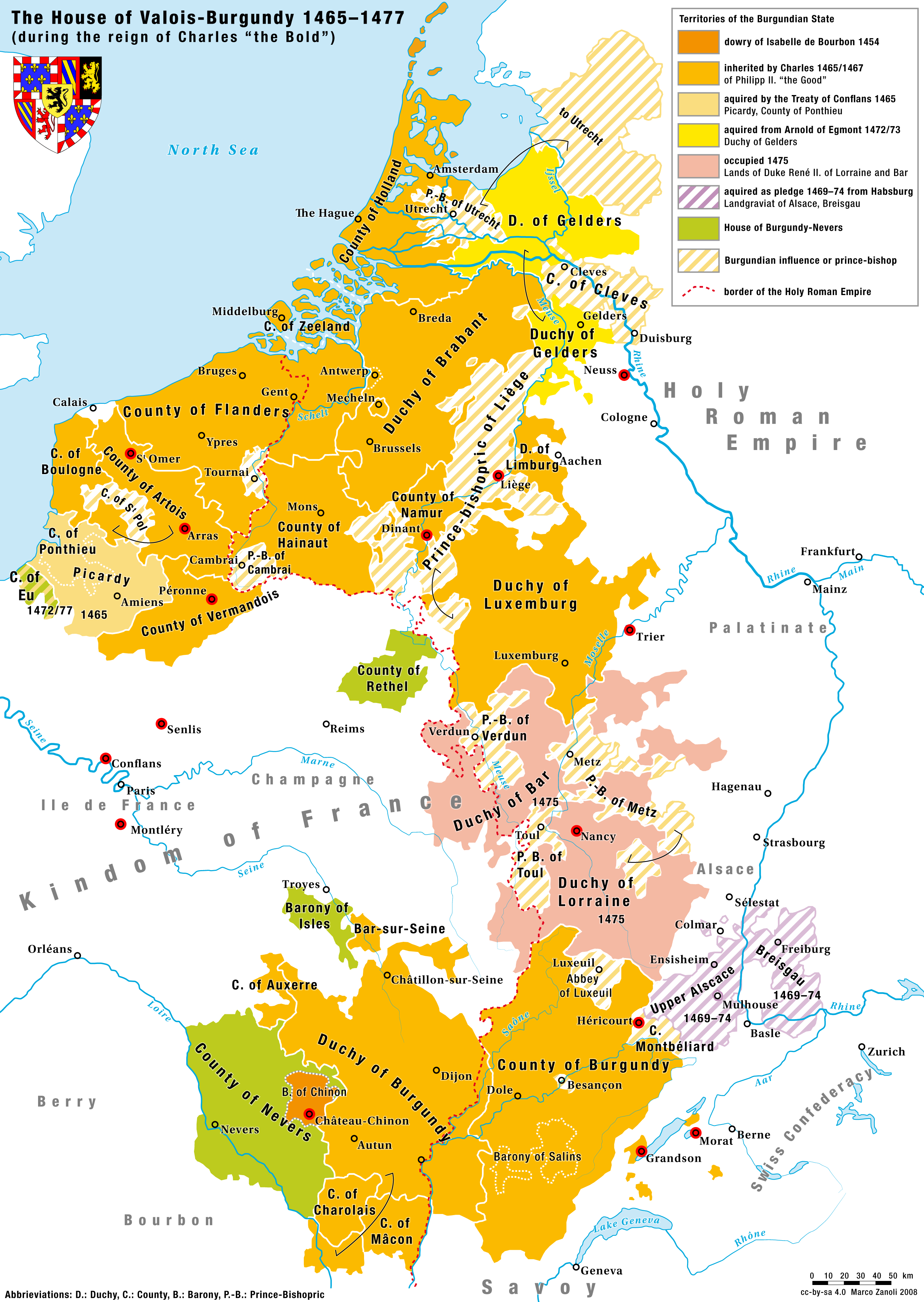
Another map showing the divisions of Burgundy: https://www.themaparchive.com/burgundian-lands-13631477.html
25: Nevers: It has grown a bit in size; taking some parts of Charolais.
26: Dijonnais: Adjusted its size and shape a bit.
27: Charolais: Its far too big in the basegame, bigger than it historically was. Decided to make it much smaller for Mâcon, for better historical divisions. It having salt as a trade-good doesn't make sense, by the way. The only salt-winning the Burgundian dukes did, was in Salins - Franche Comté. It should be livestock, as Charolais is known for its breed of cow, which already existed in some form back in the 15th century.
28: Mâcon: Second new province for the French region, to make historical shapes more likely and to break-up the big Charolais province. It was a Burgundian county, like Auxerrois and Charolais. It should have wine as tradegood.
The eighth state is the new state of Franche-Comté:
Disclaimer: I've been convinced by multiple people that France-Comté might indeed be too big. There is a way to separate it into multiple provinces while still staying true to the timeline of EU4. I went for three small provinces, but if they're too small they can always be merged into two provinces. The argument for such small provinces is them being part of the HRE, which has a greater province-density to begin with. Ibiza, Avignon and Dobrzyn are small, too. A state can never have just two provinces, that's why Mâcon could be given to this state (even if not part of this region, it wouldn't be the first time such a thing happens). This region was historically separated into three bailliages.
 29: Gray: Although Vesoul was the capital of the bailliage of the north, it wasn't the economical capital. Gray was bigger and wealthier. Vesoul was also plundered and burned-down multiple times. Gray was much more important. Could be given grain as tradegood.
30: Besançon: Although not under direct Burgundian control, it was still under heavy influence by the dukes. It was the most important and biggest city of the whole Franche-Comté, also semi-independent. It could be given its own releasable tag: The Free City of Besançon. Some very good wines are from this region, so it could be given wine as tradegood.
31: Salins: Salins-les-Bains was a major saltproduction-site, the reason why the current Franche-Comté province has salt as tradegood. If Franche-Comté can only be split in two provinces, I'd go for Besançon and Salins.
The nineth state is Poitou:
32: Bas-Poitou: Nothing has changed.
33: Haut-Poitou: Moved the capital of Poitiers to the correct location, cutting a very, very small part from Anjou. A part of it has also been given away to make place for the new province of La Marche.
34: Saintonge: Moved the capital of Saintes a bit further inland.
35: Angoumois: Nothing has changed.
The tenth state is Massif Central:
36: La Marche: Another new province, first new one in the south. La Marche, with Guéret as capital, has been a county of France for a long time, separate from Limousin. It's still a separate province these days.
37: Limousin: Split to make way for La Marche. The general shape of the province, as well as the position of the river and the city of Limoges had to be corrected to make way for the new province. It's more historically accurate this way.
38: Bourbonnais: The location of the capital, Moulins, has changed.
39: Auvergne: Not much has changed here, only a small part of it has been given to Vivarais. More about that later.

The eleventh state is Savoy:
40: Lyonnais: Nothing has changed. There may be a chance for the province of Forez, but it has no priority. Should have a new Arpitan culture.
41: Dauphiné: Nothing has changed. Should have a new Arpitan culture.
42: Bresse: New province, split from Savoie. Capital is Bourg-en-Bresse. Tradegood should be livestock (because of its award-winning poulet) and the terrain should be hilly. It's quite small, but I think it could be included next to Geneva (upcoming Savoy-thread) to make Savoy more flavourful and historically correct. This part was conquered by France earlier than the rest of Savoy. Should have a new Arpitan culture.
 43: Savoie: Has been split to create Bresse. The capital of Chambéry has been moved a bit. Should have a new Arpitan culture.

The twelfth state is Guyenne:
44: Périgord: Nothing has changed.
45: Quercy: Nothing has changed.
46: Rouergue: Nothing has changed.
I wonder if the Gascon culture of some of these provinces can be revisited. I think Occitan fits better for all three of them. Same with Limousin. Unless the Limousin dialect is closer to Gascon, of course. Debatable aspect.
The thirteenth state is Gascony:
47: Aquitaine: Slightly moved the city of Bordeaux. Very, very minor. Could be renamed to Bordelais, although I personally don't mind its current name all too much.
48: Labourd: Nothing has changed.
49: Armagnac: Slightly adjusted the borders to make room for some other provinces. Also adjusted the location of the city of Auch a little bit.
50: Béarn: Lost some weight to the new province of Foix. It consists of the counties of Béarn + Bigorre.
The fourteenth state is the new state of Toulouse:
51: Toulouse: Shrunken a bit to make place for two new provinces. Also placed the city of Toulouse itself in a more correct position.
52: Foix: Finally. France's most-wanted and split from Béarn and parts of Toulouse (the capital city of Foix itself is located there). It's basically the counties of Comminges + Foix. Should definetely be included, as the Foix-tag shouldn't be releasable from Béarn if the city of Foix itself isn't even located there, as is the case in the current basegame.
53: Carcassonne:
 Okay, joke's on me. The fortress located in Narbonnais should be given to this province. Carcassonne had a massive, but old, fortress. Toulouse was a big and wealthy province, it can easily be split this way.
The fifteenth state is Languedoc:
54: Vivarais: Cut a small part from Auvergne and gave it to Vivarais to include Gévaudan (2), a county and a city which was a historical part of the Languedoc region. A separate new province would be too much, as this region was quite poor.
55: Montpellier: Nothing has changed.
56: Narbonnais: Slightly adjusted the border to make room for Carcassonne. The county was historically small, so it doesn't really matter much. Also made sure to put the city of Narbonne closer to the sea, as it's too much inland in the current basegame.
The last and sixteenth state is Provence:
57: Avignon: Nothing has changed.
58: Forcalquier: Put it in the correct position. The city is currently still in the position of Draguignan. Forcalquier, while not very populated, was a historical county, so it should definetely stay in-game. I tried to make the borders slightly bigger than its historical shape, because it would be too small and lineair otherwise.
 59: Aix: Renamed Provence to Aix. Provence itself was a county on its own, but I decided to split it. Aix-en-Provence was the capital and is still a sizable city nowadays. But what about Marseille you might say, well, they're only 30km apart from each other and Marseille wasn't the capital. Reminder that this province should never be called Provence if the historical county of Provence is split. Moved the location of the city to the more correct location, too.
60: Toulon: Provence should at least have a well-developed harbor-city if Marseille isn't added, so Toulon fits that role perfectly. It grew quickly in size and fame during EU4's timeframe.
1: Brest or Cornouaille: with either Brest or Quimper as capital. I would personally go for Brest, as it's already the capital of the province in the base-game, but it's in the location of Quimper. Brest quickly gained importance within EU4's timeframe as an important harbor-city. The current name for the province, Finistère, was introduced after the French Revolution, so it's anachronistic.
2: Saint-Malo: Armor, while a Breton name, is anachronistic; also created after the French Revolution. It should just be called after its capital; Saint-Malo. The location should also be shifted, as it's currently in the location of the city of Dol.
4: Rennais: Nothing has changed here.
5: Nantais: Nothing has changed.
The second state is Normandy:
6: Cotentin: Nothing has changed here.
7: Caen: Nothing has changed here.
8: Rouen: The name has been changed to its capital, Rouen. This is because Caux is a geographical entity which didn't encompass the city of Rouen itself. Neither was it some kind of duchy or county. The location of Rouen is also corrected, as it was placed too much to the north. A small part of this province has been given to Chartres, that's because the city of Evreux was already under French control in 1444.
The third state is Ile-de-France:
10: Valois: The capital of Soissons has been shifted to the correct location, it was way off.
11: Chartres: As mentioned earlier, the city of (2) Evreux has been given to this province. (1) Chartres itself is obviously still the provincial capital, its placement has been corrected slightly, though.
12: Paris: Nothing has changed here.
13: Nemours: Not much has changed, only a small part has been given to Troyes. More about that later.
The fourth state is Champagne:
14: Rethelois: The capital of Rethel has been moved to the correct location; a minor change.
15: Reims: Nothing has changed here.
16: Troyes: The city of Troyes has been moved to the correct location, but in order to do that, a part of Nemours had to be given to the province. It should be in an almost direct line beneath Reims, but this isn't the case in the base-game.
The fifth state is Loire (the Loire-river Valley):
17: Maine: The capital of Le Mans has been shifted to the correct location.
18: Anjou: The capital of Angers has been moved more to the north, so the shape of the river has to be changed a little, too. It was in the incorrect location.
19: Touraine: Nothing has changed here. I really wanted to squeeze Blois between Touraine and Orleanais, but it would result in a true mini-province, sadly. If you guys find a way, make it happen! It was a very important and populated region.
20: Orleanais: Nothing has changed here.
21: Berry: The location of the capital, Bourges, was way off. So, it has been changed to the correct location. A very small part of the province has been given to the new province of La Marche. A very subtle change, though.
The sixth state is Lorraine, Metz and Lorraine are also a part of this state, but not shown on this map:
22: Verdun: First new province. Part of the new Verdun/Trois Eveches (Three Bishoprics) tag. It was an independent bishopric, conquered by France in the 16th century alongside Toul and Metz. This would mean that the current in-game province of Trois Eveches gets renamed to Metz itself and becomes a part of this tag.
The seventh state is Burgundy:
24: Auxerrois: Its shape has been adjusted to make way for its actual capital; Auxerre. Its current capital is Semur, an important castle, but it wasn't the historical capital of this county. Auxerrois is obviously named after Auxerre itself.
Another map showing the divisions of Burgundy: https://www.themaparchive.com/burgundian-lands-13631477.html
26: Dijonnais: Adjusted its size and shape a bit.
27: Charolais: Its far too big in the basegame, bigger than it historically was. Decided to make it much smaller for Mâcon, for better historical divisions. It having salt as a trade-good doesn't make sense, by the way. The only salt-winning the Burgundian dukes did, was in Salins - Franche Comté. It should be livestock, as Charolais is known for its breed of cow, which already existed in some form back in the 15th century.
28: Mâcon: Second new province for the French region, to make historical shapes more likely and to break-up the big Charolais province. It was a Burgundian county, like Auxerrois and Charolais. It should have wine as tradegood.
The eighth state is the new state of Franche-Comté:
Disclaimer: I've been convinced by multiple people that France-Comté might indeed be too big. There is a way to separate it into multiple provinces while still staying true to the timeline of EU4. I went for three small provinces, but if they're too small they can always be merged into two provinces. The argument for such small provinces is them being part of the HRE, which has a greater province-density to begin with. Ibiza, Avignon and Dobrzyn are small, too. A state can never have just two provinces, that's why Mâcon could be given to this state (even if not part of this region, it wouldn't be the first time such a thing happens). This region was historically separated into three bailliages.
30: Besançon: Although not under direct Burgundian control, it was still under heavy influence by the dukes. It was the most important and biggest city of the whole Franche-Comté, also semi-independent. It could be given its own releasable tag: The Free City of Besançon. Some very good wines are from this region, so it could be given wine as tradegood.
31: Salins: Salins-les-Bains was a major saltproduction-site, the reason why the current Franche-Comté province has salt as tradegood. If Franche-Comté can only be split in two provinces, I'd go for Besançon and Salins.
The nineth state is Poitou:
32: Bas-Poitou: Nothing has changed.
33: Haut-Poitou: Moved the capital of Poitiers to the correct location, cutting a very, very small part from Anjou. A part of it has also been given away to make place for the new province of La Marche.
34: Saintonge: Moved the capital of Saintes a bit further inland.
35: Angoumois: Nothing has changed.
The tenth state is Massif Central:
36: La Marche: Another new province, first new one in the south. La Marche, with Guéret as capital, has been a county of France for a long time, separate from Limousin. It's still a separate province these days.
37: Limousin: Split to make way for La Marche. The general shape of the province, as well as the position of the river and the city of Limoges had to be corrected to make way for the new province. It's more historically accurate this way.
38: Bourbonnais: The location of the capital, Moulins, has changed.
39: Auvergne: Not much has changed here, only a small part of it has been given to Vivarais. More about that later.
The eleventh state is Savoy:
40: Lyonnais: Nothing has changed. There may be a chance for the province of Forez, but it has no priority. Should have a new Arpitan culture.
41: Dauphiné: Nothing has changed. Should have a new Arpitan culture.
42: Bresse: New province, split from Savoie. Capital is Bourg-en-Bresse. Tradegood should be livestock (because of its award-winning poulet) and the terrain should be hilly. It's quite small, but I think it could be included next to Geneva (upcoming Savoy-thread) to make Savoy more flavourful and historically correct. This part was conquered by France earlier than the rest of Savoy. Should have a new Arpitan culture.
The twelfth state is Guyenne:
44: Périgord: Nothing has changed.
45: Quercy: Nothing has changed.
46: Rouergue: Nothing has changed.
I wonder if the Gascon culture of some of these provinces can be revisited. I think Occitan fits better for all three of them. Same with Limousin. Unless the Limousin dialect is closer to Gascon, of course. Debatable aspect.
The thirteenth state is Gascony:
47: Aquitaine: Slightly moved the city of Bordeaux. Very, very minor. Could be renamed to Bordelais, although I personally don't mind its current name all too much.
48: Labourd: Nothing has changed.
49: Armagnac: Slightly adjusted the borders to make room for some other provinces. Also adjusted the location of the city of Auch a little bit.
50: Béarn: Lost some weight to the new province of Foix. It consists of the counties of Béarn + Bigorre.
The fourteenth state is the new state of Toulouse:
51: Toulouse: Shrunken a bit to make place for two new provinces. Also placed the city of Toulouse itself in a more correct position.
52: Foix: Finally. France's most-wanted and split from Béarn and parts of Toulouse (the capital city of Foix itself is located there). It's basically the counties of Comminges + Foix. Should definetely be included, as the Foix-tag shouldn't be releasable from Béarn if the city of Foix itself isn't even located there, as is the case in the current basegame.
53: Carcassonne:
The fifteenth state is Languedoc:
54: Vivarais: Cut a small part from Auvergne and gave it to Vivarais to include Gévaudan (2), a county and a city which was a historical part of the Languedoc region. A separate new province would be too much, as this region was quite poor.
55: Montpellier: Nothing has changed.
56: Narbonnais: Slightly adjusted the border to make room for Carcassonne. The county was historically small, so it doesn't really matter much. Also made sure to put the city of Narbonne closer to the sea, as it's too much inland in the current basegame.
The last and sixteenth state is Provence:
57: Avignon: Nothing has changed.
58: Forcalquier: Put it in the correct position. The city is currently still in the position of Draguignan. Forcalquier, while not very populated, was a historical county, so it should definetely stay in-game. I tried to make the borders slightly bigger than its historical shape, because it would be too small and lineair otherwise.
60: Toulon: Provence should at least have a well-developed harbor-city if Marseille isn't added, so Toulon fits that role perfectly. It grew quickly in size and fame during EU4's timeframe.
22: Verdun.
28: Mâcon.
29: Gray (optional).
31: Salins.
36: La Marche.
42: Bresse (optional, especially if Geneva gets added).
52: Foix.
53: Carcassonne.
60: Toulon.
28: Mâcon.
29: Gray (optional).
31: Salins.
36: La Marche.
42: Bresse (optional, especially if Geneva gets added).
52: Foix.
53: Carcassonne.
60: Toulon.
EDIT: The latest dev-diary showed us the new French setup, I was quite sad to see that old provinces haven't been properly adjusted, even though this thread was made roughly 5 months before the dev-diary. Anyway, I hope the developers will still look at this map and adjust the cities.
1: Moved the capital and it should be renamed to Brest.
2: Moved the capital.
3: Moved the capital and it should be renamed to Saint-Malo.
4: Moved the capital (Angers, which is in the Maine-province) to the correct bank of the river, as the current capital is in the location of Saumur.
5: Moved the capital.
6: Moved the capital and it should be renamed to Rouen. Caux was a geographical entity without Rouen.
7: Moved the capital.
8: Moved the capital.
9: Moved the capital to the correct bank of the river.
10: Moved the capital (Soissons) to the correct position above the river and in the current Reims-province. The current capital is in the position of Compiegne.
11: Moved the capital.
12: Moved the capital.
13: Moved the capital.
14: Moved the capital to the correct bank of the river.
15: Auxerrois currently has a fortress as capital, but it should have Auxerre as capital; the city it was named after in the first place and more important.
16: Moved the capital.
17: Moved the capital to the correct bank of the river.
18: Moved the capital.
19: Moved the capital.
20: Moved the capital.
21: Moved the capital of Gueret and reshaped the province.
22: Moved the capital of Limoges (should be above that river) and reshaped the province.
23: Moved the capital to the correct bank of the river.
24: Moved the capital.
25: Moved the capital.
26: Moved the capital to the correct bank of the river.
27: Moved the capital closer to the river.
1: Annecy, although sizable nowadays, is barely located in the province and thus should be renamed to either Bugey (with the capital of Belley, which is already in the correct position) or to Bresse (with the capital of Bourg-en-Bresse, which is indicated by the red dot). The latter has my preference, as it was more important within the timeframe of EU4.
2: Geneve should be next to the lake.
Attachments
.jpg)
.jpg)

.png)

.png)
Last edited:
Upvote
0


 Just kidding, great suggestion!