• We have updated our Community Code of Conduct. Please read through the new rules for the forum that are an integral part of Paradox Interactive’s User Agreement.

Tinto Maps #19 - 20th of September 2024 - India

Hello everyone, and welcome once again to another Tinto Maps! Today we will be taking a look at India! Yup, a whole subcontinent… Exciting!

Let me say a foreword before I start sharing with you some beautiful maps. Some of you may wonder why we decided to make the entire Indian subcontinent in just one DD, instead of spreading it a bit. There are two reasons for that. The first is the political situation: the Sultanate of Delhi is at its zenith, under Muhammad bin Tughlaq. You will soon see that it rules over more than half of the region, approximately; so splitting that polity into several DDs would have felt weird.

The other is that we felt that a more cohesive approach made sense in this region, as it’s sooo diverse compared to others, that the way we approached it, both for its setup and content, was from the generic to the particular; therefore, we think that it will also help us more when we tackle the review of the region. Speaking of that, don’t worry much about the time available to prepare suggestions; you may already know that we have a backlog of several regions, and therefore weeks, before we hit the Indian review, so you will have plenty of time to research and prepare them. In any case, as it’s a massive task (we know it firsthand), we’ll let you know a bit in advance when we plan to start the in-depth review of it, so you have time to wrap it up.

As a final say, I just want to mention that an old acquaintance of the community, @Trin Tragula , now Design Lead in CK3, helped us to map a big chunk of it. Thanks, mate! And now, maps!

Countries:
Countries.jpg

Colored Wastelands.png

As I just mentioned, the Sultanate of Delhi is at its zenith, under Muhammad bin Tughlaq, extending through the Indo-Gangetic Plain, including Bengal, and to the south, throughout the Deccan. There we have its toughest contender, Vijayanagar, a county that is a bulwark of Hinduism. Other important countries around it are Orissa and Sindh, but much smaller countries generally surround Delhi. You might wonder how it would be possible to stop Delhi from completely controlling the region, then. For this, two things are affecting its capability to achieve it. The first is the base game mechanics: ruling over so many different cultures and religions with low control will be hard. The second is a Situation that involves the Fall of the Sultanate; if Delhi wants to succeed, it will have to fight back against rebellions, which involves the potential independence of the Bengalese countries or newborn ones such as the Bahmanis, and the multiple Indian states around it, which are ready to take over it.

Dynasties:
Dynasties.jpg


Locations:
Locations.jpg

Locations 2.jpg

Locations 3.jpg

Locations 4.jpg
Yes, we are making some adjustments to the coloring of the mapmodes!

Provinces:
Provinces.jpg

Provinces 2.jpg

Provinces 3.jpg

Provinces 4.jpg

Areas:
Areas.jpg

The bug is still there, yes… The area that is to the southwest is Malabar.

Terrain:
Climate.jpg

Topography.jpg

Vegetation.jpg

Here we have a new type of topography: Atolls. We added it some months ago, as we worked on finishing the map of the Pacific Ocean, and it will be the last one added to the game.

Development:
Development.jpg

A new map mode is born! Here you have the development of India. The most developed place is Delhi, which is part of the fertile Gangetic Plain.

Harbors:
Harbors.jpg


Cultures:
Cultures.jpg

Cultures 2.jpg

Cultures 3.jpg
Not an entirely new map, but a glorious one. We chose it to be the one to present how the different cultures could be present in the game for a reason.

Religions:
Religions.jpg

Religions 2.jpg

Religions 3.jpg
India is the birthplace of numerous religions, and that needs to be reflected in the religious map. The main religion is Hinduism, but don’t be deceived by its homogeneous look, as it will be quite deep feature-wise. We also have Buddhism, which is at a low point, after some centuries of prosecutions. Mahayana is a majority in Sindh, although that's not completely exact, as an earlier form of Buddhism was practiced there; we’re also not 100% convinced about it being a majority, as some sources and accounts set the Islamization of the region to be completed under the Ghaznavids, in the 11th and 12th century, while others delay it until the 14th century - we followed the later approach, but we're very open to feedback in this specific matter. Another form of Buddhism is Theravada, which is the most practiced religion in Sailan. Some interesting minorities present in the region are Jains (yellow stripes), Nestorians (the pink stripe in Malabar, which portrays the ‘Saint Thomas Christians’), Jews (which have their own separate culture, ‘Kochini’), and several Animist confessions, of which we’ve already split Satsana Phi, the traditional religion of Tai people, and Sanamahism, the religion of Meitei people. Oh, although it’s not strictly part of the region, the light blue stripes to the north is Bön religion.

Raw Materials:
Raw Materials.jpg

Raw Materials 2.jpg

Raw Materials 3.jpg

Raw Materials 4.jpg
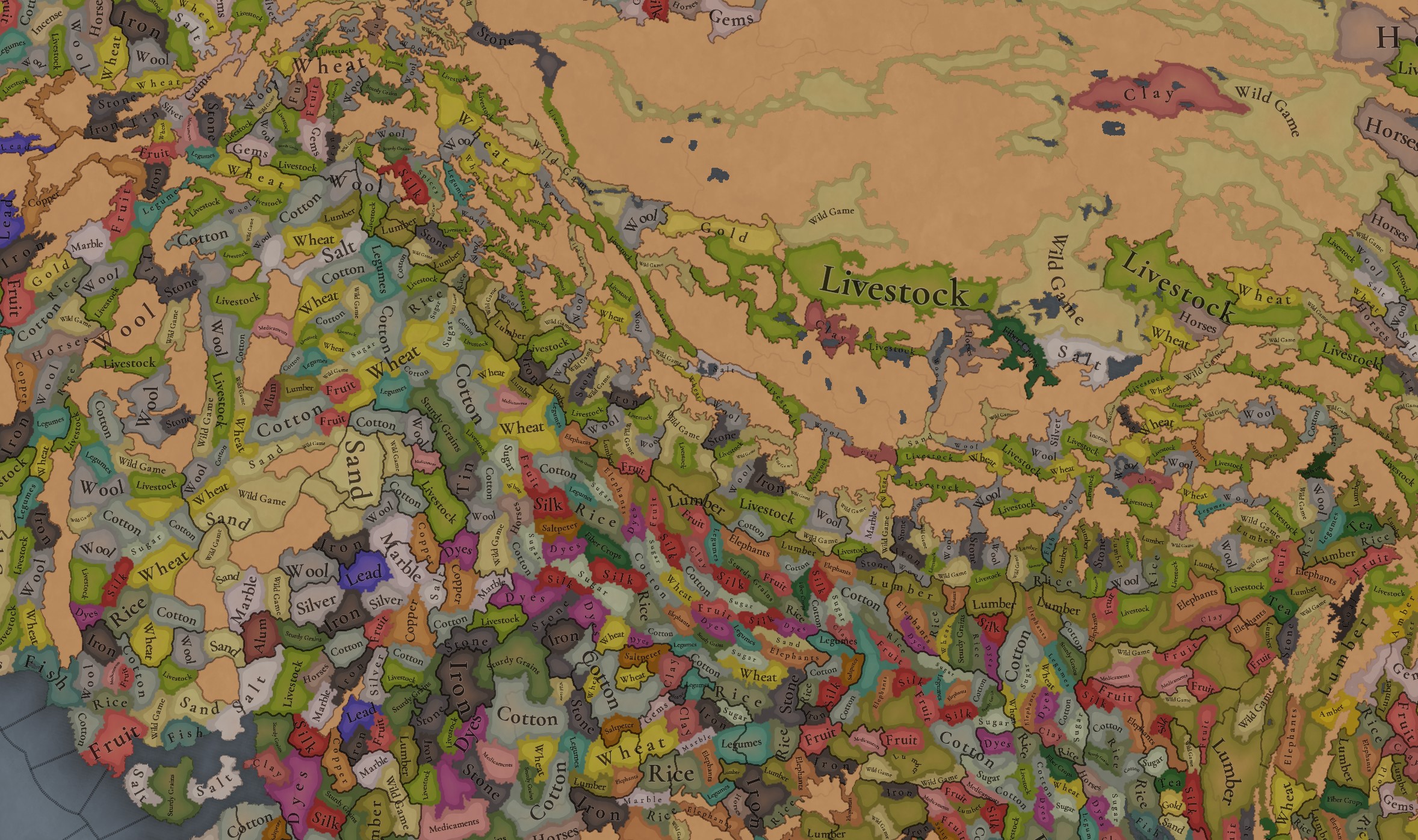
India was for some time in the period the wealthiest region of the world, one of the main reasons being that it’s incredibly rich in very different types of resources, including some of the expensive ones. That will make for a very interesting economic gameplay.

Markets:
Markets India.png

There are several market centers in India that we think portray well the situation in 1337: Kabul (yes, it’s in Afghanistan, but it’s one for the area of Kashmir), Delhi, Khambat, Calicut, Pulicat, Varanasi, and Chittagong.

Population:
Population.jpg

Population 2.jpg

Population 3.jpg

Population 4.jpg

Population 5.jpg

Population 10.jpg

Population 9.jpg

Population 6.jpg

Population 7.jpg

Population 8.jpg

India has a big population. To be precise, around 95M pops. Delhi is the second largest country in the world in population, with 41M pops, which makes it a behemoth, with very serious governance challenges. I’m also showing this week the progress we’re making with the coloring of the population mapmode; the stripes on several locations mark that they’re overpopulated, as they have more pops living on them than the pop capacity available (something that may be reviewed, as balancing very densely populated regions such as India or China is really challenging).

And that’s all for today! We hope you enjoyed this massive Tinto Maps. Next week we will be taking a look at the Steppe. Which one, you might wonder? Well, the one ruled by the Golden Horde, from Ukraine in the west to Mongolia in the east. Cheers!
 
  • 120Like
  • 98Love
  • 3
  • 3
  • 1
Reactions:
Sundarbans should be flooded and almost inhabited. Technology for clearing and settling those areas came after 16th-17th Century. Seeing these dense mangrove regions inhabited while Eastern/Western Ghats hills uninhabited and impassable makes no sense.
 
Last edited:
  • 1Like
Reactions:
Hinduism is a conglomeration of many different philosophies which are often contradicting. It doesn't even feel like they should be in one big religion. I hope they get represented. The ideas are so contrasting that these will consider each other heretic or even heathen.

I have mentioned below all of them with their brief summary -

Buddhism - Life is suffering, to get rid of pains give up all emotions
Jainism - Life is suffering because we are harming each other.
Ajivika - Life is pre-destined, nothing will bring any change.
Chārvāka - Only what is visible is what exists. Enjoy while you live.
Uchchhedvāda - Nothing exist beyond birth death. There is nothing like morality.
Shāshwatavāda - Interplay of seven elements is what makes the universe.
Akriyāvāda - Morality comes from emotions, emotions comes from actions.
Agyānvāda - I do not know what I do not know that's why I suspend my judgement.
Nyāya - Cause of suffering is wrong knowledge. Logical Knowledge is required.
Vaisheshika - World is made up of molecules and elements.
Sāmkhya - Material Body should control soul for harmony.
Yoga - Soul should by means of exercise control material body.
Pūrva Mimānsa - Only rituals can help please the gods.
Advaita Vedānta - Soul is having illusion of being different from Universe.
Dvaitavāda - Soul and Universe are completely different, don't expect reunion.
Vishist Advaitavāda - Soul is made from Universe however it is not an illusion.
Dvaita Advaita - Soul and Universe are different but cannot exist without each other.
Suddha Advaita - Everything is manifestation of God, he does he wants.
Achintya-Bheda-Abheda - God lives within our heart, no need to go to temple.
Most of these were dead by this period though. Instead of / in addition to these, there should be regional differences, for example, Hinduism of the Himalayas is a lot different than Hinduism of UP/Bihar region.
 
  • 2Like
  • 2
  • 1
Reactions:
Most of these were dead by this period though. Instead of / in addition to these, there should be regional differences, for example, Hinduism of the Himalayas is a lot different than Hinduism of UP/Bihar region.
None of them are dead. They still survive. All of them. Perhaps you are ignorant and don't know about them. Each of them have their separate books and founders. These books are followed till date.
 
  • 1
Reactions:
None of them are dead. They still survive. All of them. Perhaps you are ignorant and don't know about them. Each of them have their separate books and founders. These books are followed till date.
There needs to be game balancing. Europa universalis gameplay for India will be broken, if each and every little faith is represented as it is. Probably will end up looking like CK3 where only 1-2 faiths dominate entire India.
 
  • 1
Reactions:
None of them are dead. They still survive. All of them. Perhaps you are ignorant and don't know about them. Each of them have their separate books and founders. These books are followed till date.
I don't think most common people really paid any heed to the philosophical schools of Hinduism, and these divisions mostly only existed amongst the priesthood. I don't think there were any geographical lines upon which different regions would follow different philosophical schools either.

Differences between common Hindus were more so based on where you were from (ex. Tamil Hindu vs. Awadhi Hindu vs. Marathi Hindu) and your Ishtadevata (Vaishnava vs. Shiv bhakt). Often both of these aspects are intertwined (somebody from Mathura or Ayodhya might be more likely to be a Vaishnava; conversely somebody from Tamil Nadu might be more likely to worship Murgan above all).
 
Last edited:
  • 2
  • 1
Reactions:
I don't think most common people really paid any heed to the philosophical schools of Hinduism, and these divisions mostly only existed amongst the priesthood. I don't think there were any geographical lines upon which different regions would follow different philosophical schools either.

Differences between common Hindus were more so based on where you were from (ex. Tamil Hindu vs. Awadhi Hindu vs. Marathi Hindu) and your Ishtadevata (Vaishnava vs. Shiv bhakt). Often both of these aspects are intertwined (somebody from Mathura or Ayodhya might be more likely to be a Vaishnava; conversely somebody from Tamil Nadu might be more likely to worship Murgan above all).
If you want some broad categorisation of god based on current day bhakti then I guess you can assign as follows Northern Plains = Ram, Gujarat = Krishna, Maharashtra = Ganesh, Bengal = Durga, Tamil = Murugan, Odisha = Jagannath, Assam = Shakti, Kashmir = Shiva, Andhra = Tirupati and so on. This is what you want to here right? It is very very dumb generalization from the perspective of history.
 
Last edited:
There needs to be game balancing. Europa universalis gameplay for India will be broken, if each and every little faith is represented as it is. Probably will end up looking like CK3 where only 1-2 faiths dominate entire India.
Tell me why there are nestorians, hussites, miaphysitism, krstjani, bogolism and such little faiths in Europe then?
 
Last edited:
  • 1Like
Reactions:
I think that Limbuwan was more of a loose confederation rather than a unified kingdom in 1337. The ten kingdoms were part of the Yakthung Chumlung.

Moreover, Limbuwan was situated to the east of the Dudhkoshi River, extending to the Teesta River in the south and bordered by Tibet in the north and purnia in south. The regions of Dudkunda and Okhaldhunga lie west of the Dudhkoshi. Some literature I’ve encountered suggests that these areas were ruled by the Kirats but does not mention a unified Limbuwan kingdom. Perhaps IO would be a more accurate representation than a unified kingdom.

I may be missing some facts, or there may be historical evidence indicating a unified Limbuwan. However, given the granularity of the maps I have seen, it seems reasonable to question why the ten independent kingdoms cannot be represented separately.

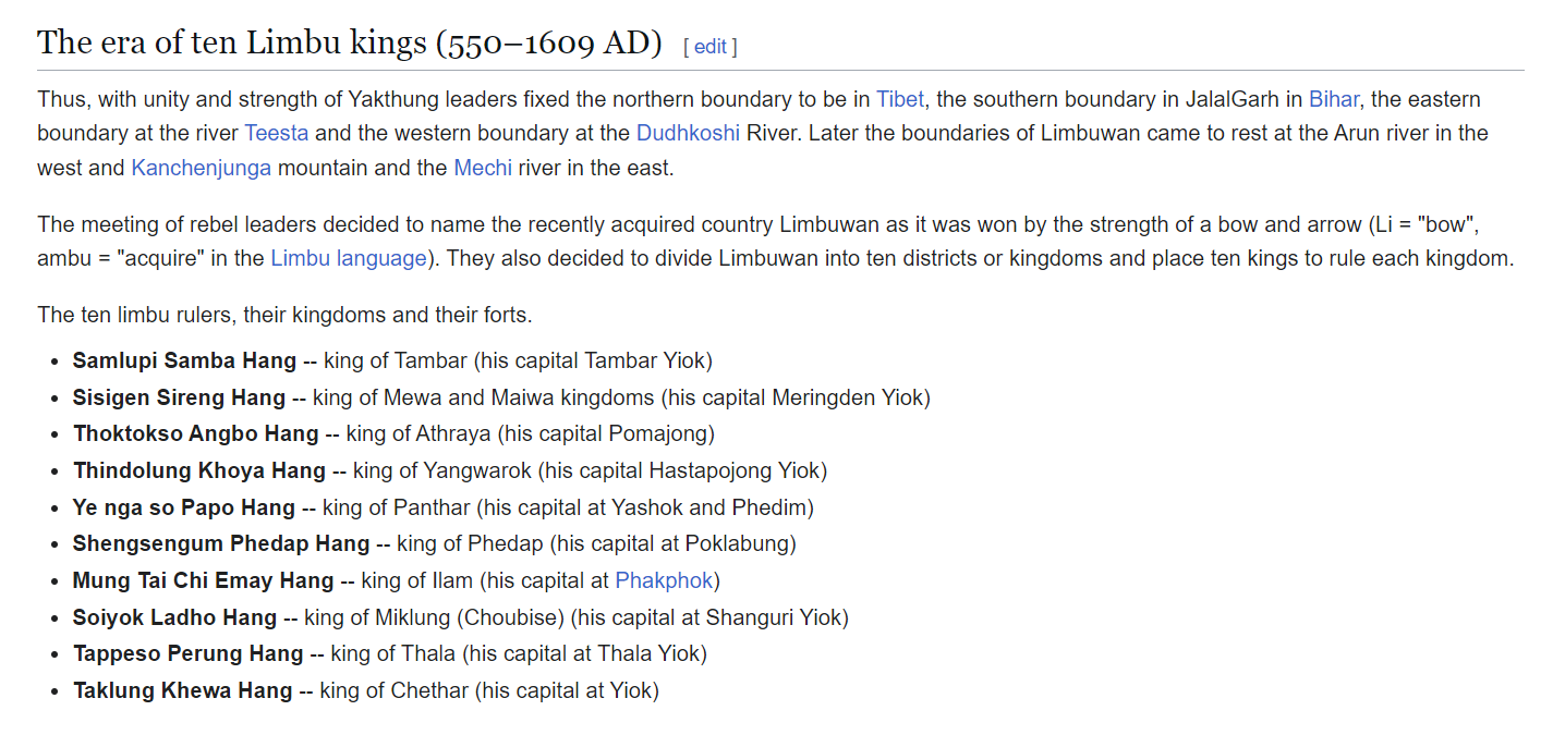
Could you possibly do a map depiction of these 10 Limbuwan kingdoms it would probably be good for the devs to be able to have an idea for your suggestion.These seem to be the 10 Kingdoms of Limbuwan
1728647537626.png
 
Could you possibly do a map depiction of these 10 Limbuwan kingdoms it would probably be good for the devs to be able to have an idea for your suggestion.These seem to be the 10 Kingdoms of Limbuwan View attachment 1200488
They represent the kingdoms yes, but they differ in size depending on period and often don't even fully exist for significant portions of time. It would completely mess up the location density and size of the region. Representing it as one polity is not a great solution, but representing it far more accurately would lead to a location density higher than that of Northern Italy and the HRE. A middle-ground could be reached by only representing some of the kingdoms in an IO, but then Morang would unquestionably dominate every time. We still don't really know all the mechanics of decentralization and ABCs so it could theoretically be represented that way, which I think will work best given PCs map. Nevertheless, we need to see more information to see if it can be decently accurate as one polity, otherwise it should be split, but not into the ten kingdoms due to map constraints (and the fact that both Chainpur and Bijayapur would be unrepresented, and Morang would be massive).
 
  • 1Like
Reactions:
1728656751983.png

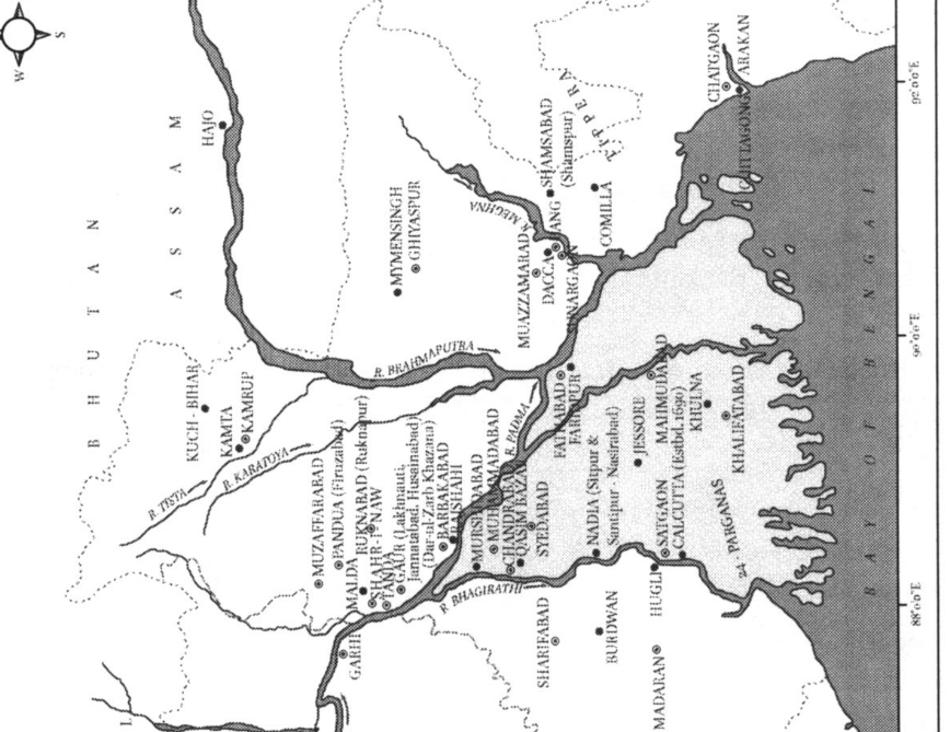
Hussain, Syed Ejaz. “Silver Flow and Horse Supply to Sultanate Bengal with Special Reference to Trans-Himalayan Trade (13th-16th Centuries).” Journal of the Economic and Social History of the Orient
 
  • 2
Reactions:
They represent the kingdoms yes, but they differ in size depending on period and often don't even fully exist for significant portions of time. It would completely mess up the location density and size of the region. Representing it as one polity is not a great solution, but representing it far more accurately would lead to a location density higher than that of Northern Italy and the HRE. A middle-ground could be reached by only representing some of the kingdoms in an IO, but then Morang would unquestionably dominate every time. We still don't really know all the mechanics of decentralization and ABCs so it could theoretically be represented that way, which I think will work best given PCs map. Nevertheless, we need to see more information to see if it can be decently accurate as one polity, otherwise it should be split, but not into the ten kingdoms due to map constraints (and the fact that both Chainpur and Bijayapur would be unrepresented, and Morang would be massive).
Honestly i think its fine to request for that level of province density if the devs cant do it that is what it is but we shouldnt pre empt their decision just yet. I hope India deserves as much attention as Europe imo. I just meant if there was a coherent map of what kingdoms or principalities were present in 1337 and where they were located specifically im not an expert on Indian or Nepalese history so i have no idea lol. I hope that Garwhal post gets implemented in its entirety too, 25 country Garwhal would be great lol
 
  • 3Like
Reactions:
Uttar Pradesh:


New Location Map:
View attachment 1199960
1: Jalali
2: Patiyali
3: Shamsabad
4: Bhogaon
5: Sakit
6: Kandhla
8: Jajmau
9: Makanpur
10: Kannauj
11: Sandila
12: Dalmau
13: Jais
14: Rampur
15: Sultanpur
16: Belha
17: Rapri
18: Auraiya
19: Samugarh
20: Radauli
21: Machhalishahr
22: Rasulpur
23: Kichhocha
24: Ibrahimabad
25: Barabanki
26: Thulendi
27: Bangarmau
28: Bisrakh
29: Bhitaura
30: Sangrampur
31: Maudaha

I feel like adding this many locations is necessary to do the region justice. The Doab, Awadh, and the surrounding regions, have always been one of the main centers of Indian civilization, and is one of the most economically potent regions in the entire world, with a huge diversity of resources, and behemoth populations. Adding more locations would allow for resources to be more accurately displayed, would help alleviate issues with population capacity, and is necessary to represent some of the granularity in political borders that will arise after the fall of the Delhi Sultanate, and the likely eventual fall of Jaunpur after it.

Also, I'd like to thank @Ekyman for his map of rivers and modern political borders overlayed on the location map. Suggesting new locations would be much, much more difficult without that overlay.


Name Changes:
Kol -> Koil
Mirat -> Meerut
Korra -> Kora
Shahjahanpur -> Jalalabad
Pilibhit -> Kabar (modern-day Shergarh)
Bareilly -> Ahikshetra (best alternative could find)
Shahabad -> Aonla
Firuzabad (What is Firuzabad??? I can't find any mentions of a settlement named Firuzabad here) -> Lakhimpur (though Lakhimpur might be just barely outside of the borders of the location, so I would move the border slightly further West so that it's included)


Resources:
I'll go more into depth on what resources should be in what specific locations in the future (if I end up having the time), but for now I'll link one of my older posts from another thread which contains some information on certain raw goods. Currently, Jaunpur in particular stands out to me, and it should be changed from legumes to silk.


Political:
Tughlaq rule over the Bareilly and Khairabad regions is extremely lose (often just a fort or two in the region, and sometimes not even that), and the locals mostly conducted their own affairs under the rule of the Katheriya Rajputs. I suggest you make the Katheriya a society of pops, with them controlling the vast majority of the Hindu population in the Bareilly and Khairabad provinces, with the Sultanate only controlling 500 or so of the population (mostly just the local garrisons of isolated forts). Alternatively, you can simply represent Katehar as an independent state under the Katheriya dynasty (I would much prefer the later for simplicity's sake, and because Katehar was by no means uncivilized [they were on a similar level of development to Gondwana, which itself is displayed as a series of settled states, so it would be inconsistent to represent Katehar as a SOP. The only reason I suggested making them a SOP potentially is because I'm not sure how else you'd represent Delhi owning a fort or two in the location {perhaps through foreign buildings, kind of like the mission or trade office, but I'm not sure how you guys are planning on doing those}], but both work to represent the Katheriya Rajput's influence over the region).
View attachment 1199972


Terrain:
I'll let @Sulphurologist take care of this, as I'm sure he's more knowledgeable than me. But there should definitely be more woods along the modern-day Indo-Nepali border (Thanks to @PerhapsItsChondoLal for finding this map of the tree cover in 1600):

View attachment 1199970

I also believe there should be more farmland along the course of the Ganges (Bihar and Bengal in particular seem lacking, though that's outside of the scope of this post).
These are my favorite Tinto maps feedback posts really good detailed and backed proposals that are coherent and show more provinces being added and where specifically in an easily interpretable visual form , Gold standard stuff imo
 
  • 1
Reactions:
The "Adam's Bridge" between Sri Lanka and the mainland is only a meter below the surface, which hampers large ship navigation. Will this be represented?

Project Caesar should be able to make ocean-going ships unable to cross into the Palk Strait and Palk Bay as they are "Narrows" where the waters are difficult to navigate. If not, there should be something like shoals added as a modifier to make what is essentially a geographical "choke point".


1728651249823.png

Asia's Maritime Bead Trade: 300 B.C. to the Present By Peter Francis

Also, from looking at Locations 4.jpg it seems that Pamban Island and Mannar Island have narrow waterways around them, which should be no more than a meter in depth if the full land bridge won't be present before it breaks in the 15th century.
 
  • 5Like
  • 1
Reactions:
If you want some broad categorisation of god based on current day bhakti then I guess you can assign as follows Northern Plains = Ram, Gujarat = Krishna, Maharashtra = Ganesh, Bengal = Durga, Tamil = Murugan, Odisha = Jagannath, Assam = Shakti, Kashmir = Shiva, Andhra = Tirupati and so on. This is what you want to here right? It is very very dumb generalization from the perspective of history.
No, I didn’t say that’s how I wanted it in the game, I was just saying historically and currently divisions in Hinduism are more so based on region and Ishtadevata (and that certain gods were more popular in certain regions, which is demonstrably true) than philosophical schools like Samkhya, and that Paradox shouldn’t break up Hinduism based on the schools. I never said that all Kashmiris should just be Shaivas or anything along those lines.

I’m not sure how they plan on doing religious mechanics (all they’ve said is that they want to keep Hinduism represented as one religion, and they want to represent the differences within Hinduism through mechanics), so I’m waiting on them to go more into depth about specific religious systems before I make any specific suggestions, but perhaps a multifaceted system of denominations could work (for example, you have your regional denomination on one level, like Bengali Hindu, and in another level you can be Kalikula or Gaudiya Vaishnava as options for Bengali Hindus). What makes this difficult is that distinctions between these groups were often blurry, and not clearly defined in the way distinctions between sects in other religions were.
 
  • 4Like
  • 1
Reactions: