• We have updated our Community Code of Conduct. Please read through the new rules for the forum that are an integral part of Paradox Interactive’s User Agreement.

Tinto Maps #19 - 20th of September 2024 - India

Hello everyone, and welcome once again to another Tinto Maps! Today we will be taking a look at India! Yup, a whole subcontinent… Exciting!

Let me say a foreword before I start sharing with you some beautiful maps. Some of you may wonder why we decided to make the entire Indian subcontinent in just one DD, instead of spreading it a bit. There are two reasons for that. The first is the political situation: the Sultanate of Delhi is at its zenith, under Muhammad bin Tughlaq. You will soon see that it rules over more than half of the region, approximately; so splitting that polity into several DDs would have felt weird.

The other is that we felt that a more cohesive approach made sense in this region, as it’s sooo diverse compared to others, that the way we approached it, both for its setup and content, was from the generic to the particular; therefore, we think that it will also help us more when we tackle the review of the region. Speaking of that, don’t worry much about the time available to prepare suggestions; you may already know that we have a backlog of several regions, and therefore weeks, before we hit the Indian review, so you will have plenty of time to research and prepare them. In any case, as it’s a massive task (we know it firsthand), we’ll let you know a bit in advance when we plan to start the in-depth review of it, so you have time to wrap it up.

As a final say, I just want to mention that an old acquaintance of the community, @Trin Tragula , now Design Lead in CK3, helped us to map a big chunk of it. Thanks, mate! And now, maps!

Countries:
Countries.jpg

Colored Wastelands.png

As I just mentioned, the Sultanate of Delhi is at its zenith, under Muhammad bin Tughlaq, extending through the Indo-Gangetic Plain, including Bengal, and to the south, throughout the Deccan. There we have its toughest contender, Vijayanagar, a county that is a bulwark of Hinduism. Other important countries around it are Orissa and Sindh, but much smaller countries generally surround Delhi. You might wonder how it would be possible to stop Delhi from completely controlling the region, then. For this, two things are affecting its capability to achieve it. The first is the base game mechanics: ruling over so many different cultures and religions with low control will be hard. The second is a Situation that involves the Fall of the Sultanate; if Delhi wants to succeed, it will have to fight back against rebellions, which involves the potential independence of the Bengalese countries or newborn ones such as the Bahmanis, and the multiple Indian states around it, which are ready to take over it.

Dynasties:
Dynasties.jpg


Locations:
Locations.jpg

Locations 2.jpg

Locations 3.jpg

Locations 4.jpg
Yes, we are making some adjustments to the coloring of the mapmodes!

Provinces:
Provinces.jpg

Provinces 2.jpg

Provinces 3.jpg

Provinces 4.jpg

Areas:
Areas.jpg

The bug is still there, yes… The area that is to the southwest is Malabar.

Terrain:
Climate.jpg

Topography.jpg

Vegetation.jpg

Here we have a new type of topography: Atolls. We added it some months ago, as we worked on finishing the map of the Pacific Ocean, and it will be the last one added to the game.

Development:
Development.jpg

A new map mode is born! Here you have the development of India. The most developed place is Delhi, which is part of the fertile Gangetic Plain.

Harbors:
Harbors.jpg


Cultures:
Cultures.jpg

Cultures 2.jpg

Cultures 3.jpg
Not an entirely new map, but a glorious one. We chose it to be the one to present how the different cultures could be present in the game for a reason.

Religions:
Religions.jpg

Religions 2.jpg

Religions 3.jpg
India is the birthplace of numerous religions, and that needs to be reflected in the religious map. The main religion is Hinduism, but don’t be deceived by its homogeneous look, as it will be quite deep feature-wise. We also have Buddhism, which is at a low point, after some centuries of prosecutions. Mahayana is a majority in Sindh, although that's not completely exact, as an earlier form of Buddhism was practiced there; we’re also not 100% convinced about it being a majority, as some sources and accounts set the Islamization of the region to be completed under the Ghaznavids, in the 11th and 12th century, while others delay it until the 14th century - we followed the later approach, but we're very open to feedback in this specific matter. Another form of Buddhism is Theravada, which is the most practiced religion in Sailan. Some interesting minorities present in the region are Jains (yellow stripes), Nestorians (the pink stripe in Malabar, which portrays the ‘Saint Thomas Christians’), Jews (which have their own separate culture, ‘Kochini’), and several Animist confessions, of which we’ve already split Satsana Phi, the traditional religion of Tai people, and Sanamahism, the religion of Meitei people. Oh, although it’s not strictly part of the region, the light blue stripes to the north is Bön religion.

Raw Materials:
Raw Materials.jpg

Raw Materials 2.jpg

Raw Materials 3.jpg

Raw Materials 4.jpg
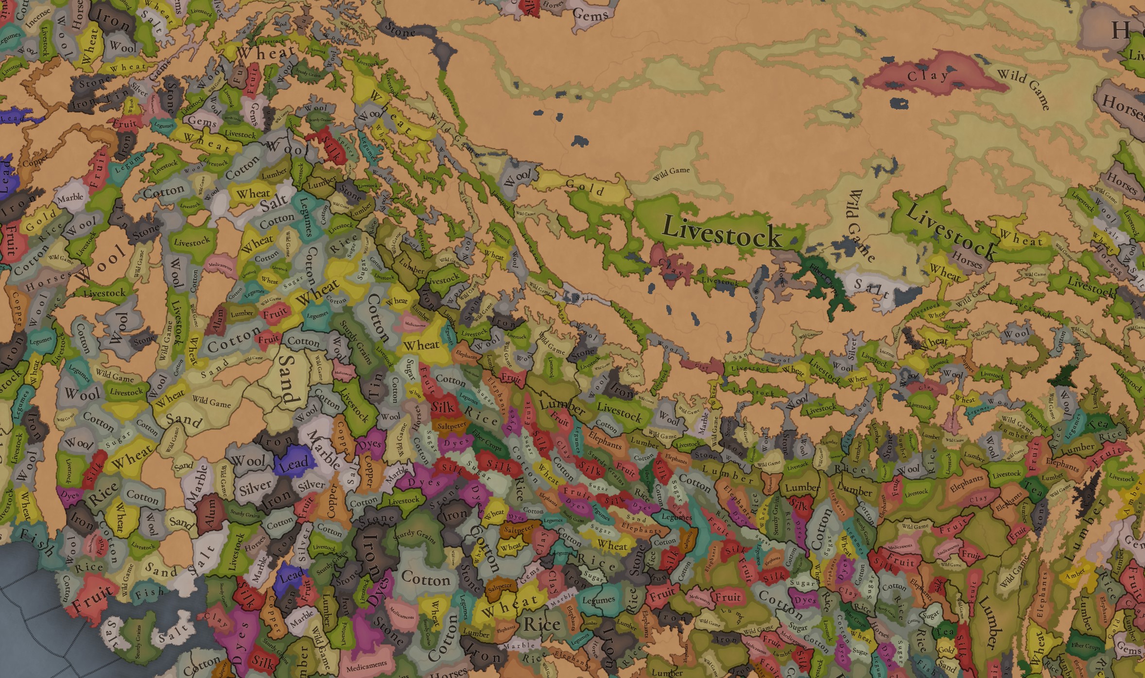
India was for some time in the period the wealthiest region of the world, one of the main reasons being that it’s incredibly rich in very different types of resources, including some of the expensive ones. That will make for a very interesting economic gameplay.

Markets:
Markets India.png

There are several market centers in India that we think portray well the situation in 1337: Kabul (yes, it’s in Afghanistan, but it’s one for the area of Kashmir), Delhi, Khambat, Calicut, Pulicat, Varanasi, and Chittagong.

Population:
Population.jpg

Population 2.jpg

Population 3.jpg

Population 4.jpg

Population 5.jpg

Population 10.jpg

Population 9.jpg

Population 6.jpg

Population 7.jpg

Population 8.jpg

India has a big population. To be precise, around 95M pops. Delhi is the second largest country in the world in population, with 41M pops, which makes it a behemoth, with very serious governance challenges. I’m also showing this week the progress we’re making with the coloring of the population mapmode; the stripes on several locations mark that they’re overpopulated, as they have more pops living on them than the pop capacity available (something that may be reviewed, as balancing very densely populated regions such as India or China is really challenging).

And that’s all for today! We hope you enjoyed this massive Tinto Maps. Next week we will be taking a look at the Steppe. Which one, you might wonder? Well, the one ruled by the Golden Horde, from Ukraine in the west to Mongolia in the east. Cheers!
 
  • 122Like
  • 98Love
  • 3
  • 3
  • 1
Reactions:
they must have control over Topal Garh too, which would not make sense, as Topal Garh was the first Garh to make and install artillery in their fort, which does not make any sense if it was in the internals of Garhwal and already under somebody else's control.
I mean, Top Garh did eventually fall to Ajay Pal anyways by the end of his campaigns, right? I can't find any indication it remained independent from the Garhwal Kingdom after Ajay Pal. I think the most likely scenario here is that Top Garh perhaps had a different name early on in its history, and was later renamed to Top Garh after the introduction of cannons to India. I don't see why the nobles of the fort couldn't have installed cannons whilst under the larger Kingdom of Garhwal later on in the 16th or 17th centuries. tbh, I doubt the word तोप had even been introduced to Garhwali yet, given that it was a loanword from the Ottomans, which then passed to Persian, and then finally passed to Indian languages. I think Occam's Razor would still just suggest that Ajay Pal just conquered both Top Garh and Badhan Garh first (alternatively perhaps there could have been a temporary coalition of a few Garhs against Kumaon, but even if that was the case I don't think that warrants a dedicated permanent Garhwali IO when we already have mechanics to represent coalitions), and then fought Kumaon.
 
Last edited:
  • 1
Reactions:
I mean, Top Garh did eventually fall to Ajay Pal anyways by the end of his campaigns, right? I can't find any indication it remained independent from the Garhwal Kingdom after Ajay Pal. I think the most likely scenario here is that Top Garh perhaps had a different name early on in its history, and was later renamed to Top Garh after the introduction of cannons to India. I don't see why the nobles of the fort couldn't have installed cannons whilst under the larger Kingdom of Garhwal later on in the 16th or 17th centuries. tbh, I doubt the word तोप had even been introduced to Garhwali yet, given that it was a loanword from the Ottomans, which then passed to Persian, and then finally passed to Indian languages. I think Occam's Razor would still just suggest that Ajay Pal just conquered both Top Garh and Badhan Garh first (alternatively perhaps there could have been a temporary coalition of a few Garhs against Kumaon, but even if that was the case I don't think that warrants a dedicated permanent Garhwali IO when we already have mechanics to represent coalitions).
Oh yeah, amongst all that I overlooked that obvious detail. o_O

Btw, now that we are in the realm of speculation, why do you think then these minor "kingdoms" managed to remain independent from these much larger foes but not from a Garh of similar size and situation?
 
Btw, now that we are in the realm of speculation, why do you think then these minor "kingdoms" managed to remain independent from these much larger foes but not from a Garh of similar size and situation?
A lot of it probably stemmed from an overall lack of incentive to actually invest the resources into conquering, subduing, and occupying Garhwal. The rough terrain would probably make long-term occupations by foreign powers difficult as well.
 
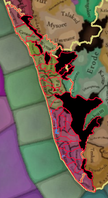
I wish there were mechanics to simulate the strength and resilience of the Malabar kingdoms. Vijayanagar Empire never successfully got into the whole of Kerala due to the terrain. Dutch, Portuguese, and British invasions constantly failed even via the sea routes due to their naval superiority. A mix of mountains+Jungles along with more impassable terrain representing the western ghats should provide a natural barrier to Vij blobbing, but I also want mechanics, advances, and government reforms to simulate the economic and defensive prowess of the Malabar Kings, particularly the Samoothiri of Kozhikode (Calicut) and Rajya of Kochin among others. It shouldn't be easy breezy for a South Indian campaign playing as the Bahamanis, Vijayanagar, or even the Ma'bar sultanate to just trailblaze through Kerala as it is in EU4.

This idea actually extends to a lot of the smaller centralized kingdoms of India, like the Garjati tribal states, Various rajput kings and the himalayan states who mostly retained their territories under changing major powers, either remaining independent or becoming vassals. They never got annexed and changed hands from the Tughlaqs to the Sayyids to the Lodis to the Mughals to the Marathas and then to the British. I don't want a 5-way Indian blob in every playthrough with all minor powers wiped off the map in 50 years. They play a major role in framing the shifting alliances and networks that caused the rise and fall of empires in this subcontinent.

Moreover, European campaigns won't be fun anymore if I reach India in the 1600s and see 4 big empires in the 4 cardinal directions and no small kingdoms to establish trading partnerships with. This is an issue in EU4 as well, with the trade protectorate subject type - I never have small enough nations in India to make into trade protectorates by the time I get there because of blobbing. I hope this can be fixed through mechanics or just scripted AI behavior. Railroading is sometimes really needed for immersion and gameplay - not just for the sake of historicity.
 
  • 6
  • 1Like
Reactions:
Chhattisgarh Rework:

I decided to do a rework for Chhattisgarh. Feel free to provide feedback if anybody has something to add.

Political:
1743970465822.png

1743970498966.png

1: Bastar (Kakatiya dynasty)
2: Kanker (Som dynasty) [Vassal of Ratnapura]
3: Ratnapura (Kalachuri/Haihaya dynasty)
4: Dhamdha (Raj Gond dynasty) [Vassal of Ratnapura]
5: Kawardha (Naga dynasty) [Vassal of Ratnapura]
6: Sarangarh (Raj Gond dynasty) [Vassal of Ratnapura]
7: Palamu (Raksel dynasty)
8: Sidhi (Baland dynasty)

The foothills of the Maikal Range were apparently under a variety of zamindars and vassal chiefs, outside of Ratnapur's direct control. I decided to just represent the most major vassals I could find information on (if Tinto wants to add more granularity, they should feel free to look through the sources I linked, there is more information in them). I'm not exactly sure when Gond rule started in Dhamdha, but I assume they would have been ruling already by 1337. Most of the rest of the political map stayed the same (I'm not really sure on the exact borders of Sarangarh and Palamu, so I just left them as you guys drew them), with the exception of adding the Sidhis of Baland.

Ratnapur should also have an event where they have the possibility of splitting in half (into separate Ratnapur and Raipur Kingdoms) near the end of the 14th century.

Locations:
1743971932592.png

1743971945299.png

1745085320466.png

1: Narayanpal
2: Barasuru
3: Bastar
4: Jagdalpur
5: Dantewada
6: Bhopalpatnam
7: Bhairamgarh
8: Injaram
9: Sukma
10: Kondagaon
11: Bhongapal
12: Paralkor
13: Kakayara
14: Ambagarh
15: Ghotia
16: Dhamtari
17: Rajim
18: Sirpur
19: Raipur
20: Tilda
21: Durg
22: Nandgram
23: Khairagarh
24: Amora/Amoda
25: Kawardha
26: Boriya
27: Nawagarh
28: Paragaon
29: Pasid
30: Ratanpur
31: Malhar/Mallar
32: Shivrinarayan/Sheorinaraya
33: Daikoni/Dahkoni OR Sarkhon OR Akaltara (all were important settlements during the time period, any would work)
34: Lapha OR Pali (all were important settlements during the time period, any would work)
35: Tummana
36: Kenda
37: Bilaigarh
38: Sarangarh
39: Basna
40: Bhadwahi
41: Ambikapur
42: Dipadih
43: Dhamdha (note that this was a last minute addition, so it doesn't feature in my vegetation or terrain maps)

I increased the location density of the fertile plains of central Chhattisgarh to put it at the same density of my other reworks.

Population:

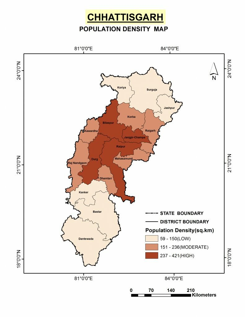
The population of Chhattisgarh's central plains seem surprisingly low to me, especially compared to other regions of India. By the turn of the 20th century the area of modern day Chhattisgarh had a population higher than British Ceylon (4.18 million vs. 3.56 million respectively), and while I know 20th century populations aren't always directly applicable to medieval times, it does a good job of giving us an estimate I'd say. Also, Bastar and Palamu combined having a population comparable to Ratnapur is kind of strange to me. I'd say add about 100,000 new pops spread out throughout Ratnapur's borders, and then after that redistribute more existing pops from other areas (from Raksel and Baster) into the central plains of Chhattisgarh, with the goal of pushing Ratnapur's population up to at least around 700k. Even today, you can see that most Chhattisgarhis live in the central plains, that trend would have been even more severe back in medieval times before much of the jungled regions of the peripheries were settled.

1743973023658.png


Vegetation:
1743973267950.png

1743973280765.png


The color scheme is identical to the one I used for my Odisha rework. I'm not really sure what the difference between forest and jungle is meant to be in EU5, so I didn't distinguish in my map.

Terrain:
1743973386424.png

I also tried my hand at a terrain map with my new locations, mostly based off of Sulphurologist's maps with a few tweaks here and there.

Cultures:
1743985192263.png

Sitapur should be majority Nagpuri with a Chhattisgarhi minority
1743985308964.png


Settlements:
1743973484833.png

Just in case its helpful, I decided to include the exact locations of settlements my new locations are named after.

Sources:
1743973571687.png

1743973636560.png

1743973666784.png

1743973804794.png
 
Last edited:
  • 5Like
  • 3Love
  • 1
  • 1
Reactions:
Cultures:
View attachment 1277745
Sitapur should be majority Nagpuri with a Chhattisgarhi minority
View attachment 1277746

Has anyone come to a conclusive terminology for the Chattisgarhi cultural identity? I mean using census data from the 21st century is fine for getting a general idea but Chattisgarhi as an identity, let alone a language or culture was not even starting to take shape until the Marathi rule in the area (which was then starting to be called Chattisgarh).

I still don't think neologies like Chattisgarhi or Assamese should exist in the game, if "Dutch" and "Walloon" don't exist in the game. It's not just about the name of the culture - its also the fact that these cultures didnt arise yet. To represent the indo-aryan stock of this region, I feel like Kosali (in reference to Dakshin Kosala, the previous name of this region) would make more sense. OR we can just use Ratnapuri, as the Kingdom based out of the Ratnapur at this point encompassed almost the entirety of what the "Chattisgarhi" culture represents in the game.

My vote is for Kosali - as the Kalachuris of Ratnapura called their kingdom "Mahakosal" (Great Kosal, the great was just for prestige purposes, they weren't all that). The term fits and will continue to be relevant late into the game's timeframe until the Bhonsle Marathas decide to bring the entire region under their rule through the Nagpur state, and start calling the region Chattisgarh (and the people, chattisgarhi). The other option is a bit more restrictive in my opinion.
 
  • 3Like
  • 2
  • 2
Reactions:
A lot of it probably stemmed from an overall lack of incentive to actually invest the resources into conquering, subduing, and occupying Garhwal. The rough terrain would probably make long-term occupations by foreign powers difficult as well.
I don't think that fully captures it unfortunately. While that could and probably would have been the reason for the Delhi based empires, that does not really make sense for Himachali kingdoms and Kumaon as these regions were similar in geography and Rawain valley has abundant mineral resources like Gold, Iron, Copper, etc and Niti, Mana passes were the routes of the very lucrative Indo-Tibetan trade. In fact these two regions were a major part behind Garhwal's prosperity and both of them directly border or are very close to Himachal and Kumaon respectively.

And again, the Panwadas do indicate, although this is only circumstantial evidence, to there being an spanning polity called Kedarkhand.

Edit: Also, the texts written before the 14-15th century call this region as Kedarkhand, mentioning "Kedare Khas Mandale", i.e., Kedarkhand, abode of the Khasas. One thing to note here is the use of word "Mandal", which as you would know was used for signifying administrative divisions or polities. The "Gram-Rajya", local administrative division of each village also used the word Mandal for itself. Thus strengthening my belief of there being an overarching polity!
 
Last edited:
Oh yeah one more thing, the name Garhwal itself emerges in the early 16th century, before that the united kingdom (hehe uk/uttarakhand) was known by the name of Kedarkhand, also the king of Chandpur Garh was known as "Bulanda Badri", that is, representative of Lord Badrinath, which was not in their jurisdiction, indicating a more widespread influence than their direct control.
 
Rajasthan Rework:

Rajasthan is roughly the size of modern-day Germany in terms of area, and it has historically had a similar level of fragmentation as the HRE. On top of that, I imagine Rajasthan will be one of the most played regions in South Asia (given that I assume a lot of players will want to play Mewar or some other Rajput state and unite Rajputana), so its important to make sure its fleshed out in my opinion.

Countries:
1744243006858.png
1744237046600.png

1744243032064.png


(Nainwa [#36] and Pirana [#37] were left off the first label map [I forgot to include them], so I labeled both in a separate map)


1: Bhatner (Bhatti dynasty)
2: Bhurupal (Johiya dynasty)
3: Kot Pallu (Sihag dynasty)
4: Dhansia (Sahu dynasty)
5: Bhadang (Saran dynasty)
6: Raisalana (Beniwal dynasty)
7: Sidhmukh (Kaswan dynasty)
8: Ludi (Puniya dynasty)
9: Kanjan (Chahar dynasty)
10: Dadrewa (Chauhan dynasty)
11: Bhanipura (Bhadu dynasty)
12: Shekhsar (Godara dynasty)
13: Pugal (Bhatti dynasty)
14: Riri (Jakhar dynasty)
15: Janglu (Sankhla dynasty)
16: Dhatarwal (Dhatri dynasty)
17: Gothra Bhukaran (Bhukar dynasty)
18: Narhar (Nehra dynasty)
19: Amber (Kachhwaha dynasty)
20: Maroth (Gaur dynasty)
21: Mewar (Sisodia dynasty)
22: Roon (Sankhla dynasty)
23: ? [I'm not sure what "Man." is supposed to represent, but I left it on the map assuming that the Tinto team did their research there]
24: Jaisalmer (Bhatti dynasty)
25: Marwar (Rathore dynasty)
26: Barmer (Chauhan dynasty)
27: Jalore (Songara Chauhan dynasty)
28: Nagarparkar (Sodha dynasty) [Tributaries of Marwar]
29: Sanchore (Chauhan dynasty)
30: Chandravati (Deora Chauhan dynasty)
31: Dungarpur (Sisodia dynasty)
32: Leedi (Sangwan dynasty)
33: Bundi (Meena dynasty)
34: Gagraon (Khichi Chauhan dynasty)
35: Delhi (Tughlaq dynasty)
36: Nainwa (Dahiya dynasty)
37: Pirana

Locations:
1744237658446.png

1744237668796.png

1744237679218.png

1745085228863.png


(The labeling is a bit different here as compared to my previous reworks, as I thought it'd be more efficient for me to just label the settlements directly. If you guys need any clarification feel free to ask me. Unlabeled settlements for the most part indicate preexisting locations)

I tried to add enough locations to ensure that the entirety of Rajasthan wouldn't just be full of locations over their population capacity.

1: Sidhmukh
2: Ludi ("Ludi Khuba" in Google Maps)
3: Dadrewa
4: Kanjan
5: Raisalana (modern-day Raslana)
6: Dhansia
7: Bhanipura
8: Bhadang ("Bharang" in Google Maps)
9: Riri
10: Shekhsar ("Sheikhsar" in Google Maps)
11: Suin
12: Rangmahal
13: Bhatner
14: Pugal
15: Narhar
16: Leedi
17: Runiya ("Runiya Barawas" in Google Maps)
18: Chugher (modern-day Anupgarh)
19: Ghusainsar
20: Janglu
21: Dhatri
22: Kalera Bas
23: Rawatsar
24: Mahajan
25: Ajmer
26: Sheo
27: Satto
28: Sojat
29: Bhinmal
30: Chandravati
31: Sanchore
32: Koliya
33: Bhitalavataka (modern-day Bhitwara)
34: Tamvavati (modern-day Dhanop)
35: Pilavahika
36: Kosana
37: Roon
38: Nachna
39: Kanod
40: Travani (modern-day Tiwari)
41: Deogarh
42: Bisalpur (Beesalpur on Google Maps)
43: Tonk
44: Dhaun Kalan
45: Pirana (Parana in Google Maps)
46: Bassi
47: Nainwa
48: Deoli
49: Bagor
50: Bari Sadri
51: Bhindar
52: Jagpura
53: Pilibanga
54: Ramnagar (modern-day Sri Ganganagar)
55: Rania
56: Baran
57: Atru
58: Sagapattana (modern-day Sagwara)
59: Bari
60: Rajgarh
61: Dirghapur (modern-day Deeg)
62: Jawar (modern-day Zawar)
63: Maroth

Sources:
 

Attachments

  • 1744237025918.png
    1744237025918.png
    180,8 KB · Views: 0
Last edited:
  • 10Like
  • 4Love
Reactions:
The Khokhars of Pothohar should be added as an independent country. There should be content for the Khokhar raids in Punjab (they sacked Lahore in 1342 and 1394) and for Jasrat Khan Khokhar's rise. Perhaps this Khokhar content can be integrated into the Fall of Delhi situation.

Rough borders of Khokhar rule in 1337:
1744308603666.png


Map of Jasrat Khan's kingdom:
1744309146179.png
 
Last edited:
  • 5Like
  • 1
Reactions:
Kerala Rework:

I'm still refining the rework here and there, so I may come back and add or edit things here and there. If anybody has anything to add, please feel free to.

Politics:
1744608072774.png

1: Trippappur (member of Venad IO)
2: Nedumangad (member of Venad IO)
3: Attingal (member of Venad IO)
4: Desinganad (member of Venad IO)
5: Elayadathu (member of Venad IO)
6: Karunagappalli [https://dutchinkerala.com/article10.php?id=03]
7: Pandalam [https://en.wikipedia.org/wiki/Pandalam_dynasty]
8: Odanad [https://en.wikipedia.org/wiki/Onattukara]
9: Elangalloor [https://en.wikipedia.org/wiki/Edapally_royal_family]
10: Tekkumkur [https://en.wikipedia.org/wiki/Thekkumkur]
11: Poonjar [https://en.wikipedia.org/wiki/Poonjar_dynasty]
12: Kothamangalam [https://sintothomaskmgm.blogspot.com/2009/08/my-kothamangalam.html]
13: Chembakaserry [http://www.arimaanokku.com/Issues PDF/Archive-2024/July-September/37.pdf]
14: Vadakkumkur [https://en.wikipedia.org/wiki/Vadakkumkur]
15: Cochin [https://en.wikipedia.org/wiki/Kingdom_of_Cochin]
16: Alangadu [https://en.wikipedia.org/wiki/Alangad]
17: Cranganore [https://en.wikipedia.org/wiki/Kodungallur_Kovilakam]
18: Punnattur [https://chavakkadonline.com/html/history.html]
19: Palakkad [https://en.wikipedia.org/wiki/Palakkad#History]
20: Valluvanad [https://en.wikipedia.org/wiki/Kingdom_of_Valluvanad]
21: Tirumanasseri (vassals of Valluvanad) [https://en.wikipedia.org/wiki/Ponnani#Pre-Portuguese_Era:_the_Centre_of_Muslim_trade]
22: Tanur [https://en.wikipedia.org/wiki/Kingdom_of_Tanur]
23: Parappanad [https://en.wikipedia.org/wiki/Parappanad]
24: Calicut [https://en.wikipedia.org/wiki/Zamorin]
25: Nilambur (vassal of Calicut) [https://www.jstor.org/stable/44145748?seq=4]
26: Kottayam [https://en.wikipedia.org/wiki/Kingdom_of_Kottayam]
27: Kadathanadu [https://kadathanadrajahs.blogspot.com/2009/08/kadathanad-rajahs.html]
28: Nedunganad [https://www.wikiwand.com/en/articles/Ottapalam]
29: Kolattunad [https://en.wikipedia.org/wiki/Kolathunadu]

Locations:
1744608268244.png

1744611367779.png

1745085149431.png

1: Pandalam
2: Mavelikkara
3: Poonjar
4: Angadipuram
5: Tanur
6: Nilambur
7: Nediyirippu
8: Parappanangadi
9: Attingal
10: Alangadu
11: Attappadi
12: Kottayam
13: Karunagappalli
14: Kudamaloor
15: Kothamangalam
16: Kallooppara
17: Punnathurkotta
18: Chembulangad
19: Kanyakumari
20: Trivandrum
21: Nedumangad
22: Kottarakkara
23: Kollam
24: Manikandapuram
25: Kaduthuruthy
26: Kochi
27: Kodungallur
28: Ponnani
29: Palakkad
30: Calicut
31: Gudalur
32: Wayanad
33: Thalassery
34: Kannur
35: Kasaragod

This may seem like a lot of locations being added, but if all these new locations were to be added Kerala would still only be comparable to the location density of Sicily, so it would still be behind a good portion of Europe in location density.

Religion:
Islam and Christianity are both very overrepresented throughout South India, but especially in Kerala. The only location on the map where Abrahamic minorities should actually be large enough to show up in the map in 1337 would be in Calicut, which reportedly had a 1/5th Muslim population at the time (https://tvaraj.com/2018/03/24/the-paravars-chapter-6-the-muhammadan-invasion-of-the-pandya-kingdom/), and Cranganore and Kollam which both had a large Christian minority, though I'm free to being corrected it somebody can find sources on large Abrahamic minorities in other areas in Kerala.

Venad IO:
Venad in the 14th century was divided into various related dynasties which ruled over different power centers. Considering the complicated nature of the Kingdom of Venad, I think an IO would be the best way to represent the situation, with the opportunity to centralize the state later on. Mechanics to represent the Attingal Queens (and the possibility of Queens like Umayamma Rani arising), the foundation of the Kingdom of Travancore, and the Ettuveetil Pillamar should also be present. I'll make a more in-depth most on how Venad flavor could look like later.

Edit: Kolattunad probably owned Kassargod, not the Alupas (https://en.wikipedia.org/wiki/Nileshwaram#history)

Edit: I changed the borders up a bit to allow Valluvanad and Tirumanasseri to border each other
1745965551974.png
 
Last edited:
  • 11Like
  • 2Love
Reactions:
There should be a substantial Mongol minority (tens of thousands, all of them probably being located in Delhi) to represent the slaves taken by both the Khaljis and Tughlaqs after their victories against the Mongols.

Gameplay wise it would also be interesting to try to liberate these slaves as the Chagatai or Ilkhanate to avenge previous defeats (perhaps a mission to do so could be interesting as well).

1744783105524.png

20,000 were taken in just 1306, one can imagine similar numbers being taken in other years during the various other failed Mongol Invasions of Delhi)

1744783002757.png


On top of slaves taken during the invasions, many Mongols came and settled by their own will in Delhi. In 1311, all the male settlers of this group were massacred (all 30,000 of them), but the wives and children remained alive even after the massacres, adding to the numbers of Mongols in Delhi even further.
 

Attachments

  • 1744783054168.png
    1744783054168.png
    3,6 KB · Views: 0
Last edited:
  • 2Like
  • 2
Reactions:
1745218052344.png

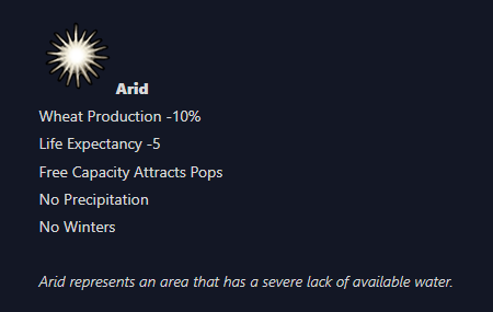
I noticed that in the climate Tinto Talks, it says that the arid climate gets no precipitation. If this is going to be the case, it does not make sense for large parts of south and west India to be arid because they do still get quite significant monsoon rains despite being classified as arid by the Koppen system. I think having them labeled as arid makes sense, but I hope that does not mean they don't get monsoons, since that would be wrong.
 
  • 1
  • 1Like
Reactions:
I have a rework for climate and topography of Maharashtra + Goa. This is built on top of my reworked location map that I put in a previous post. The only change since then is in Goa's locations.

Locations:
1745221374110.png


Climate:
Notable changes: More tropical locations on the east of the Western Ghats, such as Pune and Chakan. Also added some subtropical in the northernmost parts. Also changed arid to go further east in certain parts, as it should be. (Using 1900 Koppen classification map)

Green - Tropical
Yellow - Arid
Cyan - Subtropical

1745221422329.png


Topography:
Added some mountains to the Ghats, specifically to 3 of the passes. Replaced many of the hills with plateau, and added hills to most of what was flatlands, leaving pretty much only river valleys and the north as flatlands. It didn't make sense to me that the Deccan Plateau only had a handful of plateau locations, all of which were in Karnataka and Tamil Nadu. Most of the region has high elevation, but not very rough terrain, which is exactly what a plateau is.
Edit:
Brown - Mountains
Grey - Hills
Green - Flatlands
Orange - Plateau

1745221609794.png
 
Last edited:
  • 8Like
Reactions:
In 1337, northern Kerala was not a Sunni-majority region; Muslim communities remained small coastal enclaves until Tipu Sultan’s late-18th-century campaigns spurred inland growth.

As most of Kerala's —Hindu, Christian, and even some Muslim groups—followed matrilineal inheritance, how would that be represented?


Smaller states, such as Kolathunadu, utilized the ghats, monsoons, guerrilla tactics, and shifting coalitions to resist larger powers. How would the smaller states in Kerala not be run over?
 
  • 2
  • 1Like
  • 1
Reactions:
Goa and Karnataka Rework:

Locations:
1746389159821.png

1746389453764.png

1746389470835.png


Names of newly added locations:
1: Hosagunda
2: Terakanambi
3: Hangal
4: Ayyavole (modern-day Aihole)
5: Itagi
6: Gadag
7: Bagali OR Kuruvatti [both names for the location would work]
8: Bankapura
9: Gokak
10: Mudhol
11: Bagewadi
12: Jevargi
13: Aland
14: Sindagi
15: Gauribidanur
16: Hunsur
17: Chikkaballapura
18: Kanakpura
19: Kuduma (modern-day Dharmasthala)
20: Kalasa
21: Shimoga
22: Puttur
23: Amruthapura
24: Basaralu
25: Kanvapura (modern-day Canacona)
26: Satari
27: Tumakuru
28: Gummanayakana Palya
29: Nayakanahatti
30: Sugandavarti (modern-day Saundatti)
31: Hullahalli

Notice some of the borders of Andhra's locations right on the Karnataka-Andhra border slightly different compared to what I had it at previously.

Also, the location right above 19 and to the left of 20 is meant to be Karkala, in case that wasn't clear. I shifted the location North by quite a bit.

Countries:
1746389740807.png

1746389757123.png

1: Kurnool (Chalukya Somadeva Aravidu)
2: Vijayanagara (Harihara I Sangama) [March of Karnata]
3: Hangal (Kadamba dynasty)
4: Goa (Kadamba dynasty)
5: Nawayath (Jamaluddin Nakhuda) {Muslim Monarchy}
6: Hosagunda (Santara dynasty) [Vassal of Karnata] {Hindu Monarchy}
7: Alvakheda (Alupa dynasty) [Vassal of Karnata]
8: Karkala (Santara dynasty) [Vassal of Karnata] {Jain Monarchy}
9: Kuduma (Heggade dynasty) {Jain Theocracy}
10: Karnata (Hoysala dynasty)
11: Kodagu (Changalva dynasty) [Vassal of Karnata]
12: Terakanambi (Ketaya Dannayaka) [Vassal of Karnata]
13: Narayanavanam (Sriranganatha Yadavaraya)
14: Tondaimandalam (Rajanarayana Sambhuvaraya)

Notice I altered the borders between Kurnool and Vijayanagara slightly since my Andhra feedback, now giving Harihara control of Gutti.

Content:

I hope Tinto includes a situation, perhaps called "The Rise of Karnata" or something similar, along the lines of the Rise of the Ottomans situation in Anatolia, perhaps with the following possible endings:

Kannada victory:
- Hoysala victory: Madurai liberated, old territories reconquered, Vijayanagar becomes fully integrated and annexed
- Vijayanagar victory: Old territories of the Hoysalas reunite under Vijayanagara after Hoysala setbacks in the war against Madurai

Islamic victory:
- Madurai victory: Hoysalas forced out of Tamilakam, Vijayanagara defeated in battle afterwards
- Bahmani/Delhi victory: Delhi or Bahmanis seize Vijayanagara and defeat the Kannada

Sources:
1746411209734.png

1746411289547.png


Edit:

Bhatkal should be part of the Nawayath Sultanate instead of under the Alupas I'm pretty sure.
1746410890723.png
 

Attachments

  • 1746389423484.png
    1.009,6 KB · Views: 0
Last edited:
  • 6Like
  • 4Love
Reactions:
1746751959080.png

Not much change in India overall politically, but I do see some changes in wasteland borders and location borders, so I'll just assume that you guys are working on those first before heading to country borders.

I've noticed you guys have added Pulicat Lake and Chilika Lake, but you've left out Kolleru Lake. It may not be clearly visible on satellite maps anymore due to the erection of thousands of fish tanks and diversion of water away from the lake, but despite that the lake is still one of the largest freshwater lakes in India. You can refer to my previous rework of Andhra for the borders of the lake overlayed on the location map.

Map of Kolleru Lake:
1746757530672.png
 
Last edited:
  • 1Like
  • 1
Reactions:
Tamil Rework:

Final rework left for South India, with that entire half of India now done. Next I'll see if I can do something for the Northeast if I end up having the time, since I see a few things that can be improved there. As it stands, modern-day Tamil Nadu's locations are greatly overpopulated, so an increase in location density should help with that. Tamil Nadu economically is also probably one of the, if not the most, important regions of South India, so it deserves a little bit more density that what Tinto has given it already in my opinion.

Locations:
1747018767405.png

1747065186678.png

1747065204045.png

1: Kodumudi
2: Kuzhanthai Maanagaram (modern-day Periyakulam)
3: Pallapatti
4: Pozhil Vaitchi (modern-day Pollachi)
5: Kangeyam
6: Thirukodimāda Chenkundrūr (modern-day Tiruchengode)
7: Mahendra Mangalam (modern-day Srinivasanallur)
8: Attur
9: Kuzhithandalai (modern-day Kulithalai)
10: Murasunadu (modern-day Hosur)
11: Rayakottai
12: Harur
13: Gudiyetram
14: Perumpuliyur (modern-day Perambalur)
15: Tirupathur
16: Chengam
17: Thennangur
18: Tiruvannamalai
19: Padaividu
20: Mayilāppūr
21: Sriperumbudur
22: Tiruttani
23: Kanchipuram
24: Tiruvetipuram
25: Tintirivaṉam (modern-day Tindivanam)
26: Chengalpattu
27: Rajanarayanan Pattinam (modern-day Sadras)
28: Tirukoilur
29: Thirumudhukundram (Virudhachalam)
30: Kumbakonam
31: Adirampattinam
32: Natham
33: Ponnamaravathi
34: Uvari
35: Thoothukudi
36: Kalakkad
37: Ambasamudram
38: Manamadurai
39: Thondi
40: Tiruppattur
41: Virudhunagar
42: Aruppukkottai

Only new locations are labeled.

Countries:
1747065256820.png


1: Tenkasi (Vira Pandyan IV; Pandya dynasty)*
2: Ma'bar (Jalaluddin Ahsan Khan; Kaithali dynasty)

*Its previous borders were lacking Karivalamvandanallur and Tuticorin, which were both important cities for the Tenkasi Pandyas, so I expanded them to include both.


Culture:

Including some of the cultures of the Nilgiri Range, including Kurumba and Badaga, would be nice.
 
Last edited:
  • 5Like
  • 1Love
  • 1
Reactions: