Hello everybody, and welcome one more Friday to Tinto Maps, the place to be for map lovers! Today we will be looking at North America, which is very handy, as we can deliver some Thanksgiving turkey maps to our friends from the USA (and Canada)!
But before I get started, let me have a word on some (shameless) promotion. You may know that we in Paradox Tinto have also been in charge of Europa Universalis IV in the past few years. Well, I just want to let you know that there’s currently an ongoing sale on the game, with several discounts on diverse packages, of which outstands the hefty Ultimate Bundle, which includes all the DLCs developed and released by Tinto in the past 3 years (Leviathan, Origins, Lions of the North, Domination, King of Kings, and Winds of Change), and a whole bunch of the older ones. I’m saying this as you may want to support the ongoing development of Project Caesar this way! Here you may find more detailed information, and all the relevant links: https://forum.paradoxplaza.com/foru...toria-bundle-up-for-this-autumn-sale.1718042/
And now, let’s move from the Black Friday sales to proper Tinto Maps Friday!
Countries & Societies of Pops:


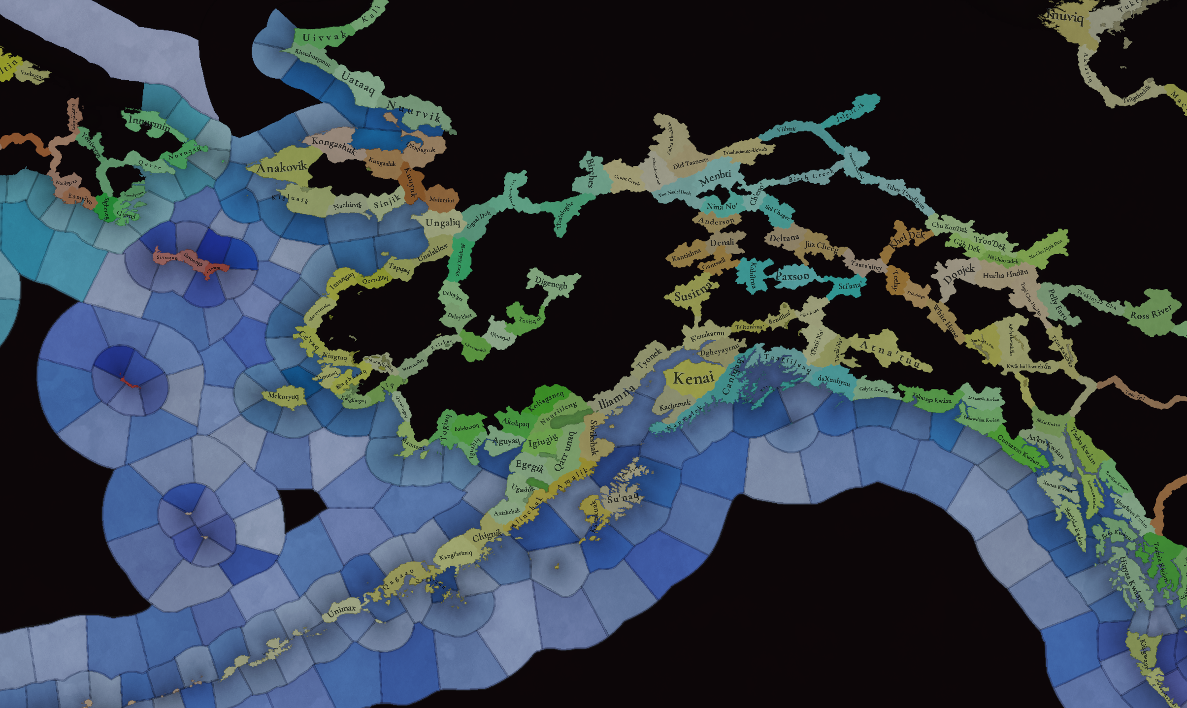
 For today’s Tinto Maps, we thought it would be a good idea to show both the land-owning countries and the SoPs. As I commented last week, we’re trying to follow consistent criteria to categorize countries and societies. This is our current proposal for North America, with Cahokia and some Pueblo people being the only regular countries in 1337, surrounded by numerous SoPs. I’m not bothering to share the Dynasty mapmode, as we don’t have any clue about them, and they’re auto-generated.
However, we have been reading and considering the feedback we received last week, in the Tinto Maps for Oceania, so we want to let you know that this is our current design proposal and that we want to hear from you what are your expectations regarding the countries that you would consider landed in 1337*, and also which countries you’d like to play with in this region, either as landed, or as a SoP.
As you may already know, our commitment is to make Project Caesar a great, fun game with your help, and we greatly appreciate the feedback we receive from you in that regard.
* This is already quite tricky, as most of our information only comes from post-1500s accounts when the native societies were already looking very different from two centuries ago. Eg.: The first reports made by Hernando de Soto about the Coosa Chiefom around 1540 points it out to be organized in a way that we’d consider it a Tribal land-owning tag, as confirmed by archaeology. However, that polity was not organized at that level of complexity in 1337, as there isn’t any contemporary data comparable to that of Cahokia. And some decades after the encounter with de Soto and some other European explorers, the mix of diseases had made the Chiefdom collapse, being more akin to what a SoP would be. This type of complex historical dynamism is what makes it so difficult to make the right call for the situation in 1337, and also for us to develop with our current game systems the proper mechanics that would be needed for SoPs to be fully playable (and not just barely half-baked).
Locations:


 Plenty of locations, at the end of the day, are a big sub-continent… You may notice that we’ve tried to use as many native names as possible, although sometimes, we’ve failed to achieve that. Any suggestions regarding equivalences of Native and Post-Colonial will be very much appreciated, as this is a huge task to do properly!
Provinces:


Areas:


Areas… And with them, an interesting question that we’d like you to answer: Which design and style do you prefer, that of the East Coast, more based on the Colonial and Post-Colonial borders? Or the one for the Midwest and the Pacific Coast, more based on geography, and less related to attached to modern states? Just let us know!
Terrain:


Some comments:
Development:

Not a very well-developed region in 1337…
Natural Harbors:


Cultures:


Lots of cultural diversity in NA!
Languages:

And the languages of those cultures!
Religions:


We have a mixed bag here: On the one hand, Eastern and Northern religions look more like the design we’re aiming to achieve, while on the other, to the south, you can find the splitter animist religions based on cultures that we now want to group into bigger religions, more akin to the northern areas.
Raw Materials:


Wild Game, Fish, and Fur are king in this region! But we are also portraying the ‘three sisters’ (maize, beans, squash), the agricultural base for many of the native American societies, using Maize, Legumes (beans), and Fruit (squash). Cotton is also present in the south, as it was also native to the region (although the modern variant comes from a crossing with the ‘Old World’ one), and there are also mineral resources present here and there.
Markets:

Two markets are present in 1337, one in Cahokia, and another in the Pueblo land.
Population:
Broken map! But as this is an interesting topic to discuss, these are the current numbers we’ve got in the region:
And that’s all for today! There won't be a Tinto Maps next week, as it's a bank holiday in Spain (as I was kindly reminded in a feedback post, you're great, people!), so the next one will be Central America on December 13th. But, before that, we will post the Tinto Maps Feedback review for Russia on Monday, December 9th. Cheers!
But before I get started, let me have a word on some (shameless) promotion. You may know that we in Paradox Tinto have also been in charge of Europa Universalis IV in the past few years. Well, I just want to let you know that there’s currently an ongoing sale on the game, with several discounts on diverse packages, of which outstands the hefty Ultimate Bundle, which includes all the DLCs developed and released by Tinto in the past 3 years (Leviathan, Origins, Lions of the North, Domination, King of Kings, and Winds of Change), and a whole bunch of the older ones. I’m saying this as you may want to support the ongoing development of Project Caesar this way! Here you may find more detailed information, and all the relevant links: https://forum.paradoxplaza.com/foru...toria-bundle-up-for-this-autumn-sale.1718042/
And now, let’s move from the Black Friday sales to proper Tinto Maps Friday!
Countries & Societies of Pops:


However, we have been reading and considering the feedback we received last week, in the Tinto Maps for Oceania, so we want to let you know that this is our current design proposal and that we want to hear from you what are your expectations regarding the countries that you would consider landed in 1337*, and also which countries you’d like to play with in this region, either as landed, or as a SoP.
As you may already know, our commitment is to make Project Caesar a great, fun game with your help, and we greatly appreciate the feedback we receive from you in that regard.
* This is already quite tricky, as most of our information only comes from post-1500s accounts when the native societies were already looking very different from two centuries ago. Eg.: The first reports made by Hernando de Soto about the Coosa Chiefom around 1540 points it out to be organized in a way that we’d consider it a Tribal land-owning tag, as confirmed by archaeology. However, that polity was not organized at that level of complexity in 1337, as there isn’t any contemporary data comparable to that of Cahokia. And some decades after the encounter with de Soto and some other European explorers, the mix of diseases had made the Chiefdom collapse, being more akin to what a SoP would be. This type of complex historical dynamism is what makes it so difficult to make the right call for the situation in 1337, and also for us to develop with our current game systems the proper mechanics that would be needed for SoPs to be fully playable (and not just barely half-baked).
Locations:


Provinces:


Areas:


Areas… And with them, an interesting question that we’d like you to answer: Which design and style do you prefer, that of the East Coast, more based on the Colonial and Post-Colonial borders? Or the one for the Midwest and the Pacific Coast, more based on geography, and less related to attached to modern states? Just let us know!
Terrain:


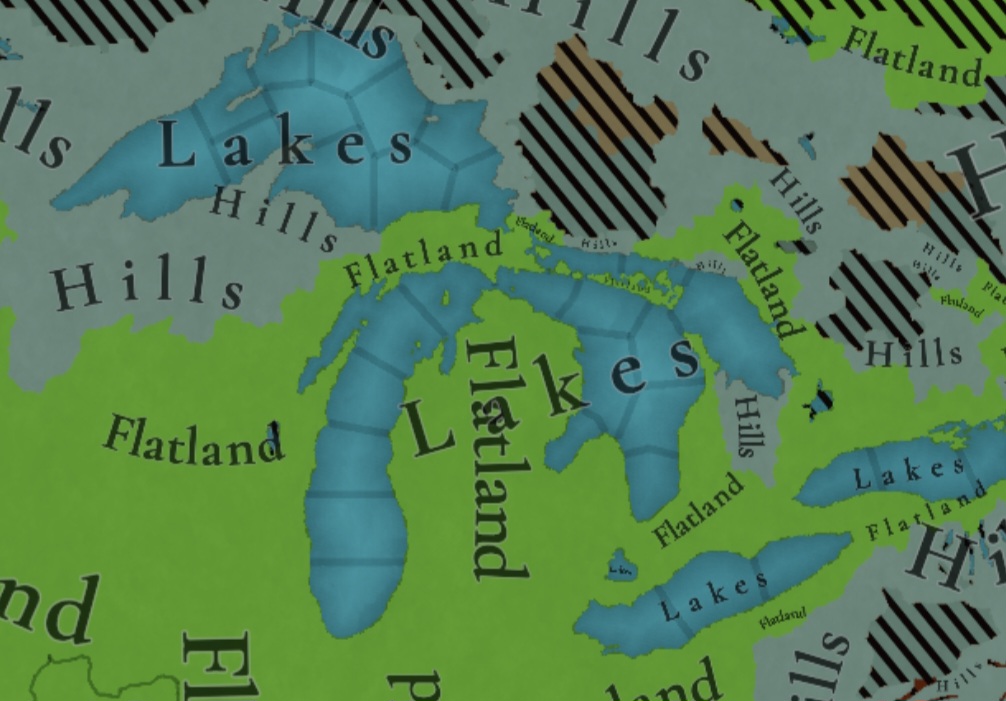
Some comments:
- Most climates are portrayed in NA, from Arctic to Arid.
- The Rocky Mountains are rocky!
- Regarding vegetation, we wanted to portray the forest cover in 1337, which is tricky, and that’s why some areas may look too homogeneous. Any suggestions are welcome!
Development:

Not a very well-developed region in 1337…
Natural Harbors:


Cultures:


Lots of cultural diversity in NA!
Languages:

And the languages of those cultures!
Religions:


We have a mixed bag here: On the one hand, Eastern and Northern religions look more like the design we’re aiming to achieve, while on the other, to the south, you can find the splitter animist religions based on cultures that we now want to group into bigger religions, more akin to the northern areas.
Raw Materials:


Wild Game, Fish, and Fur are king in this region! But we are also portraying the ‘three sisters’ (maize, beans, squash), the agricultural base for many of the native American societies, using Maize, Legumes (beans), and Fruit (squash). Cotton is also present in the south, as it was also native to the region (although the modern variant comes from a crossing with the ‘Old World’ one), and there are also mineral resources present here and there.
Markets:

Two markets are present in 1337, one in Cahokia, and another in the Pueblo land.
Population:
Broken map! But as this is an interesting topic to discuss, these are the current numbers we’ve got in the region:
- Continent:
- 20.487M in America (continent)
- Sub-continents:
- 10.265M in North and Central America (we have a pending task to divide them into two different sub-continents)
- 10.222M in South America
- Regions (roughly 1.5M):
- 162K in Canada
- 1.135M in the East Coast
- 142K in Louisiana
- 154K in the West Coast
- 43,260 in Alaska
And that’s all for today! There won't be a Tinto Maps next week, as it's a bank holiday in Spain (as I was kindly reminded in a feedback post, you're great, people!), so the next one will be Central America on December 13th. But, before that, we will post the Tinto Maps Feedback review for Russia on Monday, December 9th. Cheers!


