• We have updated our Community Code of Conduct. Please read through the new rules for the forum that are an integral part of Paradox Interactive’s User Agreement.

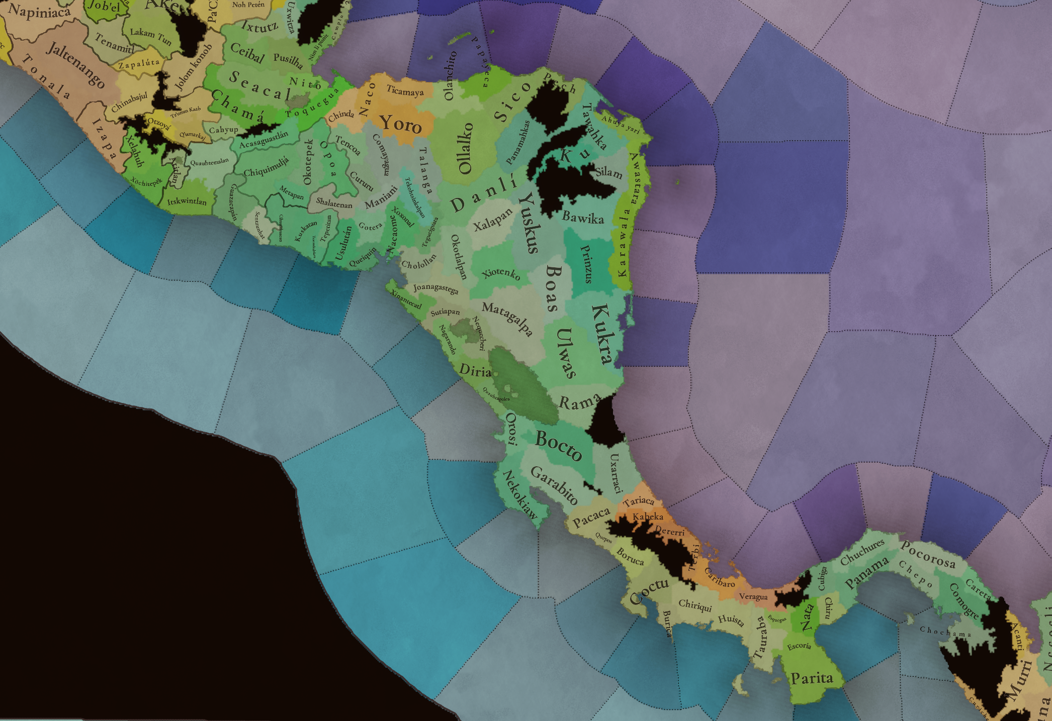
Tinto Maps #29 - 13th of December 2024 - Central America

Hello everybody, and welcome to Tinto Maps, the happy Fridays for map lovers! Today, we will be looking at Central America, which includes the Caribbean. Before we start, I want to introduce you @RaulTrullenque , the only member of our Content Design team who had not yet gone public, and who worked really hard on the maps and content of the Central American and South American regions.

And now let’s get started without further ado!

Countries
Countries1.png

Countries2.png

Countries3.png

Countries4.png

Countries5.png

Countries6.png

Countries7.png

Tenochtitlan.png

Mayan.png
Welcome to the Mesoamerican Thunder Dome! This area is characterized by its numerous Altepetl, more or less comparable to city-states. Most of them are ruled in 1337 by peoples of Nahua origin, something that you may see much more clearly in the culture map. The biggest power in this moment is the Empire of P’urhépecherio, though, founded by the Purepecha people. In any case, you may notice that there’s a lot of detail in this area, including a tiny Nahua settlement recently founded on an island over Lake Texcoco, Tenochtitlan. This is the first time in a PDX GSG that we have the island itself present on the map, although the location covers some more land over the lake coast, to make it playable. Finally, we also have the Mayan polities of the Postclassic Period, of which Cocom, with its capital Màayapáan, was the most important, along with others, such as K’iche’ and its capital Q’umarkaj.

SoPs
SoPs1.png

SoPs2.png

SoPs3.png

SoPs4.png
On the outskirts of the Mesoamerican polities, there are plenty of peoples organized on different ways. To the north, we have the ones that populate the area known as Aridoamerica, which were collectively termed by the Nahua as ‘Chichimeca’. We also have plenty of societies close to the Mayan lands and the Isthmus. And, finally, the Taíno people populate some of the biggest islands in the Caribbean.

Locations
Locations1.png

Locations2.png

Locations3.png

Locations4.png

Locations5.png

Locations6.png

Locations7.png

Locations8.png

Plenty of locations here! I just want no note that the Darien Gap is an impassable wasteland, which means that any army trying to cross from modern Panama and Colombia will need transport ships to be able to do it.

Provinces
Provinces1.png

Provinces2.png


Areas
Areas1.png

Areas2.png


Terrain
Climate.png

Climate2.png

Topography.png

Vegetation.png

Vegetation2.png

A very diverse region! Most of it is covered by Tropical Jungles and Forests, but Sierra Madre Occidental and Oriental make for very specific conditions in the Mexican Altiplano, which are not only visible in the Topography map but also in the climate and vegetation of the area.

Development
Development2.png

The most developed regions in Mesoamerica are the Valley of Mexico and the Mayan coastline.

Natural Harbors
Harbors.png

There are some good ports in the Caribbean, no surprise that most of them would later become important cities in the Colonial Period.

Culture
Cultures.png

Cultures2.png

Tons of cultures!

Language
Dominant Languages1.png

Dominant Languages2.png

Court Language.png

And also languages! The first two maps are the Dominant Languages per location, while the third is the Court Languages one. The dark blue language is ‘Totozoquean’, as it is not so easily readable (something we have to change).

Religions
Religions.png

This map is today in a more advanced state, as we have merged plenty of cultural religions into regional groupings. Of these, Tonalism, Nahua, and Mayan are part of the Tonalist religious groups, while the others are part of the Folk American group (a regional split of the former ‘Animist’ group). Nahua and Mayan have their different mechanics, which we’ll talk about in future Tinto Talks. Let us know what do you think of this design and any suggestions about the religious grouping!

Raw Materials
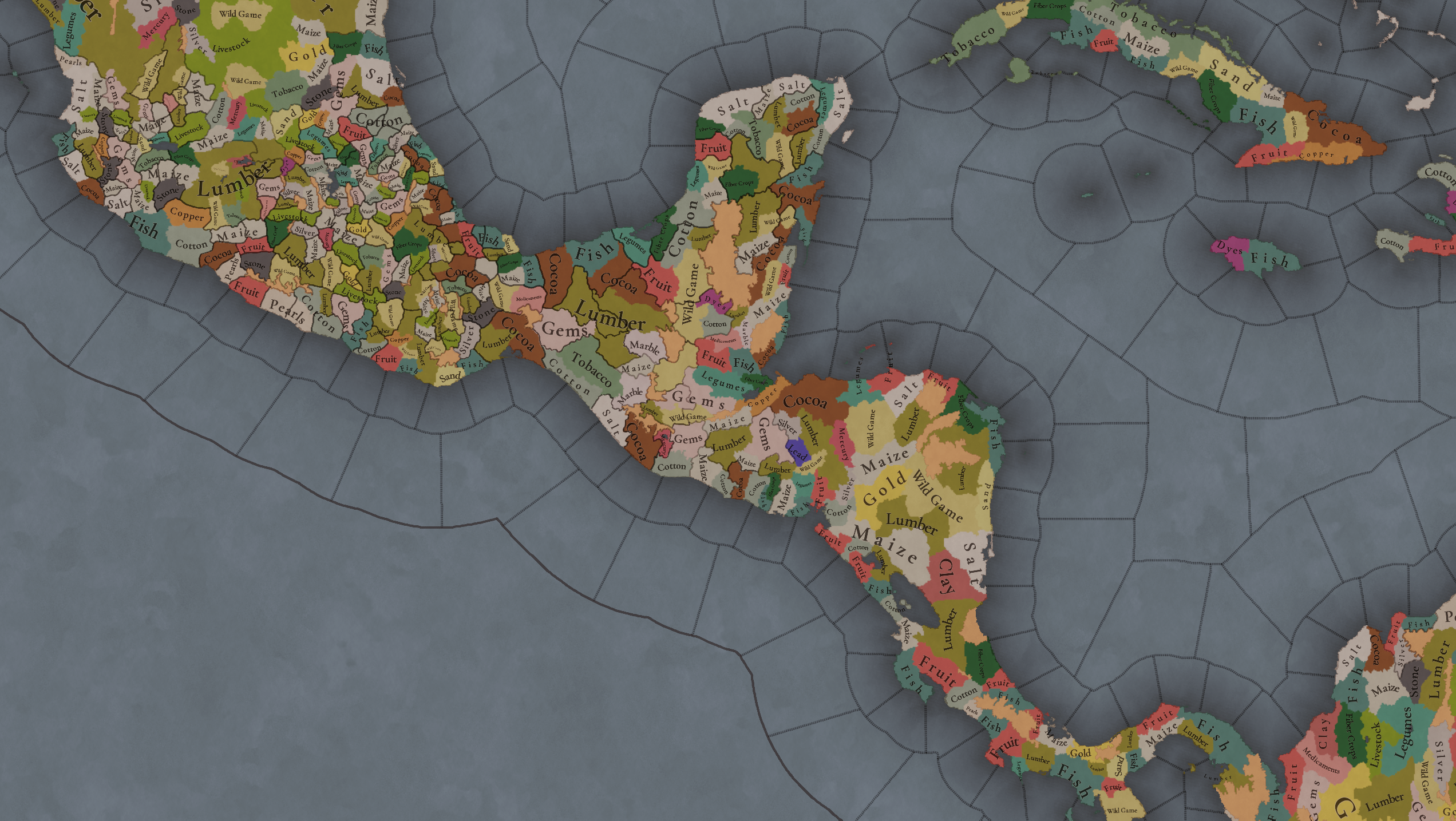
Raw Materials1.png

Raw Materials2.png

Raw Materials3.png

Raw Materials4.png

Maize is king in Mesoamerica, although there are plenty of other resources, including juicy Gold and Silver. Obsidian is not a separate resource, as it’s too regional-specific, so it’s included under the Gem coverage, but we have ways to represent it in-game; for instance, there’s a production method to produce Weaponry using Gems as an input.

Markets
Markets.png

A couple of bugs were reported while taking the screenshot of this map! But well, you can see that Azcapotzalco, Màayapáan, and Noh Petén (capital of the Itza people) are the most important ones.

Population
Population1.png

Population2.png

Population3.png

Population4.png

Population5.png

Population6.png

Population7.png

We have solved a couple of issues with the pop editor, and this week this map is in a decent state to be shown! Yay! Total numbers in the region are roughly 8.6M pops, distributed this way:
  • 523K in Aridoamerica (includes the lands to the North-West of the Purepecha Empire)
  • 6.947M in Mesoamerica (including North-Western Mayan lands)
  • 1.003M in Central America (including South-Eastern Mayan lands)
  • 151K in the Caribbean Islands

And that’s all for today! We hope you enjoyed these meaty maps! Next week we will be taking a look at the Levant Feedback, on Monday 16th, and South America, on Friday 20th! Cheers!
 
  • 118Like
  • 96Love
  • 5
  • 1
Reactions:
Have you seen my raw materials suggestions here and here? Unfortunately I didn't really have any information about Michoacán beyond what's already in game, but I suggested many changes for Guerrero, Oaxaca, Puebla, Veracruz, Hidalgo Edo de Mexico, Morelos, El Salvador and western Nicaragua. I would love feedback if you have more sources to compare.
The links do not open
 
I just saw the links for the raw material suggestions, I couldn't agree more on most of them! Having turkey as livestock, copal as incense, prickly pear cactus as fruit, and liquidambar as medicaments are especially welcome! Would there be any beekeeping in the area or was that more limited to the Maya on the Yucatán Peninsula?

One thing I'm wondering about is having both obsidian and turquoise as gems. It does make sense but it seems like it would kinda ruin the trade between Mesoamerica and the Southwest. Especially since I thought most of the turquoise came from New Mexico.
 
  • 3Like
Reactions:
Would there be any beekeeping in the area or was that more limited to the Maya on the Yucatán Peninsula?
Yes there was. I suggested beeswax as a possible material for multiple locations around Guerrero, the Mixteca, Totonacapan, the Huasteca and the Puebla sierras. It also existed in west Mexico and in interior Honduras. However, it's a bit of a secondary product compared to big ones like maize, maguey, dyes, cotton, cacao, precious minerals. It also existed in parts of El Salvador but definitely was overshadowed by most of those same products. One thing to watch out for though is honey was also made from maguey, so sometimes it translates into fiber crops instead of beeswax, and it can be hard to tell which is correct.

Chili has also been added as a raw material, and this whole region is the epicenter of it. Actually it was found in a similar distribution to honey.
 
  • 2
  • 1Like
  • 1
Reactions:
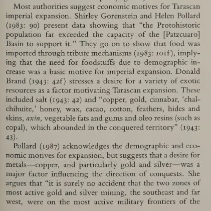
Also, an excerpt from pg. 139 of Aztec Imperial Strategies on goods motivating the Purepecha expansion:
1751936812591.png

Unfortunately it doesn't list the particular settlements or zones where all these goods were found, but I guess they should be present within Michoacan or the immediately neighboring areas of Colima, Jalisco, Guanajuato. Copper, salt, wild game, cotton, gems (chalchihuites) are already present, but I guess cacao, incense (copal), beeswax should be added. I'm guessing the southeast and far west refer to Tierra Caliente and Jalisco respectively, so gold/silver can be added there. I'm thinking cinnabar should be represented as dyes rather than mercury.
 
  • 2Like
  • 2
Reactions:
Have you seen my raw materials suggestions here and here? Unfortunately I didn't really have any information about Michoacán beyond what's already in game, but I suggested many changes for Guerrero, Oaxaca, Puebla, Veracruz, Hidalgo, Edo de Mexico, Morelos, El Salvador and western Nicaragua. I would love feedback if you have more sources to compare.
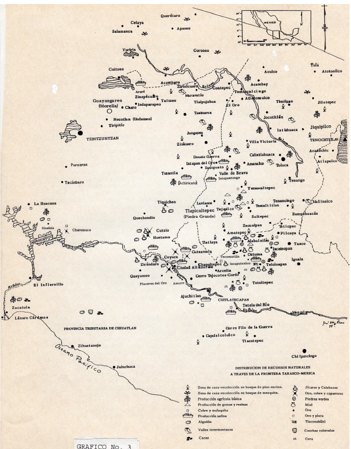
For the raw materials of Michoaca, I found this map. It's a bit old, but it has a large number of raw materials and locations that we can use, and it will also help make Western Mesoamerica more granular.For the raw materials of Michoaca, I found this map. It's a bit old, but it has a large number of raw materials and locations that we can use, and it will also help make Western Mesoamerica more granular.

resources_mich_gro.png

I understand that it is not entirely legible, but I am trying to make an approximation with it and other articles/theses that I will present soon.

Source: Rivero, José Hernández. “Arqueologia De La Frontera Tarasco Mexica.” Tesis ENAH, 1994.
 
Last edited:
  • 2Like
  • 2
Reactions:
Hi,
you have done an excellent job establishing the political entities and locations in Mesoamerica. I would like to know where you get your information or how you know what shape a province or location might have. Also, if you would like, I could help you clarify the location of some regions and their correct names (I don't know if they already have them), as well as their raw materials (through the Matricula de Tributos, for example), mainly in the regions of Guerrero, Oaxaca, and Michoacán. I can work with shapefiles and other formats.
Hello. Thanks,
My starting source for the whole region is the work of Peter Gerhard, his books for New Spain have a colonial administration focus, still each province comes with usefull information about their prehispanic ethnic and political background, for the ones that were part of the Tenochca and Tzintzuntzani empires could include the references about the previous independent city states. From these I look for books about particular regions and mostly very specific papers and theses.

About the regions I have tried to focus on the zones that dont get as much attention as the Mexica Empire and the Maya area, like Western Mesoamerica and the Chichimec frontier. The Southern Mesoamerican Frontier is also on my plans but I wonder how much I can cover before the official feedback for the region gets posted (in around a month maybe). Anyway even after the feedback thread we can still contribute with more sources and arranged suggestions.

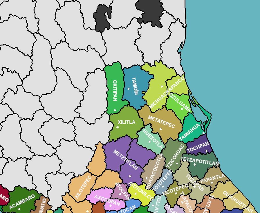
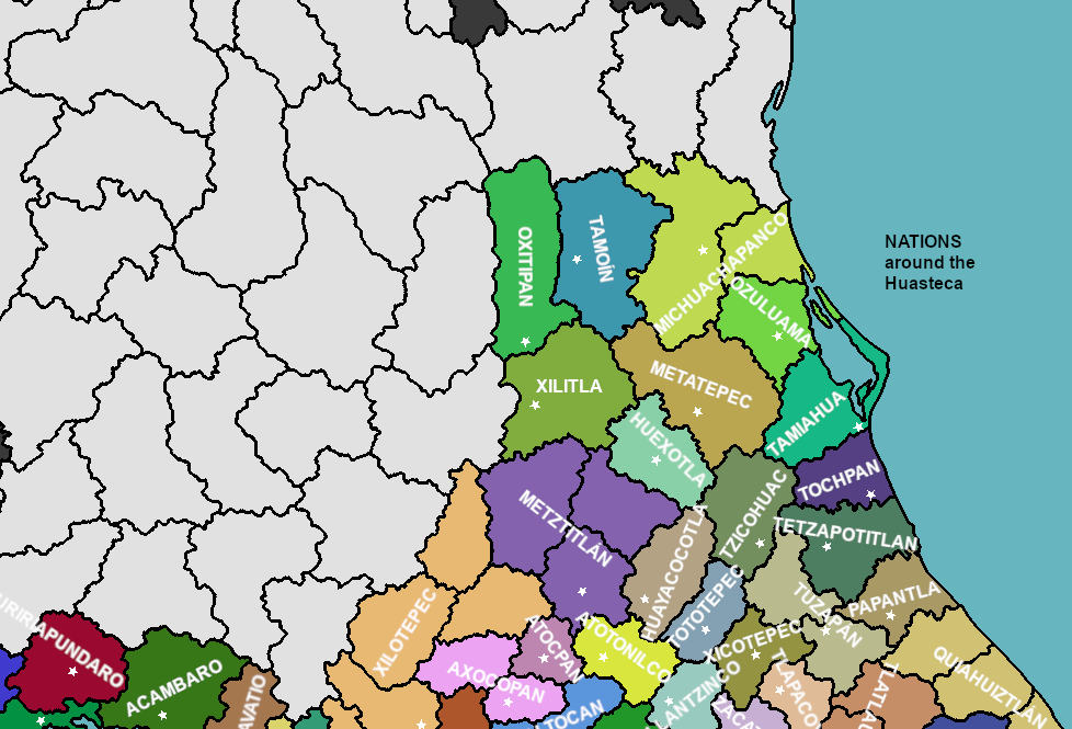
For example here is the advancement for the Huasteca and surrounding altepeme.
Huasteca altepeme.png


Next post (soon) comes with the lists of locations and cultures for each one, plus the explanation and sources for this changes.
From here with the location setup, the raw materials could be assigned properly.
 
  • 4Like
  • 1Love
  • 1
Reactions:
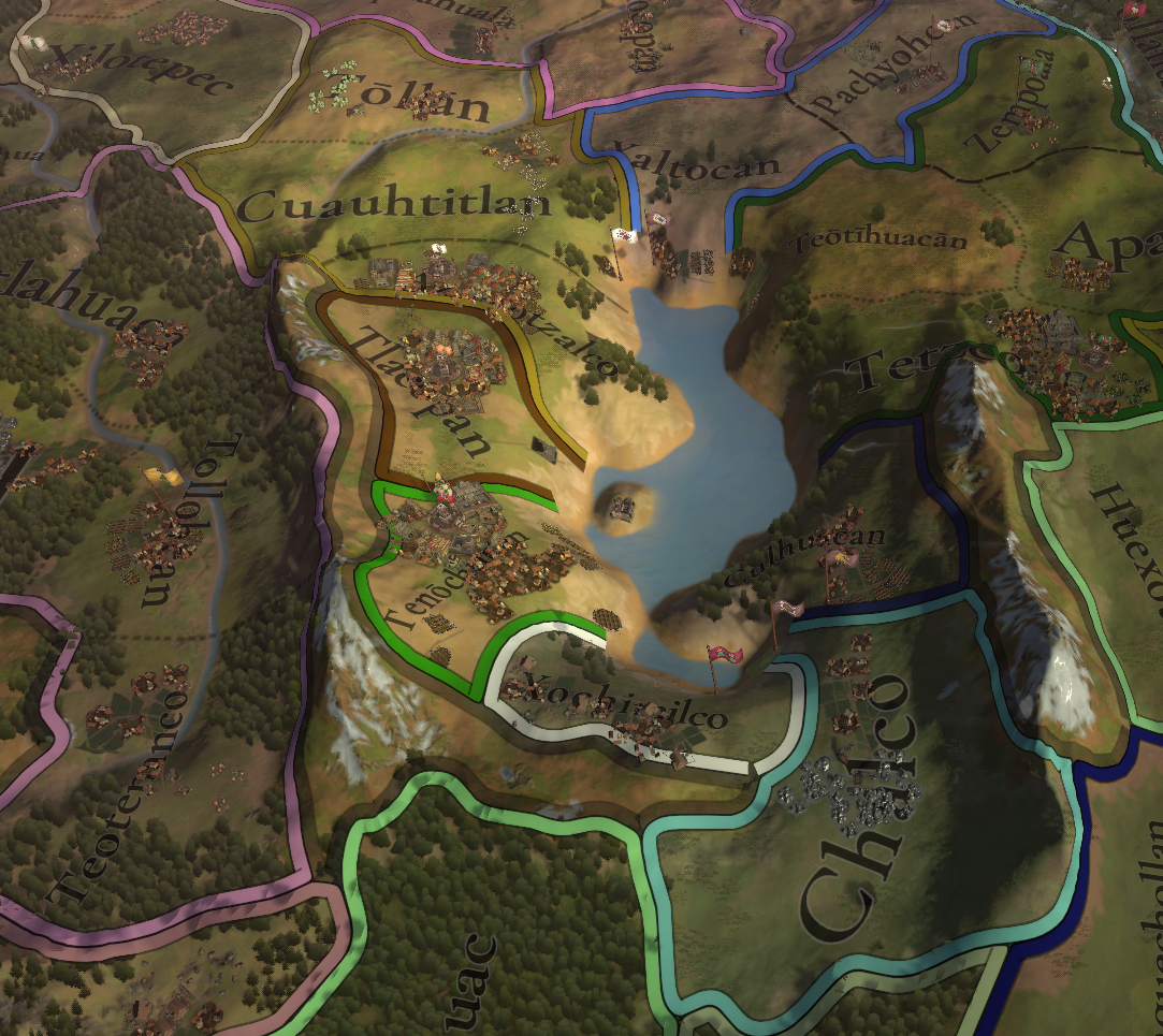
Something to note though, in 1337 Tlacopan should be owned by Tepanecapan or at least a vassal. It looks like it's already a vassal? The Mexica overthrew their Tepanec masters through the context of a succession dispute, and Tlacopan was a dissident Tepanec city that supported the same side as the Mexica.
 
  • 1
  • 1Like
Reactions:
I get what you're saying, although that might distort the shape of the lake which is important too
I suppose this is not a problem, as you can raise the terrain level, and make a slightly lower level with an edge that represents the true shape of the lake. Since most lakes are not at sea level, but are higher above sea level.
 
  • 2Like
Reactions:
The playable Altepeme from the Huasteca and neighboring Otomi and Totonac zones:
Huasteca region Nations.png


NATIONPROVINCELOCATIONCULTURE 01CULTURE 02
MichuachapancoPanucoPanucoTéenek
MichuachapancoPanucoTampicoTéenek
OzuluamaPanucoOzuluamaTéenek
TamiahuaPanucoTamiahuaTéenek
MetatepecPanucoTantoyucaTéenek
TamoínOxitipanTamuínTéenek
OxitipanOxitipanOxitipanTéenek
XilitlaOxitipanXilitlaTéenekOtomi
HuexotlaMetzititlánHuexotlaTéenekOtomi
TochpanTochpanTochpanTéenek
TetzapotitlánTochpanTetzapotitlánTéenekTutunakú
TzicohuacTochpanTzicohuacTéenekTepehua
HuayacocotlaTochpanHuayacocotlaTéenekOtomi
TototepecTochpanTutotepecTéenekOtomi

From the last dev diary it seems like Tanchipa (Tamchipa) is already replaced by Tamtoc. This is an upgrade since as it was pointed out before the real site of Tanchipa is near to Ciudad Mante, to the north. So certainly Tamtoc is a better option that is truly localized in that zone. Still, the best name for this location and altepetl is not Tamtoc but Tamuín (Tamoín).
Very close to each other are the sites of Tamuín (Tamohi) and Tamtoc. Each one a significant and populous population that could be deserving of their own location if it weren't because they are really close to each other for this scale of localities. Additionally by the time of the Spanish conquest not only the nearby places like Tamtoc were under Tamuín (Tamoín on early sources) but also other relevant populations like Tancuayalab.

Complementing the rename of Tamtoc into Tamoín (or Tamuín), the locality of “Mante” should be changed to Tanchipa (Tanxipa/Tamchipa) considering this town is clearly the most relevant and certainly localized place around modern Ciudad Mante. Meanwhile the name “Mante” is subject of various linguistic hypotheses and was not relevant until way later times.
Also, it has to be clarified that the proper Huastec (Téenek) town of Tanchipa was a marginal mesoamerican population. Similarly to other notable Huastec towns like Tammapul, Tanchaycha and Tancoyol (Jalpan locality) in the transitional area between the Mesoamerican and Aridoamerican regions. This zone was part of the contraction of the Classical Mesoamerican frontier, then a suitable buffer where the Spaniards used the christianized mesoamericans as example to persuade the nomadic nations to convert and settle. So it is questionable if these towns should be playable as proper altepeme, still these localities are certainly good material for events related to their recolonization by Mesoamerican and European nations.

The rest of the Huastec zone needs more location corrections like: putting Oxitipan (early sources naming) on the archaeological site of Tanute, replace the wrongly named “Tziuhcoac” locality with Tantoyuca corresponding to the altepetl of Metatepec (Metlaltepec), create a new Tampico locality (do not mistake with the modern Tampico to the north) from Panuco both controlled by Michuachapanco, add Tamiahua locality and altepetl between Ozuluama and Tochpan, around the modern frontier of San Luis Potosi and Hidalgo should be added the altepeme of Xilitla and Huexotla, then around where “Tetzapotitlan” was placed is the true Tzicohuac (Tzicoac) at the archaeological site of Loma Bonita (Mesa of Cacahuatenco Ixhuatlán de Madero), meanwhile the true Tetzapotitlan should take the identity of “Teayotlan” since the true Teayotlan was at the west very close to the more relevant Tetzapotitlan (Castillo de Teayo).

PROVINCELOCATIONCULTURE 01CULTURE 02
XilotepecXilotepecOtomi
XilotepecTecozautlaOtomi
XilotepecZimapanOtomiXi'oi
XilotepecIxmiquilpanOtomi
MatlatzincoAcambayOtomi

Xilotepec (Jilotepec) is a very relevant Otomí altepetl, which (as has been mentioned) should not control the localities in modern Queretaro state at the starting date. Xilotepec’s domains before being conquered by the Mexica included the zone from Acambay to Zimapan (also sites like Jiquipilco/Xiquipilco and Chapantongo but these ones would conflict by proximity and scale with others). It was only after the Spanish conquest that the christianized Otomi population of Xilotepec colonized the locations corresponding to Querétaro and Guanajuato like Ixtachichimecapan(San Juan del Río), Kerendarhu (Querétaro), Tolimán, Xichú, Quijay (San Luis de la Paz), Cocomacán (Dolores near San Miguel), Copúz (San Felipe) and Apatzeo (Apaseo). This later colonization is also another great historical opportunity for some in-game event chain.

PROVINCELOCATIONCULTURE 01CULTURE 02
MetzititlánMetzititlánOtomi
MetzititlánChichicaxtlaOtomi
MetzititlánTlanchinolTéenekOtomi

Metztitlán is another very important Otomí altepetl, but unlike Xilotepec it was not conquered by the Mexica. In game it was mistakenly controlling Zimapán and Ixmiquilpan, that should be for Xilotepec, and “Cadereyta” that should be named Tolimán (colonized also by Xilotepec Otomíes). Instead of these localities, the localities that Metztitlán should control are the new Chichicaxtla and Tlanchinol, of course also Metzititlán proper.

NATIONPROVINCELOCATIONCULTURE 01CULTURE 02
AtotonilcoAtotonilcoAtotonilcoNahuaOtomi
TollantzincoAtotonilcoTollantzincoOtomiNahua
ZempoalaAtotonilcoZempoalaNahuaPame
AxocopanAxocopanAxocopanOtomiNahua
AxocopanAxocopanMixquiahualaOtomiNahua
AtocpanAxocopanAtocpanOtomiNahua

For the rest of the Otomi region apart from the general redrawing and culture distribution, the only other notable change is @nyetflix2 suggestion to replace “Tlapacoya” (right to the southeast of Metztitlán) with Atotonilco (province and altepetl).

NATIONPROVINCELOCATIONCULTURE 01CULTURE 02CULTURE 03
TlapacoyanTlapacoyanTlapacoyanTutunakúNahua
TuzapánTlapacoyanTuzapánTutunakú
TuzapánTlapacoyanPantepecNahuaTutunakúOtomi
XicotepecTlapacoyanXicotepecNahuaTutunakúOtomi
ZacatlánTlapacoyanZacatlánNahuaTutunakú
PapantlaPapantlaPapantlaTutunakú
QuiahuitztlánPapantlaCuyuxquihuiTutunakú
QuiahuitztlánPapantlaNauhtlánTutunakú
QuiahuitztlánCempoahuallanQuiahuitztlánTutunakúNahua
TlatlauhquitépecTlatlauhquitépecTlatlauhquitépecTutunakú
TlatlauhquitépecTlatlauhquitépecXonotlaTutunakú
TlatlauhquitépecTlatlauhquitépecTeziutlánTutunakúNahua

The Totonac zone also get multiple changes: the nation of Pantepec would be replaced by the new Tuzapan altepetl controlling both Tuzapan and Pantepec locations, while Xicotepec location will be also its own independent altepetl, the location and altepetl of Tlapacoyan (the relevant one) should be more to the west between Tuzapan and Zacatlán, Tlatlauquitepec altepetl would control Tlatlauquitepec, Teziutlan and the new Xonotla locality that replaces the eastern “Tlapacoyan”
Other relevant change for the Totonac region is the cultural framework noted by @nyetflix2 including significative Nahua population at Cempoala, also Xicotepec (plus the nearby Cuauhchinanco and Pahuatlán) were conquered by the Acolhuas, and Umeacatl lord of Mizquihuacan (Mixquihuacan) and first of a long dynasty doubtfully labelled as Totonaca.

It should be noticed also the Tepehua at Tollantzinco, Pantepec, Tzicohuac, Huayacocotla, Tutotepec and Xicotepec. I agree with one of @nyetflix2 observations that Tepehua could be their own but also be represented as Totonac from their close relation. I lean towards the second option since Tepeuha already had lesser regional weight, Totonacs are already affected by Nahua influence and their region already had not only Totonac and Nahua populations, but also Otomi and Huastec overlaps.

SOURCES:
  • Aguilar-Robledo, M. 2003. La territorialidad en el norte de Mesoamérica: el señorío de Oxitipa en el siglo XVI. Tiempos de América, revista de historia, cultura y territorio. n°10. pp. 03-18.
  • Ariel de Vidas, A. 2009. Huastecos a pesar de todo. Breve historia del origen de las comunidades teenek (huastecas) de Tantoyuca, norte de Veracruz. Centro de Estudios Mexicanos y Centroamericanos.
  • Avilez-Moreno, M. R. 2014. El señorío de Tuzapan. Algunos indicadores históricos y arqueológicos de su papel en el centro-norte de Veracruz. Arqueología. nº 47. pp. 146-159.
  • Brambila-Paz, R. 2023. Economía y cultura en Jilotepec. Siglo XVI. Jilotepec. Jarquín-Ortega, M. T., and Morales-López, V. E. El Colegio Mexiquense.
  • Cervantes-Jáuregui, B. 2021. De Jilotepec al Bajío la expansión Otomí en el siglo XVI. In: Brambila-Paz, R. La expansión de Jilotepec en el siglo XVI. Colección Etnohistoria, Serie Logos. Instituto Nacional de Antropología e Historia. Secretaria de Cultura.
  • Espinosa-Ruiz, A. R. 2013. Lienzo de Tzoquitetlán, hoy propuesto a renombrar como Lienzo de la Provincia de Tzicohuac. Arqueología. nº 46.
  • Fernández-Christlieb, F., and Garza-Merodio, G. 2006. La pintura de la Relación geográfica de Metztitlán, 1579. Secuencia. Revista de Historia y Ciencias Sociales. nº 66. pp. 160-186.
  • García-Márquez, A. 2014. El Posclásico en Veracruz. Los Nahuas de Cempoala. Universidad Nacional Autónoma de México.
  • Gerhard, P. 1986. Geografía Histórica de la Nueva España, 1519-1821. Universidad Autónoma de México.
  • Gerhard, P. 1996. La frontera norte de la Nueva España. Universidad Autónoma de México.
  • Granados-Saucedo, F. S. 2011. El culto a la montaña en El Centro Norte de México y sus implicaciones calendárico-astronómicas. Los casos de El Cerrito, El Barrio de la Cruz, El Rosario y La Trinidad, en Querétaro; y Huamango, Estado de México. Universidad Nacional Autónoma de México.
  • Guzmán-Pérez, M. 2012. Otomíes y Mazahuas de Michoacán, siglos XV-XVII. Trazos de una historia. Tzintzun, Revista de Estudios Históricos. nº 55. pp. 11-74.
  • Kroefges, P. C., Schulze, N., Hernández-Correa, A. L., and García-Morales, A. O. 2021.Oxitipa y el sitio arqueológico de Tanute, Huasteca potosina. Arqueología, Revista de la Coordinación Nacional de Arqueología. nº65.
  • León-Portilla, M. 2009. El Códice de Xicotepec. Estudios De Cultura Náhuatl. nº 29. pp. 327-331.
  • Márquez-Lorenzo, E. 2021. Tetzapotitlan-Teayo. Precisiones toponímicas en la Huaxteca meridional, México. Revista pueblos y fronteras digital.
  • Meade-Esteva, M. 1983. La Huaxteca Potosina en la Época Colonial siglo XVI. Universidad Nacional Autónoma de México.
  • Melgarejo-Vivanco, J. L. 1943. Totonacapan. Talleres Gráficos del Gobierno del Estado.
  • Melgarejo-Vivanco, J. L. 1947. La Provincia de Tzicoac. Trabajadores Intelectuales de Veracruz.
  • Melgarejo-Vivanco, J. L. 1970. Códices de Tierras. Los lienzos de Tuxpan. Universidad Veracruzana.
  • Melgarejo-Vivanco, J. L. 1981. Tamiahua. Una Historia Huasteca. Punto y Aparte.
  • Melgarejo-Vivanco, J. L. 1985. Los Totonacas y su cultura. Universidad Veracruzana.
  • Offner, J. A. 2010. Un segundo vistazo al Códice de Xicotepec. Itinerarios. vol. 11.
  • Olivier, G. 2008. Viaje a la Huasteca con Guy Stresser-Péan. Centro de Estudios Mexicanos y Centroamericanos.
  • Ramírez-Castilla, G. A. 2022. El Totonacapan y la cuestión totonaca. Ollin. n° 17. pp. 23-30.
  • Rovira-Morgado, R. 2010. Elites locales y economía política en la Mesoamérica Posclásica: El caso de Molango (Señorío de Metztitlán). Revista de Indias. vol. 70. nº 249. pp. 525-550.
  • Stresser-Péan, G., and Stresser-Péan, C. 2001. Tamtok, sitio arqueológico huasteco. Centro de Estudios Mexicanos y Centroamericanos. Colegio de San Luis.
  • Tellez-Nieto, A. L. 2019. Primer Acercamiento a la Organización Sociopolítica del Noreste de Hidalgo durante el Periodo Posclásico Tardío (1100-1521 d.c.) El Colegio de Michoacán.
  • Vite-Hernández, A. 2016. Entre la mesa y los siete cerros. Historia y paisaje ritual de los nahua de Huautla, Hidalgo. Universidad Nacional Autónoma de México.
  • Wright-Carr, D. C. 2012. Los signos glotográficos en el Códice de Huichapan. Relaciones. nº 132. pp. 33-73.
 
  • 2Like
  • 2
  • 1Love
Reactions:
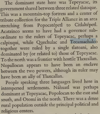
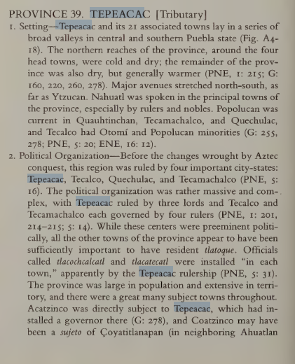
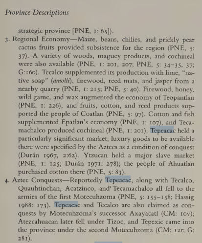
Tecamachalco would make more sense belonging politically to Tepeyacac than Tehuacan:
1752618637800.png

However there's also a case for both it and Tecalco to be independent:
1752619358871.png

1752619370272.png
Summary of cultures:
  • Tecamachalco: Chocho-Popoloca/Ngiwa with a Nahua ruling class
  • Tepeyacac: Nahua with an Otomi minority representing those to the north around San Salvador el Seco
  • Tecalco: Nahua with Otomi, Popoloca minorities
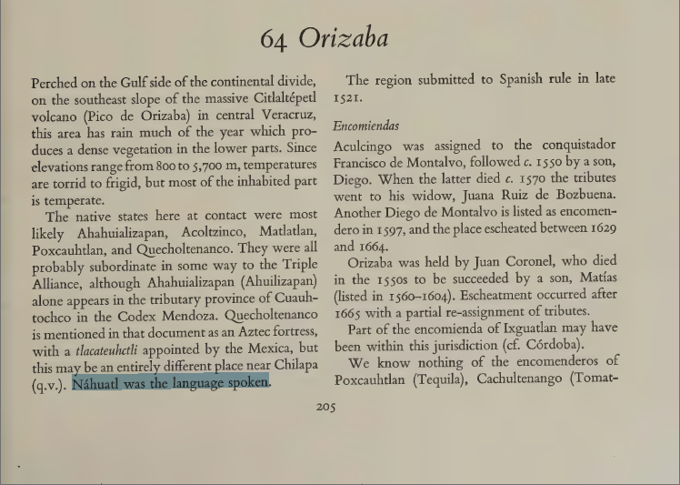
I also am not finding any particular reason to think Zongolica, Ahuilizapan, or Teotitlan were subordinate to Tehuacan. The first two should be Nahua culture, and Teotitlan Mazatec with a Nahua minority, though Mazatec can be included in a Popoloca/Ngiwa culture as it's fairly closely related. Also note, the original Nahuatl name of Zongolica is Tzoncoliuhcan.
1752628493374.png

1752619023686.png
 
Last edited:
  • 2
  • 1Like
Reactions:
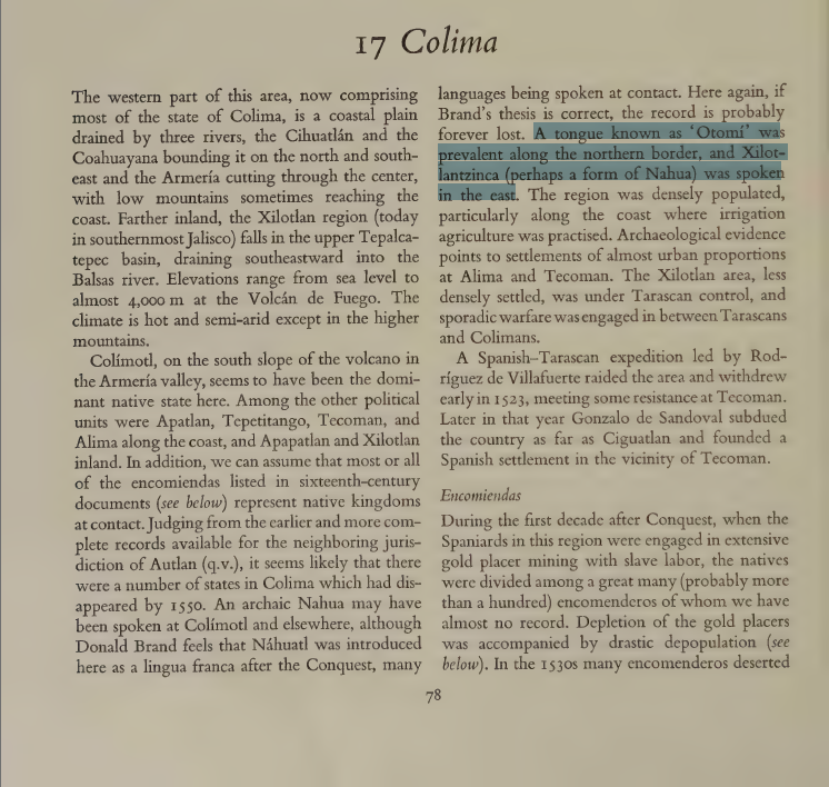
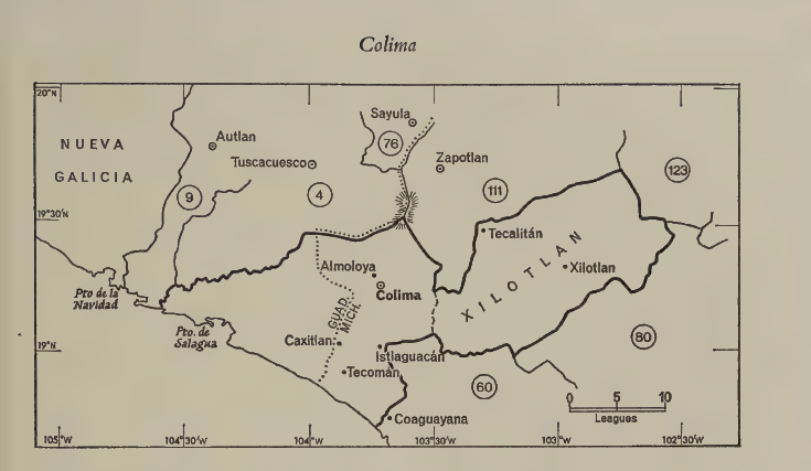
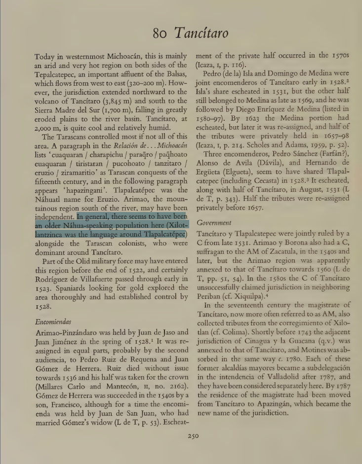
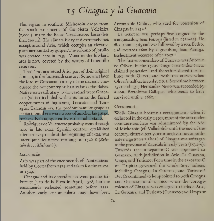
"Otomi" and Xilotlantzinca were present in the province of Colima (thus probably also Tecoman and Tepetitiango), alongside Nahua
For what it's worth, I was wrong about this. I said this based on a vague source but then checked the original source (Gerhard's Guide to the Historical Geography of New Spain) which is clearer - the province of Colima included Xilotlan, so obviously there are Xilotlantzinca there. No reason to think they were in the modern state of Colima itself.

"Otomi" existed along the northern borders of Colima, so only in Colima and Tepetitiango, not Tecoman. Though the whole Otomi question is problematic. I'm back to thinking they were a post-conquest introduction through auxiliaries against the Chichimeca, but then I have no idea what to replace them with.

1752681994950.png

1752682010538.png

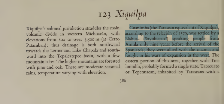
As long as we're in Colima, I view paradox's distribution of Teco favorably, as although I have never found a clear definition of "Teco" it seems to refer to the Nahuatl-speaking population of Colima. The Teco presence in northwestern Michoacán seems to have only arrived in the early 1500s and come from Amula:

1752681680228.png

As for the coast of Michoacan, it is a mess of undocumented languages. Today an archaic dialect of Nahuatl is spoken here, but this could easily have been adopted as a lingua franca, as happened to the minor languages in southern Jalisco. As long as it's not Purepecha culture, I'd be okay with most any choice for the coast - Teco, Xilotlantzinca or even Chumbia are possibilities.

Then the remaining Nahua population in Jalisco could be a 'Cuyutec' culture:
1752682756367.png

source

though I suppose this also has the same problem of possibly being a post-conquest introduction. At the end of the day though, just having the 16th century-sitatuation represented in detail would be fantastic. It's not like I expect PDX to magically reconstruct a severely underresearched area.

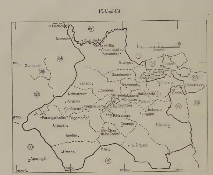
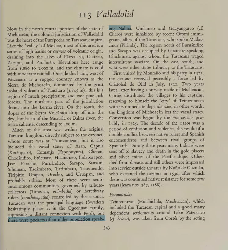
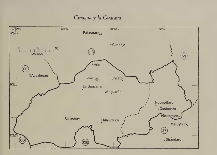
In a similar vein to my mistake with Colima, the other Nahua presence in Michoacan is hard to get an exact location for. They are noted for the province of Valladolid, which includes a lot of EU5 locations.
1752681894840.png


1752681782006.png

1752682136649.png
We really just know that Xilotlantzinca was spoken at Tepalcatepec. Xilotlantzinca could be its own culture, but grouping it with Teco would be acceptable in my opinion.

1752682212759.png

1752682240112.png

As for the Otomi minorities in the valleys of Mexico and Puebla-Tlaxcala I mentioned in the flavor post, Gerhard is also the main source on that. I can't post too many pictures here here but I can list locations where they're present:
    • Tenochtitlan
    • Tlacopan (large population) - along with Xi'oi Chichimec and Popoloca
    • Tetzcoco - along with Xi'oi Chichimec
    • Chalco
    • Xochimilco
    • Cuautitlan
    • Culhuacan -
    • Teotihuacan - along with Popoloca
    • Tollan - should be majority Otomi, with a Nahua minority
    • all four locations of Tlaxcala - along with Popoloca
    • Huejotzingo
    • Cholula (inhabited Totimehuacan)
    • Tecalco
    • Tepeaca - were located to the north, around San Salvador el Seco and Nopalucan
    • Apan (Otomi and Nahua about even) - along with Xi'oi Chichimec
    • Ixtlahuaca (including some Mazahua)
    • Toluca (including some Mazahua)
    • Zempoala - should be majority Otomi with a Nahua minority, along with Xi'oi Chichimec
    [*]
The Chichimec minorities in general were not as populous as the sedentary cultures.
 
Last edited:
  • 3Like
Reactions:
1752711046624.png

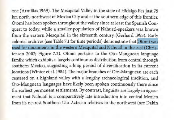
1752711019427.png

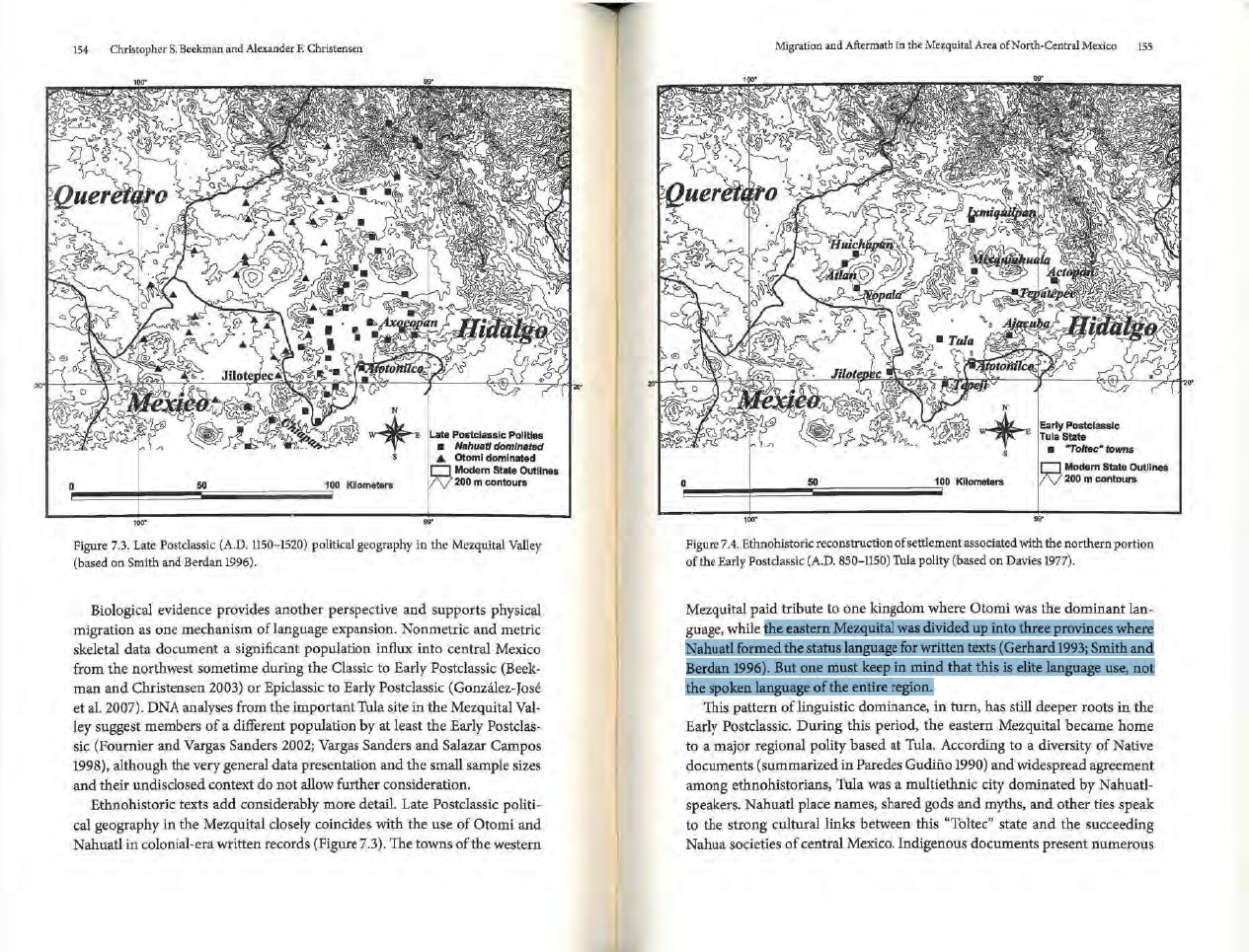
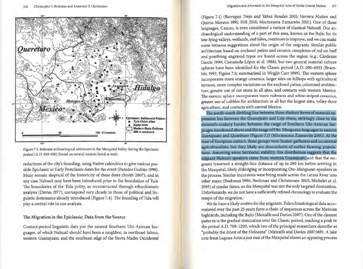
An interesting tidbit on Nahua minorities in the Mezquital valley of Hidalgo. Guess they dominated the ruling classes in Ixmiquilpan, Mixquiahuala, Tollan, Axocopan, Actopan.

1752711631001.png
It goes on to suggest these are the inheritors of the Toltec state, arriving in the epiclassic and forming the Coyotlatelco/Tula Chico culture, whose borders largely line up with this distribution. As the book notes though, the majority of the whole region was Otomi. More relevant to EU5, it asserts that Guamares most likely spoke a Uto-Aztecan language close to Nahuatl, much like Cazcan.

source: Christopher S. Beekman and Alexander F. Christensen. Migration and Aftermath in the Mezquital Area of North-Central Mexico
 
  • 1Like
Reactions:
For the raw materials of Michoaca, I found this map. It's a bit old, but it has a large number of raw materials and locations that we can use, and it will also help make Western Mesoamerica more granular.For the raw materials of Michoaca, I found this map. It's a bit old, but it has a large number of raw materials and locations that we can use, and it will also help make Western Mesoamerica more granular.

View attachment 1331854
I understand that it is not entirely legible, but I am trying to make an approximation with it and other articles/theses that I will present soon.

Source: Rivero, José Hernández. “Arqueologia De La Frontera Tarasco Mexica.” Tesis ENAH, 1994.
What are caparroza, malaguita, tlacozahuitl, gomas y realzas? I don't know these words, not even sure if I'm spelling them right
 
What are caparroza, malaguita, tlacozahuitl, gomas y realzas? I don't know these words, not even sure if I'm spelling them right
Caparroza = ferrous sulphate, It was used in dyeing to give color to fabrics/cloth, I think.
Malaquita: It is a green stone, similar to jade, used in jewelry, mainly
Tlacozahuitl: I think it's also a precious stone.
Gomas y resinas = gums and resins. They are substances that harden and serve many purposes (medicinal, as adhesives, coatings, sealants, etc.)
Don't worry if the image isn't clear. In a few days, I'll be presenting the progress on the Michoacan and Jalisco regions, and I'm also preparing something for the Guerrero region (if you don't mind, using some of your original ideas).
 
  • 3
Reactions: