• We have updated our Community Code of Conduct. Please read through the new rules for the forum that are an integral part of Paradox Interactive’s User Agreement.

Tinto Maps #6 Great Britain & Ireland Feedback

9 September 2024 12 May 2025​


What an exciting week we have had, and best of all I finally get to say the name Europa Universalis V. It still feels weird in my mouth after carefully saying Caesar for what feels like a lifetime.

But lo, the day is finally come for the British Isles feedback thread. This short update was supposed to come out a few months ago, but I just had to teach some of you a lesson. Also I had a lot of other things on, like appearing in the announcement show last week.


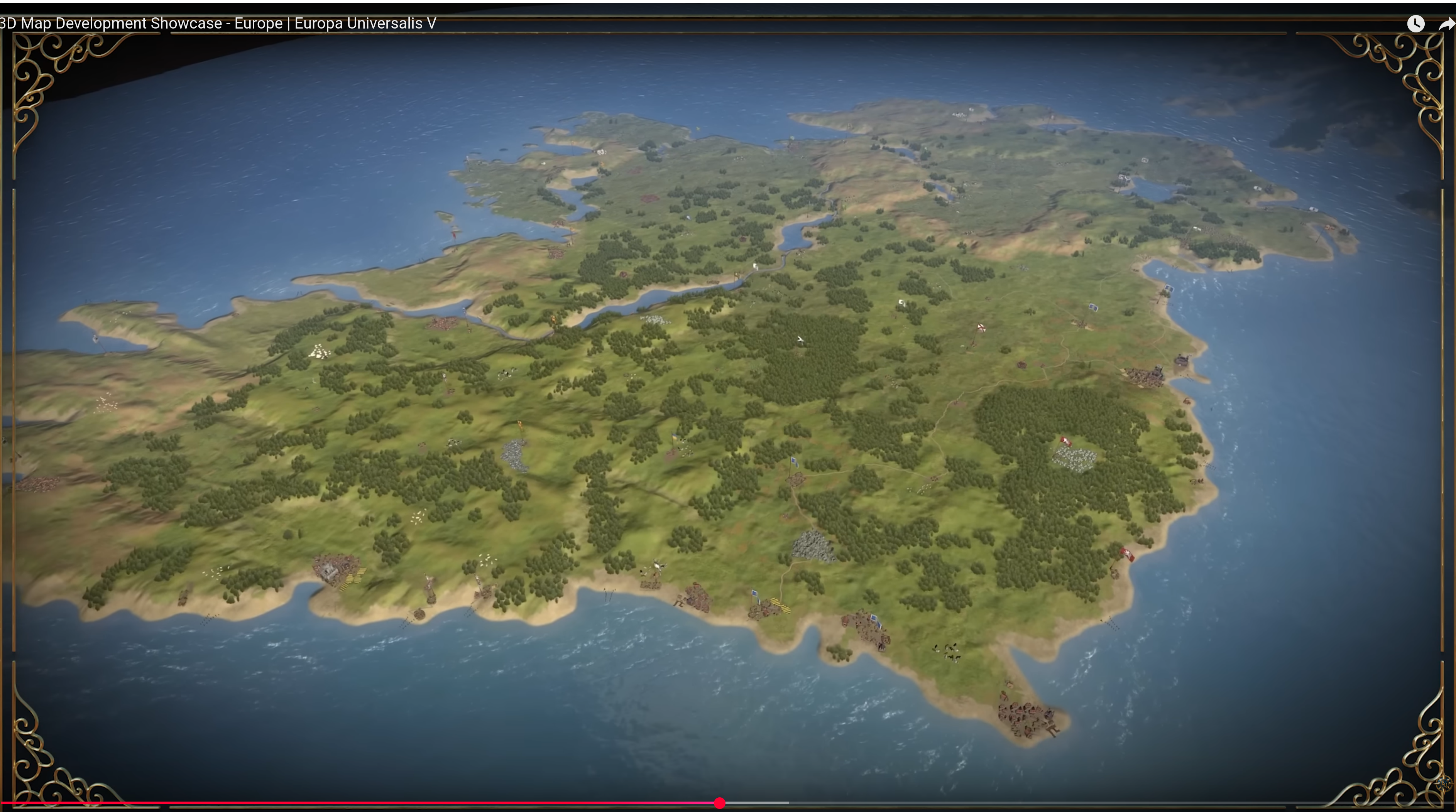
Here we see the updated topography:

topography.jpg


The updated vegetation:
vegetation.jpg


Many impassable barriers have been added, for example the various peaks of the Pennines and the Wicklow Mountains. The Shannon also now poses a more significant barrier between east and west Ireland, with only a few crossing points often guarded by stockades.


Here we have the Locations map, bear in mind they are only showing the default English names but many places have Gaelic or Brythonic versions.

locations.jpg


Every country has had a general increase in density.

England, in particular the south, has had a big revamp at Location and Province level to more accurately reflect the historical counties, many of them pre-Norman in origin and many of them still in use today in some form. Westminster as a capital has been killed and rolled into a monolithic London.


Provinces:
provinces.jpg


Areas:

areas.jpg


And political mapmode (with overlord colouring off):
political.png


And Dynasties:
dynasty.jpg


We have added the Earldom of Orkney in the northern isles as a Norwegian vassal. Meanwhile the Palatinate of Durham and Chester have both been promoted from a special set of buildings to vassals under England. Wales has also been limited strictly to the Principality of Wales, with the marcher lords existing as very low control locations under England.

Ireland has had a major rework in terms of locations and tags. Mostly there have been minor Irish chieftaincies added. As always we are grateful to the many suggestions that have come from the forumers.


Culture:
culture.jpg


The most obvious culture change is that English has had Northumbrian split off, to represent the divide between southern and northern dialects and attitudes. A practical example of this is how in the south the English are more friendly to Normans, whereas the Northumbrians hate them (the northern shires still bear the scars of the Harrying of the North). Northumbrians and Scots also spoke a similar form of English in this period, so it helps to set them up as a sort of middleman.

Norwegians in northern Scotland and the nearby North Atlantic have also been split into Norn.


As a bonus, Court Language, showing 3 main worlds: Gaelic, Anglo-French, and Roman Catholic Bishoprics.

court_language.jpg


There have also been some changes to Raw Goods, as you can see here:

raw.jpg


We still have time to make some changes, so let us know what we can do to push this even further towards where it needs to be.

I won’t show Population numbers right now, as it’s pending a proper rework. Among other things, the idea is to reduce the population numbers in England.
 
Last edited:
  • 162Like
  • 76Love
  • 8
  • 5
Reactions:
@WelshStalker As the resident Welsh expert would there be any possible name for a revolver tag for the Flemish minority in Wales, for the unlikely event they rose up which I suspect could potentially happen in game?
Not really sorry, no. Even in areas of their highest concentration, they could only sustain a plurality of the population rather than a majority, they tended to have important roles within western towns, such as burghers, tradesmen. Records suggest that the only place you'd find Flemings really comprising entire settlements and villages would be in the Haverfordwest area of Pembrokeshire around the Lordships of Rhos and Daugleddau (see below) (see pages 6 and 7 of '‘A Folk of Strange Origin and Customs’- To What Extent Did Medieval Flemish Settlers Impact Wales and its Culture?' by George Kardan).

1748111928244.png


Even then, they wouldn't venture out beyond the castles which formed the Landsker line, so the area of greatest concentration would look more like this:

1748112111461.png


The Flemings were actually highly loyal to the crown, with some accounts suggesting this loyalty was owing to the crown having taken them in from an overpopulated Flanders subject to intense flooding and inundation, accepted them as subjects and granted them land and titles in exchange for assistance in subjugating the Welsh and Scottish. Some documents note that the Flemish dialect of Dutch and English were so mutually interchangeable at the time that the natural assimilation over time of Flemish settlements and peoples into the English colonies in places like the Lordships of Pembroke and Narberth was evident.

The same document linked above notes that the Flemings were all but wiped out in Ceredigion (bar from Cardigan in some low numbers iirc) on page 22, noting a high degree of hatred and animosity between the Flemish and the Welsh:

Rhys ap Gruffudd slaughters and subjugates the Flemings of Ceredigion and destroys their castles (after which, in contrast to Pembrokeshire, no traces of Flemish settlement remain). They are also shown as powerful and merciful when Llywelyn accepted hostages and an indemnity to avoid sacking Haverford.80 They are then presented as agile and statesmanlike when Llywelyn ap Iorwerth sacked and made ‘vast slaughter’ around Rhos and Deugleddv in five days and then concluded a truce (though this could also be interpreted as atypical retreat after securing some booty or meeting stiff resistance).
These are just some of the examples. While it might seem that there was much boasting of the slaughter and destruction of the Flemings, we are reminded by Gerald of Wales of the cruelty meted by the Flemish against the Welsh. Indeed, every action begets a reaction and thus the Welsh can even boast of their oppression of the ‘Flemyssid’.

Essentially, though the Flemings did settle, they were loyal servants of the crown, in too few a number to constitute a majority anywhere in the country capable enough of independence in any sense of the word, routed from large parts of West Wales apart from Pembrokeshire by the late 12th century, holed up only in walled towns such as Cardigan etc. Their presence in the country shouldn't be over-estimated, apart from a Pembroke location, and their presence shouldn't really come anywhere near as close in any other location of the country as far as I can tell (though if someone finds documentation of high settlement elsewhere, would be nice to see it here and read it).


(On another note, in reading this, it may show that a Pembroke location would be better served with a wool rgo rather than a fish one:
Page 10: "Irrespective of the magnitude or veracity to any Flemish textile technology transfer, wool trade and cloth manufacture was the mainstay industry of the area of Southern Pembrokeshire, and by 1300s Haverfordwest was ‘one of the chief outputs for the passage of wool from Britain’." )
 
  • 3
  • 2Like
Reactions:
Not really sorry, no. Even in areas of their highest concentration, they could only sustain a plurality of the population rather than a majority, they tended to have important roles within western towns, such as burghers, tradesmen. Records suggest that the only place you'd find Flemings really comprising entire settlements and villages would be in the Haverfordwest area of Pembrokeshire around the Lordships of Rhos and Daugleddau (see below) (see pages 6 and 7 of '‘A Folk of Strange Origin and Customs’- To What Extent Did Medieval Flemish Settlers Impact Wales and its Culture?' by George Kardan).

View attachment 1305931

Even then, they wouldn't venture out beyond the castles which formed the Landsker line, so the area of greatest concentration would look more like this:

View attachment 1305934

The Flemings were actually highly loyal to the crown, with some accounts suggesting this loyalty was owing to the crown having taken them in from an overpopulated Flanders subject to intense flooding and inundation, accepted them as subjects and granted them land and titles in exchange for assistance in subjugating the Welsh and Scottish. Some documents note that the Flemish dialect of Dutch and English were so mutually interchangeable at the time that the natural assimilation over time of Flemish settlements and peoples into the English colonies in places like the Lordships of Pembroke and Narberth was evident.

The same document linked above notes that the Flemings were all but wiped out in Ceredigion (bar from Cardigan in some low numbers iirc) on page 22, noting a high degree of hatred and animosity between the Flemish and the Welsh:

Rhys ap Gruffudd slaughters and subjugates the Flemings of Ceredigion and destroys their castles (after which, in contrast to Pembrokeshire, no traces of Flemish settlement remain). They are also shown as powerful and merciful when Llywelyn accepted hostages and an indemnity to avoid sacking Haverford.80 They are then presented as agile and statesmanlike when Llywelyn ap Iorwerth sacked and made ‘vast slaughter’ around Rhos and Deugleddv in five days and then concluded a truce (though this could also be interpreted as atypical retreat after securing some booty or meeting stiff resistance).
These are just some of the examples. While it might seem that there was much boasting of the slaughter and destruction of the Flemings, we are reminded by Gerald of Wales of the cruelty meted by the Flemish against the Welsh. Indeed, every action begets a reaction and thus the Welsh can even boast of their oppression of the ‘Flemyssid’.

Essentially, though the Flemings did settle, they were loyal servants of the crown, in too few a number to constitute a majority anywhere in the country capable enough of independence in any sense of the word, routed from large parts of West Wales apart from Pembrokeshire by the late 12th century, holed up only in walled towns such as Cardigan etc. Their presence in the country shouldn't be over-estimated, apart from a Pembroke location, and their presence shouldn't really come anywhere near as close in any other location of the country as far as I can tell (though if someone finds documentation of high settlement elsewhere, would be nice to see it here and read it).


(On another note, in reading this, it may show that a Pembroke location would be better served with a wool rgo rather than a fish one:
Page 10: "Irrespective of the magnitude or veracity to any Flemish textile technology transfer, wool trade and cloth manufacture was the mainstay industry of the area of Southern Pembrokeshire, and by 1300s Haverfordwest was ‘one of the chief outputs for the passage of wool from Britain’." )
Should Low Franconian(Flemish), really be the largest minority in Pembroke? I would have thought that it would be Welsh, with a large Flemish minority, but not the largest.
 
mate look
I think you need to calm down a wee bit over what happens in Scotland
From reading this I get the impression that you're very into your Norway stuff but mate go on the Norway feedback forum, we can't make all of Scotland Norn just bc you feel like it

The line "Norse presence was before 'Scotland'" is very interesting to me. There is a very direct link from the Pictish notions to Gaelic ones to a more modern Scottish one. That identity had already been there for 500+ years at game start, so I really don't see how anything in that time-frame is relevant. There is already a Norn culture in-game, and no-one is disputing that it existed, but only really in the regions specified. The NW of Scotland has for a long time been Gaelicised and at game-start you would be looking at a rinrig (fearann-tuatha) system type of existence taking over, which was a firmly Scots Gaelic way of working.

Please mate, gies aw a rest here n pack it in

Relax, already given up to have any historical debate here. I noticed long ago the "agreed consensus" wants no debate on this topic.

Norway here is a maritime nation spread out between Scandinavia, Britain and whatever Greenland, Iceland, Faroe and Shetland island get shown as. I have been recently active in the Scandinavia map forum without any problems. But Norwegian lands and culture in Britain is obviously to be found here.
So is it logical to discus the british map in the scandinavia forum? don`t think so. Or is this to be seen as intruding a fan club...
we can't make all of Scotland Norn just bc you feel like it
I don`t know how many links on sources to my reasoning i have given. But it has been many. On the other hand you guys have given me non in opposition other than topics outside the focus. So the "feel like it" is on you from my point of view.

The Normal thing when speaking about the presence of a culture that is in the process of assimilation is to start with the history, look at its foundations, how it developed towards game start, point towards other examples, then end it on date by a conclusion. I was very detailed about that giving many sources.

Was first surprised by the negativity. Corrected some minor mistakes i did and was of course open to changes depending on the reasoning for it. Then surprised by the lack of any arguments against based on real sources. And the little tolerance to a different view.
Felt like i was surrounded by a bunch of grumpy kids who blames me for stealing their candy:rolleyes:

"This is our agreed consensus, how dare you challenge it attitude. "

And in the end i just got irritated by the whole thing. And perhaps made me less diplomatic so to speak.

There is already a Norn culture in-game, and no-one is disputing that it existed, but only really in the regions specified. The NW of Scotland has for a long time been Gaelicised and at game-start you would be looking at a rinrig (fearann-tuatha) system type of existence taking over, which was a firmly Scots Gaelic way of working.
If so, then nobody gives proper sources on it? Not even one. You have agreed on opposition, without giving any academic reasoning trough sources.

Also keep in mind us "outsiders" write on our second language. Even trying to avoid misunderstandings. It of course can happen. But i don`t think i have misunderstood the attitude here.

To my "mates" here
You can give your courses to my picture visiting the lands spoken of.
Clan Gunn heritage center.jpg

Clan Gunn port.jpg


Anyway
past this now.
Meet many great Scottish and Irish in person trough my travels and those visiting Norway. No bad feelings towards the nations. Quite opposite.


N.B I'm thankful to Paradox for a really great job so far.

My debate was just meant for possible historical improvement on minor things based on research while debating on a topic that interests me.

But yes, thankful to end my involvement here. Looking forward to the release:)
 
  • 4
  • 3Haha
Reactions:
I have been recently active in the Scandinavia map forum without any problems
Because you aren't bringing up something wrong in the Scandinavia map forum.
is this to be seen as intruding a fan club...
No, plenty of non-Brits or Irish have weighed in.

What it's seen as is obsessing over something that's wrong.
Relax, already given up to have any historical debate here. I noticed long ago the "agreed consensus" wants no debate on this topic.
It's not "no debate" or else nobody would've responded to you.

You're acting as if there's a cabal organised to fight either the existence of Norn, or you, there is no universal consensus: the facts say you're wrong, so everyone who follows said facts is saying that you're wrong.
I don`t know how many links on sources to my reasoning i have given. But it has been many. On the other hand you guys have given me non in opposition other than topics outside the focus. So the "feel like it" is on you from my point of view..
Your sources are all, at least, 200 years irrelevant to EUV.

Of course you're getting less opposition in other topics, you're not banging on about something incorrect in other topics.

Yes, it is on you to justify why you want a near dead culture to be expanded massively.
Was first surprised by the negativity. Corrected some minor mistakes i did and was of course open to changes depending on the reasoning for it. Then surprised by the lack of any arguments against based on real sources. And the little tolerance to a different view.
There was no "negativity", people told you that you were wrong and reacted or responded appropriately to your comments.

Again, your sources are centuries 'out of date'.

There's plenty of tolerance for different views, there's little tolerance for incorrect views. If anything people have been exceedingly tolerant to you, if they weren't then they either would've: ignored you; copy-pasted the same debunk, or; told you to stop bringing it up.
Felt like i was surrounded by a bunch of grumpy kids who blames me for stealing their candy:rolleyes:
Nobody has treated you like that, at all.

In fact, you're the one acting like a child; by whining and whining about people informing you that you're wrong.
"This is our agreed consensus, how dare you challenge it attitude.
There wasn't a secret meeting behind your back; people have come to this conclusion independently because that's what the facts indicate.

My debate was just meant for possible historical improvement on minor things based on research while debating on a topic that interests me.
You have not been debating, you've been ignoring everyone else and rehashing the same thing over and over.

It wouldn't be an historical improvement, because it's historically inaccurate.

Nobody is saying this isn't interesting, they're telling you it's not related to EUV.
Also keep in mind us "outsiders" write on our second language. Even trying to avoid misunderstandings. It of course can happen. But i don`t think i have misunderstood the attitude here.
Don't try to make this a cultural or language thing. You're not being treated as an outsider, you're being told the truth: you are wrong.

You can give your courses to my picture visiting the lands spoken of.
I can't believe I have to tell you this: just because you have been to a place does not mean you are the authority on its history.
 
Last edited:
  • 7
  • 2Like
Reactions:
Should Low Franconian(Flemish), really be the largest minority in Pembroke? I would have thought that it would be Welsh, with a large Flemish minority, but not the largest.
From my research it would be a Welsh majority with like 20-35% English and then some Flemish lets be generous and say like 10% max.

I made a brief post about English colonisation of Wales in the original thread and these are the best estimates on numbers. Matthew Frank Steven (the academic) skimmed over his estimates for Pembrokeshire and Glamorgan so those numbers are my discernment, but they align with his general overview of the regions at specifically this period in time.

I will say I have not looked too much into the Flemish communities past them existing in places walled off towns like Cardigan.

Original Comment with the source
 
  • 2
Reactions:
I'm not sure about how the court language mechanics work but very relevant to the starting time period of this game Gerald FitzGerald, 3rd Earl of Desmond (Gerald the poet) born 1335 and chief Justice of Ireland in 1367 was instrumental in spreading the adoption of Irish as the lingua franca of the hiberno-norman earls and identity as "more Irish than the Irish themselves".

He was fluent in French, English and Irish and the Desmonds would've had a strong alliance with the Gaelic McCarthy Mór. A strange period where the Hiberno-Norman families held the balance of peace between the Gaels and the English / Anglo-Normans.

They became bitter rivals of the Butlers of Ormond into the 1500s who stayed Anglo-Norman and loyal to the English crown leading to the Desmond rebellions. Eventually leading the English crown focus on the dissolution of the Earldom of Desmond in the 1600s.

So the hiberno-norman earls would be capable of alliance with anyone in the Atlantic Archipelago during the first 250 years or so but the Anglo-Norman earls would not be culturally accepting of the Gaels. All except for the Anglo-Normans would have had hostility or tensions with the English crown while the Hiberno-norman earls had agreements or family hostage situations to maintain peace while being granted control of the country but seated in Dublin.

See Wikipedia Gerald FitzGerald, 3rd Earl of Desmond (couldn't share link)
 
  • 6Like
  • 3
Reactions:
Here's a small map with possible revisions for northeast Ulster - my earlier map was very sloppy in dividing the current Newtownards location between Bangor on the coast and Newtownards in the south - they are 3km from each other and both on the northeastern coast.

Instead, Lisnagarvey/Lios na gCearrbhach (modern Lisburn) is a better choice, occupying the western inland part of the current Newtownards location (which should be named Bangor). The location borders are a rough outline of the 2015 Lisburn and Castlereagh borders, which despite reflecting Belfast's sprawl a bit far east and south, do show where the line is drawn between Lisburn, Belfast, and Newtownards/Bangor.

It also looks like Antrim should be able to bypass Belfast southwards, in the land to the east of the current Belfast tile. Belfast's influence doesn't seem like it would go all the way from the coast to Lough Neagh, especially that far back in time.

The map shows Newry as its own location, but I think probably the most elegant solution is to treat Newry as part of Tandragee (Fews), placing the port of Tandragee location where Newry city is.
Rathfriland keeps the brown coloured land, and its port is in Kilkeel instead.

northeast ulster revision.png

Ballymore location probably isn't right to put as a Pale location; it could be the new tag Kinaleagh/Cinél Fhiachach and the location renamed Castletown Geoghegan (or Kilbeggan as a more neutral/agnostic location).

Looking at the annals of Ulster and Loch Cé, the starting ruler and heir for 1337 appear to be named.

Possible starting ruler: Conchobhar Ruadh Mac Eochagáin LC1342.10
Possible heir: Fergal Mac Eochagáin U1351.8
 
  • 2
  • 1Like
Reactions:
Should Low Franconian(Flemish), really be the largest minority in Pembroke? I would have thought that it would be Welsh, with a large Flemish minority, but not the largest.
From my research it would be a Welsh majority with like 20-35% English and then some Flemish lets be generous and say like 10% max.

I made a brief post about English colonisation of Wales in the original thread and these are the best estimates on numbers. Matthew Frank Steven (the academic) skimmed over his estimates for Pembrokeshire and Glamorgan so those numbers are my discernment, but they align with his general overview of the regions at specifically this period in time.

I will say I have not looked too much into the Flemish communities past them existing in places walled off towns like Cardigan.

Original Comment with the source
Though I liked the post and found it really useful in some aspects, I did have some concerns in relation to the population figures given and the source material in the post made last year, namely due to the methodology used and frankly the overlooking of Wales within (not a criticism of Vispian at all, more the authors of the study, something they themselves note!). Its why I didn't really mention it at the time, though its a decent gauge of rough trends, I don't feel it best go deeper here though, it does the trick, I just feel it leaves a lot to be said about the newly conquered territories in 1282.

Notwithstanding this, it may be possible to roughly gauge the percentage of Flemish population utilising the figure given for the region of Southern Pembrokeshire within, so its somewhat useful, though some other problems arise as to the EUV location shape vs study area, but I'll mention that towards the end.

Pembrokeshire and the Flemish
The Three Waves:
What we do know is that there were 3 waves of settlements in the 12th century, the first two being in 1108 and 1113 by King Henry the 1st and the 3rd taking place in 1155 under King Henry the 2nd. What is known by surviving records is that the first plantation is attested to by William of Malmesbury to have consisted of approximately 2500 Flemings, planted into modern day Pembrokeshire around the year 1108, instigated by Henry the 1st likely upon the disbanding of mercenaries from Flanders. (Source 1) (Source 2)

The second wave of Flemish colonisation around 1113 seems to have been the most significant in the wake of a flooding event in the low countries, with many individuals such as Wizo Flandrensis (Wizo the Fleming) leaving the overpopulated region for greener pastures. Many landholdings established in southern Pembrokeshire as a result and the near mass expulsion of native Welsh from the cantref of Rhos appears to have occurred around this time, it is likely that nearly double the original colony or some 4,000 individuals came during this wave, enabling the wholesale change in the demographic landscape of this portion of the county.

Not much is known about the third wave of colonisation in 1155, though the following is written of it:
When Henry Plantagenet succeeded his cousin Stephen in 1155, first acts was collect all the Flemish condottieri he could lay his hands on and send them into West Wales, where he deemed they would be out of the way, surrounded as they would be by the Welsh and the sea.


The High Degree of Flemish Losses:
It should be noted however that the Flemings were highly utilised in battle against the native Welsh owing to the nature of their plantation and there were a high number of mercanaries and warrior like men amongst them. The Flemish therefore likely suffered heavy casualties in the Battles of Crug Mawr and Mwnt and other such battles of the period between Marcher Lords and Native Welsh that must be taken into account.

Any assessment of the population growth of these waves of Flemings of Pembrokeshire vs the baseline population growth of the Kingdom of England should in turn be quite a fair bit lower owing to the contention and violent nature of the region, especially when noting that the Flemish population of places such as Rhos were devastated in 1137 by roaming Welsh armies following their victory over the Anglo-Normans and Flemish at Crug Mawr. Furthermore, in relation to the losses inflicted on Flemish soldiers in such battles, the following is told of the Battle of Crug Mawr in relation to both the Norman and Flemish invaders:

Grufudd defeats Stephen of Cardigan and Robert Fitz Martin of Cemaes at Cardigan Bridge, where the Foreign Colony is almost exterminated.


Rough Estimates of Total Wave Populations:
Some estimates have been thrown around placing the total settlement from these three waves at approximately 10,000 individuals (Between all three waves in 1108, 1113 and 1155), though again I believe this should be reduced to some 7,500 people total, as no accurate accounts have been made of other settlements apart from the first. It is also likely that the third wave would have been of a similar if not a far smaller size to the first, having comprised more of violent mercenaries that the crown wanted nothing to do with.

If we can state that the first wave would have been 2500 people based on the account of William of Malmesbury and that the second was the largest and third the smallest, then the other 5000 can be divided into 3500 for the second wave and 1500 for the third. This would give us a rough baseline of waves to assess growth by parallel to the population of England at the time. We can then try and assess the percentage of Flemish peoples within the area based off of the number listed in the study raised by @Vispian which was 34,699.


English Population vs Each Wave (By Year):
This section utilises the following site as a baseline for population growth, if anybody else wants to try with any other sources feel free. I’ll first note the estimated population of England at the time as well as the rough number of Flemish settlers.

Wave 1: 1108 – Estimated population of England: 1,940,000​
Some accurate figures for this wave stating 2,500.​
Wave 2: 1113 – Estimated population of England: 2,000,000​
Likely the largest wave, no accurate figures, but let’s say it’s larger than the first wave at 3500.​
Wave 3: 1155 – Estimated population of England: 2,540,000​
Likely the smallest wave, seemingly only mercenaries, so we can call it 1500.​
And the end date of 1290:​
Population of England in 1290 : 4,750,000​

Seems to be that the rounded average rate of population growth for England per year is somewhere in the region of +0.493% (1108-1290), +0.490% (1113-1290) and +0.465% (1155-1290) respectively for the start dates of waves 1, 2 and 3 to the year 1290 (Not a mathematician, please feel free to respond and correct!).

This can be used to roughly gauge the growth in relation the population of England. Though these population estimates for England could be used as bases for population growth in the Flemish community of Pembrokeshire for each wave of colonisation, this figure should be cut by about a third I would say to account for the enormous losses in battle over the years, hostile nature of the environment, overwhelmingly male nature of settlers, eradication of settlements etc.

If each wave is assessed as growing commensurate with the rates between 1108 and 1290, 1113 and 1290 and 1155 and 1290 as that of the Kingdom of England, the Flemish populations for each wave would be somewhat in the area of 6,118, 8,314 and 2,806 respectively, however, in cutting it by a third to account for the above, what we would be left with is the following:

1st Wave - 1108: 2500 settlers at the noted rate and reduced by 1/3rd would be around 4,037
2nd Wave - 1113: 3500 settlers at the noted rate and reduced by 1/3rd would be around 5,487.​
3rd Wave - 1155: 1500 settlers at the noted rate and reduced by 1/3rd would be around 1,852.​
This would give a population somewhere in the region of 11,376.​

Given the population of 34,699 in 1290 noted in the study referenced by @Vispian, this would be some 32-33% the population of the area, though given assimilation into the English plurality of the region, I would hazard a guess of some 30% on the safe side, compared to probably around 45% English (to which the Flemings were assimilating to) and 25% Welsh (if that).


Location Size and Shape Problem:
Though this raises further problems, as the diocese noted in @Vispian 's study only covers the following area (Image 1) whereas the Image 2 is roughly approximate to the location of Pembroke as it appears in-game (at current):
1748308808433.png
1748308798217.png

This discounts all populations of the other lordships in the area such as Narberth, Laugharne, St Clears and Ystlwyf as their populations seemingly wouldn’t appear in the 34,699 figure given in the study noted, so 30% for the region shown would be far too high.

I have twice previously suggested the reshaping of the location or addition of another location (Source 2) which would perhaps better reflect the demographic nature of the Pembroke location and division between the majority Welsh and majority Anglo-Norman/Flemish so as to accurately reflect the colonised nature of the south of the county, and this may also assist in making the population of such a location more accurate as well as better reflect the percentage of Flemings present (Though ofc I wouldnt want to push Dave any further on the topic, he's already represented Wales far better than I think any of us could have imagined).
1748308839464.png
 
  • 6
Reactions:
Hi, I know I’m around 2 weeks late but I have an oddly specific question.

In 1351 Edward III gave Henry Grosmont the Duchy of Lancaster as a County Palatine and, of course, the County Palatines of Chester and Durham are present here. I think it would be pretty interesting to include Lancaster’s Palatine (Probably through an event around 1351) into the game. I’m aware it’s random and silly, but it would just be pretty interesting.

Alternatively there could just be a feature to grant nobles or generals Palatines to rule over, maybe to increase the nobility’s opinion of you as a last measure.

Anyway thanks for reading, I’d love to hear what your thoughts on this are, even if it never happens. I personally just think it would be cool.
 
  • 1Like
Reactions:
Hi, I know I’m around 2 weeks late but I have an oddly specific question.

In 1351 Edward III gave Henry Grosmont the Duchy of Lancaster as a County Palatine and, of course, the County Palatines of Chester and Durham are present here. I think it would be pretty interesting to include Lancaster’s Palatine (Probably through an event around 1351) into the game. I’m aware it’s random and silly, but it would just be pretty interesting.

Alternatively there could just be a feature to grant nobles or generals Palatines to rule over, maybe to increase the nobility’s opinion of you as a last measure.

Anyway thanks for reading, I’d love to hear what your thoughts on this are, even if it never happens. I personally just think it would be cool.
I do not think it should be an event that just happens with no agency for the player. However, having an option to create Palatinates as a form of vassal to increase control in an area and increase nobility happiness could be interesting.
 
  • 2Like
Reactions:
Bit of a late response but
Will Ireland have any unique buildings/monuments.
Some good options would be
The Hill of Tara (where the irish High Kings were inaugurated)
Dún Aonghasa (Iron age Fort)
Brú na Bóinne (Area with over 90 neolithic tombs and monuments including Newgrange)
or Ireland's monasteries and tombs that dotted the country

Also it would be cool if irish pagans were shown in the game similarly to the Norse pagans, as there was still pagans in Ireland as late as the 1850s such as those on the Inishkea Islands where they worshipped the Godstone/Naomhóg
And when it comes to artifacts/works of art, what does Ireland have?
Some good options would be
Brian Boru harp
book of kells
The Ardagh Chalice
 
  • 3
  • 2Like
Reactions:
On the Norn stuff, I still think that Norse-Gael is quite a weird culture. How exactly did it spread parellel to Highland culture? Because prior to Scottish take over calling the culture of the Northern Hebrides "Gael" in any way makes no sense.

When did Manx stop being Norse-Gael and become... Manx?
Prior to the Norse taking it over for a bit the entire culture of the Hebrides was "Gaelic", part of the kingdom of Dal Riada. And even when the Norse took over they Gaelicised themselves, assimilated into the clann system and spoke the Irish/Gaelic language.
 
  • 1Like
Reactions:
Added dynasty map to main post.

View attachment 1296953
The Earldom of Ulster was still under the control of the De Burgh dynasty, with Elizabeth de Burgh still the Countess of Ulster.
The de Burghs that rule Mayo, Clanricarde, Castleconnell, and Ulster, the O'Connors who rule Connaught and Sligo, the Fitzgeralds who ruled Kildare and Desmond and the O'neill that rule Tyrone and Clandeboye were different branches of the same family (Mac William Iochtar Mac William Uachtar, Clanwilliam, and de Burgh for the de Burghs respectively, Clann Aodha Buí for the Clandeboye O'Neills, who were a branch of the main O'Neills, O'Connor Don for the Connaught O'Connors, who also competed with the O'Connor Rua for supremacy, and O'Connor Sligo for the Sligo O'Connors, and ), and each Irish clan should have the opportunity to found their own septs independent from the main branch, but can still succeed them and have claims
Whilst the Mac Aonghusa ruled Iveagh, it wasn't the main branch, but the Mac Artáins who ruled
The Ua Conchobhair Failghe should replace the Ua Failghe
The Plantagenet land in Cork should be ruled by the de Barry dynasty
 
  • 1Like
Reactions:
Prior to the Norse taking it over for a bit the entire culture of the Hebrides was "Gaelic", part of the kingdom of Dal Riada. And even when the Norse took over they Gaelicised themselves, assimilated into the clann system and spoke the Irish/Gaelic language.
AFAIK the consensus is that the Norse simply largely obliterated the previous inhabitans and culture in large parts of the Hebrides, I don't think the Norse-Gael moniker makes sense for those people at that point in time.

They most definitely did not speak Gaelic up in the north, they did eventually assimilate in Ireland and Mann and maybe south-western Scotland, but not most of Hebrides afaik

IMO Norse Gael shouldn't be a thing in the Hebrides, at least northern half, and the culture should be split between majority Highland and large minority of Norn at this point.

Edit: No idea why people "disagree" with facts, there is very weak evidence of continuity of Gaelic within the Hebrides, mostly restricted to maybe lingering Christian communities and there is very good reason to believe all of the Hebrides from north to south became majority Norse speaking for a while:

"Theterms of Norse settlement may have differed in other parts of westernScotland (for example, Clancy 2008; Jennings and Kruse 2009). However, the evidence emerging from Tiree (Holliday 2016) and elsewhere inthe Hebrides suggests that the initial impact of Viking settlement in thesouth was very similar to that in the north. The defining difference waswhat happened next."

From "The Viking Age in Scotland", which btw includes 0 mentions of the term "Norse-Gael"

Another source:

"One further factor that may have encouraged the identification ofthe Gallgáedil with Ketill Flatnose’s Hebridean subjects was the perception that the Norse impact on the southern Hebrides was somewhatless intense than the impact on the Northern and Outer Isles. This impression is the product of an examination of the toponymic evidence.Early analysis of settlement names in the Outer Isles and the Southern Hebrides, respectively, showed that in the former names of Norse originmade up about seventy per cent of the total, and those of Gaelic onlyabout thirty per cent, while in the latter the proportions were reversed.This created the impression that Norse settlement in Islay and the adjacent islands may have been simply an aristocratic veneer and that the bulk of the population would have maintained their Gaelic language and identity. This encouraged an interpretation of the Gallgáedil as either a hybridgroup or as a basically Gaelic group under Norse leadership. Recentlymore thorough analysis of the place-names of Islay has suggested that infact as late as the sixteenth century the vast majority of farm names wereof Norse origin and that the high proportion of Gaelic names in themodern toponymy of the island are the product of land re-organisationand the establishment of new names in the course of the last  years. Itseems likely that in the tenth and eleventh centuries Islay was as Norse asLewis and it seems likely that similar studies of other southern islands,and even Kintyre, might produce similar results.31 Again, for what it isworth, Landnámabók seems to imply that Ketill established himself asruler of a region that was already inhabited by Scandinavians.

From the book "From Pictland to Alba: 789-1070" from Alex Woolf.

I'm honestly not even sure the outer Hebrides were provably Gaelic before Norse Settlement, so the use of Norse-Gael there is even more questionable.
 
Last edited:
  • 4
Reactions:
Really loving the map updates! Very glad to see a lot of the suggested changes being incorporated too. I've thought of some minor changes for the map to Scotland that might be worth mentioning. I think some work might need to be done to emphasise Stirling's strategic location, and improve the shape of the current Glasgow location.

Location Name Changes:
  • Peterhead – Peterhead was only founded about halfway through the game’s time period. Fraserburgh is a similar fishing town that was founded a couple of centuries earlier, and is more often represented on maps in this time period, but again, this town was founded after the start date. Buchan could be used for a location name here, if needed.
  • Garioch – If you’re wanting settlements for most of these places, then Inverurie should be the name. It is the largest settlement in the area, and has been for most (if not all) of the game’s timeframe. Kintore is another potential alternative.
  • Kildrummy – This location seems to represent the hilly areas of Deeside, and therefore I would suggest Braemar as the location name instead. Similar to Kildrummy, Braemar is a significant castle in the area, and had a small local town affiliated with it as well. It’s more central within the location, and is more closely tied to the key geographic features of the area. On older maps, Braemar is often indicated as ‘Castletown’. Braemar may be a bit anachronistic for the time period, so Castletown may be more fitting.
  • Kincardine – This location represents Mearns, which is a largely agricultural area southeast of the Cairngorms. Kincardine lies along the river Dee, and is north of a section of the Cairngorms that splits this area from the rest of present-day Aberdeenshire. As a county town, Kincardine declined significantly over the first couple centuries of the game's timeline. Maps of the period often list Cowie (or Cowy) as another main location in the area. It’s a castle right next to present-day Stonehaven. Stonehaven could also work as a location name, but I would recommend Cowie with a potential rename to Stonehaven if a town is established there.
  • Stirling/Glasgow – The Stirling and Glasgow boundaries still seem a bit odd. Armies should be able to travel directly between Glasgow and Dumbarton without having to travel through Stirling. Likewise, Stirling’s importance as a strategic pinch point between the north and south of Scotland should be reflected in the location’s geography. Clackmannan lies almost directly to the east of Stirling, and is largely peripheral for those travelling north/south. A connection between Stirling and Strathearn should be made, which would represent Stirling’s strategic importance in this area. It might be worth introducing a short section of impassable terrain between Clackmannan and Strathearn as well, as the Ochil hills would have prevented movement between those areas. These hills can be seen in the second screenshot
    View attachment 1297815View attachment 1297816

    Province Changes

  • I would suggest the addition of Ayrshire (Ayr and Irvine locations).
  • Move Dumfries from Teviotdale to Galloway.
  • Move both Duns and Berwick from Lothian to Teviotdale. The Lammermuir hills make a natural split between the Lothians and the Teviotdale province. Berwick should be included here as trade often followed the Tweed river.
  • I would consider whether to move Stirling into the Lothian province.
  • Should Arran be included in Argyll?
Trade Good Changes
  • The Dunbar location is in some of the best agricultural land in Scotland, and is used far more for crops than for grazing. To have either wheat or sturdy grains here would be a good idea.
  • I wonder if the Linlithgow trade good should be changed to Livestock, as this is a historic industry in the area.
  • The Peterhead location is one of the major producers of fish in Scotland. I'm unfamiliar with the area's economy at the game start, but I was a bit surprised to see that fish was not listed as the trade good there.
As the game progresses, I'm hoping that the importance of quarrying and mining in Scotland will also be incorporated.

Vegetation
  • The Dunbar and Linlithgow locations are some of the most fertile areas of Scotland, so I'm surprised to see sparse vegetation listed there. It would make sense for this area to be included as grassland.
  • The vegetation in Dornoch should probably be sparse. There's incredibly little of it. I could understand having grassland in Thurso, as this area is flatter and much better for agriculture.
Topography
  • I'd recommend that the land at Dunbar be changed to Flatland. The location seems to represent the area to the north of the Lammermuir hils (which seem to be included in 'Duns'), and the land here is either flat, or mostly rolling hills -- similar to Edinburgh
  • Locations like Gairloch, Assynt, and Ardtornish may make more sense as Mountains rather than hills. I don't know exactly what the criteria for 'mountains' are, but I imagine the highlands meets them! That area is a dense collection of some of the highest peaks in Britain, and any country would have significant difficulty expanding development in this area, as it would be heavily constrained to small pockets of land in between mountains and lochs.
View attachment 1297829
Yes, I totally agree. I was very surprised to see Peterhead without fish as its trading good. Its very core to the region.
 
  • 1Like
Reactions:
Time to start reporting on the work that I have been doing.

I've deep dived into the goods again. It's a big undertaking. Big enough that it is actually hard to report on my findings in any kind of depth without breaking things up. So, that is what I am going to do. I am going to break things up.

Here is the first post. New locations.

I would like to advocate for four new locations in the England map.

1) Keswick in Cumberland.
2) Furness (or other preferred name) in Westmorland
3) Bridgnorth in Shropshire.
4) Dudley in Staffordshire.

Keswick and Furness:
Maps:
Before:
Present before north.jpg


After:
Present after north.jpg


The numbers are the pixel sizes of the locations.

Why do this?
1) There is a political justification. There were five medieval boroughs in Cumberland: Carlisle, Cockermouth, Egremont, Penrith, and Keswick. Keswick is currently the odd man out. Furness was governed by Furness Abbey, one of the most powerful religious institutions in England at the time with broad and unusual political power (https://richardiii.net/the-significance-of-furness-abbey-and-its-benefactors/). It was also technically part of Lancashire.

2) Next, per the images above, there is enough space. The locations in the before image have larger Cumberland locations than coastal Northumberland, while the after is closer to the same. FWIW - I could have drawn Keswick a little bit bigger to get it up into the 2300 to 2400 range. I assume the actual borders that Paradox would create would look different than I have drawn here. The image is just an example.

3) Also, something that I care about maybe more than others, the two extra locations allows for a more accurate depiction of the regional economies. Keswick represents the high fells and will end up with copper, while Furness will have iron. Without the two locations, you end up doing something wonky like assigning copper to Cockermouth, which represents the northwest coast, and giving Kendal iron, which doesn't make sense because it was an important wool town.

Bridgnorth and Dudley
Maps:
Before:
South before.jpg


After:
South after.jpg


Again, numbers are pixel sizes. Ignore the slight variation. I had to remake the map because I messed up when saving it the first time.

Why do this?

1) There is a political justification. There were four main towns in Shropshire: Shrewsbury, Ludlow, Bridgnorth, and Oswestry. Bridgnorth was discussed before Oswestry (suggesting it was more important) in this very indepth article on the governance of Shropshire during the 17th century (https://core.ac.uk/download/pdf/153490026.pdf). Dudley is technically part of Worcestershire, but it is an exclave that is contained within Staffordshire. If that is a problem, then it could be replaced with Wolverhampton, but my impression was Dudley was the more important town. Both Bridgnorth and Dudley were burgess towns.
2) Next, per the images above, there is space. If you look at the before image, Shropshire and Staffordshire have larger locations than the surrounding counties. In the after, the location sizes look more normal compared to the rest. Again, the shape of the locations are just suggestions. I expect the locations that Paradox would draw would look different.
3) As above, one of my motivations is goods representation. Bridgnorth and Dudley are there to help represent the Black Country, which is notably absent from the current Paradox maps. Bridgnorth is going to end up with iron, Dudley with coal. Without those two locations, you end up assigning iron to Shrewsbury, which is very odd from a historical perspective. Shrewsbury was a wool town. Stafford might be more justifiable since the coal mining occurred in Cannock Chase, which isn't terribly far from Stafford, BUT it makes way more sense to assign coal to Dudley since it was an early iron/coal town (self proclaimed "birthplace or capital of the Black Country".

Next up (likely tomorrow), I will start working my way through the metals. I've found some really good sources, which I think make it clearer where to put stuff.
 
Last edited:
  • 2Like
  • 2
Reactions: