• We have updated our Community Code of Conduct. Please read through the new rules for the forum that are an integral part of Paradox Interactive’s User Agreement.

Tinto Maps #7 - 21st of June 2024 - Anatolia

Hello everyone, and welcome to the seventh edition of Tinto Maps! I am once again asking for your support back to the duty of showing a new region of the map of the super secret Project Caesar, which this week is Anatolia!

Countries:
Countries.jpg

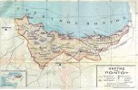
A beautifully divided Anatolia! The disintegration of the Sultanate of Rûm in the 13th century, caused by the Mongol invasion, led to multiple Turkish Beyliks grabbing power over their area. Probably the strongest in 1337 is the Ottoman one, founded by the Turkoman leader Osman Ghazi, but there are other strong contenders such as the Eretnids, the Germiyanids, or the Karamanids, which will be fighting for hegemony over the region. You might also notice that the Byzantine Empire//Eastern Roman Empire//Basileía Rhōmaíōn//[insert here your favorite naming option] still holds a few positions in Anatolia, the most notable being the city of Philadelphia. Apart from them, other interesting countries in the region are the Despotate of Trebizond, held by the Komnenoi, the Armenian Kingdom of Cilicia, and, of course, The-country-known-in-another-IP-as-Hisn-Kayfa, the Ayyubid remnant in al-Jazira. And you might also notice some Genoese outposts, making them important players as well.

Dynasties:
Dynasties.png

The dynastic map is pretty straightforward, as a different dynasty rules each Beylik. We have fixed the issue with the random dynasty names, so no more weird 'the XXXX of XXXX' dynastic names anymore. To spice things up, we could maybe start a Byzantine discussion: Palaiologos, or Komnenos?

Locations:
Locations.jpg

As usual, please consider that dynamic location naming is not yet a thing in this region, and therefore the inconsistencies in the language used. As an additional note of caution, please don’t use the Aegean Islands as a reference or benchmark for comparison, as a review of them is something that we’ve got on our list of ‘to do’. You may be able to see that the location density in the region is gradual, from denser coastal regions to bigger inland ones.

Provinces:
Provinces.png

We have changed the coloring of the provinces, making them more different, and easier to understand, though. Apart from that, suggestions in this matter are welcomed, as usual.

Terrain:
Climate.jpg

Topography.jpg

Vegetation.jpg

The terrain in Anatolia is quite interesting and unique, as it’s composed of very different features: the central Anatolian Plateau, with a colder climate and more sparse vegetation, is opposed to the rugged and more forested coastlines to the north and south, while only having fluvial flatlands to the west, and in Cilicia (an area that always has been a choke point between Anatolia and Syria. And to the east, the territory becomes increasingly more mountainous, as it approaches the Caucasus.

Cultures:
Cultures.jpg

Anatolia is the first region of the Middle East with cultural and religious minorities added, just in time for this Tinto Maps, so we can have endless discussions about the divide between the Greek and Turkish cultures! Hurray! Now seriously, we’ve made what we think is the most accurate division for 1337, given the scarcity of data. The stripes point to a variation of the pop percentages in each location, from let’s say 70% of Greeks in Izmit or Bursa, to 80% of Turks in Ankara or Konya. We have also added some subdivisions of these cultures, with the Pontic and Cappadocian Greeks; and the Turkomans (you might note a majority of them around Sivas and Malatya), that portray more a ‘class//social grouping’ divide than an ethnic or language divide, as these Turkoman pops are always tribesmen, while we consider the settled population as Turkish. Other than that, we have a good amount of Armenians distributed between the areas of Cilicia and Armenia; Laz people to the north; and Kurds to the east (the brownish-greenish culture). Also, please ignore the chunk of Syria that appears, as the minorities there are not yet done.

Religions:
Religions.jpg

We’re back to interesting religious divisions! We have in Anatolia Orthodox, Sunni, Miaphysite, and Nestorian pops. And if you wonder what are those pink stripes in Thrace, they are a Paulician minority.

Raw Materials:
Raw Materials.jpg

There are some interesting materials distributed all over Anatolia, such as Alum (which was a main export to Italy, usually handled by the merchant republics), Silk, Marble, or Copper. And if you’re wondering about the Spices, they were previously Saffron.

Markets:
Markets.jpg

The market centers of the region are Constantinople to the west, Trebizond to the north, and Damascus to the south. Nothing speaks against a Turkish Beylik conquering one or all of them, or creating a new market center, probably in the middle of the Anatolian Plateau, although probably it will require some infrastructure to make it fully functional.

Location and Country Population:
Pops Locations.jpg

Pops Country.jpg

And populations. Byzantium has some edge over each of the Beylikz, but not if they ally with each other, or if they ally with its Balkanic rivals… Also, have I heard about a 66K Ayyubid challenge?

That’s all for today! We’ll most likely be uploading the French feedback results by the end of next week or at the start of the following one (as next week there's an important bank holiday for this company, Midsommar St. John's Day, and some people will be on vacation a few days), and in the meantime, we'll also be reading and answering your feedback about Anatolia. And next Friday, we will be taking a look at Russia. See you then!

PS: I had a flight today that was delayed, therefore the delay on the DD until an (interesting) hour in which I'll be available for replying.
 
  • 150Love
  • 136Like
  • 7
  • 4
  • 1
Reactions:
Hm, afaik, soil management is done to prevent loss of fertility, rather than improving it above its natural capabilities.
All I've seen about central Anatolian soil is that it has little or no constraints for agriculture and does well in all categories of soil quality.
For example, this is a map of soil workability (low inputs):
View attachment 1151809

Of course there is an argument to be made how, for example, soil workability relates to Medieval and Early Modern technology. For example, the wet soils of the Po valley weren't workable for the Romans because they didn't have suitable ploughs and horseshoes, but once those technological constraints were overcome, they became the most fertile region in Italy. I'm not sure if any significant constraints like that actually existed in the time period, though.
Soil fertility extends a lot beyond its “natural” state. Soil improvement practices include things like slash and burn agriculture, crop rotation, mixed cropping, basic irrigation, and organic fertiliser (such as by letting livestock graze on the land). All of these methods can increase soil fertility above its “default” level.

Modern improvements can take this even further with artificial fertiliser and advanced irrigation, whilst mechanisation can make less fertile soils still viable for agriculture by increasing yields per unit of labour.

This is why I wonder whether the areas highlighted for high-yield agriculture today would have been the same back in 1337. From doing a bit of cursory reading on the subject, it seems like the late Ottoman/early Turkish Republic put a lot of resources into improving soil quality and expanding the agricultural sector.

So a modern soil map may not be an adequate reflection of soil quality in the 14th century.
 
  • 3Like
  • 1
Reactions:
On the Internet Archive, there's a Turkish book about various Anatolian beyliks: Anadolu Beylikleri Ve Akkoyunlu Karakoyunlu Devletleri by İsmail Hakkı Uzunçarşılı.

This book includes family trees for each beylik dynasty, which could be very helpful.

Here are some key points I found:

  • The Karasi dynasty descended from the Turkoman Danishmends (see Danishmendids). They briefly attempted to occupy Gelibolu but failed.
  • Tacüddin Bey's wife was the daughter of the Emperor of Trebizond (see Eudokia of Trebizond).
  • Süleyman Bey (of Hacıemir)'s wife was another daughter of the Emperor of Trebizond.

1719068554900.png


- According to my sources, all the Marmara Islands except Imralı were controlled by the Byzantine Empire. Only Imralı (Besbicus) was captured by the Ottoman navy before game start date.
1719068953796.png

shouldn't be under Karesi.

-Marmara Island was famous for its marble.
 
Last edited:
  • 12Like
  • 1Love
  • 1
  • 1
Reactions:
Soil fertility extends a lot beyond its “natural” state. Soil improvement practices include things like slash and burn agriculture, crop rotation, mixed cropping, basic irrigation, and organic fertiliser (such as by letting livestock graze on the land). All of these methods can increase soil fertility above its “default” level.

Modern improvements can take this even further with artificial fertiliser and advanced irrigation, whilst mechanisation can make less fertile soils still viable for agriculture by increasing yields per unit of labour.

This is why I wonder whether the areas highlighted for high-yield agriculture today would have been the same back in 1337. From doing a bit of cursory reading on the subject, it seems like the late Ottoman/early Turkish Republic put a lot of resources into improving soil quality and expanding the agricultural sector.

So a modern soil map may not be an adequate reflection of soil quality in the 14th century.
Well what specifically did they do to 'improve soil quality'?
The map I posted already excludes irrigation and artificial fertilizers. The other things you listed are just farming practices that help with managing fertility or output, but again, as far as I know, you're not going to improve the soil above that it's naturally capable of. Otherwise we'd have great soil everywhere.
It's not like the places that stand out in a modern soil suitability map are good because they were improved by humans, they are good because of geography and geology.
There are some rare ways that soil was actually improved by humans, by piling up multiple layers of manure, but that's small scale.
 
I suppose on that same note, in 1337 do you have Serbia and the Byzantines having a truce? There was a conflict between them that ended in a peace treaty in 1334; they should probably have a truce in 1337.

The reason I bring it up is because if you have the Byzantines and the Ottomans at war and Serbia not having a truce in 1337, then Serbia would be best off more-or-less immediately declaring war against the Byzantines if the Byzantine AI isn't inclined to simply "give up defending Anatolia" as it was in 1337.

Historically speaking, at this point the Byzantines basically gave up trying to defend Anatolia. My fear of having the Ottomans and Byzantines start at war in 1337 is that the AI will overcommit and ruin itself economically trying to defend territory that it can't afford to defend. That and, with Serbia not having a truce with the Byzantines, Serbia declaring war and conquering large swathes of the Byzantines.

All of that before the civil war!
I think at this point it would be better to teach AI to ignore undefendable territories, even if the scripting is not generic and only applies to Byz at the starting position, rather than tweak the diplomatic situation itself which would apply to everyone including humans

let humans make difficult decisions, damn it! PDX has historically been very bad at forcing players to accept defeat.
 
  • 1
Reactions:
And next Friday, we will be taking a look at Russia. See you then!

Thank you for all the awesome work with them maps.

Regarding future Map posts I would suggest posting a rough (or detailed) timeline for upcomming regions. The reasoning is as follows, releasing such a timeline would give a chance to contributers from all over the world to prepare feedback in advance. Following the same logic, nonhistorians and map-painters like me could put the effort in and dig up further information, contact historians, read the documents all in the effort to have the final product as polished as possible.

There might be a person in Garalo who really enjoys map painting and would give up some of his free time to provide feedback in order to have his "own" region represented as accurately as possible.

For the last part, there was also a suggestion to blur the regions neigbouring the one being currently discussed. In my opinion and for the same reasoning as above this would be counterproductive in terms of quality and quantity of feedback. In my own personal case, the shown maps of the italian region pushed me to investigate balkan areas and prepare information in advance.

Cheers and keep them maps flowing.
 
  • 4
  • 1Like
Reactions:
I think overreliance on Vryonis is a bit suspect. It's an important and thorough book but it both comes from an era before there was access to more Ottoman sources and also argues a specific narrative. He argues on death and destruction too much without reliable data and seems to infer worst case scenario whenever he speculates. For example the idea of Greeks all being forced to convert or put to death on West Coast doesn't line up with commentary from both Ibn Battuta and Gregory Palamas who spoke of existence of mixed Turkish and Greek communities in these areas. Sure Turks did engage in raiding and looting (including taking slaves) and there must have been cases of forceful conversion but it can't be too common and similarly entire villages being killed by Turkish raiders must have happened but it is hard to imagine that was the standard conduct and it couldn't be that there was such a total destruction and replacement on West coast by 1337. Situation is a bit different with hinterlands and especially mountain valleys where Yörük/Turcoman migrants made into their pastures but that concerns certain specific areas around mountains in West, Southwest and South. We also have to take into account impact of Black Death which might have affected coastal cities inhabited by Greeks and Latins that were on route of Blacksea and Aegean trade routes for eventual near total replacement of Greeks in Western coast.

However Ludi is wrong about West coast because Greeks moved to Symrna and specifically to the city from 18th century onward as economic conditions of Aeagean changed, it wasn't just gradual trend where there must have been more Greeks there in say 15th century than in 16th century. Moreover I think particularly the Southern provinces of Aydin and Muğla should be Turkish majority and should have a lot more of those tribal Turcoman populations.
Does Vryonis actually even focus on destruction that much? I just read a couple pages on conversion and he clearly puts a lot of weight on conversion, destruction of the church infrastructure and administration(not just "everyone was killed") and the gradualness of the process.
 
  • 1
Reactions:
Does Vryonis actually even focus on destruction that much? I just read a couple pages on conversion and he clearly puts a lot of weight on conversion, destruction of the church infrastructure and administration(not just "everyone was killed") and the gradualness of the process.
I think he considers the destruction the prerequisite of the collapse of church and state administration, leading to all the later developments.
 
I think at this point it would be better to teach AI to ignore undefendable territories, even if the scripting is not generic and only applies to Byz at the starting position, rather than tweak the diplomatic situation itself which would apply to everyone including humans

let humans make difficult decisions, damn it! PDX has historically been very bad at forcing players to accept defeat.
Agreed, though I say that given the recency of the peace treaty signed between Serbia and the Byzantines, that there should also at least be a truce at the game start, even if only for a couple of years.
 
  • 2
Reactions:
When we look at Anatolia's forest percentage, we can see that, while nearly every region loses its forest, Anatolia gains back between 1000-1350. The reason I believe is that Anatolia lost population and farmland. Then it leads to forests to grow back. Fast Turkification of Anatolia can be explained by pastoralist Turks taking Greek farmers' lands to graze their animals.
Farms can support a much larger population than a pastoralist lifestyle. So Greek population needs to migrate or face starvation. And according to Ibni Haldun, Orhan Bey was still living in a tent in 1330. We can claim that a lot of Turcoman replaced a lot of Greeks in western Anatolia already in 1350.
 

Attachments

  • 8-Table3-1.png
    8-Table3-1.png
    280,3 KB · Views: 0
  • 9-Figure6-1.png
    9-Figure6-1.png
    2,5 MB · Views: 0
  • 1000.png
    1000.png
    64,5 KB · Views: 0
  • 1500.png
    1500.png
    61,6 KB · Views: 0
  • 6Like
  • 1
Reactions:
Pontic Greeks were not just only on the Pontic coastline, majority of the area in this map was majority Greek way until the Ottoman collapse and the subsequent population exchange.
 

Attachments

  • cf87cf89cf81ceafcf82-cf84ceafcf84cebbcebf1.jpg
    cf87cf89cf81ceafcf82-cf84ceafcf84cebbcebf1.jpg
    723,4 KB · Views: 0
  • 5
  • 1
Reactions:
Does Anatolia produce a lot more wool than the other Mediterranean/European regions(except for England) ? I would be tempted to say that it looks like there isn't enough wool provinces to make Anatolia one of the largest supplier for Italian weavers, but maybe it's a lot more compared to other regions
 
  • 2
  • 1Like
Reactions:
  • 1Like
Reactions:
Pontic Greeks were not just only on the Pontic coastline, majority of the area in this map was majority Greek way until the Ottoman collapse and the subsequent population exchange.
Sinope had significant Pontic population, but does it extend all the way inland? That is not what the Ottoman censuses indicate it was majority Turkish by 1881, which is before the massacres of Pontic Greeks or the population exchange. Vryonis also notes Turkmens as being numerous in Çandar area and Chepni colonization is notable, but I am interested to hear your thoughts and sources on the Northern Anatolian Greek population in 14th century. 1480 tax records also says there were 50.000 Greek households compared to 38.000 Turkish households, but that is obviously much later. Below are the 1881 Ottoman census maps:
1000068201.png
1000068202.png
 
  • 7
  • 2Like
  • 2
Reactions:
1480 tax records also says there were 50.000 Greek households compared to 38.000 Turkish households, but that is obviously much later.

Yes, and normally, before 1480 the Greek population would be higher, and Turkish would be lower. None of the maps you provided are valuable or make any sense either, between 1914 and 1923, about 353,000 Pontic Greeks were killed and 1.5 million were expelled. But according to your totally real maps there would have been less than 170,000 Greeks in the entire Northern Anatolian region, let alone Pontos. Hell, even in Russia there were more than 150,000 Pontic Greeks at that time, can you understand how much of a joke your argument is? I hope no one from the development team takes Turkish nationalists seriously in matters such as this.
 
  • 7Like
  • 6
  • 1Haha
Reactions:
Yes, and normally, before 1480 the Greek population would be higher, and Turkish would be lower.
I agreed with that, obviously.
None of the maps you provided are valuable or make any sense either,
Only used them because you said 19th century Ottoman censuses showed those regions as Greek majority, which they didn't.
between 1914 and 1923, about 353,000 Pontic Greeks were killed and 1.5 million were expelled.
And this is before those happenings as it is from 1881
But according to your totally real maps there would have been less than 170,000 Greeks in the entire Northern Anatolian region, let alone Pontos.
The maps are from the 1881 Ottoman census that you can find online. Do the censuses show anything different than the map? In that case, the map is terrible. If it doesn't, either the census is lying, or you are, and I am all ears if it is the first case.
Hell, even in Russia there were more than 150,000 Pontic Greeks at that time, can you understand how much of a joke your argument is?
Tell me a census figure for the region then.
I hope no one from the development team takes Turkish nationalists seriously in matters such as this.
I am asking you about what you would think would be most accurate in 1337, and if you have any sources as I can't find much. No need for all the aggressivity.

Will be waiting on which part of the Ottoman census is false according to you, but that is not the point. Interested to hear you out. Chairetes.
 
  • 7Like
Reactions:
I agreed with that, obviously.

Only used them because you said 19th century Ottoman censuses showed those regions as Greek majority, which they didn't.

And this is before those happenings as it is from 1881

The maps are from the 1881 Ottoman census that you can find online. Do the censuses show anything different than the map? In that case, the map is terrible. If it doesn't, either the census is lying, or you are, and I am all ears if it is the first case.

Tell me a census figure for the region then.

I am asking you about what you would think would be most accurate in 1337, and if you have any sources as I can't find much. No need for all the aggressivity.

Will be waiting on which part of the Ottoman census is false according to you, but that is not the point. Interested to hear you out. Chairetes.

United Nations document E/CN.4/1998/NGO/24 (WRITTEN STATEMENT /SUBMITTED BY THE INTERNATIONAL LEAGUE FOR THE RIGHTS AND LIBERATION OF PEOPLES, dated 1998-02-24):
The number of Pontians in the beginning of the twentieth century may be estimated at about 750,000. The process of their elimination goes from 1916 to 1923.
From 1916 to 1923, about 350,000 Pontians disappeared through massacres, persecution and death-marches. The population which could survive was driven to exodus. Thousands went away as refugees to a number of countries, such as France and the United States of America. Some 190,000 of the survivors arrived in Greece before 1923. The agreement signed in 1923 by Greece and Turkey, along with the Lausanne Treaty, for the mass exchange of refugees between the two countries, did not include the Pontians still alive in the region, most of whom had been converted to Islam. As a whole, about 200,000 fled from 1916 to 1923 to the Caucasus, mostly to Georgia and to Russia.
1719084031125.png

The "Ottoman" records are laughable and questionable at best, probably either wrong or deliberately changed in order to aid Turkey deny genосides. I'd like to hear you keep denying the Greek genосide in this thread as well, görüşürüz.
 
  • 4
  • 3Like
Reactions: