• We have updated our Community Code of Conduct. Please read through the new rules for the forum that are an integral part of Paradox Interactive’s User Agreement.

Tinto Maps #9 - 5th of July 2024 - Carpathia and the Balkans

Greetings, and welcome to another Tinto Maps! This week we will be taking a look at Carpathia and the Balkans! It will most likely be an interesting region to take a look at, with a lot of passion involved… So I’ll just make an initial friendly reminder to keep a civil discussion, as in the latest Tinto Maps, as that’s the easiest way for us to read and gather your feedback, and improve the region in a future iteration. And now, let’s start with the maps!

Countries:
Countries.png

Carpathia and the Balkans start in a very interesting situation. The Kingdom of Hungary probably stands as the most powerful country in 1337, but that only happened after the recovery of the royal power enforced by Charles I Robert of the House of Anjou, who reined in the powerful Hungarian nobility. To the south, the power that is on the rise is the Kingdom of Serbia, ruled by Stefan Uroš IV Dušan, who has set his eyes on his neighbors to expand his power. The Byzantine Empire, meanwhile, is in a difficult position, as internal struggles ended in Andronikos III being crowned sole emperor, at the cost of dividing the realm; both Serbia and Bulgaria have in the past pressed over the bordering lands, while the Ottomans have very recently conquered Nicomedia. The control over the Southern Balkans is also very fractioned, with a branch of the Anjou ruling over Albania, the Despotate of Epirus under the nominal rule of Byzantium as a vassal, Athens, Neopatria and Salona as vassals of the Aragonese Kings of Sicily, Anjou protectorates over Achaia and Naxos, and only nominal Byzantine control over Southern Morea. It’s also noticeable the presence of the Republics of Venice and Genoa, which control several outposts over the Adriatic and Aegean Seas. A final note: in previous maps, Moldavia was shown in the map, but we’ve removed it from it, and it will most likely spawn through a chain of events in the 1340s.

Dynasties:
Dynasties.png

The House of Anjou rules over Naples, Hungary, Albania, Achaia, and Cephalonia; they’re truly invested in their push for supremacy over the region. Apart from that, each country is ruled by different dynasties, except for Athens and Neopatria, ruled by the House of Aragón-Barcelona.

Locations:
Locations 1.png

Locations 2.png

Locations 3.png

Locations 4.png
This week we’re posting the general map of the region, along with some more detailed maps, that can be seen if you click on the spoiler button. A starting comment is that the location density of Hungary is noticeably not very high; the reason is that it was one of the first European maps that we made, and we based it upon the historical counties. Therefore, I’m already saying in advance that this will be an area that we want to give more density when we do the review of the region; any help regarding that is welcome. Apart from that, you may notice on the more detailed maps that Crete appears in one, while not being present in the previous one; because of the zooming, the island will appear next week along with Cyprus, but I wanted to make an early sneak peek of the locations, given that is possible with this closer zoom level. Apart from that, I’m also saying in advance that we will make an important review of the Aegean Islands, so do not take them as a reference for anything, please.

Provinces:
Provinces.png

Provinces! Nothing outstanding to be commented on here; as usual, we’re open to any feedback regarding them.

Terrain:
Climate.png

Topography.png

Vegetation.png

Terrain! The climate of the region is mostly divided between Continental and Mediterranean, with some warmer and some colder regions. Regarding the topography, the Carpathian mountains are famously important and strategic, while the Balkans are a quite hilly and mountainous region, which is also greatly covered by woods and forests.

Cultures:
Cultures.png

Here comes the fun part of the DD: The cultural division of the Balkans! A few comments:
  1. Hungary is full of different minorities. Transylvania, especially, is an interesting place: there we have a mix of ‘Hungarians’, ‘Transylvanians’ (which are the Romanian-speaking inhabitants of the region), ‘Transylvanian Germans’, and ‘Szekely’ people.
  2. We have divided the Southern Slavic-speaking region into their dialectal families of Slovene, Croatian, Bosnian, and Serbian.
  3. The Southern Balkans are mostly divided among Bulgarian, Albanian, and Greek cultures.
  4. We’re also portraying plenty of other cultures, such as Dalmatians, Aromanians, Sclavenes, Arvanites, Cumans, Jasz, or Ashkenazi and Romanyoti Jews.

Religions:
Religion.png

This one is also interesting. Apart from the divide between Western Catholicism and Eastern Orthodoxy, we have the Krstjani in Bosnia, Bogomils (the pink stripes both in Bosnia and Macedonia), and Paulicians in Thrace. The Jewish populations do not pass the threshold percentage to appear on the map, but there are plenty of communities across the region.

Raw Materials:
Raw Materials.png

The materials of the region. Something very noticeable is the richness of minerals, with plenty of Iron, Copper, Tin, Lead, Gold, and Silver. Specifically, Slovakia is very rich, and you definitely want more settlers to migrate to the region, and exploit its resources. The region is also very rich in agricultural resources, as you can see.

Markets:
Markets.png

The region is mostly divided among four markets: Venice, Pest, Ragusa and Constantinople.

Country and Location population:
Population 1.png

Population 2.png

Population 3.png

Population 4.png
Country and location population (which I’ve also sub-divided, and is under the Spoiler button).

And that’s all of today! I hope that you find the region interesting; we certainly think that it is. Next week we will go further south, and we will take a look at the Syrian Levant and Egypt. Cheers!
 
  • 193Like
  • 69Love
  • 7
  • 4
  • 3
  • 1Haha
Reactions:
We've been reading this thread. Transylvania is a tag than can revolt/spawn from Hungary, as it happened historically in the 16th century, when it was 'released as a subject' by the Ottomans. However, we don't think that it fits for the situation of 1337, as King Charles I Robert made a clear effort to rein in the different voivodes, and make them into appointed offices, not hereditary ones. Thus, we want to portray a more centralized Kingdom of Hungary because of that.
 
  • 76
  • 39
  • 28Like
  • 3
  • 2Love
Reactions:
I'm super happy with the political colours being more bright and full compared to the earlier screenshots. Byzantium could still be a bit darker purper in my book but at least its proper purple now instead of washed out pink
 
Last edited:
  • 15Like
  • 2
Reactions:
Were Bosnians really separate from Serbians or Croats at that point in time? Wasn't a Bosnian cultural identity only shaped later, during the ottoman times?
I think they're just going for as granular as possible. They split the French cultures into like 10+ and they split Czech into Bohemian and Moravian, which to me, as a Czech, also looks jarring and makes no sense. The description says they divided them based on dialects.
 
  • 15Like
  • 2
Reactions:
I'm sad that Split (Spalato) doesn't produce the world's best cabbages.

I hope that at least Diocletianus's Palace will be present and give a huge cabbage production bonus.

1720185024998.png
 
  • 30Haha
  • 3Like
  • 2
  • 1Love
Reactions:
Reposting my Bulgaria/Moldavia suggestions here

Vidin's political status in 1337

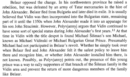
Vidin had a strong history of autonomy as the seat of several despots, including the eponymous founder of the Shishman dynasty. Having received Vidin after the death of the rebellious boyar Jacob Svetoslav, the family rose to prominence under Michael I Shishman – who was elected Tsar of Bulgaria following the death of George II Terter in 1323. Even so, Vidin’s separate political institutions were preserved, and the office of despot was transferred from Michael I to his brother Belaur. In 1331, Belaur’s weak nephew Ivan Stephen was dethroned by the despot of Lovech – Ivan Alexander, beginning the reign of Bulgaria’s last imperial dynasty. In response, Belaur broke ties with Tarnovo – ultimately seeing his possessions conquered by Ivan Alexander in 1336. Nevertheless, the latter’s authority over the region remained weak and his ally Michael II – son of Michael I Shishman became the despot of Vidin. Although not as ambitious as his predecessor, Michael II Shishman could still theoretically press his claim to the Bulgarian throne as a member of the fallen Shishman dynasty.

This information is available in the Bulgarian-language paper ПОЛИТИЧЕСКА ИСТОРИЯ НА ВИДИН ( XII в. – КРАЯТ НА XIV в. ) (page 28) on academia.edu, and in the English-language book The Late Medieval Balkans: A Critical Survey from the Late Twelfth Century to the Ottoman Conquest (page 273).

citation.png


When exactly Michael II died remains unknown, but by 1356 Ivan Alexander’s eldest son Ivan Sratsimir had been coronated in Vidin – ruling in parallel to his father in Tarnovo. This happened following Ivan Alexander’s divorce from Theodora of Wallachia in 1350, which saw the birth of a new heir to his second wife (also named Theodora) and the subsequent disinheritance of his eldest son. Following the death of his father in 1371, Ivan Sratsimir cut all ties with Tarnovo – leaving Bulgaria divided on the eve of Ottoman invasion. Although this was something of a black swan event, it’s safe to say that it was helped along by Vidin’s deeply rooted preexisting autonomy.

How would this play out in-game?

Vidin would be a vassal of Bulgaria in 1337 ruled by Michael II Shishman. Around 1350, Bulgaria would be hit by an event concerning Ivan Alexander’s divorce from Theodora of Wallachia. This would give Bulgaria a new heir (Ivan Shishman), replace the ruler of Vidin with Ivan Sratsimir, and change the rank/title of Vidin's ruler from Despot to Tsar. Upon the death of Ivan Alexander, Vidin would become totally independent.

Okay, so Vidin was an autonomous entity in 1337. Why is this worth depicting?

I don’t know how Paradox intends to depict the rise of the Ottomans in-game, but I hope that their plan isn’t just to give them massive buffs. The Ottomans rose not because they were an unstoppable juggernaut, but because many of their enemies were deep in the throws of crisis. When Bulgarian and Ottoman troops first met on the field, Bulgaria had already been utterly hollowed out by more than a century of dynastic struggles, feudal fragmentation, heresy, and demographic decline as a consequence of warfare. It should be very difficult for a player to recover from this situation, and this should be what makes the Ottomans such a threat. It would be a far more organic/interesting approach to take, and you cannot accurately depict the fall of the Balkan states without depicting the feudal fragmentation which preceded it.

Vidin’s western border, Pirot, and the Timok valley


I’m a little perplexed why the entire Timok valley is depicted as being part of Serbia in 1337, not even Serbian maps tend to do that. More importantly, Bulgaria was invaded by Hungary in 1365 – the latter incorporating Vidin as a banate (province) for 4 years. This was quite a significant event in 14th century Bulgarian history, and it would have been impossible if the Tsardom of Vidin hadn't shared a border with Hungary in the Timok valley. As for Pirot, I can find no sources indicating that it had passed from Bulgarian to Serbian hands by the 1330s. Serbian historians Vladimir Aleksić and Igor Stamenović note that the medieval Church of St. Nicholas in Staničenje (a village in the vicinity of Pirot) contains a founders' inscription from 1332 which mentions Despot Belaur and Tsar Ivan Alexander as co-rulers of the region.

My source for this information is the paper CHURCH OF SAINT NICOLAS IN STANIČENJE AND SERBIAN-BULGARIAN DEMARCATION IN PONIŠAVLJE REGION IN 13TH AND 14TH CENTURY, BELGRADE HISTORICAL REVIEW Vol. VI (2015) (page 117) on academia.edu.

Vidin.png


The Despotate of Dobruja (Karvuna) in 1337

Having seen Project Caesar's in-game political map of the Balkans, one thing which sticks out to me is the lack of feudal fragmentation in Bulgaria - particularly in Dobruja. There is a misunderstanding about when the Despotate of Dobruja (Karvuna) came into being and when it ceased to exist. Information on the English-speaking internet is scarce so it's easy to parse a few wikipedia articles and take what they say at face value. Wikipedia says that Karvuna gained its independence in 1356 and fell in 1411, with its final ruler Ivanko dying in 1388. However, this information is erroneous and lacks citations. Thankfully, Bulgarian historian Georgi Atanasov's 496-page book ДОБРУДЖАНСКОТО ДЕСПОТСТВО - КЪМ ПОЛИТИЧЕСКАТА, ЦЪРКОВНАТА, СТОПАНСКАТА И КУЛТУРНАТА ИСТОРИЯ НА ДОБРУДЖА ПРЕЗ ХІV ВЕК (which is available on his academia.edu page) provides an exceptionally thorough examination of the Despotate's political, ecclesial, economic, and cultural history through the lens of archeological and historical records.

When did Karvuna really become an independent polity?

In short, the Despotate was a domain of the Terteroba clan, which lost the imperial throne of Bulgaria to Michael I Shishman in 1323 but retained their authority in Karvuna, later expanding it to Silistra and the Danube delta. Initially, Balik accepted the Byzantine title of Archon and embraced the Patriarchate of Constantinople to assert his independence from Tarnovo. Indeed, the first record of an autonomous ruler in Dobruja is from 1346, when Balik intervened in the Byzantine civil war (1341-1347) on behalf of Anna of Savoy. However, the first mention of Varna under the ecclesial jurisdiction of the Constantinople rather than Tarnovo comes from a 1323 codex, indicating that Balik likely created his domain that same year – which coincides with the dethronement of the Terteroba clan in Bulgaria. Despite this, the exiled Terterids never surrendered their political identity – Venetian, Lithuanian, and German sources all used the name Bulgaria as a synonym for the Despotate. (Source: ДОБРУДЖАНСКОТО ДЕСПОТСТВО - КЪМ ПОЛИТИЧЕСКАТА, ЦЪРКОВНАТА, СТОПАНСКАТА И КУЛТУРНАТА ИСТОРИЯ НА ДОБРУДЖА ПРЕЗ ХІV ВЕК, page 67, page 197)

Demographic decline and the demise of the Despotate

Although I don’t have population figures, Atanasov provides an excellent overview of the demographic process underway in Dobruja during the late Middle Ages. Essentially, Dobruja contained 3 population “islands” – one along the Black Sea from Varna to Kaliakra, one along the Danube around Drastar (Silistra), and one in the Danube delta. The rest of the country consisted of empty hinterland, a fact stemming not only from the arid character of Dobruja’s interior but also from the waves of marauding nomads who attacked the region starting in 1036 AD. Pechenegs, Cumans, Mongols, and Tatars all ravaged Dobruja, which was their entry point into the Balkan Peninsula. As a consequence, hundreds of villages disappeared from the archeological record in Northeastern Bulgaria, coin circulation became restricted to fortifications along the Black Sea/Danube, and the accounts of travelers (among them 12th century Byzantine historian John Kinnamos and 15th century Venetian author Giovanni Maria Angiolello) began to describe Dobruja as a desert, which remained common until the 16th century. During the 10th century, the region contained roughly 30 stone fortifications and 280 unfortified villages, while a century later all unfortified villages were destroyed as well as all inland stone fortifications. During the reign of Dobrotitsa, Varna and its satellite fortifications accounted for perhaps half of the population of his realm. (Source: ДОБРУДЖАНСКОТО ДЕСПОТСТВО - КЪМ ПОЛИТИЧЕСКАТА, ЦЪРКОВНАТА, СТОПАНСКАТА И КУЛТУРНАТА ИСТОРИЯ НА ДОБРУДЖА ПРЕЗ ХІV ВЕК, page 13 - 19)

Dobruja.png


Despite being crippled by this demographic catastrophe, the Despotate stubbornly clung to independence by means of clever diplomacy. Initially a Byzantine ally, Karvuna's most capable ruler Dobrotitsa warmed relations with Tarnovo to expand his holdings west into Silistra and south along the Black Sea coast in exchange for his participation in Tsar Ivan Alexander's campaign to retake Vidin from Hungary in 1369. When relations between the Despotate and its northern neighbour soured under Ivanko, a Wallachian invasion saw him temporarily ejected from his holdings in 1389 - only to be reinstalled by his Ottoman allies in 1391. Ultimately, Karvuna would outlast even Tarnovo itself, lingering on until a Tatar invasion - not an Ottoman one, destroyed the Despotate in 1399. (Source: ДОБРУДЖАНСКОТО ДЕСПОТСТВО - КЪМ ПОЛИТИЧЕСКАТА, ЦЪРКОВНАТА, СТОПАНСКАТА И КУЛТУРНАТА ИСТОРИЯ НА ДОБРУДЖА ПРЕЗ ХІV ВЕК, page 183 - 207)

Yashko - a Jasz remnant state in eastern Moldavia

An interesting thing which I and some others have noticed is the premature existence of Moldavia in-game despite its traditional date of foundation not being until 1346. While I take no issue with this, I do think that it provides an opportunity to explore a little-known polity which preceded the creation of Moldavia.

Enter the Jasz

The Jasz were a group of Alanian peoples who fled west in the wake of the Mongol invasion, most famously settling in Hungary. We’ve seen that Jasz culture exists in central Hungary in-game, but an interesting fact to note is that the Jasz people also had a polity in eastern Moldavia which is attested at least until 1330. In fact, the etymology of Moldavia’s traditional capital city (Iași) likely derives from their name.

Prior to the emergence of the Moldavian state in the mid-14th century, Moldavia was the scene of competition between the Golden Horde, Hungary, Galicia, and Bulgaria, none of whom really governed the region directly but instead patronized local princes/chieftains. Bulgarians identified Moldavia (and especially the area around Iași) as Yashko (land of the Jasz people), and Alanians were frequently employed as soldiers in Bulgarian campaigns. Dusan’s code (written in 1349) mentions that at the battle of Velbazhd in 1330, the "Gospodstvo (lordship of) Yashko” participated on the side of Bulgarian Tsar Michael I Shishman, which implies a continued Bulgarian suzerainty over the region. Additionally, 13th-14th century jewelry found in hoards near the villages of Voinești, Oțeleni, and Cotnari attest to the influence of South Slavic material culture in what would become Moldavia. Furthermore, there were 3 villages in the vicinity of Iași whose names contained the word Șchei (an old Romanian exonym for Bulgarians), suggesting that a trickle of Bulgarian colonists may have accompanied this influence.

What happened to the Jasz polity in Moldavia?

One of the most important landowners in 15th century Moldavia was a boyar with the unusual name of Stoyan Prochelnik. Prochelnik was a title in medieval Bulgaria and Serbia (but not Moldavia) denoting a fortress-governor, leading Bulgarian academics such as Tervel Popov and Plamen Pavlov to conclude that Stoyan was a descendant of the old Jasz lords who kept their former title as a surname. This would explain why his family held large estates around Iași, and it would paint a plausible picture of how the Moldavian state came to supplant the Jasz one. Essentially, as Vlachs settled the plains around Iași while Bulgarian influence receded, the old Jasz polity was absorbed by the newcomers on favorable terms and its aristocrats were integrated into the Moldavian nobility.

How would this look in game?

For one, I propose the creation of an Orthodox Jasz-culture principality (perhaps allied to or a vassal of Bulgaria) in eastern Moldavia which would coexist with an independent Moldavia in the west. It should have a low population given that the area was recently subject to Tatar raids, and Moldavia should receive an event to annex it either through diplomacy or conquest. In general, this would add some interesting flavour to Eastern Europe, and I think it would be cool to play as a remnant of the Alans. Lastly, given the polity’s close relationship with Bulgaria, I suggest that it be able to reform Bulgaria if it manages to conquer the region. Think of it like how Theodoro is a Gothic country with a Greek bureaucratic/religious language, which can reform Byzantium in EU4.

My source for most of this information is the paper "Политическото присъствие на възобновеното Българско царство в днешна Молдова (XII – XIV в.)" which is available at the Central and Eastern European Online Library.

An overview of fourteenth century Thrace from a Bulgarian perspective

One of the eccentricities of Bulgarian history is the persistence of a segment of the population which retained its migration-era Slavic tribal identity well into the Middle Ages – a notable example of this being the case of the Dragovithians (also known as Drougoubitai or Dregovichi, originating in southern Belarus), who continued to appear in Byzantine sources as inhabitants of the diocese of Philippopolis during the 14th century (see Dimitri Obolensky's The Bogomils: A Study in Balkan Neo-Manichaeanism, page 158). On the topic of dualistic heresies in Bulgaria, 13th century Italian inquisitor Rainerius Saccho distinguished the so-called “Bulgarian Church” (Ordo de Bulgaria), associated with Bogomilism and centered on Macedonia, from the “Dragovithian Church” (Ordo de Drugutia), associated with Paulicianism and centered on Thrace – particularly Philippopolis. Toponymical reminders of the Dragovithians are especially prominent in the northwestern Rhodopes, where the river Dragovitsa flows into the Maritsa near the monastery of Krichim (see Donka Radeva's Павликяни и павликянство в българските земи – архетип и повторения VII–XVII век - available on academia.edu).

Prior to the 1340s, the northwestern Rhodopes were a scarcely governed frontier – their isolated ravines inhabited by marauding nomads lacking political allegiance to Bulgaria, Byzantium, or Serbia. Referring to the region as Merope, Greek author Nicephorus Gregoras described how its strongholds and villages had voluntarily acknowledged Byzantine suzerainty in exchange for their placement under the rule of a local chieftain named Momčil in 1343. It should be noted that Czech historian Konstantin Jireček connected the etymology of Merope to the Rup people (see Konstantin Jireček's пътувания по българия, page 452), a distinct Bulgarian ethnographic group who derive their name from the word Ropka, meaning “valley” (see Ivan G. Iliev's КЪМ ВЪПРОСА ЗА НАЗВАНИЯТА НА ТРИ БЪЛГАРСКИ ЕТНОГРАФСКИ ГРУПИ: РУПЦИ, ШОПИ, ХЪРЦОИ - available on academia.edu). Interestingly, their first appearance coincides with the exit of Dragovithians from the historical record of the Rhodopes - which were also the epicenter of Islamic proselytism in Ottoman Bulgaria, a phenomenon associated with traditional strongholds of dualism. It's even more telling that the so-called Paulician dialect of the Bulgarian language - associated with late converts from Paulicianism to Catholicism, is a member of the Rup dialects.

Momčil began his career as a bandit leader before acceding to Byzantine service at the age of 30 (in 1335, assuming that he was born in 1305 per Bulgarian historian Yordan Andreyev), yet his propensity for raiding put him in hot water with his overlord – forcing him to briefly seek refuge at the court of Stefan Uroš III sometime before 1341. Upon his return to Byzantine service, Momčil became one of the most prominent magnates in Thrace – amassing an army of 5,000 infantrymen and 300 cavalrymen, as well as significant wealth by means of plunder. He played an important role in the ruinous Byzantine civil war of 1341 – 1347, playing John Kantakouzenos and Anna of Savoy against one another in pursuit of ever greater privileges. Having acquired the title of despot and extended his domain to the cities of Komotini and Gratzianous, the emboldened magnate proclaimed the independence of Merope during the summer of 1344. He went on to conquer Xanthi and nearly killed John Kantakouzenos in battle, falling to a 20,000-strong Turco-Byzantine force under Umur Bey the following year. Subsequently, some of Momčil’s power was inherited by his cousin Rajko – who was last mentioned governing part of the latter’s domain as a kephale under Stefan Dušan before fading from the pages of history (see Elena Gkartzonika's Banditry and the Clash of Powers in 14th-Century Thrace: Momcilo and his Fragmented Memory - available on academia.edu).

Knowing this, what should change?

Firstly, it seems that Project Caesar conflates Paulicianism with the Armenian minority which was brought to Thrace by the Byzantines. This ignores their successful proselytization efforts among the local population, made evident by the association contemporary authors drew between the heresy and Slavic Dragovithians. As such, Paulicianism should be far more present among the Bulgarian inhabitants of Thrace. Keep the Armenian minority, but spread it out more - their main area of settlement wasn't the Rhodope mountains, but the city of Philippopolis and its northern environs facing the Balkan ridge.

Secondly, I'd like to see Momčil and his polity represented in some way - either as a society of pops or as a Byzantine vassal. The Dragovithians and their likely descendants - the Rup people, clearly enjoyed a sort of autonomy rooted in their existence on the fringes of Byzantine and Bulgarian institutions, a status which I think a society of pops would represent perfectly. They reached their zenith under Momčil and even briefly achieved statehood, at the very least Merope should pop out of Byzantium when their civil war kicks off. That said, I'm not arguing that they should be a separate culture - Nicephorus Gregoras makes it clear in his work that Momčil and his kin were Bulgarians.
 
Last edited:
  • 74Like
  • 28
  • 11
  • 5Love
  • 1
Reactions:
To start off I would like to present a map of the carpathian basin:
2273b51b712c85096bbf81684ded6086.jpg


You have all of Transdanubia as Flatland which is plain wrong.
To go by your current locations:
Somogyvár, Segesd, Zalavár , Belmura: should be Hills
Part of Veszprém, part of Buda, and part of Pécs should be mountains

For vegetation: most hills and mountains in Hungary should be forests / woods
 
  • 43Like
  • 8
  • 4
  • 3Love
  • 2Haha
Reactions: