Hello, and welcome one more week to another Tinto Maps, where we assemble several maps for the shake of it (well, also to gather feedback, I guess). After the nightmarish maps of last week, we’re showing a much less fragmented region this week, the Maghreb. Let’s take a look at it, then.
Countries:


This week I’m showing two versions of the country map, one without colored wastelands, and another with them colored (please take into account that some work still needs to be done regarding the coloring of the corridors). Only four new countries are to be shown this week (as Fezzan already appeared some weeks ago). First is first, there are dynamic keys for them similar to the Mamluks, so their full name in the game are ‘Marinid Sultanate of Morocco’, ‘Zayyanid Sultanate of Tlemcen, and ‘Hafsid Sultanate of Tunis’ (Tripoli starts with a random ruler, as we weren’t able to find which was the reigning dynasty in 1337). The main power in this period is the Marinid dynasty, ruling from Fās, after grabbing the power from the Almohads almost a century ago. They start at war with the Zayyanids of Tlemcen, and its capital is close to falling to the mighty Sultan Abu al-Hasan ‘Ali. They also have a foothold in Iberia, around Algeciras and Ronda, which may lead to future campaigns about the control of the Strait of Gibraltar.

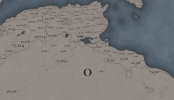
And this is the starting diplomatic situation between Morocco and Tlemcen, with the capital of the latter almost surrounded by the former...
Dynasties:

Here we have the three main dynasties of the Maghreb in 1337, the Marinids, the Zayyanids, and the Hafsids. Apart from those, the dynasties of Tripoli and Fezzan are randomly generated, as we don’t know who was ruling in those places at that specific time.
Locations:


 Here are the maps of the locations. In the first, you may see the corridors (the non-named locations) connecting the Maghreb with the Saharan inner lands and oases. Regarding the location density, we might want to increase it in a few places (that Siṭṭāt location is too big compared to its neighbors, for instance).
Provinces:

We’re open to suggestions for the provinces, as usual.
Areas:

The areas of the Maghreb correspond to their historical division (al-Aqṣā, al-Awsat, al-Adna, and Tripoli). The northern section of the Sahara is split in two areas, the Western Sahara, and the Sahara Oases.
Terrain:


Better late than never!
Cultures:

The cultural division of the region is very, very interesting, we think. The first thing that I want to stress is that we’ve divided the most Arabized zones from the more traditionally Berber ones. The more Arabized cultures are the Moroccan, Algerian, Tunisian, Lybian, and the Hassaniya tribe, in the western Sahara. Meanwhile, the Berber-speaking peoples are divided into Masmuda, and Sanhaja in al-Maġrib al-Aqṣā; the Zenati in al-Maġrib al-Awsat; the Kabylian, Chaoui, and Mozabite in al-Maġrib al-Adna; and the Eastern Berber (a name that we will probably change, given the feedback already received in the Egyptian Tinto Maps) in Tripoli. The Berber-speaking Tuareg and the Saharan-speaking Toubou inhabit the central Saharan Oases.
Religions:

Most of the region’s population practices Sunni Islam, with a very important zone where Ibadism is the majority, more or less corresponding with Mozabite and Eastern Berbers. Although it’s not shown on the map, there are two religious minorities present, the Mustaʿravi Jews, in a bunch of urban centers across the region, and some native Christians spread through al-Maġrib al-Adna.
Raw Materials:

The Maghreb is very rich in different materials, especially Morocco (which was used a long time ago as a ‘RGO-gameplay’ testing ground by our QAs). The Saharan corridor is way less productive, but it’s somehow important for the next map…
Markets:

The market centers of the region are placed in Fās and Al-Jazā'ir, which makes for good market access and distribution for the start of the game, in general terms. You might notice that trading happens across the corridors, which makes for a real connection between the markets to the north and south of the Sahara in 1337. This means that we can effectively simulate the trading of Saharan and sub-Saharan goods (salt, alum, gold, ivory) to the north until maybe some European countries decide to explore down the African coast and make direct trading in the Gulf of Guinea, avoiding the Maghrebi intermediaries.
Population:


 The population of the region is around 5,5M, with an interesting distribution: al-Maġrib al-Aqṣā and al-Maġrib al-Adna have more or less a similar population, with al-Maġrib al-Awsat having half of them, and Tripoli and Saharan Oases being way less populated.
And that’s all for this week! The next one we will travel across the Sahara, and take a look at the region of Western Africa. See you!
Countries:
This week I’m showing two versions of the country map, one without colored wastelands, and another with them colored (please take into account that some work still needs to be done regarding the coloring of the corridors). Only four new countries are to be shown this week (as Fezzan already appeared some weeks ago). First is first, there are dynamic keys for them similar to the Mamluks, so their full name in the game are ‘Marinid Sultanate of Morocco’, ‘Zayyanid Sultanate of Tlemcen, and ‘Hafsid Sultanate of Tunis’ (Tripoli starts with a random ruler, as we weren’t able to find which was the reigning dynasty in 1337). The main power in this period is the Marinid dynasty, ruling from Fās, after grabbing the power from the Almohads almost a century ago. They start at war with the Zayyanids of Tlemcen, and its capital is close to falling to the mighty Sultan Abu al-Hasan ‘Ali. They also have a foothold in Iberia, around Algeciras and Ronda, which may lead to future campaigns about the control of the Strait of Gibraltar.
And this is the starting diplomatic situation between Morocco and Tlemcen, with the capital of the latter almost surrounded by the former...
Dynasties:
Here we have the three main dynasties of the Maghreb in 1337, the Marinids, the Zayyanids, and the Hafsids. Apart from those, the dynasties of Tripoli and Fezzan are randomly generated, as we don’t know who was ruling in those places at that specific time.
Locations:
Provinces:
We’re open to suggestions for the provinces, as usual.
Areas:
The areas of the Maghreb correspond to their historical division (al-Aqṣā, al-Awsat, al-Adna, and Tripoli). The northern section of the Sahara is split in two areas, the Western Sahara, and the Sahara Oases.
Terrain:
Better late than never!
Cultures:
The cultural division of the region is very, very interesting, we think. The first thing that I want to stress is that we’ve divided the most Arabized zones from the more traditionally Berber ones. The more Arabized cultures are the Moroccan, Algerian, Tunisian, Lybian, and the Hassaniya tribe, in the western Sahara. Meanwhile, the Berber-speaking peoples are divided into Masmuda, and Sanhaja in al-Maġrib al-Aqṣā; the Zenati in al-Maġrib al-Awsat; the Kabylian, Chaoui, and Mozabite in al-Maġrib al-Adna; and the Eastern Berber (a name that we will probably change, given the feedback already received in the Egyptian Tinto Maps) in Tripoli. The Berber-speaking Tuareg and the Saharan-speaking Toubou inhabit the central Saharan Oases.
Religions:
Most of the region’s population practices Sunni Islam, with a very important zone where Ibadism is the majority, more or less corresponding with Mozabite and Eastern Berbers. Although it’s not shown on the map, there are two religious minorities present, the Mustaʿravi Jews, in a bunch of urban centers across the region, and some native Christians spread through al-Maġrib al-Adna.
Raw Materials:
The Maghreb is very rich in different materials, especially Morocco (which was used a long time ago as a ‘RGO-gameplay’ testing ground by our QAs). The Saharan corridor is way less productive, but it’s somehow important for the next map…
Markets:
The market centers of the region are placed in Fās and Al-Jazā'ir, which makes for good market access and distribution for the start of the game, in general terms. You might notice that trading happens across the corridors, which makes for a real connection between the markets to the north and south of the Sahara in 1337. This means that we can effectively simulate the trading of Saharan and sub-Saharan goods (salt, alum, gold, ivory) to the north until maybe some European countries decide to explore down the African coast and make direct trading in the Gulf of Guinea, avoiding the Maghrebi intermediaries.
Population:
And that’s all for this week! The next one we will travel across the Sahara, and take a look at the region of Western Africa. See you!