• We have updated our Community Code of Conduct. Please read through the new rules for the forum that are an integral part of Paradox Interactive’s User Agreement.

Tinto Maps #28 - 29th of November 2024 - North America

Hello everybody, and welcome one more Friday to Tinto Maps, the place to be for map lovers! Today we will be looking at North America, which is very handy, as we can deliver some Thanksgiving turkey maps to our friends from the USA (and Canada)!

But before I get started, let me have a word on some (shameless) promotion. You may know that we in Paradox Tinto have also been in charge of Europa Universalis IV in the past few years. Well, I just want to let you know that there’s currently an ongoing sale on the game, with several discounts on diverse packages, of which outstands the hefty Ultimate Bundle, which includes all the DLCs developed and released by Tinto in the past 3 years (Leviathan, Origins, Lions of the North, Domination, King of Kings, and Winds of Change), and a whole bunch of the older ones. I’m saying this as you may want to support the ongoing development of Project Caesar this way! Here you may find more detailed information, and all the relevant links: https://forum.paradoxplaza.com/foru...toria-bundle-up-for-this-autumn-sale.1718042/

And now, let’s move from the Black Friday sales to proper Tinto Maps Friday!

Countries & Societies of Pops:
Countries.png

SoPs.png

SoPs2.png

SoPs3.png

SoPs4.png

SoPs5.png
For today’s Tinto Maps, we thought it would be a good idea to show both the land-owning countries and the SoPs. As I commented last week, we’re trying to follow consistent criteria to categorize countries and societies. This is our current proposal for North America, with Cahokia and some Pueblo people being the only regular countries in 1337, surrounded by numerous SoPs. I’m not bothering to share the Dynasty mapmode, as we don’t have any clue about them, and they’re auto-generated.

However, we have been reading and considering the feedback we received last week, in the Tinto Maps for Oceania, so we want to let you know that this is our current design proposal and that we want to hear from you what are your expectations regarding the countries that you would consider landed in 1337*, and also which countries you’d like to play with in this region, either as landed, or as a SoP.

As you may already know, our commitment is to make Project Caesar a great, fun game with your help, and we greatly appreciate the feedback we receive from you in that regard.

* This is already quite tricky, as most of our information only comes from post-1500s accounts when the native societies were already looking very different from two centuries ago. Eg.: The first reports made by Hernando de Soto about the Coosa Chiefom around 1540 points it out to be organized in a way that we’d consider it a Tribal land-owning tag, as confirmed by archaeology. However, that polity was not organized at that level of complexity in 1337, as there isn’t any contemporary data comparable to that of Cahokia. And some decades after the encounter with de Soto and some other European explorers, the mix of diseases had made the Chiefdom collapse, being more akin to what a SoP would be. This type of complex historical dynamism is what makes it so difficult to make the right call for the situation in 1337, and also for us to develop with our current game systems the proper mechanics that would be needed for SoPs to be fully playable (and not just barely half-baked).


Locations:
Locations.png

Locations2.png

Locations3.png

Locations4.png

Locations5.png

Locations6.png

Locations7.png

Locations8.png

Locations9.png

Locations10.png
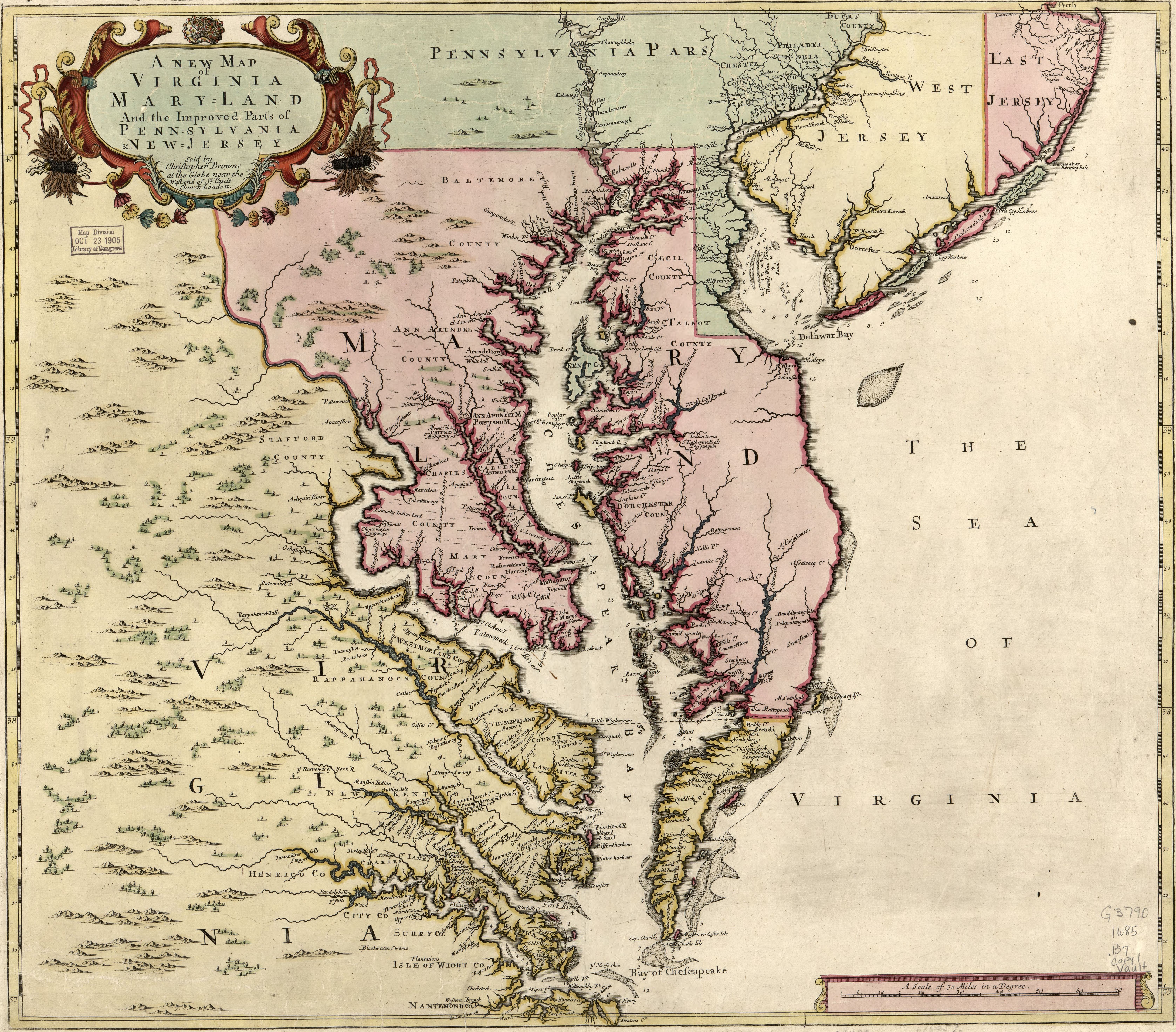
Plenty of locations, at the end of the day, are a big sub-continent… You may notice that we’ve tried to use as many native names as possible, although sometimes, we’ve failed to achieve that. Any suggestions regarding equivalences of Native and Post-Colonial will be very much appreciated, as this is a huge task to do properly!

Provinces:
Provinces.png

Provinces2.png

Provinces3.png


Areas:
Areas.png

Areas2.png

Areas… And with them, an interesting question that we’d like you to answer: Which design and style do you prefer, that of the East Coast, more based on the Colonial and Post-Colonial borders? Or the one for the Midwest and the Pacific Coast, more based on geography, and less related to attached to modern states? Just let us know!

Terrain:
Climate.png

Topography.png

Topography2.png

Vegetation.png

Some comments:
  • Most climates are portrayed in NA, from Arctic to Arid.
  • The Rocky Mountains are rocky!
  • Regarding vegetation, we wanted to portray the forest cover in 1337, which is tricky, and that’s why some areas may look too homogeneous. Any suggestions are welcome!

Development:
Development.png

Not a very well-developed region in 1337…

Natural Harbors:
Harbors EC.png

Harbors WC.png

Harbors3.png


Cultures:
Cultures.png

Cultures1.png

Cultures2.png

Cultures3.png

Lots of cultural diversity in NA!

Languages:
Languages.png

And the languages of those cultures!

Religions:
Religions.png

Religions2.png

We have a mixed bag here: On the one hand, Eastern and Northern religions look more like the design we’re aiming to achieve, while on the other, to the south, you can find the splitter animist religions based on cultures that we now want to group into bigger religions, more akin to the northern areas.

Raw Materials:
Raw Materials.png

Raw Materials 2.png

Raw Materials3.png

Wild Game, Fish, and Fur are king in this region! But we are also portraying the ‘three sisters’ (maize, beans, squash), the agricultural base for many of the native American societies, using Maize, Legumes (beans), and Fruit (squash). Cotton is also present in the south, as it was also native to the region (although the modern variant comes from a crossing with the ‘Old World’ one), and there are also mineral resources present here and there.

Markets:
Markets.png

Two markets are present in 1337, one in Cahokia, and another in the Pueblo land.

Population:
Broken map! But as this is an interesting topic to discuss, these are the current numbers we’ve got in the region:
  • Continent:
    • 20.487M in America (continent)
  • Sub-continents:
    • 10.265M in North and Central America (we have a pending task to divide them into two different sub-continents)
    • 10.222M in South America
  • Regions (roughly 1.5M):
    • 162K in Canada
    • 1.135M in the East Coast
    • 142K in Louisiana
    • 154K in the West Coast
    • 43,260 in Alaska

And that’s all for today! There won't be a Tinto Maps next week, as it's a bank holiday in Spain (as I was kindly reminded in a feedback post, you're great, people!), so the next one will be Central America on December 13th. But, before that, we will post the Tinto Maps Feedback review for Russia on Monday, December 9th. Cheers!
 
  • 184Like
  • 49Love
  • 20
  • 7
  • 7
Reactions:
Wisconsin area changes

Most of northern Wisconsin is really forested swampland and definitely not hilly. I live up here.
The Driftless area was not glacier covered in the last ice age so it retained its rugged and hilly terrain.
The southern Pecatontica (Galena), location should probably be Lead.
The on unreadable location north of Odeba should probably be Sand, in has some the highest quality sand deposit for modern uses, so definitely useful for the time period.
Keweenaw Peninsula should be Copper, native Americans traded and used the native copper found here from Cahokia to New York.

Also worried about Cahokia market map, you should see the effect of the Mississippi, Ohio, and Missouri Rivers on the market access range as the access improves due to proximity to the rivers.

Also the Black Hills in South Dakota should be Hills not Mountains (if I'm reading the location right) and either have Forest or Woods not Sparse.

17329205937611.png
 
  • 6Like
  • 3
Reactions:
1733018662330.png

I saw the Title. I saw this Image. I was almost tempted to just close the site LOL.

Very humble: Here is NA! BEHOLD! (Nothing) - but yeah. Can't wait for the colonial game.

One question though. If you build ships in the Lakes (if you even can) can you transport them back to the ocean later on?
 
  • 2Haha
  • 1Like
  • 1
  • 1
  • 1
Reactions:
Colonial dynamic naming for Michigan:

Note that in real life there is a lot of mixing between these, where a place is named by one group of colonisers and the name is retained by the group that replaces them, even long after the original group is gone. Detroit is the most obvious one. There are even examples of Americans naming places after French people all by themselves, like Marquette and Cadillac. Perhaps it would be convenient to introduce some sort of game mechanic where the country that first colonises a location gets to have its name persist, unless the new group explicitly decides to rename them?

These English names all operate under this principle, and intentionally exclude modern-day significant placenames of French origin. However, if the game treats colonial renaming in the same way it treats dynamic naming, then this list should also include:
- Marquette
- Cadillac instead of Big Rapids
- Cheboygan instead of Shabwegan
- Detroit in place of Lernoult
- Au Sable in place of Standish

1733084873370.png

1733084505556.png

1733084530716.png

1733084557375.png

1733084575530.png

(there is a city named "Norway" in the Chicagon location. Maybe it could be used, but it's actually named for the Norway Pine, not the country)

1733084596493.png

1733084684030.png

(except for Ypsilanti, these are all classicisms, so you could reject them as inauthentic)
1733084740676.png

1733084773812.png

1733084823462.png
 
Last edited:
  • 11Like
  • 1
Reactions:
View attachment 1224677
I saw the Title. I saw this Image. I was almost tempted to just close the site LOL.

Very humble: Here is NA! BEHOLD! (Nothing) - but yeah. Can't wait for the colonial game.

One question though. If you build ships in the Lakes (if you even can) can you transport them back to the ocean later on?
Unless we get an Erie canal type of project, I don't believe the great lakes are traversable to the Gulf of Saint Laurence, and I don't *think* major ships could have traveled say down the river systems to the Mississippi, that's only enabled by locks and artificial connections today. But I'm not an expert on this. I *would* love an Erie canal buildable like how the Suez, Kiel, and Panama were in eu4, especially since it was completed at the tail end of the game period.
 
  • 7Like
Reactions:
I am by no means an expert on the topic of native naming, but some of the province names in the modern area of British Columbia (I'm from Vancouver) seem off.

In particular:
Haida Gwaii is already a native name used today to refer to the queen Charlotte Islands and the people whose traditional lands that area represents (the Haida people). From what I can tell a different name was used in the draft map, why?

Vancouver Island is labelled as "north Vancouver" and "south Vancouver". This could be confusing as north Vancouver and south Vancouver are modern districts of the city of Vancouver on the British Columbia mainland (not the island!). An easy fix could be renaming to "north Vancouver Island" and "south Vancouver Island" but these names are getting pretty long... Also Vancouver is of course an explorer's name and not a local native term so doesn't really fit your naming convention.

Meanwhile, the chosen name for the modern city of Vancouver area itself (text resolution isn't great but looks like Lushoomed) is a name I've not heard of before. Not saying it's for sure wrong just odd I haven't heard of it...

Other names you could consider featuring are Squamish, Coquitlam, Capilano, Salish, and Cowichan. Squamish and Capilano would be particularly relevant for the modern Vancouver area, as Chief Capilano was a major figure in Vancouvers history and there are modern areas named for him and his people (Squamish is a nearby city).
 
  • 5Like
Reactions:
You should not be able take ships out of the Great Lakes to unless the game allows you to build some rather large canals. Contemporary canals like the first version of the Erie Canal were generally not large enough for ocean going ships.

What the British and Americans did do in the War of 1812 is took cannons and other naval supplies off existing ships to fit out ships on the Great Lakes. When ships are placed 'in ordinary' (mothballed), their cannon (and perhaps some other goods) should go back into the market (or storage). I would love to see a system where when you scrap ships in PC, some of the resources used to build them go back into the market (or storage).
 
  • 4Like
Reactions:
I am by no means an expert on the topic of native naming, but some of the province names in the modern area of British Columbia (I'm from Vancouver) seem off.

In particular:
Haida Gwaii is already a native name used today to refer to the queen Charlotte Islands and the people whose traditional lands that area represents (the Haida people). From what I can tell a different name was used in the draft map, why?

Vancouver Island is labelled as "north Vancouver" and "south Vancouver". This could be confusing as north Vancouver and south Vancouver are modern districts of the city of Vancouver on the British Columbia mainland (not the island!). An easy fix could be renaming to "north Vancouver Island" and "south Vancouver Island" but these names are getting pretty long... Also Vancouver is of course an explorer's name and not a local native term so doesn't really fit your naming convention.

Meanwhile, the chosen name for the modern city of Vancouver area itself (text resolution isn't great but looks like Lushoomed) is a name I've not heard of before. Not saying it's for sure wrong just odd I haven't heard of it...

Other names you could consider featuring are Squamish, Coquitlam, Capilano, Salish, and Cowichan. Squamish and Capilano would be particularly relevant for the modern Vancouver area, as Chief Capilano was a major figure in Vancouvers history and there are modern areas named for him and his people (Squamish is a nearby city).

While there were Cowichan people in the Lower Mainland (greater Vancouver), the term is now better associated with the Cowichan Valley on Vancouver Island. Salish is too general of a term - there were Salish speakers over a large area. Musqueam is another nation in Vancouver.
 
  • 1Like
Reactions:
You should not be able take ships out of the Great Lakes to unless the game allows you to build some rather large canals. Contemporary canals like the first version of the Erie Canal were generally not large enough for ocean going ships.

What the British and Americans did do in the War of 1812 is took cannons and other naval supplies off existing ships to fit out ships on the Great Lakes. When ships are placed 'in ordinary' (mothballed), their cannon (and perhaps some other goods) should go back into the market (or storage). I would love to see a system where when you scrap ships in PC, some of the resources used to build them go back into the market (or storage).
Devil's advocate here, there wasn't a huge need for it, and the political and economic capital didn't become available until the 19th century. But, again, the us wasn't colonized until rather late, so if it was colonized a century of two earlier, it seems reasonable.
If, as Britain I go nuts on colonizing North America and putting it under one colonial nation early on, I see no reason why I couldn't make a canal as wide as the Kiel or other canals which are traversable in previous titles. Even if that's not feasible, the making, scrapping, and refitting the ships outside the lakes could be simply abstracted no?
 
  • 2Like
Reactions:
Created an account just to express my visceral dislike of the east coast Area borders, lol. Seeing the US state lines just feels fundamentally wrong for a game that begins in 1337, and the large majority of the game didn’t feature these borders.

I tried to reflect on these feelings, and understand that many Americans may have a strong preference for the borders to be this way. This is a commercial product, and if this impacts their experience (and potentially likelihood to buy) perhaps it’s understandable. Particularly where modern state borders reflect some geographical feature, it makes some sense to reflect them in the province/area structure of the game. But not straight lines.

If, in the end, this approach is kept there are some areas that are particularly egregious. The ‘bootheel’ in Missouri and Michigan having land over the Straits of Mackinac happened as relatively silly aspects of negotiations to become states right before the end of the game (literally the last year of the game in Michigan’s case). West Virginia didn’t exist until the Civil War, 25 years after the end of the game, and doesn’t make sense to be an area in the game. At least shaped as it is. In general, I would argue for all of the lands of the Louisiana Purchase to have the approach of the Western and Central areas of North America. These were admitted states as they currently are right at the end of the timeframe of the game, as were Ohio, Illinois, Maine, etc.

With all that said, I still can’t agree with the idea even if it could be improved as above. In particular, it should be a consistent approach across the game. In other locations I cannot see this same approach being taken, particularly Australia – why shouldn’t an Australian be able to re-create some of the modern country? Obviously Central and South America maps haven’t been released yet but this would be the same for them – they would have to reflect modern state borders for much of the land masses.

An argument could be made for other regions colonised somewhat in the timeframe of the game – why shouldn’t African and Indian borders, among others, show future colonial shapes so European colonisation can go along somewhat historical lines here too? If they didn’t have these shapes, then why should the areas inhabited by the native Americans for the majority of the game time?

Importantly the borders were by no means guaranteed to occur the way they did, particularly from a starting point of 1337. Even if you take European dominance as a starting point, had England/Britain been less successful and France, Spain and the Netherlands more successful, the borders in this area would have been hugely different. As it is, the east coast of North America just looks like it is sitting there, waiting to be settled by Britain.

I think if we wanted to have these colonial-type borders in the game, then there should be a mechanic to create then – reshape area borders to fit in with the approach that was actually taken by colonial powers. Obviously, that would likely take significant development time to implement (a DLC?), but it would actually simulate what happened in the area dynamically to reflect what the process of colonization was, rather than force our actual history onto it.
 
  • 9
  • 3Like
Reactions:
Created an account just to express my visceral dislike of the east coast Area borders, lol. Seeing the US state lines just feels fundamentally wrong for a game that begins in 1337, and the large majority of the game didn’t feature these borders.

I tried to reflect on these feelings, and understand that many Americans may have a strong preference for the borders to be this way. This is a commercial product, and if this impacts their experience (and potentially likelihood to buy) perhaps it’s understandable. Particularly where modern state borders reflect some geographical feature, it makes some sense to reflect them in the province/area structure of the game. But not straight lines.

If, in the end, this approach is kept there are some areas that are particularly egregious. The ‘bootheel’ in Missouri and Michigan having land over the Straits of Mackinac happened as relatively silly aspects of negotiations to become states right before the end of the game (literally the last year of the game in Michigan’s case). West Virginia didn’t exist until the Civil War, 25 years after the end of the game, and doesn’t make sense to be an area in the game. At least shaped as it is. In general, I would argue for all of the lands of the Louisiana Purchase to have the approach of the Western and Central areas of North America. These were admitted states as they currently are right at the end of the timeframe of the game, as were Ohio, Illinois, Maine, etc.

With all that said, I still can’t agree with the idea even if it could be improved as above. In particular, it should be a consistent approach across the game. In other locations I cannot see this same approach being taken, particularly Australia – why shouldn’t an Australian be able to re-create some of the modern country? Obviously Central and South America maps haven’t been released yet but this would be the same for them – they would have to reflect modern state borders for much of the land masses.

An argument could be made for other regions colonised somewhat in the timeframe of the game – why shouldn’t African and Indian borders, among others, show future colonial shapes so European colonisation can go along somewhat historical lines here too? If they didn’t have these shapes, then why should the areas inhabited by the native Americans for the majority of the game time?

Importantly the borders were by no means guaranteed to occur the way they did, particularly from a starting point of 1337. Even if you take European dominance as a starting point, had England/Britain been less successful and France, Spain and the Netherlands more successful, the borders in this area would have been hugely different. As it is, the east coast of North America just looks like it is sitting there, waiting to be settled by Britain.

I think if we wanted to have these colonial-type borders in the game, then there should be a mechanic to create then – reshape area borders to fit in with the approach that was actually taken by colonial powers. Obviously, that would likely take significant development time to implement (a DLC?), but it would actually simulate what happened in the area dynamically to reflect what the process of colonization was, rather than force our actual history onto it.
Let me try to approach your position here.
The straight lines such as in Virginia and Tennessee? Sure, those I really don't mind being adjusted to follow cultural or geographic boundaries, especially as provinces are divided broadly by terrain and vegetation already.
But one thing puzzles me, why is this middle ground approach unpalatable to you, merely that it doesn't seem to be consistent across the world?

I'm curious then, what your ideas on other borders should be, you don't seem satisfied with merely following things like rivers and mountains, so what's the alternative? Or am I misunderstanding your position?

This is also just asking everyone so against the straight lines, basically what bases would you emphasize for the shapes of provinces?

Also, addressing the whole American consumer angle, for my POV it's like a nice to have, especially to do things like comparing regions in the otl to my game, but it's by no means a deal breaker for me or a huge draw.
What *would* bother me would be attempts to diverge from period maps, charters, etc to the point that they don't make logical sense, it only to not match any modern state borders. I'm not trying to insinuate this is your position, just saying where my line in the sand as a consumer is.
 
  • 5
  • 2Like
Reactions:
OKAY CALIFORNIA TIME! And oh boy does it need some work...
I Couldn't Decide's (ICD) post is real good please listen to that as it covers a lot of names for things, but there is def more to talk about.
Societies of Pops:
The lack of any societies of pops on the west coast is wild, as per the definition given last week a society of pops needs at least some of chiefdomly authority, permanent settlements, agricultural development, and some kind of taxation. Cause the main thing here is just a lack of agricultural development. A lot of Californian peoples had the other three. Most notably I'd say is the Chumash, wild that they aren't at least a society of pops, they've had periods in the past where a big chief would have control over large portions of the Chumash lands with other chiefs under them (like they could even be properly landed), they've even had civil wars (See one of Kitsepawit/Fernando Librado's books, I forget which one). But other groups like the Ohlone, Tongva, Pomo, Yokuts, and Mohave, at least, should be counted. They had chiefdoms, though some could be quite small, they had various permanent settlements (or often semi-permanent, where they'd have 2-3 they'd go between depending on the season), and they had taxation. I assume the reason none of these got societies of pops is due to chiefdomly authority, but at least some of them had that.

To start big, Areas:
Why is the PNW Pomo? The Pomo weren't even there???? (And why is the Great Salt Lake part of that area?) California was mentioned to be properly changed to Alta California (and Aridoamerica? to Baja California), that's fine I guess since obviously there's no clear indigenous name. But if you want to use an indigenous group as names like with the PNW, then Pomo or Chumash would fit, but obviously that does feel weird. Anyways, given that the PNW should not be Pomo, the Pomo Sea is also weird, I know it doesn't have a name, and also no single indigenous name, so you could call it the California Sea, or the Cascadia Sea after the subduction zone that covers a lot of it, or the Farallon Sea after that plate/the islands off SF also named for it.


Smaller, Provinces:
Yuru Kyara, seems to an alternate spelling of yúruk va'áraaras that I can't easily find a source of. This should probably not be the case given that the Yurok are already called Oohl (good) and yúruk va'áraaras comes from the Karuk. Next to this is Sequoyah, which is an odd choice, because Sequoyah is a Cherokee guy (and who the trees were named after), so that should also be something else. Now with these two, they cover the Pacific Coast Athabaskans, Yuru Kyara covers the Oregon ones and Sequoyah the California ones, kinda. Specifically: Yuru Kyara here covers the Oregon Athabaskans as well as the Yurok who are not Athabaskan, as well as the Whilkut/Hoilkut, who are California Athabaskan. And Sequoyah covers Wíyot, who are not Athabaskan (the Wíyot and Yurok are close), and doesn't include the Hupa (Na:tinixwe) who are put into Shasta. So I guess now to mention Takelma and Shasta, since Shasta covers Na:tinixwe (Hupa), Tsnungwe, Wintu, Amblu Kai, and Okwanuchu, only the last of which is a Shastan group, though the Hupa location might also include a little bit of New River Shasta but I think they are mostly in the impassable mountains. And Takelma covers all the other Shasta lands, and the Karuk. My opinion is that maybe Karuk, Yurok, and Wiyot should be together and be named something more reasonable, the California Athabaskans including Hupa should be a province named maybe Kinist'ee or Na:tinixwe Mixine:whe' or something, the Oregon Athabaskans should be a province that could be called Nuu-wee-ya', and that Takelma/Shasta should split into three so that Shasta can cover the actual Shastan lands (also as ICD mentioned, they should be probably be Kahosadi, their own name rather than Shasta), the other two can be Takelma and Wintu or something.

To the east, Klamath and Maidu. These need to be split into three, Achomawi and Atsugewi should be together (Palaihnihan maybe, though I don't know exactly where that name came from). I don't know why the Yana location is so big, a chunk or most of that should probably be part of the Achomawi. If there's enough room Yana could be its own province given its disconnect from the people around them, but Idk. Also Sacramento should probably be called Nisenan as ICD said.

Nearby, Northwestern Numu should probably have a different name, Goyatöka probably.
Southwards, Nomlaki should probably be Patwin instead, given the Patwin were the larger of the two. Pomo is also more or less alright, it's a weird mess that covers the Pomo, two Miwok groups, the Wappo, and Yuki. There should probably be more locations added to it which could cause it to split up, though Idk how best to do that since it would have to split the Pomo. Could potentially add another Yukian locations to make three Yukian locations into a Yuki province, give Pomo like five locations, and then put Coast Miwok/Wappo/Lake Miwok as its own province.

Next, Miwok. Think its fine mostly, though I would like to see SF Bay expanded east a bit to show Suisun Bay. When I get to locations I can expand a bit more, since a Bay Miwok location would be nice, and that would squeece between Nomlaki/Patwin and the Northern Valley Yokuts provinces.

Speaking of the Yokuts, they could have some slightly nicer names, for one its Yokuts and not Yokut, but also could just grab from the location names to make them sound more fitting with the rest of the nearby provinces, or do what ICD suggested.

Just to the west, I have no idea why the Ohlone are called Aacistak, sure its the Ohlone name for Monterrey, but there are better ways for this. Ohlone is an option given its well known-ness, but it not nearly universally accepted, and ICD suggested the Mutsun name for the Salinas river. Though I think Muwekma is probably the best choice. Nonetheless, more locations could be added and cause it to split, potentially with the Esselin/Salinan splitting off.

Lower, Chumash should not have the Tongva, it should be its own thing, there's well enough locations it can have to be on its own, and Tongva definitely should have its own stuff. That's all I gotta say there, they need to be split.

Mojave could probably be called something after one of the people there, or an indigenous name for the desert. And lastly Cochimi should get more locations and then be split into with Kumeyaay or something.


Now smallest, Locations:
Baseline: there should be more. I don't have the energy to check names for everything. But I'll try to cover some.
First of all, in the Shastan lands, Waika is the Shastan name for Mt. Shasta, of which the location doesn't even include (it's in Siskiyou, or in the impassable bit between Siskiyou and Okwanuchu), and related, there should be passage between Waiki/Siskiyou and Wintu. Waika and Siskiyou could both be split, there are four bands of Shasta that can be used. (Ahotireitsu, Ikirukatsu, Irauitsu, and Wiruwhikwatsu I think?). Nearby, Chidkhu I don't know what that's supposed to be, nothing comes up for that, I assume that's supposed to be Chetco? In which case, Chetco or Chit or Cheti could be used, also the location should be split to give Tolowa something. Tututni could also be split. Over east Chewaucan and Silver Lake could be Paavituviwarai and Dühütayohikadü respectively (Yahuskin groups of those two areas).

Back west, I can't read what the Wíyot location is called, but it looks like it starts with a J or an I, and I don't know what that could possibly be. It should probably just be called Wíyot (or Ku'wil). The Mattole location should be smaller, Sinkyone should have some of that. The Hupa location should be smaller to allow for a Konomihu/Tlohomtah'hoi location. Amblu Kai does not include Amblu Kai (0/2 for the mountains here...), there are a number of Wintu bands that can be chosen for names. I mentioned already the giant Yana location that should be split and much given to Achomawi, there are also multiple Achomawi bands/villages to pick from. Harder for names is the Nomlaki, best I can find without wading through books is Paskenta for the Hill Nomlaki (wading through a book I can find a couple village names but that's it), but I can't find any actual names for the River Nomlaki.

In Pomo lands, I said before but there could be another Yuki location, two or three more Pomo locations, Wappo could be two or even three (can split Wappo in two and/or split Lake Miwok off from them), and Coast Miwok could be split. I can't read the Yuki location names but Ukomno'om, Huchnom, and Ukohtontilka work. Pomo has a lot of village and larger group names to work with. Wappo is Onasatis, but can also have a Mishewal (the classic Kroeber handbook also mentions a few principal towns for the Wappo, that's neat, SoP wink wink), and can have the Lake Miwok split off utilizing one of its villages not sure if there was a specific Lake Miwok group name (also, the southwest of the location should be Pomo, not Wappo, the Wappo were pretty northwest to southeast aligned). And the Coast Miwok probably shouldn't just be called Mewuk, a better choice might be Hookooeko which was what most of them were called (as opposed to Olamentko and Lekahtewutko which were both in the northwest of them, one of those could be split off to make a second location, or just go with a more tribelet level split and grab any of those names), or Micha-ko which was the specific word for people (their version of Miwok).

Moving on, Suisin should be Suisun. I don't really know what to do for the Maidu/Nisenan, but its weird. Mountain Maidu should be Yamani Maidu. Yupa should be Yupu. Mechoopda doesn't look like its in the right spot (I think its in the northwest, maybe Konkow territory). I have no idea what Kuyuongkuwi is supposed to be. And Maidu should probably be something different rather than just "Maidu". Kroeber's handbook has a map and (sadly incomplete) village list that covers things, however flawed this thing is its quite helpful for some of this stuff.

The Ohlone locations should be more, Ramaytush, Tamien/Tamyen, and Rumsen would all be nice. ICD mentioned the fixed Salinan name of Te'po'ta'ahl, but the location could also be split more into 2-3 Salinan locations and an Esselen location. Yokuts could also have a bit of splitting up, like Yawdanshi. The Chumash and Tongva should definitely be split up more, and why at all use Ineseno and Ventureno (and not even use the accents!). An earlier user, Bosporus, made a good post for splitting the locations, and I generally agree with that but think Mikiw could be split into Mikiw and Saxpilil, and that Kumeyaay should keep their land east of the lake.

Terrain/Dev/Harbors:
Don't know for much, but the Chumash should probably have a bit of a harber, and maybe a lil bit of dev.

Cultures:
Chidkhu/Chetco as said earlier is weird and should not cover Yurok (and instead could be with Tututni) who should be on their own, but if Yurok is combined then it should be with Wíyot, but really they are different. Karuk shouldn't have the Hupa. Mattole shouldn't have Sinkyone and the coastal Yuki. Wíyot shouldn't have Whilkut/Hoilkut. Pomo shouldn't have Wappo. This whole area is a mess that doesn't make sense. Needs a full re-looking at. In addition, the whole Maidu area is also weird. Achomawi has Yana in it when it shouldn't (but should have part of Yana cause as explained earlier Yana shouldn't be that big), Maidu shouldn't have Yahi, Yana and Yahi should be their own thing as Yana. I still have no idea what that culture between Maidu and Nisenan is, and I don't know what its supposed to be. Maidu should cover the Maidu and probably Konkow locations, and Nisenan with the Nisenan locations, and I already said how those locations are a big mess in themselves. The southern stuff seems fine.

Languages:
Algic and Dene (Athapaskan) are wrong, Chidkhu/Chetco shouldn't be Algic (that is specifically Yurok/Wíyot), Ko Kwel/Tututni/Chidkhu Chetco/Whilkut Hoilkut should be Dene. The little red one I assume is Yukian, and the coastal Yuki should also be that, as well as the Wappo. Penutian and Hokan should probably be split up.

Religions:
Kuksu has no business being in Washington/Idaho, or even Oregon. Kuksu's influence goes north up to Shasta at most, but is mostly concentrated in central California from ~Yuki/Wintu to Ohlone/Yokuts. Puhagimist has no results on google, I have no idea wtf that is supposed to be. Chumash and Tongva, and some nearby cultures (including a bit of Yokuts), use datura to do spiritual stuff and are quite similar in that regard. I've seen it be called Datura Cult a bunch, not sure if there's a better name unless each should be given their own name, but overall that should definitely be separate from Kuksu. There's also what is sometimes called World Renewal, and I'm not sure if there's a better name, for Karuk/Yurok/Wíyot that doesn't have Kuksu influences really. I have no idea what Oregon/Washington/Idaho should have instead of Kuksu but it sure ain't Kuksu. And I'm not really sure what to do instead of Puhagimist, but it would be nice for it to be a real word.

Raw Materials:
Idk really anything here, especially since Shellfish isn't a material which is one of the major things. Glad the Ohlone Mercury is there though.

Markets:
I assume only landed places can have markets, but if there can be more than a Pomo or Chumash location would be good to have on, quite a major trade network in area.

Population:
>154K in the West Coast
Aiya.
The lowest estimate for California itself is 133k, with estimates often being upwards of 350k (Though it should at the very least be 300k in my opinion, the <150k estimates make no sense with the population after the mission era still being 100-150k when it killed at least 50%). It should be so so much higher than 154k for the entire west coast, which seems to include Washington and Oregon, and possibly some amount of inland stuff around the Great Basin or Southwest, since it's unclear where else those are. So yes, its criminally low. There are also some studies that suggest disease had traveled from elsewhere like Mexico prior to the start of the mission era and therefore the population should be much much higher, like around a million, but that's much harder to know. But the 300-350k figure at least should be used.
 
  • 9Like
  • 4
  • 1
Reactions:
Let me try to approach your position here.
The straight lines such as in Virginia and Tennessee? Sure, those I really don't mind being adjusted to follow cultural or geographic boundaries, especially as provinces are divided broadly by terrain and vegetation already.
But one thing puzzles me, why is this middle ground approach unpalatable to you, merely that it doesn't seem to be consistent across the world?

I'm curious then, what your ideas on other borders should be, you don't seem satisfied with merely following things like rivers and mountains, so what's the alternative? Or am I misunderstanding your position?

This is also just asking everyone so against the straight lines, basically what bases would you emphasize for the shapes of provinces?

Also, addressing the whole American consumer angle, for my POV it's like a nice to have, especially to do things like comparing regions in the otl to my game, but it's by no means a deal breaker for me or a huge draw.
What *would* bother me would be attempts to diverge from period maps, charters, etc to the point that they don't make logical sense, it only to not match any modern state borders. I'm not trying to insinuate this is your position, just saying where my line in the sand as a consumer is.

The borders of Tennessee and Virginia are two examples, but it's present in almost all of them. Just look at the border areas of West Virginia, Virginia, West/Pennsylvania and Maryland/Delaware and then what it does to the shape of provinces underneath. They've done a good job at making the province boundaries as reasonable as possible, but these still look ridiculous. And the border between Virginia and North Carolina etc and how it is reflected in the provinces - what is it about the Parallel 36°30′ north that make it relevant in determining province boundaries? I have nothing against a province/area border following a river or mountain, but I am unaware of one that sticks strictly to a parallel line for so long.

When I said that 'I still can’t agree with the idea even if it could be improved as above' I was mostly referring to the improvements removing the most egregious issues, but keeping many of the straight lines like between Indiana and Ohio. I would be satisfied with Ohio's southern border, which follows a river, being reflected in game, assuming there was no reason to think another border could be plausible (I do not know enough about the area to suggest one).

The biggest issue is that the Area borders as they stand reflect a logic of borders that is anachronistic to the 1337 start date of the game. It is a colonial logic that began to be developed well over 100 years after the start, and did not come dominate in the area until the later half, and in particular latest part, of the game. Before this land and borders tended to stick to geographical features or historically understood cultural or social norms. As I mentioned in my post there are other areas of the world that have more colonial style logics now, but wouldn't have had at the start of the game and don't in the maps we've seen. There should be a consistent approach across the game to this situation.

Ultimately we don't know for sure how vast swathes of the world in 1337 could be reasonably broken down into land parcels like Provinces and Areas, and then even onwards through much of the time period of the game. Yet these locations haven't ended up with straight lines and unbelievably odd shapes - judgements have been made based on some criteria. I think a consistent approach should be taken with the Americas. Again, this could draw upon borders that ended up forming where there is some obvious sense that fits within the criteria - a geographical feature, etc, so some would be able to be created.

When you mention being bothered by "attempts to diverge from period maps, charters, etc to the point that they don't make logical sense", part of the difficulty here is what 'period' means. I don't believe we have any physical maps of any part of the Americas from prior to colonisation, so don't have this 'logical sense' for those areas in 1337. Why should a European logic from hundreds of years later be applied outside of Europe, and then not in all areas Europeans colonised?
 
Last edited:
  • 6
  • 2Like
Reactions:
I think it would be helpful tor someone to describe exactly what they think the Eastern American areas should look like instead of what they do now.
 
  • 4
  • 3Like
Reactions:
A few inconsistencies and issues I've noticed.

Inconsistencies:
1. You use the Native name for the Wolastoqey, but then the European name for their culture (Maliseet). The Mi'kmaq also use their European name (their local name for 'friend'). It should be either Wolosteqey and L'nu, or Maliseet and Mi'kmaq, it's weird to mix and match like this.
2. Why are the Wolastoqey represented as an SOP and not the Mi'kmaq or Passamaquoddy or Penobscot? They were united people groups just as much as the Wolosteqey, or even more so for the case of the Mi'kmaq. (https://en.wikipedia.org/wiki/Wabanaki_Confederacy)
3. Why are some of the place names in New Brunswick and Nova Scotia based on European names and others on Indigenous names? There are lists of Indigenous place names out there (https://www.cbu.ca/indigenous-initiatives/lnu-resource-centre/) that you could use if needed.
4. What's with the wastelands in New Brunswick and Nova Scotia? Sure, those areas aren't very populated today, but that's not because they can't be. You've got wastelands in forests and hills (some hills larger than others), and even one near St John on the coast. What is the purpose behind this?
5. There are also plenty of Indigenous elders and resource centres (at least in Canada, anyways) that you could reach out to who I'm sure would love to help you represent their regions accurately. Have you considered reaching out to them for help with this? A lot of resources about Indigenous people aren't always written down, or they focus on contact and post-contact times, so reaching out to elders is often a great way of getting access to information that may be only contained in oral tradition. A quick search, or message/phone call to local university Indigenous departments, usually reveals many contacts. Though in some cases you may also have to physically travel to these locations as well.

Other issues:
1. Why aren't Saint John and the area near Bangor natural harbours? The same for Quebec City, the Miramichi area, Campbellton, Charlottetown, and St John's?
2. What about Montreal and the St. Lawrence River? It you have the great lakes represented, why not the ways in which to get to and from those lakes?
3. The Blackfoot (Niitsitapi) and Cree of the plains lived very different lives than those in the Great Lakes and Eastern regions. It might be better to separate their religions?
4. Why do the Dorset people speek Cree?
5. What about other rivers? In North America, and Canada especially, perhaps more so than other continents, rivers were a major way of getting around in the early colonial days. With Europeans building settlements and forts often only on major rivers at first. The entire HBC companies forts were on major rivers that flowed into the Hudson Bay. To not include these seems strange.
 
  • 4Like
  • 3
  • 3
Reactions:
I think natural borders make a lot more sense than states. Things like Rhode Island and other US states have borders that wouldnt make any sense in historical context
 
  • 3
  • 1Like
  • 1
Reactions:
Some general comments regarding the language setup:

Even if Hokan and Penutian are valid linguistic families, they are still far too deep to be represented in-game even at the level of language family, and certainly not at the level of language. Yes, that means a lot of language isolates, but that's an accurate reflection of the linguistic diversity of California.

"Yutonahua" is a perplexing choice of name, since both the Numic (Yuta) and Nahuan languages have clearly been separated from it. In any case, it should be split into multiple languages, all in the Uto-Aztecan family along with Nahuatl, Takic, and the Numic languages.

Wakashan consists of two distinct dialect continua, Kwakiutlan and Nootkan, which should be separate languages in the Wakashan family.

Salishan is also far too diverse to be a single language. At least the division between Interior and Coast Salishan should be represented; a four-way split between Nuxalk, Central Salishan, Tsamosan, and Interior Salishan would be even better.

The current Dene grouping should also be elevated to the level of family, with at least Tlingit and Eyak as separate languages. The "Na-dené" exclave in northern Mexico appears to be an oversight.

Dorset and Beothuk should have their own languages rather than Cree.

Sauk-Fox-Kickapoo should be a single language (perhaps called Meskwaki) separate from Shawnee and including Mascouten.

The remnant "Iroquoian" language can be merged with Wendat.

The Tutelo language might be better called "Mosopelea", and Catawba should be added as a separate language.

The Tunica language needs to be separated from Natchez, and Chitimacha separated from Atakapa.

The Florida region in general needs a thorough revamp; the Calusa culture can at least be split into Tocobaga, Calusa, Tequesta, Mayaimi, Ais, and Mayaca, and a separate Ais language should be added. Timucua can be split into multiple cultures as well.
 
Last edited:
  • 3Like
Reactions:
This is really neat my dream has been to be able to play as Chahokia but as someone who has studied the pre European contact Mississippian civilization and cultures so I'd like to see the other cities of the mound builders such as Moundville and Spiro as nation's. I haven't been following this completely so I don't know if you can play societys of pops but I would like to play as the Cherokee.
 
  • 1
Reactions:
Why should a European logic from hundreds of years later be applied outside of Europe, and then not in all areas Europeans colonised?
How is it european logic when those were the state borders of an american state, the USA?

I'm pretty convinced now that the only reason why there is so much hate against the historical state borders in the east is just straight-up anti-american bias.
One person here even admitted in a comment that they don't want to see those borders because it reminds them of american exceptionalism and manifest destiny.

This thread is also a perfect case example for how people who post in these map threads don't necessarily represent the player base. This thread makes it sound like everyone loves to play as native americans, wants as many settled states at the start here as possible and hates anything related to colonialism.

But I guarantee you that among the millions of people who will actually play the finished game, the representation of history such as the first settlements on the east coast, the american frontier, the relationship of colonies to the motherland, the american revolution, the louisiana purchase, the expansion into former buffer territory, and yes, recreating historical borders, will garner way more interest than actually playing as native americans in 1337.

I have been farming dislikes in this thread since it came out, but maintain that there is nothing wrong with the state borders and that they should be represented in the game.
The border between France and Belgium was drawn arbitrarily, even though there are many nearby rivers that could have been used as border. It also ignores the historical borders of Flanders. Nobody complained in the relevant thread that this border is "unnatural" and should be changed in the game.
The same can be said about the border between the Netherlands and Germany. I mean, why doesn't it just follow the Ems? Wouldn't that be an obvious natural border? Should the game remedy this historical mistake?
The border could have been drawn a million different ways throughout hundreds of years of history, so should the game not represent how it actually ended up?

The fact that people are arguing for historical borders not to be represented in the game because they don't like how they look is completely absurd. Nobody made comments like this in other map threads. And that's why I have come to the conclusion that there is a lot of bias involved.
 
Last edited:
  • 20
  • 13Like
Reactions:
1733018561819.png


Looking at the Chesapeake region, a few adjustments can be made.

First, the Potomac River should be navigable at least up to Anacostia (see Buzzard Point in the historical map below). On top of the Potomac still being navigable during this time period, the Washington Naval Yard was established in 1799 and was essential during the War of 1812. While not a natural harbor and shifted more towards technological and industrial development, the Naval Yard produced several ships during the 1800's and functioned as a major component of the local economy.


A_new_map_of_Virginia%2C_Maryland%2C_and_the_improved_parts_of_Pennsylvania_%26_New_Jersey._LOC_2005630923_%28cropped%29.jpg

(Note how Delaware should be in Pennsylvania when looked at geographically and historically.)


Second, the Nentego (Nanticoke) location seems to be placed further than where they were historically. The Nentego location is on the western shore of Chesapeake Bay instead being of the eastern shore. In addition, the location of Patapsco was sparsely populated, so there should simply be a location with pops outside of a SoP until the migration of the Susquehannock into the area.

Map from Towson University
image-642242bfaacee.jpg


Third, the location "Wiscontiss" isn't showing any search results but Conowingo is a place along the Susquehanna River of Susquehannock origin, although they haven't migrated here yet.


Last, Potapoco is misspelled as Popotaco. The Potapoco were absorbed as a sub-tribe into the more dominant Piscataway and the Piscataway grand chief was also based in this location, so it could instead be called Piscataway (although that could obscure the roots of the English name Port Tobacco).

But if any devs are hungry this week, maybe @Pavía should pick up something from the local taco shop ;)


As a side note, if diacritics are being used like with the Wënami, then wə̆nálâhtko·w would be better written as W'nalātchtko than Wonalahtko in English.


Also, after looking at the claims of the American colonies, having the colonies compete with each other could be part of the mechanics of colonization.

Nycolony.png


Puebloans:

I like that we got at least a few Puebloan tags! For those who don't know:

- Acoma Pueblo = Áakʼu
- Teypana is the same
- Pueblo of Isleta = Shiewhibak
- Zia Pueblo = Tsi'ya
- Sandia Pueblo = Tuf Shur Tia
- Pueblo Galisteo = Than-u-ge
- Ohkwee Ówîngeh is the same and was formerly known as San Juan Pueblo
- Taos Pueblo = Iałopháybo

For the area immediately around the north New Mexican Pueblos, I feel like you could add locations for some of the other local Pueblos like Cicuye, Kawaika, Kua-Kaa, Puye, etc.
Thanks
 
  • 7Like
  • 2
Reactions: