• We have updated our Community Code of Conduct. Please read through the new rules for the forum that are an integral part of Paradox Interactive’s User Agreement.

Tinto Maps #6 Great Britain & Ireland Feedback

9 September 2024 12 May 2025​


What an exciting week we have had, and best of all I finally get to say the name Europa Universalis V. It still feels weird in my mouth after carefully saying Caesar for what feels like a lifetime.

But lo, the day is finally come for the British Isles feedback thread. This short update was supposed to come out a few months ago, but I just had to teach some of you a lesson. Also I had a lot of other things on, like appearing in the announcement show last week.


Here we see the updated topography:

topography.jpg


The updated vegetation:
vegetation.jpg


Many impassable barriers have been added, for example the various peaks of the Pennines and the Wicklow Mountains. The Shannon also now poses a more significant barrier between east and west Ireland, with only a few crossing points often guarded by stockades.


Here we have the Locations map, bear in mind they are only showing the default English names but many places have Gaelic or Brythonic versions.

locations.jpg


Every country has had a general increase in density.

England, in particular the south, has had a big revamp at Location and Province level to more accurately reflect the historical counties, many of them pre-Norman in origin and many of them still in use today in some form. Westminster as a capital has been killed and rolled into a monolithic London.


Provinces:
provinces.jpg


Areas:

areas.jpg


And political mapmode (with overlord colouring off):
political.png


And Dynasties:
dynasty.jpg


We have added the Earldom of Orkney in the northern isles as a Norwegian vassal. Meanwhile the Palatinate of Durham and Chester have both been promoted from a special set of buildings to vassals under England. Wales has also been limited strictly to the Principality of Wales, with the marcher lords existing as very low control locations under England.

Ireland has had a major rework in terms of locations and tags. Mostly there have been minor Irish chieftaincies added. As always we are grateful to the many suggestions that have come from the forumers.


Culture:
culture.jpg


The most obvious culture change is that English has had Northumbrian split off, to represent the divide between southern and northern dialects and attitudes. A practical example of this is how in the south the English are more friendly to Normans, whereas the Northumbrians hate them (the northern shires still bear the scars of the Harrying of the North). Northumbrians and Scots also spoke a similar form of English in this period, so it helps to set them up as a sort of middleman.

Norwegians in northern Scotland and the nearby North Atlantic have also been split into Norn.


As a bonus, Court Language, showing 3 main worlds: Gaelic, Anglo-French, and Roman Catholic Bishoprics.

court_language.jpg


There have also been some changes to Raw Goods, as you can see here:

raw.jpg


We still have time to make some changes, so let us know what we can do to push this even further towards where it needs to be.

I won’t show Population numbers right now, as it’s pending a proper rework. Among other things, the idea is to reduce the population numbers in England.
 
Last edited:
  • 162Like
  • 76Love
  • 8
  • 5
Reactions:
For Ireland, I found a great source that uses tithe records to estimate the economic activity of different regions of Ireland in the early 14th century - though do note several regions (County Louth, County Wexford, and much of the midlands and Breifne) lack data entirely, and this is before the Bruce invasion and Burke civil war that devastated the Earldom of Ulster.

1747155078664.png


1747155014210.png


The short takeaway is that you could probably stand to boost development in County Limerick, Tipperary, and especially Kilkenny, and that the areas around the Norman castles of Carrickfergus, Coleraine, and especially Downpatrick were much richer and densely-populated than the areas held by Clandeboye around modern Belfast, which would only become significant after settlement. You could also stand to boost central Mayo and Thomond a little!
 
  • 5Like
  • 5
  • 2Love
Reactions:
@SaintDaveUK Since the first tinto maps for ireland theres been quite a few improvements to the map which is awesome, but i did notice there were some locations that were not in the correct in game areas / irl irish provinces. The locations of killeshandra, cavan and killycolly, which comprise the county cavan irl should be in the ulster area as cavan is in the irish province of ulster irl. The dundalk location is the county louth irl and should be a part of the leinster area as the county is in the irish province of leinster irl, and the entire province of kildare, which includes the counties kildare and carlow irl should also be a part of the county leinster. Ive overlayed a screenshot of the map in game with a map of the provincial borders irl and circled the areas to show these discrepancies.View attachment 1297790

If possible could you also post the dialects map of both ireland and britain and a zoomed image of the political map mode of just ireland, with the country names based on the primary culture of the nations? The names 'East Breifne' and 'Owill' dont sit right.

Also what culture is the orange striped culture in pembroke?

View attachment 1297801
Cavan and Louth are in the correct provinces - they'd only be assigned to Ulster and Leinster respectively under the Tudors. Kilkenny and Carlow should be in Leinster, though.
 
  • 3Like
  • 1
  • 1
Reactions:
From what I've read, it was the construction of the old military road that made the area passable from north to south, at least to large armies, but I also don't see any indication that this road couldn't have been built significantly earlier. The main problem was that the terrain was (and still is) bogs. But I can't think of a reason for it to be more difficult to build such roads north south then it is to build them east west.
There are a number of gaps (Wicklow Gap, Sally Gap) that facilitate east-west travel.

In theory an army could make its way through Wicklow and attack Dublin from the south (or vice versa), but in practice it was rare (I believe the Normans might have managed it?). While the troops might make the journey, keeping them supplied would be nearly impossible, so armies would travel to the east or west of Wicklow (creating bottlenecks which could be fortified).

I’m not sure if making the province border impassable is the best way to represent this, but it does have the benefit of being the simplest…
 
@SaintDaveUK Since the first tinto maps for ireland theres been quite a few improvements to the map which is awesome, but i did notice there were some locations that were not in the correct in game areas / irl irish provinces. The locations of killeshandra, cavan and killycolly, which comprise the county cavan irl should be in the ulster area as cavan is in the irish province of ulster irl. The dundalk location is the county louth irl and should be a part of the leinster area as the county is in the irish province of leinster irl, and the entire province of kildare, which includes the counties kildare and carlow irl should also be a part of the county leinster. Ive overlayed a screenshot of the map in game with a map of the provincial borders irl and circled the areas to show these discrepancies.View attachment 1297790
Cavan was part of Connacht and Louth part of Ulster at game start.
 
  • 1Like
Reactions:
View attachment 1297732
Here's what my personal prefer for English areas would be, for what it's worth.

The Circuits are interesting choices to represent a purely internal division, but they weren't coherent geographic reasons. All of the Circuits had a "tendril" to take them close to London, because circuit judges were reluctant to have permanent residence very far from the London. This has actually been true even until the very recent era; it's long been a sore point of the Bar of England and Wales that circuit judges tend to be clustered toward London for easier access to the Inns of Court. It is an artificiality that wouldn't sensibly survive any alt-history where England faced actual division.

The term "the Home Circuit" is also dependent on a London-oriented England. While this is clearly by far the most likely history, it would be strange if e.g. a player-ruled England focused on York rather than London had its region called "the Home Circuit".

South Midlands is... I really don't like it. That comes from nowhere really, I appreciate what you're trying to do but it doesn't work for me.

I'm also very reluctant to call anything containing Hampshire "the West Country" - any respectable cider drinker would have your head. It may have shared a circuit with the others (again - to create a London tendril) but that's about it.

I also really dislike Northumbria, because over the term period, the English version of that - land north of the Humber, Northumberland - came to apply to the ceremonial county of (obviously) Northumberland; the term didn't remain in use for the larger area.

One answer might be just to... accept that the South of England is the best option going, and run with this:

1747156603575.png


The South of England may have a lot of provinces here, but to be fair they're all geographically quite small provinces - I don't think many would be weeping if Bucks, Beds, and Herts were rolled up (they already are in the modern era for many purposes). Purely by land area, all of these geographies are pretty even, and they're basically just the circuits with the London tendrils chopped off and given back to the South of England.
 
  • 7Like
  • 1
  • 1
  • 1
Reactions:
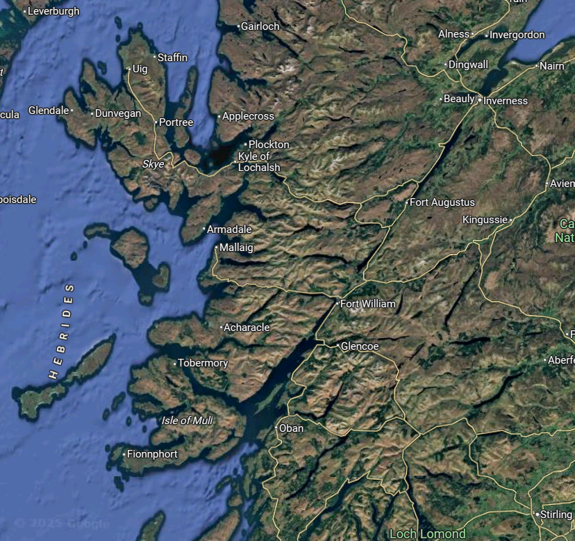
Really loving the map updates! Very glad to see a lot of the suggested changes being incorporated too. I've thought of some minor changes for the map to Scotland that might be worth mentioning. I think some work might need to be done to emphasise Stirling's strategic location, and improve the shape of the current Glasgow location.

Location Name Changes:
  • Peterhead – Peterhead was only founded about halfway through the game’s time period. Fraserburgh is a similar fishing town that was founded a couple of centuries earlier, and is more often represented on maps in this time period, but again, this town was founded after the start date. Buchan could be used for a location name here, if needed.
  • Garioch – If you’re wanting settlements for most of these places, then Inverurie should be the name. It is the largest settlement in the area, and has been for most (if not all) of the game’s timeframe. Kintore is another potential alternative.
  • Kildrummy – This location seems to represent the hilly areas of Deeside, and therefore I would suggest Braemar as the location name instead. Similar to Kildrummy, Braemar is a significant castle in the area, and had a small local town affiliated with it as well. It’s more central within the location, and is more closely tied to the key geographic features of the area. On older maps, Braemar is often indicated as ‘Castletown’. Braemar may be a bit anachronistic for the time period, so Castletown may be more fitting.
  • Kincardine – This location represents Mearns, which is a largely agricultural area southeast of the Cairngorms. Kincardine lies along the river Dee, and is north of a section of the Cairngorms that splits this area from the rest of present-day Aberdeenshire. As a county town, Kincardine declined significantly over the first couple centuries of the game's timeline. Maps of the period often list Cowie (or Cowy) as another main location in the area. It’s a castle right next to present-day Stonehaven. Stonehaven could also work as a location name, but I would recommend Cowie with a potential rename to Stonehaven if a town is established there.
  • Stirling/Glasgow – The Stirling and Glasgow boundaries still seem a bit odd. Armies should be able to travel directly between Glasgow and Dumbarton without having to travel through Stirling. Likewise, Stirling’s importance as a strategic pinch point between the north and south of Scotland should be reflected in the location’s geography. Clackmannan lies almost directly to the east of Stirling, and is largely peripheral for those travelling north/south. A connection between Stirling and Strathearn should be made, which would represent Stirling’s strategic importance in this area. It might be worth introducing a short section of impassable terrain between Clackmannan and Strathearn as well, as the Ochil hills would have prevented movement between those areas. These hills can be seen in the second screenshot
    A map of the world  AI-generated content may be incorrect.
    1747156289193.png


    Province Changes

  • I would suggest the addition of Ayrshire (Ayr and Irvine locations).
  • Move Dumfries from Teviotdale to Galloway.
  • Move both Duns and Berwick from Lothian to Teviotdale. The Lammermuir hills make a natural split between the Lothians and the Teviotdale province. Berwick should be included here as trade often followed the Tweed river.
  • I would consider whether to move Stirling into the Lothian province.
  • Should Arran be included in Argyll?
Trade Good Changes
  • The Dunbar location is in some of the best agricultural land in Scotland, and is used far more for crops than for grazing. To have either wheat or sturdy grains here would be a good idea.
  • I wonder if the Linlithgow trade good should be changed to Livestock, as this is a historic industry in the area.
  • The Peterhead location is one of the major producers of fish in Scotland. I'm unfamiliar with the area's economy at the game start, but I was a bit surprised to see that fish was not listed as the trade good there.
As the game progresses, I'm hoping that the importance of quarrying and mining in Scotland will also be incorporated.

Vegetation
  • The Dunbar and Linlithgow locations are some of the most fertile areas of Scotland, so I'm surprised to see sparse vegetation listed there. It would make sense for this area to be included as grassland.
  • The vegetation in Dornoch should probably be sparse. There's incredibly little of it. I could understand having grassland in Thurso, as this area is flatter and much better for agriculture.
Topography
  • I'd recommend that the land at Dunbar be changed to Flatland. The location seems to represent the area to the north of the Lammermuir hils (which seem to be included in 'Duns'), and the land here is either flat, or mostly rolling hills -- similar to Edinburgh
  • Locations like Gairloch, Assynt, and Ardtornish may make more sense as Mountains rather than hills. I don't know exactly what the criteria for 'mountains' are, but I imagine the highlands meets them! That area is a dense collection of some of the highest peaks in Britain, and any country would have significant difficulty expanding development in this area, as it would be heavily constrained to small pockets of land in between mountains and lochs.
1747157158790.png
 
Last edited:
  • 4
  • 1Like
Reactions:
Yes, last thread we hummed and hawed over whether to give them to Balliol or England so much that it was clear that neither had a strong enough de facto hold over Mann.
That's good, if we want to be 100% accurate William of Montague was both a vassl of Edward and Balliol as he was both Earl of Salisbury and Count of Pebbleshire but he was the indipendent King of Mann and his indipendence was offcially confirmed by King Edward III in 1333, so I hooe that Man starts as a tier 3
 
Last edited:
  • 1
Reactions:
Is Wales still a tier 2 formable? Beacuse I think it should be tier 1 if England is a tier 2 since historically it was a principality inside England
 
Last edited:
  • 4
Reactions:
Is Wales still a tier 2 formable? Beacuse I thinknit should be tier 1 if England is a tier 2 since historically it was a principality inside England
Wales and England are totally different places. I could understand if somewhere like Yorkshire were a formable that could then form England, but that logic doesn't really track with Wales.
 
  • 4Like
Reactions:
Wales and England are totally different places. I could understand if somewhere like Yorkshire were a formable that could then form England, but that logic doesn't really track with Wales.
Yeah but Wales has its own formable(Hen Ogledd I think it was called) which is kind of a Brythonic England and it has to be a tier 2 because if not you won't be able to form Great Britain which is a tier 3
 
  • 2
Reactions:
1747157873102.png

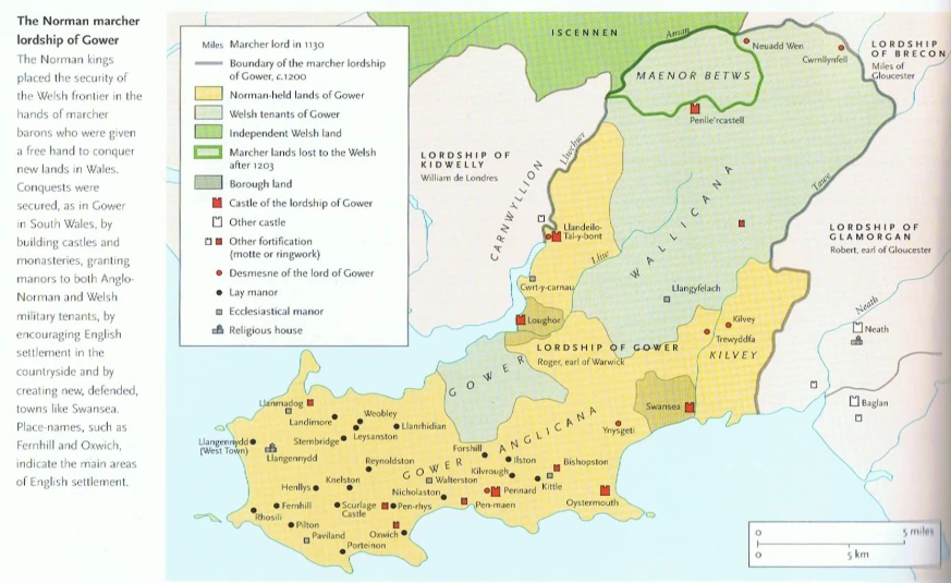
Moving on from Wales proper, much of the border regions of modern Shropshire and Herefordshire were not integrated into the standard shire system, and were instead held by Marcher Lords - whatever system you use to represent the Marches should include the locations I highlighted in red.

I've redrawn Oswestry to properly represent the Lordships of Oswestry and Caus, as well as making sure the Shrewsbury location include Shrewbury itself. Moving the border west also allows you to make Oswestry either majority-Welsh speaking or at least have a hefty minority - Welsh was spoken in Oswestry until the 18th century at the least. I've also added a location representing Bishop's Castle and Clun, but that's not as necessary.
1747158060076.png
1747158150162.png

I also really appreciate the addition of an Ewyas/Archenfield Welsh-speaking province in Herefordshire! Ewyas isn't a town though - the seat of the Lords of Ewyas was Longtown.

As for other culture changes in Wales - the Swansea location should probably be majority-English to represent the English of Gower. Additionally, I think the English pops in Conway are misplaced - it was the Earl of Denbigh who was settling English-speakers in his lands.
1747158478982.png
 

Attachments

  • 1747158029813.png
    1747158029813.png
    163,4 KB · Views: 0
  • 1747158428399.png
    1747158428399.png
    157,8 KB · Views: 0
  • 2
  • 1Like
Reactions:
Feels a little cursed having Yorkshire and Lancashire in one area but I think this is what I would settle on:
1747158610578.png

1 - West Country
2 - South East England
3 - Thames Valley / Home Counties
4 - East Anglia
5 - East Midlands
6 - West Midlands
7 - South Pennines
8 - North Pennines

North England definitely the hardest bit to divide, but this feels most suitable (though I'm not set on the names).
 
  • 6
  • 2
  • 1
Reactions: