• We have updated our Community Code of Conduct. Please read through the new rules for the forum that are an integral part of Paradox Interactive’s User Agreement.

Braziler

Second Lieutenant
Sep 11, 2024
139
511
At the beginning of the game, Brazil was inhabited by several native peoples, who were migrating. Determining its boundaries is practically impossible. So the administrative divisions must be taken from the colonial period, which is not really a bad thing, given how organically they were formed. Since this is a broad work covering a large area that little has been revealed and which seems very bad, I think it would be good to have a discussion with other people who know about Brazil before delving into it any further, so here is a small sample:

Project Capture (40)~2.jpg

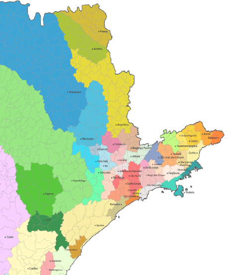
This is how the region is now. We have important places, built before the end of the game, like São Paulo on uninhabited lands.
Brazil-PC-02.png

That is my initial purpose, with the density of places following (more or less) the same as South Africa.
I really need to change the names of places that were founded after 1836, like Extrema, and add more uninhabited lands (due to the high forest between 1337 and 1836 that was uninhabited and ways that weren't drawn)

Update #1 - Reworked uninhabited lands.
Captura de Tela (2840).png


It is also necessary to rework the areas so that they are more similar to the captaincies.
Brazil-PC.pnge-02.png

This is the OSM for reference.
Brazil-PC.pngb-02.png

And this is a map of places in 1839 (as well as 1836) for reference.
Brazil-PC.pngc-02.png

This is the relief map, based on a very good work posted on the forum.
Brazil-PC.pngd-02.png

The climate map. Blue is Tropical, green is subtropical.
Brazil-PC.pngna-02.png

Finally, this is the likely ethnic distribution in 1500 years. We do not have data for 1337, but there were probably far fewer Tupi and Guarani peoples.

Let me know your opinion.
 
Last edited:
  • 38Like
  • 8
  • 2
  • 1
Reactions:
Yeah, that wasteland setup seemed so bad I wanted to give it a try myself. I decided to start by making a location map from scratch, and then add wastelands covering borders/uninhabitable locations. Here's how it looks so far:

QIn3TOU.jpeg

IayvtId.jpeg

RTmw67L.jpeg

Some of these locations may be too small (I still have to take a second pass), but I'm still being as historical as possible: locations are based on villas/cities from the time period (I'm working with 1500-1840 here) and whatever younger municipality spawned from the mother villa/city.

I still need to look at wastelands (at best I sketched the Serra do Mar, but lmao this is hard) and to review the location density compared to similar-sized countries (Minas Gerais is comparable to France, but should it have one-third of its locations? one-seventh? one-tenth?). I should probably also take a look at the 1872/1890 Censuses, but that's for another time...

The biggest issue is that we don't really have something to compare to, as Brazil is mostly native land for at least half the game while every Tinto Map until now has covered settled lands. "but what about Africa" the partition of Africa happened after 1840, but a lot of Brazil was settled by then. So we have Europe and we have Africa, but not the middle ground.
 
  • 13Like
  • 3
  • 1
Reactions:
Good idea for a thread! I'm not super familiar with a lot of places in Brazil, and I do understand that there are going to be areas similar to the central African rainforests that will be considered 'wastelands', but I couldn't help but notice that there are more wastelands in southern Brazil than I was expecting. I'd be curious to hear more about the reasons for it (maybe there are some spots that would still be uninhabited) but I'm glad to see the first post point out how future important sites like São Paulo should have the possibility to be created. Also, kudos to the work on making the locations, provinces, and areas. It looks like a good amount of effort went into it so I love to see it!

brazil religious map.png


Something I was looking into more was which settled countries we might expect to be in Brazil at the 1337 start date. One of the obvious choices is the Marajoara society at Marajó Island at the mouth of the Amazon river. According to the religion map above, it looks like at least most of the island isn't a wasteland. Another choice worth looking into are the cities built by the Kuikuro people in the Upper Xingu region. Based on archaeological sites like Kuhikugu, these were very large settlements with thousands of people! I haven't mapped them on to know for sure, but I'm guessing and hoping that the Xingu cities are in one of the inhabitable areas on the map.

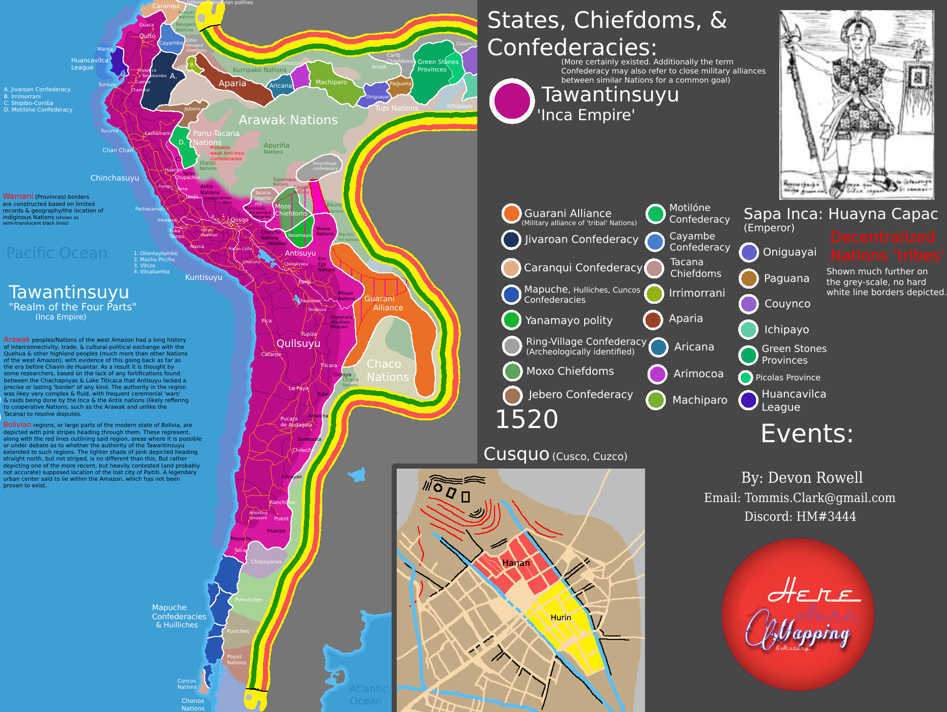
Another part of the map that is currently lacking is around the Amazon River. From the limited amount that I've seen from searching online, there were several large chiefdoms that controlled the banks of the river. Some maps that people have made online to show these chiefdoms are located here on Reddit by Flat-Ad-2492 and here on DeviantArt by AztlanHistorian. Hopefully the devs can expand the habitable areas around the Amazon River at least a little bit to be more like the maps below.

amazonia__1542____spanish_by_aztlanhistorian_de7b7ui-pre.jpg


inca.png
 
  • 28Like
  • 5
  • 3Love
  • 2
Reactions:

FleetingRain - (Like I'm new here can't use de answer bottom) This was a long job, but unfortunately I must say that the density it uses is similar to that of Germany (which is the densest) and unfortunately it will never be accepted by developers. I have now selected the specific municipalities of 1872, removing those that had not been founded, using the original name, in order to guarantee the colonial "flavor". I used South Africa as a base because it was colonized well before the rest of the continent, although I must accept a slightly higher density on the coast (since new locations are activated with each update).

The empty lands of the Serra do Mar, I made based on the inclined section and based on the TRI method published by other people here on the forum, the curious thing is that although in some places we ignore impassable lands by founding cities on the hills , we have crossed few low mountains with our infrastructure to this day.

Tahami Tsunami - Unfortunately we don't learn about the natives at school, so I know little about them. I don't know if the brazilian natives would be tags, maybe the marajoarans, but like they not survive to late colonization is not possible said precisely, however SOP yes.
 
Last edited:
  • 6Like
Reactions:
First of all, awesome contribuitions, I really hope that PDX take them into account whenever they are working in the area!

Giving my two cents on the theme, I would LOVE to see the Serra do Mar being mostly one contiguous wasteland with some unsettleable but crossable corridors, similar to what has been implemented in the Sahara.
Off the top of my head, two key crossing points between the coastal and the inland regions of Paraná were the (now known as) Itupava Path and Graciosa Road, which seem to have been used as paths by the indigenous peoples of the region, and would later be the main paths for the Tropeiros crossing the region starting in the 1700s.

Do I think those exact path would have necessarily been used by the indigenous people of the 1300s? No, but they do make sense to be present in later years, and are somewhat historically accurate, given that the indigenous peoples living in the two regions did in fact show evidences of trade interactions, but not many territorial disputes - giving the impression of those "trade corridors" having existed.

Anyways, if if not necessarily strictly historical, those corridors would be a gerta gameplay impplementation, both for a not to probable but still possible native start, and also for the colonial game later on!

Again, most of those ideas came off of my memory at htis time, so might not be 100% accurate, but I do want to contribute more to this discussion!

Also, I would love if PDX would be able to tell us which sources they have mostly been using for the region! It would surely avoid a lot of "double work" on the side of people aiming to contribute and help!
 
  • 8Like
Reactions:
First of all, amazing contributions. I really hope PDX takes them into consideration whenever they are working in the field!

Giving my opinion on the subject, I would LOVE to see Serra do Mar being basically a devastated and contiguous area, with some unstable but crossable corridors, similar to what was implemented in the Sahara.
Off the top of my head, two important crossing points between the coast and the interior of Paraná were the (today known as) Caminho do Itupava and Estrada da Graciosa, which appear to have been used as paths by the indigenous peoples of the region and, later, would be the main paths for the tropeiros who crossed the region from 1700 onwards.

Do I think these exact paths would necessarily have been used by indigenous peoples in the 1300s? No, but they make sense that they would have been present in later years, and are historically accurate given that indigenous peoples living in both regions did indeed show evidence of trade interactions, but not much territorial disputes - giving the impression that these "trade corridors" existed.

Either way, even if it's not necessarily strictly historical, these corridors would be a great gameplay implementation, both for a not-so-likely-but-still- possible native start, and for later colonial play!

Again, most of these ideas came from my memory at the time, so they may not be 100% accurate, but I want to contribute more to this discussion!

Also, I would love it if PDX could tell us which sources they have been using the most for the region! It would certainly avoid a lot of "double work" on the side of people who intend to contribute and help!
I reduced the number of corridors, as some were recent and had never been used during the game period. I took note of the Itupava route and will implement it.
 
  • 2Like
Reactions:
Let me know your opinion.
I find that the current situation, as much as so little has been shown, it's bad enough for good feedback to be already at-work, so it's great to see this thread up (i was thinking on opening something like that myself, but due to uni commitments was postponing it repeatedly), there's a lot that can be made and determined before Paradox discloses their "current" version (Tinto Maps Brazil probably will take a lot of time, or any Tinto Maps on America for that purpose), and there's a lot to be discussed.

Since this thread is up, soon enough (probably next week, after my exams are over) i will contribute to this with my musings, mostly over demography (the whole American continent must have given the devs hell in the "numbers" department, haha), cultures (There's A LOT that Paradox can get wrong, especially in Brazil, due to the rather recent nature of the Tupi-Guarani migrations) and tags (Brazil will be a great opportunity to delineate what i think should be SoPs vs. "Tribal" gov settled countries). Most of the demography stuff will come from my research on Native American historical demography that i did for my Scientific Methodology class last year, Brazil was supposed to be a big part of that research (because, uh, lol, i am Brazilian, even though nothing about my profile gives that up) but it quickly ballooned out of my finish-until-deadline writing capacity and i restricted it to only the Caribbean...So i ended up digging a lot of sources and discussions up, and lining all of them up in my notes, for nothing...Now they will be useful! (Or at least my sunk-cost-hurting heart hopes so).
The biggest issue is that we don't really have something to compare to, as Brazil is mostly native land for at least half the game while every Tinto Map until now has covered settled lands. "but what about Africa" the partition of Africa happened after 1840, but a lot of Brazil was settled by then. So we have Europe and we have Africa, but not the middle ground.
That's my main issue with location-map construction before Paradox actually post the maps, even if the map is wrong, the map gives valuable information as to the intent of how Tinto wants its "right", my guess is that coastal location density should be bigger than the interior (duh), with location size increasing towards the interior quicker in the Northeast than in the Southeast (because well, Minas Gerais and São Paulo should be location-denser than, whatever, Espirito Santo), the South's (and the North's) locations shouldn't be compared to those of the rest of Brazil, but to their neighbouring regions' (La Plata and the non-Brazilian Amazon) because they will be bound by the 3x rule Tinto is broadly applying for location-size flow.

So we'd have a general South America pattern where locations are denser in the coast, become bigger in the Sertão  and Cerrado, and then dense-fy again as it nears the Upper Plata Basin and the Andes, the latter being i would guess the most location-dense region of South America in the game. Due to the 3x rule, we'd probably be getting a "denser-than-expected" Paraguay River Valley and Andean Amazon for the sake of location consistency (a similar thing may happen in the Cerrado states neighbouring Minas and São Paulo), a fact that can be exploited for the good of greater historical accuracy.
but I couldn't help but notice that there are more wastelands in southern Brazil than I was expecting.
TBH, as a very brazilian Brazilian (lmao), these wastelands kinda baffled me as well, not in their existence, but in their size, half of the South region as an "uninhabitable wasteland" isn't exactly accurate by any metric, specially considering that it is the most "european-settlement-friendly" region in the entire country.
Something I was looking into more was which settled countries we might expect to be in Brazil at the 1337 start date. One of the obvious choices is the Marajoara society at Marajó Island at the mouth of the Amazon river. According to the religion map above, it looks like at least most of the island isn't a wasteland. Another choice worth looking into are the cities built by the Kuikuro people in the Upper Xingu region. Based on archaeological sites like Kuhikugu, these were very large settlements with thousands of people! I haven't mapped them on to know for sure, but I'm guessing and hoping that the Xingu cities are in one of the inhabitable areas on the map.

Another part of the map that is currently lacking is around the Amazon River. From the limited amount that I've seen from searching online, there were several large chiefdoms that controlled the banks of the river. Some maps that people have made online to show these chiefdoms are located here on Reddit by Flat-Ad-2492 and here on DeviantArt by AztlanHistorian. Hopefully the devs can expand the habitable areas around the Amazon River at least a little bit to be more like the maps below.
The Marajoara should definitely be a settled tag (or tags, in the plural, maybe?), i wonder what exactly that Marajó wasteland represents? I don't remember there being anything wasteland-worthy in the island itself. Anyway, besides that, and the Xingu cities, i would argue that most Tupi tribes should be settled "Tribe" tags, but i will elaborate further on that later.

The Amazon Basin's giant wasteland didn't exactly shock me (especially considering how that region works in EU4), but it certainly is something to be fixed, since much of that wasteland was actually settled by Europeans in the game's timeframe...Not extensively, of course, but settled nonetheless. This is without even considering the great opportunity Paradox would have of putting the on-the-academic-spotlight Amazonic societies into the game, if they model the region properly. At the bare minimum one should be able to trace Pizarro's route in the actual location map (so there should be a way to go from Peru to the mouth of the Amazon).
First of all, awesome contribuitions, I really hope that PDX take them into account whenever they are working in the area!

Giving my two cents on the theme, I would LOVE to see the Serra do Mar being mostly one contiguous wasteland with some unsettleable but crossable corridors, similar to what has been implemented in the Sahara.
Off the top of my head, two key crossing points between the coastal and the inland regions of Paraná were the (now known as) Itupava Path and Graciosa Road, which seem to have been used as paths by the indigenous peoples of the region, and would later be the main paths for the Tropeiros crossing the region starting in the 1700s.

Do I think those exact path would have necessarily been used by the indigenous people of the 1300s? No, but they do make sense to be present in later years, and are somewhat historically accurate, given that the indigenous peoples living in the two regions did in fact show evidences of trade interactions, but not many territorial disputes - giving the impression of those "trade corridors" having existed.

Anyways, if if not necessarily strictly historical, those corridors would be a gerta gameplay impplementation, both for a not to probable but still possible native start, and also for the colonial game later on!

Again, most of those ideas came off of my memory at htis time, so might not be 100% accurate, but I do want to contribute more to this discussion!

Also, I would love if PDX would be able to tell us which sources they have mostly been using for the region! It would surely avoid a lot of "double work" on the side of people aiming to contribute and help!
AFAIK the Natives actually using it in the 1300s is irrelevant – Although they probably did, since most Bandeira routes were native-inherited, and it's quite rare for people to just...Switch their mountain routes, it's hard enough to find your way through a mountain, why would you give up a path? – Tinto's criteria for corridors and mountain passes has been basically: People used it? Is it possible to army through it? If both questions are answerable with a "yes", it is deemed acceptable. And the answer for the Serra do Mar roads are both yes (Bandeirantes count as army enough for me, at least...).
 
  • 10Like
  • 1Love
  • 1
Reactions:
I can't really read what is on the maps you posted but it seems decent. And yeah the setup that PC seems to have given Brazil is quite baffling. Entire regions historically occupied by towns and farms aren't represented. They even seem to have made almost the entirety of Santa Catarina into a wasteland.

I would argue that the settled peoples of the Amazon River should be represented as SOPs because we have no good idea about their political structure.
 
  • 3Like
Reactions:
I find that the current situation, as much as so little has been shown, it's bad enough for good feedback to be already at-work, so it's great to see this thread up (i was thinking about opening something like that myself, but due to uni commitments was postponing it repeatedly), there's a lot that can be made and determined before Paradox discloses their "current" version (Tinto Maps Brazil will probably take a lot of time, or any Tinto Maps on America for that purpose), and there's a lot to be discussed.

Since this thread is up, soon enough (probably next week, after my exams are over) I will contribute to this with my musings, mostly over demography (the entire American continent must have given the devs hell in the "numbers" department, haha ), cultures (There's A LOT that Paradox can get wrong, especially in Brazil, due to the rather recent nature of the Tupi-Guarani migrations) and tags (Brazil will be a great opportunity to delineate what I think should be SoPs vs. " Tribal" gov settled countries). Most of the demography stuff will come from my research on Native American historical demography that I did for my Scientific Methodology class last year, Brazil was supposed to be a big part of that research (because, uh, lol, I am Brazilian, even though nothing about my profile gives that up) but it quickly ballooned out of my finish-until-deadline writing capacity and i restricted it to only the Caribbean...So i ended up digging a lot of sources and discussions up, and lining all of them up in my notes, for nothing...Now they will be useful! (Or at least my sunk-cost-hurting heart hopes so).

That's my main issue with location-map construction before Paradox actually post the maps, even if the map is wrong , the map gives valuable information as to the intent of how Tinto wants its "right" , my guess is that coastal location density should be bigger than the interior (duh), with location size increasing towards the interior quicker in the Northeast than in the Southeast (because well, Minas Gerais and São Paulo should be location-denser than, whatever, Espirito Santo), the South's (and the North's) locations shouldn't be compared to those of the rest of Brazil, but to their neighboring regions' (La Plata and the non-Brazilian Amazon) because they will be bound by the 3x rule Tinto is broadly applying for location-size flow .

So we'd have a general South America pattern where locations are denser on the coast, become bigger in the Sertão  and Cerrado , and then dense-fy again as it nears the Upper Plata Basin and the Andes, the latter being I would guess the most location-dense region of South America in the game. Due to the 3x rule, we'd probably be getting a "denser-than-expected" Paraguay River Valley and Andean Amazon for the sake of location consistency (a similar thing may happen in the Cerrado states neighboring Minas and São Paulo), a fact that can be exploited for the good of greater historical accuracy.

TBH, as a very Brazilian Brazilian (lmao), these wastelands kinda baffled me as well, not in their existence, but in their size , half of the South region as an "uninhabitable wasteland" isn't exactly accurate by any metric, especially considering that it is the most "European-settlement-friendly" region in the entire country.

The Marajoara should definitely be a settled tag (or tags, in the plural, maybe?), I wonder what exactly that Marajó wasteland represents? I don't remember there being anything wasteland-worthy in the island itself. Anyway, besides that, and the Xingu cities, I would argue that most Tupi tribes should be established "Tribe" tags, but I will elaborate further on that later.

The Amazon Basin's giant wasteland didn't exactly shock me (especially considering how that region works in EU4), but it certainly is something to be fixed , since much of that wasteland was actually settled by Europeans in the game's timeframe...Not extensively , of course, but settled nonetheless. This is without even considering the great opportunity Paradox would have of putting the on-the-academic-spotlight Amazonic societies into the game, if they model the region properly. At the bare minimum one should be able to trace Pizarro's route in the actual location map (so there should be a way to go from Peru to the mouth of the Amazon).

AFAIK the Natives actually using it in the 1300s is irrelevant – Although they probably did, since most Bandeira routes were native-inherited, and it's quite rare for people to just...Switch their mountain routes, it's hard enough to find your way through a mountain, why would you give up a path? – Tinto's criteria for corridors and mountain passes has basically been: People used it? Is it possible to army through it? If both questions are answerable with a "yes", it is considered acceptable. And the answer for the Serra do Mar roads are both yes ( Bandeirantes count as army enough for me, at least...).
My main concern is the interior, how to represent it? One huge province (consistent with the municipal division not after 1836), several smaller provinces (thus having places that would only come into existence later) or a few smaller provinces with impassable lands between them (since there were large forests until 1836). Any of these seems incoherent to me. I am also concerned if Tinto decides to ignore colonization and use only data referring to natives.
 
My main concern is the interior, how to represent it? One huge province (consistent with the municipal division not after 1836), several smaller provinces (thus having places that would only come into existence later) or a few smaller provinces with impassable lands between them (since there were large forests until 1836). Any of these seems incoherent to me. I am also concerned if Tinto decides to ignore colonization and use only data referring to natives.
The existence of forests inbetween settlements does not mean it should be a wasteland. Wastelands in other parts of the world are reserved to more extreme circumstances- mountain peaks that physically cannot be crossed properly and the densest of jungles. The only part of Brazil that fits this criteria in my opinion is the Amazon, maybe some of the Pantanal and maybe some of the highest points of the Serra do Mar.

Aside from that, the vast majority of the Mata Atlantica and the Cerrado, the Pampas and the Caatinga should not be wastelands even if demographic density in certain parts of them was low up until recently.
 
  • 9
  • 1Like
Reactions:
My main concern is the interior, how to represent it? One huge province (consistent with the municipal division not after 1836), several smaller provinces (thus having places that would only come into existence later) or a few smaller provinces with impassable lands between them (since there were large forests until 1836). Any of these seems incoherent to me. I am also concerned if Tinto decides to ignore colonization and use only data referring to natives.
It surely won't be one giant province, since that would make it kinda unplayable from a army movement perspective, unless one talks about Areas/Regions. The most coherent path overall, and the likelier, is that there will be several locations (most of these consistently bigger than, like, São Paulo's/Minas' or the coast's in general), any "large forests" won't be unpassable unless they are actually unpassable, there's forest vegetation type for the cases where it is passable. It probably will result in a fair share of anachronistically-named locations, but the Americas have the benefit of it not really mattering that much – Because the start-date is 1337, any "European" location names are, well, "European", so dependant on who colonizes the place in-game, that way you can have a location which has no settlements in the game's timeframe just always follow that the "Portuguese culture dynamic name is = to the modern Brazilian city/town in the location's borders", if there is no historical name, the name will just be a modern one, because it will only be a relevant name through colonization. In short, it doesn't need to portray history if it can't, because once the game kicks in is already "another reality" entirely.

On the other point, i highly doubt that Tinto will ignore colonization, since it's supposed to be a main staple of the game itself, and with Africa closed off thanks to the new disease system, much more of that "colonization attention" will go to the Americas, i assume. Besides that, especially once you go further into the interior, there's only so much data about the natives to use in the game, so i actually believe that decisions like location borders and probably areas/regions will come from the historical colonial setup.
 
  • 4Like
Reactions:
View attachment 1186886
It is no longer possible to pass through several points in the Serra do Mar where more recent highways were built, nor to go to Paraná via an equally recent highway, but rather via the more historic route. There are still details that could be improved, but nothing in the plans.
 
  • 2Like
Reactions:
Tahami Tsunami - Unfortunately we don't learn about the natives at school, so I know little about them. I don't know if the brazilian natives would be tags, maybe the marajoarans, but like they not survive to late colonization is not possible said precisely, however SOP yes.
No worries, I didn't know about most of these societies until very recently so I wouldn't blame anyone for not knowing about them either!

I agree that the Amazon Rainforest would probably be mostly populated with SOPs. However, like with Africa's prominent kingdoms in the Congo, I also believe there are some prominent examples of tags that should be settled countries.

Like you and @TalusOfDixie suggest, the Marajoara chiefdoms should be considered settled countries. In this 2004 paper titled The Camutins Chiefdom, I'd like to share some lines that highlight the development of the island:

"Focusing on one of the Marajoara chiefdoms, a group of 34 mounds located along the Camutins River, the study demonstrates that the location of ceremonial mounds in highly productive areas was related to control over aquaculture systems. The study suggests that the existence of similar ecological conditions in several other locations on the Island led to the multiplication of small chiefdoms, which, once in place, competed for labor, prestige, and power."

The Marajoara should definitely be a settled tag (or tags, in the plural, maybe?), i wonder what exactly that Marajó wasteland represents? I don't remember there being anything wasteland-worthy in the island itself.

The paper above seems to suggest tags and also implies what you've said that there wouldn't be many, if any, "wastelands" on the island due to how competitive it was!

The Xingu cities should also be considered as settled countries. This article from Scientific American isn't shy to mention walled settlements, massive gardens and orchards, and roads the size of modern 4-lane highways connecting them!

I would argue that the settled peoples of the Amazon River should be represented as SOPs because we have no good idea about their political structure.

I would agree that it seems like we don't have a ton to go off of with the political structures (we obviously have far less info compared to Edward III's England, etc.). However, from the little I've read so far, it seems like they were a bit more complex than what would be initially assumed. From this article called In the Footsteps of Orellana and Carvajal, "Carvajal describes “13 overlords”, chiefdoms and tribes which went by the name of Irimara, Irrinorrany, Amurians, Conuipuyara and a further “26 overlords”. None of this concurs with the idea that the Amazon littoral was an almost primordial wilderness. Indeed, the mere mention of words like “overlords” and “tribute” is suggestive of a much more complex political and social order."

I'm including some links below in case you're interested in reading up the large settlements that are described as having miles of houses, large orchards, and turtle farms (something that wasn't on my bingo card either).

More sources of Amazonian River chiefdoms:

- A section from River of Darkness about the ruler of Machiparo

- Following Francisco de Orellana across the Amazon Jungle

- Source 1 for Revisiting first contacts on the Amazon

- Source 2 for Revisiting first contacts on the Amazon
 
  • 7Like
  • 2
  • 1Love
Reactions:
I would agree that it seems like we don't have a ton to go off of with the political structures (we obviously have far less info compared to Edward III's England, etc.). However, from the little I've read so far, it seems like they were a bit more complex than what would be initially assumed. From this article called In the Footsteps of Orellana and Carvajal, "Carvajal describes “13 overlords”, chiefdoms and tribes which went by the name of Irimara, Irrinorrany, Amurians, Conuipuyara and a further “26 overlords”. None of this concurs with the idea that the Amazon littoral was an almost primordial wilderness. Indeed, the mere mention of words like “overlords” and “tribute” is suggestive of a much more complex political and social order."

I'm including some links below in case you're interested in reading up the large settlements that are described as having miles of houses, large orchards, and turtle farms (something that wasn't on my bingo card either).

More sources of Amazonian River chiefdoms:

- A section from River of Darkness about the ruler of Machiparo

- Following Francisco de Orellana across the Amazon Jungle

- Source 1 for Revisiting first contacts on the Amazon

- Source 2 for Revisiting first contacts on the Amazon

I'm familiar with all this but I believed SOPs were kind of meant to represent exactly this kind of arrangement. Obviously if they made them into tags it'd be cool as well.
 
  • 2Like
Reactions:
I'm familiar with all this but I believed SOPs were kind of meant to represent exactly this kind of arrangement. Obviously if they made them into tags it'd be cool as well.
Ah, I probably should've asked you first. I hope my response didn't come off as preachy!

I guess I'll need a refresher on the description for SOPs since I'm still a little confused as to what separates SOPs from Settled Countries. I thought it was that Settled Countries would own locations and have some form of Administration or Beauacracy to enforce laws and complete massive building projects.
 
Last edited:
  • 2Like
Reactions:
I would agree that it seems like we don't have a ton to go off of with the political structures (we obviously have far less info compared to Edward III's England, etc.). However, from the little I've read so far, it seems like they were a bit more complex than what would be initially assumed. From this article called In the Footsteps of Orellana and Carvajal, "Carvajal describes “13 overlords”, chiefdoms and tribes which went by the name of Irimara, Irrinorrany, Amurians, Conuipuyara and a further “26 overlords”. None of this concurs with the idea that the Amazon littoral was an almost primordial wilderness. Indeed, the mere mention of words like “overlords” and “tribute” is suggestive of a much more complex political and social order."
I would like to add that the archaeological and textual evidence is supported by modern-day surviving indigenous cultures, the Amazon's indigenous populations have an unusual concentration of, uh, socially hierarchical hunter-gatherers. Most nomadic hunter-gatherer cultures are in absence of a rigid social hierarchy, for multiple reasons (some which should be obvious), but in the Amazon the rule is the exception, and most groups, even if hunter-gatherer, have a visible social hierarchy, which today is mostly pointed out as inherited from a previous, agricultural and stratified, experience of society. Some groups, like the Yanomami in Roraima and Cuicuro in the Xingu, are to this day still mostly agricultural/horticultural.
I'm familiar with all this but I believed SOPs were kind of meant to represent exactly this kind of arrangement. Obviously if they made them into tags it'd be cool as well.
I guess I'll need a refresher on the description for SOPs since I'm still a little confused as to what separates SOPs from Settled Countries. I thought it was that Settled Countries would own locations and have some form of Administration or Beauacracy to enforce laws and complete massive building projects.
Well, i don't think so, at least not by how Tinto has been differing SoPs from settled countries so far. The Marajoara and Xingu cultures are exactly the kind of example of what a "settled country" (actual government, agrarian society, defined social hierarchy and lawmaking...) vs SoPs (Which would be most of what surrounds them? Probably), you can't have a 50k pop city without first developing actual governance...These shouldn't really be problematic cases.

SoPs are supposed to portray these 2 cases:
- Socially organized cultures of hunter-gatherers (see: the Sami)
- Non-state agrarian or pastoral, that also/consequently are mostly communal, cultures (Most African SoPs would be portraying this)

Some people kicked and screamed on why the Arab tribes weren't SoPs, but i kinda agree with Paradox's line-drawing. Although non-bureaucratical enough to earn the "Tribe" government, most Arab tribes are based on extra-communal government of multiple settlements (usually oases), what includes the capacity for public (low scale) infrastructure projects and the political understanding of concepts like having a "territory" that is governed by a given tribe, and these characteristics are in direct opposition to what SoPs are supposed to portray (and the reason that a single culture can't have multiple SoPs, or at least it cannot until now). And with this comparison, the Xingu and Marajoara cultures probably come off as more state-y than all of the Arabic tribes, since they historically could bureaucratically organize larger scale projects (and so shouldn't be given "Tribe" government status neither).

There will be some political organizations in the Americas that will fall in the same blurry line as the Arab tribes, and i hope these don't end up as SoPs for consistency. And, finally, i kinda anticipated my point on why the Tupi tribes should be settled countries with "Tribe" government type, they worked like Arab tribes! Not trying to 1-1 parallel them, but an individual Tupi tribe would be an organization that, well, consist of extra-communal government of multiple settlements (but NOT oases), what includes the capacity for public (low scale) infrastructure projects and the political understanding of concepts like having a "territory" that is governed by a given tribe, see what i'm getting at? Well, that's as far as i wanna go for now.

tl;dr: no, SoPs aren't made to portray that, and you can easily see what SoPs are made to portray by taking the Arab tribes (which are not SoPs) and comparing their situation to any given subject.
 
  • 8Like
  • 2
  • 1
Reactions:
I'm familiar with all this but I believed SOPs were kind of meant to represent exactly this kind of arrangement. Obviously if they made them into tags it'd be cool as well.

I don't believe that these are the sort of societies that SOPs are meant to represent. Pavia said in this post that the criterion for State Societies are:
  • Organized through States, which implies a public power holding:
    • Monopoly of Violence
    • Tax Collection
    • Public Works
    • Writing/record-keeping systems.
Historical mentions of defined territories, overlords, and armies suggest that there was indeed a Monopoly of Violence in many of these states.

Mentions of tribute are similarly indicative of a tax system, as overlords would need to be able to extract goods from their population in order to provide tribute to more powerful states. Note I do not believe "tax collection" refers specifically to the collection of money, as there have historically been state societies that have collected taxes in different ways, such as the inca practice of requiring public work and material goods, foregoing money entirely.

There are many historical mentions of public works going beyond what you'd expect of a stateless society, such as walled cities, causeways, roadworks, and the sort of large farms and orchards that would have required a large population to maintain and harvest.

The only one we're missing the the requirement for writing and record-keeping systems, but as we have seen in the African maps revealed so far, this isn't an absolute requirement, as the Congolese Kingdoms and the Kingdom of Zimbabwe are included as state societies even though they had as far as we know no writing system. (if oral history counts then that would include basically every human society).

Ultimately I think that there is a gradient between "Society of Pops" and "State Societies" and the choices they make on which to include as what will be inconsistent as a result. We can already see this being the case with tribes in the Arabian Peninsula being considered state societies while Tuareg tribes were all bundled together into a SoP.


Personally, I like @Tahami Tsunami's suggestions, I would very much like at least a few Amazonian states to be included. I think they would have a very interesting gameplay loop, as their settled societies relied on managed environments that required a large manpower to maintain. The arrival of Old World diseases and resulting apocalyptic population loss would mean that the environments they managed in order to maintain their farms and orchards would become their downfall, the lack of manpower allowing the forests and rivers to quickly reclaim the farms and orchards that they relied on for sustenance.

In real life this led to most of the societies of the deep Amazon 'reverting' to hunter-gatherer economies and slash-and-burn agriculture in order to adapt to and survive such an extreme catastrophe. It is in my opinion the closest example we have of how a post-apocalyptic scenario might actually play out, and it would be really interesting to have a gameplay loop where rather than growing, you have to do your best to manage your decline in such a way that a portion of your country may survive long enough to rebuild. Also, and I know this probably isn't a concern to most of the players, but I think it would be a good educational tool both to teach people about how the Amazon came to be the way it is now, and how sudden mass dying can lead to a domino effect of collapsing systems ending in total socio-economic collapse.
 
  • 7Like
  • 1Love
  • 1
  • 1
Reactions:

FleetingRain - (Like I'm new here can't use de answer bottom) This was a long job, but unfortunately I must say that the density it uses is similar to that of Germany (which is the densest) and unfortunately it will never be accepted by developers. I have now selected the specific municipalities of 1872, removing those that had not been founded, using the original name, in order to guarantee the colonial "flavor". I used South Africa as a base because it was colonized well before the rest of the continent, although I must accept a slightly higher density on the coast (since new locations are activated with each update).
That's my main issue with location-map construction before Paradox actually post the maps, even if the map is wrong, the map gives valuable information as to the intent of how Tinto wants its "right", my guess is that coastal location density should be bigger than the interior (duh), with location size increasing towards the interior quicker in the Northeast than in the Southeast (because well, Minas Gerais and São Paulo should be location-denser than, whatever, Espirito Santo), the South's (and the North's) locations shouldn't be compared to those of the rest of Brazil, but to their neighbouring regions' (La Plata and the non-Brazilian Amazon) because they will be bound by the 3x rule Tinto is broadly applying for location-size flow.

This is an issue I got to when I reached the Southern region. You can't just do the usual coast/hinterland density when you have an enormous river enabling colonization from the west. It's very annoying overall, and I think the best we can do regarding locations before the actual TM drops is to setup the city/villa setup by 1836-1850.

My main concern is the interior, how to represent it? One huge province (consistent with the municipal division not after 1836), several smaller provinces (thus having places that would only come into existence later) or a few smaller provinces with impassable lands between them (since there were large forests until 1836). Any of these seems incoherent to me. I am also concerned if Tinto decides to ignore colonization and use only data referring to natives.

I really doubt we need huge provinces in the interior. Take São Paulo: the entire West was native territory, should it be a single location? Of course not, there's more than enough space for a couple locations there, be they based on known indian settlements or just from the earlier towns built there in 1850-1900. Most of those lands weren't settled but were already mapped, it makes sense that they'd have been split already by geographical features.
 
  • 3Like
Reactions:
View attachment 1186473
This is the relief map, based on a very good work posted on the forum.

I still need to look at wastelands (at best I sketched the Serra do Mar, but lmao this is hard) and to review the location density compared to similar-sized countries (Minas Gerais is comparable to France, but should it have one-third of its locations? one-seventh? one-tenth?). I should probably also take a look at the 1872/1890 Censuses, but that's for another time...

Hey,

If you want to use the terrain ruggedness index that I usually post for these kind of theads, you can view the global map I made here.
Interpret it however you like :)
1726233627693.png
1726233592448.png
 
  • 7Like
  • 4Love
Reactions:
My two cents of contribution for this discussion are the following, I will make 3 posts

FIRST POST: TUPIANS

The easiest way to classify native peoples in Brazil is throught linguistic branches, tribal identities change with the time and they radically changed after colonization, so, culture and linguistics are more realiable ways to start a 1337 setup.
Would be madness try to represent thousands of different tribes and to pin point locations of small groups in a South America map in 1337, in my opinion linguistic branches are a good starting point for a initial setup and after the initial setup is made, more divisions can be created based in historical documentation, historical relevance for game's time perios and gameplay considerations.
In Subsaharan Afrca map we saw that linguistic families and branches were used in a lot of cases to decide how different ethnicities would be grouped together in the same in-game culture, the same can apply here.
We also must consider that Brazil is a country of continental proprtions, is perfectly acceptable to have a huge number of native cultures in Brazil, I am certain that USA will have hundreds of native cultures, would not be right to argue that same should not be valid for South America.

The 2 main groups of natives in Brazil are:
1- Tupians (primary language family)
2- Macro-Jê (primary language family)

The tupians are divided by linguistic families in:

- Western:
. Ariquém
. Tupari
. Mondé
. Puruborá
. Ramarrama

- Eastern:
. Juruna
. Mundurucu
. Maweti-tupi-guarani

The maweti-tupi-guarani is certainly the most important family for the colonial period of Brazil, because inside this family we have the branches:
- Maués (not very important for game's time period)
- Aweti (not very important for game's time period)
- Tupi Guarani (probably the most important people for early colonial history of Brazil).

The reason why the tupi-guarani is the single most important branch is because inside it we have the sub-branches:

- Sub-branch 1 (Guarani):
All Guarani groups, including the guaranis of south Brazil, Paraguay and the chiriguanos in Bolivia.

- Sub-branch 3 (Tupi):
All Tupinambás groups of the Atlantic coast (Tupinambás, Tupiniquins, Potiguaras, the classical tribes of brazilian coast for players familiarized with EU4, also, the Tamoios for people familiarized with early brazilian history), beyond the Tupinambás this group also includes two groups alongside the Amazon river the Cocamas and the Omaguás (also known as Cambebas, Omaguás/Cambebas are a relatively known people for the old practice of artifical cranial deformation).

In total we have 8 Tupi-Guarani sub-branches but the sub-ranches 1 and 3 are really the most important for the game:
1: Guarani
2: Guaráio
3: Tupi
4: Tenetehára
5: Xingu
6: Kawahíb
7: Kamayurá
8: Northern (includes people as the Zoé, Oiampi and Guajá)

For the game representation I think that is crucical to represent as separeted Tupian cultures:

- Tupinambás: Natives of Atlantic coast, Tupinambás, Tamoios, Tupiniquins and Potiguaras can be included here.
- Guaranis: All guarani people could e included here but maybe the devs would like to make the Chiriguano culture to be separeted considering that Chiriguanos had the fame of be the raiders of the region.
- Omaguás and Cocamas: If we are representing the chiefdoms along the Amazon river the Tupian cultures alongside this river should be in game.

All the others will depend if the region where they live is represented in the final game version by a wasteland or not, a wasteland will probably be be the case for a lot of tupians groups, because a lot of these peoples were located near Rondônia or were located inside the Amazon Rain Forest, far away from the main rivers, but I will argue that if their homeland is not a wasteland, they should be present.

I would have as cultures if their homeland is not a wasteland in the final version: Ariquém, Tupari, Mondé, Puruborá, Ramarrama, Juruna, Mundurucu, Maués, Awetis, Guaráios, Tenetehára, Kawahíb, Kamayurá, Oiampi (representing the northern sub-branch).

Xingu is a special case, because the region of the Xingu was very diverse and was occupied by Tupians, Macro-Jês, Arawaks, Caribs and isolated groupds. I think that a Xingu culture should exist but they should be a culture apart to better represent this diversity without going crazy with dozens of sub-divisions for a small region.

Currently, I am searching for a good map of Brazil showing the pre-contact location of all these branches and sub-branches, if I not find one I will try to make one later.
 
Last edited:
  • 10Like
  • 1
Reactions: