• We have updated our Community Code of Conduct. Please read through the new rules for the forum that are an integral part of Paradox Interactive’s User Agreement.
Huh.. I was looking for sources on the topic and came across Early Swahili mosques: The role of Ibadi and Ismaili communities, ninth to twelfth centuries by Pradines, S. This is Chapter 11 of the article Muslim Cultures of the Indian Ocean (freely available on Google Scholar), and discusses that Shia and Ibadi migrants were more important to the initial Islamization of the Swahili Coast than I thought. I'll try and get a better understanding, but it's possible there should be more minorities. However, the article does say that all the Shi'ite communities were overwhelmed by Sunni migrants - where that leaves the (Ibadi?) ruling dynasty of Pate, I'm not sure.
 
  • 5
  • 2Like
Reactions:
I know that there will be dynamic naming for locations but I do not believe the same is true of provinces/areas. Would it be possible to have a game rule to use European names for provinces and areas when such existed historically rather than names derived from indigenous languages?
 
  • 2Like
  • 1
Reactions:
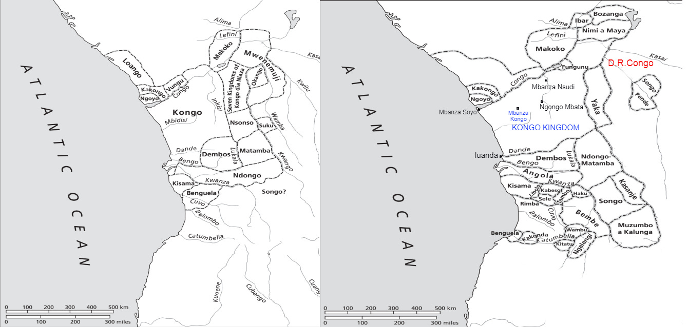
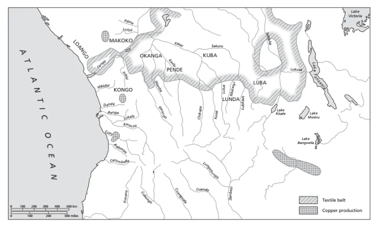
I understand that this map is from Portuguese colonization period but is there room for some of there kingdoms in a form of SOPs at least?
1550 abd 1650
1747469208812.png

1747469101961.png
 
  • 2Like
  • 1
Reactions:
Sure:
View attachment 1289639

The country on Grande Comore is Bambao:
View attachment 1289640
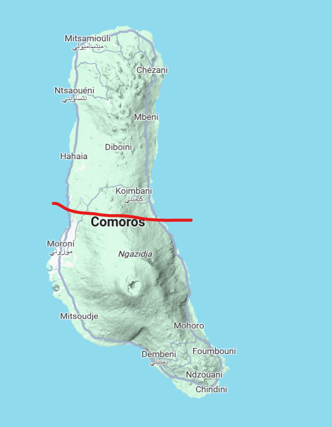
Would it be possible to split Anjouan into its two respective islands? Would it also be possible to split Grande Comore into two halfs to represent the mountain volcano in its southern half? Also im pretty sure Grande Comore is a colonial name. The indigenous name for the island in Swahili is Ngazidja

1747597164054.png
 
Last edited:
Would it be possible to split Anjouan into its two respective islands? Would it also be possible to split Grande Comore into two halfs to represent the mountain volcano in its southern half? Also im pretty sure Grande Comore is a colonial name. The indigenous name for the island in Swahili is Ngazidja

View attachment 1301881

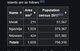
I wanted to argue to at least give each of the three/four islands each own location, but with even European location sizes rarely much under 1000 km², I agree with the current solution of making Mwali part of the Ndzwani location.

1747601981075.png


Mayotte is 374 km²
 
There seems to be a mistake. The Viye Province is not part of the Viye Area, and the Central Kongo Province is in the West Kongo Area.
 
Last edited:
  • 4
Reactions: