• We have updated our Community Code of Conduct. Please read through the new rules for the forum that are an integral part of Paradox Interactive’s User Agreement.

Roger Corominas

Captain
Paradox Staff
May 19, 2021
481
23.632
Hello and welcome to another week of Tinto Maps Feedback, in which we will take a look at China!

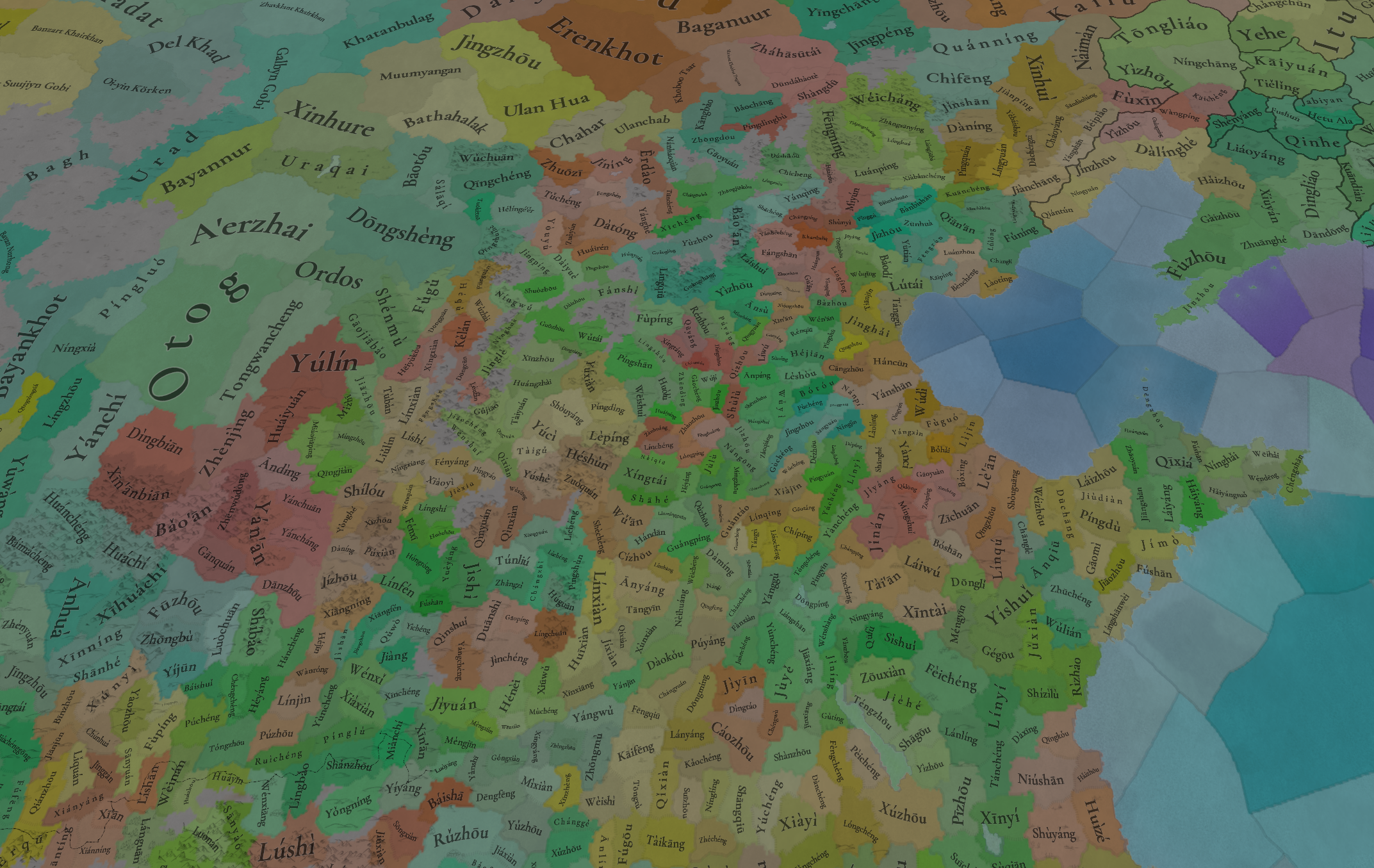
This area has received quite a bit of changes, although the locations themselves have not been touched that much. One change that we still have in the plans to do is to update all location names to use the names of the counties instead of the county seats, as, after the feedback we received, we agree that this is the best way to name locations in China. However, it’s a long list of names that we have to check and change, so it will take a while to do it all. To that effect, we would appreciate any help you can give us by providing lists of the current names of locations and the county name they should use instead. We are aware that there were already many suggestions for name changes in the first Tinto Maps, and we have them already bookmarked, but any further suggestions and feedback will be equally appreciated, and even more if ‘compilations’ of county names by provinces/areas are made.

Now, let’s look at what has changed:

ADDITIONS
Added the following:
  • Locations
    • Qídōng
    • Dépíng
    • Tángyì
    • Cháochéng
    • Geshitsa
    • Kazhi
    • Gurkyang
  • Lakes
    • Hala Nur
    • Jūyán Sea
    • Qīngtǔ Lake
  • TAGs
    • Möng Hkeng
    • Möng Hten
    • Möng Ting
    • Möng Ngüm
    • Möng Hsa
    • Möng Wo
    • Möng Ku
    • Yuánjiāng
    • Niuwu
    • Níngyuǎnzhōu
    • Nalou
    • Yánjǐng
    • Běishèng
    • Yáo'ān
    • Hèqìng
    • Ānnán
    • Āníng
    • Mílè
    • Jiànshuǐ
    • Shípíng
    • Níngzhōu
    • Luóluósī
    • Chāngzhōu
    • Xianlong
    • Wǔdìng
    • Réndé
    • Dōngchuān
    • Gyelthang
    • Yongning
    • Tiānquán
    • Muchi
    • Wēimào
    • Tsakho
    • Sōngpān
    • Lóngzhōu
    • Mínzhōu
    • Táozhōu
    • Khagya
    • Hézhōu
    • Jīshízhōu
    • Biri
    • Renamed Chakla to Minyag
    • Removed Ngapa
  • Cultures
    • Renamed Dōngběi to Yān
    • Renamed Jiāoliáo to Jiāodōng
    • Renamed Lányín to Liáng
    • Renamed Hak-kâ to Kèjiā
    • Renamed Xīnán to Shǔ
    • Renamed Yuè to Yuèhǎi
    • Renamed Miao to Hmong
    • Renamed Mien to Yáo
    • Added:
      • Liáodōng
      • Huáihǎi
      • Qín
      • Tàizhōu
      • Chǔ
      • Chángdé
      • Yuè
      • Xuānzhōu
      • Wùzhōu
      • Qúzhōu
      • Chúzhōu
      • Jiāngshān
      • Táizhōu
      • Ōuhǎi
      • Túnxī
      • Jìxī
      • Qíwù
      • Xīnxiāng
      • Lǎoxiāng
      • Xiāngxī
      • Yǒngzhōu
      • Héngzhōu
      • Wǎxiāng
      • Huìzhōu
      • Dōngjiāng
      • Fúzhōu
      • Fúníng
      • Mánjiǎng
      • Xīnghuà
      • Mǐnnán
      • Cháozhōu
      • Fúlǎo
      • Léizhōu
      • Qióng
      • Cūnhuà
      • Jiànníng
      • Xīnhuì
      • Málǎo
      • Huàzhōu
      • Gāozhōu
      • Wúchuān
      • Yángjiāng
      • Guǎngxìn
      • Tǔbái
      • Yùlín
      • Dānzhōu
      • Mài
      • Guìběi
      • Guìnán
      • Bo
      • Gyalrong
      • Baima
  • Languages
    • Renamed Chinese to Mandarin
    • Added:
      • Chinese language family
      • Classical Chinese
      • Shǔ
      • Xiāng
      • Gàn
      • Píng
      • Yuè
      • Mǐn
      • Huīzhōu
      • Kèjiā
      • Jìn
      • Northern Mandarin dialect
      • Southern Mandarin dialect
      • Qiangic
  • Religions:
    • Split Mahāyāna into Eastern Buddhism, Tibetan Buddhism, and Sānjiào
  • Dynamic names
    • Added dynamic character names for all Chinese languages
CORRECTIONS
Locations
  • Reworked some wastelands
  • Adjusted some location shapes
  • Adjusted the Chinese coast according to feedback
Raw goods
  • Changed several Raw Goods as suggested
Terrain and Vegetation
  • Total Review
Minorities
  • Adjusted minorities with the newly added cultures

Countries:
Countries.png
Countries color.png

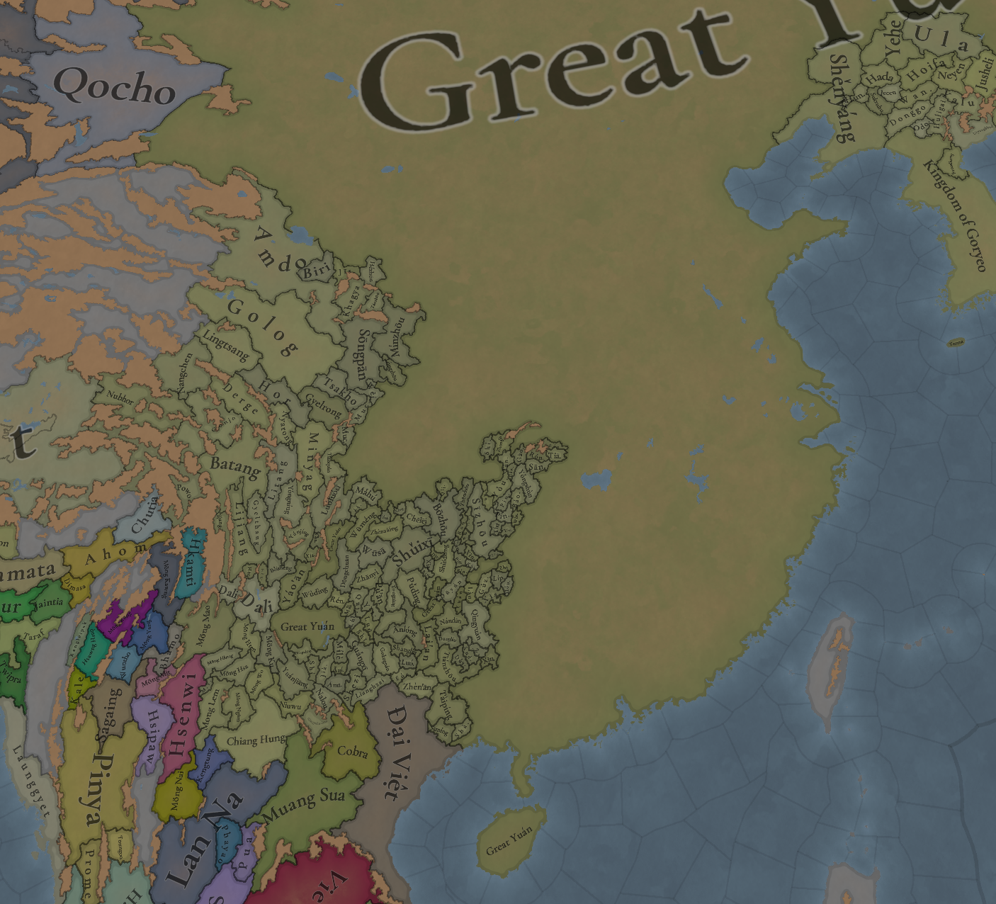
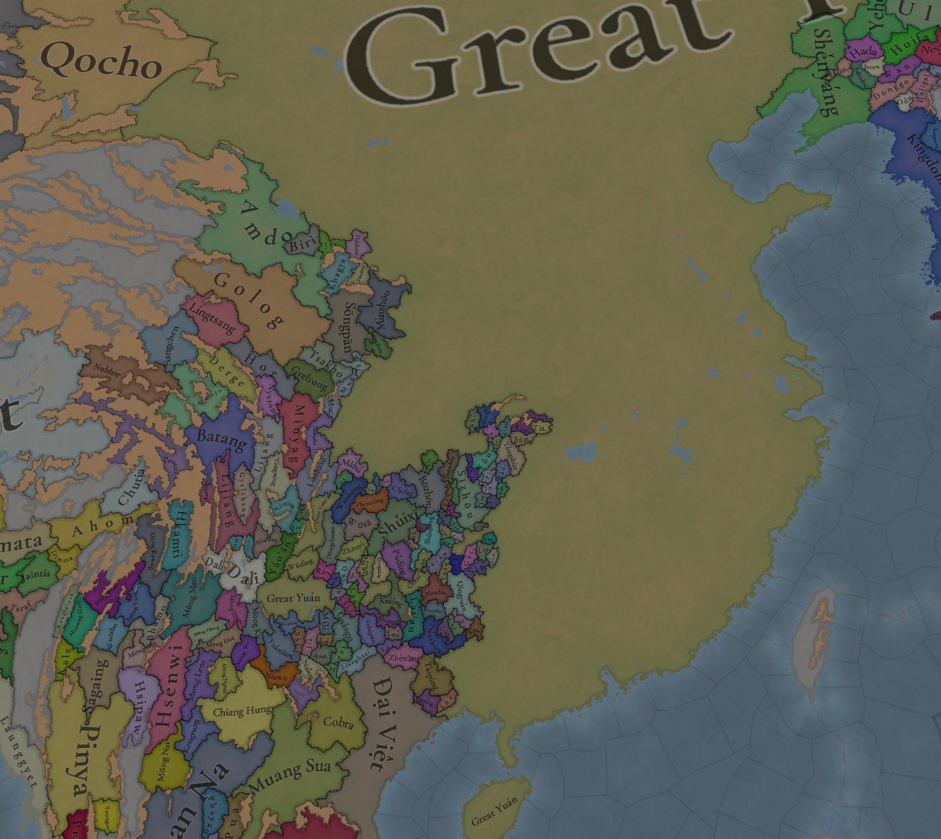
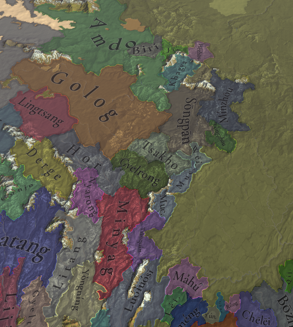
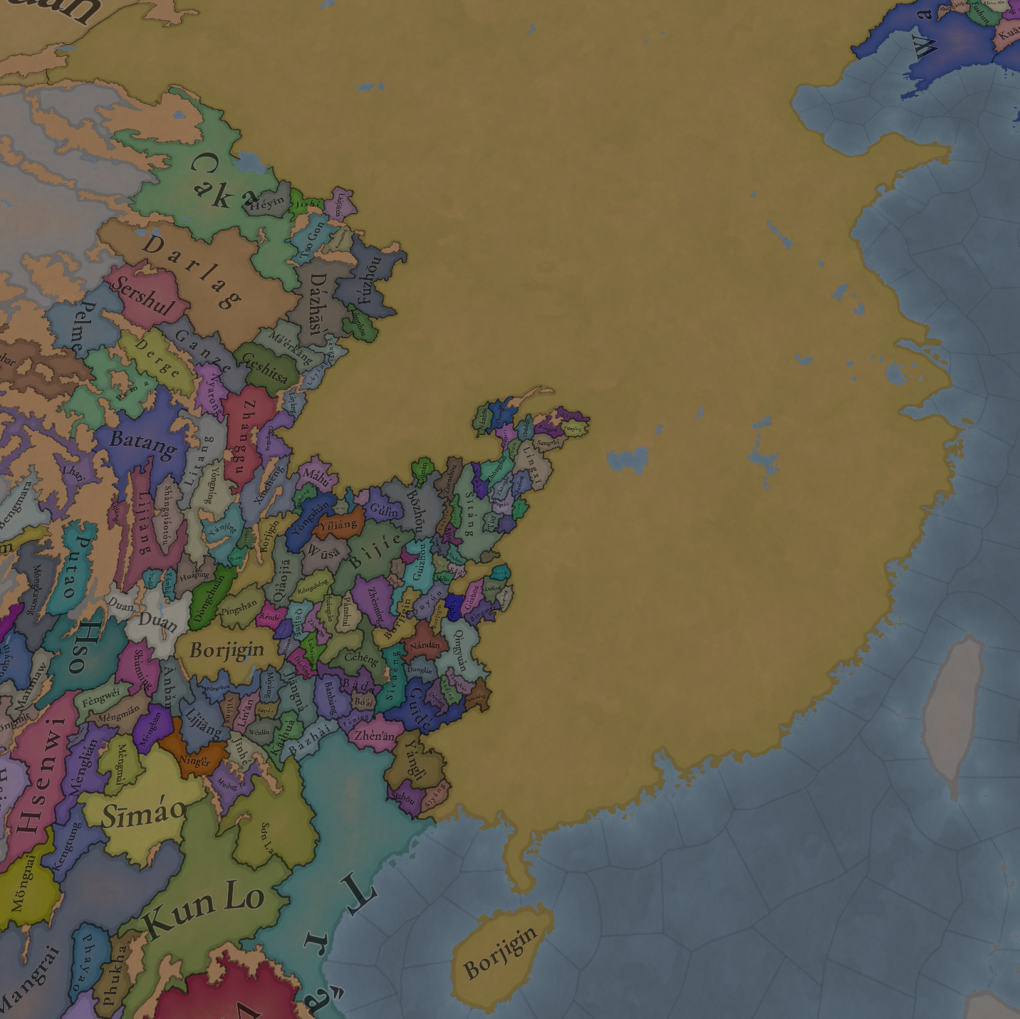
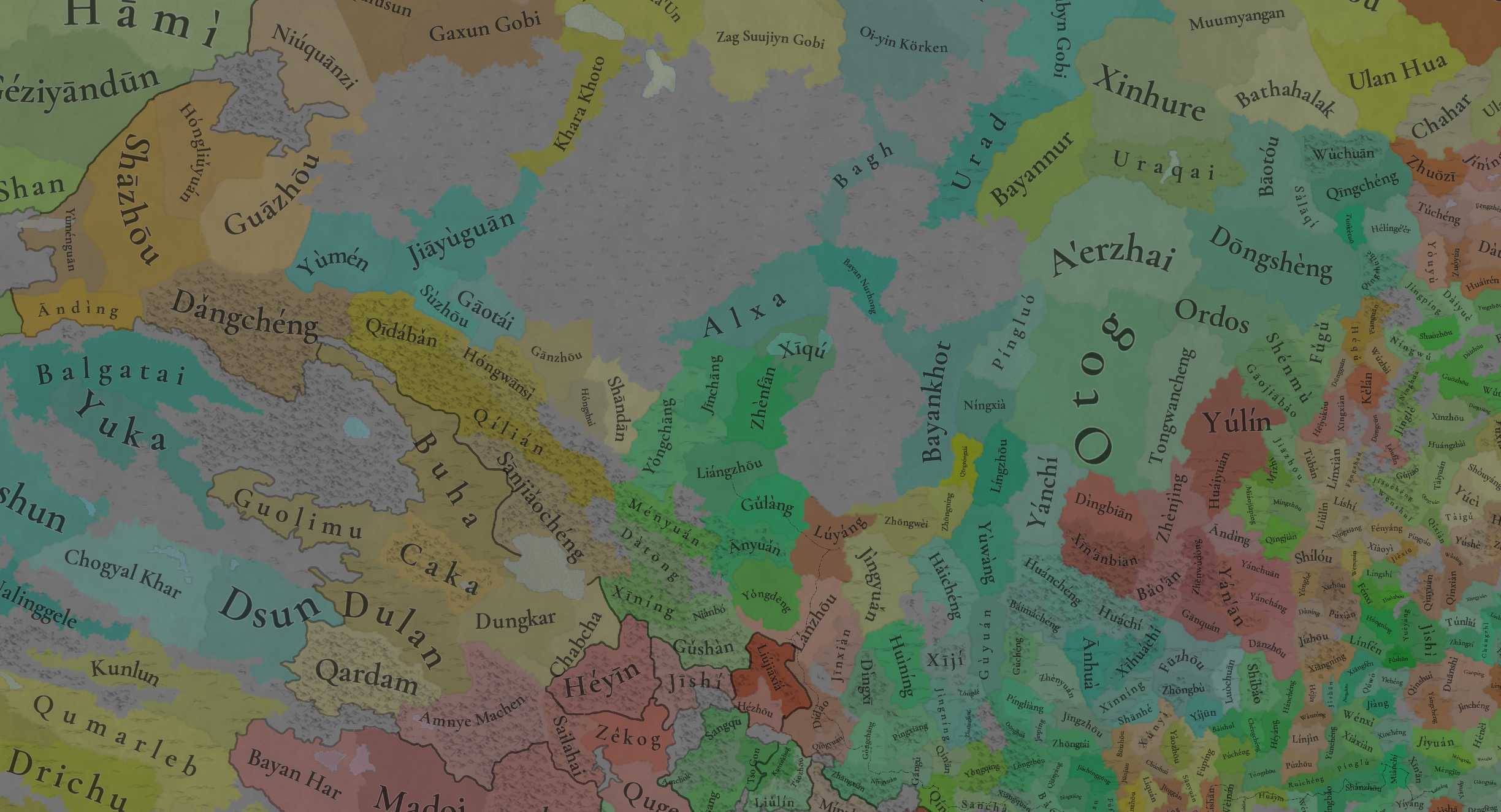
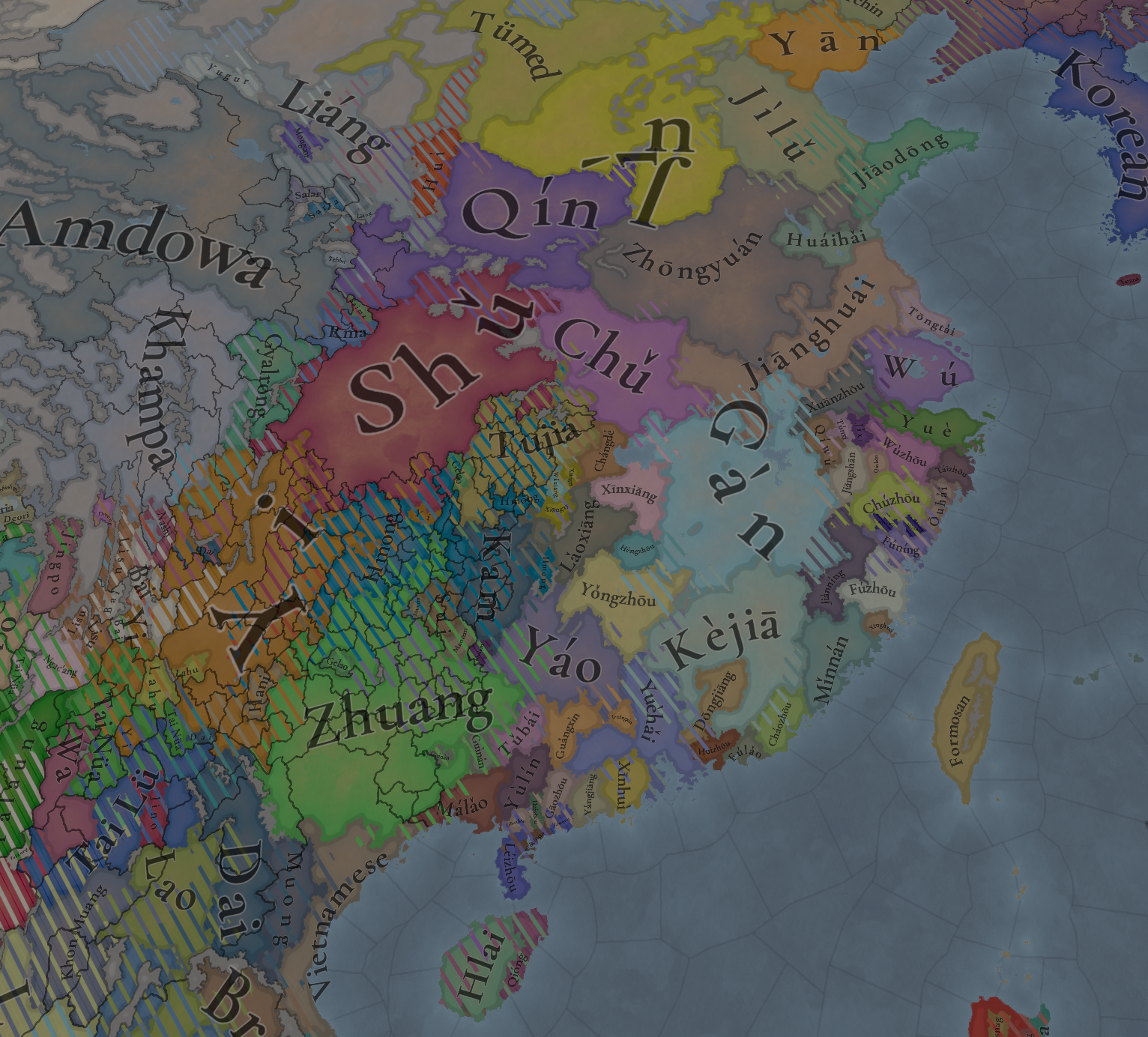
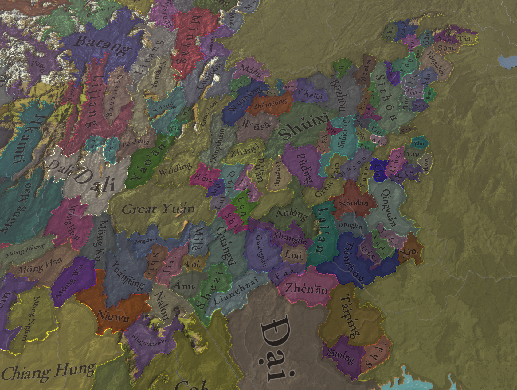
Quite a lot more to see here compared to the previous iteration. As you can see, we have added the Tusi states, which is a new type of subject, in the border towards Yunnan.
Countries zoom 1.png
Countries zoom 2.png

Dynasties:
Dynasties.png

Societies of Pops:
SoPs.png

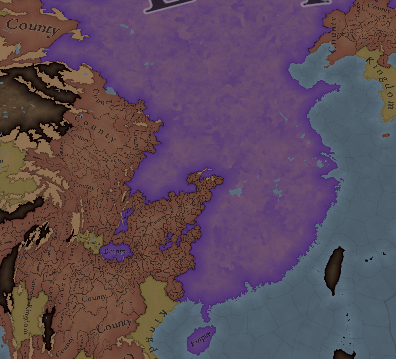
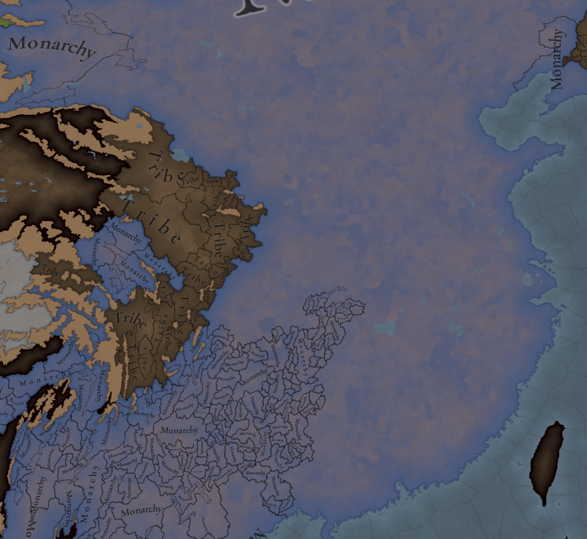
Country ranks and Government Types:
Country ranks.png

Government Types.png

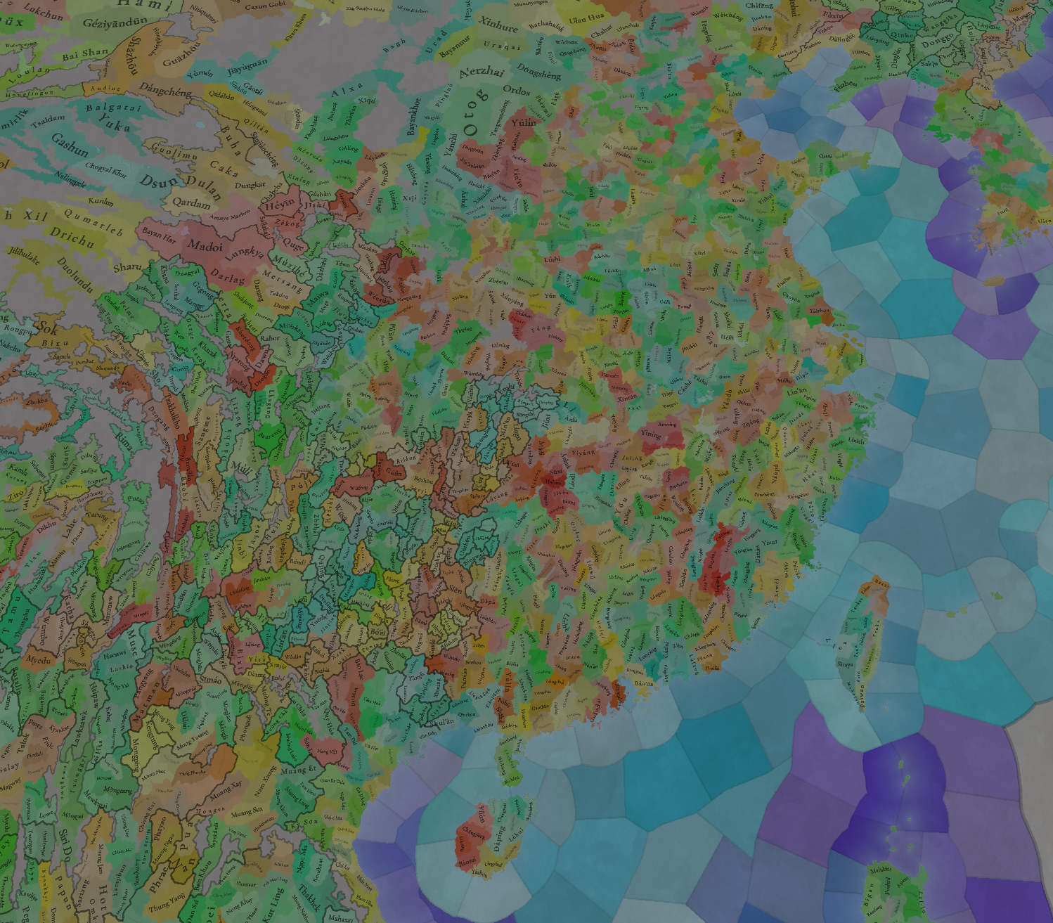
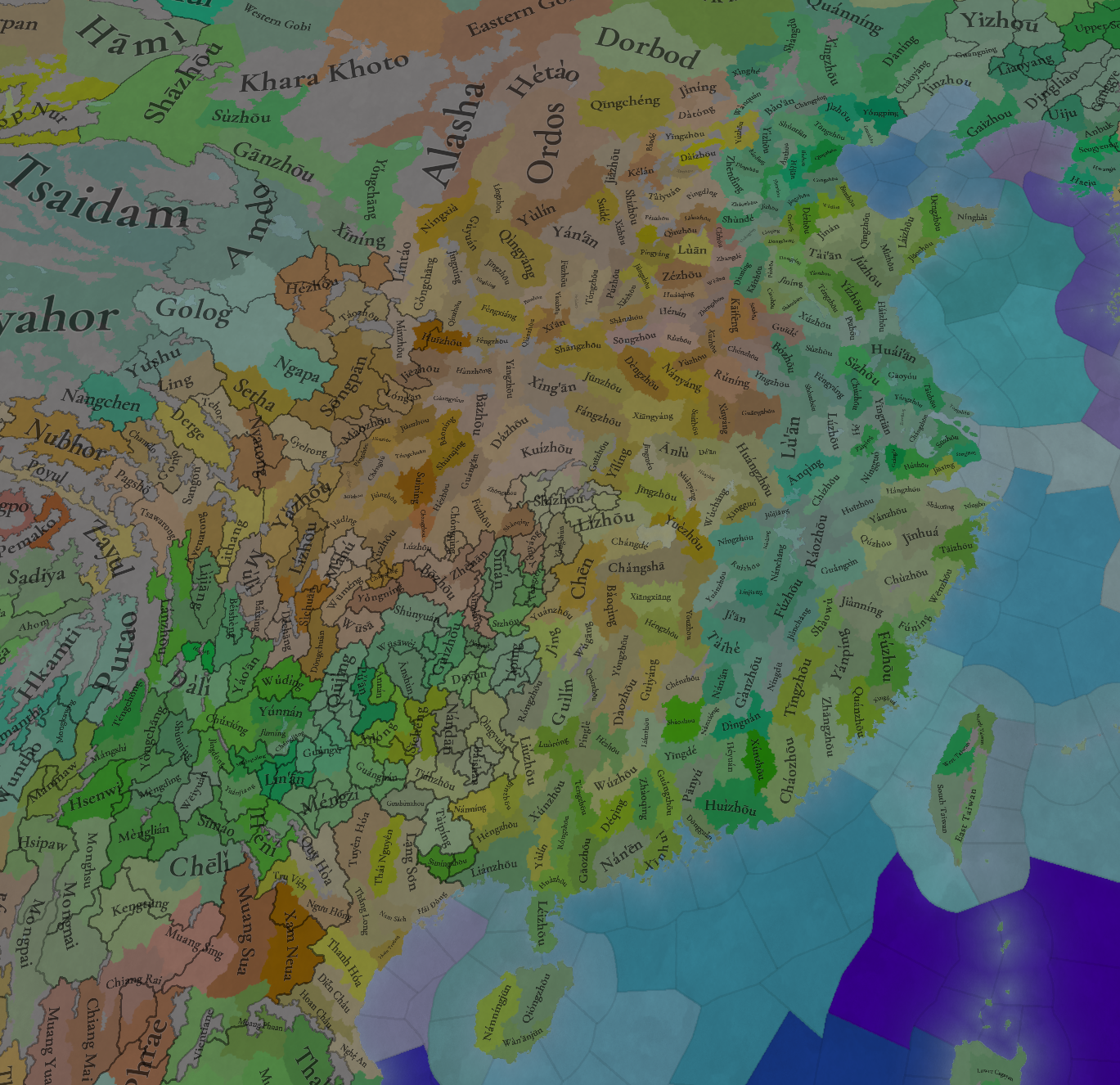
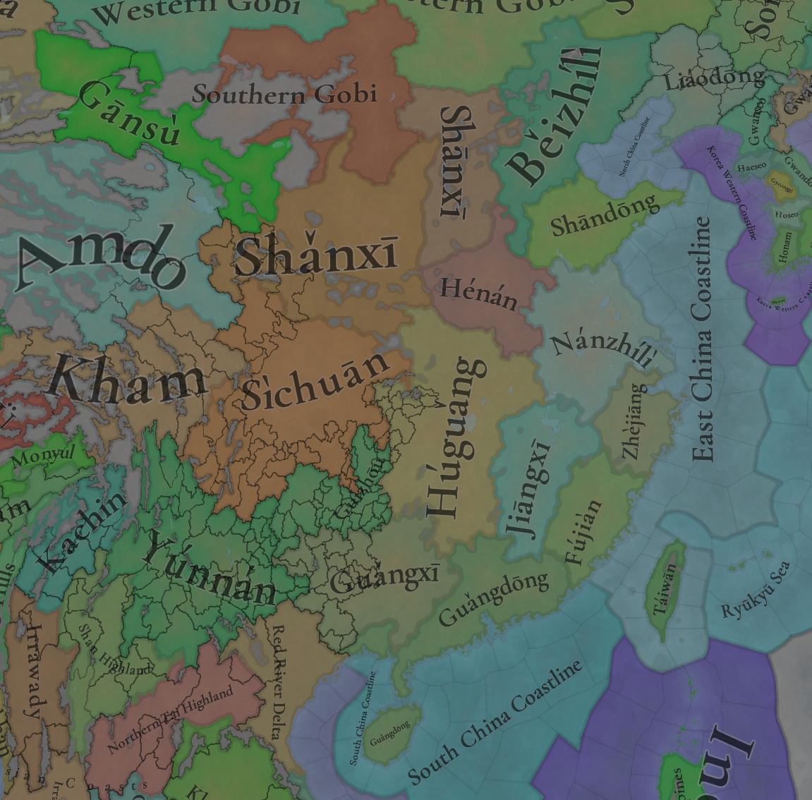
Locations
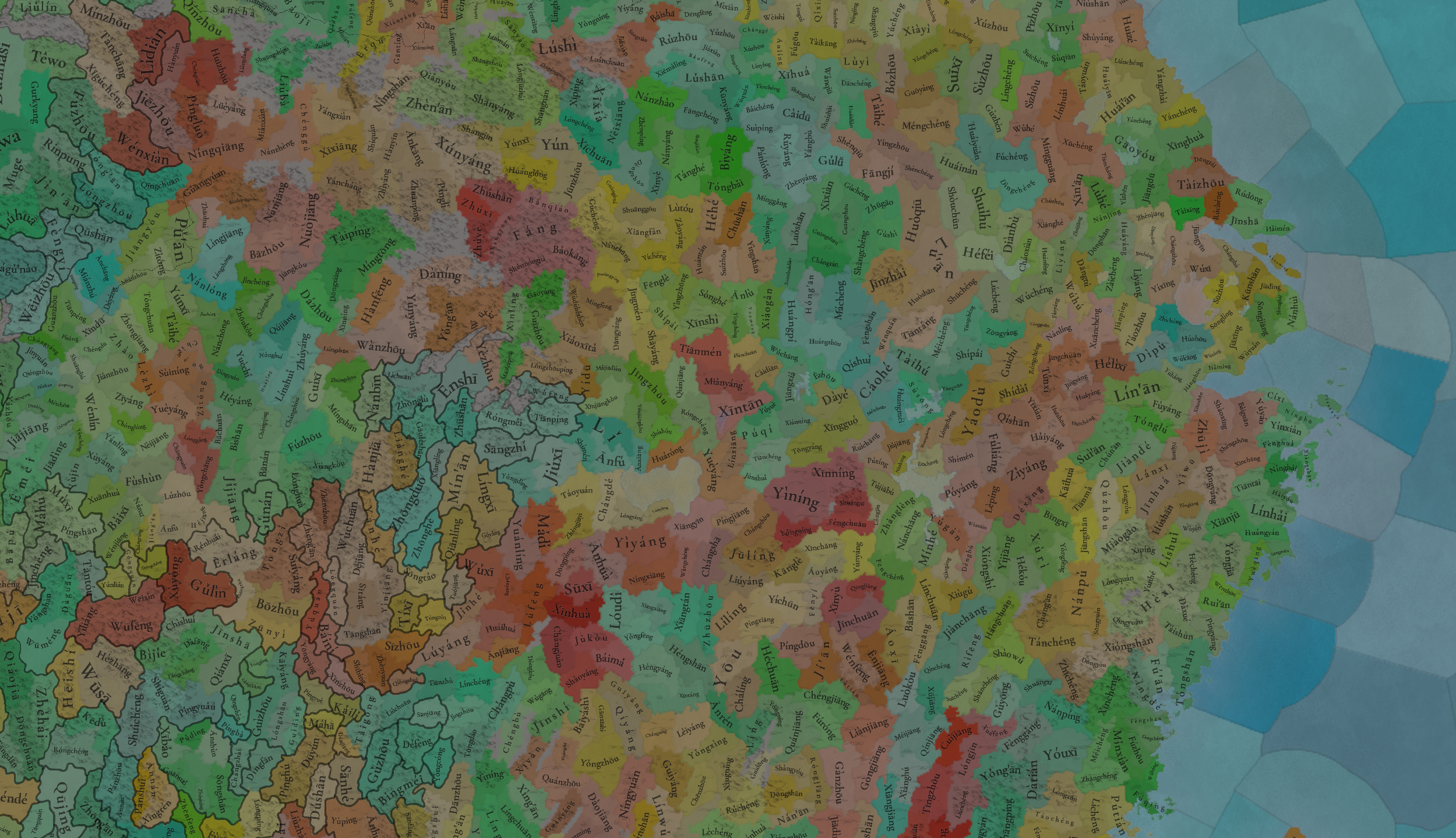
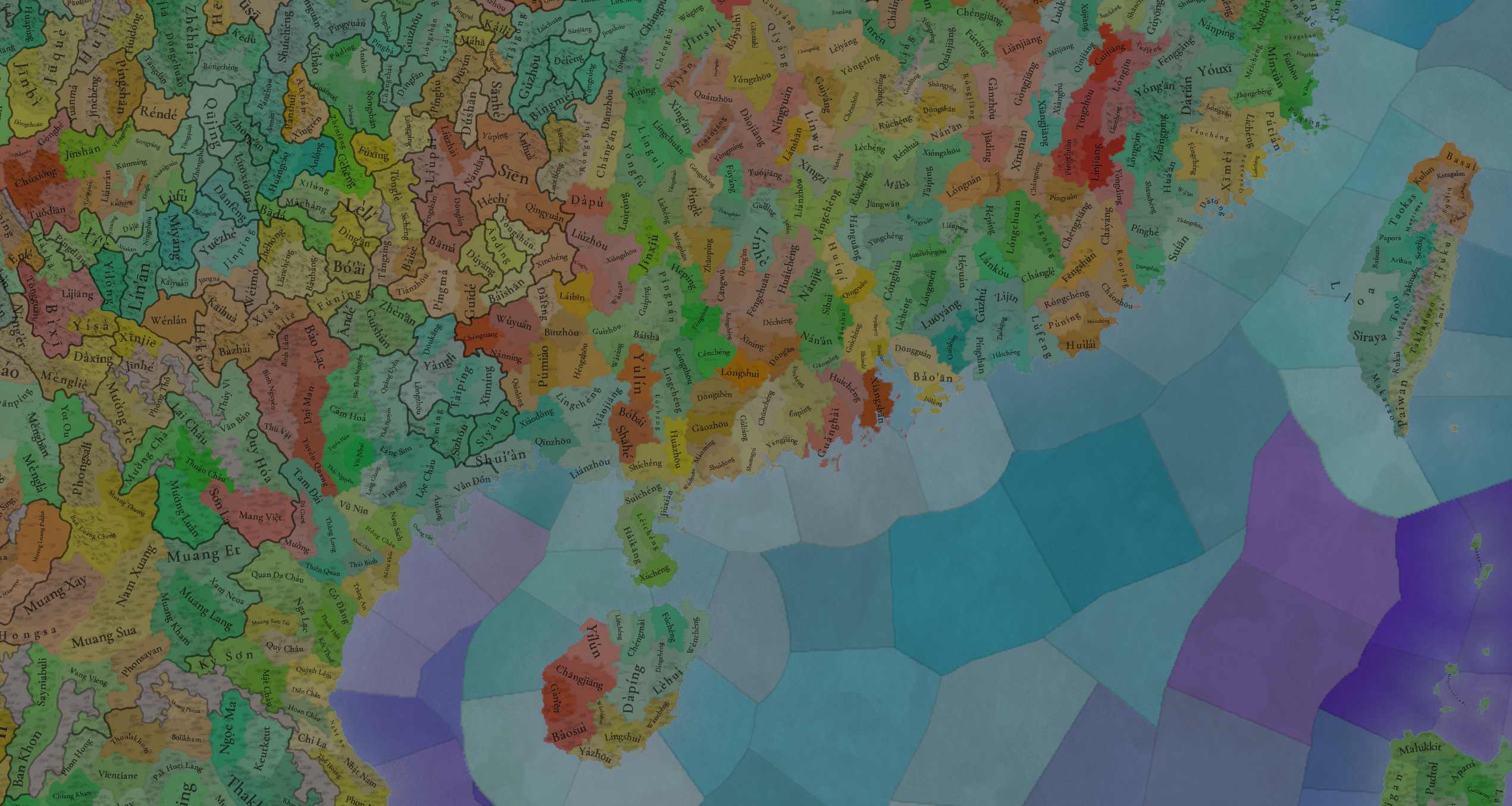
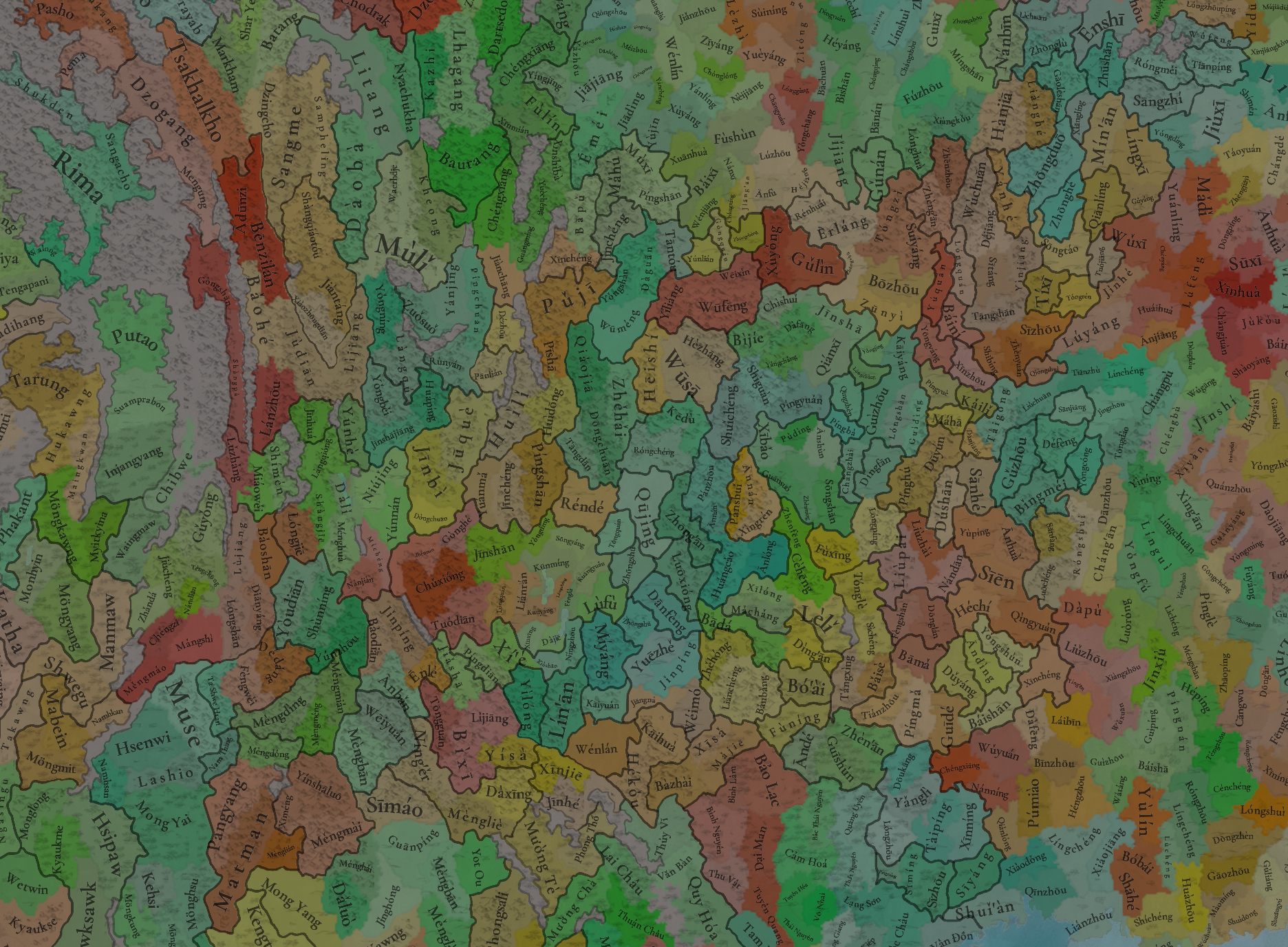
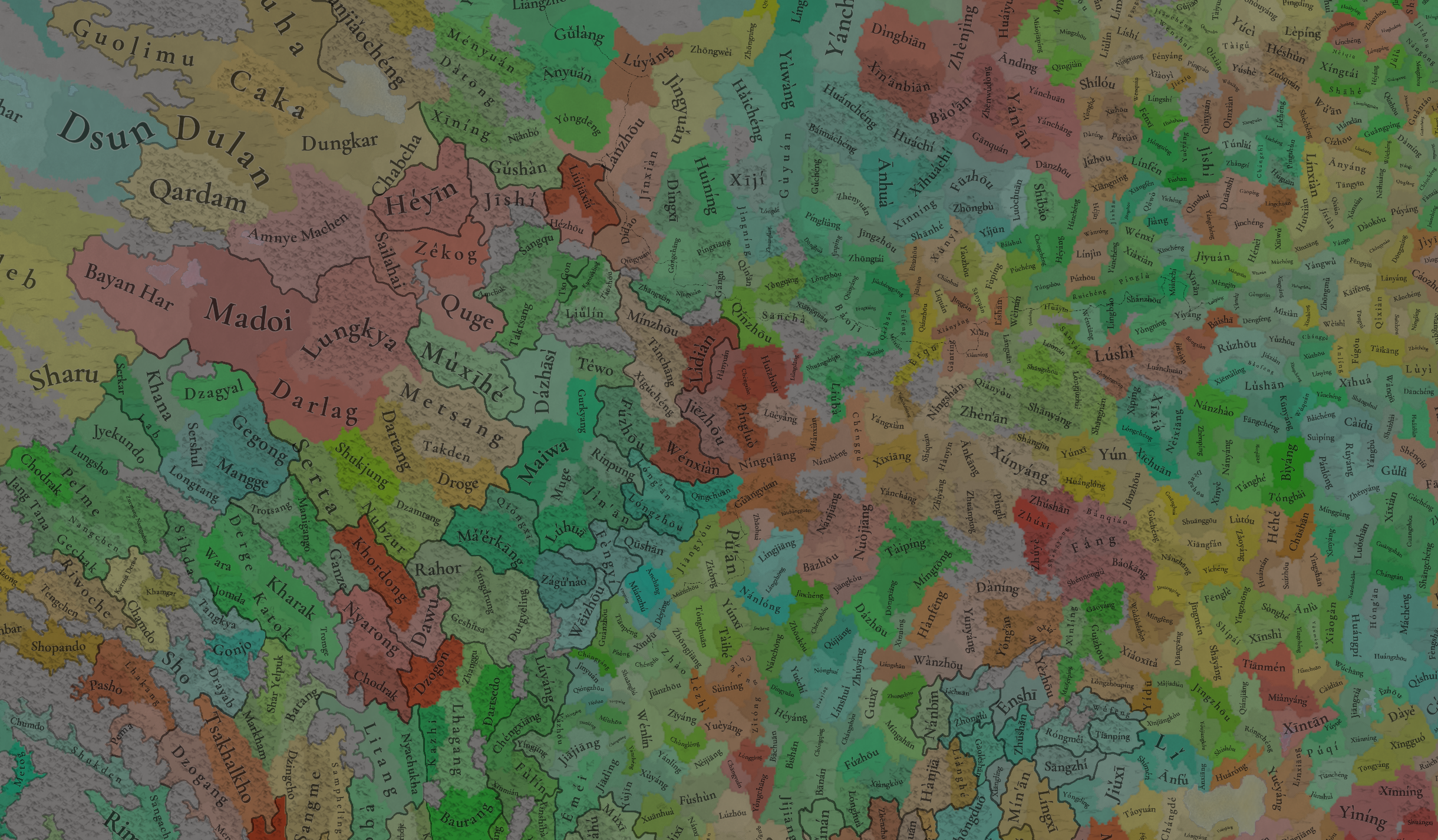
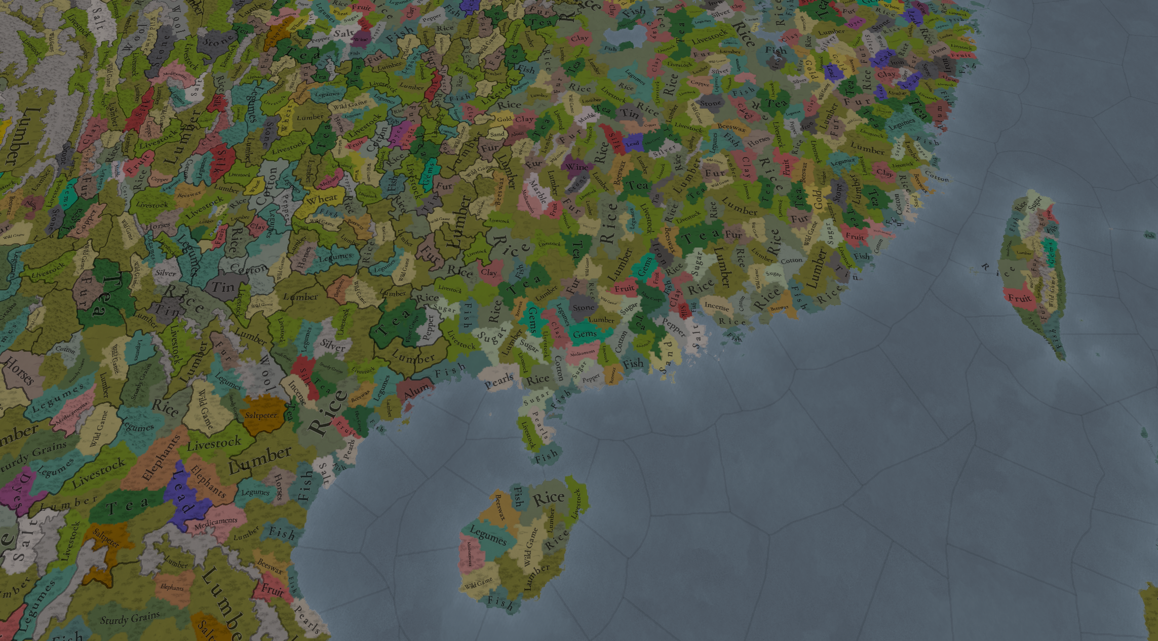
Locations.png

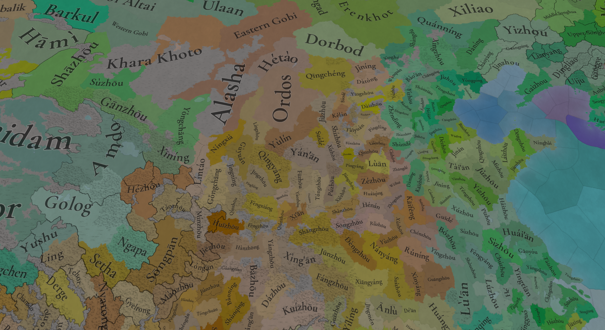
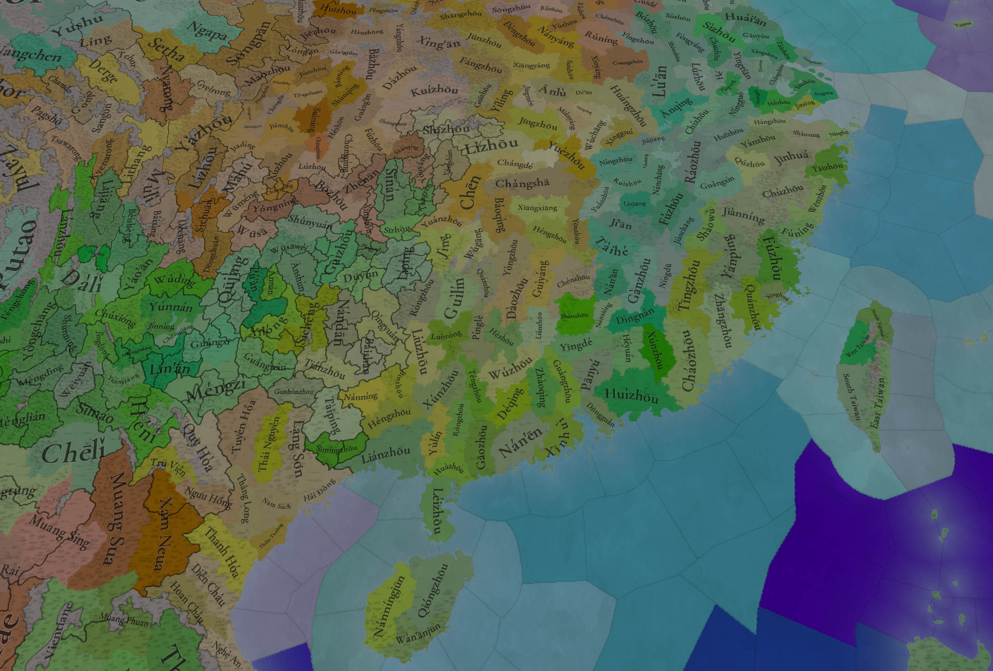
As I said, not much substantial changes here, but some small touches here and there.
Locations zoom 1.png
Locations zoom 2.png
Locations zoom 3.png
Locations zoom 4.png
Locations zoom 5.png
Locations zoom 6.png
Provinces:
Provinces.png
Provinces zoom 1.png
Provinces zoom 2.png

Areas:
Areas.png

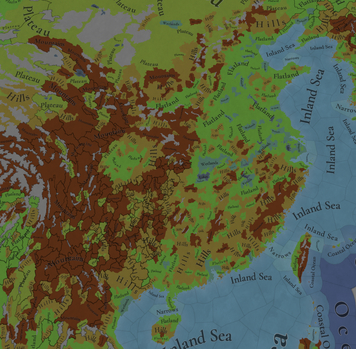
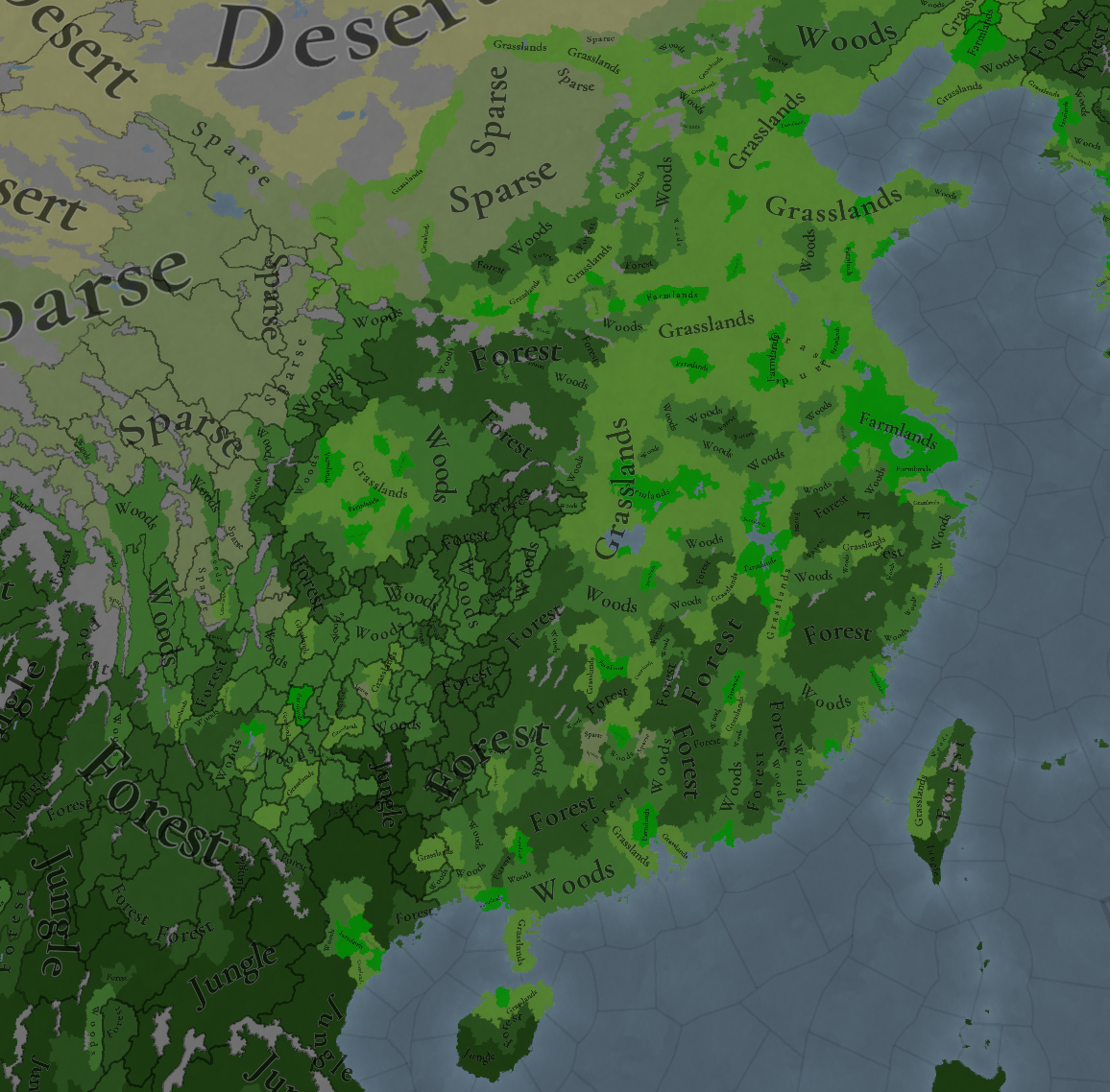
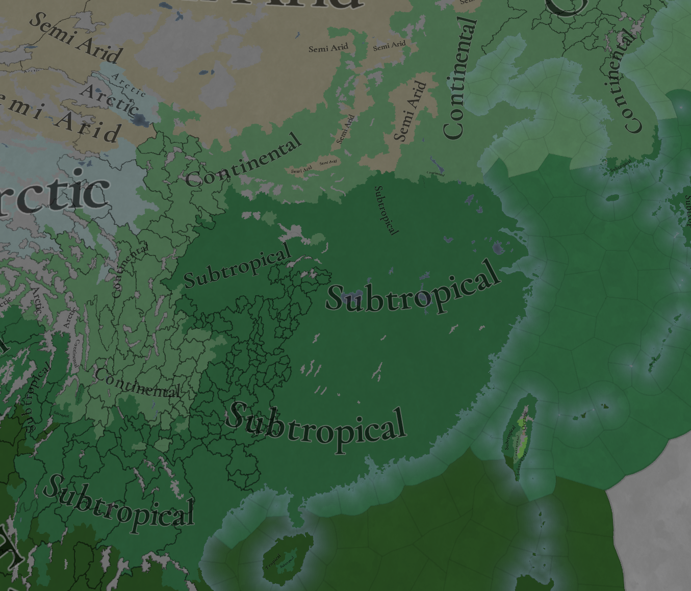
Terrain:
Topography.png
Vegetation.png
Climate.png

Development:
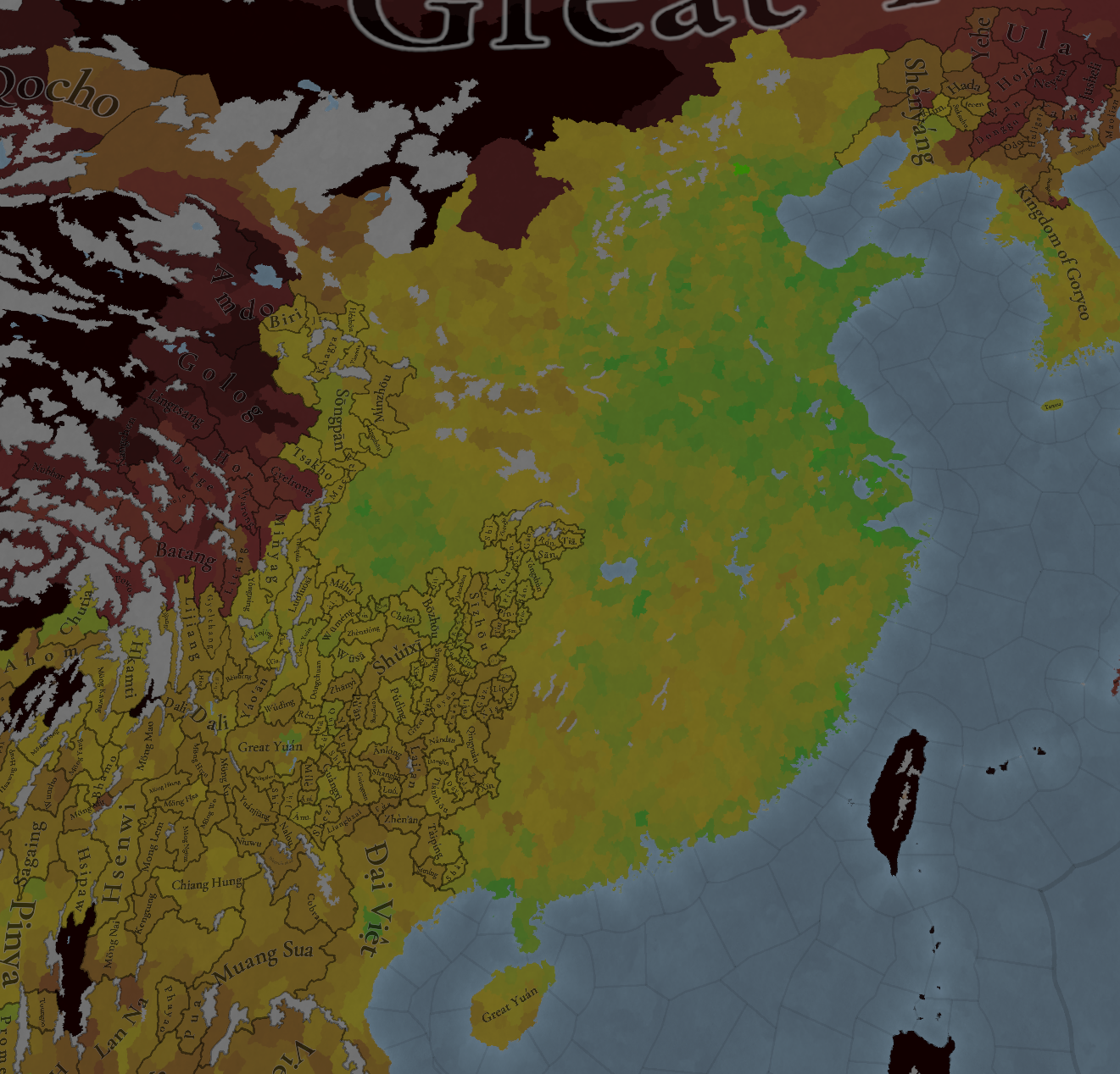
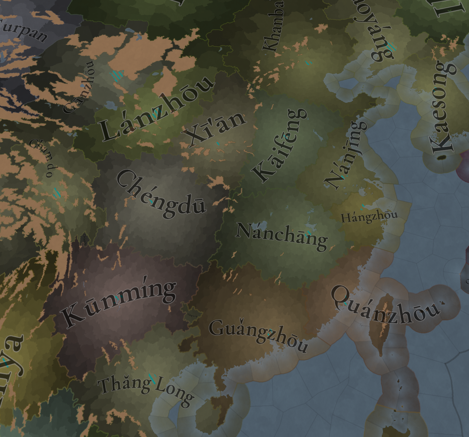
Development.png

There are some pending adjustments towards making the division between the ‘core’ China region and the northern provinces less steep; we’re holding them a bit, until we complete the final regional division divide (which will be soon).
Harbors:
Natural Harbors.png

Cultures:
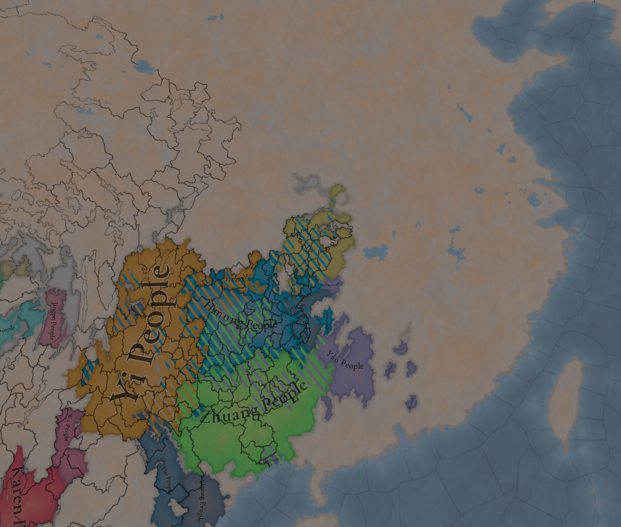
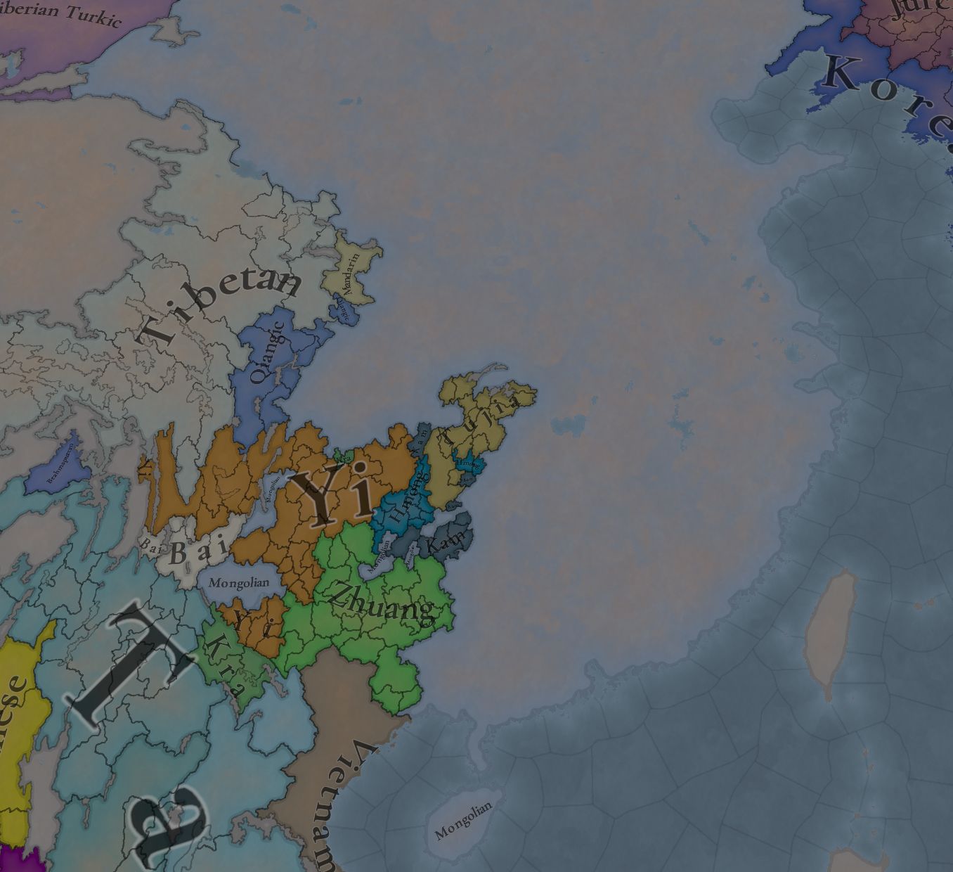
Cultures.png

China had quite a bit of cultures before the review, now it has quite a bit more, also with plenty of minorities…
Culure wheel.png

Languages
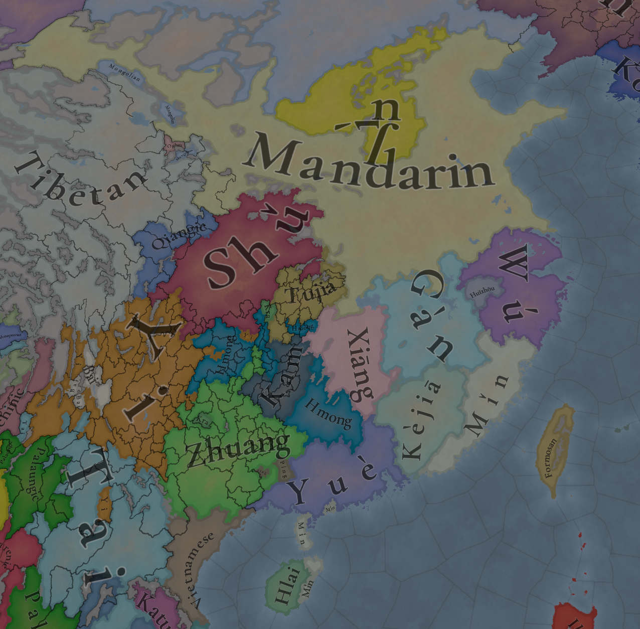
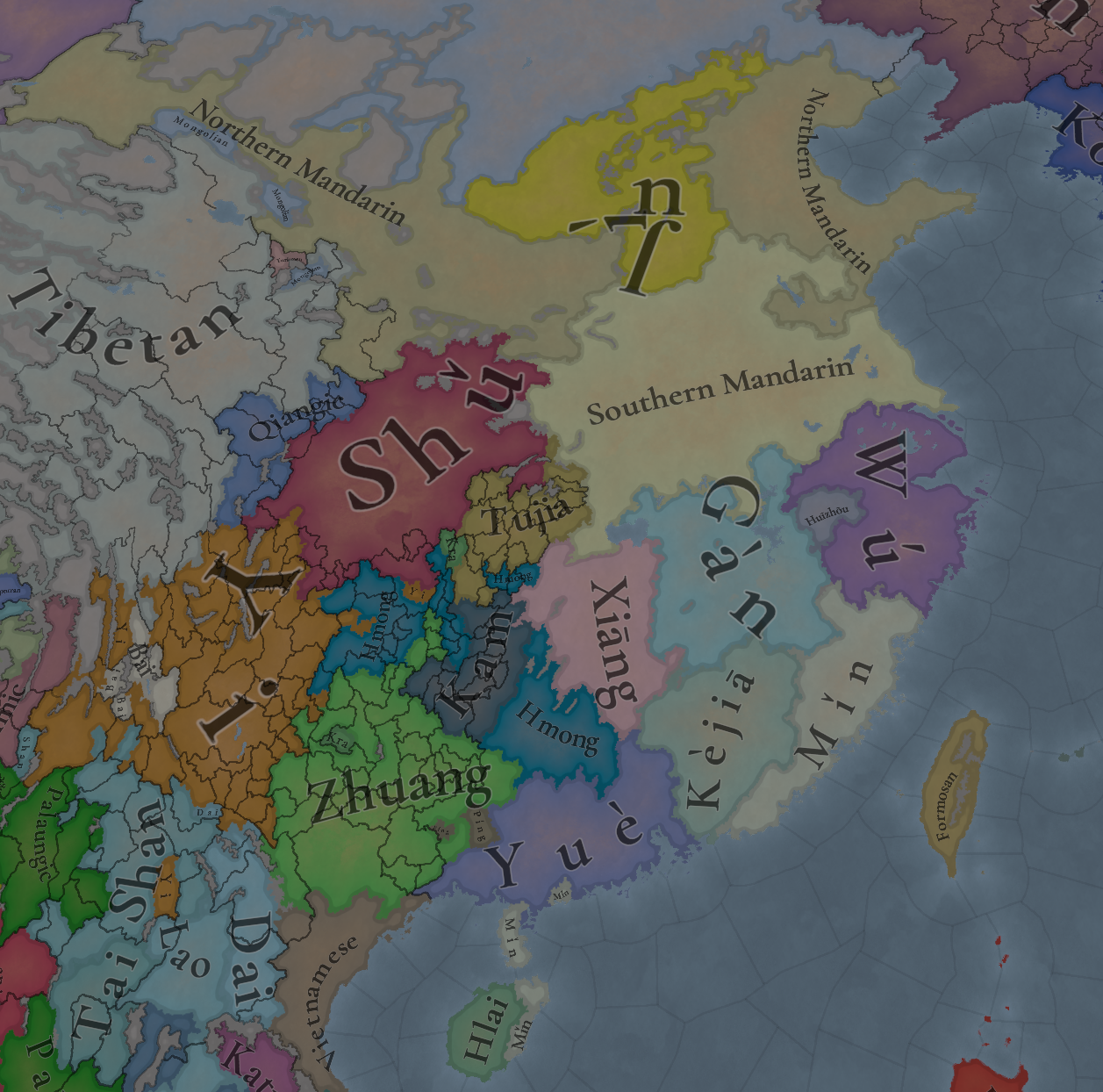
Languages.png

Location languages
Dialects.png

Location dialects
Country language.png

Country languages (the Mongolian name is not visible in main China due to it being spread all over up to the Golden Horde)
Court Language.png

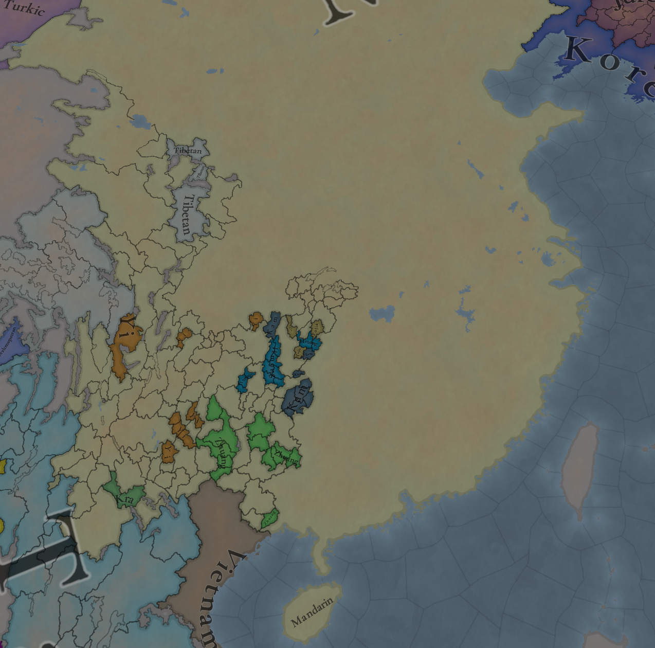
Court Languages. Mandarin is also the court language of all direct vassals of Yuán, while those using other languages are vassals of vassals.
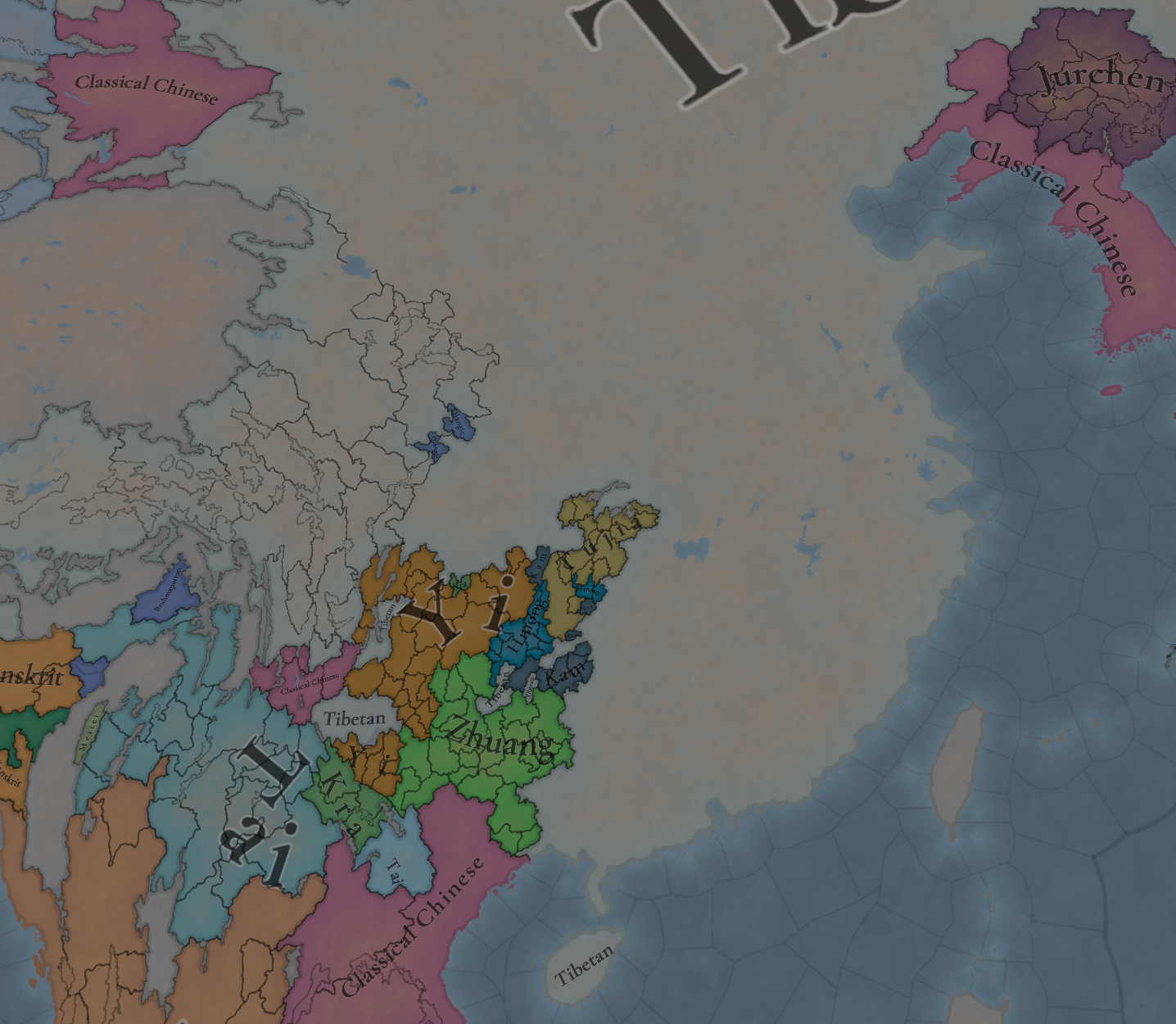
Liturgical Language.png

Liturgical Languages. Yuán starts following Tibetan Buddhism, so it uses Tibetan Language, but Eastern Buddhism as well as Sānjiào are set to use Classical Chinese.

Religion:
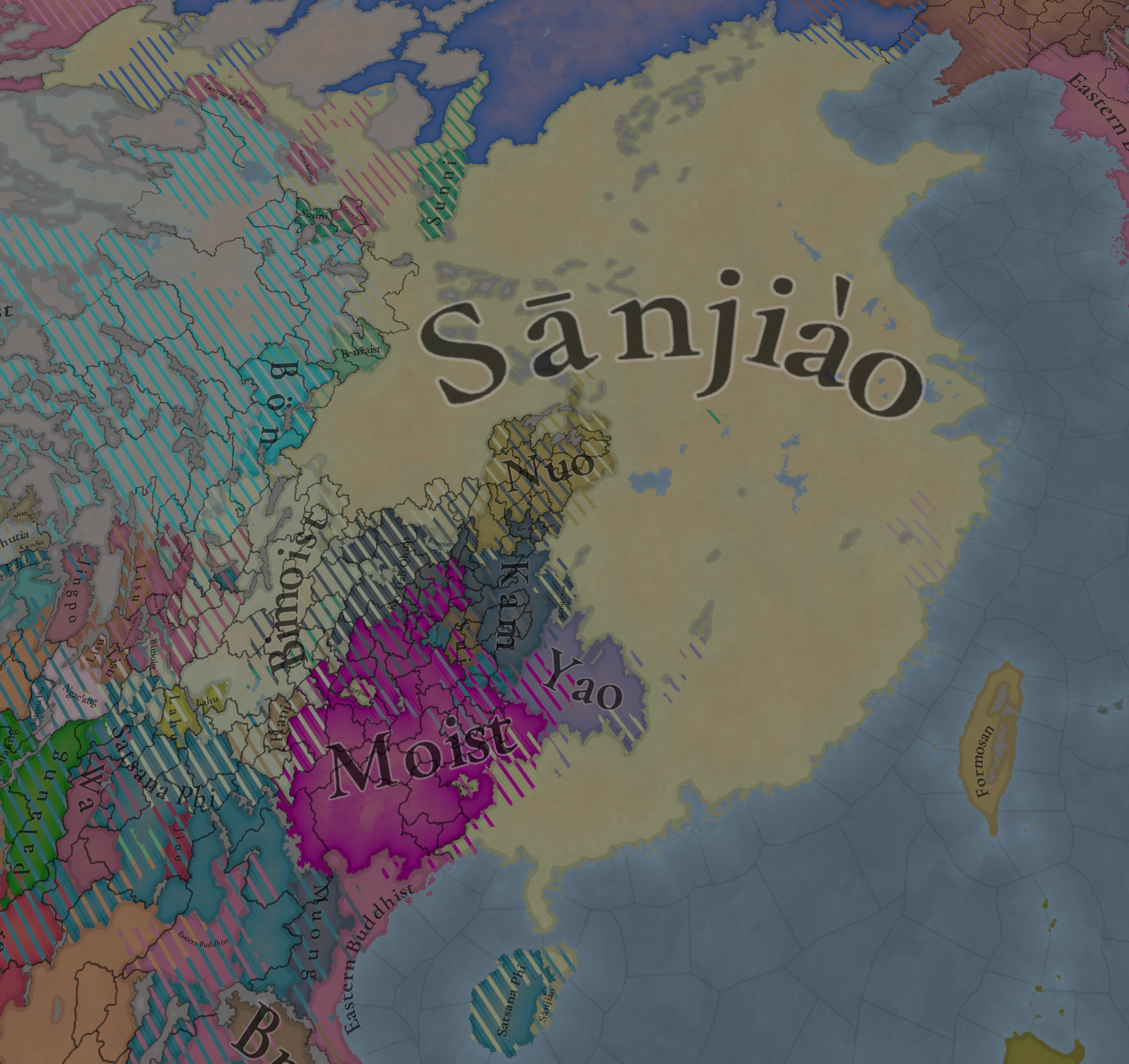
Religions.png

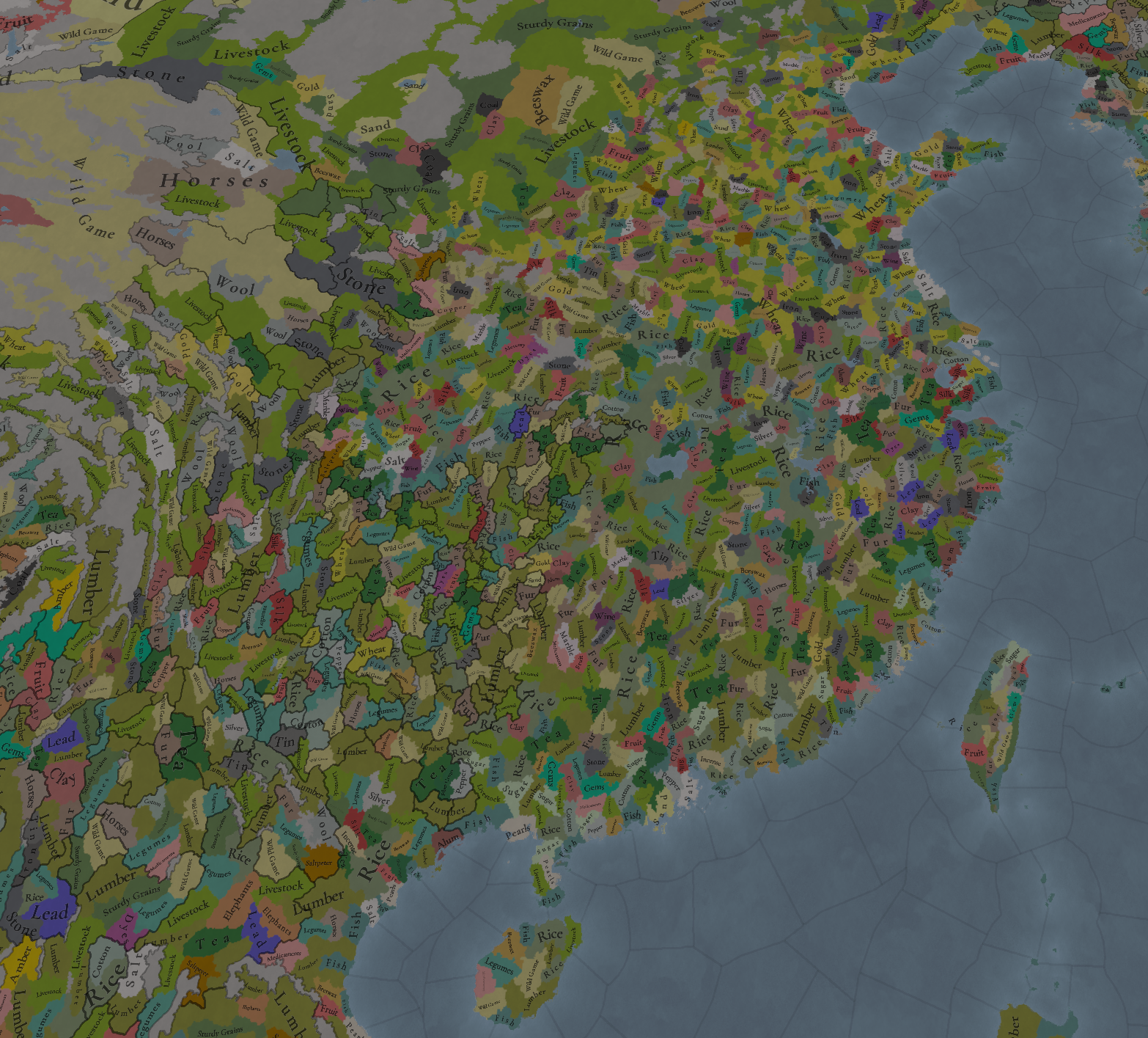
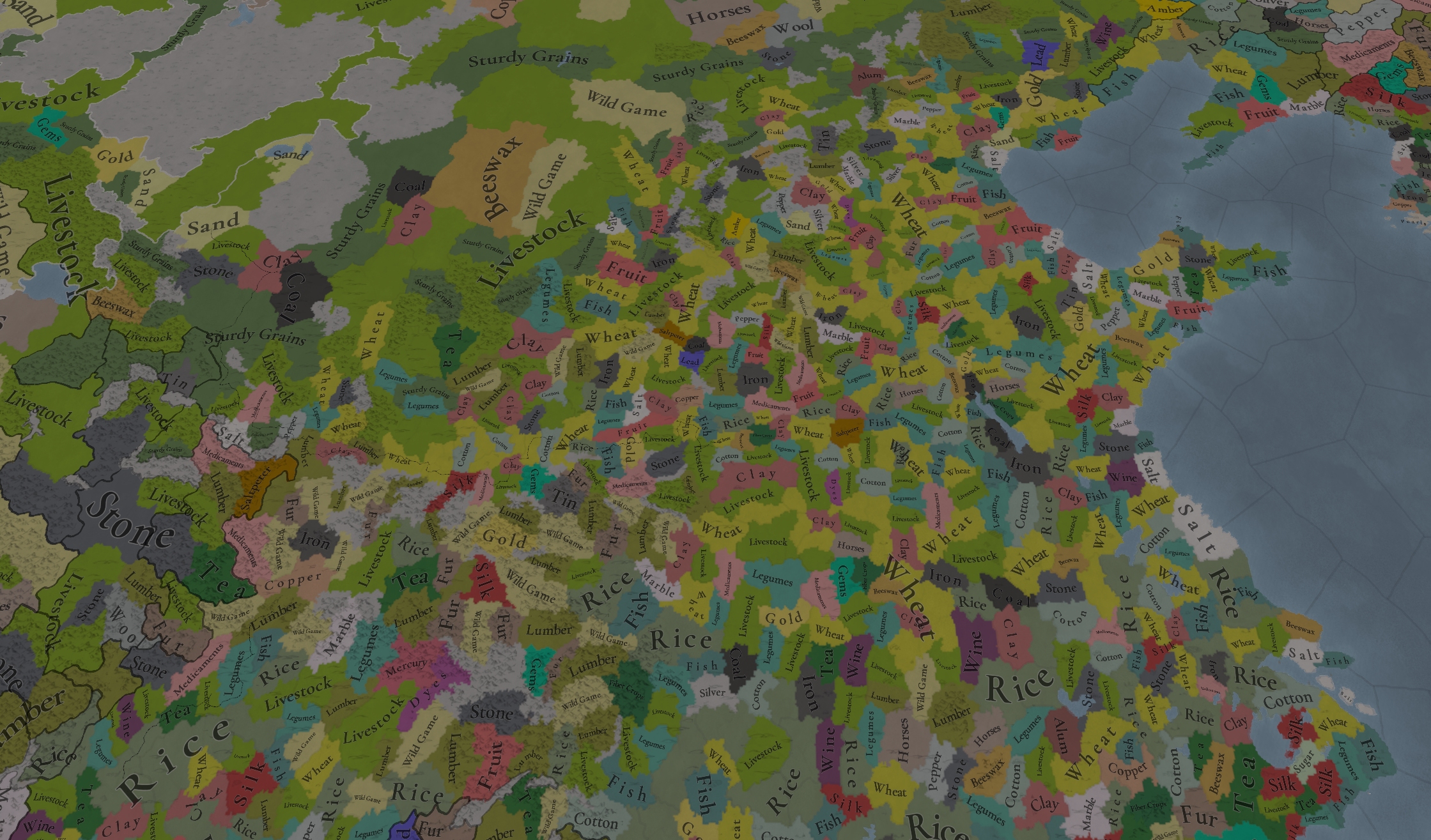
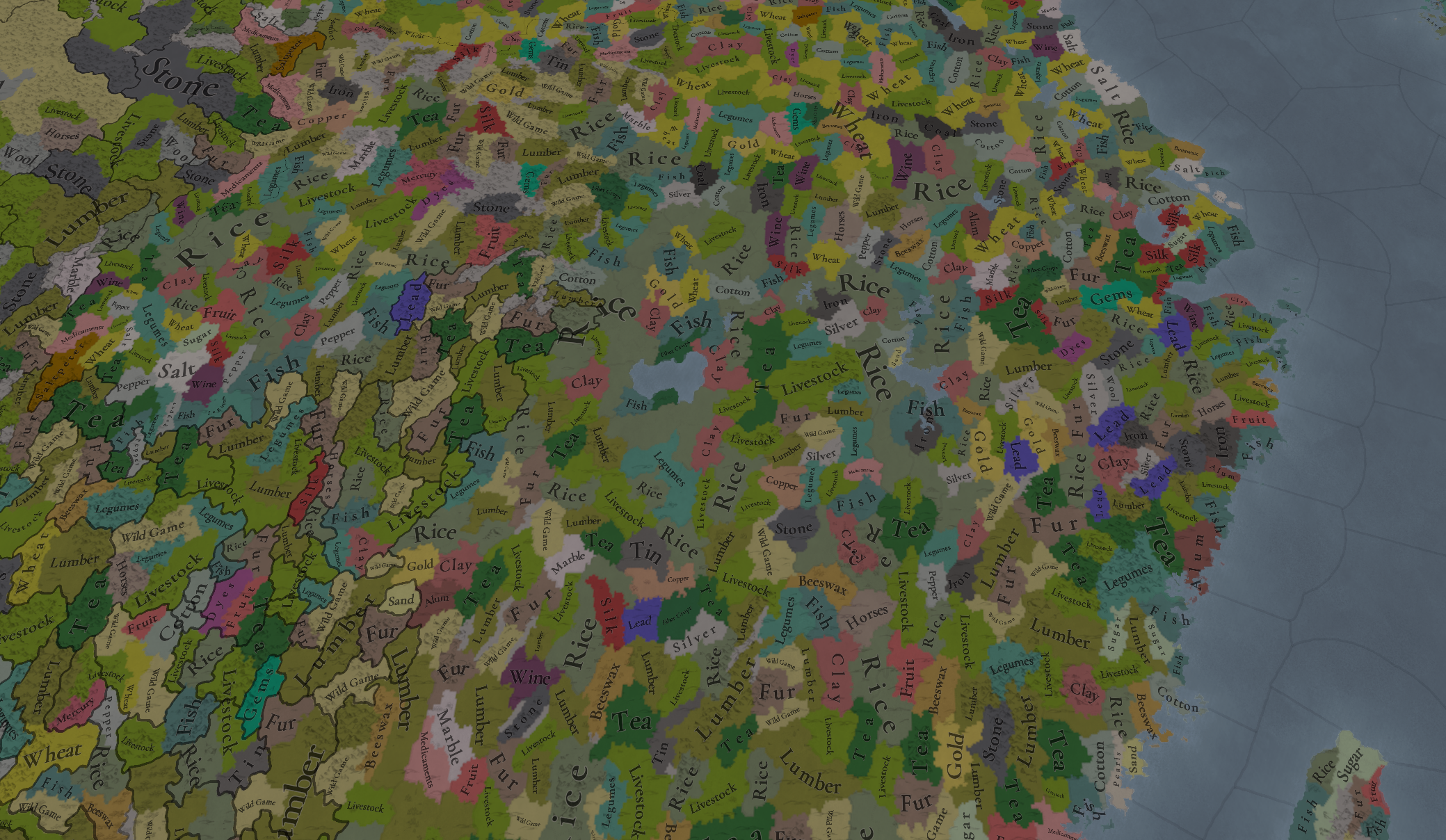
Raw Materials:
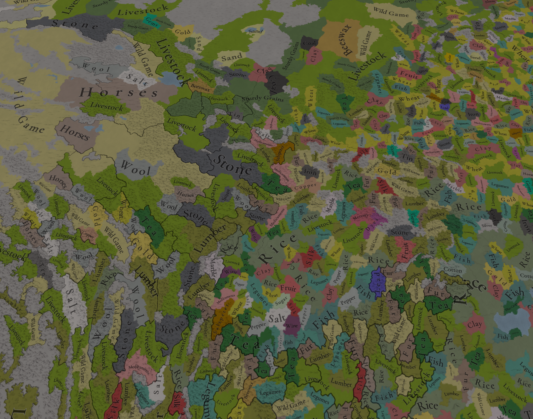
Raw Materials.png
Raw Materials zoom 1.png
Raw Resources zoom 2.png
Raw Resources zoom 3.png
Raw materials zoom 4.png

Markets:
Markets.png

And that’s all for today! Remember that we have more China-related content planned for the rest of the week:

  • Wednesday -> Tinto Talks about the mechanics for the Middle Kingdom, the Chinese Empire IO!
  • Friday -> Tinto Flavour about China

And always as a reminder: Wishlist Europa Universalis V now!
 
  • 65Like
  • 20Love
  • 3
  • 2
  • 1
Reactions:
Still waiting for some Central Europe Flavour :(
IMG_8096.jpeg
 
  • 52Haha
  • 7Like
  • 2
  • 1
Reactions:
Good job as always! I've done some research on the region so here's some stuff I found:

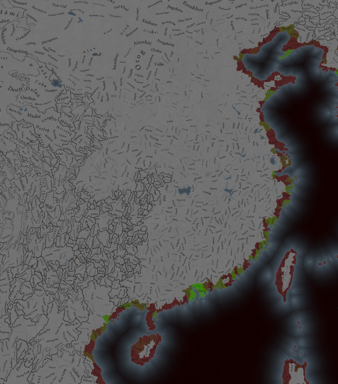
-1-Most of the coastal locations in this region present at least some minimum natural harbour features, therefore I'll list all the locations that don't: Pa'kuali', Truku, Amis, Paiwan, Babuza, Papora, Taokas, Suìchéng, Línchéng, Băosuì, Xīměi, Lìchéng, Línhăi, Cíxī, Yúyáo, Băiguān, Hăiníng, Wùyuán, Dōngtái, Xīnghuà, Huìzé, Zhāoyuăn, Dūchāng, Wéizhōu, Shòughuāng, Lè'ān, Fùguó, Wúdì, Háncūn, Lútái and Kāipíng
-2-Most if not all of the provinces and areas' names in China shouldn't have accents because they aren't used in their standard english forms(standard written english doesn't use diactrics in most cases) and because it would make for a better distinction of centain places(e.g. Shănxī should be renamed to Shaanxi), the same goes for Chinese cultures, languages(Wu, not Wú) and tags(Yuan, not Yuán) too, however they should be(and are already) used for dynamic location names like it's done everywhere else, in this case through the use of the Pinyin romanization system
-3-Due to the sheer size of China's land, resources and population I think it's better to use the Qing 18 provinces system to make up the areas of China proper, even if it was instituted towards the end of the game's timeframe, since it was just an extention of the already present Ming 15 provinces system it requires the splitting of a few areas namely Huguang(into Hubei and Hunan) and Nanzhili(into Jiangsu and Anhui), some internal adjustment between areas that are already present in game but don't properly follow their historical boarders(Gansu, Shaanxi, Yunnan, Sichuan and Guizhou) and finally give some in-game locations and provinces that were only added to the administration around the mid/late 19th century(or that were never added to begin with) to the neighbouring regions of Mongolia(give the location of Fēngzhèn together with the provinces of Qingcheng, Jining, Xinghe, Shangdu, Xingzhou, Quanning, Daning and Chaoyang), Tibet(give the provinces of Hezhou, Taozhou, Songpan and Yazhou) and Indochina(give the locations of Pangyang, Matman, Yot Ou, Muòng Te and Phong Tho)
P.s. Gansu's external borders should get some rework as well(e.g. give Hāmì province to Mongolia or Xinjiang) since they look too modern for the time period
-4-If the area of Nanzhili is split as I suggested then the area of Beizhili should just be called Zhili
Here are the maps I based this section on
Screenshot_20250720_100059_Chrome.jpgScreenshot_20250721_164752_Chrome.jpg
-5-Beside the areas I also think that regions of China proper should be reworked for the same reasons, as such I suggest creating 5 or 6 regions based on the greater administrative regions enstablished by the Chinese government in the early 50s which was in turn based on the governor-generals ruled districts in the later Qing period, these regions(based on my previous suggestions for areas) should be:
-Huabei/North region, composed by the areas of Zhili and Shanxi
-Huadong/East, composed by Shandong, Jiangsu, Anhui, Jiangxi, Zhejiang, Fujian and Taiwan
-Xinan/Southwest, composed by Sichuan, Yunnan and Guizhou
-Xibei/Northwest, composed by Gansu and Shaanxi
-Huanan/South, composed by Guangxi and Guangdong
-Huazhong/central, composed by Henan, Hubei and Hunan
The last two were administrated as a single region but I seaprated them due to their geigraphical differences, I put both names but I hope that you use the chinese names for the in-game regions rather than english ones since they are more flavourful
-6-Considering how important it was Macau should be a location even if it's too small, Gibraltar is smaller but it's present in the game with a location larger than its actual size due to its relevance in the period and I think that the same should done for Macau
-7-The Yangtze river should be sailable up to Nánjīng since it was a very important harbour during this time period and even to this day it's the largest inland port in the world
-8-Formosan culture and language should be split as they weren't the same throughout the island
-9-The Tusi should have a tribal government type
 
Last edited:
  • 19Like
  • 5
  • 1
Reactions:


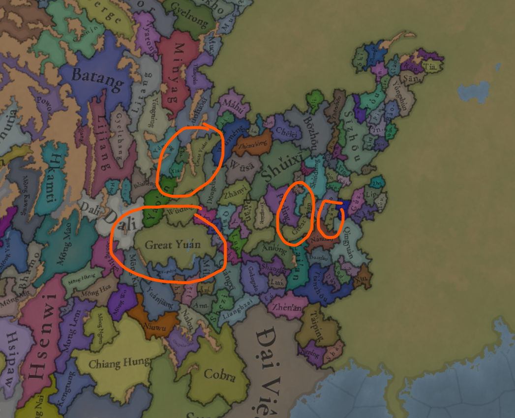
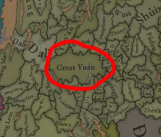
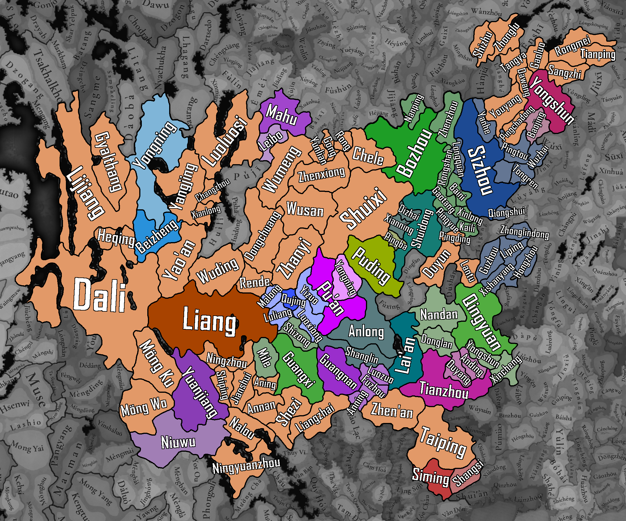
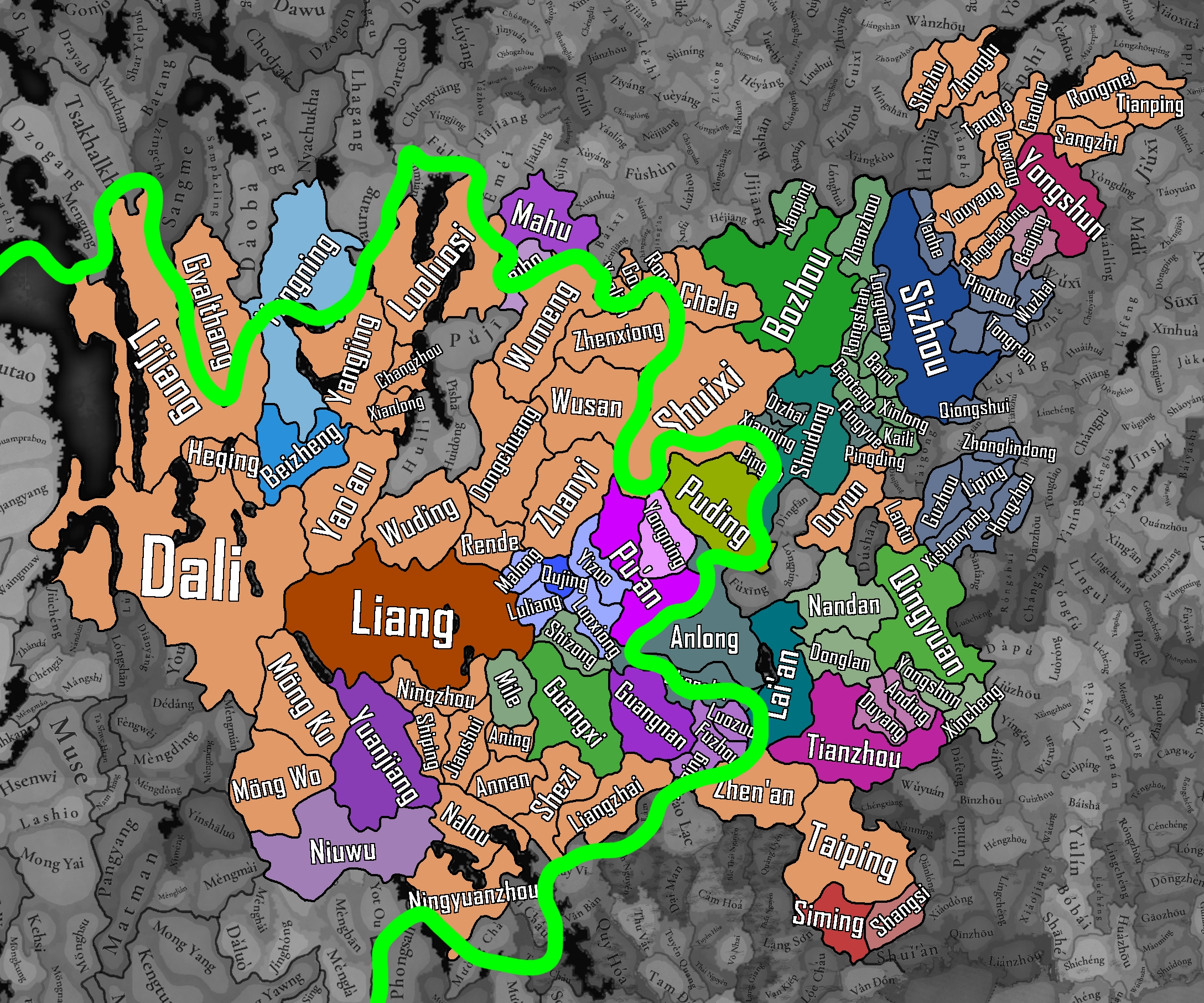
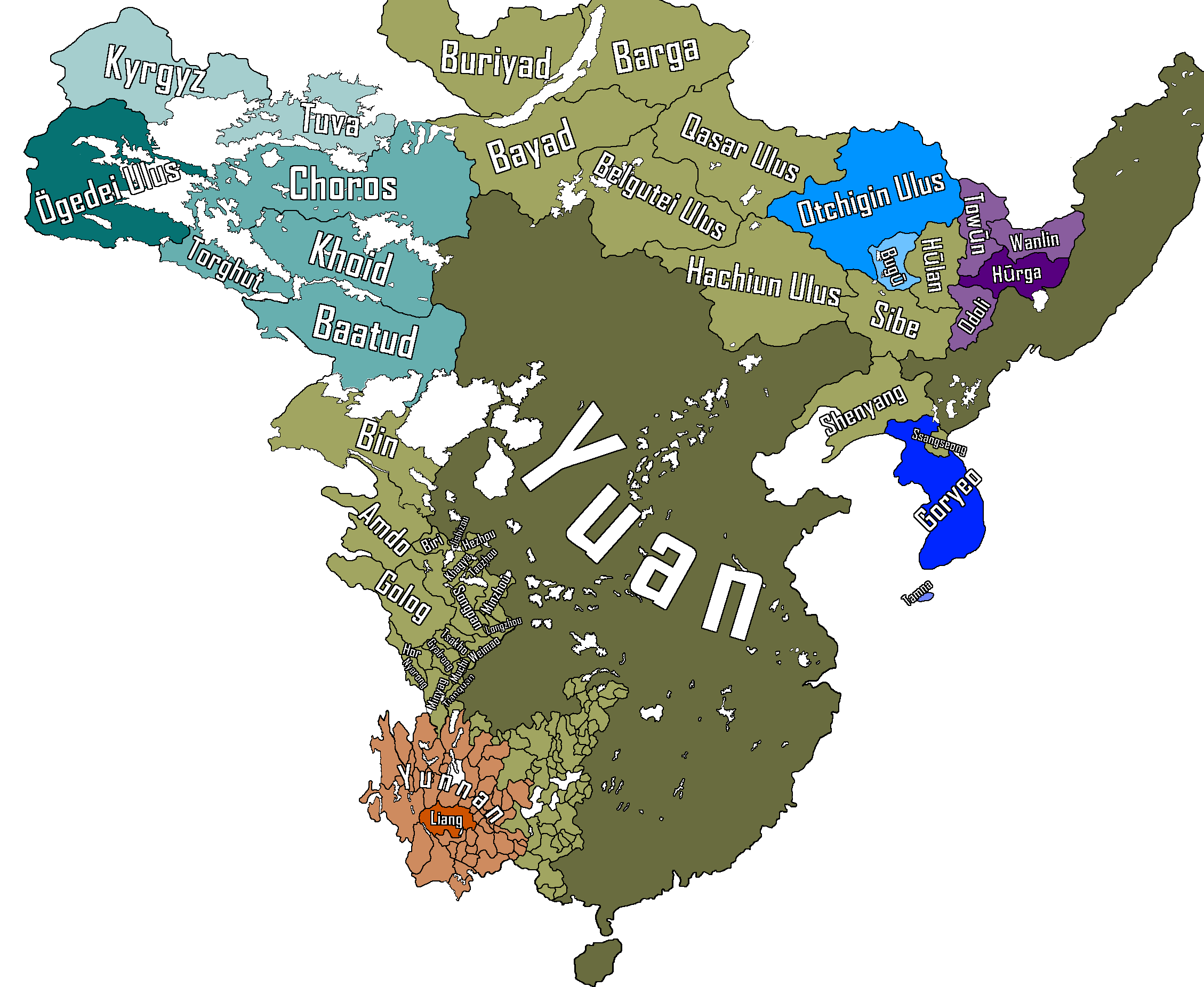
Absolutely beautifully done Tusi in the West/South-West. Although I would add that this should be Liang:

1753102904389.png
1753102911780.png

The Tusi outlined in Green are vassals of Liang:

1753103119718.png


General overview of the entirety of Yuan and it's vassals (may update it later in the Manchuria region especially):

Full information on the countries, including rulers, heirs, titles, etc: https://forum.paradoxplaza.com/foru...h-of-october-2024-china.1709509/post-30398160


1753102943156.png

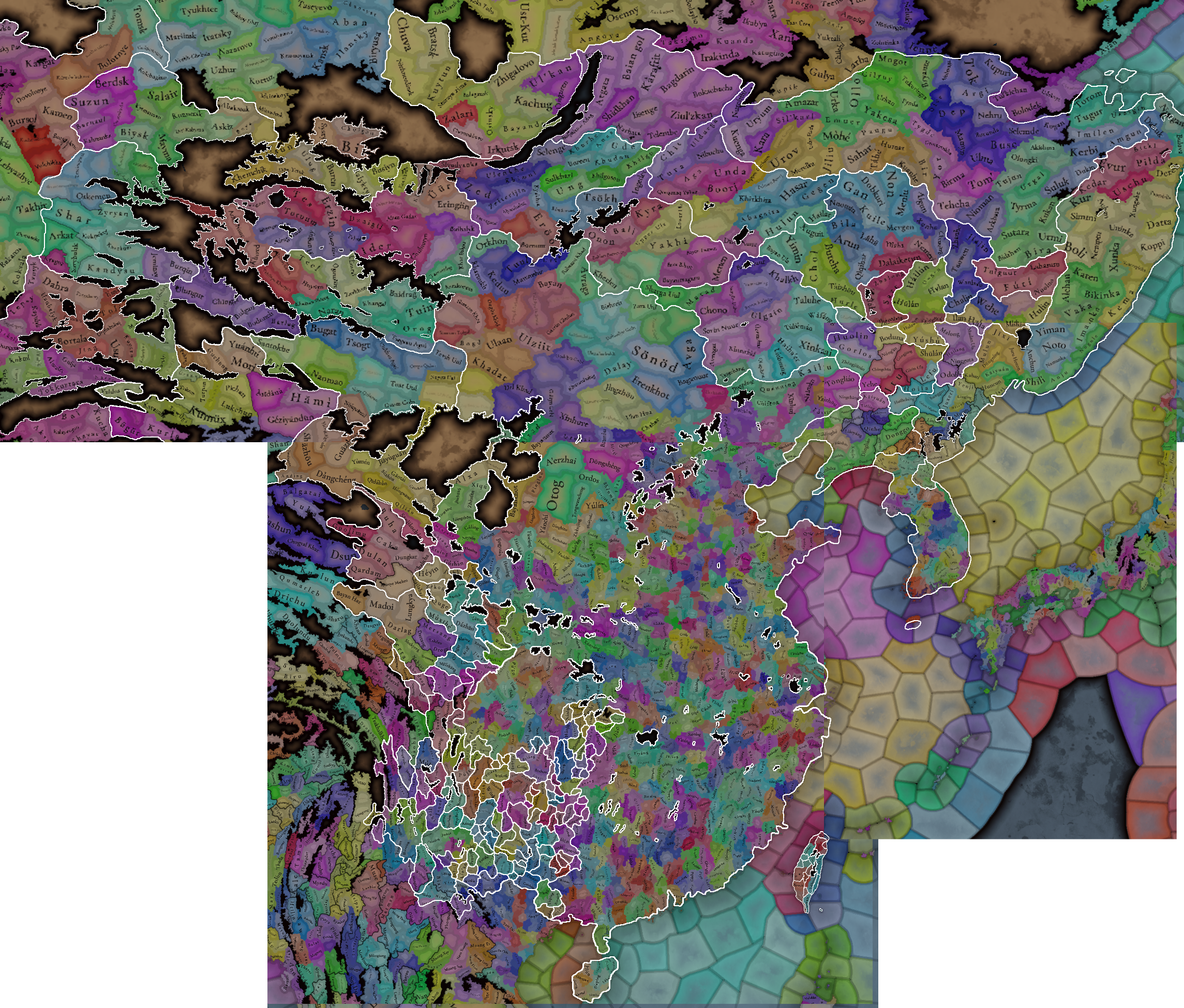
Borders with the old locations:
1753102960798.png


Last edited:
  • 30Like
  • 8
  • 4Love
  • 1
Reactions:
A couple posts I'll link here as these things could still be changed:

Burma and Yunnan locations

This post focuses on the locations in northern Burma and Southwestern Yunnan.

The first map includes simple name change suggestions to fix inaccuracies, and dynamic names for different languages.

The second map includes suggestions for redrawing locations and possible new additions.


Location Renames / Dynamic Names
View attachment 1330486
Coloured = location with a new name

New Locations / Redrawn Locations
Green = New location
Yellow = Reshaped location
Red = Reshaped wasteland
Second map = display of geography


General sources and explanations:


List: Location Renames / Dynamic Names


List: New Locations


List: Redrawn Locations


Some maps of historical metal mines in Yunnan:
View attachment 1280836

https://gssc.uni-koeln.de/forschung-1/verbundprojekte/metal-mining

View attachment 1280837
https://brill.com/view/journals/jesh/64/3/article-p251_3.xml

The silver is particularly important to include as the province made up over half of the national total during the Yuan dynasty.

Sipsongpanna (Chiang Hung) was also apparently rich in metals, but I didn't see any exact locations:
View attachment 1280835

This is a continuation of yesterday's post, commenting on some of the changes seen in the up-to-date map setup. For full suggestions and sources, refer to my main post on the Shan states.

View attachment 1322409

Map of suggested changes:
View attachment 1322413


Country names

A few of the names of countries here were my own transliterations, and with these not being referenced anywhere else I think it would be better to change them to something else more recognizable, which is more in line with the "common name" naming convention used everywhere else in-game, where the name can at least be searched for and found in a book/source. These countries are Möng Hten, Möng Hsa, Möng Ngum, Möng Wo and Möng Ku. The other country names from my suggestions are already referenced with the same spelling in (at least) the Gazetteer of Upper Burma and the Shan States, so these should be fine.

View attachment 1322410

I'll include links for the following names which are mentioned in sources:

Möng Hten -> Qingdian (native) or Shunning (Chinese)
"Möng Hten" is just a Tai place name from the general area (ᥛᥫᥒᥰ ᥗᥦᥢᥴ), which wouldn't be the right language anyway as Qingdian was a Mon-Khmer (probably Wa or Bulang) polity.​

Möng Hsa -> Mouzhan (official) or Mengsa (capital)

Möng Wo -> Moeng Bò (native) or Weiyuan (Chinese)

Möng Ku -> Jingdong (official) or Menggu (native name transliterated into Chinese).

Möng Ngum -> Moeng Wiang (native name of capital) or Yinsha Luodian (official, Chinese)
Möng Ngum is also not a historically accurate name, it's just a transliteration of a modern name of Shangyun (ᥛᥫᥒᥰ ᥒᥤᥛᥰ).​


Border changes

- Möng Mao should not own the locations of Tengchong, Guyong, Lujiang, Baoshan, and Dianyang (the location names from the original Tinto Maps post), and these should instead belong to Dali. Möng Mao's war with Yuan forces (i.e. the Duan family of Dali and the Liang prince of Kunming) didn't begin until 1342, and at most it should have only subdued neighbouring Tai polities (I also mentioned what land it could own in my Shan state post).
View attachment 1322411
https://en.wikipedia.org/wiki/Möng_Mao#Rise

- Moeng Wiang (Yinsha Luodian) should only occupy the locations of Yinshaluo and (probably?) the eastern parts of Mengdong. Ximeng and Mengmai should be owned by Möng Lem, and it's mentioned that these states were split north-south rather than east-west.
View attachment 1322412
https://www.proquest.com/docview/3143985160/AEBA28ED01984536PQ/2

- Möng Ting is way too small because of the current location setup. The problem is that both Möng Ting and Mouzhan (Möng Hsa) had their capitals within the in-game Mengding location, so it needs to be split (best donebby adding Gengma in the eastern half). Additionally, Möng Ting should own the western half of the Mengdong location. If the locations aren't changed for whatever reason, then the entire region should go to Möng Ting, as it was the more powerful state before Mouzhan was split off in 1326, and during the early Ming dynasty where Mouzhan and Mengdong were merged back into Möng Ting.

- Yuan should not directly own territory in Kunming, it should belong to the local prince of Yunnan/Liang who had entirely overshadowed the central Yuan government by the early 1330s.
View attachment 1322415
https://books.google.com/books?id=itKyDwAAQBAJ

There are also some border changes which could be made to better fit Yuan era divisions.

 
Last edited:
  • 19Like
  • 3
  • 1
Reactions:
The natives on the south coast of Taiwan were organised enough to give the Dutch and later the fleeing Ming remnants under Koxinga trouble. They should be SOP or a small settled nation
 
  • 18Like
  • 5
Reactions:
Court Languages. Mandarin is also the court language of all direct vassals of Yuán, while those using other languages are vassals of vassals.

Is there any evidence of this actually being the case? Assuming court language means the language of day-to-day administration, the tusi were deliberately appointed as mostly independent vassals due to their role in administration over native populations
 
  • 4
  • 1Like
Reactions:
It seems China will continue to be underrepresented in eu5 like it was in eu4 lol

Why do Korea, France, Britain Castile etc have 5x more location density than China?
 
  • 37
  • 18Like
  • 2Haha
  • 2
  • 1
Reactions:
View attachment 1203728
Zuoquan(左权). It s name of eighth route army general. He died in 1942 and in honor him they named the place. Should call it Liaozhou or Liaoshan.
This is one of the top posts on the last review. Could these not be checked before scheduling a feedback post? I'm sure you could have/will fix this in under a minute, but it feels bad to see that even after the Golden Horde feedback you received, easy stuff like this remains unchanged:

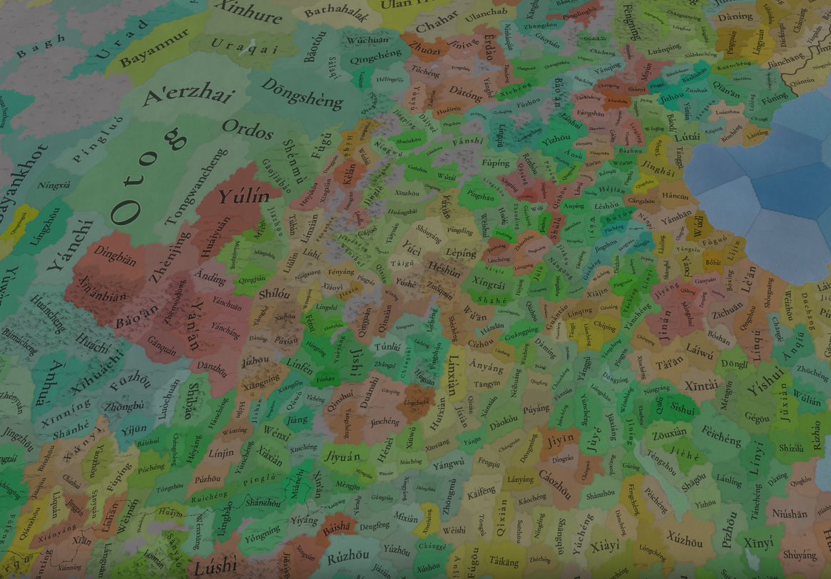
Locations zoom 1.png

https://en.wikipedia.org/wiki/Zuoquan_County

Could these not be fixed before a post is scheduled rather than always having a disclaimer that there are names to be changed? The way things are, won't get to see those changes, and won't be able to review them, because this is probably the last location view we're seeing of China this feedback cycle.
 
Last edited:
  • 11Like
  • 7
  • 4
  • 1
Reactions:


Absolutely beautifully done Tusi in the West/South-West. Although I would add that this should be Liang:


The Tusi outlined in Green are vassals of Liang:

View attachment 1336889


General overview of the entirety of Yuan and it's vassals (may update it later in the Manchuria region especially):

Full information on the countries, including rulers, heirs, titles, etc: https://forum.paradoxplaza.com/foru...h-of-october-2024-china.1709509/post-30398160


View attachment 1336886
Borders with the old locations:
View attachment 1336888

We decided to keep the Liang principality as directly owned by Yuan, as the title was mainly a nominal one and the Tusi setup was already complicated enough, but it is something that we may take another look at.
 
  • 26
  • 11Like
  • 1
  • 1
Reactions:
Very sad that you chose to keep goose shit green as the colour of the biggest country on Earth at start. It deserves a beautiful colour (plus it's still to similar to Delhi's and Khmer's colour and it's not immediately obvious at first glance who their numerous vassals belong to)
 
  • 32
  • 7Haha
  • 5Like
Reactions:
We decided to keep the Liang principality as directly owned by Yuan, as the title was mainly a nominal one and the Tusi setup was already complicated enough, but it is something that we may take another look at.


The title was nominal, but the rule was de facto real. The rulers administered Yunnan hereditarily, but preferred to go by the title of Liang, which maybe they thought was more prestigious. Kind of like if the King of England only held England, but primarily referred to himself as King of France first and foremost.

The reason I would keep Liang (Yunnan) is because of Basalawarmi and his last stand against the Ming, as the last Yuan loyalists in China.


Last edited:
  • 21Like
  • 2
Reactions: