• We have updated our Community Code of Conduct. Please read through the new rules for the forum that are an integral part of Paradox Interactive’s User Agreement.

Pavía

Content Design Lead PDX Tinto
Paradox Staff
12 Badges
Jan 3, 2006
3.835
160.571
  • Crusader Kings II
  • Europa Universalis III Complete
  • Europa Universalis IV
  • Heir to the Throne
  • Europa Universalis III Complete
  • Europa Universalis III Complete
  • 500k Club
  • Europa Universalis IV: El Dorado
  • Europa Universalis IV: Cradle of Civilization
  • Crusader Kings II: Jade Dragon
  • Stellaris: Distant Stars
  • Stellaris: Ancient Relics
Hello, and welcome to another Tinto Maps Feedback post! Today, we will be reviewing the region of South East Asia. Let's start with the list of changes, that, as I mentioned last week, is shared between both regions, as we worked on them in parallel:

ADDITIONS

Added the following:
  • TAGs
    • Kiliman
    • Lanao
    • Ibalon
    • Pulilu
    • Taytay
    • Kumalarang
    • Vientiane
    • Cobra
    • Hkamti
    • Mong Kong
    • Hsawng Hsup
  • Minorities
    • Added the missing cultural and religious minorities of the region
CORRECTIONS

Renamed the following:
  • Locations (only corrections):
    • sinugbohan to irong_irong
    • dumangas to araut
    • virac to vidak
    • himoragat to naga_bikol
    • lagawe to kiyyangan
    • lianga to langan
    • mainit to cabadbaran
    • marakato to makarato
    • baybay to pangasugan
    • vigan to bigan
    • cabagbagototan to kandong
    • tabuk to tobog
    • buayan to makar
    • datu_piang to buayan
    • laillo to lal_lo
    • davao to tagloc
    • linao to bislig
    • davao_gulf to tagloc_gulf
  • Provinces
    • northern_highland_province to madhyamagrama_province
    • angkor_wat_province to angkor_province
    • ilocos_province to samtoy_province
    • maynila_province to katagalugan_province
    • mid_cagayan_province to cordillera_province
    • pantabangan_province to pampanga_province
    • mindoro_province to mait_province
Cultures
  • thai_group
  • shan_group
  • Removed ahom_culture
  • Removed shan_culture
  • dambro_culture
  • tai_long_culture
  • tai_nua_culture
  • tai_lu_culture
  • tai_language_family
    • zhuang_language
    • thai_language
      • dai_dialect
      • thai_dialect
      • shan_dialect
      • lao_dialect
  • kam_language
  • hlai_language
  • kra_language
  • palaungic_language
  • kachinic_language
  • philippine_language_family
    • bikol_language
    • visayan_language
      • hiligaynon_dialect
      • waray_dialect
      • cebuano_dialect
      • southern_visayan_dialect
      • palawanic_dialect
    • danao_language
      • danao_dialect
      • subanon_dialect
      • manobo_dialect
    • kapampangan_language
  • bornean_language_family
    • cham_language
      • achenese_dialect
      • cham_dialect
    • malay_language
      • minangkabau_dialect
      • iban_dialect
      • malay_dialect
      • banjarese_dialect
      • kutai_dialect
    • lampung_language
    • rejang_language
    • madurese_language
    • dayak_language
    • kayanic_language
  • barito_language_family
    • sama_language
  • moluccan_language_family
    • sumba_language
    • maluku_language
    • aru_language
    • tanimbar_language
  • helong_culture
  • hawu_culture
  • asilan_language
  • bahnaric_language
  • katuic_language
  • khmu_language
  • nicobarese_language
  • andamanese_language
  • Removed phuralung_religion
  • ngacang_religion
Raw Goods
  • Changed several Raw Goods as suggested
Terrain and Vegetation
  • Total Review

Let's now take a look at the maps:

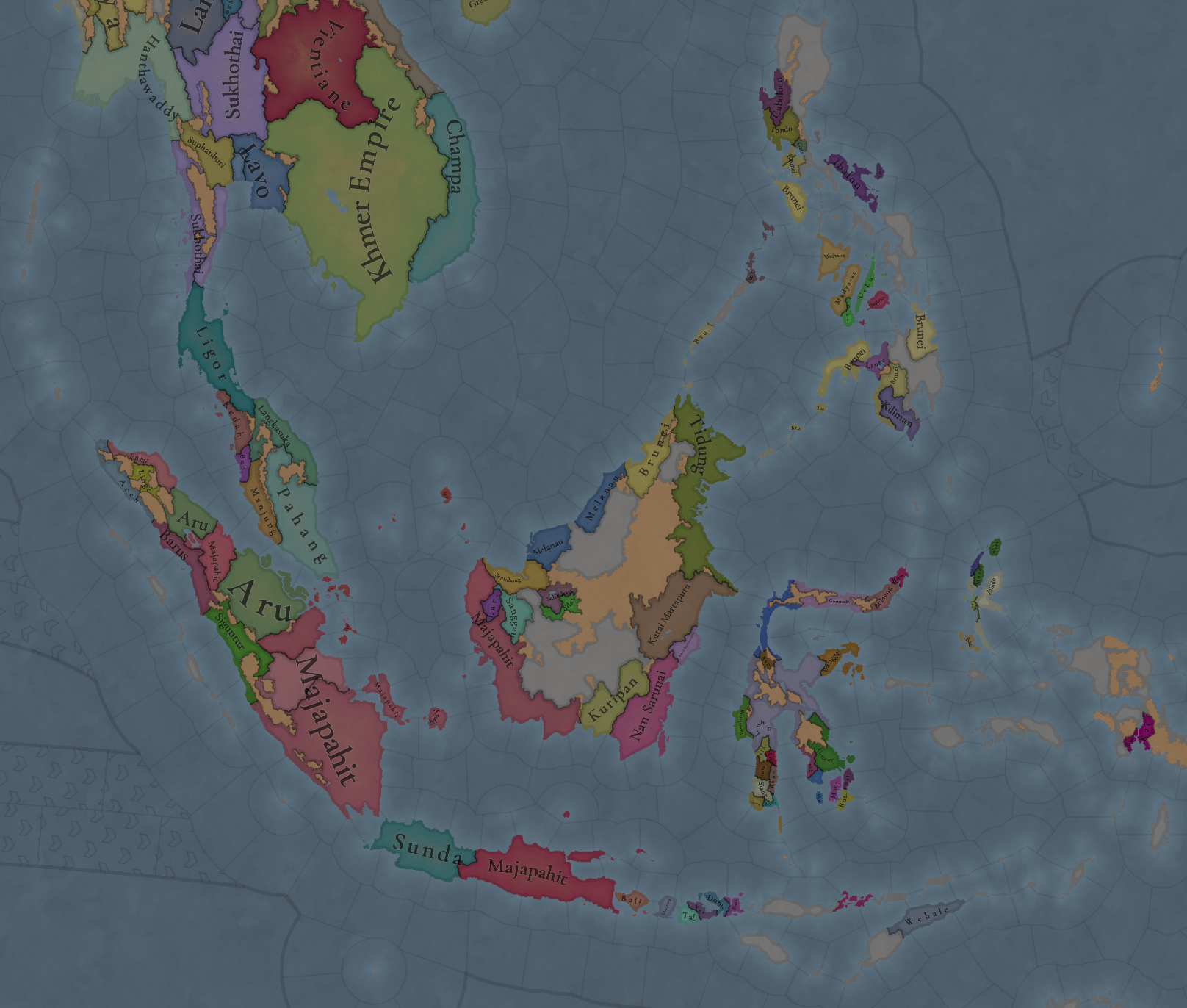
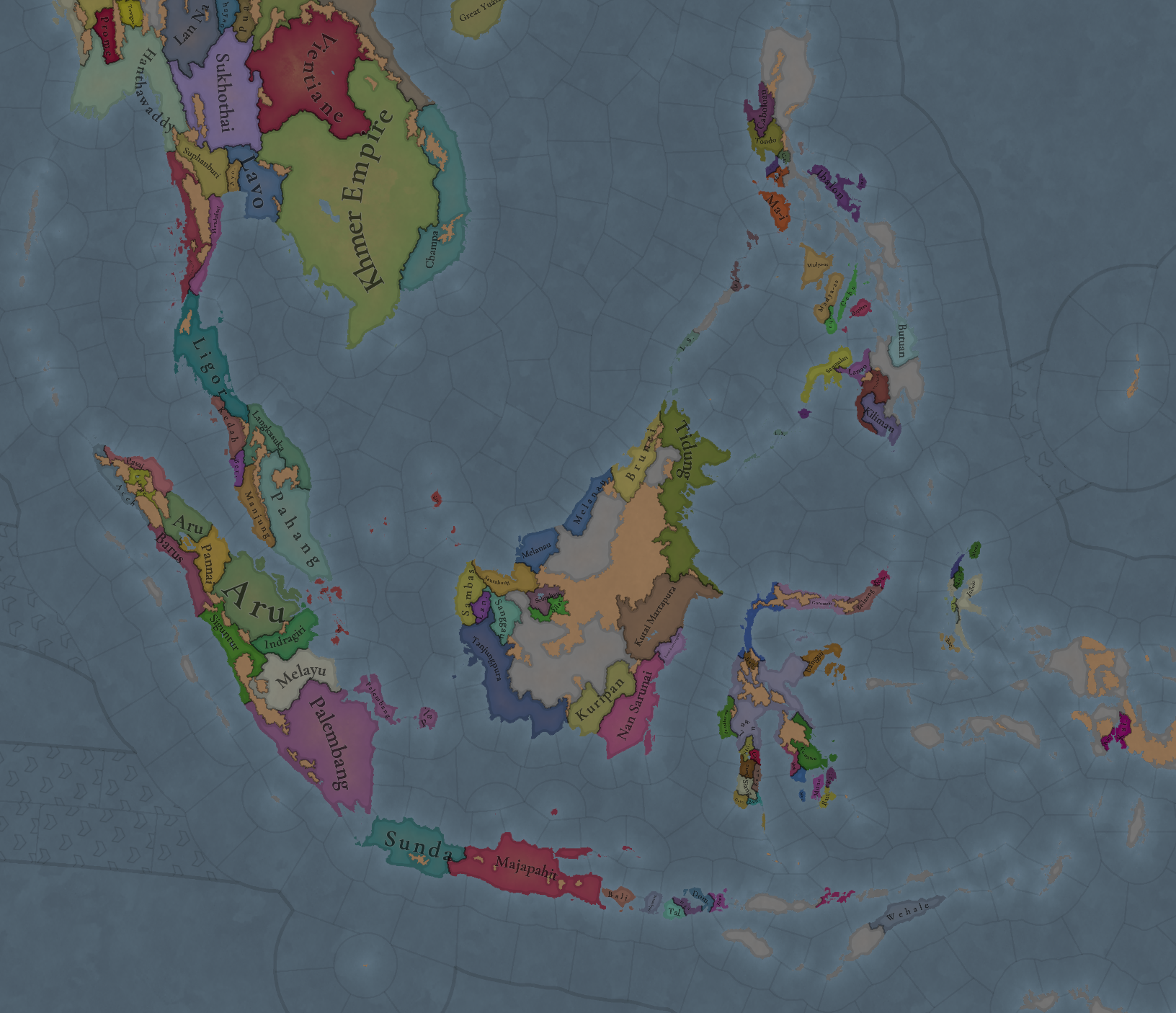
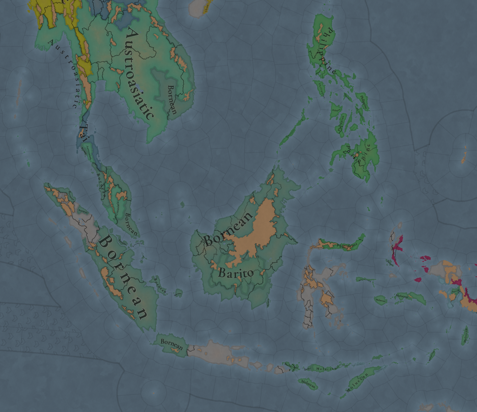
Countries:
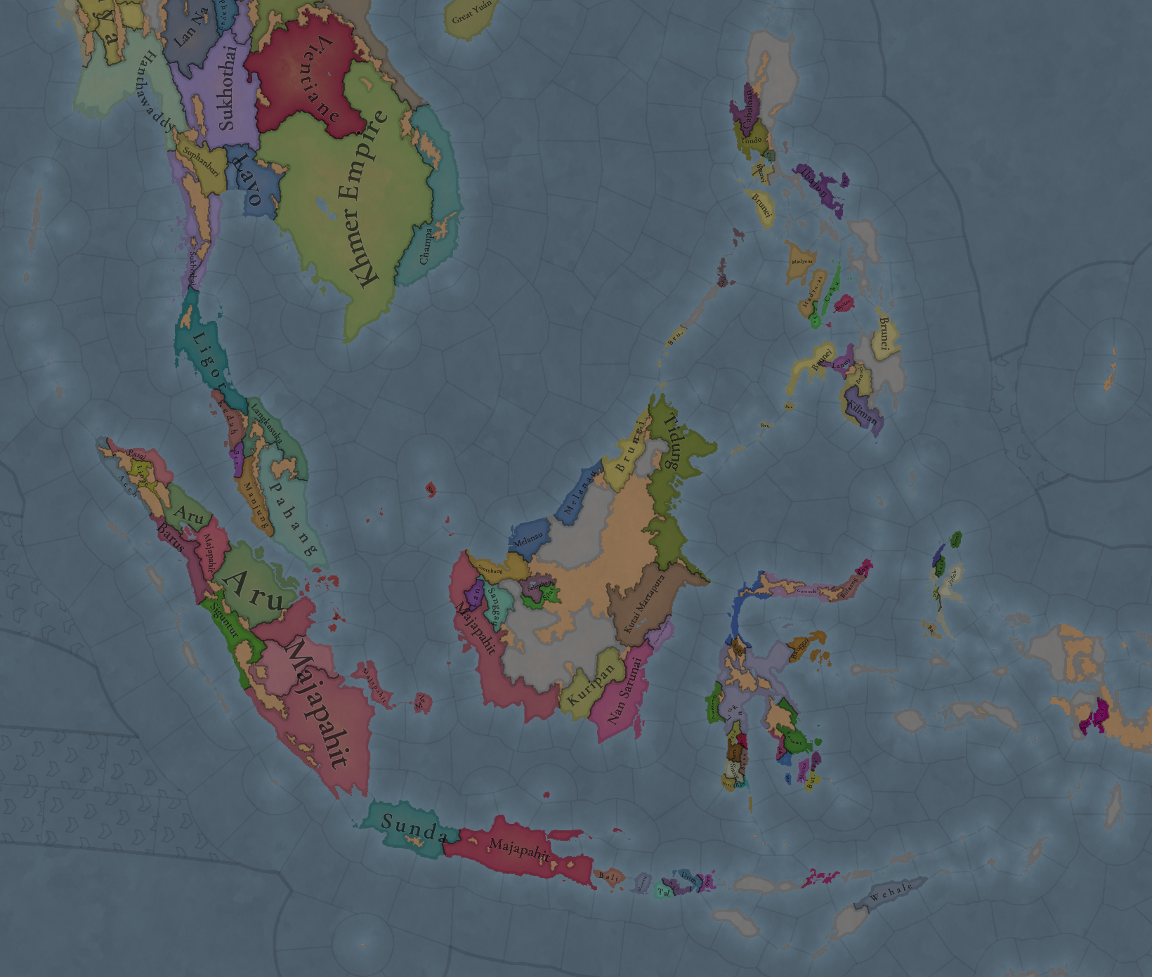
Countries.png

Countries2.png

Countries3.png

Some changes and tweaks here and there.

Dynasties:
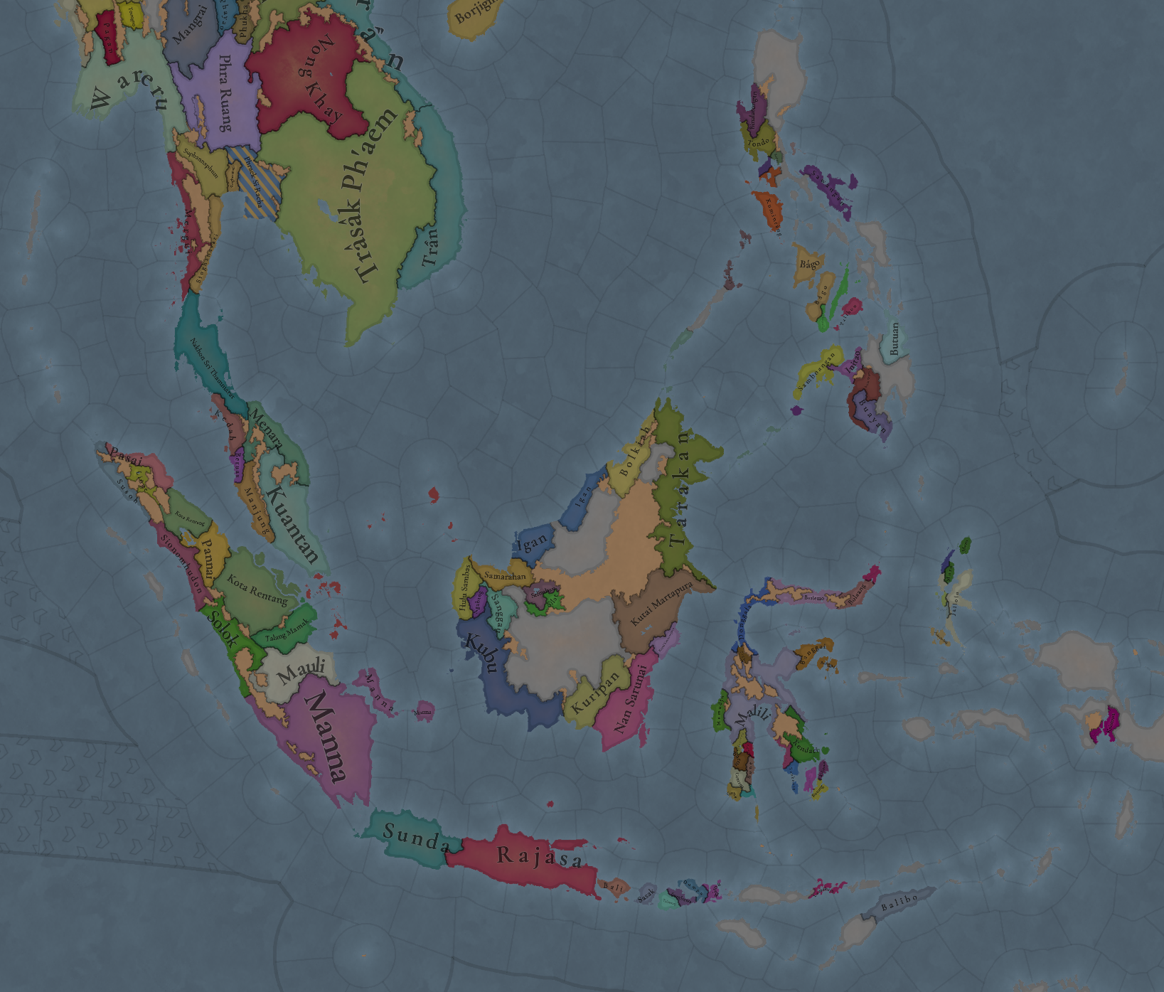
Dynasties.png


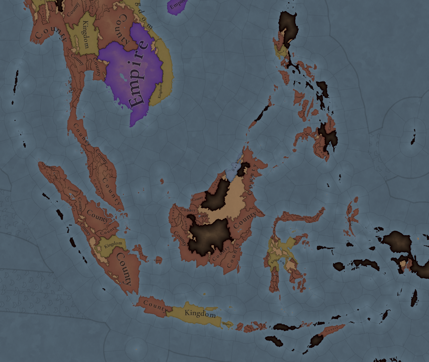
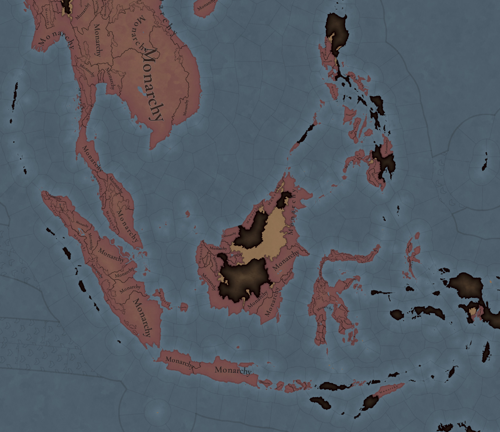
Country Ranks & Government Types:
Country Ranks.png

Government.png


SoPs:
Sops.png


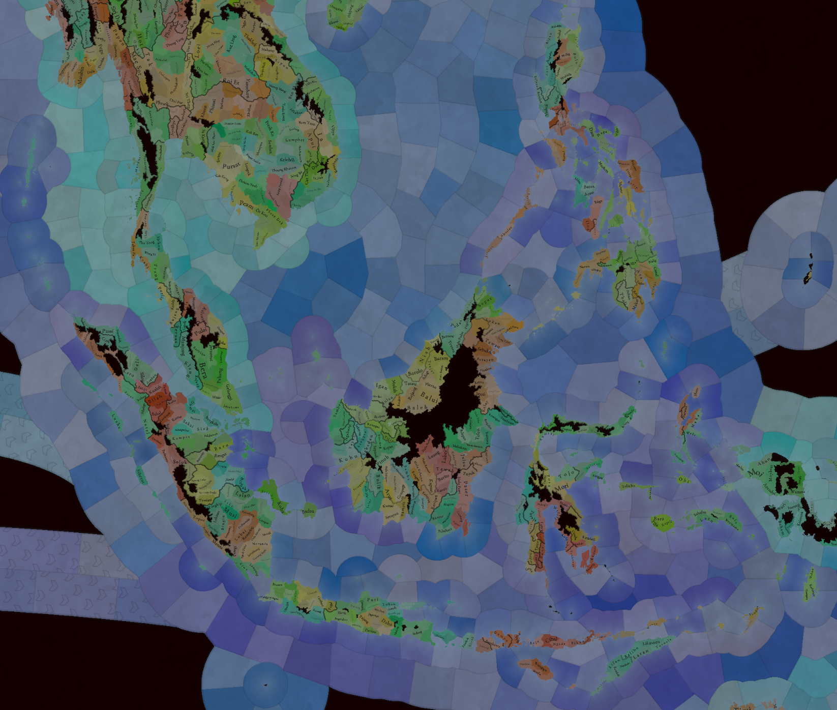
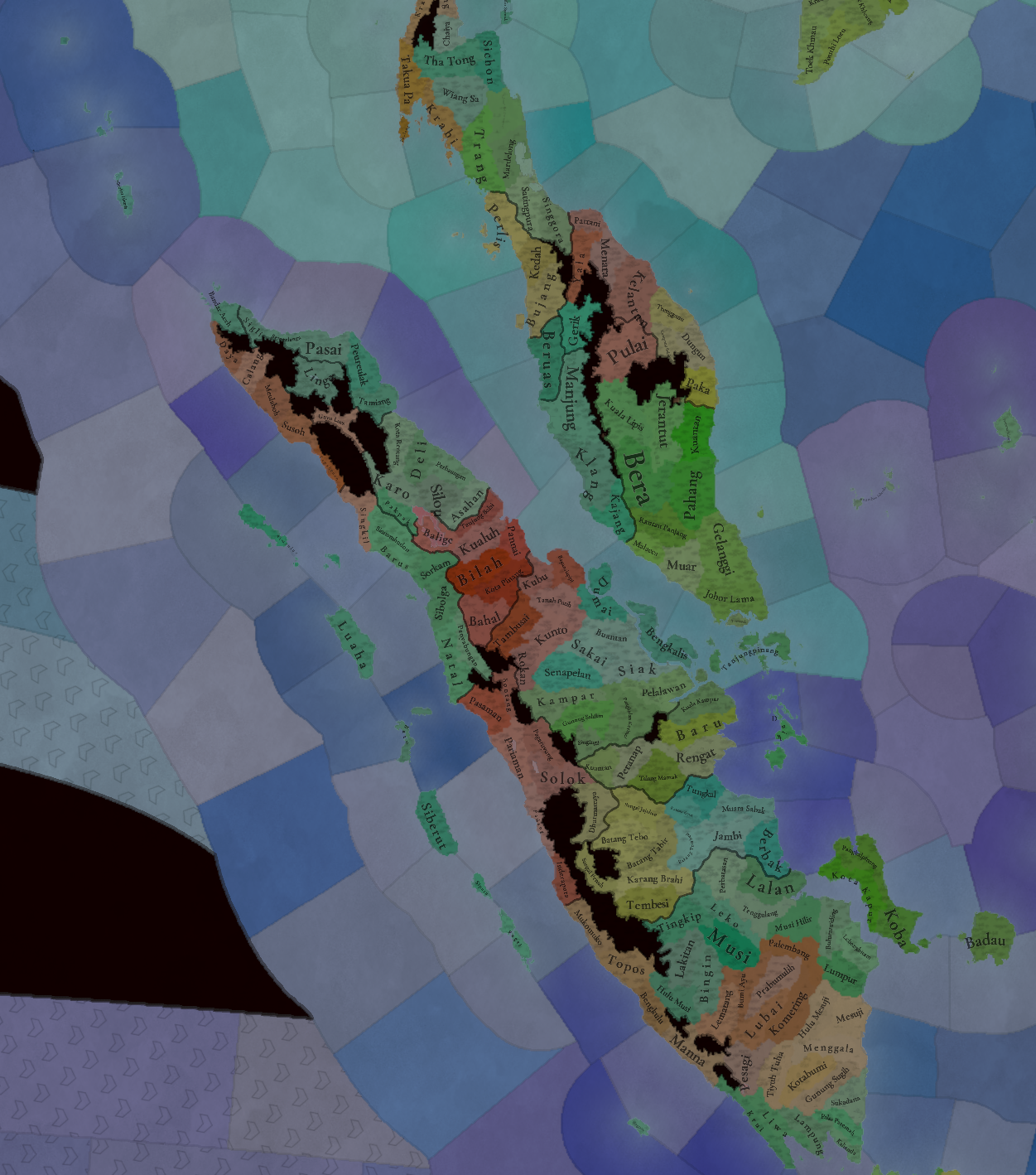
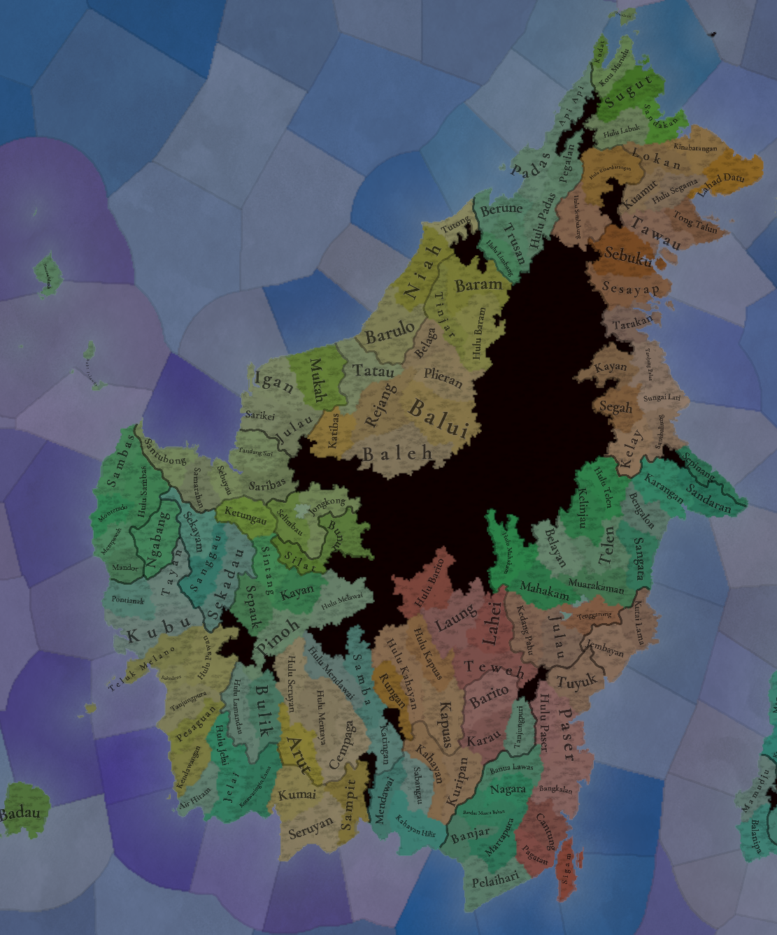
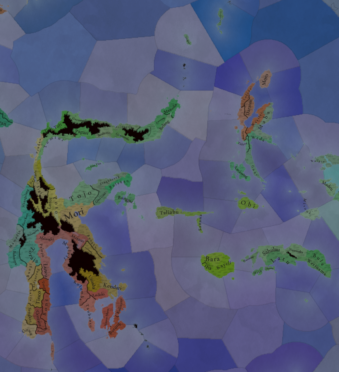
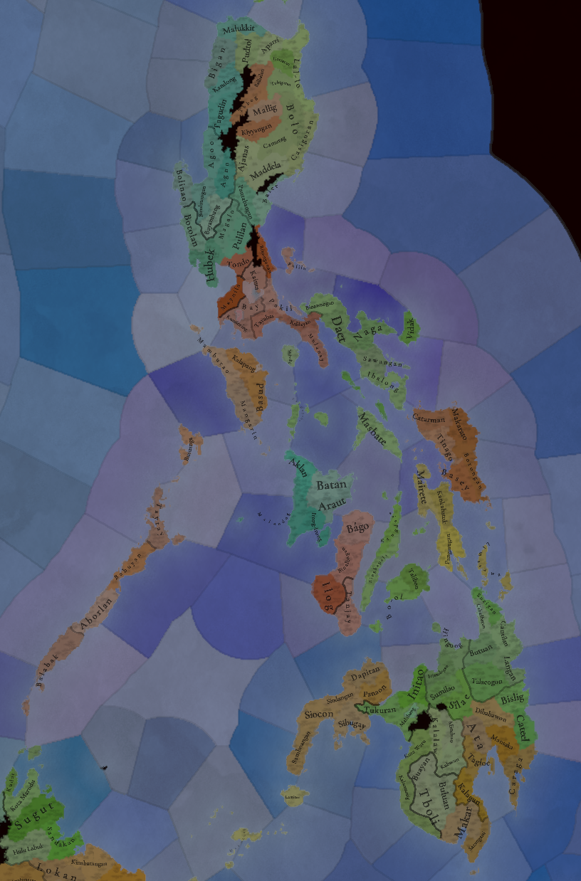
Locations:
Locations.png

Locations2.png

Locations3.png

Locations4.png

Locations5.png

Locations6.png
Not many changes here either, this week, as per the reasons given last week.

Provinces:
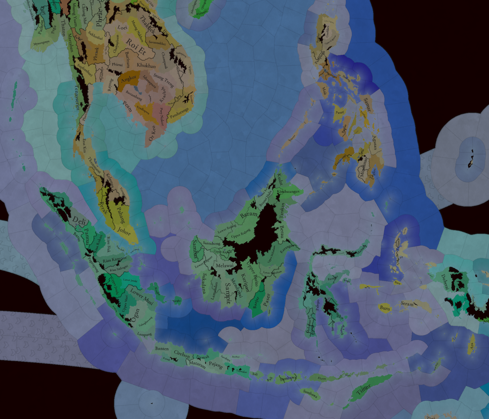
Provinces.png


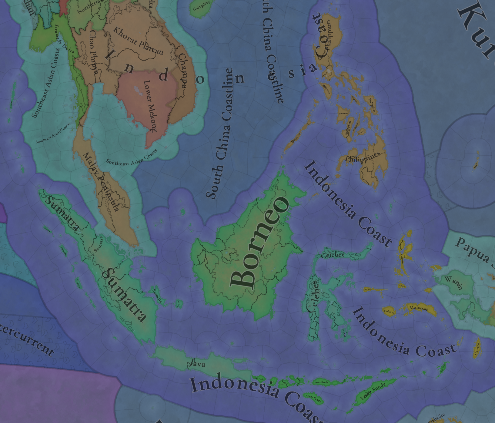
Areas:
Areas.png

The visualization of areas has improved a lot compared to last year, but we still have some work to be done, as breaking the huge 'Indonesia Coast' area into smaller areas - something that we'll tackle soon, as we already have a pass planned on Areas + Regions worldwide.

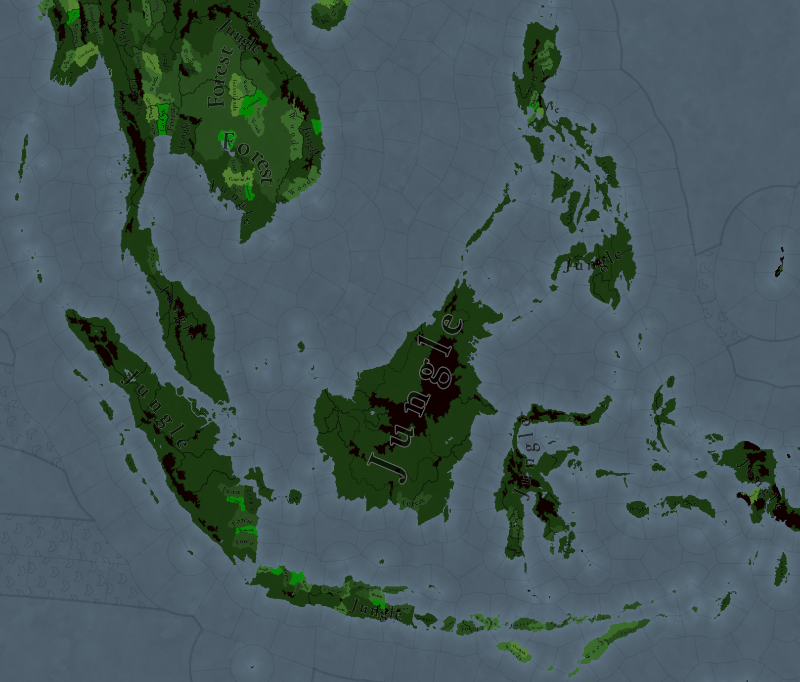
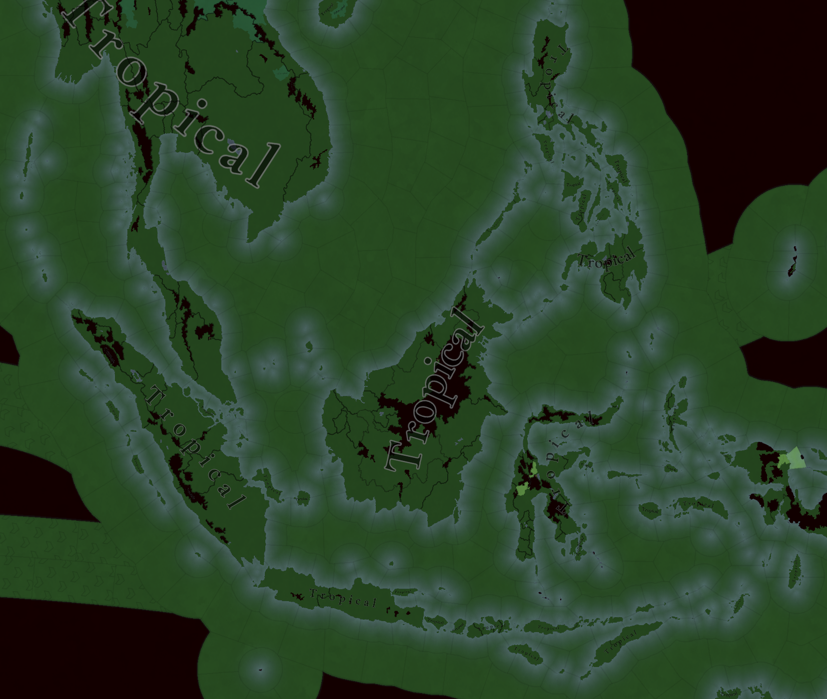
Terrain:
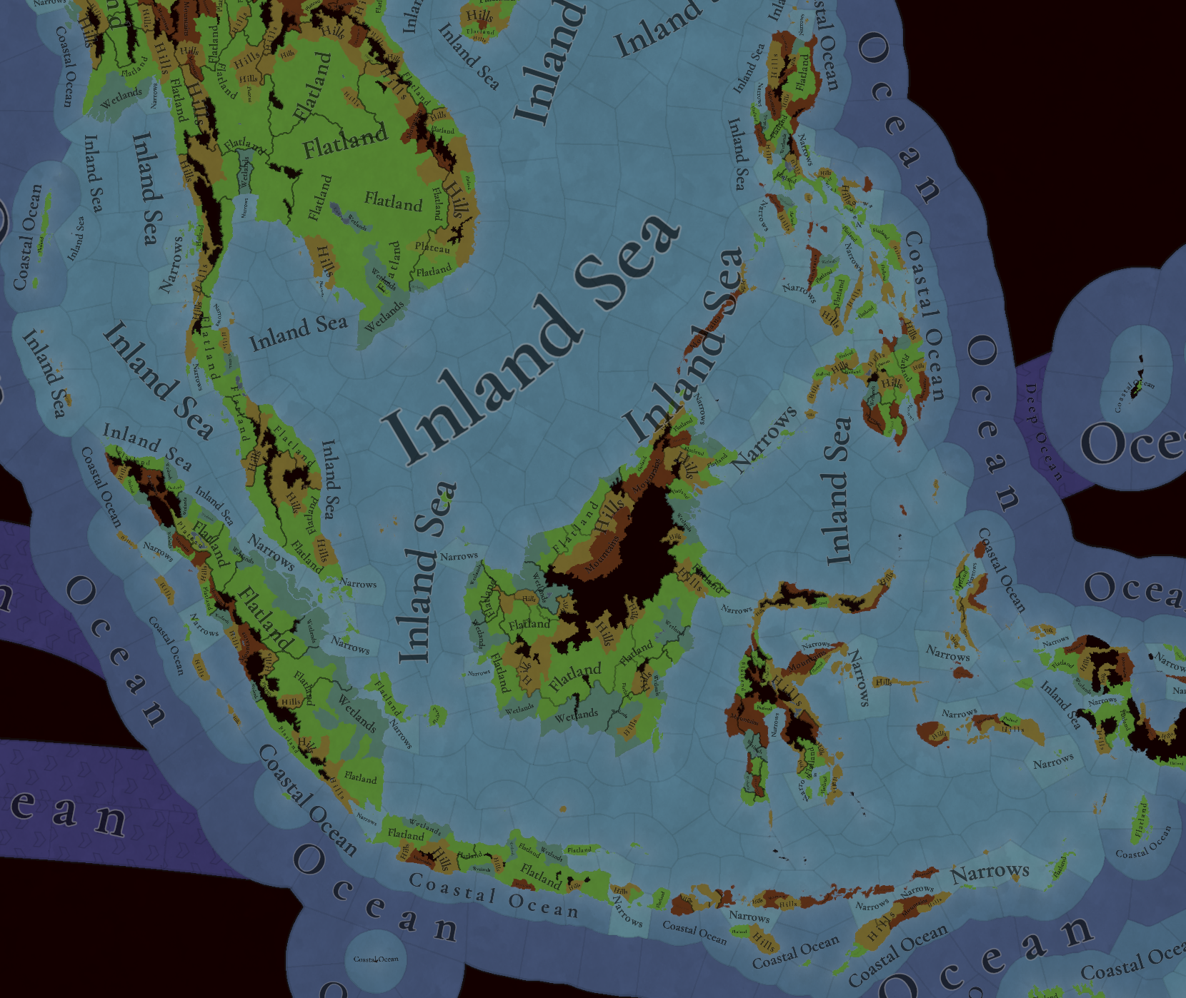
Topography.png

Vegetation.png

Climate.png

Some tweaks here and there.

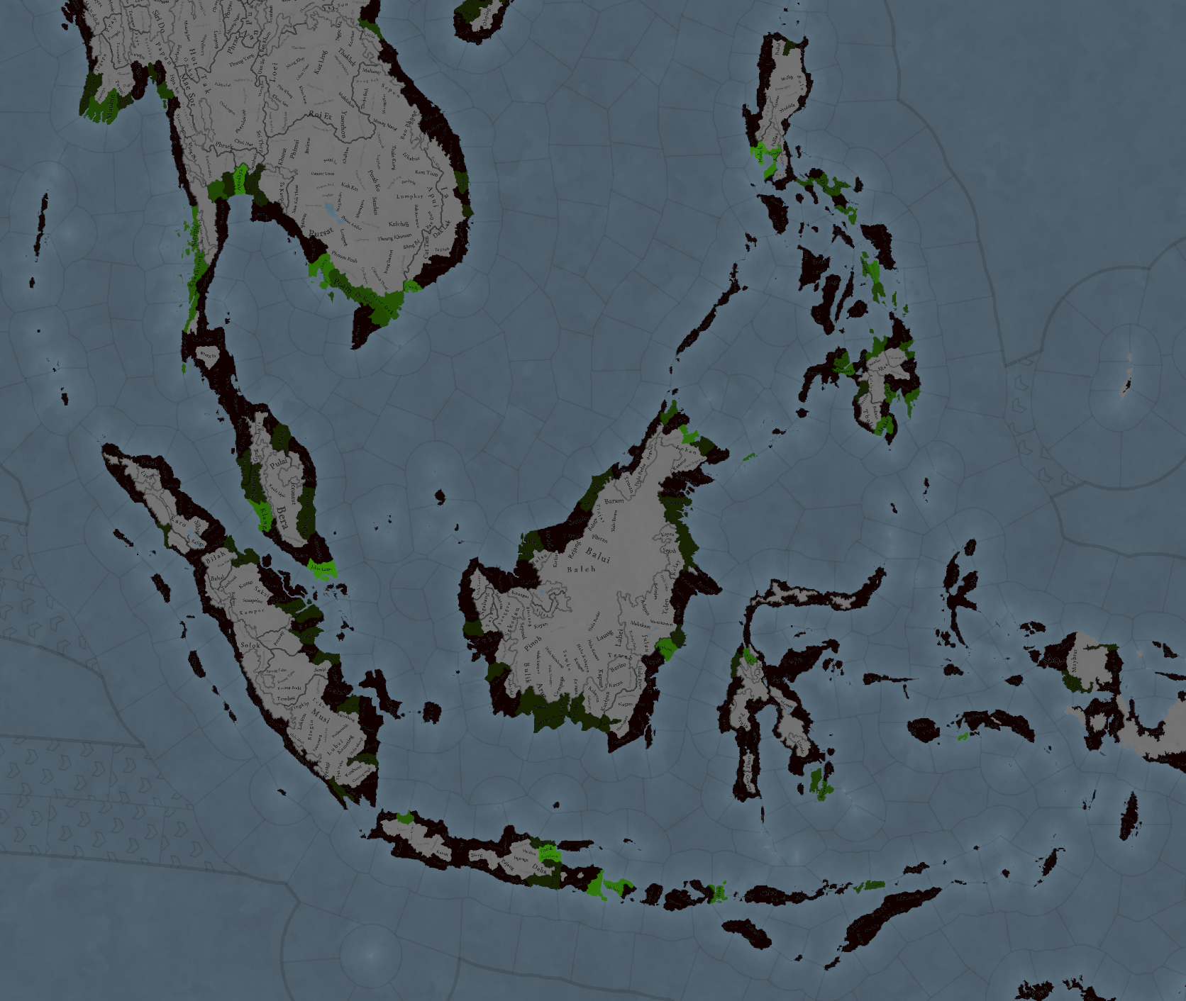
Dangers:
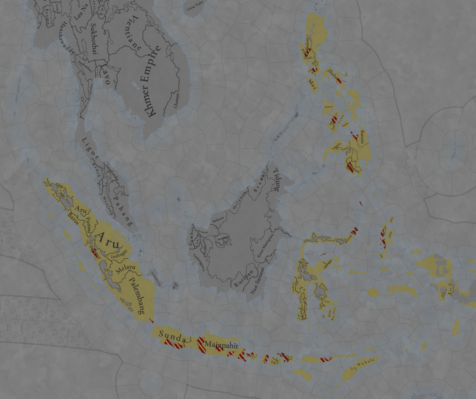
Dangers.png

A map that we usually don't share, but that in the case of Indonesia, is pretty relevant: Possible Earthquakes + Volcanoes - or, as it's called in-game, Dangers!

Development:
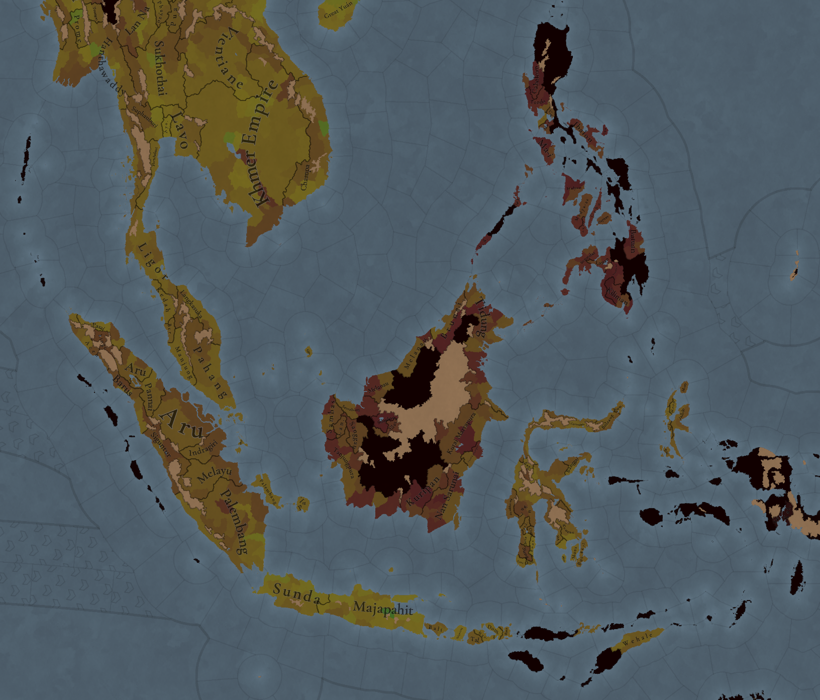
Development.png


Harbors:
Harbors.png


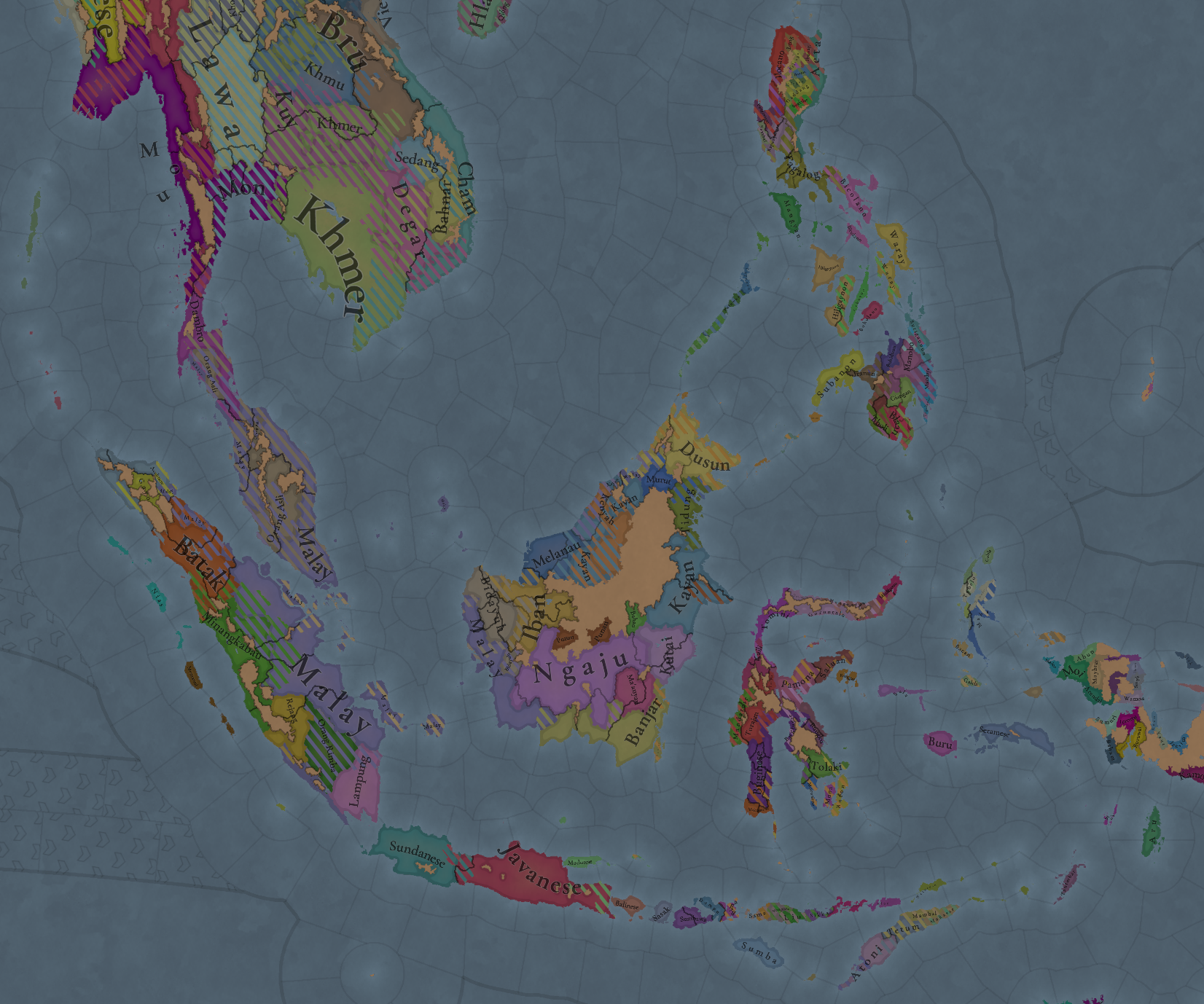
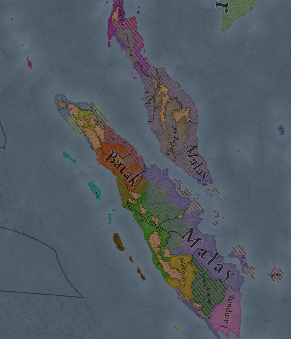
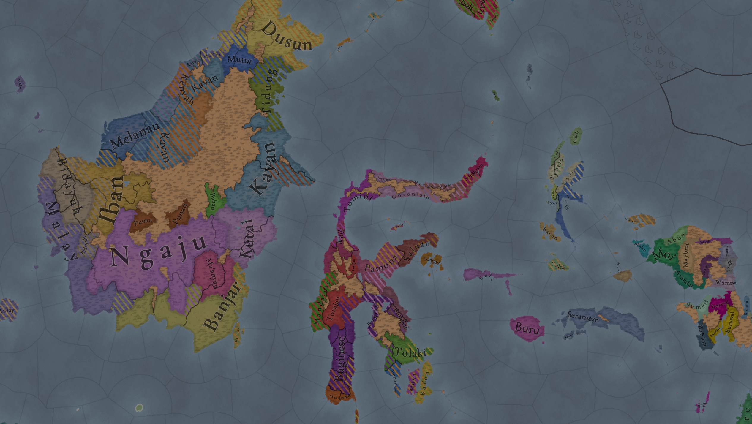
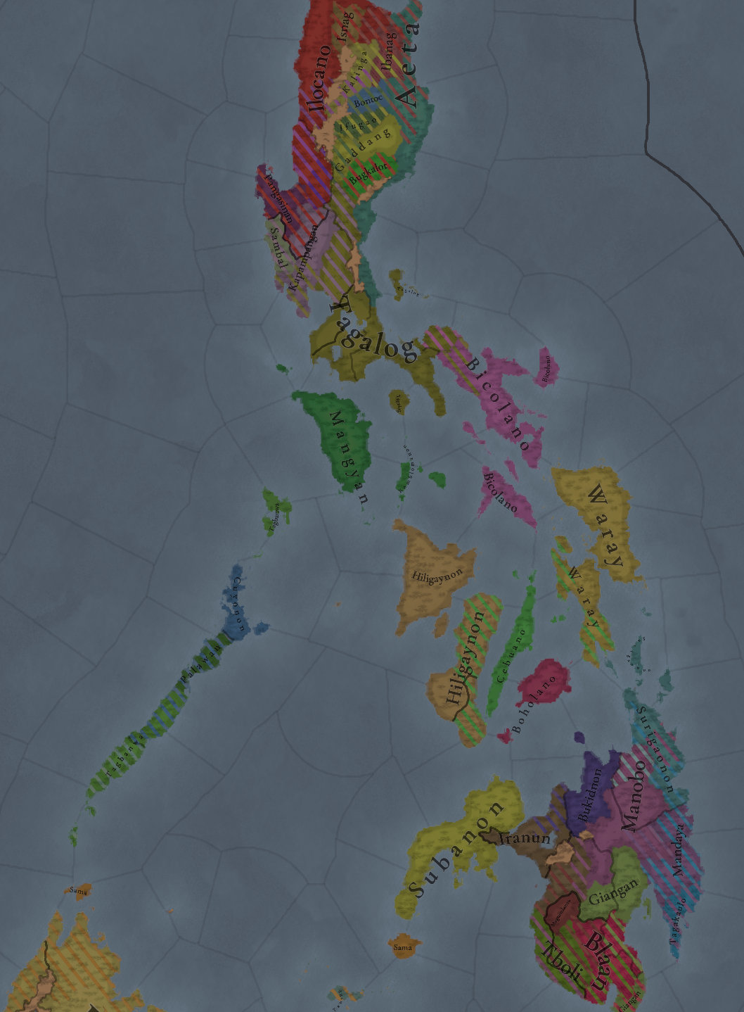
Cultures:
Cultures.png

Cultures2.png

Cultures3.png

Cultures4.png

Cultures5.png
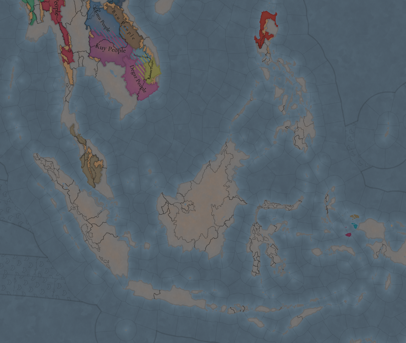
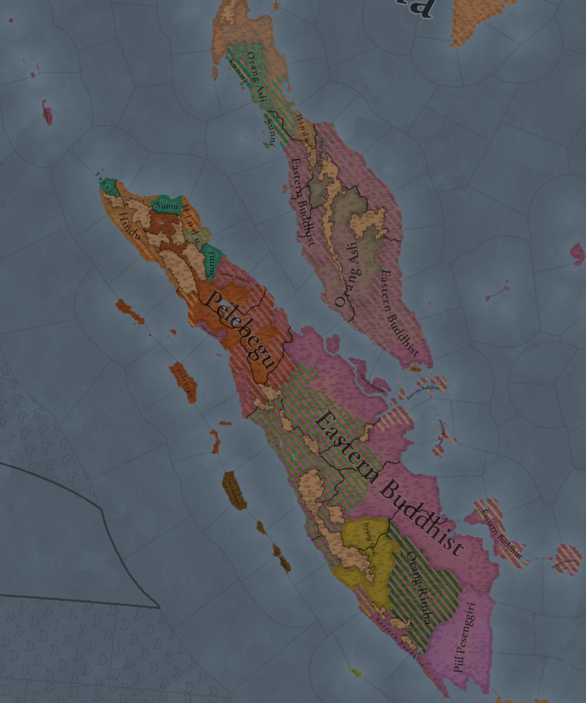
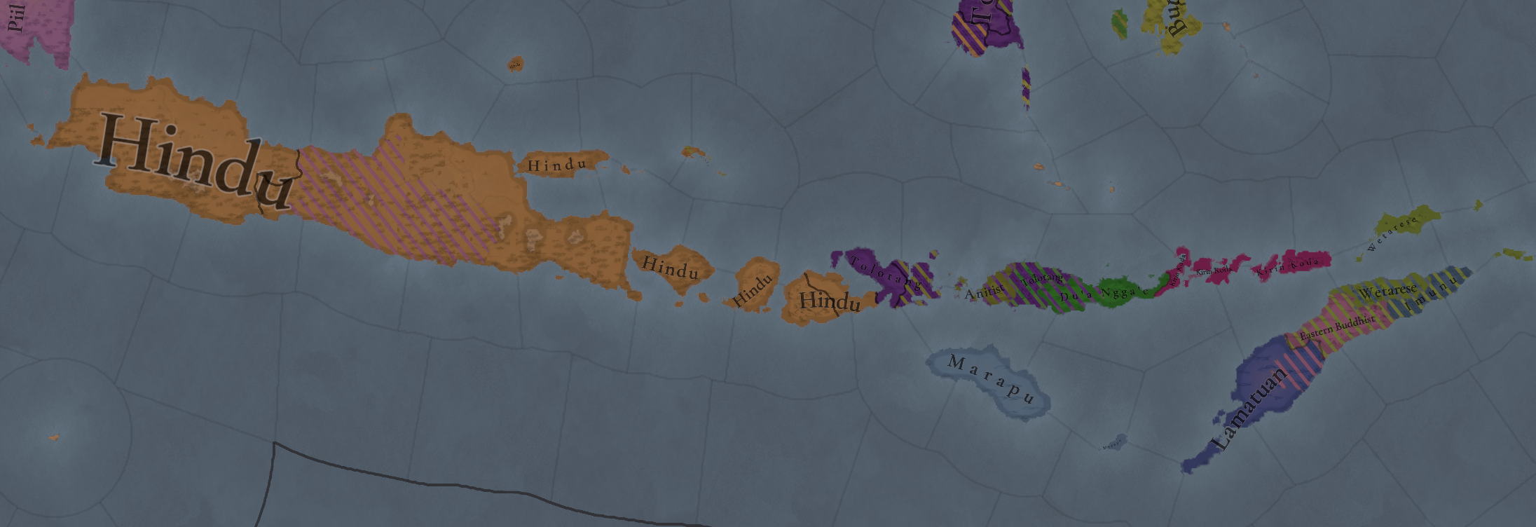
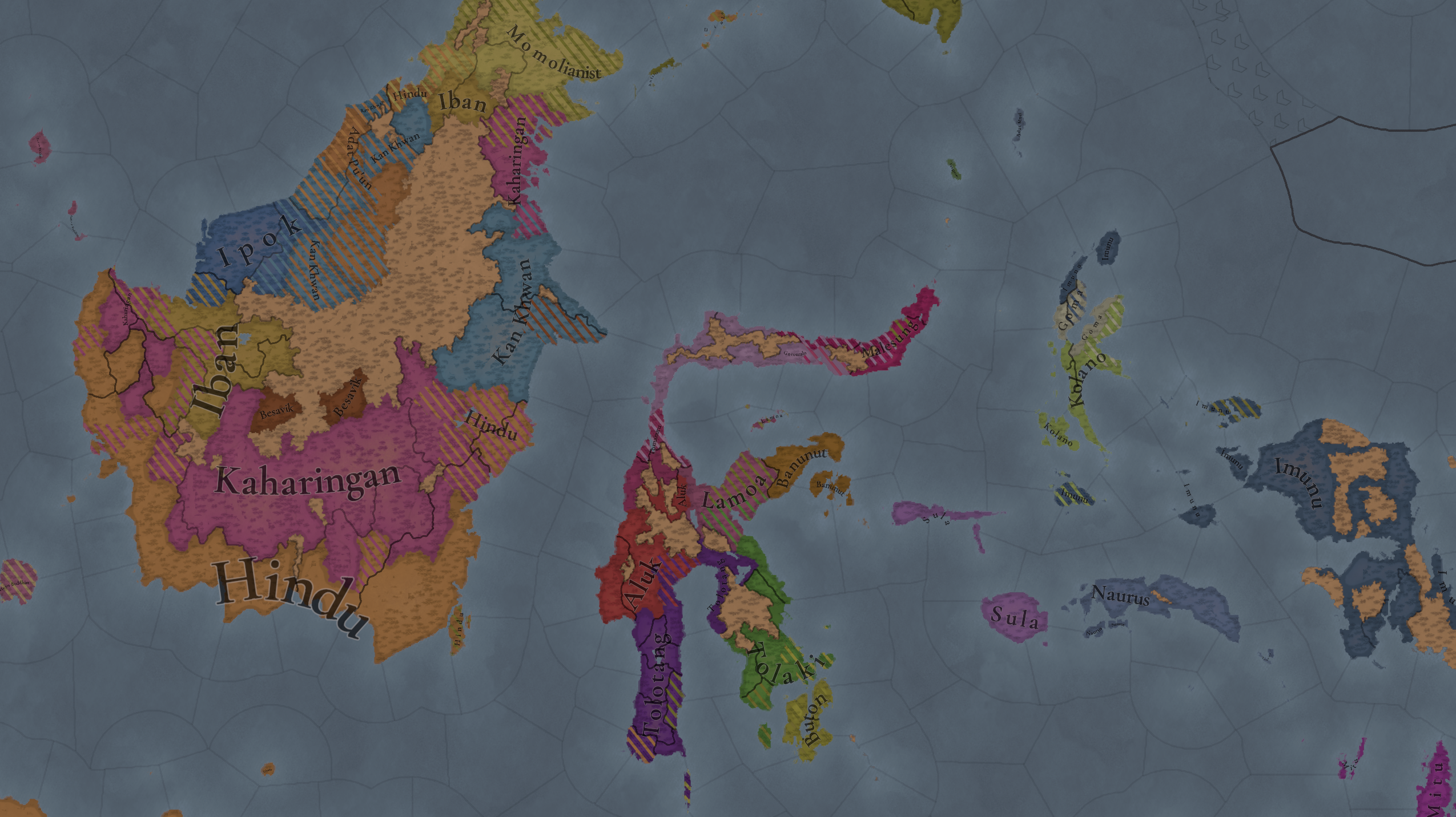
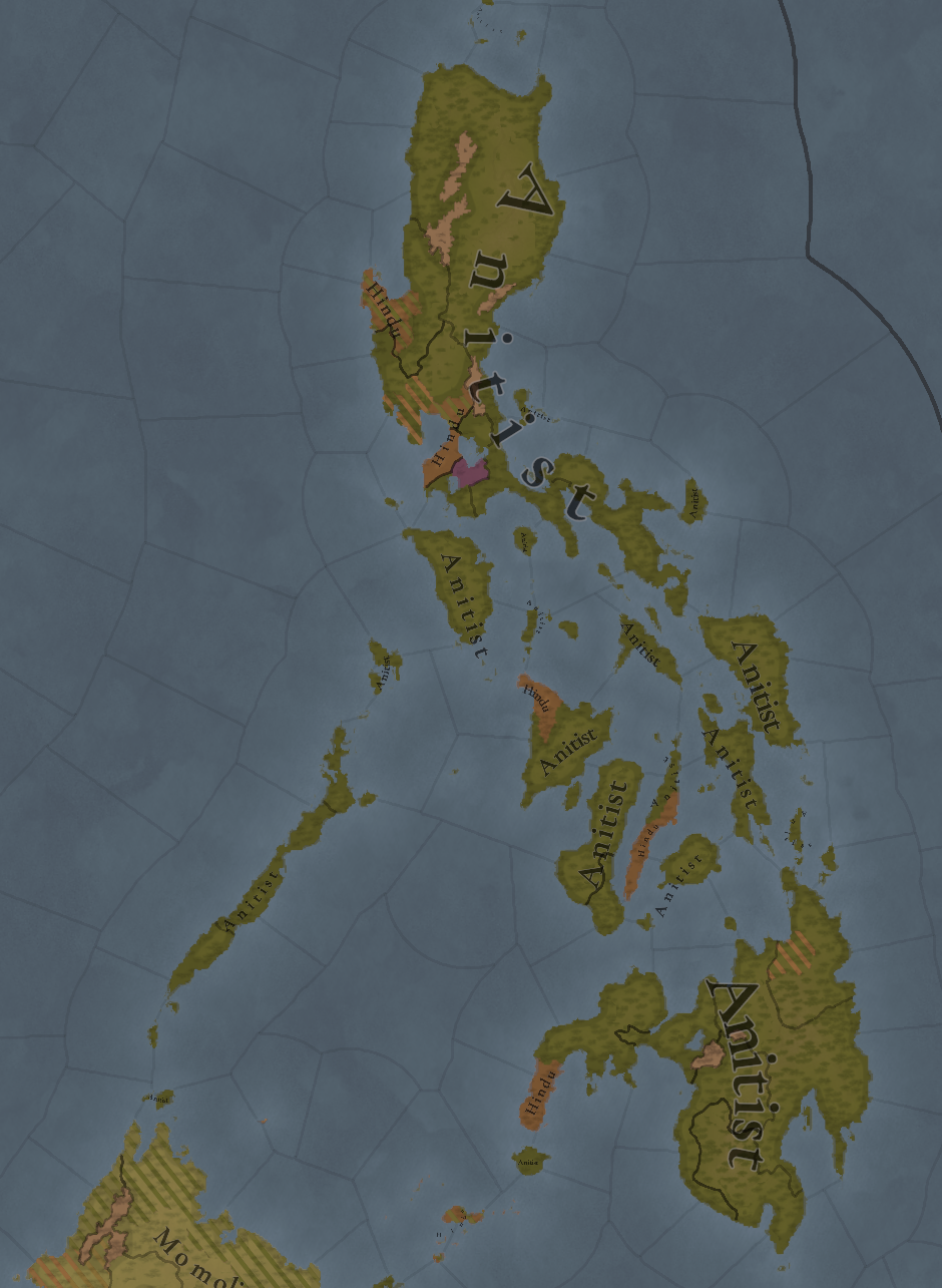
Here is where we've done the greatest rework, as Indonesia is fully populated by different cultural minorities.

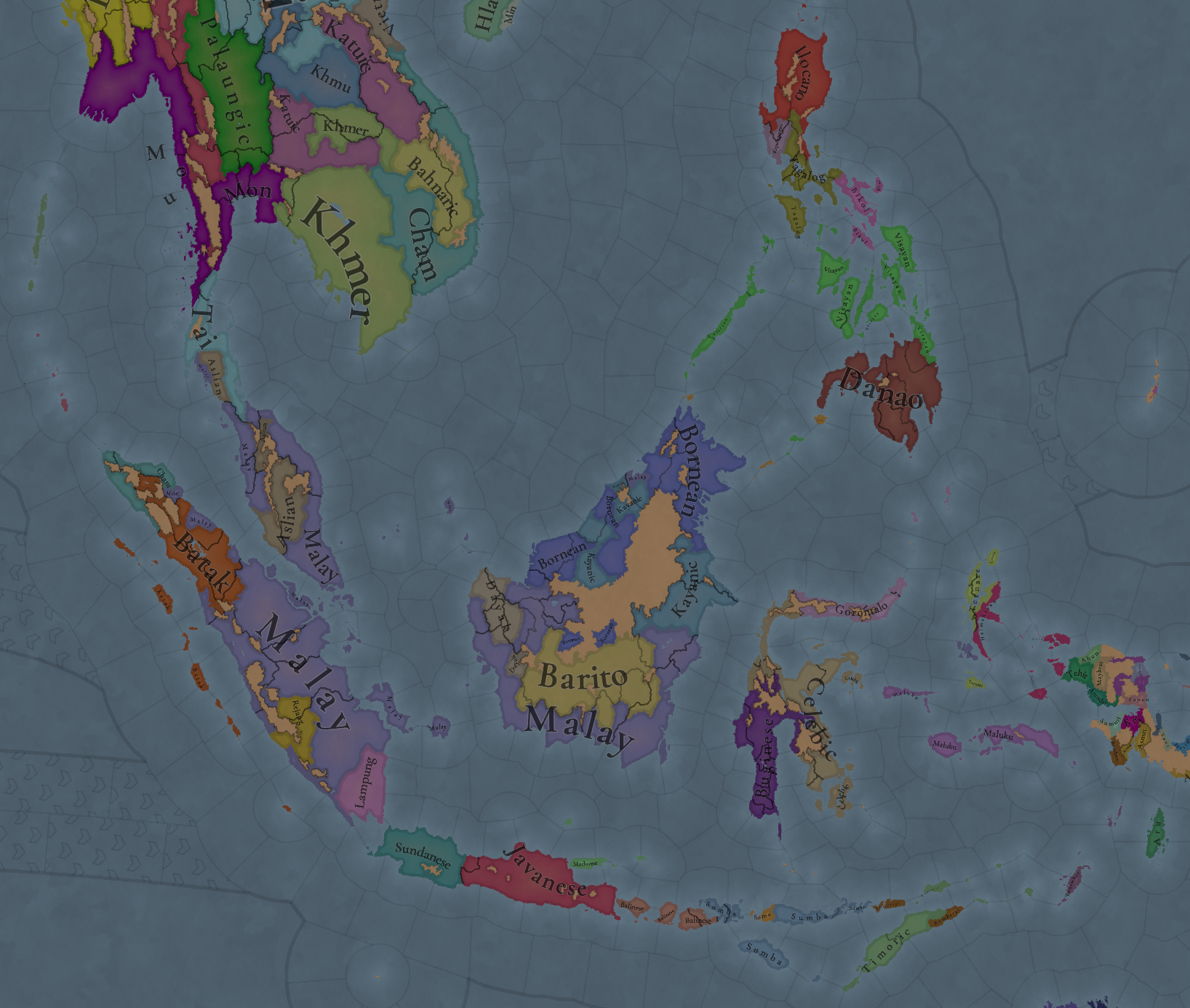
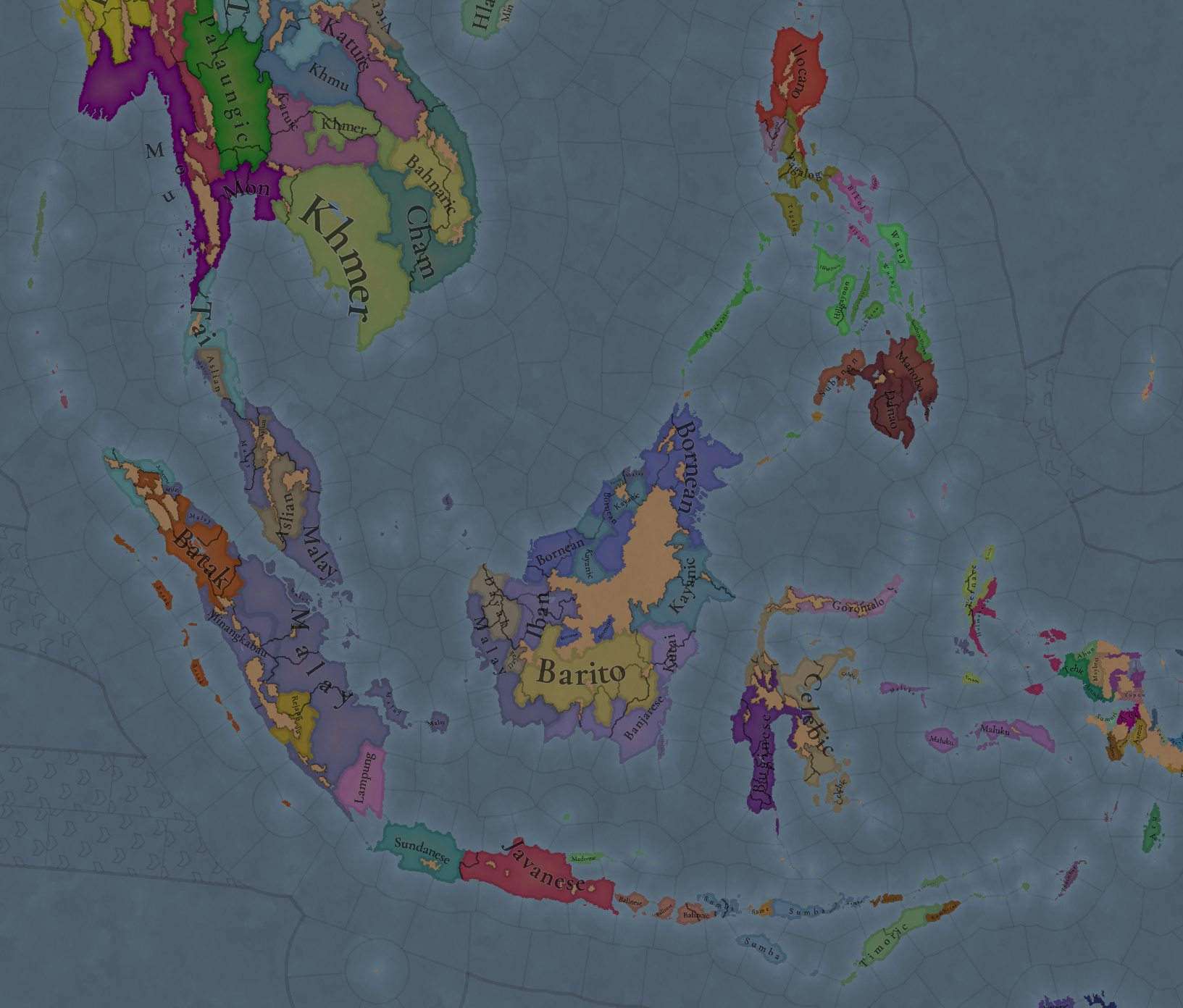
Languages:
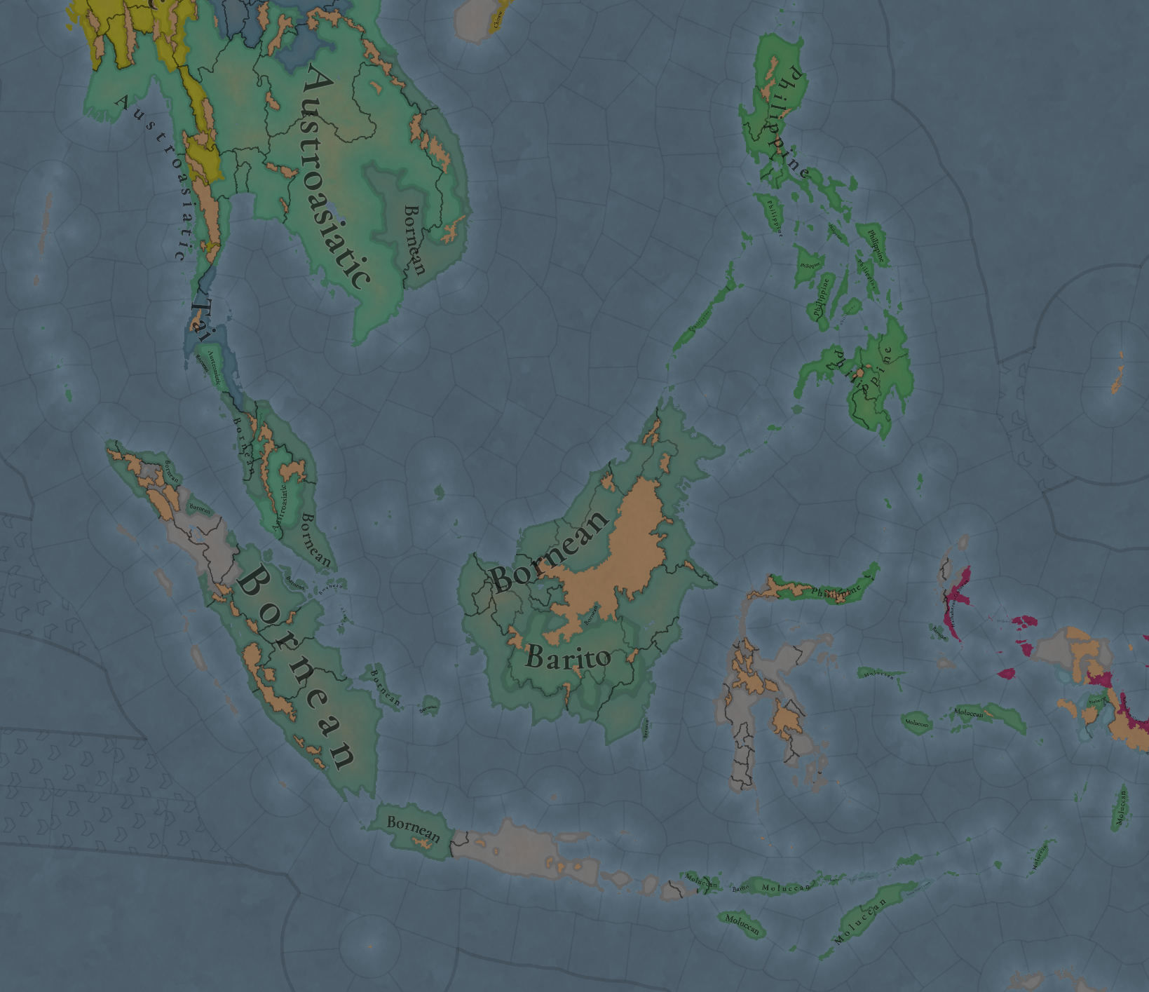
Languages1.png

Languages2.png

Languages3.png

Here you have the 3 Language levels of the game, in a very linguistically rich region.

Religions:
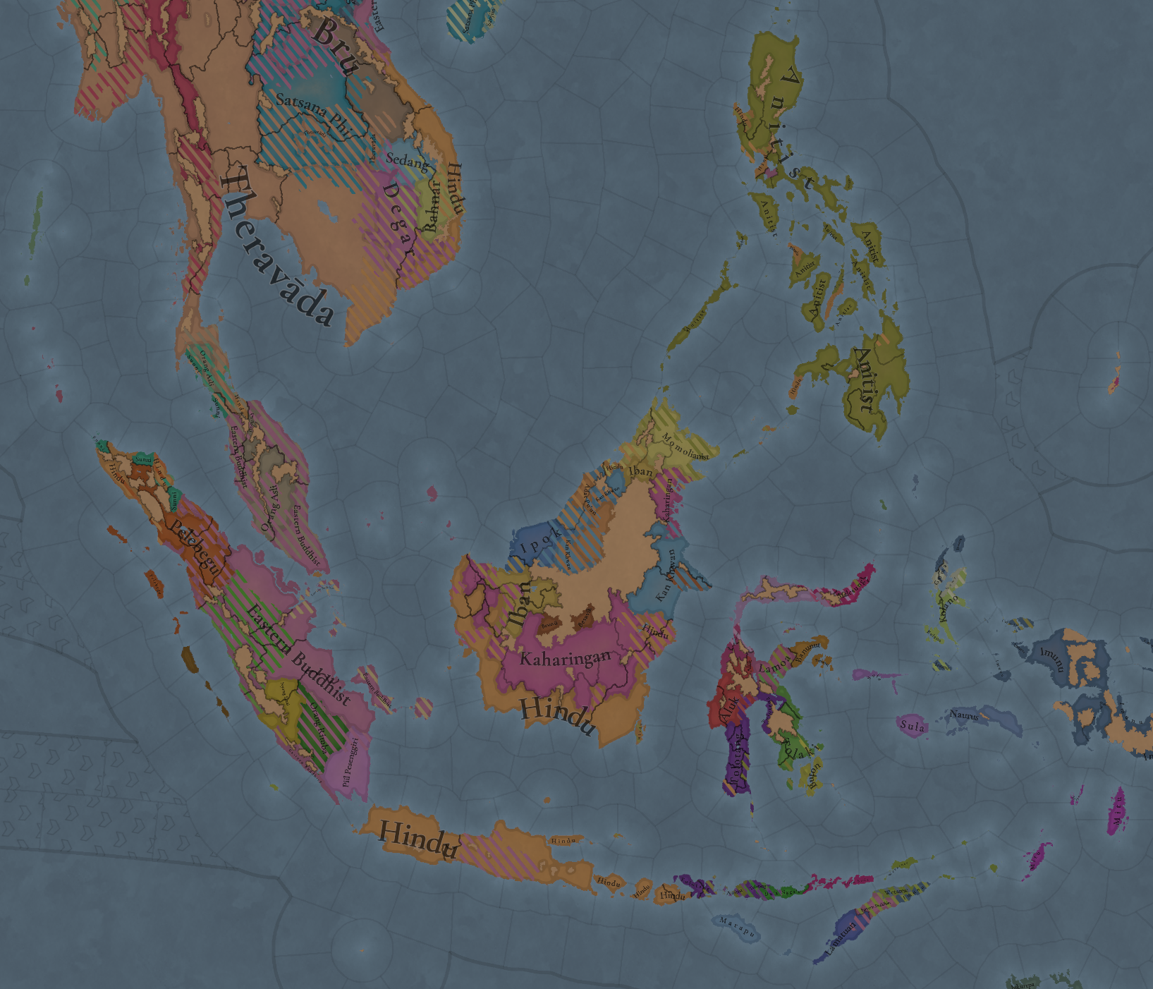
Religions.png

Religions2.png

Religions3.png

Religions4.png

Religions5.png
We've also put a lot of effort into polishing the religious distribution of the region.

Raw Materials:
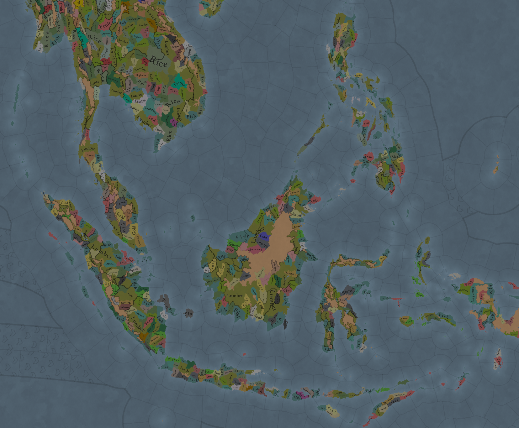
Raw Materials.png

Some tweaks, here and there. You might also notice that there's a unique spice in the region, Cloves!

Markets:
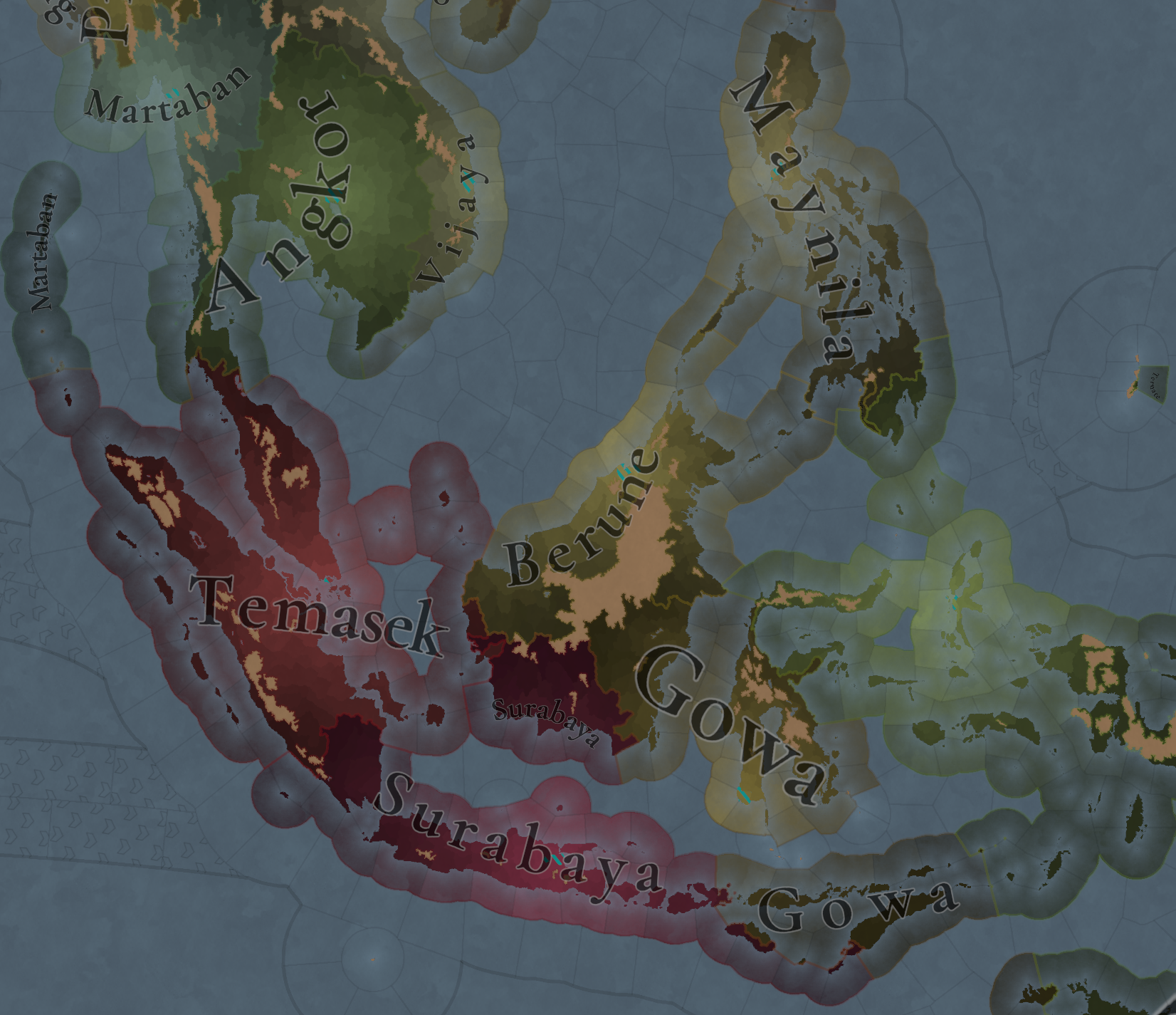
Markets.png

Not many changes, Surabaya is now a market center instead of Sunda Kelapa, and that's it.

And that's all for today!
 
  • 57Like
  • 17Love
  • 3
  • 2
Reactions:
Good job as always! I've done some research on the region so here's some stuff I found:

-1-The locations of Pattani, Dungun, Malacca, Bujang, Bandar Aceh, Pasai, Deli, Siak, Tungkal, Pangkalpinang, Badau, Kalianda, Lampung, Krui, Bengkulu, Padang, Sibolga, Simeulue, Tanjungpinang, Anambas Islands, Sambas, Sukadana, Cantung, Bangkalang, Paser, Tuyuk, Sangata, Karangan, Sepinang, Sebuku, Tawau, Tong Talun, Lahad Datu, Kinabatangan, Kudat, Api Api, Padas, Berune, Barulo, Tandang Sari, Saribas, Sebuyau, Santubong, Banten, Pangguyangan, Cibadak, Purwalingga, Pacitan, Bangkalan, Sugeneb, Jepara, Demak, Semarang, Cirebon, Maimbung, Lamitan, Babuyan, Taytay, Busuanga, Samboangan, Siocon, Sibugay, Sindangan, Dapitan, Initao, Butuan, Surigao, Cantilan, Bislig, Mansaka, Ata, Kalagan, Kalamansig, Basey, Tinago, Bo-ol, Singhapala, Kangdaya, Bágo, Binalbagan, Tanjay, Irong Irong, Araut, Batan, Masbate, Parpagoha, Burias island, Kalapang, Mangarin, Sawangan, Binawangan, Mulanay, Taybas, Kumintáng, Pakil, Pulilu, Casiguran, Laillo, Bigan, Agoo, Binalatongan, Bolinao, Manado, Amurang, Gororntalo, Toli Toli, Donggala, Poso, Tojo, Una Una, Lingketeng, Bulakan, Banggai, Mori, Kendari, Kalisusu, Taubonto, Kolumba, Malili, Palopo, Gowa, Sidenreng, Balanipa, Mamudju, Samprangan, Lombok, Sasak, Taliwang, Sumbawa, Dompu, Waingapo, Bajo, Ngada, Sikka, Larantuka, Lamakera, Sangliar-Dol, Yamdena, Kupang, Likusaen, Taliabu, Sanana, Kayeli, Amassing, Gane, Tidore, Waigeo, Ternate, Wasilei, Jailolo, Huamual, Saparua, Sahulau, Latu, Werinama, the Kai islands and Wokam should all have some minimum natural harbour suitability
-2-The modern name of Indonesia wasn't a thing in this time period therefore this region should be renamed to Nusantara(outer islands), an Austronesian word which was and is used to refer to all maritime SEA and not just modern day Indonesia, another better name would be East Indies but it's more Eurocentric and works better if the Carribeans are named West Indies
-3-Since it's a bit weird in terms of naming I suggest to split the area of the Philippines into its three island groups which are Luzon, Visayas and Mindanao
-4-The area of the Malay Peninsula should be split into Malaya in the south and Tambralinga in the north
-5-The Barat Daya islands(in game province province) should be part of the Moluccas area since they are considered part of that archipelago to this day
-6-The location of Temasek should be renamed to Singapura(in Malay) as that was its name from the eaely 14th century onward, while the country on the other hand should be called Singapore since that's the english name
-7-In 1337 the Kingdom of Tanjungpura and Palembang were not yet subjects of Majapahit, while Banggai was already a tributary
-8-In 1337 the rulers of Kedah and Aceh were not muslims, even though a considerable amount of tgeur population was
-9-Most of the polities in the region were or will be ruled by Kings(Maharajas and Sultans) therefore like I said in the Indochina TM feedback I think that the more powerful(and indipendent) countries in 1337 should be at least considered kingdoms(e.g. Majapahit), same goes for the ones that rivaled those kingdoms and managed to resist them in this time period(e.g. Sunda), while those who are not should be considered duchies
-10-Although it's not always the case I suggest using religion to determine the form of government, countries in the region that weren't yet ruled by muslim, Hindu and Buddhist in 1337 could start with a tribal form of government since the spread of those faiths brought newer and more innovative ways of ruling a country with them(mandala system for Hindus and Buddhism and islamic law)
 
Last edited:
  • 13
  • 12Like
  • 2
  • 1
Reactions:
My favourite region when I play as Japan
 
Last edited:
  • 15Haha
Reactions:
Dangers.png


Admittedly, I am not a fan of the name "dangers" for this map mode. A better name would be "seismic activity", or maybe something more flavourful, like "temblor", or "tremor", no?
 
  • 25
  • 6Like
  • 4
Reactions:
  • 18
  • 10Like
  • 1
Reactions:
Did you accidentally copy-paste the mainland SEA change-log or is it an aggregate of both the mainland and maritime parts of the greater region?

Let's start with the list of changes, that, as I mentioned last week, is shared between both regions, as we worked on them in parallel:
 
  • 20Like
  • 6Haha
  • 1
  • 1
Reactions:
  • 7Like
  • 3
Reactions:
I wanted to write it too :D
And on sea tiles it can show possible tsunami, hurricane areas and these kind of things.
Those can be checked in the Weather map mode, as it uses a different system.
 
  • 18
  • 10Like
Reactions:
Do the Eastern Buddhist countries in this region still have access to the sects like Confucianism, Daoism, or Musok which we saw in the Buddhism Tinto Talks?
 
  • 11Like
Reactions:
What's the point of putting red stripes where there are volcanoes? Just fully make the location red since where there are volcanoes there are earthquakes, right now it just makes it more complicated to read
 
Last edited:
  • 18
  • 4
Reactions: