• We have updated our Community Code of Conduct. Please read through the new rules for the forum that are an integral part of Paradox Interactive’s User Agreement.
Well, that is very sad to hear. :(
Was there a change of approach when it comes to releasables? Because some time ago I thought that You were okay with that...
I mean, it was confirmed that there will be small, few locations releasables like Cornwall and others...

As I said in original post regarding the history of Lauenburg-Bütow and ideas behind adding it, I would be perfectly happy even if it was just a "bare bones" tag without additional flavor. Having it be recognized in a historical game in any form would be a big victory for my local history community by itself.
I just thought coding just another country in wouldn't be very difficult... :confused:


Is it a result of more tight deadline, so there is less time adding things, or is it something else?

In any way, I would kindly ask you to reconsider, even if it's just this once for this small addition.

And if not, can there still be hope for it in the future updates of Project Caesar?
Ok, now I see the issue, I thought you meant a releasable at setup, and in this case, it would be a releasable by event; there's a separate thread that you can use to post Flavor Event suggestions: https://forum.paradoxplaza.com/forum/threads/flavor-event-suggestions-please-add-your-own.1697485/

And, in any case, better to discuss these issues in the proper Tinto Maps, to not hijack the discussion about Anatolian feedback.
 
  • 26Like
  • 4Love
  • 1
Reactions:
Doesn't it feel a bit luckluster regarding the changes in Anatolia if we are to compare them to Poland and Germany especially some location changes could have been added to look more pleasing (the Biga location for one could have been reduced) but at least you gave Trebizond Kotyora and Oinaion as they controlled them at the time
IMG_20240909_180154.jpg

All in all a bittersweet Anatolia feedback maybe there could be reviewed again in the future?
 
Last edited:
  • 4
  • 2Like
  • 1
Reactions:
Ok, now I see the issue, I thought you meant a releasable at setup, and in this case, it would be a releasable by event; there's a separate thread that you can use to post Flavor Event suggestions: https://forum.paradoxplaza.com/forum/threads/flavor-event-suggestions-please-add-your-own.1697485/

And, in any case, better to discuss these issues in the proper Tinto Maps, to not hijack the discussion about Anatolian feedback.
Okay, thank You a lot for clarification. Once again, sorry for posting it in an unrelated thread, I didn't get a response previously, so posted this here to be sure that it will be seen by You. I will refrain from this practice and edit my comments in this thread in a way, so it won't distract the discussion.
Anyway, many thanks, I'll post ideas in Flavor Event suggestions thread in a little while from now. :D
 
Last edited:
  • 1Like
Reactions:
Considering the amount of historical text related to Anatolia region, compared to other regions, where it's hard to find much. It do be looking quite lackluster indeed.
But then again, maybe we have been spoilt too much with how many locations some other regions have gotten. Like "but last year I had 37" moment.
 
  • 6
  • 2
  • 2
  • 1Like
Reactions:
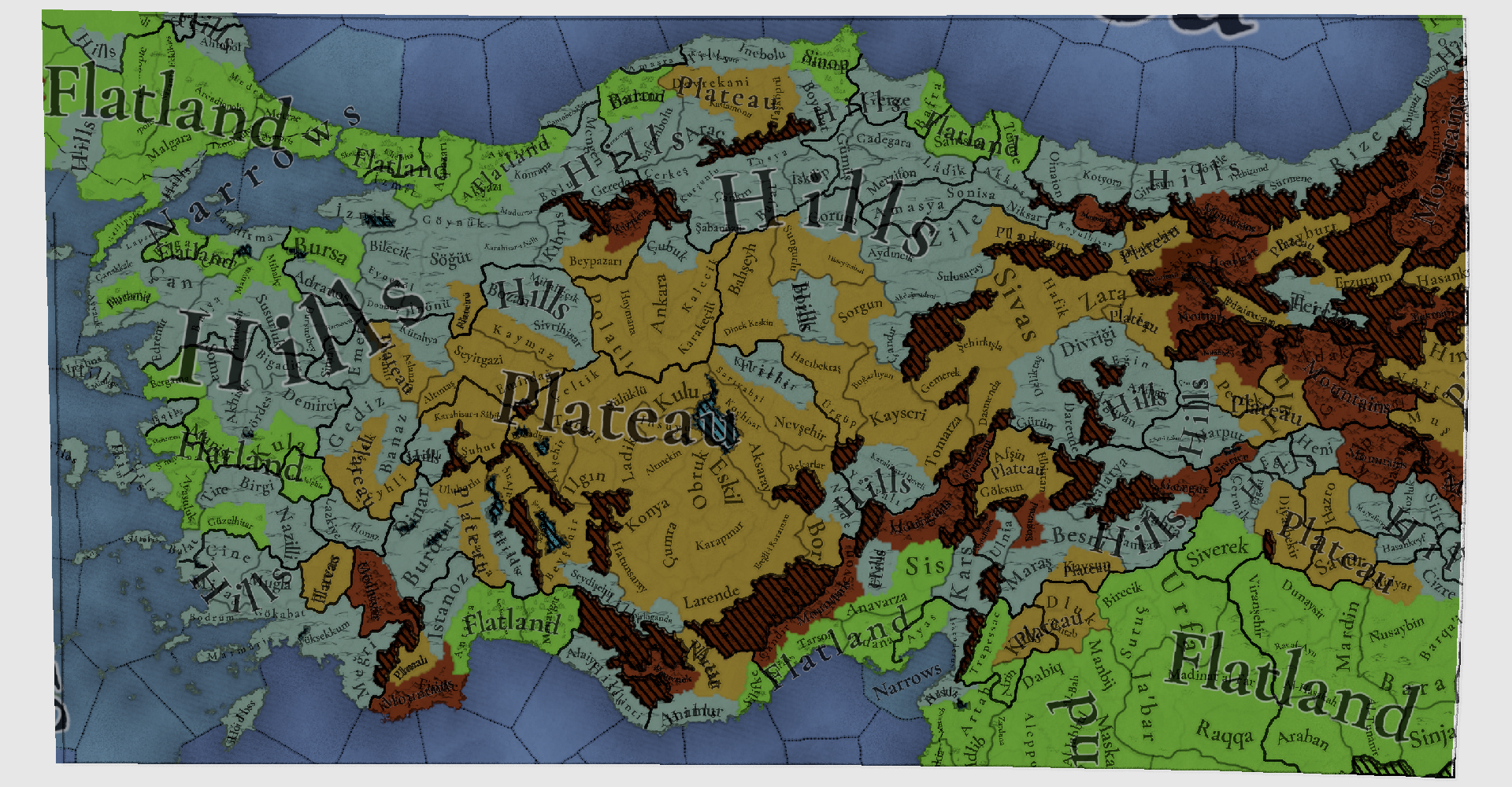
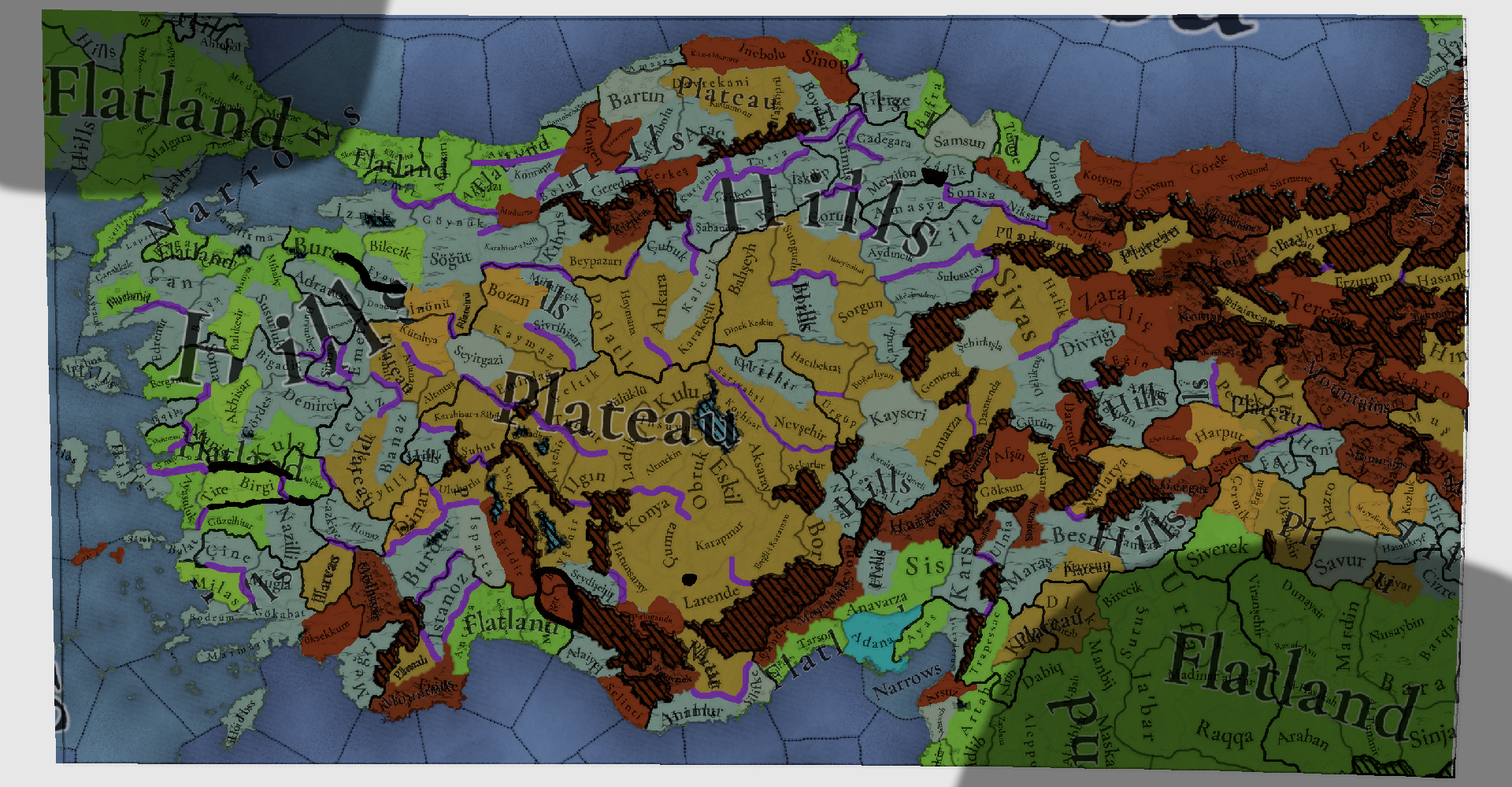
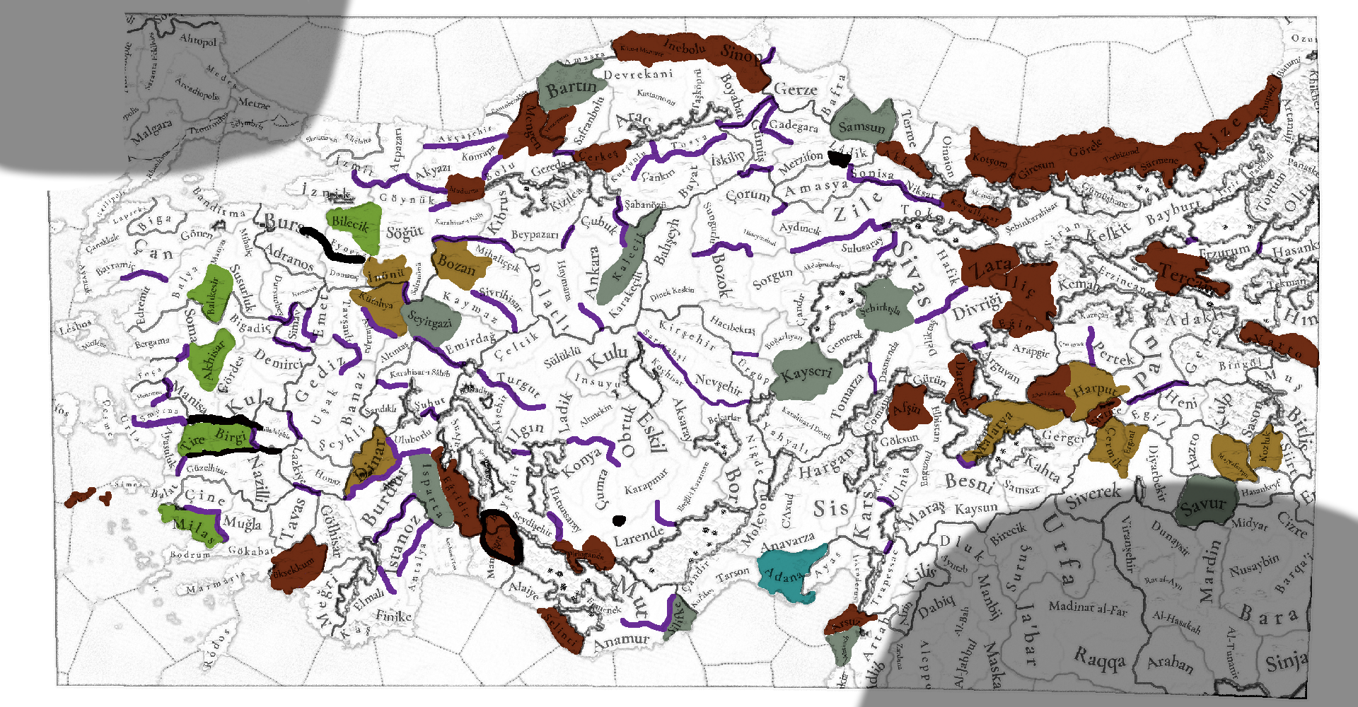
Alrighty, my last topographic analysis for about 3 weeks due to traveling! Let's make it count.

If I had to pick a Tinto Maps post to prove where ridge crossings would be the best fit: this is the one!
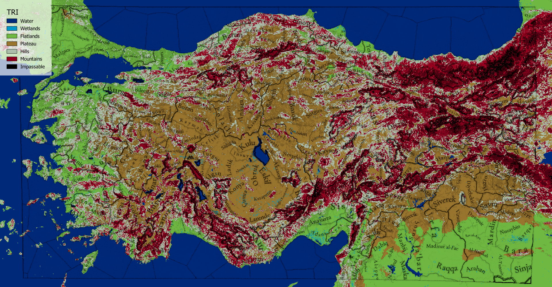
A large majority of the location borders identically overlap local hill and mountain ranges.
The inland plateaus are in reality often fringed by hills or mountain ranges, significantly limiting the pathfinding of the area.
Again they are indicated as purple lines, made independently of the other topograhic suggestions.

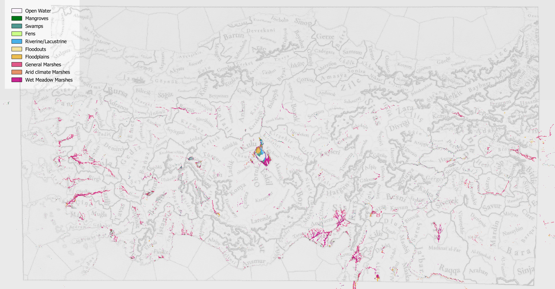
Most Wetlands are relatively small compared to the location it represents (Sinop, Demirli in the North and several rivers on the Western Coast).
However, I do think Adana Location in the South is a ripe candidate for the Wetland terrain type due high number of triburaties having floodplains in the delta south of the city.

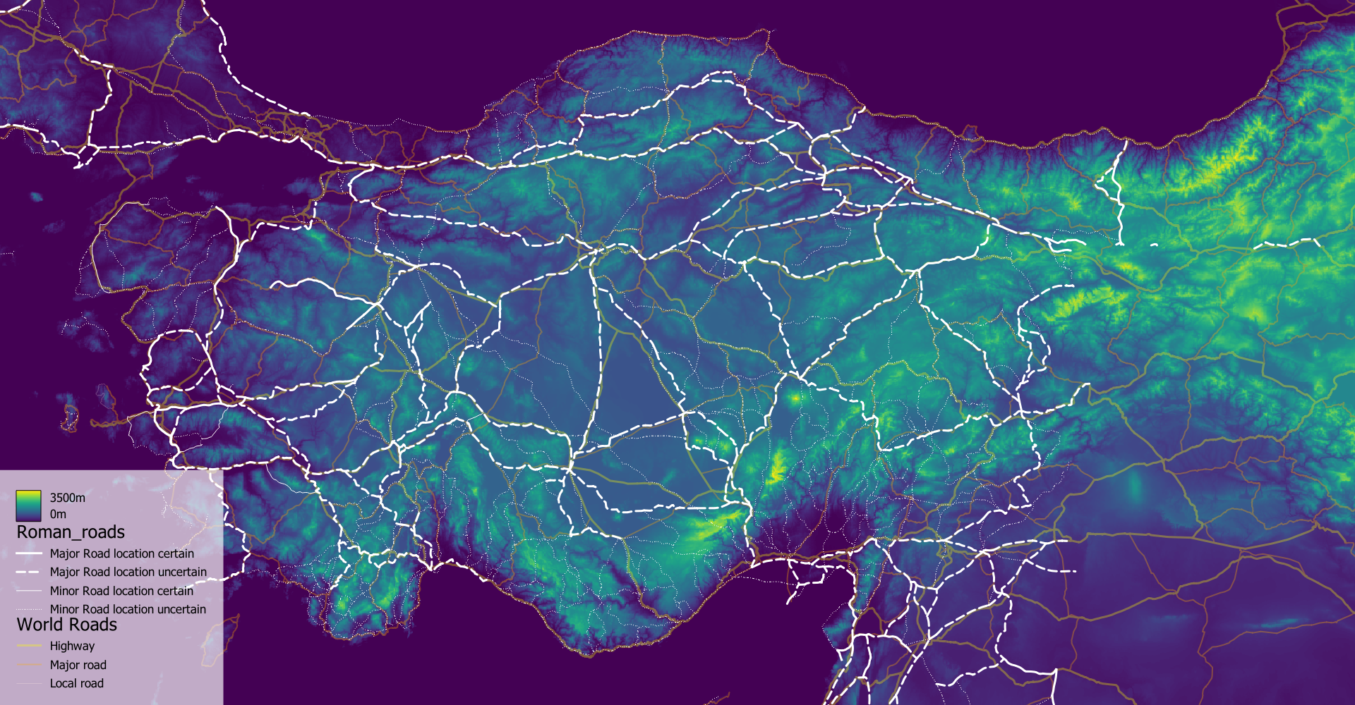
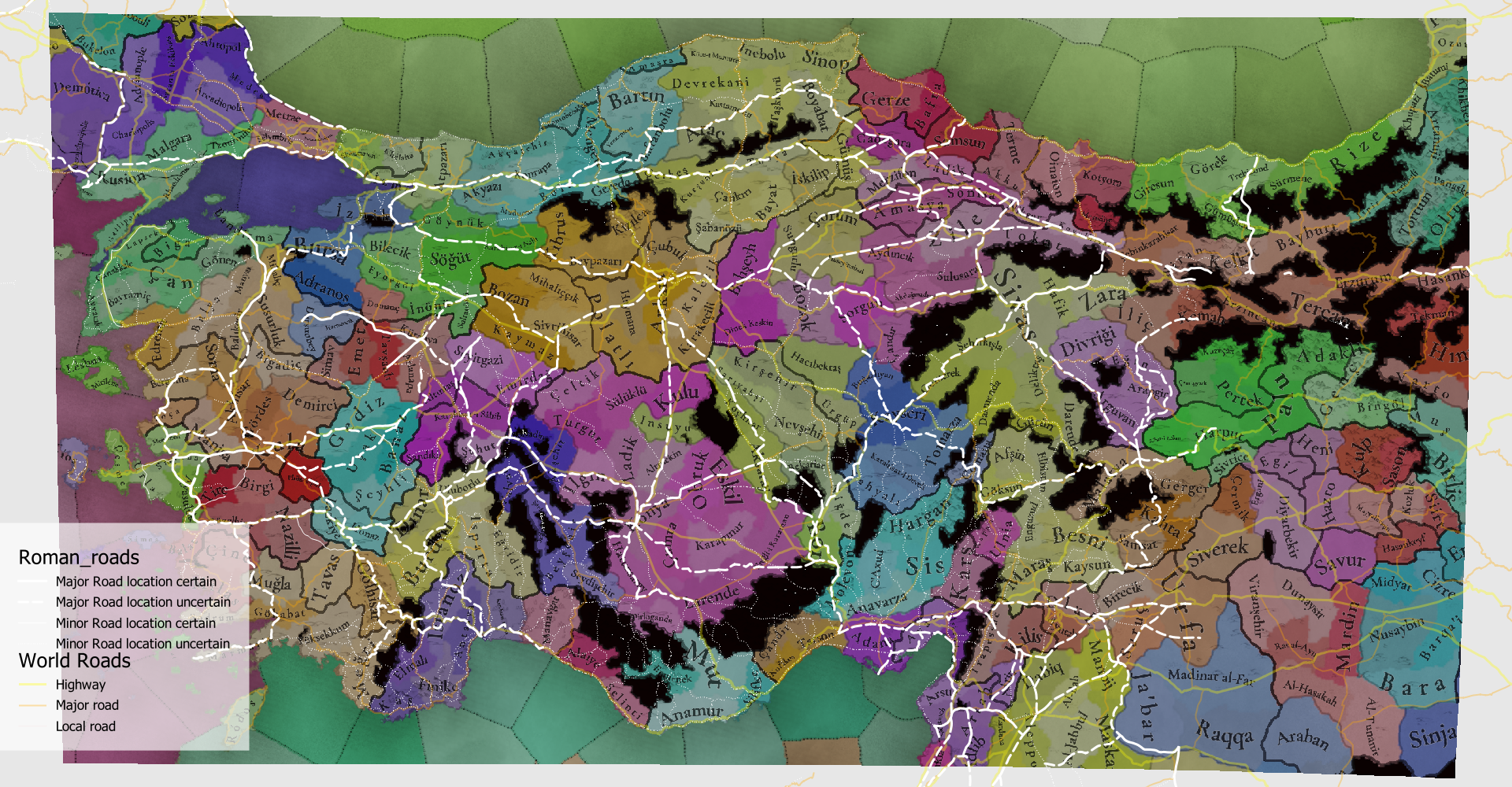
Defining Impassables is in this region very subjective, so I cross-referenced it with the known Roman Road Network. As I mentioned last time, I still vehemently believe that the two parallel mountain ridges southeast of Izmir should be impassable,

The Westernmost part of the Taurus mountains is currently easily crossible as a flatlands-plateau crossing between Manavgtat and Beyscinir, while there definitely should be a mountain (nearly impassable!) terrain between them.

For the rest there are a lot of locations I'd suggest to change into mountains, especially for the Trebizond region. While the forest there color a vibrant green on sattelite imageries, one will soon notice that nearly all habitation and infrastructure is along the coast. This is clearly reflected in the TRI-map as well. In general I also suggest a lot more mountains for the other mountainous regions too, as this is absolutely incredibly rugged terrain.


For those that are enjoying my posts, see you all back in October!


Current design by TintoSuggested changes"Changelog" of suggestions
TopoCurrent.png
TopoChanges.png
TopoChanges_Overlay.png

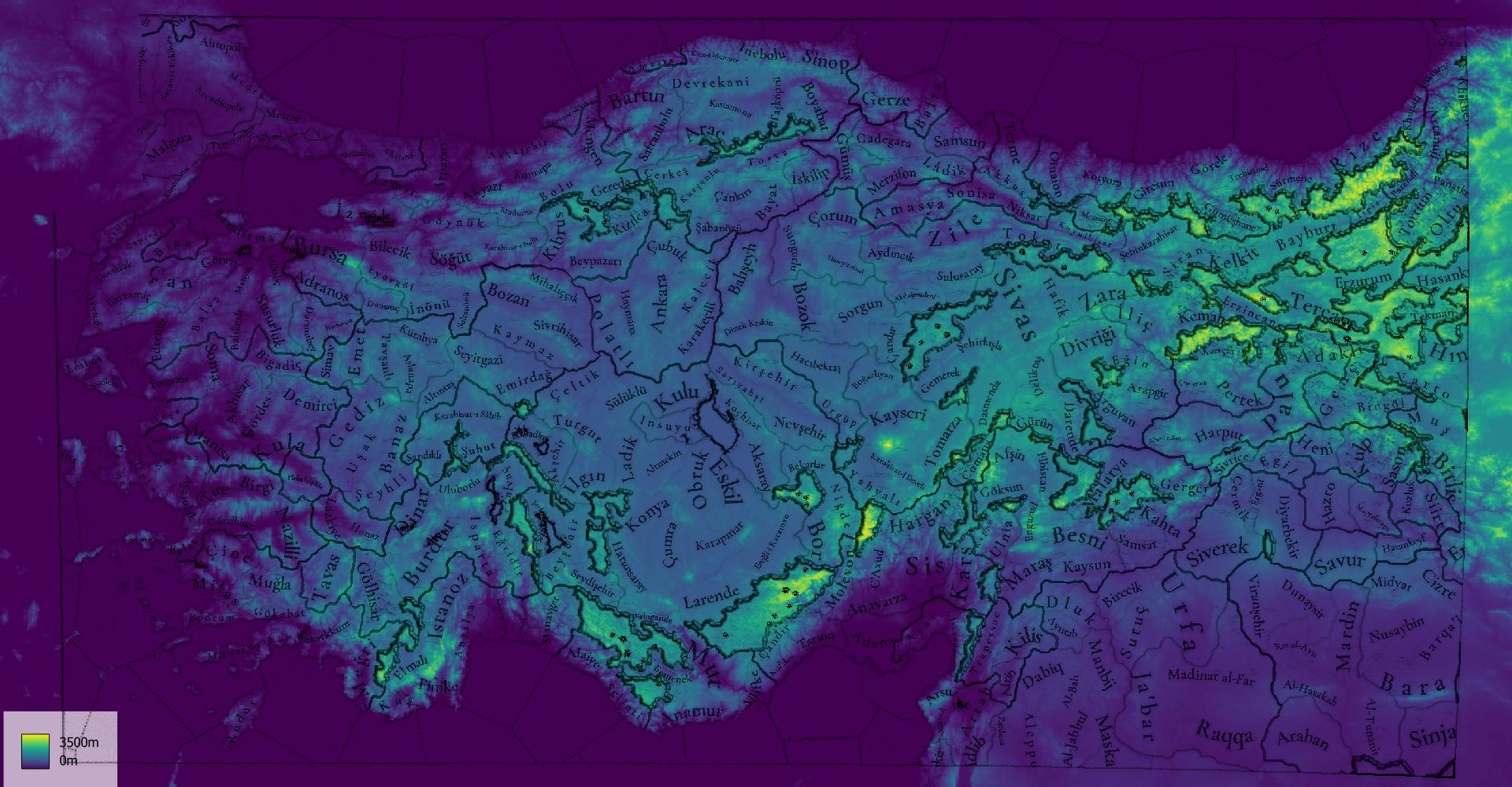
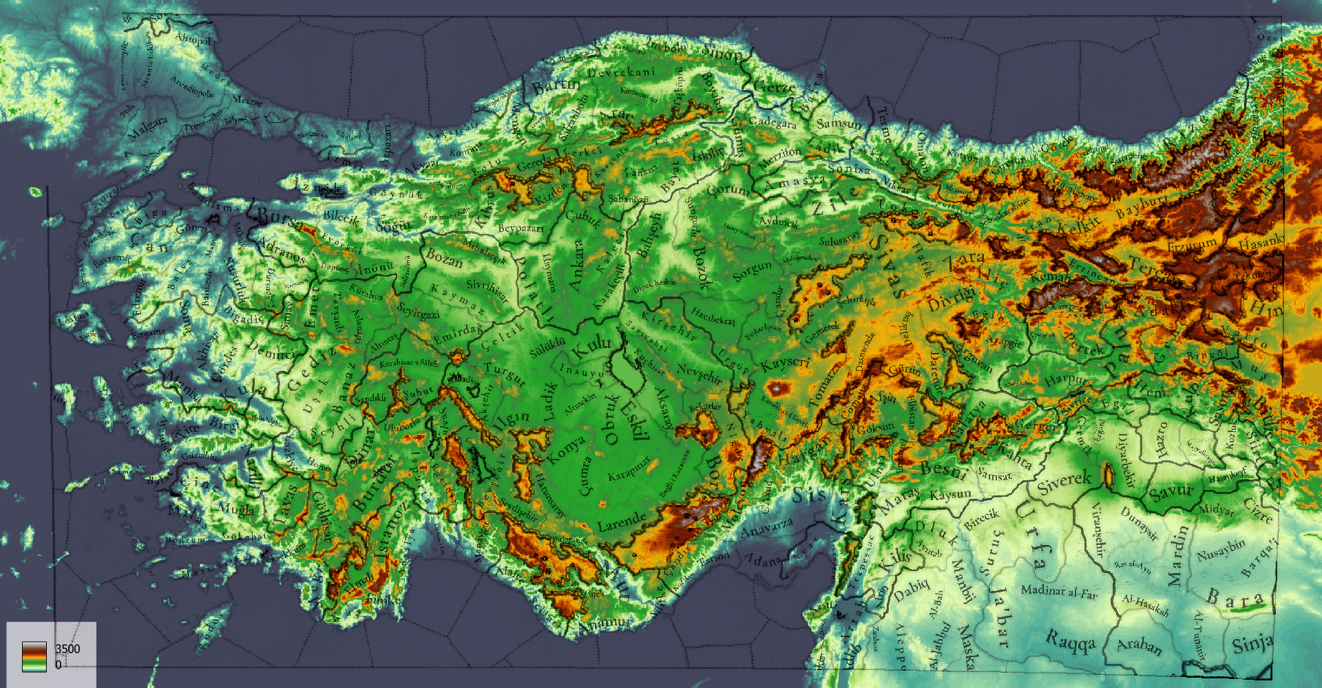
Terrain Ruggedness IndexLinear DEMDEM with exaggerated Lower Terrain
TRI.png
DEM_Viridis.png
DEM_Colorful.png

Global Wetlands map (unfortunately limited to 40 degrees North, which goes through the middle of the map)Paper for approximate indication of recent Wetland loss
Wetlands.png
tehs_a_1930587_f0001_oc.jpg

Roman Roads on top of the linear DEMRoman Roads on top of the Locations.
RomanRoads.png
RomanRoads_Locations.png
 
Last edited:
  • 17
  • 13Like
  • 8Love
  • 2
  • 1
Reactions:
Im really sorry but compared to the other reviews of the regions, Anatolian one has been extremely lackluster. Compared to the density of iberia, poland and even arabia, the provinces in anatolia feel too large and generic. There were a lot of great recommendations and reviews under the original thread too. Its a shame for such a geographically and culturally diverse region
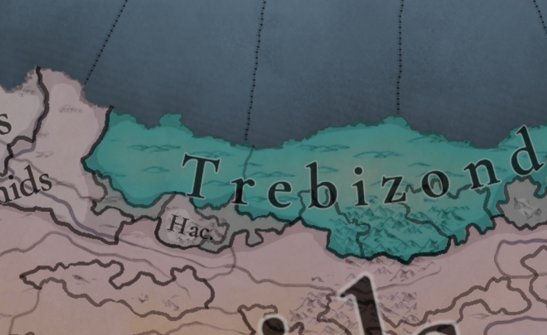
Does it feel a bit luckluster regarding the changes in Anatolia if we are to compare them to Poland and Germany especially some location changes could have been added to look more pleasing (the Biga location for one could have been reduced) but at least you gave Trebizond Kotyora and Oinaion as they controlled them at the time
View attachment 1185446
All in all a bittersweet Anatolia feedback maybe there could be reviewed again in the future?
Considering the amount of historical text related to Anatolia region, compared to other regions, where it's hard to find much. It do be looking quite lackluster indeed.
But then again, maybe we have been spoilt too much with how many locations some other regions have gotten. Like "but last year I had 37" moment.
I already mentioned this in previous map reviews, but I'll repeat it again. After we post each Tinto Maps, we find that each region is in different state with the others, in density, accuracy, etc., even if we tried to be consistent with our design and methods. This means that the review of each region will also be different, as we need to focus on different issues. So you may think 'hey, they added much less new locations in Anatolia', but then maybe you're overlooking that maybe it was already in a better position compared to others, and also that maybe what we needed to focus on for this region was not adding more locations, but improving the cultural and religious diversity of it (which is another thing that will make its gameplay different from, let's say, Western Europe).

So, as I say, do not expect each map review to add hundreds of locations; instead, giving us direct feedback in the Tinto Maps Feedback threads on what could specifically be improved even further after the review is quite useful.
 
  • 48
  • 24Like
  • 8
  • 1
Reactions:
Jesus Christ every Map feedback looks like a completely different game, what an absolute eye candy.

Genuine question, why do you, sometimes, mention in the changelog the characters addition like 'tvs_ilyas_bey' and how is this relevant to us and the map itself?

Genuine question 2: is there any remaining pops in this age of the celtic tribres of Galatia that migrated to central Anatolia?

Genuine question 3 (sorry, I stop already): what's the difference between Turkish and Turkoman?
 
  • 1
Reactions:
do not expect each map review to add hundreds of locations; instead, giving us direct feedback in the Tinto Maps Feedback threads on what could specifically be improved even further after the review is quite useful

breakfast-secondbreakfast.gif


We're getting second feedbacks?
 
  • 8Haha
  • 3Like
Reactions:
Jesus Christ every Map feedback looks like a completely different game, what an absolute eye candy.

Genuine question, why do you, sometimes, mention in the changelog the characters addition like 'tvs_ilyas_bey' and how is this relevant to us and the map itself?

Genuine question 2: is there any remaining pops in this age of the celtic tribres of Galatia that migrated to central Anatolia?

Genuine question 3 (sorry, I stop already): what's the difference between Turkish and Turkoman?
1. That's more for internal testing, but I think that it doesn't hurt to let you know that these are things that we add during the review.
2. Not really, as at this point they've gone through two processes of Hellenization, and another of Romanization, and now they've been under the rule of the Turks for 200 years or so; so there's only a memory that the region is called Galatia, because of that.
3. Turkish are settled Turks, while Turkomans are tribal Turks (simplifying the matter a lot).
 
  • 15Like
  • 3
  • 2
Reactions:
@Pavía I noticed nobody translated the names for the Genoese colonies and trading posts in Anatolia the majority of which should have some Genoese/Italian minorities in them so here's a list:

Location in the game/Genoese/Italian(usually coincides with the Genoese one)

These ones should be owned by Genoa from the start in 1337:
Amasra/Amastris
Foça/Fogliavecchia/Focea
Samsun/Simisso

These ones should still have a commercial presence or a few Genoese pops:
Ayas(today's Yumurtalik)/Laiazzo(in 1337 it should belong to Cilicia since the town wasn't fully conquered by the Mamluks until 1347 and the Venitians should have a trading post here since the Pope banned them from trading with the port of Alexandria and the Mamluks in 1322, so they enstablished a post here in an Cilician Christian port close enough to Egypt to "bypass" the ban until 1344 when the decree expired, the king of Cilicia was in favour of this since he used the money he got from the tariffs to pay tribute to the Mamluks for his indipendence)
Edremit/Adramittio(Genoa may still have some trade concessions that they stole from the Venetians 30 prior)
Balat/Palatia(trade post only by Venice briefly in the past with the Seljuks)
Trebizond/Trebisonda(has a trading post at the start and apparently the city had both Venetian and Genoese neighborhoods until the 20th century I hope they are rapresented)
Smyrna/Smirna(the Genoese should have a trading post and e few fortresses outside the city)
Ponthoherakleia/Penderachia
Çeşme/Cesme
Rize/Rize
Sinop/Sinope(also a sizable Genoese pop and a trading post at the start)

These ones are not in the game:
Kerpe/Carpi
Kusadasi/Scala Nova
Kaleköy/Simena
Çandarli/Pitane
Tenedos island/Tenedo

And that's all, I will do the rest in the other regions
 
Last edited:
  • 11Like
  • 3
Reactions:
This will be my biggest feedback so far, i spend my all childhood in the Western Anatolia, so this region is where I can contribute the Tinto most. You did a great job so far, i'm thankfull for that. I waited until this feedback was published for it to be changed, but the connection between some of the locations in western anatolia is a bit inconsistent. Especially considering that armies will pass through these locations, I can say that the armies moving between the two locations stop at unrelated settlements. I also made some arrangements on the borders of Eastern Anatolia and Syria, taking advantage of modern borders.

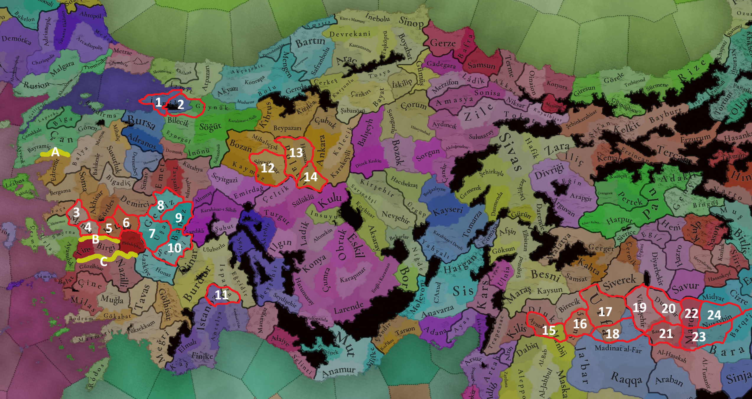
So here's my suggestions:

Locations.png


1- Gemlik/Yalova = (Nicaea had no sea border.)
2- Nicea/İznik = (City itself located eastern-most part of the lake so location must be eastwards.)
3- Manisa
4- Turgutlu = (I added this location because its more populated than Manisa itself, and geographically more accurate.)
5- Salihli
6- Kula
7- Uşak = (Uşak and Kula is directly connected but its not the case in this Tinto Map.)
8- Gediz = (It's a province north of Uşak)
9- Banaz
10- Şeyhli/Sivaslı = (I can recommend a name change to this province "Çivril" is more accurate.)
11- Bucak = (Burdur has a direct connection with Antalya through Bucak, not with Istanoz/Korkuteli.)
12- Sivrihisar = (Emirdag has a direct connection with Sivrihisar unlike what we have.)
13- Polatlı
14- Haymana = (Haymana is not at the east of Polatlı its in the south.)
15- Ayntab = (Manbij is at more south. Also this violates modern borders.)
16- Suruç
17- Urfa
18- Harran = (A suggested location, it's different than Urfa and popular with its farmlands.)
19- Viranşehir = (This province is just at the east of Urfa, it shouldn't be shown so far.)
20- Dunaysir
21- Ras Al'Ayn
22- Mardin = (Mardin borders does not flow that south.)
23- Kamışlı/Qamishli = (Another suggested province its just at the south of Nusaybin.)
24- Nusaybin

Suggested Wastelands:
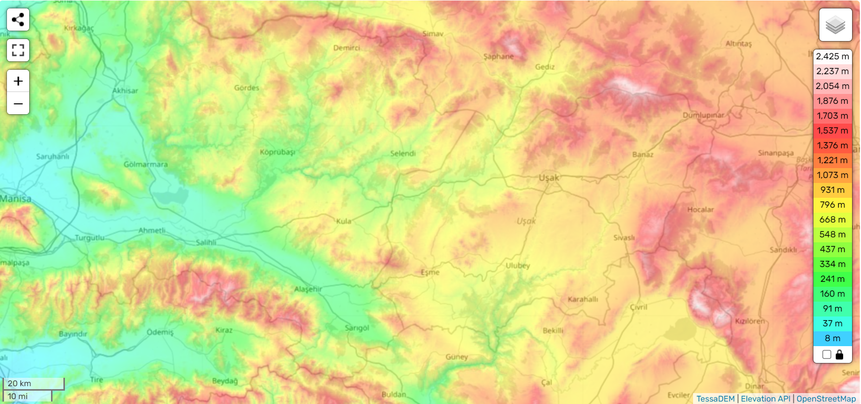
A- Kazdağları/Mount Ida = 1,770 m It should be in the game.
B- Bozdağ Mountains = 1,135 m It's divides many locations in the western anatolia
C- Aydın Daglari/ Messogis = 1.831 m An ancient mountain range, should be in the game.

EDIT: Just saw the feedback of @Sulphurologist . Uludag in Bursa is a good addition. Location design is okay but it could be better to show it in the game.

Generally i liked the Tinto design but my suggestions are crucial, so please consider. ;)

References:
The map I prepared was prepared according to the characteristics of geography. Those who wish can check the accuracy of this information:
Ekran görüntüsü 2024-09-09 183227.png
 
Last edited:
  • 15Like
  • 11
  • 3
Reactions:
I assume, given the layout and what did aid did not conform to my suggestions, that you have an event that gives the northwestern territories of the Sutayids to the Aq Qoyunlu? Presumably the same event would give Amid (Diyarbakr) to the Artuqids.

I also assume that the Artuqids are going to be more of a thing for the next TM (Iraq/Persia/etc.)?
 
Last edited:
  • 1Like
Reactions:
@Pavía

@racnes made the following suggestion (https://forum.paradoxplaza.com/foru...t-of-june-2024-anatolia.1689600/post-29857707) about the potential renaming of certain locations quite late in the original thread about Anatolia, and (parts of it) may have been overlooked (or not). I think it's quite a good suggestion overall, even though I don't agree with all of it (I'm glad you guys kept Gümüshane, for example).

I'm glad a whole lot of other things have been changed, though! Especially in case of the tradegoods (Alum in Sebinkarahasir, Fruits in Malatya, Medicaments in Karahisar-I Sahib, etc.), the Kurdish Emirates, the slight expansion of Trebizond, the addition of more Shiites, Mongols, Kurds, etc. Love it.
 
  • 6Like
  • 1Love
  • 1
Reactions:
I like seeing lake Amik present on the map - its often forgotten in PDX games.

However, there is also lake Sugla before much of it was converted to farmlands in recent times. All of the villages now surrounding this farmland used to stand on the lakeshore. Size-wise its about the same or larger as lake Aksehir, which is depicted, so I hope it can be added.
 
  • 2Like
Reactions:
@Pavía

@racnes made the following suggestion (https://forum.paradoxplaza.com/foru...t-of-june-2024-anatolia.1689600/post-29857707) about the potential renaming of certain locations quite late in the original thread about Anatolia, and (parts of it) may have been overlooked (or not). I think it's quite a good suggestion overall, even though I don't agree with all of it (I'm glad you guys kept Gümüshane, for example).

I'm glad a whole lot of other things have been changed, though! Especially in case of the tradegoods (Alum in Sebinkarahasir, Fruits in Malatya, Medicaments in Karahisar-I Sahib, etc.), the Kurdish Emirates, the slight expansion of Trebizond, the addition of more Shiites, Mongols, Kurds, etc. Love it.
yeah its probably not seen because I posted it late
 
Are the Germiyamids the overlord of each of their red neighbors? If not the coloration needs to be changed. Assuming I’m right though I’m wondering how an Ottoman breakout is supposed to occur. Historically they conquered the Karasids before breaking out into the Balkans at the expense of Byzantium, but that doesn’t seem feasible if the Geriyamids and their vassal swarm outnumber the Ottomans