• We have updated our Community Code of Conduct. Please read through the new rules for the forum that are an integral part of Paradox Interactive’s User Agreement.
Don't know if written already but it's Mayyafar-i-qin, not Mayyafar-a-qin.

And Northern Anatolian coast has too much Oceanic IMO. Yes some places higher up is classified as Oceanic climate, but the coastline is solidly humid subtropical, and most things happened in the coastline. The region is famous for it's tea and hazelnuts, which you don't associate with Oceanic climate normally.

Even Istanbul could be subtropical. It seems the devs looked at Köppen map for Turkey at Wikipedia (?) but that seems to be incorrect there. This Köppen map of Istanbul is more accurate:

The Map

Though again, it's a mix of Mediterranean shifted Subtropical, but for example olives don't grow well in Istanbul.

Sinop-Samsun as Mediterranean climate seems correct.
 
  • 2
Reactions:
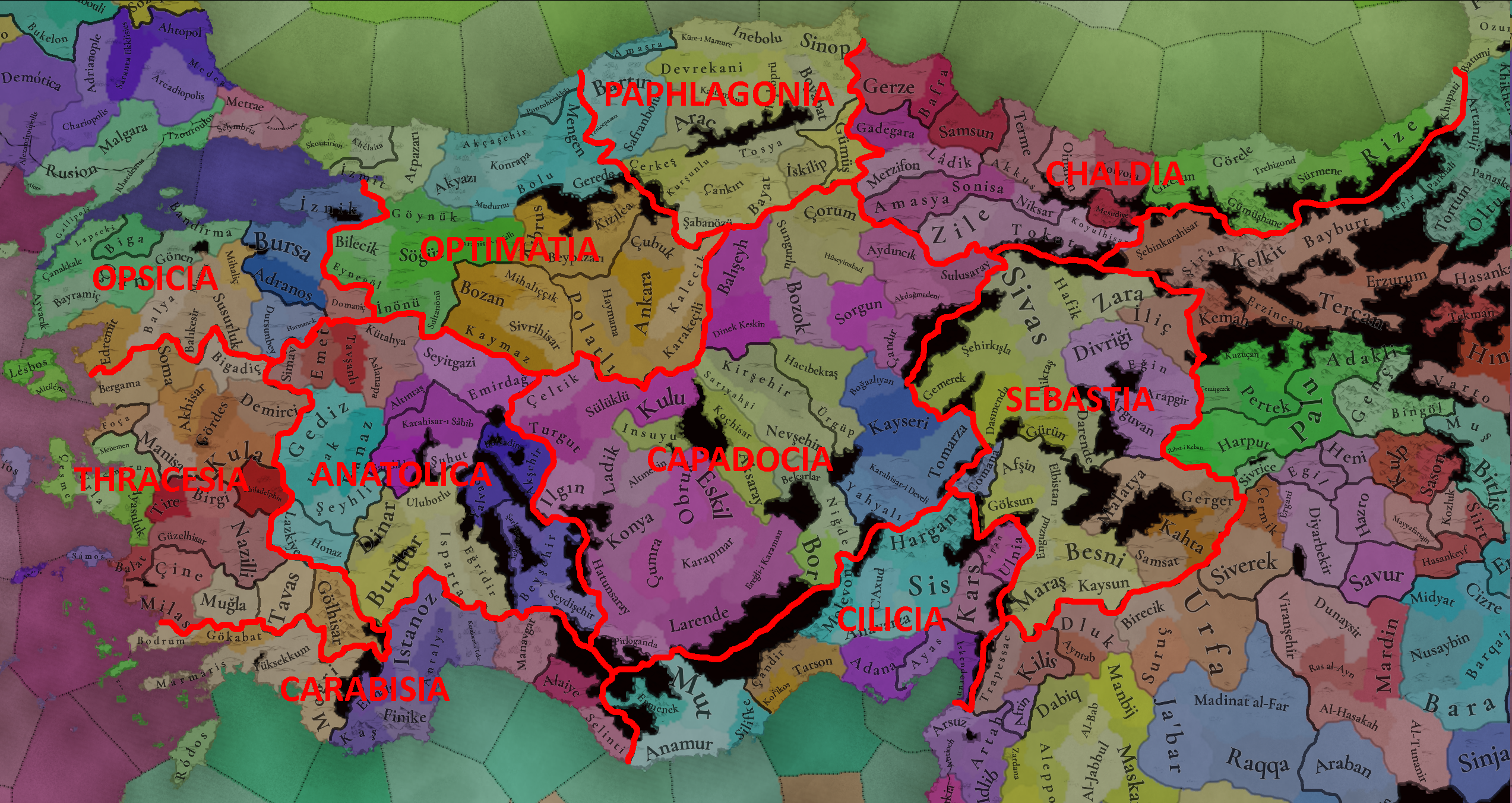
If we compare the European areas and especially the neighboring Balkan region, Anatolia has huge areas, especially with the density of provinces/locations, it should have more than four areas. Therefore, I propose to divide Anatolia after the inspiration of Byzantine themes:

1726078365555.png
 
Last edited:
  • 11
  • 8Like
  • 1
Reactions:
If we compare the European areas and especially the neighboring Balkan region, Anatolia has huge areas, especially with the density of provinces/locations, it should have more than four areas. Therefore, I propose to divide Anatolia after the inspiration of Byzantine themes:

View attachment 1186382
Yeah, the original proposal does seem a bit on the larger side for the areas, and also doesn't seem like they're derived from, say, the Ottoman Eyalets of the region (which would also be rather sizable, particularly the Anatolia Eyalet).
 
  • 1Like
Reactions:
Areas in Anatolia should look like Ottoman vilayets imo. This map might be too modern but at least it divides Anatolia evenly.

View attachment 1185507
If we compare the European areas and especially the neighboring Balkan region, Anatolia has huge areas, especially with the density of provinces/locations, it should have more than four areas. Therefore, I propose to divide Anatolia after the inspiration of Byzantine themes:

View attachment 1186382
The dislike discrepancy between these posts is ridiculous. Anatolia at the start of the game is Turkish and it remained Turkish for the entire time span, therefore if area names are not dynamic, Turkish names (as well as regions) should take precedence. in particular "Sebastia" has been extinguished from any use as a geographical designator since the initial Turk conquest nearly 300 years before the start date.
I'm not sure what Tinto Maps they started appearing in, but I absolutely love the tiny drawn mountains and forests that imitate old map styles. They give the map some needed texture while still letting the displayed information take precedence in the player's eye. Can't wait to see how the game looks by release if this is what it is looking like now.
Personally I vastly prefer the topography shading of eu4. The little mountain emojis don't pop out, they're hardly noticeable, and it doesn't convey the feeling of terrain very well at all. I really hope the game has an option to turn on eu4-style topography shading.
 
  • 9
  • 2Like
  • 2
  • 1
Reactions:
The dislike discrepancy between these posts is ridiculous. Anatolia at the start of the game is Turkish and it remained Turkish for the entire time span, therefore if area names are not dynamic, Turkish names (as well as regions) should take precedence. in particular "Sebastia" has been extinguished from any use as a geographical designator since the initial Turk conquest nearly 300 years before the start date.

Personally I vastly prefer the topography shading of eu4. The little mountain emojis don't pop out, they're hardly noticeable, and it doesn't convey the feeling of terrain very well at all. I really hope the game has an option to turn on eu4-style topography shading.
I guess my only issue with that example is that it's all the way from the 20th century Ottoman divisions of the regions (at least per the map). The ones the Ottomans actually used for the bulk of the period would be more ideal, but they're also similarly lopsided (a large Anatolia eyalet that holds most of the west and a few smaller ones for the rest of the region).

So your choices are either anachronistic (either from before or after the time period of the game) or lopsided in terms of balance.
 
  • 3Like
Reactions:
Western Anatolia feels a bit generic as an area name given no other areas are also named after Anatolia. Perhaps it could be renamed to Asia Minor? Whilst nowadays this tends to refer to all of Anatolia, in the past it generally meant the heavily Greek areas on the western end.
 
  • 2Like
Reactions:
IMG_4169.png

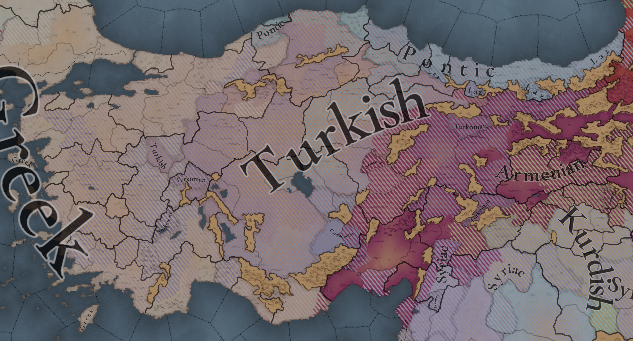
You said that you were going to review the colours of all the different cultures during the review; but none of them have changed. Could you please change the colours to make them easier to distinguish! I suggest making Turkish red, Kurdish yellow, Greek either sky blue or purple and Laz any colour which is more distinguishable from Pontic.

Edit: Although technically not within the scope of this thread, I would also love to see a forest green Bulgarian colour. Which is why I think red suits Turkish better, so it isn't too similar to this Bulgarian colour.
 
Last edited:
  • 13Like
  • 7
  • 1
Reactions:
Yes that seems accurate, sinopia in specific didn't cease to be produced, but it was no longer a major export I believe. Locally kept being used in monastic art (all of those Cappadocian cave churches) and to decorate pottery, it's still used for the same purpose among the latter. I think the clay pottery province(s) should stay as they are, but perhaps some adjacent North Cappadocian province such as Sariyasi or Kirsehir should have dyes being produced to reflect this.

From the paper I linked earlier:
Great catch. I agree that swapping Kirsehir's lumber for dyes makes a lot of sense.

From a gameplay perspective, there's tons of lumber in Anatolia (with a fair amount on the plateau, too). Meanwhile, there's very little in terms of dyes which might support central Anatolian textiles.

That said... earth pigments were poor clothing dyes and were largely used as paint for building/artwork. Still, having dyes here might at least approximate the trees/plants traditionally used for textile dying, which PC doesn't really seem to represent.
 
  • 3
  • 1Like
Reactions:
Hello, I noticed this in the original Tinto Maps, but I thought it would get cleaned up. Splitting the island of Lesvos into "Lesbos" and "Mytilene" is a bit of an awkward division. Generally, the locals consider Lesvos to be the entire island, while Mytilini is the capital city; however, in modern Greek both can be generally used to refer to the whole island. Essentially, this is the equivalent of splitting the UK into to parts "England" (including Wales) and "United Kingdom." The awkwardness of the name is compounded by the fact that a former Prime Minister of Greece got in hot water for talking about "Lesvos and Mytilini" when listing islands in the north Aegean a few years ago.
I think using the name Mytilini generally works for the eastern part of the island, but I would suggest a different one for the west. An obvious one would be "West Lesvos," which is the official modern name for the area. Alternatively, I would suggest one of the following towns if you are looking for a more inspired name: Kalloni, Eresos, Molyvos, Mantamados. They are all located in western Lesvos and existed prior to 1300. Between the four, you'll find a few significant ports, castles, and churches.
 
  • 5Like
  • 2
Reactions:
Hello, I noticed this in the original Tinto Maps, but I thought it would get cleaned up. Splitting the island of Lesvos into "Lesbos" and "Mytilene" is a bit of an awkward division. Generally, the locals consider Lesvos to be the entire island, while Mytilini is the capital city; however, in modern Greek both can be generally used to refer to the whole island. Essentially, this is the equivalent of splitting the UK into to parts "England" (including Wales) and "United Kingdom." The awkwardness of the name is compounded by the fact that a former Prime Minister of Greece got in hot water for talking about "Lesvos and Mytilini" when listing islands in the north Aegean a few years ago.
I think using the name Mytilini generally works for the eastern part of the island, but I would suggest a different one for the west. An obvious one would be "West Lesvos," which is the official modern name for the area. Alternatively, I would suggest one of the following towns if you are looking for a more inspired name: Kalloni, Eresos, Molyvos, Mantamados. They are all located in western Lesvos and existed prior to 1300. Between the four, you'll find a few significant ports, castles, and churches.
Mithymna would be the best solution, in my opinion (as well as others)! ;)

 
  • 2Like
Reactions:
Hey! Just wanted to let you know here that today's Tinto Maps is delayed until 15:30, as we had some last-minute technical issues that we needed to solve to have proper and beautiful screenshots. Sorry for the inconveniences; please try not to hijack this thread, and instead wait patiently until 15:30. ;)
 
  • 18Like
  • 4
Reactions:
Hey! Just wanted to let you know here that today's Tinto Maps is delayed until 15:30, as we had some last-minute technical issues that we needed to solve to have proper and beautiful screenshots. Sorry for the inconveniences; please try not to hijack this thread, and instead wait patiently until 15:30. ;)
Wow.
 
  • 24Haha
  • 4
  • 1
  • 1
Reactions:
Hey! Just wanted to let you know here that today's Tinto Maps is delayed until 15:30, as we had some last-minute technical issues that we needed to solve to have proper and beautiful screenshots. Sorry for the inconveniences; please try not to hijack this thread, and instead wait patiently until 15:30. ;)
My reaction to this information:
Screenshot_20240911_011753_Chrome.jpg
 
  • 8Haha
  • 2Like
Reactions:
Hey! Just wanted to let you know here that today's Tinto Maps is delayed until 15:30, as we had some last-minute technical issues that we needed to solve to have proper and beautiful screenshots. Sorry for the inconveniences; please try not to hijack this thread, and instead wait patiently until 15:30. ;)
Edging us like this...
Smh...

Also: MMW, the next tinto maps after this will be central asia.
 
  • 1Like
Reactions:
Hey! Just wanted to let you know here that today's Tinto Maps is delayed until 15:30, as we had some last-minute technical issues that we needed to solve to have proper and beautiful screenshots. Sorry for the inconveniences; please try not to hijack this thread, and instead wait patiently until 15:30. ;)
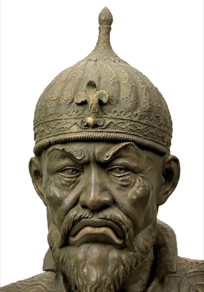
Unacceptable. Please submit yourself to Beg Timur in Samarkand for punishment for this transgression
 
Unacceptable. Please submit yourself to Beg Timur in Samarkand for punishment for this transgression
We like to call him Baby Timur, at least until he grows up...
 
  • 4Like
  • 1Haha
  • 1
Reactions:
I'm not sure what Tinto Maps they started appearing in, but I absolutely love the tiny drawn mountains and forests that imitate old map styles. They give the map some needed texture while still letting the displayed information take precedence in the player's eye. Can't wait to see how the game looks by release if this is what it is looking like now.
They already were there, but they depend on the zoom level to have them appear.
 
  • 6Like
  • 1
Reactions:
View attachment 1186781
You said that you were going to review the colours of all the different cultures during the review; but none of them have changed. Could you please change the colours to make them easier to distinguish! I suggest making Turkish red, Kurdish yellow, Greek either sky blue or purple and Laz any colour which is more distinguishable from Pontic.

Edit: Although technically not within the scope of this thread, I would also love to see a forest green Bulgarian colour. Which is why I think red suits Turkish better, so it isn't too similar to this Bulgarian colour.

Agree but Bulgaria(both the country and the culture) should have the colour they have in Eu4, it's so unique and stands out much also I think everybody is uses to it from Crusader kings
 
  • 1
Reactions: