• We have updated our Community Code of Conduct. Please read through the new rules for the forum that are an integral part of Paradox Interactive’s User Agreement.

CKIII Dev Diary #26 - Map Scope

Salutations!

As a continuation from last week, I will be talking about the scope of the map and, perhaps more importantly, showing you how it all actually looks. Get ready for a very screenshot heavy DD!

Europe
Europe has been reworked from the ground up. We made sure to give all of Europe proper attention when painting baronies and counties. It was important for us to make sure we have a good and consistent quality level across the map. I’m sure you’ll find eastern Europe in particular fleshed out with a lot more detail than what you may be used to in CK2.

26_01_kiev.jpg


26_02_novgorod.jpg


Since we’ve already shown bits and pieces of Europe in screenshots and videos, let’s have a look at a few specific locations, and what special buildings they have available. Starting with France, it felt like an obvious choice to include Notre-Dame, one of the most recognizable cathedrals of the time period.

26_03_notre-dame.jpg


26_04_northern_france.jpg


26_05_aquitaine_burgundy.jpg


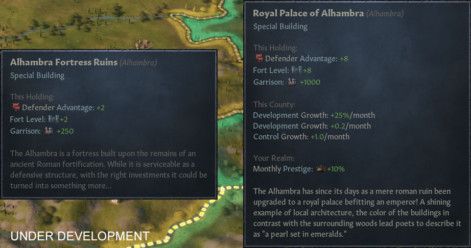
Next up, Iberia. Featuring two major rivers, plenty of hills and a few special buildings. In the county of Granada you’ll find Alhambra. While merely an old ruin at game start, it can be upgraded to offer some of the highest fortifications in the game.
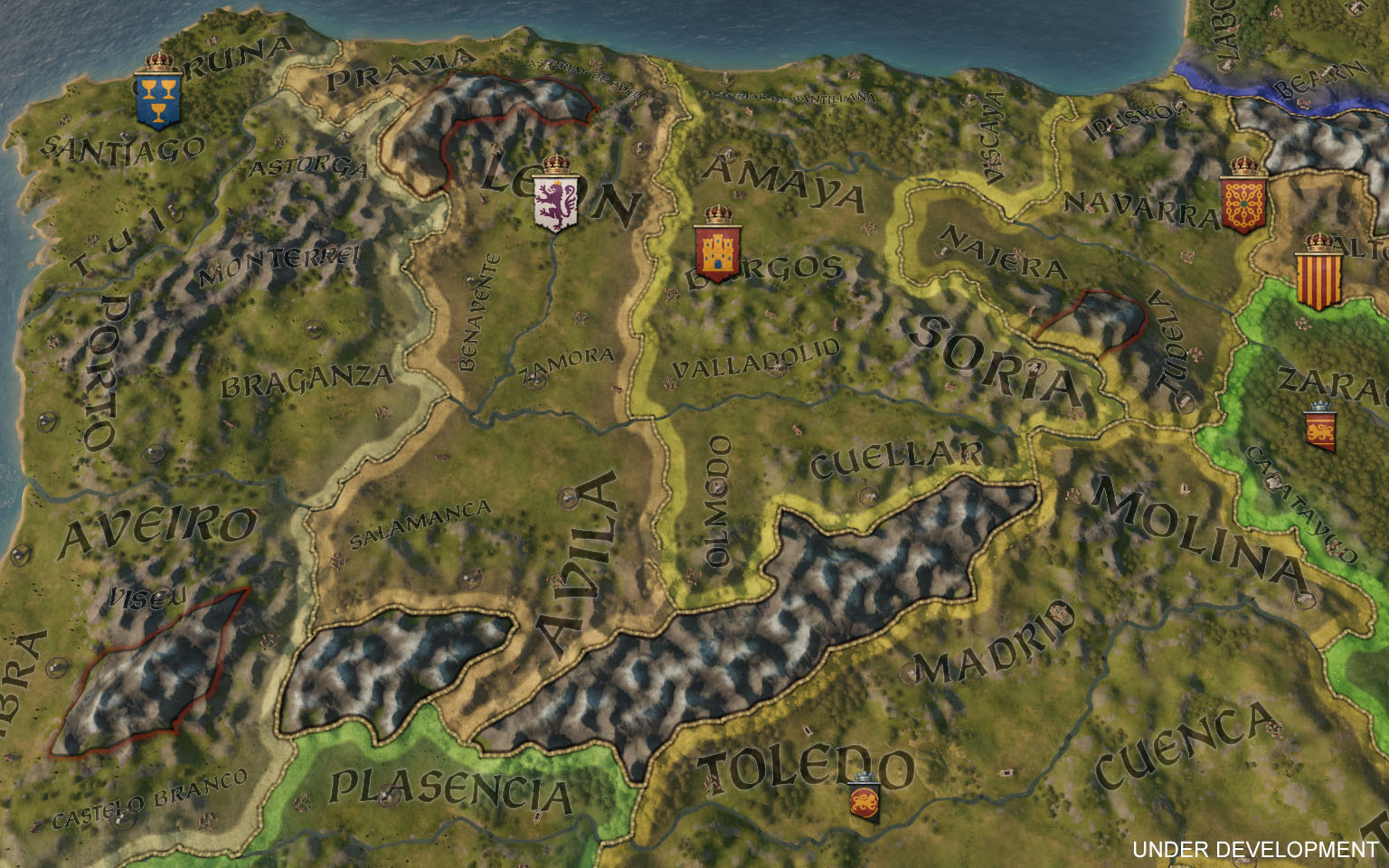
26_06_northern_iberia.jpg


26_07_southern_iberia.jpg


26_08_alhambra.jpg


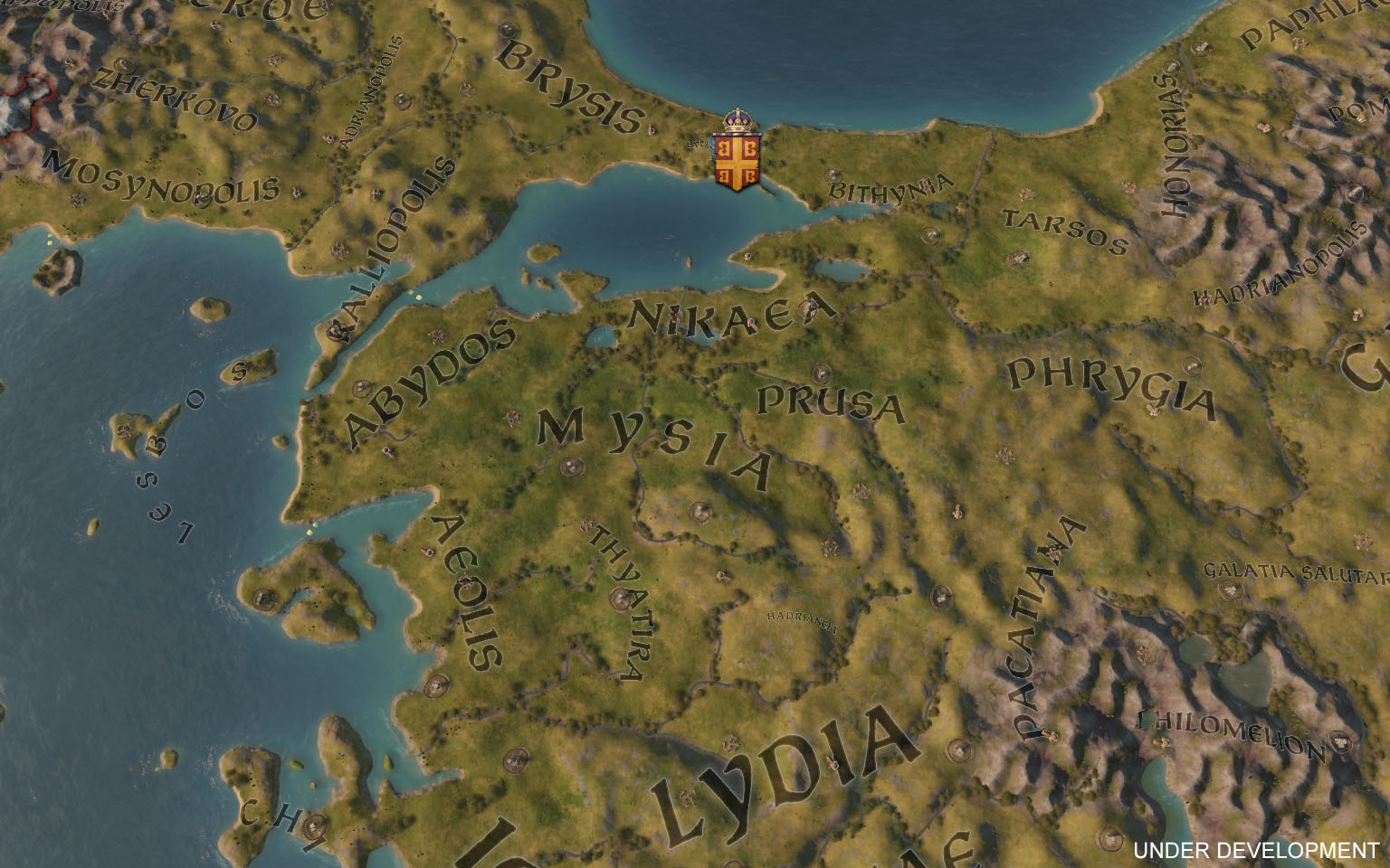
Speaking of special buildings. The city of the world’s desire, features not one, but two, special buildings. This makes Constantinople a very spectacular holding, and if that isn’t enough, it also has the highest development level in the game.
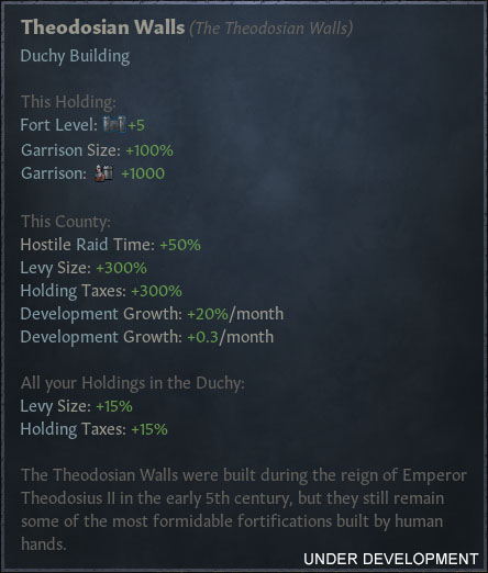
26_09_theodosian_walls.jpg
26_10_hagia_sophia.jpg


26_11_greece_anatolia.jpg


Before moving on, I’ll just leave this culture screenshot right here:

26_12_what_cultures_now.jpg


The Middle East
The Middle East has seen the same level of attention and rework as Europe, with some particular attention spent on updating history across the region. For example, the Seljuks control a vast empire in 1066, properly representing their historical borders. They have a plethora of different cultures as their subjects and may fall apart if not careful.
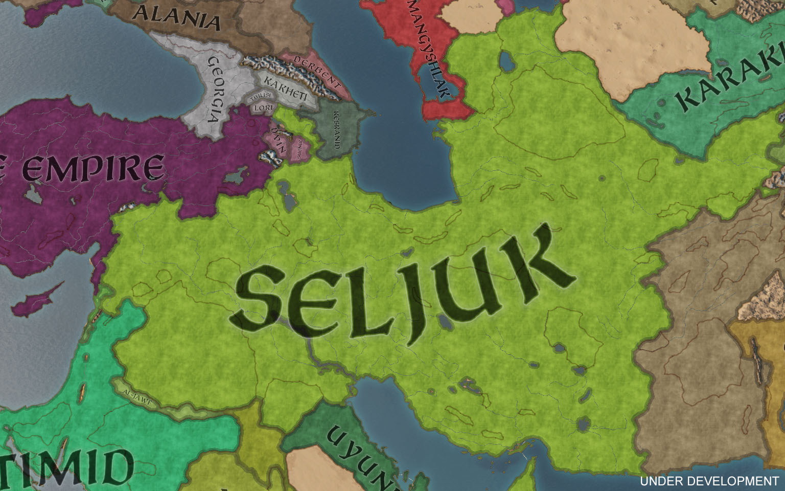
26_13_seljuk.jpg


Development in the region is above your average starting levels. Baghdad, for example, starts out with one of the highest levels of development in the game — bested only by a few other locations such as Constantinople! Baghdad also has one of the single most impressive special buildings available, the House of Wisdom.
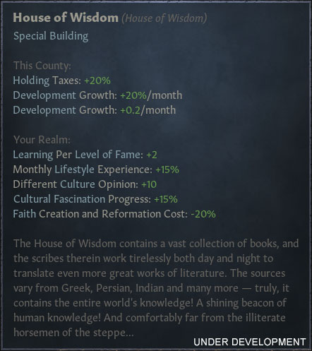
26_15_house_of_wisdom.jpg


26_16_baghdad.jpg


26_17_nishapur.jpg


26_18_jerusalem.jpg


Africa
Africa has seen some of the greatest additions to the map. No longer cut in half, the Sub-Saharan kingdoms have plenty of space to expand in as we have included the entire Nigerian coast.

26_19_west_africa.jpg


We have a total of five different pagan faiths to play as, giving you plenty of different options. A solid first pick would be Benin, within the Niger delta. They start off with a decent development level and access to a special building: The massive construction that is the Walls of Benin.
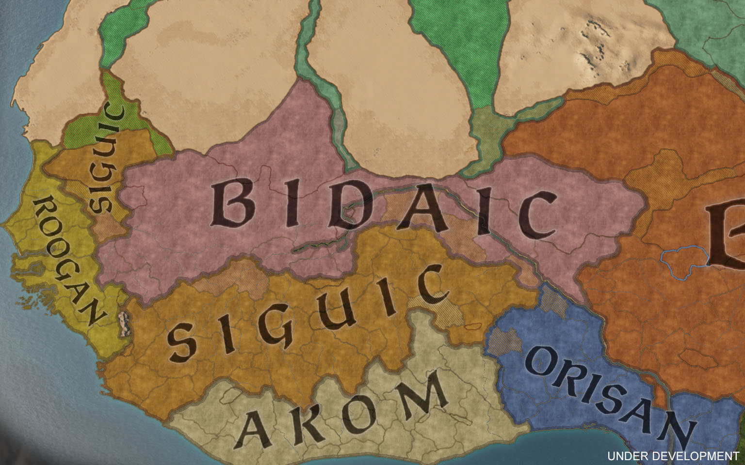
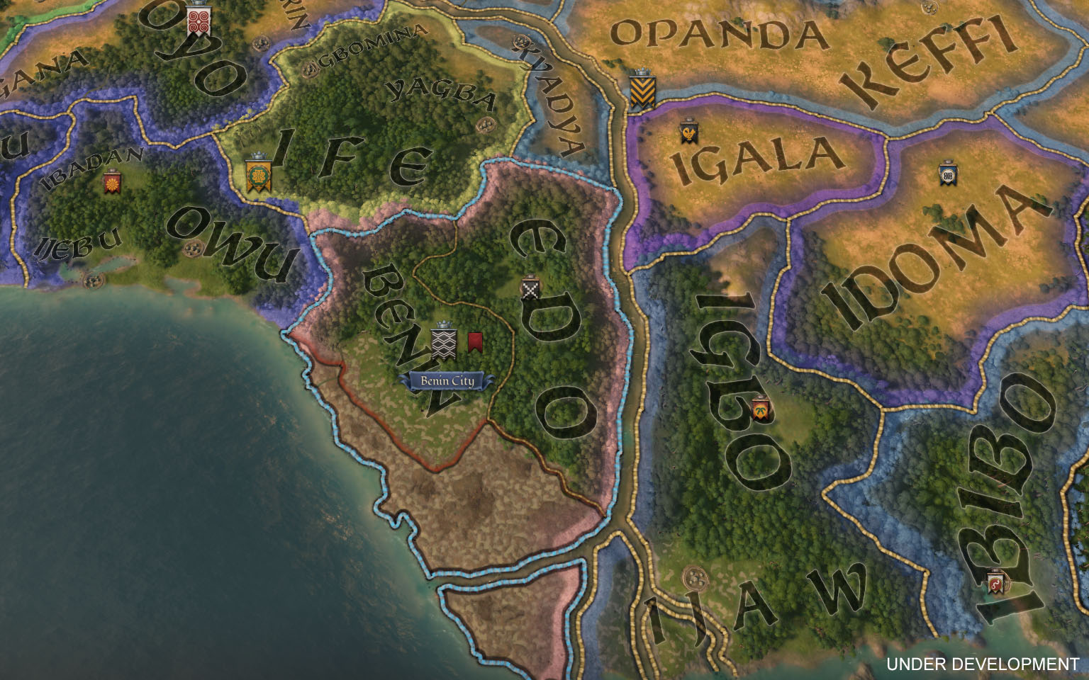
26_20_faiths_west_africa.jpg


26_21_benin.jpg


26_22_walls_of_benin.jpg


Some cultures will start with the ability to sail major rivers, allowing them to use the Niger to quickly ferry troops back and forth. The coast on the other hand, will be open for everyone to use. You won’t be able to sail around the African coast to reach Europe however, or vice versa. That route is blocked by impassable sea, since it was often difficult, if not impossible, to sail along the western coast due to storms and rough seas. No viking raids in Africa, I’m afraid!

26_23_ghana_niger.jpg


26_24_coast_of_guinea.jpg


26_25_impassable_sea.jpg


Let’s not forget the Horn of Africa. Expanded to include Mogadishu, the area offers more space to play in, with christian, muslim, jewish, and pagan rulers all wanting a piece of each other.

26_26_ajuraan.jpg


26_27_ajuraan_close_up.jpg


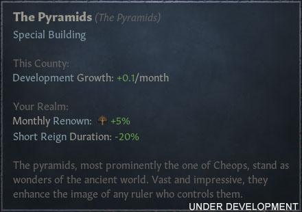
Finally, let's mention Egypt. A rich area that has a lot of floodplains, good development levels, and even a couple of special buildings. All encompassed by the Nile, a major river with green and lush vegetation.

26_28_egypt.jpg


26_29_pyramids.jpg


The Far East
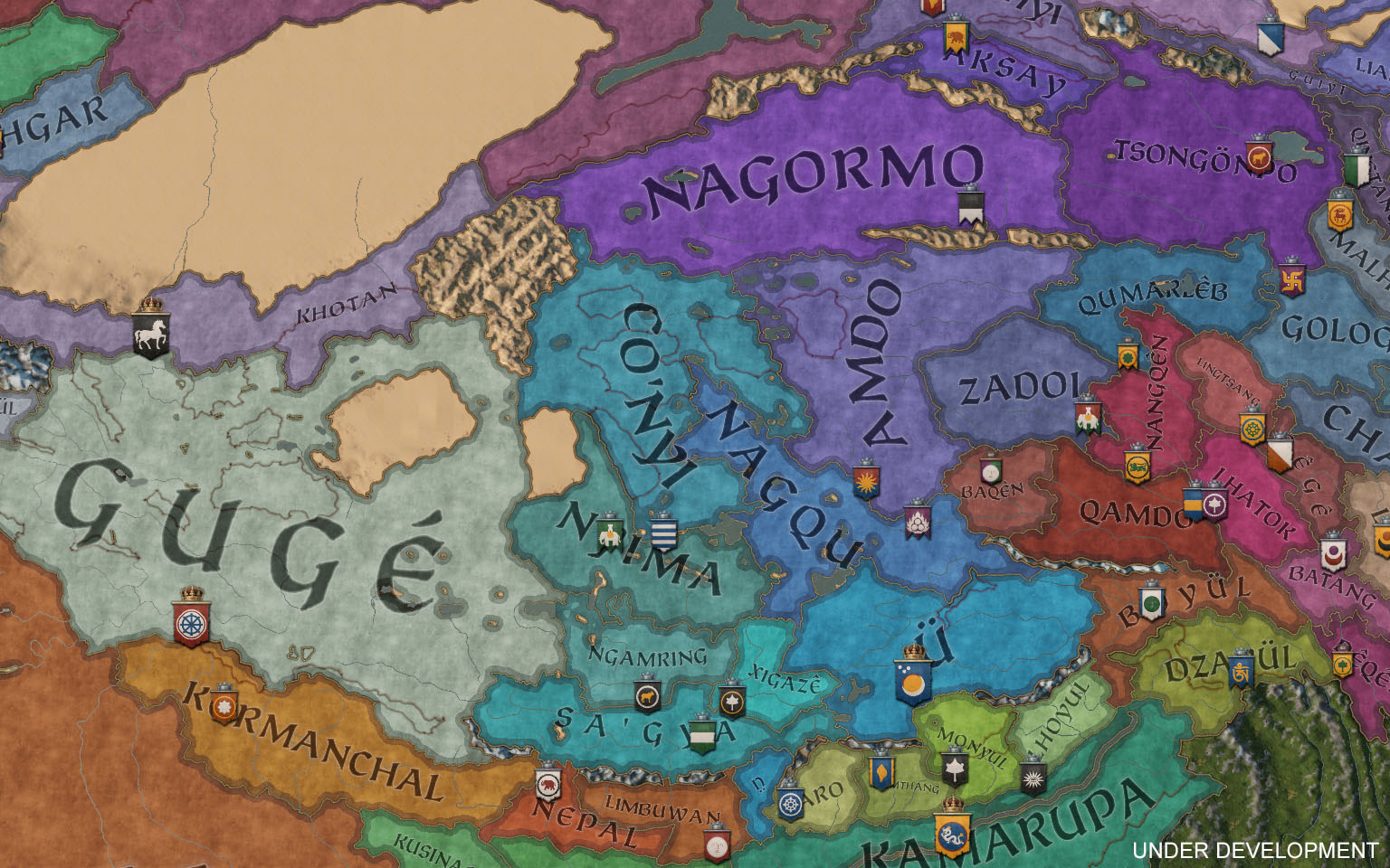
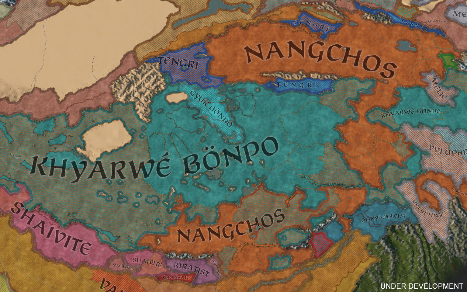
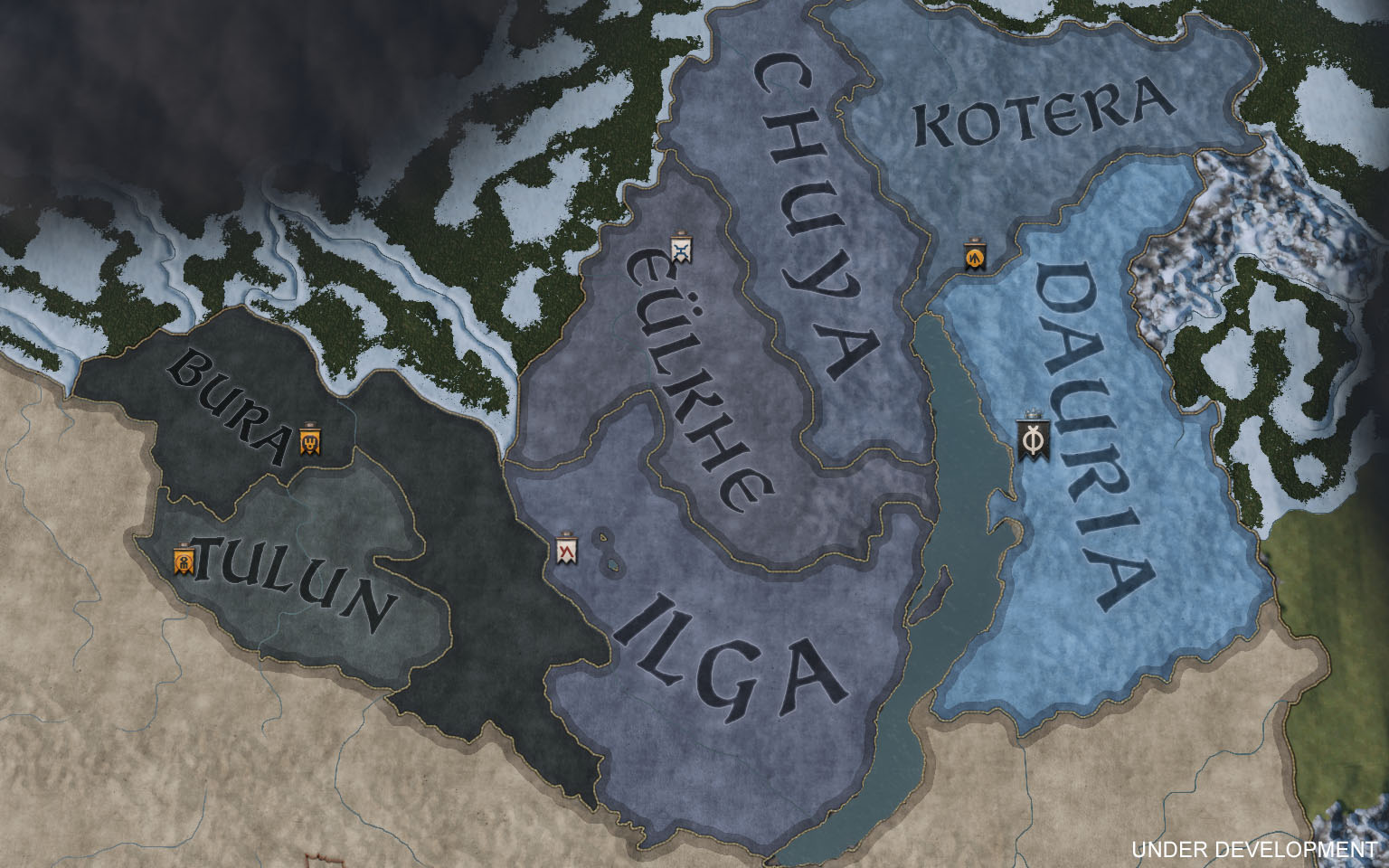
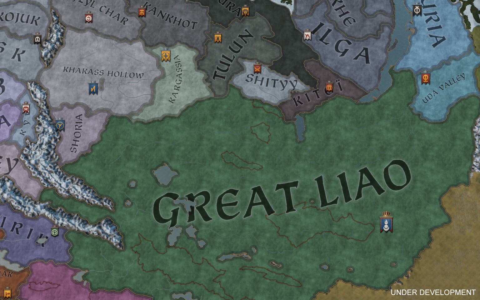
Looking east, the map has been expanded to include the entirety of Tibet, along with a small extension of Mongolia, accompanied by a whole set of new cultures and faiths!

Starting with Tibet, the area has a whole bunch of independent realms since the Tibetan Empire is long gone by the time of our two start dates. There’s a wide range of rulers of different faiths and cultures spread out across the plateau. The two most prominent faiths being Bön and Nangchos, a Buddhist faith syncretized with different Tibetan beliefs and practices.

26_30_tibet.jpg


26_31_tibetan_faiths.jpg


26_32_lhasa.jpg


Turning to Mongolia, there is a powerhouse present in both bookmarks. In 867, you have the Kirghiz Khanate, and Great Liao in 1066. Counties and provinces include Karakorum and the entire area surrounding lake Baikal.

26_33_baikal_867.jpg


26_34_mongolia_1066.jpg


Expanding Tibet and Mongolia left us with a small empty space in the south, and we really couldn’t have that, now could we? So we went ahead and filled out Myanmar (or Burma) down to the Gulf of Martaban with brand new baronies and counties. Which gives you two rather interesting starting options. In 1066, you’ll be able to play as king Anawrahta of the Pagan Kingdom. Starting shortly after his conquest of the Mon kingdoms to the south, most of the area will already be under his control, giving you a great opportunity to push into India! Alternatively you can start as Pagan in 867, yet a small and upstarting kingdom, allowing you to play with the unique faith of Ari Buddhism.

26_35_pagan.jpg


26_36_shwedagon.jpg


I’ll wrap it up here. Otherwise I’ll end up posting screenshots all day. Do you think I missed an important area somewhere? Let me know and maybe, just maybe, I’ll see if I can’t share some more.
 
  • 109Love
  • 87Like
  • 22
  • 9
  • 6
Reactions:
Sorry to ask, but Wikipedia is buggy, so what is the Kalozha?

The Kalozha church of Sts. Boris and Gleb is the oldest extant structure in Grodno, Belarus. It is the only surviving monument of ancient Black Ruthenian architecture, distinguished from other Orthodox churches by prolific use of polychrome faceted stones of blue, green or red tint which could be arranged to form crosses or other figures on the wall. The church was built before 1183.
 
  • 1
Reactions:
Ok here's an idea for a compromise about the African coast thing. Maybe they can put a river tile across the coast so only certain cultures can cross ocean to africa.
A good try, but it would be as historical as allowing ships to cross the Atlantic straight from Spain/Canary Islands to Central America.
Nobody did that in Middle ages with medieval sailing technologies and nobody could, untill the mid. 15th century.

The reason is:
1) there were constant currents as well as constant winds both in the same direction. Ships therefore could go one way, but not the other - hence nobody could return back and since nobody was known to ever come back, nobody risked to go there.
2) Some people claimed that Vikings could, because they used oars. Yes, with oars they obviously could sail against constant currents and winds at the same time (as they did against rivers). The tiny problem here is that along the coast of West Africa, this situation is for some 1200 kilometers. Nobody could push against constant wind and current for 1200 kilometers straight. Not even the Vikings. Note that this distance is almost 300 kilometers more that straight from Norway to Iceland... and even the Vikings didn't go straight, but always stopped either at the Shetland or Faroe Islands... which makes this twice as much as the longest distance crossed by the Vikings.
The Phoenicians did, however - in the 6th century BC - and this would be legitimate claim. But here comes the third crucial constraint:
3) The coast all the way from Nul Lamta in Morocco (a bit north of Cape Bojador) was deserted with no ports or even water sources. One could go there and back if one could refill his supplies, but you can't refill your supplies when there's no sweat water nor food you can get from the coast for a lot more than 1200 kilometers. Ho would the Phoenician Hanno do that? He did that in times, when the Sahara was a savanna inhabited by gazzeles, giraffes and lions, just like we know from Saharan paintings made by the Garamantes. In the times of Hanno the Navigator, neither the Sahara, nor the coast of West Africa were deserts. And it is fairly possible that at that time, 2000 years before the Portugeese crossed this way, the currents and winds might have been different than a millenium later, at the start of Medieval period.

With this said, before the new navigation techniques, which allowed sailing against the wind, in the 15th century, nobody could sail around West African coast and back.
This naval route was in fact as hard to cross as the central Atlantic (with no possible stops on the way for more than 1000 kilometers)... so allowing it is like allowing Sailing to the Americas across the Central Atlantic... I mean - it was more possible to cross the Atlantic in the north, where you could stop and refill every 500 kilometers, than along the coast of West Africa, where you couldn't do that for over 1200 kilometers.
 
Last edited:
  • 17
  • 9
  • 3Like
Reactions:
The Kalozha church of Sts. Boris and Gleb is the oldest extant structure in Grodno, Belarus. It is the only surviving monument of ancient Black Ruthenian architecture, distinguished from other Orthodox churches by prolific use of polychrome faceted stones of blue, green or red tint which could be arranged to form crosses or other figures on the wall. The church was built before 1183.
It would be amazing if it shows up on the map like the Notre-Dame! This sounds like a very elaborate design.
 
  • 1Like
  • 1Love
  • 1
  • 1
Reactions:
I would prefer a smaller map, actually. Or an option to pick an area to play in.

1)it would make performance less of an issue
2)it would make it easier for me to decide where to play next

I see other benefits too. It would make easier to distinguish individual cultures and religions, make more unique events for characters and such.
Having a huge map is great for converting your games to EU4, tho.
 
  • 9
  • 3
  • 1Like
  • 1
Reactions:
I'm not sure if it's the texture of the map in political map mode and/or the font used but in a sense the screenshots CK3 looks visually a bit like a downgrade from CK2. I hope there will be some upgrades coming in this regard. For sure the shields look a lot better than the default CK2 shields.
 
  • 9
  • 1Like
  • 1
Reactions:
1) there were constant currents as well as constant winds both in the same direction. Ships therefore could go one way, but not the other - hence nobody could return back and since nobody was known to ever come back, nobody risked to go there.

Winds and currents to the north assume? So as a one-way travel with a lot of supplies stocked on your ship it would have been possible to travel from Guinea to the north?
 
  • 1
Reactions:
Winds and currents to the north assume? So as a one-way travel with a lot of supplies stocked on your ship it would have been possible to travel from Guinea to the north?
The problem would be, then, how much is a lot, and if naval tech of the time allowed stockpiling in such numbers. If the answer is "no, it won't fit", then leaving it as mare incognita is technically fine. This is not Civilization, after all ... well, except for tree cutting. You can assign your seneschal or steward to cut trees to increase development or something, I guess.
 
  • 1
Reactions:
Winds and currents to the north assume? So as a one-way travel with a lot of supplies stocked on your ship it would have been possible to travel from Guinea to the north?

No, the current is predominantly southwards. It's possible to go to Guinea, it's just not possible to get back once you're there. So nobody went - who's interested in a one-way suicide trip?
 
  • 5
  • 2
Reactions:
No, the current is predominantly southwards. It's possible to go to Guinea, it's just not possible to get back once you're there. So nobody went - who's interested in a one-way suicide trip?

The other factor of course being that if you send ships down the unexplored coast and every time they never come back... well, what would you assume? My first guess would not be 'living it up on the Gold Coast'.
 
  • 6
  • 1
Reactions:
Looking through this thread it seems that all posts of Tuesday evening and night got eaten by the server, so I'll try to rewrite my post here:

You've already specified that # of holding slots will be fixed at launch. This would make the ability to increase (or just vary) holding slots per county one of the single only ways in which CK3 has a straight up weakness vs. CK2. I (and the vast majority of fans, I'm sure) would love it if changing was something you would consider patching in somewhere down the line.

Especially now that we have a development value to give a more detailed understanding of the wealth and strength of a region than just holding count, it would be great if the two could be connected somehow. In CK2 (with Reaper's Due) the event that allowed a Prosperity 3 county with <7 holding slots and Crown Focus to gain an edditional slot at a huge down payment always gave a great feeling that you had a real ability to affect the value of your region that I really want to see taken to its natural conclusion in CK3 by having high delevopment counties get the opportunity to increase their holding slots.

I realise ofc that this would be a huge undertaking that might take years before you had time to implement it, and I completely understand that. All I want to know is if there's any probability that you'll consider it, or if it's completely off the table?
 
  • 4
  • 1
Reactions:
Hey, wait a minute! Wasn't an early description of the map that there was a Dragon where China would be? Where is that? It's totally gone from what it looks like...
 
  • 1
Reactions:
Yeah, sure.. ;)
I bet a lot of medieval rulers wish defense against vikings was as simple as saying it can't happen there.
A good try, but it would be as historical as allowing ships to cross the Atlantic straight from Spain/Canary Islands to Central America.
Nobody did that in Middle ages with medieval sailing technologies and nobody could, untill the mid. 15th century.

The reason is:
1) there were constant currents as well as constant winds both in the same direction. Ships therefore could go one way, but not the other - hence nobody could return back and since nobody was known to ever come back, nobody risked to go there.
2) Some people claimed that Vikings could, because they used oars. Yes, with oars they obviously could sail against constant currents and winds at the same time (as they did against rivers). The tiny problem here is that along the coast of West Africa, this situation is for some 1200 kilometers. Nobody could push against constant wind and current for 1200 kilometers straight. Not even the Vikings. Note that this distance is almost 300 kilometers more that straight from Norway to Iceland... and even the Vikings didn't go straight, but always stopped either at the Shetland or Faroe Islands... which makes this twice as much as the longest distance crossed by the Vikings.
The Phoenicians did, however - in the 6th century BC - and this would be legitimate claim. But here comes the third crucial constraint:
3) The coast all the way from Nul Lamta in Morocco (a bit north of Cape Bojador) was deserted with no ports or even water sources. One could go there and back if one could refill his supplies, but you can't refill your supplies when there's no sweat water nor food you can get from the coast for a lot more than 1200 kilometers. Ho would the Phoenician Hanno do that? He did that in times, when the Sahara was a savanna inhabited by gazzeles, giraffes and lions, just like we know from Saharan paintings made by the Garamantes. In the times of Hanno the Navigator, neither the Sahara, nor the coast of West Africa were deserts. And it is fairly possible that at that time, 2000 years before the Portugeese crossed this way, the currents and winds might have been different than a millenium later, at the start of Medieval period.

With this said, before the new navigation techniques, which allowed sailing against the wind, in the 15th century, nobody could sail around West African coast and back.
This naval route was in fact as hard to cross as the central Atlantic (with no possible stops on the way for more than 1000 kilometers)... so allowing it is like allowing Sailing to the Americas across the Central Atlantic... I mean - it was more possible to cross the Atlantic in the north, where you could stop and refill every 500 kilometers, than along the coast of West Africa, where you couldn't do that for over 1200 kilometers.
There are a few documented cases of Europeans trying to sail down the African coast during the late middle ages.
None came back, though.
 
  • 1
Reactions:
so does this mean that, since all baronies within a county must fall under the county holder, a pope-owned Venaissin will encompass the whole county all the way to the coast?
You won’t be able to sail around the African coast to reach Europe however, or vice versa. That route is blocked by impassable sea, since it was often difficult, if not impossible, to sail along the western coast due to storms and rough seas. No viking raids in Africa, I’m afraid!
couldn't maybe sailing around Mauritania be unlocked with technology? if Henry the Navigator could do it, we should let him!
 
  • 1
Reactions:
Ok here's an idea for a compromise about the African coast thing. Maybe they can put a river tile across the coast so only certain cultures can cross ocean to africa.

IMHO, if they are going to allow transversing of the coast between Europe and West Africa, it should be tied to having the highest level of naval tech.
 
  • 1Like
  • 1
Reactions:
Will the Venetian Arsenal be included? It's admittedly towards the end of the tiemline but it's too damned unique not to include (could also have the Doges Palace I suppose).
 
  • 1
  • 1Like
Reactions:
  • 2
Reactions:
Karelian as a separate culture is not? Ok.
Question. What do Karelians do in the White Sea(Belomorye later(XIV) white karelia) in the 9th-11th century?
Karelians on the Novgorodian and later Russian side of the border started to settle northward towards the White Sea by the late XIV century.
www.png

The development of the territory by the Karelians began in the XIV century, and took place in stages from south to north. The stages of colonization of the territory were not numerous due to adverse climatic conditions. Vast territories remained uninhabited for a long time.
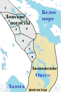
Lope Pogosts(Lopskiye pogosty) in XIV century.
Pogosts_Lopskie.png

P.S. Sami.
The Scandinavians called them lappar or lapper, the Russians - “Lapps”, “Loplans” or “Lop”.

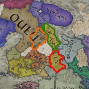
asdasdaw.jpg

Map(Orange - Kainuu, Green - Belomorye(later White Karelia). Red - Prionezhye(later Karelia Olonets)

Kainuu and Saami.
Well, you do not have experts on the history of Russia (One province of Ingria, instead of Izhora (Karelian) and Vodi (Estonian), and probably not only that) ...
But even your former lands, your current neighbor in the form of Finland ...
Kainuu was Sami land and only at the beginning of the XIV century did migration and colonization by Karelians (Savonians) from the south begin and ended by the end of the XVII century.

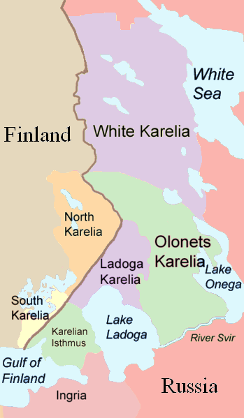
Karelians.
Modern!
Many_Karelias.png
Prionezhye(Lake Onega-Onego or Karelia Olonets) was also colonized by the Vepsians from the south only in the IX-X century, before that the Sami lived there, only by the XII-XIII century the Karelians migrated here.
Therefore, what kind of Karelia (and culture) do you have on the political map in the IX-XI century? Karelia is a Karelian Isthmus and eastern finland(Savo), was subsequently colonized "Priladozhye"(Karelian ladoga) in IX-X century and only later it became known as the current Karelia(Karelia Olonets and White Karelia), during the colonization of XIII and XIV centuries.
As for a separate Karelian culture, which can be traced from the Scandinavian sagas ...
But they added a certain Biarmian culture from two or four provinces.

Biarmians.
Considering that it is still unclear who the Biarmians were, but the sagas say that they spoke the same language as the Finns, considering that the Scandinavians called the Sami - Finns, everything goes well.
Archeology also indicates the same thing, about a certain hybrid of Sami and pre-Indo-European nomads (Circum-arctic nomads (Pechora-Sihirtia)) in the northern regions of European Russia, before the arrival of Samoyeds from the east in the XV century.
Given that the Vepsians moved north, colonizing the dvina region by the IX-X century.
So what kind of Biarmians are we talking about? But okay, let's say the so-called Sami of the Northern Dvina region. But then it was more significant and historical to add the Karelian culture, which had historical significance.

In general, such a historical absurdity, it is clear that this region was not intentionally studied and all were transferred from the previous part (although the Belomorye(later White Karelia) in CK2 was Sami).

P.S.
Paradox said that there were more applicants for testing than expected. Personally, I pointed out the history predominantly. As we can see from the map, they did not take any consultants on history.
 
Last edited:
  • 6
  • 1Like
  • 1
Reactions:
Okay, some gripes with Ingria.
The area shouldn't be a piece of Novgorod, but split in two. Vodi (an Estonian tribe) and Izhori (Karelian tribe). Vodi (and Izhori) would often would align themselves with Novgorod, but not entirely a part of Novgorod prior to 1149, when Novgorod repelled an invasion of Tavastians/Jäämi/Em/Häme. Izhorians lived in the east around Neva and would later penetrate further into Ingria.

View attachment 576607
View attachment 576617

Besides that I saw a Youtube video where the map is shown in religion mode. In the 867 start date, the Curonian peninsula was 100% Baltic, which does not make any sense whatsoever.

It's like every time Paradox makes a CK game, they greatly overestimate the extent of the Baltic tribes and later fix the culture/religion borders a few years later...

Here is a map of Finnic tribes in 1000AD, in 867 the Livonians inhabited a slightly bigger area in Latvia:
 

Attachments

  • Finnic tribes 1000AD.png
    Finnic tribes 1000AD.png
    569,6 KB · Views: 0
  • 2
  • 1Like
Reactions: