Salutations!
As a continuation from last week, I will be talking about the scope of the map and, perhaps more importantly, showing you how it all actually looks. Get ready for a very screenshot heavy DD!
Europe
Europe has been reworked from the ground up. We made sure to give all of Europe proper attention when painting baronies and counties. It was important for us to make sure we have a good and consistent quality level across the map. I’m sure you’ll find eastern Europe in particular fleshed out with a lot more detail than what you may be used to in CK2.


Since we’ve already shown bits and pieces of Europe in screenshots and videos, let’s have a look at a few specific locations, and what special buildings they have available. Starting with France, it felt like an obvious choice to include Notre-Dame, one of the most recognizable cathedrals of the time period.


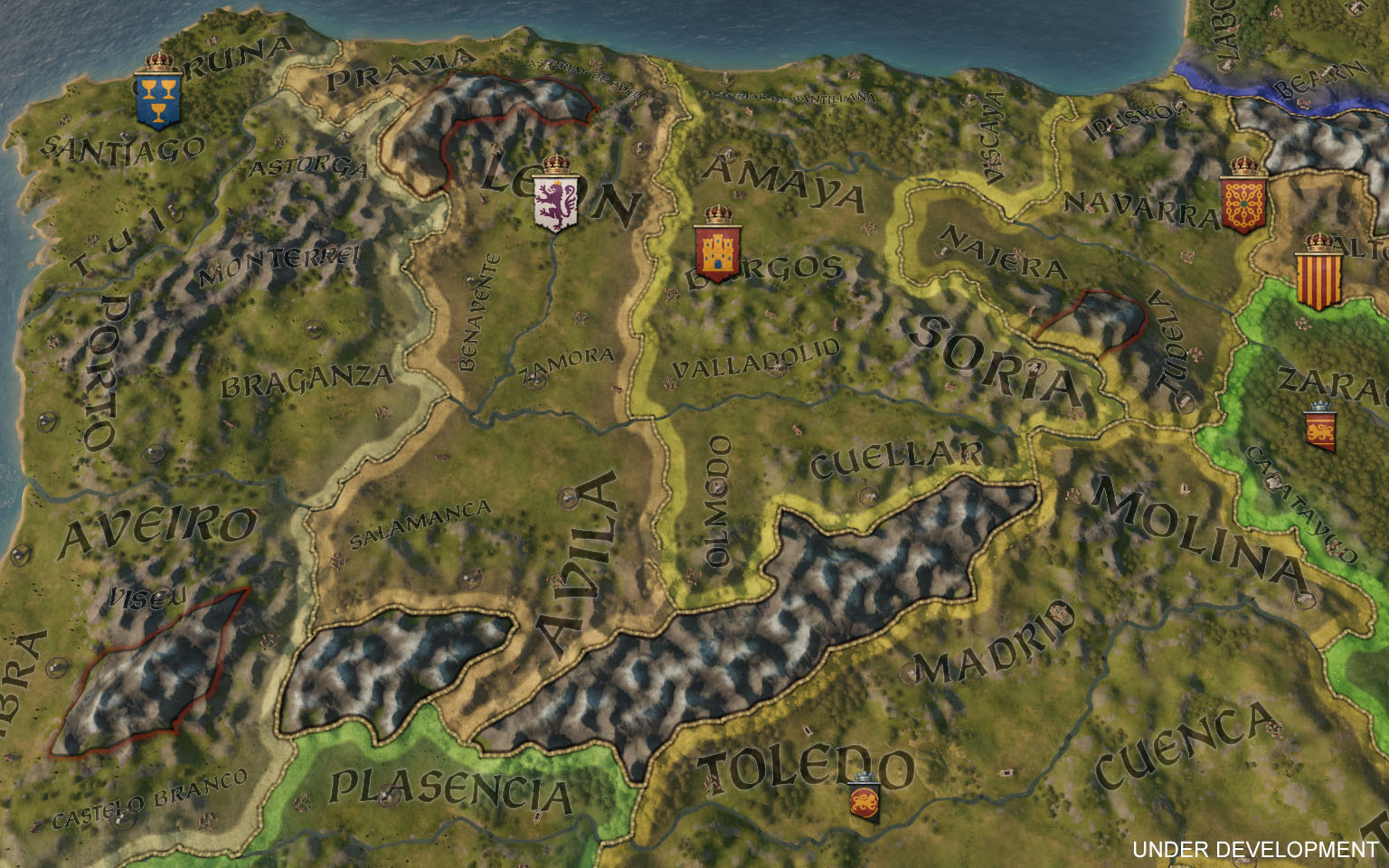
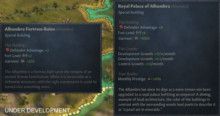
Next up, Iberia. Featuring two major rivers, plenty of hills and a few special buildings. In the county of Granada you’ll find Alhambra. While merely an old ruin at game start, it can be upgraded to offer some of the highest fortifications in the game.

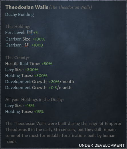
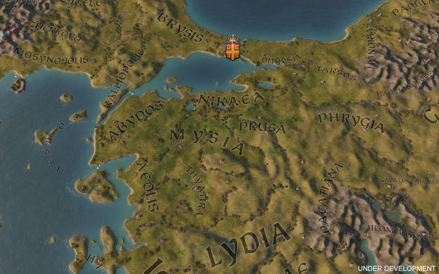
Speaking of special buildings. The city of the world’s desire, features not one, but two, special buildings. This makes Constantinople a very spectacular holding, and if that isn’t enough, it also has the highest development level in the game.

Before moving on, I’ll just leave this culture screenshot right here:

The Middle East
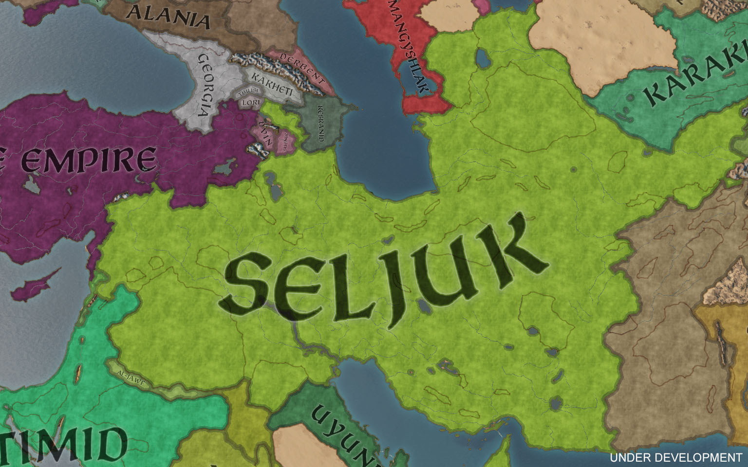
The Middle East has seen the same level of attention and rework as Europe, with some particular attention spent on updating history across the region. For example, the Seljuks control a vast empire in 1066, properly representing their historical borders. They have a plethora of different cultures as their subjects and may fall apart if not careful.
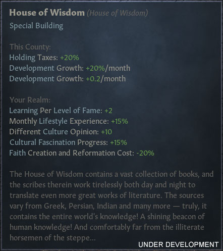
Development in the region is above your average starting levels. Baghdad, for example, starts out with one of the highest levels of development in the game — bested only by a few other locations such as Constantinople! Baghdad also has one of the single most impressive special buildings available, the House of Wisdom.


Africa
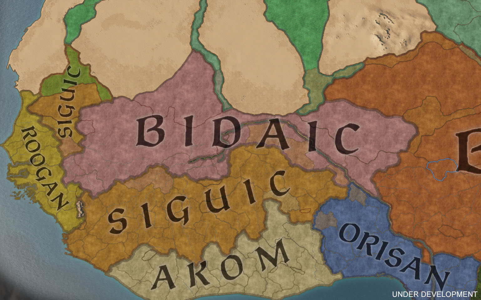
Africa has seen some of the greatest additions to the map. No longer cut in half, the Sub-Saharan kingdoms have plenty of space to expand in as we have included the entire Nigerian coast.

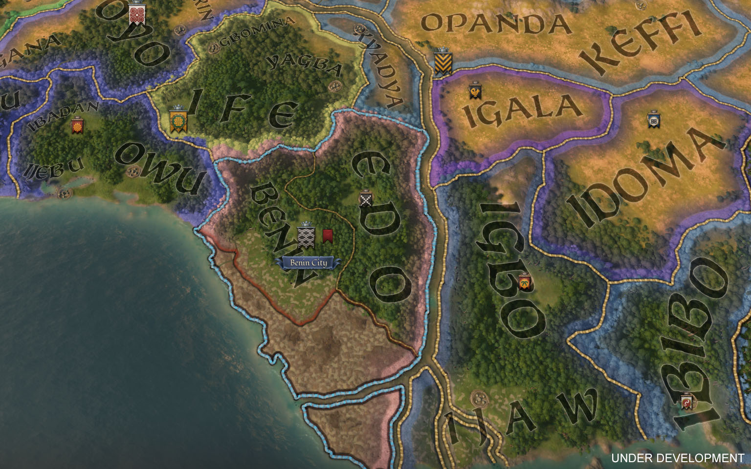
We have a total of five different pagan faiths to play as, giving you plenty of different options. A solid first pick would be Benin, within the Niger delta. They start off with a decent development level and access to a special building: The massive construction that is the Walls of Benin.

Some cultures will start with the ability to sail major rivers, allowing them to use the Niger to quickly ferry troops back and forth. The coast on the other hand, will be open for everyone to use. You won’t be able to sail around the African coast to reach Europe however, or vice versa. That route is blocked by impassable sea, since it was often difficult, if not impossible, to sail along the western coast due to storms and rough seas. No viking raids in Africa, I’m afraid!


Let’s not forget the Horn of Africa. Expanded to include Mogadishu, the area offers more space to play in, with christian, muslim, jewish, and pagan rulers all wanting a piece of each other.


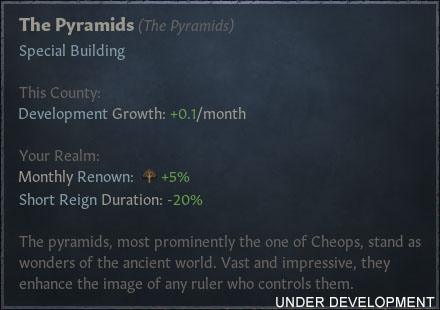
Finally, let's mention Egypt. A rich area that has a lot of floodplains, good development levels, and even a couple of special buildings. All encompassed by the Nile, a major river with green and lush vegetation.

The Far East
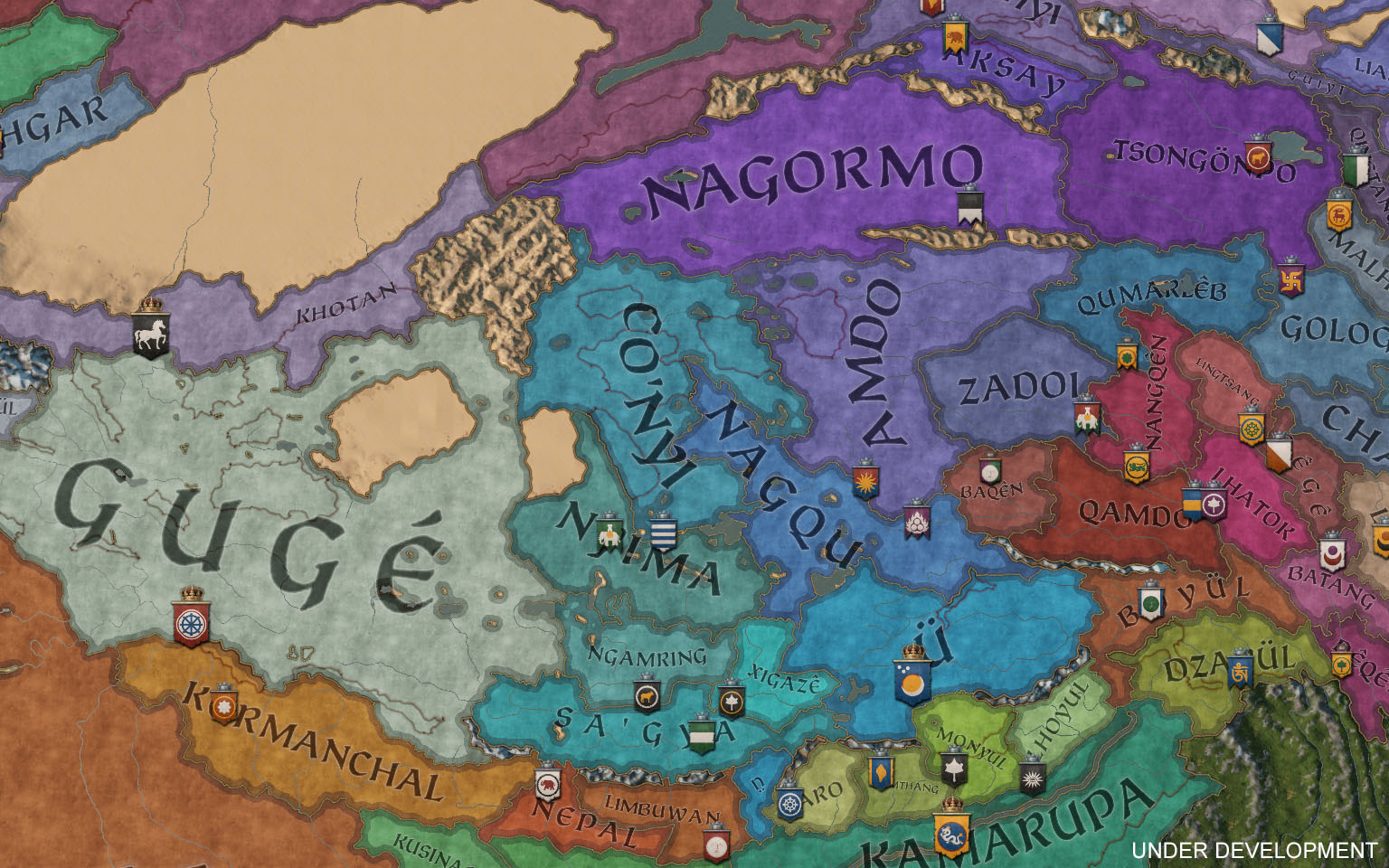
Looking east, the map has been expanded to include the entirety of Tibet, along with a small extension of Mongolia, accompanied by a whole set of new cultures and faiths!
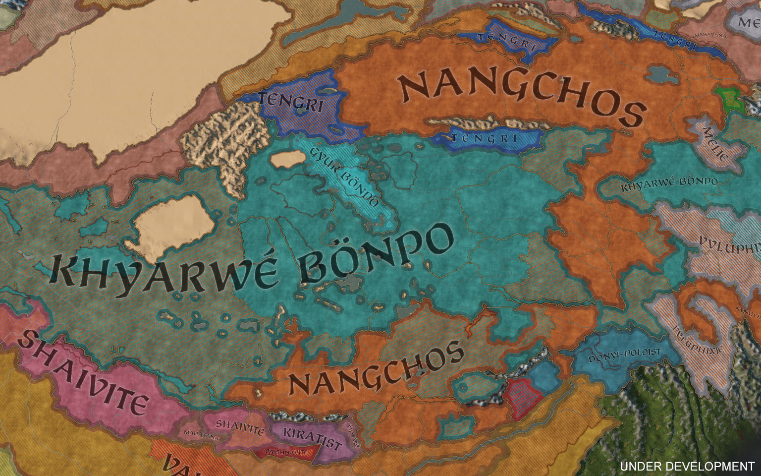
Starting with Tibet, the area has a whole bunch of independent realms since the Tibetan Empire is long gone by the time of our two start dates. There’s a wide range of rulers of different faiths and cultures spread out across the plateau. The two most prominent faiths being Bön and Nangchos, a Buddhist faith syncretized with different Tibetan beliefs and practices.

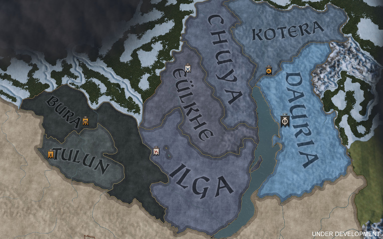
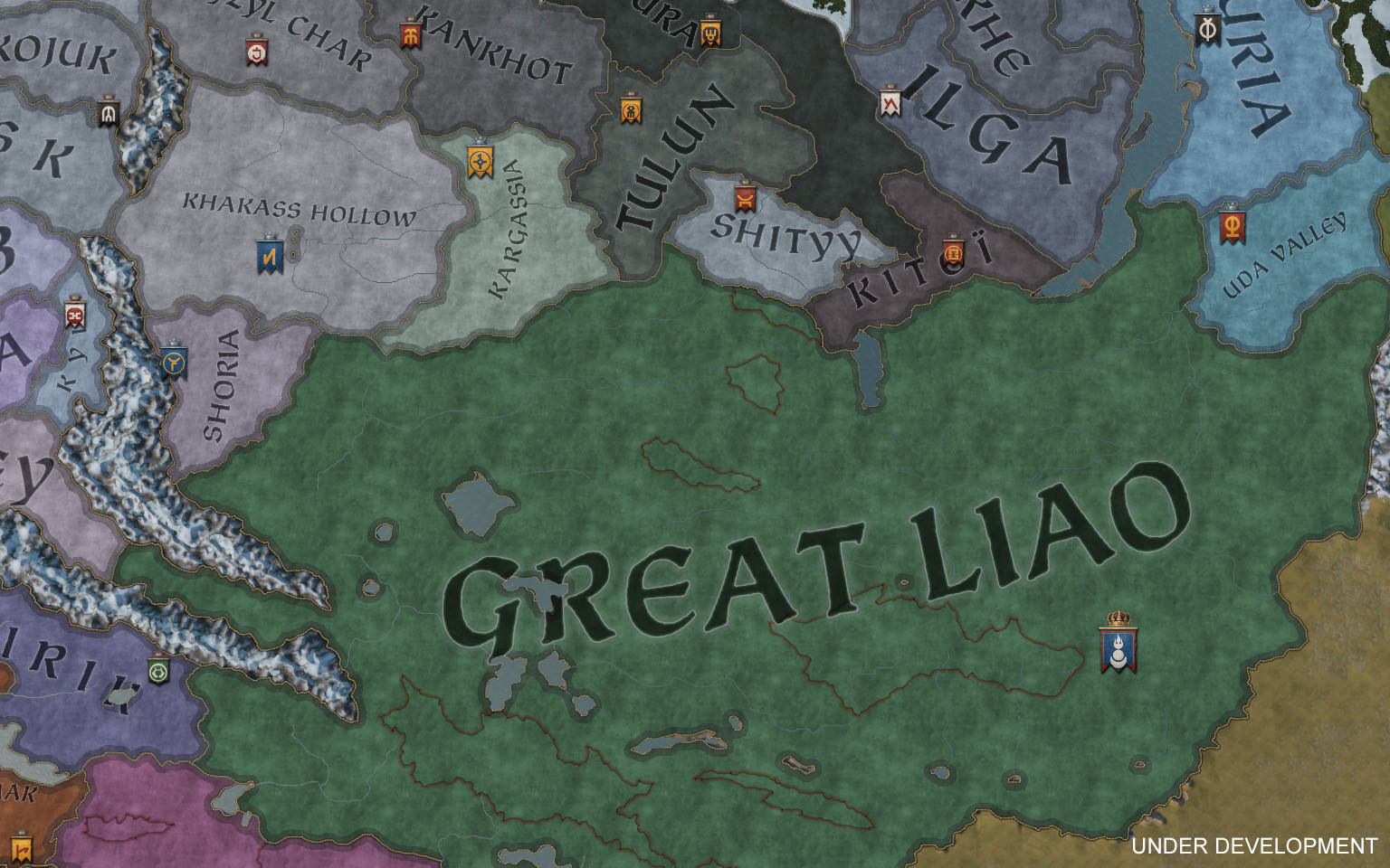
Turning to Mongolia, there is a powerhouse present in both bookmarks. In 867, you have the Kirghiz Khanate, and Great Liao in 1066. Counties and provinces include Karakorum and the entire area surrounding lake Baikal.
Expanding Tibet and Mongolia left us with a small empty space in the south, and we really couldn’t have that, now could we? So we went ahead and filled out Myanmar (or Burma) down to the Gulf of Martaban with brand new baronies and counties. Which gives you two rather interesting starting options. In 1066, you’ll be able to play as king Anawrahta of the Pagan Kingdom. Starting shortly after his conquest of the Mon kingdoms to the south, most of the area will already be under his control, giving you a great opportunity to push into India! Alternatively you can start as Pagan in 867, yet a small and upstarting kingdom, allowing you to play with the unique faith of Ari Buddhism.


I’ll wrap it up here. Otherwise I’ll end up posting screenshots all day. Do you think I missed an important area somewhere? Let me know and maybe, just maybe, I’ll see if I can’t share some more.
As a continuation from last week, I will be talking about the scope of the map and, perhaps more importantly, showing you how it all actually looks. Get ready for a very screenshot heavy DD!
Europe
Europe has been reworked from the ground up. We made sure to give all of Europe proper attention when painting baronies and counties. It was important for us to make sure we have a good and consistent quality level across the map. I’m sure you’ll find eastern Europe in particular fleshed out with a lot more detail than what you may be used to in CK2.


Since we’ve already shown bits and pieces of Europe in screenshots and videos, let’s have a look at a few specific locations, and what special buildings they have available. Starting with France, it felt like an obvious choice to include Notre-Dame, one of the most recognizable cathedrals of the time period.


Next up, Iberia. Featuring two major rivers, plenty of hills and a few special buildings. In the county of Granada you’ll find Alhambra. While merely an old ruin at game start, it can be upgraded to offer some of the highest fortifications in the game.


Speaking of special buildings. The city of the world’s desire, features not one, but two, special buildings. This makes Constantinople a very spectacular holding, and if that isn’t enough, it also has the highest development level in the game.


Before moving on, I’ll just leave this culture screenshot right here:

The Middle East
The Middle East has seen the same level of attention and rework as Europe, with some particular attention spent on updating history across the region. For example, the Seljuks control a vast empire in 1066, properly representing their historical borders. They have a plethora of different cultures as their subjects and may fall apart if not careful.

Development in the region is above your average starting levels. Baghdad, for example, starts out with one of the highest levels of development in the game — bested only by a few other locations such as Constantinople! Baghdad also has one of the single most impressive special buildings available, the House of Wisdom.


Africa
Africa has seen some of the greatest additions to the map. No longer cut in half, the Sub-Saharan kingdoms have plenty of space to expand in as we have included the entire Nigerian coast.

We have a total of five different pagan faiths to play as, giving you plenty of different options. A solid first pick would be Benin, within the Niger delta. They start off with a decent development level and access to a special building: The massive construction that is the Walls of Benin.


Some cultures will start with the ability to sail major rivers, allowing them to use the Niger to quickly ferry troops back and forth. The coast on the other hand, will be open for everyone to use. You won’t be able to sail around the African coast to reach Europe however, or vice versa. That route is blocked by impassable sea, since it was often difficult, if not impossible, to sail along the western coast due to storms and rough seas. No viking raids in Africa, I’m afraid!


Let’s not forget the Horn of Africa. Expanded to include Mogadishu, the area offers more space to play in, with christian, muslim, jewish, and pagan rulers all wanting a piece of each other.


Finally, let's mention Egypt. A rich area that has a lot of floodplains, good development levels, and even a couple of special buildings. All encompassed by the Nile, a major river with green and lush vegetation.


The Far East
Looking east, the map has been expanded to include the entirety of Tibet, along with a small extension of Mongolia, accompanied by a whole set of new cultures and faiths!
Starting with Tibet, the area has a whole bunch of independent realms since the Tibetan Empire is long gone by the time of our two start dates. There’s a wide range of rulers of different faiths and cultures spread out across the plateau. The two most prominent faiths being Bön and Nangchos, a Buddhist faith syncretized with different Tibetan beliefs and practices.


Turning to Mongolia, there is a powerhouse present in both bookmarks. In 867, you have the Kirghiz Khanate, and Great Liao in 1066. Counties and provinces include Karakorum and the entire area surrounding lake Baikal.


Expanding Tibet and Mongolia left us with a small empty space in the south, and we really couldn’t have that, now could we? So we went ahead and filled out Myanmar (or Burma) down to the Gulf of Martaban with brand new baronies and counties. Which gives you two rather interesting starting options. In 1066, you’ll be able to play as king Anawrahta of the Pagan Kingdom. Starting shortly after his conquest of the Mon kingdoms to the south, most of the area will already be under his control, giving you a great opportunity to push into India! Alternatively you can start as Pagan in 867, yet a small and upstarting kingdom, allowing you to play with the unique faith of Ari Buddhism.


I’ll wrap it up here. Otherwise I’ll end up posting screenshots all day. Do you think I missed an important area somewhere? Let me know and maybe, just maybe, I’ll see if I can’t share some more.


