• We have updated our Community Code of Conduct. Please read through the new rules for the forum that are an integral part of Paradox Interactive’s User Agreement.

Tinto Flavour #31 - 11th of July 2025 - Aztecs

Hello, and welcome one more Friday to Tinto Flavour, the happy days in which we take a look at the flavour content of Europa Universalis V!

Today, we will take a look at the flavour content for the Aztecs! Let’s start without further ado:
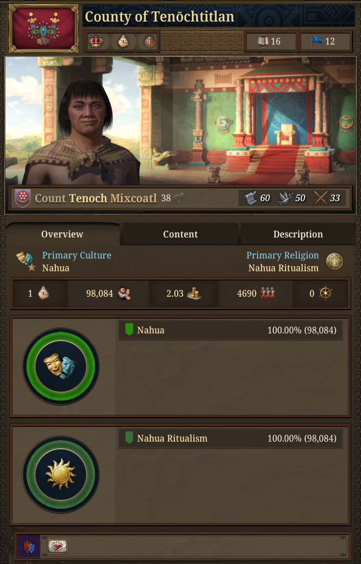
For the past two centuries, groups of Nahua people descended from the Chichimec migrated to central Mexico from their legendary ancestral home, known as Aztlan. Our people were one of those wandering groups.

As with many other Nahua nations, we settled our own Altepetl. It was named Tenōchtitlan, and we built it over an artificial island in the heart of Lake Texcoco. Our most prominent figures were also influenced by the Toltec culture, and we started to develop a refined civilization in the lagoon. We would also come to be recognized as prime fighters by our neighbors, as our equally refined warring skills make Aztec armies a force to be feared...

However, we currently stand as vassals of the Altepetl of Tepanecapan, our expansion possibilities are limited to the proximities of the lagoon we inhabit. Only an intelligent leader can lead us in our journey to subdue the valley of Mexico and beyond.

Country Selection.png

As usual, please consider all UI, 2D and 3D Art as WIP.

Before we start, you may notice that we have reconfigured the Country Selection Panel a bit, and that we now have a new tab called ‘Content’, where we’re grouping the unique features and content available to each country:
Content.png


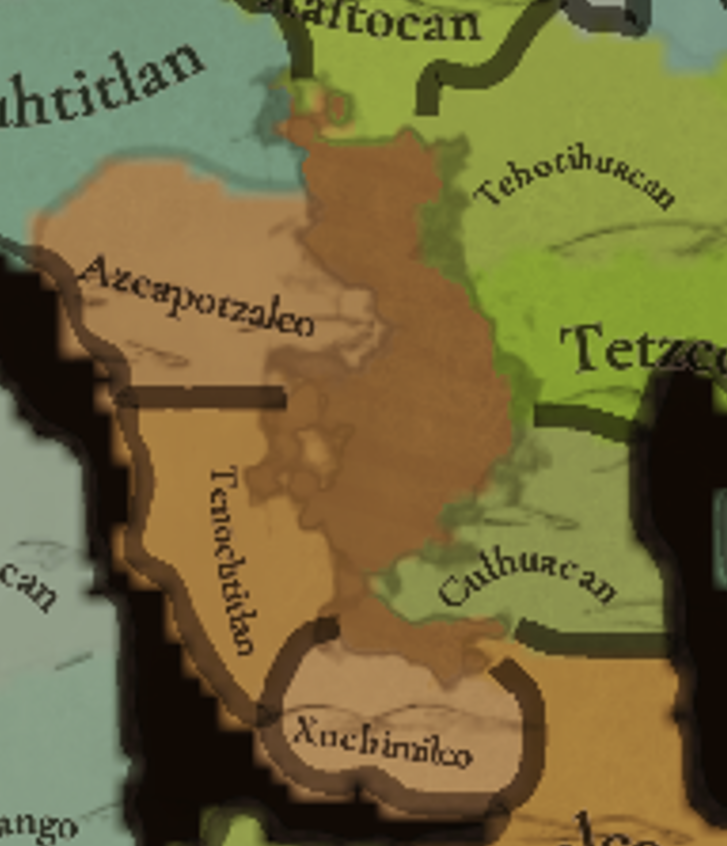
Tenochtitlan.png

Please take into consideration that the first screenshot is the most zoomed-in map that we’ve ever shared with you, in a very difficult area from a geographical point of view. Therefore, please consider it as the usual WIP stuff, as it’s already on our radar to make some improvements here and there to make it look better.

Mexico.png

Mexico may prove to be a very difficult area to expand in…

The Nahua countries start with a unique government reform, the Altepetl, that nudges towards expanding through subjects, and also slave-raiding (which is also linked to the Nahua Ritualism mechanic of sacrificing slaves, as we saw last Wednesday):
Estates.png


Reform Altepetl.png

There are also a couple of Privileges available to countries that practice Nahua Ritualism:
Privileges Warrior Tribunal.png

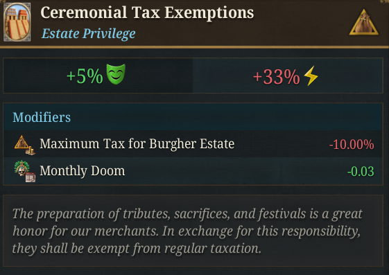
Privilege Tax Exemptions.png

And also attached to Nahua Ritualism, a unique building that unlocks two unique units, the infamous Jaguar and Eagle Warriors:

Building Warrior Temple.png


Unit Jaguar Warriors.png

Unit Eagle Warriors.png


And a unique Sumptuary Law, with two available policies:
Sumptuary Law.png

Policy Warrior Culture.png

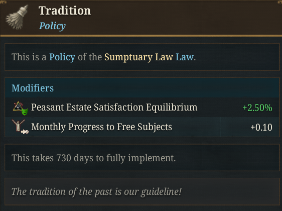
Policy Tradition.png

And a unique policy for the Administrative System:
Calpixque Syste,.png

Here you have some of the unique Advances of the Aztecs:
Advance Warrior Societies.png

Building Calmecac.png

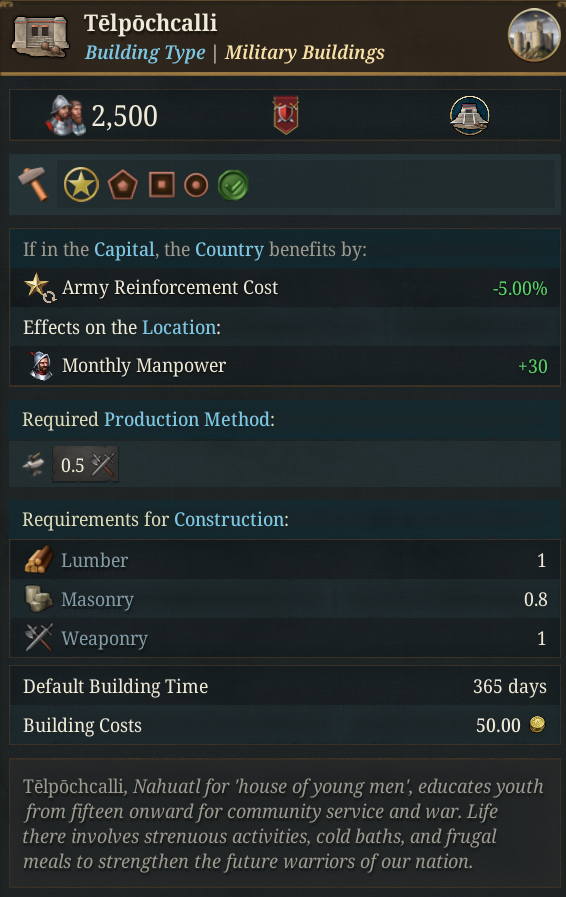
Building Telpohcalli.png


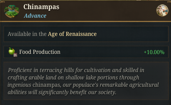
Advance Chinampas.png

AdvanceCalpixcayotl.png

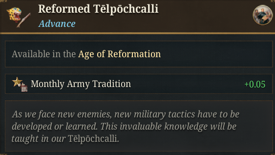
Advance Reformed Telpohcalli.png

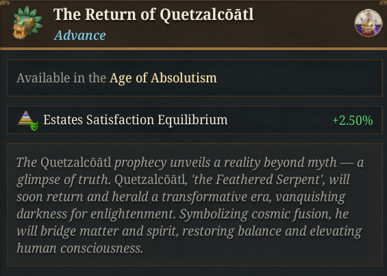
Advance Return of Quetzalcoatl.png

Although most of the content related to the Aztecs is very attached to the Nahua Ritualism features, and thus, is very mechanical, there are still some non-generic, non-religious related DHEs available for them:
Event Pyramid1.png

Event Pyramid2.png


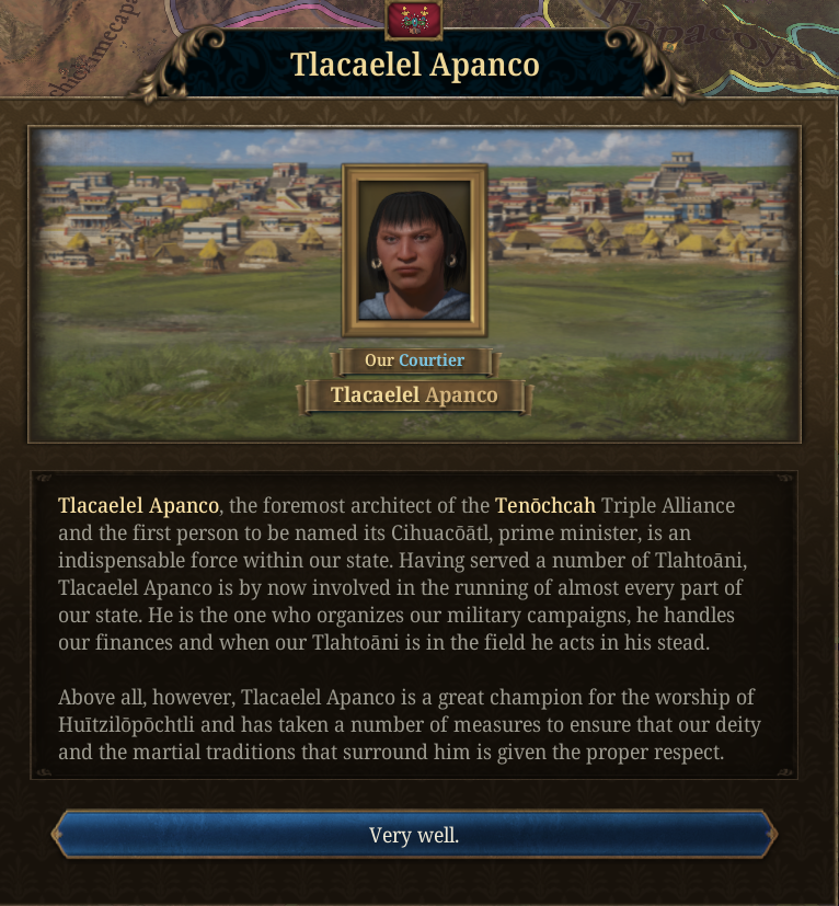
Event Tlacaelel.png


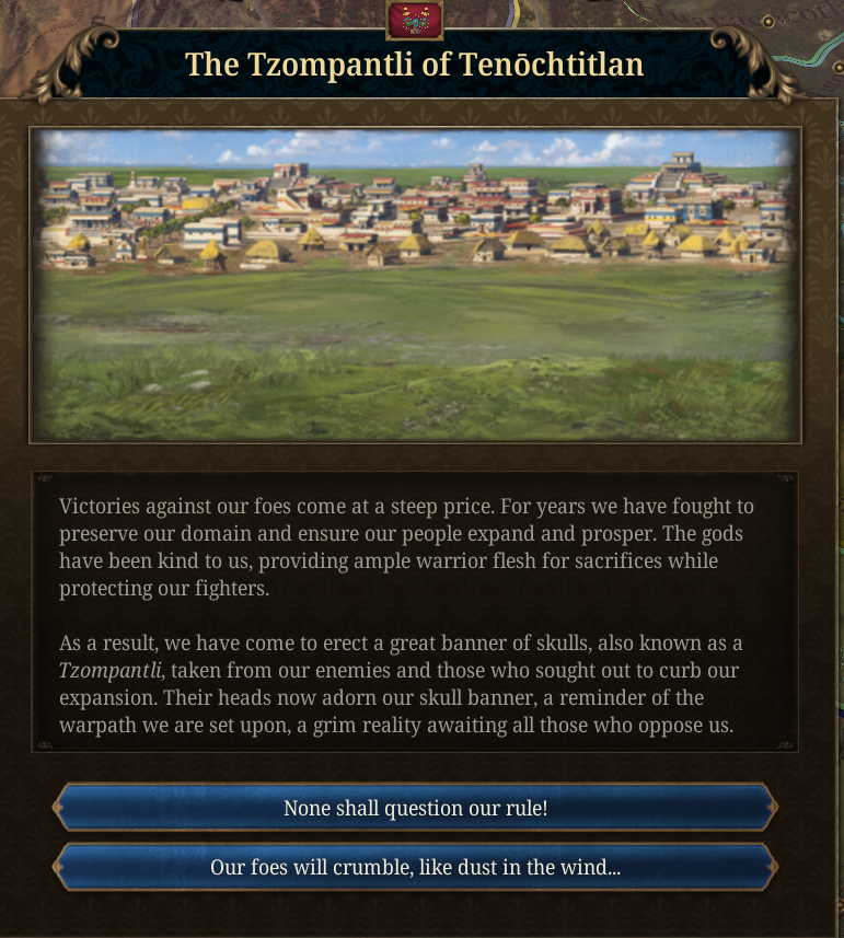
Event Tzompantly.png

And well, a final boss to deal with:
Event Cocoliztli.png

… And much more, but that’s all for today! Next week we’ll have a Tinto Maps Feedback on Monday, a Tinto Talks on Wednesday, and Tinto Flavour on Friday:
  • Tinto Maps Feedback for Indonesia
  • Wednesday -> Tinto Talks about Inti & Folk Religions
  • Friday -> Tinto Flavour about the Inca
And also remember, you can wishlist Europa Universalis V now! Cheers!
 
  • 83Like
  • 44Love
  • 5
  • 4
  • 1
Reactions:
Do you think this image accurately represents the size real of Lake Texcoco?

View attachment 1332856

With your answer, I'll know what we're talking about.
It looks a bit screwed up due to the low resolution and lack of height data but more or less, yeah. The actual lake was "only" 30-ish kilometers from east to west, which in EU5's scale isn't that much. Again the locations around the lake are already pushing up against the minimum acceptable density and you're making thinly veiled accusations of racism (or what feels like them, maybe that's not your intent) because they didn't turn a 6 pixel island into its own location.
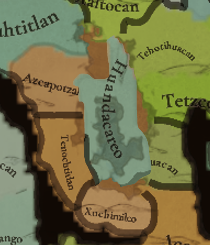
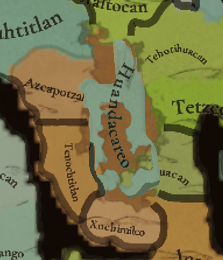
To all those who say that military units and buildings don't fit on an island of Tenochtitlan, I ask:

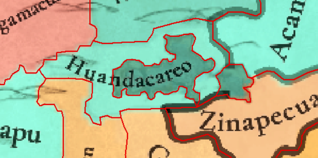
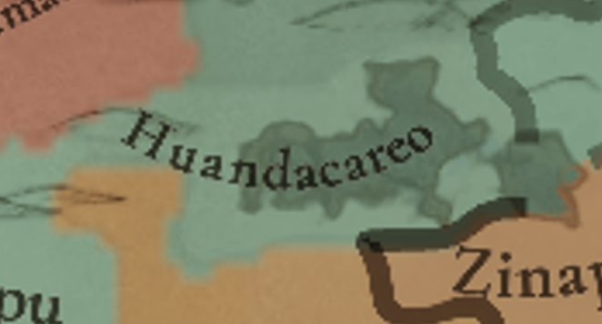
In this location I found in Mesoamerica, where are they going to put the units and buildings?

Huandacareo.png


In the lake?

In the two pixels on the lake's shore?
I expect the relatively large area in the west will be where most buildings go, with some overflowing onto the lakes coast. Same way Tenochtitlan includes the island but all the actual graphical elements are placed on the "mainland" potion of the location.

Edit: also even the strip is way more than 2 pixels wide, so even if that large area is the west wasn't there it still wouldn't be comparable to Tenochtitlan.
 
Last edited:
How about you put the Pyramids/any unique 3d building models on the island, along side a few visual buildings, and maybe any fort building, while all the 'development buildings' (models representing urban sprawl) hug the coastline of the lake? And there's just that modifier to defense to represent the difficulty of sieging down the island. This could have the bonus that sieging units sit on the coast making it look like they are having extra difficulty sieging it down.
There's only space for a building, so I'd say the pyramid could go there, if it's possible. But otherwise I pretty much agree with this.
 
No, other than the religion and the IO.
Will you have custom Mayan localisation to estates and titles? "Count" appears jarring there too.

From what I've seen, most Mayan countries should be localised as "Kuchkabal" (eg. Kuchkabal of Mayapan), although the leader position's title is confusing:

- Ajaw/ahau: a sort of priest king, used more in the Classical Era from what I've understood, but also appears in the Postclassical Era (eg. Hunac Ceel adopted this title too for example, or the Petén Itza kingdom as Ajaw Kan Ek')
- Halach Uinik: used for the leaders of many Kuchkabals
- Batab: the title used by leaders of individual cities; in Kuchkabals, where there was no Halach uinik, maybe the rulers could be one of the Batabs or something

But I'm not very knowledgeable in Postclassical Maya social organization so please someone correct me plus my inconsistent orthography
 
  • 3Like
Reactions:
I agree the shores of the Lake at the Aztec Capital look too steep.
Been in Mexico City two months ago, seen the Models. Just raise the water level and the shore would look flater and softer. :)
 
  • 1Like
Reactions:
Hello, and welcome one more Friday to Tinto Flavour, the happy days in which we take a look at the flavour content of Europa Universalis V!

Today, we will take a look at the flavour content for the Aztecs! Let’s start without further ado:


View attachment 1332481
As usual, please consider all UI, 2D and 3D Art as WIP.

Before we start, you may notice that we have reconfigured the Country Selection Panel a bit, and that we now have a new tab called ‘Content’, where we’re grouping the unique features and content available to each country:
View attachment 1332482

View attachment 1332483
Please take into consideration that the first screenshot is the most zoomed-in map that we’ve ever shared with you, in a very difficult area from a geographical point of view. Therefore, please consider it as the usual WIP stuff, as it’s already on our radar to make some improvements here and there to make it look better.

View attachment 1332484
Mexico may prove to be a very difficult area to expand in…

The Nahua countries start with a unique government reform, the Altepetl, that nudges towards expanding through subjects, and also slave-raiding (which is also linked to the Nahua Ritualism mechanic of sacrificing slaves, as we saw last Wednesday):

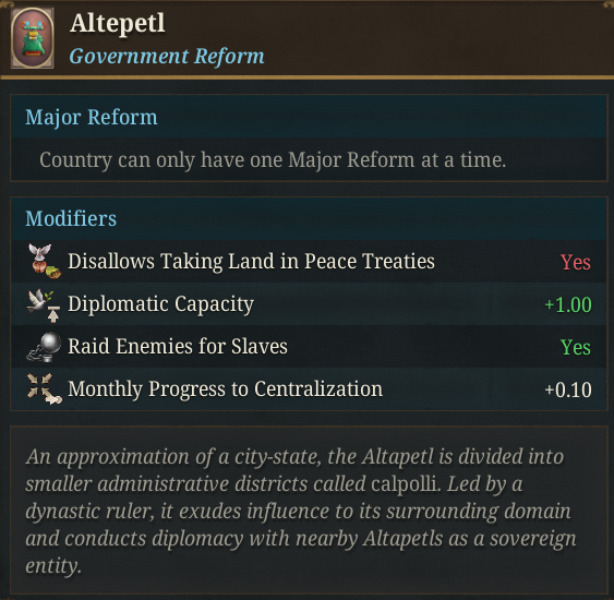
There are also a couple of Privileges available to countries that practice Nahua Ritualism:
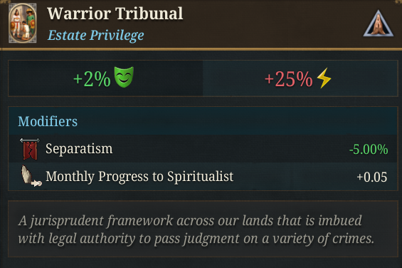
And also attached to Nahua Ritualism, a unique building that unlocks two unique units, the infamous Jaguar and Eagle Warriors:
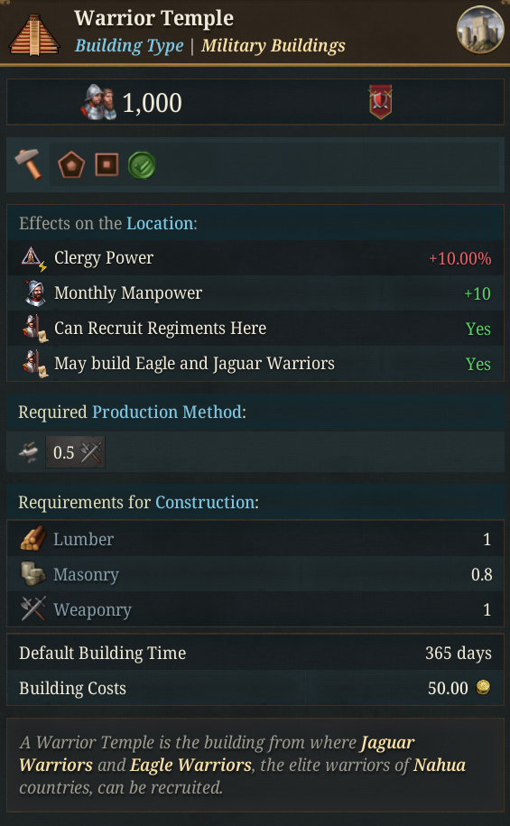
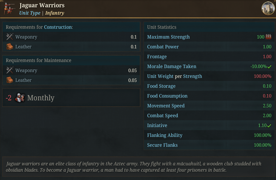
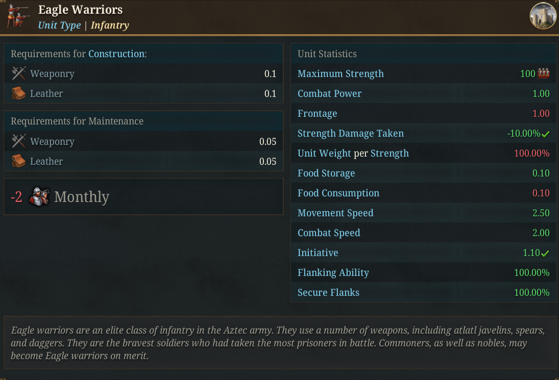
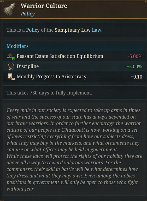
And a unique Sumptuary Law, with two available policies:

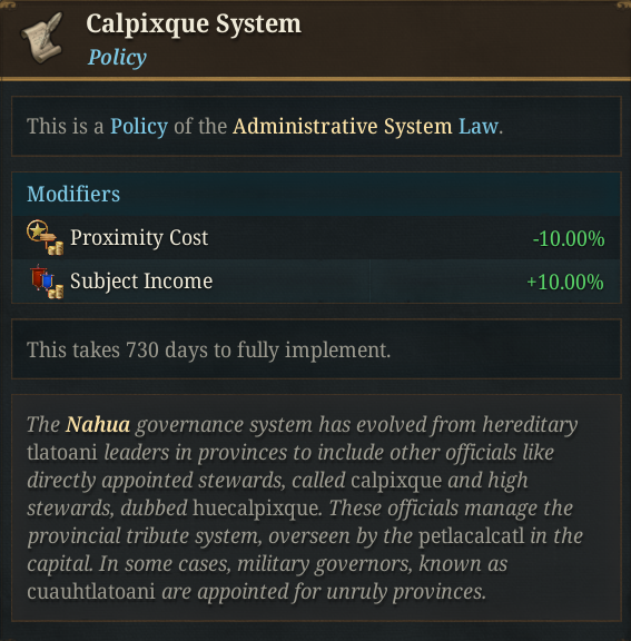
And a unique policy for the Administrative System:
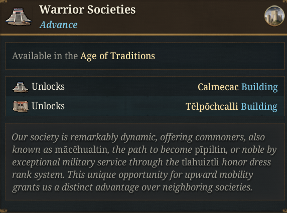
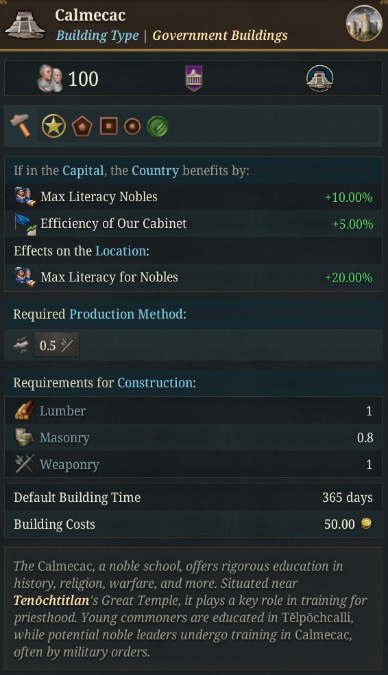
Here you have some of the unique Advances of the Aztecs:
Although most of the content related to the Aztecs is very attached to the Nahua Ritualism features, and thus, is very mechanical, there are still some non-generic, non-religious related DHEs available for them:
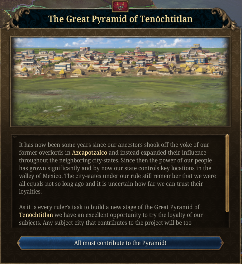
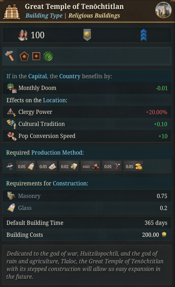
And well, a final boss to deal with:
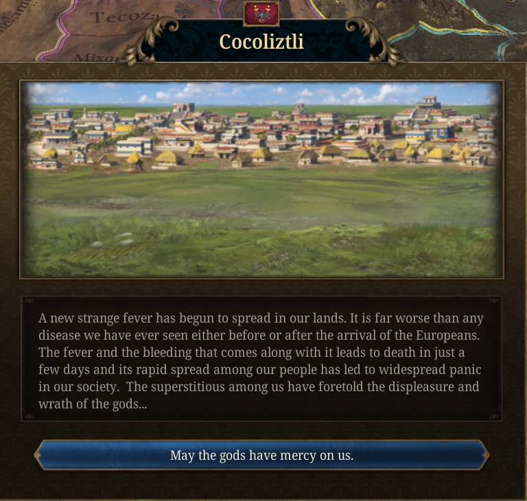
… And much more, but that’s all for today! Next week we’ll have a Tinto Maps Feedback on Monday, a Tinto Talks on Wednesday, and Tinto Flavour on Friday:
  • Tinto Maps Feedback for Indonesia
  • Wednesday -> Tinto Talks about Inti & Folk Religions
  • Friday -> Tinto Flavour about the Inca
And also remember, you can wishlist Europa Universalis V now! Cheers!
There should be some mechanic which accounts for the difficulty of campaign logistics in the Americas pre-Columbus because of the lack of suitable draft animals to carry food for armies. This tended to keep polities much smaller, because it was impossible to sustain longer-range conquests or suppressions of rebellions.
 
  • 1Like
Reactions:
I agree the shores of the Lake at the Aztec Capital look too steep.
Been in Mexico City two months ago, seen the Models. Just raise the water level and the shore would look flater and softer. :)
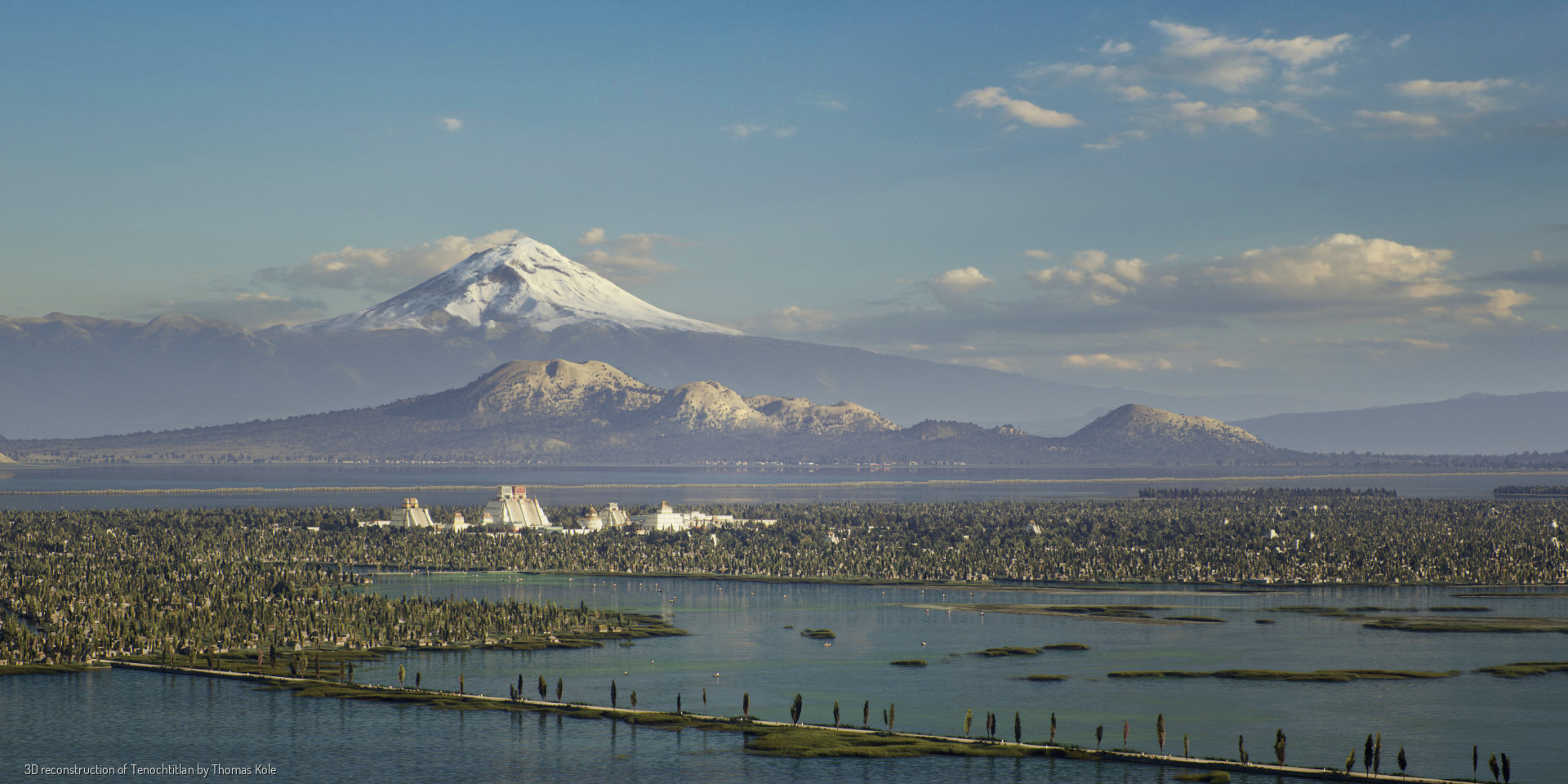
In fact, for those who don't know Mexico City, formerly Tenochtitlan, they have a pretty good recreation of Tenochtitlan and its surrounding area at this link, in case you're interested:
Retrato de Tenochtitlan
A small sample:
TENOCHTITLAN.jpg

To a certain extent the lake was not very deep, hence the use of chinampas used to increase the space for cultivation and construction.

And on this other page, you can take a virtual tour of the streets of Tenochtitlan and see its majesty in all its splendor: Recorrido Virtual Tenochtitlan
 
  • 3Like
  • 2Love
Reactions:
Europeans say that granularity and having many locations doesn't matter, but they demand and demand that their small country, which is 5 or 6 times smaller than Mexico, for example, have locations even on top of buildings and people.
Not sure what that has to do with anything, but alright?

I do agree with what you said elsewhere, that Tenochtitlan should be an island. If that gets implemented, I wouldn't be opposed to seeing 3D models of the bridges leading off of it!
 
The same thing happened with Macau (a Portuguese colony), which they didn't include, but they did include Hong Kong (an English colony).
Hong Kong is about 23 times larger than Macau; they're not comparable. Macau is several times smaller than even Venice (actual Venice, not even the whole lagoon). Gibraltar would be a better comparison, but the Gibraltar location in-game is far, far, far larger than the actual modern Gibraltar (in terms of inland extent, not an inaccurate coastline).
To all those who say that military units and buildings don't fit on an island of Tenochtitlan, I ask:

In this location I found in Mesoamerica, where are they going to put the units and buildings?

View attachment 1333028

In the lake?

In the two pixels on the lake's shore?

Are they going to remove the lake?

Are they going to modify the shape of the lake so the buildings and units fit?

This is from the map of Central America; I didn't make it up; you can go check it out on Tinto Maps.

And I didn't even have to search far to find this case; there may be more.

So, what will PDX do?

Or rather, what do you think is the right thing to do?
I think you're underestimating the size of that location. Here's that location:
1752357337628.png

And here's Lake Texcoco at the exact same zoom level (from the Tinto Maps):
1752357363177.png

Here's Huandacareo roughly overlayed on Lake Texcoco:
1752358227470.png

Could they technically make the island big enough to hold the 3D models? Probably yes. But it would not look anything like the actual island or lake at that point, so it's fair for people to not want that.

Pavia and Aldaron already explained the problem with direct reference to the underlying pixel map and your solution in the other thread was to expand the size of the lake beyond its real size so that the island could be expanded and still be in roughly the correct part of the lake. If we're choosing the lesser of two evils here I'd very much prefer to have one location that should only be island "sprawl" onto the mainland a bit than have the entire lake be the wrong size, which would cascade into the surrounding geography making all of that wrong as well. The island is currently just 6 pixels and they want it to be 100 for playability; it's a huge growth.

And I'm sort of with Aldaron here where, considering how many inaccurate you have to make the map in order to fix the inaccuracy of Tenochitlan not being an island, I don't really see the gameplay point of this. I don't think they're gonna add navies to the lake, nor do I think it'd be fun if they did. Which means you basically just get a straight-crossing bonus for defense or something like that. A custom modifier seems better than that anyway, and that doesn't require making the location an island.
Do you think this image accurately represents the size real of Lake Texcoco?

View attachment 1332856

With your answer, I'll know what we're talking about.
Comparing it to this map on Wikipedia and looking at the scale there, it seems like it largely does. The resolution is low and it might be missing some of the northern extensions, but the main body of water seems to be around the right scale when you measure it out.
If that gets implemented, I wouldn't be opposed to seeing 3D models of the bridges leading off of it!
This is sort of a separate thing, but they could have custom 3D models for Tenochtitlan regardless of how the location borders end up, and I'd be all for that.

Personally I'd rather have an accurate-looking Tenochtitlan, with potential for accurate-looking custom models, and a modifier for the defense bonus instead of an inaccurate look and a "real" river-crossing defense bonus or something.
 
  • 5
  • 2Like
Reactions:
Hong Kong is about 23 times larger than Macau; they're not comparable. Macau is several times smaller than even Venice (actual Venice, not even the whole lagoon). Gibraltar would be a better comparison, but the Gibraltar location in-game is far, far, far larger than the actual modern Gibraltar (in terms of inland extent, not an inaccurate coastline).

I think you're underestimating the size of that location. Here's that location:
View attachment 1333169
And here's Lake Texcoco at the exact same zoom level (from the Tinto Maps):
View attachment 1333170
Here's Huandacareo roughly overlayed on Lake Texcoco:
View attachment 1333178
Could they technically make the island big enough to hold the 3D models? Probably yes. But it would not look anything like the actual island or lake at that point, so it's fair for people to not want that.

Pavia and Aldaron already explained the problem with direct reference to the underlying pixel map and your solution in the other thread was to expand the size of the lake beyond its real size so that the island could be expanded and still be in roughly the correct part of the lake. If we're choosing the lesser of two evils here I'd very much prefer to have one location that should only be island "sprawl" onto the mainland a bit than have the entire lake be the wrong size, which would cascade into the surrounding geography making all of that wrong as well. The island is currently just 6 pixels and they want it to be 100 for playability; it's a huge growth.

And I'm sort of with Aldaron here where, considering how many inaccurate you have to make the map in order to fix the inaccuracy of Tenochitlan not being an island, I don't really see the gameplay point of this. I don't think they're gonna add navies to the lake, nor do I think it'd be fun if they did. Which means you basically just get a straight-crossing bonus for defense or something like that. A custom modifier seems better than that anyway, and that doesn't require making the location an island.

Comparing it to this map on Wikipedia and looking at the scale there, it seems like it largely does. The resolution is low and it might be missing some of the northern extensions, but the main body of water seems to be around the right scale when you measure it out.

This is sort of a separate thing, but they could have custom 3D models for Tenochtitlan regardless of how the location borders end up, and I'd be all for that.

Personally I'd rather have an accurate-looking Tenochtitlan, with potential for accurate-looking custom models, and a modifier for the defense bonus instead of an inaccurate look and a "real" river-crossing defense bonus or something.
Gameplay triumphs over realism. And that was the reason for many a non-realistic change in other regions. Besides even by the coastal design philosophy that is employed by EU5, Lake Tenochtitlan should mostly be drained. I rather had it they remove the weird wastelands surrounding the provinces - which was quite traversable actually - and make it so that Tenochtitlan (And triple alliance) can be portrayed as it was, which will actually enhance the gameplay btw.

Also for a lot of the non-European regions, we are going back to old problematic ways, instead of innovating, which seemed to be the direction that EU5 was heading a year ago, sadly.
 
  • 1
Reactions:
Gameplay triumphs over realism. And that was the reason for many a non-realistic change in other regions.
Ok, but what's the gameplay benefit of island Tenochtitlan even? Either they make it uncrossable and allow navies in the lake, which I don't think would be good gameplay, or they just add straights and then the defense bonus is just a straight-crossing bonus, which isn't very interesting, can be replicated with a custom modifier, and might be less representative of the real situation than a custom modifier.
It's great that you overlap them, now draw in the one from Huandacareo, where the buildings and units would go, I want to see it, come on, I'll wait for you.
Anywhere left here? Again, you're underestimating the size of this location. You remove the lake and it's still many, many times the size of Tenochtitlan island. The island is currently only 6 pixels. It's not a case of it being almost big enough or something - it's closer to not existing at all than it is to being big enough to be a location.
1752363378635.png
 
  • 3Like
  • 3
Reactions:
Here is a small sample of the beauty of the classical Nahuatl language:
That is the type of example I was looking for. But when do your sources say it was first written down? My searches tell me it was first written in the Latin alphabet based on the original oral sources. They say that the Nahuatl version is a retranslation of the written Spanish version. That feels more like the tales of Cú Chulainn than like Plutarch to me. I love Cú Chulainn, but I don't think it's the type of work that would provide evidence of literacy for the Irish.

Are there any books that share practical information (like Fibonacci's Liber Abaci or the Babylonian era "Farmer’s Almanac")? I feel that is what the EU5 literacy bonuses reflect. Books that let people learn new practical techniques that help merchants do math, or farmers know when to plant different types of crops.

I think you can chill a bit, I think the other guy is just stupid, not necessarily racist.
Thanks for taking the heat out of it. I'm never racist.

Of course I admit that his idea that Aztec heiroglyphs shouldn't count as a written language for mechanical purposes is moronic. Even if you suppose that not a lot of 'books' were written in the language (patently false) the idea that the letters couldn't be used to write such things in an alt-history scenario is insane.
Alt history is fine, as long as it's realistic. How much work needs to be done before you get from historical 1337 to that alt-history scenario though? I think I'm asking for a realistic historical start, and a realistic path from there to alt-history (so by 1500 the new world doesn't consistently look skewed in one direction or the other).

I was worried a building giving the Aztecs the highest noble literacy in the world based on a country specific advance in the age of traditions doesn't really fit. Obviously, this is just from what we have seen so far, but +10% literacy country wide and an additional +20% in the specific location is much higher than any other literacy bonuses we have seen from any buildings.
 
  • 1
Reactions:
This is sort of a separate thing, but they could have custom 3D models for Tenochtitlan regardless of how the location borders end up, and I'd be all for that.

Personally I'd rather have an accurate-looking Tenochtitlan, with potential for accurate-looking custom models, and a modifier for the defense bonus instead of an inaccurate look and a "real" river-crossing defense bonus or something.
Mhm! Just imagine if they implement day/night patterns, so we could see the temples and palaces light up!
 
  • 1
Reactions:
That is the type of example I was looking for. But when do your sources say it was first written down? My searches tell me it was first written in the Latin alphabet based on the original oral sources. They say that the Nahuatl version is a retranslation of the written Spanish version. That feels more like the tales of Cú Chulainn than like Plutarch to me. I love Cú Chulainn, but I don't think it's the type of work that would provide evidence of literacy for the Irish.

Are there any books that share practical information (like Fibonacci's Liber Abaci or the Babylonian era "Farmer’s Almanac")? I feel that is what the EU5 literacy bonuses reflect. Books that let people learn new practical techniques that help merchants do math, or farmers know when to plant different types of crops.


Thanks for taking the heat out of it. I'm never racist.


Alt history is fine, as long as it's realistic. How much work needs to be done before you get from historical 1337 to that alt-history scenario though? I think I'm asking for a realistic historical start, and a realistic path from there to alt-history (so by 1500 the new world doesn't consistently look skewed in one direction or the other).

I was worried a building giving the Aztecs the highest noble literacy in the world based on a country specific advance in the age of traditions doesn't really fit. Obviously, this is just from what we have seen so far, but +10% literacy country wide and an additional +20% in the specific location is much higher than any other literacy bonuses we have seen from any buildings.
Consider that Chinese is also a hieroglyphic language that is in use today. And consider that it was originally a language only used by the priests, and as far as archaeological records show, only used to write on turtle shells for the purposes of divination.

Pretty much every language started as the sole domain of priests, but none of them have shown any sort of barrier for widespread literacy in a culture. Certainly one can argue about the downsides of a hieroglyphic system, but as the Chinese show, it's clearly no barrier for anything in modern day society.

About the only thing I think worthy of comment is that it's likely Aztec hieroglyphs would have ended up simplified for ease of drawing and distribution- this is what happened with Cuneiform where symbols became abstracted into a series of dashes by record keepers. Of course- that's speculative and we can't really imagine what that would have looked like, and so it's best kept as an abstraction for Nahua tags if referenced at all.
 
  • 3
Reactions:
Consider that Chinese is also a hieroglyphic language that is in use today. And consider that it was originally a language only used by the priests, and as far as archaeological records show, only used to write on turtle shells for the purposes of divination.

Pretty much every language started as the sole domain of priests, but none of them have shown any sort of barrier for widespread literacy in a culture. Certainly one can argue about the downsides of a hieroglyphic system, but as the Chinese show, it's clearly no barrier for anything in modern day society.

About the only thing I think worthy of comment is that it's likely Aztec hieroglyphs would have ended up simplified for ease of drawing and distribution- this is what happened with Cuneiform where symbols became abstracted into a series of dashes by record keepers. Of course- that's speculative and we can't really imagine what that would have looked like, and so it's best kept as an abstraction for Nahua tags if referenced at all.
Although Nahuatl is written with the Latin alphabet today, it has its own grammatical rules, prefixes, suffixes, and more.

And there's something I believe to be "Abstraction" and "Phonetic Ideograms."

To make myself clear:

Abstraction expressed through drawings together or in combination, represents abstract ideas and concepts. When combined, they form a completely different meaning. In some cases, the newly formed word doesn't have a literal translation and must be explained in a paragraph.

For example, to name airplane, two words are combined:

Tepoztli = iron/metal

Tototl = bird

So, literally, we translate it as "metal bird," but the correct translation is "airplane."

That's an easy word, but there are others that are formed from three or more words.


Phonetic ideograms involve forming new words with suffixes and prefixes of existing words. However, that's not all. They are also used as a characteristic of the original word to name something, such as taking the first syllable of a word and combining it with another, forming a completely different word.


One of them could be Chalchihiuhtlicue, the goddess of water and springs.

Her name is made up of two words:

Chalchihuitl = jade
Cueitl = skirt
(Obviously, as in every language, we have conjunctions of various kinds, in this case, "i" as a way of expressing something in the third person).

This forms "jade-skirt," but the correct meaning is "She of the jade skirt."

Somewhat more complex is the famous "Altepetl" = city/town, which literally means "Water-hill."

Literally, it means nothing; it's nonsense. However, the characteristics of the elements (water, hill) are used to describe a more abstract concept.


What's my point with all this?

The Nahuatl language has evolved over these 500 years along the path of abstraction and difrasism. And with that, although words like "telephone" and other technical terms weren't originally known, with this system of difrasism and abstraction inherent in the Nahuatl language, it's possible to name anything.


P.S. I'm not a language expert or a grammar teacher, I'm just trying to explain this from a native speaker's perspective.
 
Last edited:
  • 1Like
Reactions:
There should be some mechanic which accounts for the difficulty of campaign logistics in the Americas pre-Columbus because of the lack of suitable draft animals to carry food for armies. This tended to keep polities much smaller, because it was impossible to sustain longer-range conquests or suppressions of rebellions.
No extra mechanic needed as it is already included

Right now, they wont be able to build camp followers as it requires horses, therefore the food capacity of Mesoamerican armies are pretty low, which obviously limits how deep your armies can go into the enemy territory during campaigns
 
  • 2
  • 1Like
Reactions:
Anywhere left here? Again, you're underestimating the size of this location. You remove the lake and it's still many, many times the size of Tenochtitlan island. The island is currently only 6 pixels. It's not a case of it being almost big enough or something - it's closer to not existing at all than it is to being big enough to be a location.
View attachment 1333199
If you're so sure, can you draw it? I already asked you in another comment, and I'll do it again. Draw it.

Where in Huandacareo would the units and buildings go? Circle where they're supposed to go. I'll wait for you.
 
  • 5
Reactions:
If you're so sure, can you draw it? I already asked you in another comment, and I'll do it again. Draw it.

Where in Huandacareo would the units and buildings go? Circle where they're supposed to go. I'll wait for you.
Hey @vinaxel33 I actually agree with you on a lot of points that some of the outlooks on Mesoamerican writing are Eurocentrist, and that I'd love the devs to spend a little more time seeing if they can make Tenochtitlan an island among other topics. That said, I don't think I'm alone in thinking you should take a breath and chill a little before responding. Over the last two threads you see to be approaching every disagreement as though it's a fight:
According to whom? Someone who has no idea about Aztec history and religion?
And with all this, he's going to erase his retrograde comments and supremacist ideas?
I want to see it, come on, I'll wait for you.

I don't know if it's your intention to come off so combative to other users, but as someone who generally agrees with your points, I recommend toning it down a little. The overwhelmingly vast majority of people are not familiar with this region of the world, never mind it's languages and cultures. Most of the people you replied to seemed to be more interested in learning or clarifying than intentionally spreading stereotypes or misinformation. People would probably be a lot more receptive if you didn't come off so abrasively - and even if they are confidently wrong, you're not winning yourself any favours like this.

It's best to imagine the people you're responding to have the best intentions rather than the worst when discussing things like this - but that's just my two cents.
 
Last edited:
  • 9
  • 1Like
Reactions: