We have updated our Community Code of Conduct. Please read through the new rules for the forum that are an integral part of Paradox Interactive’s User Agreement.
You are using an out of date browser. It may not display this or other websites correctly. You should upgrade or use an alternative browser.
Hello, and welcome to another new Tinto Maps! I’m back to duty, after the review of Italy that we posted last Thursday, and Johan taking care of Scandinavia last Friday. Today we will be taking a look at Germany! This region comprises the modern territories of Czechia, Austria, Switzerland, and Liechtenstein. However, for most of the timeline in Project Caesar, it was better known as the Holy Roman Empire. This organization once was a feudal empire elevated from the Kingdom of the Germans, but by 1337 was mostly disaggregated into a multitude of temporal and ecclesiastical jurisdictions, with only a tenuous feudal relationship with their Emperor.
Let’s start diving deep into this nightmare, then…
Countries:
I’m showing here a bit more of what the region is, so you can have a clear depiction of how it looks compared to the neighboring regions we’ve previously shown (and so that the Reddit guy who is patchworking the world map has an easier day ). What I can say about this when the map speaks for itself… The lands of Germany are highly fractured among different principalities, making for an extremely complex political situation. The Emperor in 1337 was Louis IV von Wittelsbach of Upper Bavaria… Because, yes, Bavaria is also divided. He is married to Margaret of Avesnes, daughter of Count William of Hainaut, Holland, and Zeleand, while his son Louis is the Margrave of Brandenburg. But probably the strongest power of the period is the Kingdom of Bohemia, whose king John also Duke Luxembourg and rules over both lands in a personal union, while also being overlord of the Margraviate of Moravia, ruler by his son Charles, and the Silesian principalities. The third contender probably is the Duchy of Austria, ruled by Albert II von Habsburg. He also rules over some lands in the formed Duchies of Swabia and Carinthia. There are also plenty of medium and small countries all over the region, with very different forms of government, which will probably make this HRE a very replayable experience…
Dynasties:
The dynastical map of the HRE gives a nice picture of the situation explained in the previous one. The von Wittelsbach, de Luxembourg (John of Bohemia is considered of French culture, therefore it uses the French toponymic article ‘de’; if he would change to the German culture, then it would be the ‘von Luxembourg’ dynasty), and von Habsburg cover much of the map; you may note that the Wittelsbach rule over five different countries (Upper Bavaria, Lower Bavaria, the Palatinate of the Rhine, and Brandenburg); while the House of Luxembourg also control the Archbishopric of Trier through Balduin, uncle of King John. Other important dynasties, although in a secondary position, are the Welfen, von Mecklenburg, and Gryf, present in multiple countries to the north; the Askanier, who happen to control half of Upper Saxony, while the rest is in the hands of the von Wettin; and the von Görz, who rule over the Duchy of Tirol and the County of Gorizia.
HRE:
We obviously have to repost the HRE IO map again here. The purple stripes mark the imperial territory, while the different types of members use different colors. We currently have these divisions in the IO: the Emperor (1, dark blue), Prince-Electors (4, light blue), Archbishop-Electors (3, medium blue), Free Imperial Cities (23, light green), Imperial Peasant Republics (2, orange), Imperial Prelates (44, white), and Regular Members (280, dark green). So, yeah, that make for a total of 357 countries that are part of the HRE. And before you ask: No, we won’t talk about its mechanics today, that will happen in future Tinto Talks.
Locations:
Germany has the highest density of locations in the world, as we wanted to portray the historical fragmentation of the HRE at the most detailed level of any Paradox GSG. There are a couple of things that we are aware of and we want to rework: the location connections (as in some places they are not obvious at all, and we want to make warfare in the HRE not impossible); and the transition between the German locations and those at their east, making it smoother (something that we will be doing in the review of Poland, Hungary and this region [e.g. for Bohemia]). A final comment: if you click on the spoiler button, you may be able to see 4 more detailed maps of the region.
Provinces:
Map of provinces. As usual, suggestions are welcomed.
Areas:
Areas. We are currently not happy with the area borders (or at least, one of our German content designers isn't, and let me note it while preparing the DD... ), as they reflect more modern areas so we will be looking into an alternative setup for them with your feedback. They also currently use their German names, which will change to English ones to be in line with other areas, as usual.
Terrain:
Terrain mapmodes. The region is quite forested, in comparison to other parts of Europe.
Culture:
Let’s open the Pandora box and take a look at the cultures! The German cultures have come through a couple of reworks, until we’ve found a spot in which we’re kind of happy (or, at least, our German content designers do not complain!). The German cultures are very linguistically related, as we thought that it would be the best starting point for 1337. Please let us know about your thoughts on them.
Religion:
Boring religion map this week, as the region is overwhelmingly Catholic. There are Ashkenazi Jews in a bunch of places (a quick account: they’re present in 204 locations all over Central and Eastern Europe), and you may also see the Waldesians we added in the review of Italy last week.
Raw Materials:
Raw materials! Plenty of!
Markets:
The main market centers of the region are Cologne, Lúbeck, and Prague. We have reviewed them a couple of times, and this is the configuration that makes for a good setup historical and gameplay-wise. And you may also see Bruges, which has been reinstated as the main market of the Low Countries, after some tweaks.
Country and Location Population:
The population of the HRE is… Fragmented. In that regard, Bohemia starts in a very strong position, with a strong competitor to its south (Austria) and north (Brandenburg).
And that’s it for today! I hope that we didn’t drive you into madness with this map… Next week we will take to a very different region, the Maghreb! See you then!
I have updated this post to include basically everything and this post is more up to date and contains more information, but here is the original post for historical reasons:
1.) Austria:
Let's begin with Austria which, oddly enough, is the biggest blob in the HRE in the current iteration of the 1337 setup. Austria was ruled by two brothers, Albert II and Otto IV, a similar situation to the Wittelsbachs who also split their dominions. Otto IV died two year later which prevented a more permanent division, but I would personally advocate for splitting Austria. As Otto IV mostly focused on Further Austria, Carinthia and Krain, he could get those parts, whereas Albert II would own Austria and Styria. Additional events (just like I hope Bavaria also gets them for their similar situation) could then lead to the unification. After all, Austria was split in 1379 for a longer time, too.
In this map from the historical atlas, you can see a rough overview of the lands obtained until 1395 by the House of Habsburg. Note that their posessions in Krain and Further Austria were much smaller in 1337, and that there were none in Tyrol or Vorarlberg. Most of the maps for Austria are from the historical atlas of Austria ("Historischer Atlas Österreich" by Manfred Scheuch).
1.1.) Tyrol:
Tyrol is mostly fine as it is, as there would be only one "mandatory" change and two optional ones.
Kufstein (and with it Kitzbühl and Rattenberg) should be owned by Upper Bavaria in 1337. It only shortly belonged to Tyrol from 1342 (until 1369), because of the marriage between Margaret of Tyrol and Louis V of Bavaria. It was finally incorporated into Tyrol in 1504.
Nearby, Zell am Ziller should be a Salzburger territory, while Itter was owned by the Bishopric of Regensburg until 1380/5. Afterwards both remained under Salzburg until the Napoleonic era. A pass from Salzburg to Eastern Tyrol could be added; this would be (Windisch) Matrei, a territory owned by Salzburg for the same amount of time.
Brixen has now been added as a separate tag. Possible new provinces could be Anras and some Alpine vallesy around Matzin.
My last observation is that Görz should extend a bit more westwards. Their main territories should be Lienz and Innichen. Although, the latter was a possession by the Bishopric of Freising, the Gorizian counts reduced the Freisinger posessions until only a couple of yards remained, i.e. most of Innichen was also owned by the Gorizians.
The following map from the historical atlas should give you an idea, thereby the numbers correspond to the years they were incorporated into Tyrol. The red borderline corresponds to Tyrol in 1918. The north-western parts labeled with 1432/1468 were owned by ministry officials subject to the Imperial Abbey of Kempten.
Rattenberg and Kufsten go to Upper Bavaria.
Zell goes to Salzburg. Matrei is a new povince connecting Salzburg to Tyrol.
Bruneck gets split and is no longer a territory. (It's now included in the Brixen province, as Brixen owned it). Innichen is a new province owned by Görz, and Anras a new province owned by Brixen.
Southern Tyrol is mostly unchanged. I only added Eppan as it was separately acquired from Brozen. Matzin could be a possible split from Gablöss to represent the valley owned by Brixen.
The most doubtful addition would be Vils which was owned by the Abbey of Kempten (Kempten would need to change from a free city to an imperial abbey).
It appears that all of Krain was added to the Habsburg dominion, but the actual extent of the land acquired in 1335 was far smaller. I will again refer to the historical atlas.
The territories around Veldes (Bishopric of Brixen) and Bischoflack (Bishopric of Freising) were only acquired after the 30YW by the Habsburgs. Furthermore the territories around it were also much later acquisitions dating to the mid 15th century / early 16th century. Veldes is called Bled in Slovenian and Bischoflack Škofja Loka.
In 1337, the Habsburgs still had a long road to get to the Adria, as it took them nearly 30 years. The lords of Duino switched their allegiance from Görz towards Habsburg, and thus the latter got their first Adriatic port with Fiume (Rijeka) and Duino-Aurisiana. The Lordship of Duino also included Prem (Ilirska Bistrica) and Senosetsch (Senožeče).
Moreover, the Habsburgs didn't own eastern Krain at this time. The Windic March, Möttling (Metlika), Tschernembl (Črnomelj) and Landstraß an der Gurk (Kostanjevica na Krki) were inherited in 1374 after the death of Albert IV. of Görz-Istria. This is sadly not shown in the above map (there's only a small yellow part at the right edge), but Istria is shown which was also part of the inheritance.
The land around Gottschee was owned by the Counts of Ortenburg (who also owned lands in Carinthia, more on that in the next paragraph). After their death, the lands were inherited by the Counts of Cilli and finally by Habsburg in the 15th century.
I don't remember where I read that the castle Lueg (Adelsberg / Postojna) was taken by the Habsburgs from Aquileia.
Furthermore, the Bishopric of Freising owned the Lordship of Klingenfels (Klevevž) until 1622, when they sold it. The Lordship consisted out of three scattered territories (map from the 13th century):
I enlarged Rijeka a bit, so that it's not as small as it currently is.
Klingenfels could also be changed to something else, but I wanted to represent the clerical and non-Habsburg territories in this region.
Rann could also be Cillian territory, but there were some clerical territories, most notably held by Salzburg, that I wanted to represent there.
Krainburg (held by Ortenburg) as name giving territory for Krain would be a nice touch.
Stein in Krain and Schönstein are optional additions to represent more important cities or give Cilli more than one province.
Aquileia loaned Windischgrätz to Salzburg in 1335 and to Ulrich of Pfannenberg in 1342. Albrecht II. of Habsburg occupied it in 1350 (see this post ).
1.3.) Carinthia:
A very positive aspect about the current setup is that all of the territories owned by the Bishoprics of Salzburg and Bamberg are represented, however Gmünd should be owned by Salzburg (it was shortly owned by the Habsburgs at the end of the 15th century, and only finally came into its dominion in 1535). The only thing that is missing are the lands of the Counts of Ortenburg who owned all of the land around Spittal until they died out (then the Counts of Cilli and thereafter the Counts of Görz inherited it). As mentioned before, they also owned a sizeable portion of Krain (Gottschee, Cabar, Laas). Therefore, I would strongly advocate for the inclusion of Ortenburg (capital Spittal).
The Habsburgs only owned Greifenburg and some territories around it in western Carinthia at that time. Greifenburg was more important than Steinfeld, so I'd change the current location name to Greifenburg (or Oberdrauburg if the territory should be Gorizian).
By the way, the connection to the Bavarian Ortenburgs is strongly contested as no blood link could be found.
Here's the map from the historical atlas (which shows Carinthia in its 1914 borders and when which part was obtained):
Feldkirchen was also owned by the Habsburgs, so it would change hands. The borders between eastern and western Carinthia were redrawn, so that Klagenfurt is now bigger. Villach now also includes Tarvis (part of Bamberg) and Gmünd was made smaller and is owned by Salzburg.
Hermagor could also be named Mauthen, but in general the borders here are up to debate, as the surrounding territory was owned by Görz. I tried to include all of the Salzburger land as well as the Habsburger land in Greifenburg. It then would be owned by the Habsburgs to represent their holdings in the region, but the name could also be changed to Oberdrauburg and become Gorizian.
1.4.) Upper Austria:
The counts of Schaunberg could be included as vassals of the Habsburgs. The Luxembourg Emperors tried weakening the Habsburgs by granting them more priviliges but this failed. However, they retained several exemptions until the reign of Maximilian I. Schaunberg bought the city of Eferding from Passau in 1367, which at that time was actually the most important town of the area.
I would propose to follow the Upper Austrian quarters which were established by HREmperor Frederick III and were valid until the end of the 18th century when the Innviertel was conquered by Austria (War of the Bavarian Succession of 1778/9). Linz should be a province south of the Danube, so I opted for removing Lambach (and renaming Grieskirchen). Sadly, there is no place to add Enns because of its proximity between Steyr and Linz.
Internally, there was the Riedmark and the Machland within the north-eastern quarter, the Schwarzviertel, though Freistadt was also part of the Riedmark at an earlier point but was part of the Mühlviertel. The Hausruckviertel contained the County of Schaunberg in the west and Linz and Enns in the east. The Traunviertel contained Steyr, Mondsee, the Salzkammergut (which was directly ruled by the Habsburgs and an important salt mining area) and the Bamberger territories of Kirchdorf, Windischgarsten and the Attergau.
The Bishopric of Passau owned the County of Ilzgau in 1220, but later the Habsburgs took away the County of Falkenstein (between Kleine Mühel and Ranna, except for Pützleinsdorf). The Passauer judicial and administrative centre was Velden (today: Altenfelden), so I would rename the province. Rohrbach was the Habsburg's try to repell Passau which worked over the years.
As mentioned earlier, Passau owned Eferding and also Riedegg (with Gallneukirchen), so I opted for giving Passau Riedegg but gave Schaunberg (with Eferding) to Schaunberg, because it was Schaunberg's capital. The alternative for Riedegg would be Pregarten when it should rather go to the Habsburgs.
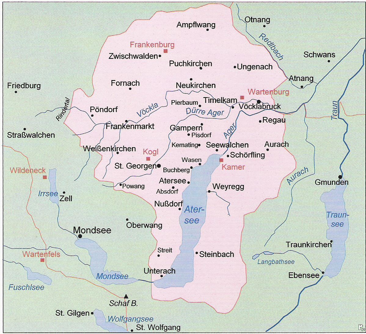
Even more obscure was the situation around the Mond- and Attersee. The former was owned by Bavaria until the Bavarian unification in the early 16th century (and then by Salzburg until 1565), whereas the other was held by the Bishopric of Bamberg until it was bought by the Habsburg.
For the end of the 12th century:
1.5.) Lower Austria:
So I noticed that Mariazell is in Lower Austria, although it has always been part of Styria, so the province should be renamed to Waidhofen an der Ybss, as it was the most important city there. Waidhofen an der Ybbs, Ulmerfeld, Hollenburg and Göstling an der Ybbs were owned by the Bishopric of Freising, so maybe the provinces could be split there and Scheibbs for Habsburg could be added.
Furthermore, the Bishopric of Freising also owned Enzersdorf so maybe that could be added, too. I would opt for it not having a border with Hungary. As Mistelbach is a rather huge province and oddly shaped, maybe Laa an der Thaya could be added, too. Salzburg also had some small holdings north of St. Pölten with Traismauer, Arnsdorf and Wölbling, but this would be rather optional for me, as Salzburg already owns a varied plethora of territories.
1.6.) Further Austria:
See part about Swabia.
1.7.) Styria:
There would be only three changes I would propose for Styria (see the overview map):
Rename Oberpölsen to Zeiring (main mine)
Redraw Murau and Oberwölz. The latter should contain the city of Katsch, i.e. be western oriented. The former would be then more eastern oriented. Oberwölz would then be owned by the Bishopric of Freising (owned Katsch and Oberwölz).
Split Leibnitz into Leibnitz (Salzburg) and Eibiswald (Duino). Eibiswald is a very recent acquisition by the Lords of Duino, as they bought it in 1332 from the Lords of Wildon.
Sadly, Gröbming cannot be added and given to Salzburg because of its proximity to Schladming.
1.8.) Vorarlberg
I just got around Vorarlberg and was surprised that Bludenz isn't in its own province. The whole situation of how the Habsburgs acquired Vorarlberg was a very complicated process as the following map from the Austrian historical atlas shows:
Bregenz would also have Lingenau and Tannberg (am Lech) in 1337.
Feldkirch would also have Hinterer-Bregenzerwald and Dornbirn.
Werdenberg would be represented by two provinces (but it could also be split into its different lines). The first one is Bludenz = Montafon and the second one is Nüziders (Sonnenberg).
The first one is Bludenz = Montafon and the second one is Nüziders (Sonnenberg).
Popular demand wants to see Vaduz, too, but it is rather small, so maybe it could get the western part of Nüziders with the Ill as border (the downside is that it won't look like the current Liechtenstein).
I would also like to mention that Sonthofen which is currently owned by the Bishopric of Augsburg could get split, so that Immenstadt could be added and owned by Bregenz.
Germany Map
2.) Bavaria:
Moving on to Bavaria, there are some changes I'd like to propose. The most important thing here, would probably be events that represent the imminent unification of Lower and Upper Bavaria in 1340.
2.1.) Upper Bavaria
I already mentioned Kufstein in the part about Tyrol. Then I'm suprised that the Bishopric of Augsburg seems to also own territories to the west of Dillingen, because they only owned a small territory around it there. I would personally give Upper Bavaria the eastern province and call it Gundelfinegn. Upper Bavaria also held territories north of Regensburg, so they should get what I guess is Burglengenfeld from the Rhenish Electorate. Moreover, I would give them the eastern province of the Bishopric of Eichstätt and call it Riedenburg (the alternative Dietfurt which was owned by Lower Bavaria was far less important; Beilngries was only a small village in the shadows of the Hirschberg, whereas Riedenburg had several castles and was a market town).
Speaking of Parsberg, I would've rather chosen the Bishopric of Regensburg, as the Lords of Parsberg really only owned a small castle with a couple of peasants (the territory would be Hohenburg). The Bishopric of Regensburg also owned Itter and the whole Brixental until 1380/5 as mentioned earlier, which makes the case for it even stronger.
Furthermore, the border in the area of Donauwörth / Oettingen / Heidenheim woul be a candidate for redrawing the provinces. I included the Bavarian city Rain to better shape the borders between Bavaria and the surrounding territories. The Imperial Abbey of Ellwangen could be carved out like and Oettingen could be repositioned to actually include Oettingen. The province of Dillingen can be made smaller, as the Bishopric of Augsburg only owned minor territories in its surroundings.
I also forgot to mention that Miesbach was owned by the County of Hohenwaldeck which broke free from Freisinger overlordship around 1300, so they should be independent in 1337.
Munich as the capital of the HRE should have more inhabitants; the city itself had around 10k.
2.2.) Lower Bavaria and Upper Palatinate
I would suggest redrawing the border between Lower Bavaria and Upper Bavaria and in general use the maps for the early divisions of Bavaria (Bavaria-Landshut, Bavaria-Munich, Bavaria-Ingolstadt, Bavaria-Straubing). Upper Bavaria extended further east in the area of Wasserburg, while Lower Bavaria owned territories west of Freising, most importantly Indersdorf.
Furthermore, as Salzburg only owned a minor exclave (Mühldorf) and nothing more, the province should either be renamed to Burghausen and given to Bavaria (or the provinceis split like in my proposal). Burghausen was an important Bavarian fortress and centre of administration (Rentamt Burghausen), so it was far more important than many current provinces around it.
Lower Bavaria should lose its northern territories above Regensburg to the Rhenish Electorate and some to the Landgraviate of Leuchtenberg (Pfreimd was the capital and Waldmünchen was bought by Leuchtenberg from Lower Bavaria in 1332). I would also suggest to give Vilseck to the Bishopric of Bamberg or otherwise just merge it with the Sulzbach province. The same applies to Kemnath as an optional addition for the Rhenish Electorate.
Further south, the Counts of Hals could get the strip north of the Danube and centred around Ering.
3.) Swabia:
After the fall of the Hohenstaufen, Swabia splintered into many smaller states, and the Habsburgs also took a huge chunk out of it. I'm glad that we finally can have more Austrian presence in Swabia with EUV.
3.1.) Rhenish Swabia
After the French feedback thread, the provincial density of Alsace is already good. It just needs a couple of more tags andredistribution of provinces.
Mühlhausen, Colmar and Straßburg were independent city states in 1337 (although it took some time for the formal imperial privilege in the latter's case), so they should all become their own tag. Similarly, this should also apply to the Abbey of Murbach and County of Lichtenberg.
Furthermore, the Landvogtei Hagenau (Unterelsass) shouldn't be owned by Austria, as they lost it in 1330 to Emperor Louis the Bavarian. Louis's chancellor Albert II of Hohenberg was the bailiff in 1337, and Louis handed it over to his relative, the Rhenish elector in 1341.
The province of Offenburg is relatively big and its primary city is located in its centre, so there are different possibility how to split it. I went with Ettenheim, as it became the primary residence of the Bishopric of Straßburg after the French conquered Alsace. There also seems to have been some confusion with Müllheim, as there were Counts of Strassberg in possession of it at some time. It should, however, be owned by a side branch of the Margraves of Baden (Baden-Hachberg-Sausenberg), but might as well be merged into the two provinces of the main line if deemed too small.
I would also liketo mention that the Palatinate became vogt of the abbey of Maulbronn in 1325, so they could get this rather important territory, too. Bretten, another important settlement in that area, was owned by the minor Counts of Eberstein who sold it the Palatinate in 1349, too.
Lastly, Triberg joined the Habsburg dominion in 1355, so it should not be owned by Austria in 1337. Freiburg joined even later in 1368, which is already represented (I appreciate that). I can't tell if it's possible to split off the County of Fürstenberg or if it's merged with St Blasien, which was owned by Austria. By the way, I would make Konstanz a bishopric, as the bishops of Konstanz were the clerical leaders in the Swabian Imperial Circle.
3.2.) Southern Swabia
So, Triberg joined the Habsburg dominion in 1355, thus it should not be owned by Austria in 1337 but by Hohenberg. Freiburg joined even later in 1368, which is already represented (I appreciate that). The County of Fürstenberg centred around Donaueschingen should be split off from St Blasien, which was owned by Austria. The territory to the south of Donaueschinegn could either be merged with it or made into Stühlingen (Counts of Lupfen) or Klettgau. The latter was owned by the Counts of Habsburg-Laufenburg, a side branch of the Habsburgs, but when it eventually died out, its inheritance went to the Counts of Sulz and not the Austrian Habsburgs.
Note that Donaueschingen was held by the Lords of Blumberg in 1337 who held it as a fief of the Counts of Fürstenberg. The Counts of Fürstenberg bought it in 1448 after the Lords of Blumberg died out.
By the way, I would make Konstanz a bishopric, as the bishops of Konstanz were the clerical leaders in the Swabian Imperial Circle, and split off the County of Nellenburg. I would also switch Wangen with Lindau, as the latter was a trade hub on the shores of Lake Constance.
3.3.) Central Swabia
I'd like to propose here that Zollern should be split off to also include the Hohenzollern (which would give a unique challenge to form the German Empire with them earlier). Hohenberg wasn't really a major player but it currently appears to have several more provinces than the surrounding tags. Probably, the Free City of Rottweil and / or the Counts of Geroldseck could become independent tags here.
A Sigmaringen province could be also added which would be owned by Württemberg in 1337 but was later sold. Likewise, an Ehingen province could be added to represent the last days of the Counts of Berg-Schelklingen whose territories became Austrian in 1346. Lastly, the rather big territories of the Free City of Schwäbisch Gmünd and Helfenstein could be represented to the west. Potentially, a Göppingen province could be carved out of those two and be given to Württemberg. There's also the possibiliy to pick Löwenstein instead of Marbach to represent the County of Löwenstein (which later became part of the Palatinate), but it was rather minor.
3.4.) Eastern Swabia
I would redraw Kempten to border Kaufbeuren, as the abbey owned this territory. Mindelheim could be added and would be owned by the Lords of von Hochschlitz (they acquired it in 1337 and sold it to the Duchy of Teck in 1369).
I was also not satisfied with the borders of the Burgau, so I took some land away from the Free City of Augsburg which did not own it anyway. This would allow for the inclusion of Burgau (along Günzburg). I also redrew the borders of Gundelfingen, Oettingen and Dillingen.
I also added the County of Kirchberg and the County of Waldburg by taking away land from Lindau, Ravensburg, Biberach and Riedlingen. Btw, Altdorf (now: Weingarten) was the administrative capital of the Habsburg territory in this region. Both Waldburg and Kirchberg contain territories by other entities, too, the former Habsburg's Gerazhausen and the latter from some minor abbeys.
The provinces look a bit less "modern" and more messy like your typical HRE borders, while also allowing for some later borders.
4.) Franconia
There are also some possible improvements for Franconia:
Dinkelsbühl (which should be a free city) could be split into Hohentrüdingen which would be owned by the Counts of Truhedingen (also changing Ebermannstadt to Scheßlitz for this purpose).
The Kulmbach-Bayreuth split could be added for "Ansbach" which should rather be called Burgraviate Nürnberg in 1337. The Hohenzollern sold the Burgraves' Castle in 1427 which de-facto ended the existence of the Burgraviate, but they still used this hollow title thereafter. Moreover, Ansbach and Kulmbach(-Bayreuth) came only into existence after the inheritance was split in 1398. Also, Kulmbach and the Plassenburg were owned by the Counts of Orlamünde until 1340 when they sold it to the Hohenzollern.
I would suggest redrawing the provinces in Lower Franconia. This would make room for the Free City of Schweinfurt, the most important city in that area, and Castell which was owned by the Counts of Castell (they later became very prominent and rich during the Industrial Revolution with their pencils). It's also rather odd for me why Henneberg owns territory west of Haßfurt, as the primary settlement of this area, Gerolzhofen, was owned by the Bishopric of Würzburg. Finally, Orlamünde could be split from Coburg and would then be owned by Weimar and Königshofen from Hildburghausen (by giving Hildburghausen some territory from Illmenau), too.
Next to Würzburg and between it and Mainz, the County of Wertheim could be added.
5.) Saxony and Thuringia
Compared to other parts of the HRE with comparable heterogeneity, Saxony currently lacks representation of smaller states. I don't know if it's on purpose or if it's because the sources are lacking. There only seems to be the County of Schönburg between Meißen and Landsberg.
Regardless of that, Chemnitz shouldn't be owned by Landsberg but by Meißen.
Personally, I'd advocate to include the following smaller players:
The Bishopric of Meißen was independent until it was incorporated into Saxony after the Protestant Reformation. It owned most of the lands south-east of Dresden and the Elbe river (most notably Bischofswerda and Stolpen) as well as Wurzen and Mügeln and their surrounding areas. Between Wurzen and Mügeln there was a small territory around Dahlen which was owned by the Bishopric of Naumburg, so in general that area was held by bishoprics and not worldly rulers.
The County of Torgau was ruled by the Counts of Torgau (Bodo of Torgau in 1337) until the mid of the 15th century. They held all of the territory around the city of Torgau, but the province should be a bit smaller by giving it to Schweinitz. The latter should also get some Lusation territory incorporated to better represent the border of Saxe-Wittenberg.
The Lordship of Waldenburg (Heinrich of Waldenburg in 1337) would represent the three small independent worldly rulers of the region (Burgraviate of Meißen and small territories owned by Colditz), as a third Meißen would probably be too much at that point.
The last one would be the Burgraviate of Colditz, althought they owned a smaller strip of land, so they are the most arguable of the aforementioned ones. Thimo VIII of Colditz, however, was an important confidant of emperor Charles IV.
Pirna was owned by Bohemia from the reign of Václav II (1293) until the reign of Wenceslaus, King of Germany (1405). Nearby Königstein actually derives its name from this period (there were no Saxon emperors or kings at that time). Alternatively, the territory could be changed to Dohna and then owned by the Burgraviate Dohna. Another large province would be Görlitz, so Rothenburg could be split off.
A rough map from the reign of Emperor Charles IV that shows this tentacle.
Lastly, I would split Naumburg to also include the Lordship of Querfurt. Naumburg itself only contolled a small territory, so it would be odd to give it the biggest Thuringian province. Aschersleben could also be split to include Ballenstedt, the cradle of Anhalt. It would also have some Mansfelder territories inside the province but Ballenstedt's historical importance warrants its inclusion. Unlike Aschersleben, it was inherited by Anhalt-Bernburg after Anhalt-Aschersleben died out. Maybe Zerbst could be split to also include Dessau. I would furthermore rename Braunlage to Walkenried and give it to its eponymous Imperial Abbey of Walkenried, as the minor county of Blankenburg hardly deserves two provinces and Braunlage was only properly founded in the 16th century.
6.) Lower Saxony
Hameln was owned by the Welfs since 1268 (see also https://www.hameln.de/fileadmin/media/Dokumente/Historisches/1264-stadtgeschichte-hameln.pdf ), when they took it from the Bishopric of Minden. Fallingbostel was also owned by the Lüneburger Welfs since the times of Henry the Lion. I think someone got confused by it belonging to the diocese of Hildesheim.
Cloppenburg was still owned by the Counts of Tecklenburg, as they lost it in 1400. As the province is rather big, I would suggest splitting it by addng Friesoythe and redraw it a bit to border Lingen. Meppen, too, could be halved by adding Papenburg, the castle the bishops used when they went to Frisia. Count Nicolas of Tecklenburg also inherited Altbruchhausen which he sold in 1338. Neubruchhausen was still owned by the Counts of Neubruchhausen until 1384 when it was sold to the Counts of Hoya. Therefore, I would suggest splittng Diepholz into Altbruchhausen, Neubruchhausen and Wildeshausen. The latter was owned by the Archbishopric of Bremen.
Oldenburg should lose Elsfleth to Friesland, as they acquired it only in 1350. I would also split the Jever province by adding Wittmund, because then the borders of the later Lordship of Jever could be better represented.
Zeven and Solltau could be split to better represent the borders of the Bishopric of Verden, as the bishopric owned Rotenburg but did not own Bergen (for Bergen also see here: https://www.stadt-bergen.de/portal/seiten/stadtgeschichte-900000036-29501.html), which was owned by Lüneburg. With these changes the western border of the Duchy of Lüneburg would look more like it does on many maps.
Paderborn could also be split to add the County of Rietberg or make it an exclave of the Bishopric of Osnabrück.
The addition of the County of Pyrmont might be a bit controversial as it was rather small. I even had to make it a bit bigger and include the non-Lippe territories in this area. Castle Sternberg was also not owned by Lippe.
Gifhorn could also be split by including the castle of Brom, and Heide could also be split to include the old capital of Dithmarschen, Meldorf. I would also like if (Amt) Neuhaus was added for Saxe-Lauenburg to give the duchy its iconic shape.
There would be two additions to round up Holstein.
The province of Eutin which would be owned by the Bishopric of Lübeck. This was an independent territory until the Reformation.
The province of Pinneberg which would be owned by the County of Schaumburg which is already represented. Holstein-Pinneberg and Schaumburg were in a personal union at that time, but it should be probably owned by the very same tag, as it's only two provinces in total.
7.) Electoral Rhenish Circle
Firstly, the County of Veldenz, as mentioned earlier, could be added which was held by the Counts of Geroldseck(-Veldenz). Geroldseck also held the County of Veldenz along the Rhine; Veldenz was actually only a small exclave, so they would only get Thallichtenberg. Moreover, there could be room for the Rhinecounty (Rheingrafschaft) if the provinces are redrawn to follow this tripartition.
Secondly, Speyer could be split to give the Bishopric of Speyer also territories west of the Rhine; Kirrweiler would be a potential candidate for that. It should also be possible to represent Lotharingian presence in the province of Saarbrücken by adding here Dillingen (Saar).
Thirdly, Darmstadt should be owned by the County of Katznelnbogen which could also get a Katzenelnbogen province carved out from Simmern, Rüdesheim and Wiesbaden. Rüdesheim could get some parts of Kreuznach and follow more the borders of Mainz. Montabaur is a rather huge province, so it'd be possible to squeeze in the County of Wied. Koblenz should also get some slight border corrections to make it more similar to the historical borders.
Fourthly, I would rename Ahrweiler to Neuenahr and give to to the County of Neuenahr. It owned basically all territory, whereas Cologne only had a small strip of land. Virneburg could be carved out and made slightly bigger. Virneburg was owned by the Lords of Virneburg who were subjects of the Palatinate, so either it would be directly owned by it or a vassal. Scheiden was owned by the Counts of Blankenheim who also owned Gerolstein and Manderscheid. I would rename it to Blankenheim, their capital, and make them independent. Obviously, Manderscheid and Gerolstein can't be carved out, because then Daun would vanish.
Fifthly, Bonn should be the capital of the Electorate of Cologne, while the city itself should become a free city. Euskirchen could be carved out of Bonn and Bergheim and given to Jülich. Speaking of which, Jülich's capital should be Jülich. Bensberg could be carved out of Cologne and given to Berg. The split between Gladbach and Neuss should follow the historical borders
Lastly, Siegburg was owned by the Lords of Heinsberg since the later 13th century. They also owned the Löwenburg and in general the Siebengebirge. Dortmund is a rather huge province for a free city, so I would carve out either Hagen or Bochum, though the latter was more important but it also depends on the exact borders. I would either rename Rees to Duisburg and give it to Berg or do the split like I did. Duisburg as a former free city was far more important.
8.) Brandenburg, Mecklenburg and Pomerania
The current borders of the Bishopric of Havelberg are odd. Havelberg and Wittstock were both owned by it, but obviously most of the Prignitz was owned by Brandenburg, thus I would split it and give Brandenburg Lenzen (an important road went through it) and Pritzwalk. Ruppin is also rather big, so maybe Rheinsberg could be split from there.
The southern borders between Saxony and Brandenburg are too far north. I think it's possible to add the Bishopric of Brandenburg with Ziesar as capital, because Brandenburg would get some areas from Saxony. The border between Teltow and Beeskow should also be looked at. I'd also rename Genthin to Jerichow.
In the east, I would add Frankfurt (Oder) as it was an important city by cutting Sternberg into two halves and giving it some territory from Lebus. Nörenburg with this 'tentacle' was also owned by Brandenburg and not Pomerania, so I would redraw the province and add Nörenburg. By the way, Saatzig should also be renamed to Stargard (it was one of the oldest cities of Pomerania). Likewise, Freienwalde and Herzfeld should maybe get renamed.
Köslin could be split to also include the important town of Kolberg. I also would like to split Neustettin and Stolp because they are so big. Schmolsin as a coastal territory could be added for Stolp and Bärwalde as another important settlement for Neustettin. The borders between the Pomeranian duchies could be improved with the residence city Gollnow.
For Mecklenburg, I would redraw the borders of the Mecklenburger principalities. Note that there was no Werle-Waren in 1337, as there were only Werle-Goldberg-Parchim and Werle-Güstrow. Adding Bützow would allow the inclusion of the Bishopric of Schwerin, the last tag missing from this area. I suppose that Rostock is a city vassal of Wismar.
9.) Bohemia:
I'd like to primarily comment on the situation of Eger (Cheb). Eger had a special status, as Emperor Louis the Bavarian mortgaged it to John the Blind under the condition that it retains its status of a free city. This mortgage was never repayed and over the centuries Eger became an integral part of the Bohemian crown, but this was certainly not true in 1337. Thus, Eger should be a republic vassal of Bohemia.
9.1.) Moravia
Now that the Moravian provinces have been revealed, I would have one improvement:
Bruntál should be owned by the Dukes of Troppau (Opava, illegitimate Přemyslid dynasty), as can be seen in above map (Fulnek was also part of it at that time but that changed much later). Thus, it shouldn't be part of Charles IV's Moravia.
Although both were rather small, I would've chosen Zlín instead of Vizovice, because Zlín became more important later on.
9.2.) Southern Bohemia
In general I tried to follow the borders between Prácheňsko and Bechyňsko which they seemingly also used.
For the subdivisions I took inspiration from maps from the late Habsburg monarchy, as I could not find further subdivisions dating to before that.
Province Prácheňsko (I gave it its tentacle into Klatovy):
Prácheň (old)
Písek (old)
Prachatice was an important city along the salt trade route.
Strakonice was seat of the important noble family, Bavorové ze Strakonic.
Province Bechyňsko:
Bechyně (old)
Budějovice (old)
Krumlov (old)
Vyšší Brod was one of the most important abbeys (Cistercians) in the Bohemian kingdom. It housed Závišův kříž from the end of the 13th century, one of the most famous and precious treasures of Bohemia.
Jindřichův Hradec was the main castle of the Páni z Hradce (one of the Vítkovci). It's also included in EU IV.
Sezimovo Ústí replaced Tábor. The province should change its name via an event during the Hussite Wars.
Pelhřimov had a nearby silver mine and was a city re-founded and owned by the bishops of Prague (until they lost it in 1416).
(I know that the addition of Pelhřimov might be heresy for southern Bohemians but their later crematorium is still known to this day ).
Hint:
From what I found Soběslav was less important than (Sezimovo) Ústí, as the former received city rights only in 1390 whereas the latter was already a city in the 13th century. Because Tábor should replace the settlement name via an event, Sezimovo Ústí makes much more sense (there were only a little more than 20 years for Soběslav as a city before Tábor was founded).
King John (of Bohemia) now legally took possession of the pledge. The people of Eger paid him the customary homage. On the 23th of October 1322 in Prague, John granted them a constitutional charter in seven articles. The people of Eger were probably satisfied with this constitutional charter. Not only that John had granted them all their earlier privileges, including that of Emperor Rudolf of Habsburg on the 7th of June 1279, the right of Eger as an imperial city, the freedom from customs granted by King Albrecht on the 7th of March 1305 against Nuremberg, the freedom from any court granted by the same ruler on the 25th of June and many other important rights. He made a special promise to them to maintain the Egerland in its present state and to make them completely independent of his supreme officials in Bohemia. Only with him or his representative, the captain, whom he wanted to nominate, should they henceforth have to deal with.
This also established the position of the Egerland as a separate territory, completely independent of Bohemia under constitutional law. From another important document it can be concluded that the people of Cheb were also asked for their opinion and that they were given a kind of legal deposit of the pledge.
From then on, this document formed the basis for the constitutional position of the Egerland against Bohemia. All of John's successors in Bohemia and the respective German emperors up to and including Emperor Charles IV confirmed this "Polladium".
Repeated attempts to include the Egerland in the Bohemian Diet resolutions remained unsuccessful and for centuries the rulers negotiated with the citizens of Eger in all matters concerning the land of Bohemia through imperial commissioners specially dispatched to Eger. Article 1 of the Osnabrück Treaty of 24 October 1648 expressly declares the Egerland "as not belonging to the Kingdom of Bohemia".
SILESIA MAP FIX (Based off of the current location borders):
Duchy of Żagań should only cover Żagań, Kożuchów, and Zielona Góra locations, it looks shifted westward.
Duchy of Jawor in Jawor, Lubań, Głogów, Wschowa locations. (Not under Bohemian vassalage.)
Duchy of Ścinawa in Wołów location.
Duchy of Świdnica in Świdnica location. (Not under Bohemian vassalage.)
Duchy of Ziębice in Ząbkowice Śląskie location.
Rename Duchy of Oels to Oleśnica.
Duchy of Brzeg in Brieg, Oława, Racibórz locations.
Duchy of Nysa in Grodków location. (Not under Bohemian vassalage.)
Duchy of Koźle in Koźle location.
Duchy of Opava in Opava, Bruntál, Krnov locations. It should be in a personal union with Racibórz (Rybnik location), when the former's Piast prince died in 1336 and got replaced by a Premyslid. You could make an achievement for Premyslid throne reclamation, kind of like in EU4 with Piast.
SILESIA MAP FIX (Based off of the current location borders):
Duchy of Żagań should only cover Żagań, Kożuchów, and Zielona Góra locations, it looks shifted westward.
Duchy of Jawor in Jawor, Lubań locations. (Not under Bohemian vassalage.)
Kingdom of Bohemia in Głogów, Wschowa locations.
Duchy of Ścinawa in Wołów location.
Duchy of Świdnica in Świdnica, Ząbkowice Śląskie locations. (Not under Bohemian vassalage.)
Duchy of Wrocław in Wrocław location.
Rename Duchy of Oels to Oleśnica.
Duchy of Brzeg in Brzeg, Oława locations.
Duchy of Nysa in Grodków location. (Not under Bohemian vassalage.)
Duchy of Namysłów in Racibórz location. (Wrong location name.)
Duchy of Koźle in Koźle location.
Duchy of Opava (Opava, Bruntál, Krnov locations) should be independent in a personal union with Racibórz (Rybnik location, rename to Racibórz), when the former's Piast prince died in 1336 and got replaced by a Premyslid. You could make an achievement for Premyslid throne reclamation, kind of like in EU4 with Piast.


 Germany has the highest density of locations in the world, as we wanted to portray the historical fragmentation of the HRE at the most detailed level of any Paradox GSG. There are a couple of things that we are aware of and we want to rework: the location connections (as in some places they are not obvious at all, and we want to make warfare in the HRE not impossible); and the transition between the German locations and those at their east, making it smoother (something that we will be doing in the review of Poland, Hungary and this region [e.g. for Bohemia]). A final comment: if you click on the spoiler button, you may be able to see 4 more detailed maps of the region.

") ), as they reflect more modern areas so we will be looking into an alternative setup for them with your feedback. They also currently use their German names, which will change to English ones to be in line with other areas, as usual.
), as they reflect more modern areas so we will be looking into an alternative setup for them with your feedback. They also currently use their German names, which will change to English ones to be in line with other areas, as usual.


 The population of the HRE is… Fragmented. In that regard, Bohemia starts in a very strong position, with a strong competitor to its south (Austria) and north (Brandenburg).
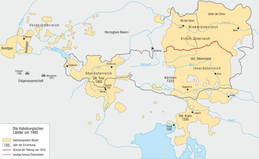


.gif "My one true love is the one true Rome (HD).gif")