• We have updated our Community Code of Conduct. Please read through the new rules for the forum that are an integral part of Paradox Interactive’s User Agreement.

Tinto Maps #15 - 23rd of August 2024 - Horn of Africa

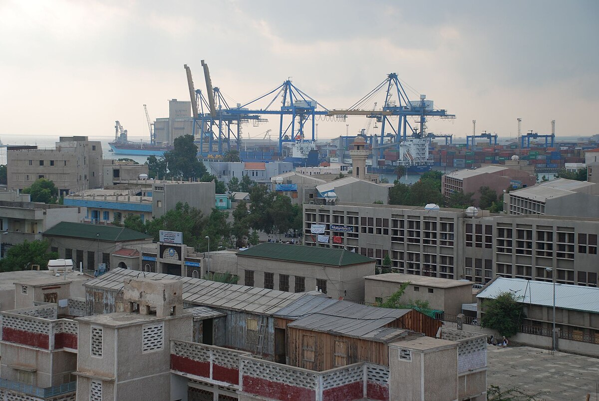
Hello, and welcome one more week to Tinto Maps! After a short break, we’re back to the duty of sharing more maps! Today the region we will look at is the Horn of Africa! So let’s take a look at it, without further ado:

Countries:
Countries.PNG

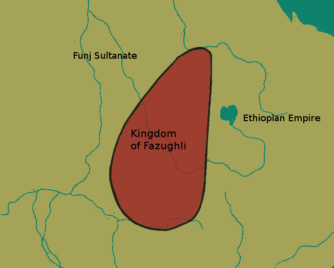
Here we have the countries around Nubia, Ethiopia, and Somalia. The first ones are organized around the ancient kingdoms of Makuria and Alodia, which control the Upper Nile region. In the second area, the Empire of Ethiopia stands as the main power, with some smaller countries around it. Finally, the two Islamic sultanates of Ifat and Ajuraan stand as the main powers in the Horn and Somalia. Finally, around the African Great Lakes, there is a country that can be considered a ‘settled’ one, Kitara.

Dynasties:
Dynasties.PNG

The dynasties of the Horn. There are some historical ones, while others are randomly generated. The most famous one is probably the Ethiopian House of Solomon, from where all their Negus come. The Walshma ruler over both Ifat and Ajuraan and we have some others, such as the Medri of Medri Bahri, the Umar of Mogadishu, the Banu Kanz of Makuria, or the Baranzi of Kitara.

Societies of Pops:
Pop-Based.PNG

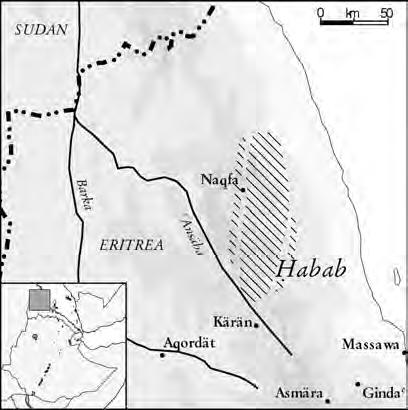
A new map has popped up! Here you can see the countries that we consider as ‘Societies of Pops’, as they were presented in the last Tinto Talks. We have the famous Oromo people in the lands between Ethiopia, Ifat and Ajuraan; the Kunama, Gumuz, and Berta in the lands between Ethiopia; and Alodia, and the Zaghwa to the north of Wadai; there are a few more to the west, but I’ll share that picture in the Western Africa thread, as it’s more appropriate there. There are more Stateless Societies of this kind that we would like to add in the future, if it is possible due to our schedule.

Locations:
Locations.PNG

Locations 2.png

Locations 3.png

Locations 4.png

Locations 5.png
Locations! You might notice that the density is quite unequal. Unfortunately, the archaeological findings for the period are scarce, specially out of the most known areas and a lack of urbanization in most of the territory has made the finding of proper non-anachronistic settlements quite a challenge. Keep this in mind when making suggestions. ;) It has been that dramatic in some areas that we had to use names of tribes and rivers, a bit contradicting our own rules, but the areas had to be represented as they were active parts in the development of the region.
One thing: a big chunk of the Arabian peninsula can be seen in today’s Tinto Maps; but, please, reserve the feedback for its future DD, when we’ll show all of the peninsula. Apart from that, you can see more detailed maps if you click on the spoiler button, as usual.


Provinces:
Provinces.png


Areas:
Areas.png


Terrain:
Climate.png

Vegetation.png

Topography.png

The terrain types of the region are quite interesting and diverse. It is marked by the Rift Valley, which creates different biomes, such as the Ethiopian Highlands and Plateau, or the African Great Lakes. That also marks a divide between Arid, Tropical, and Oceanic climates. The vegetation of the region also ranges from desertic and sparse, to jungle forests. And one more note: you may also note that 'Marshes' have been renamed into 'Wetlands', as we could put some work into that suggestion the last week.

Natural Harbors:
Natural Harbors.png


Cultures:
Cultures.png

Another interesting map this week… You might notice that the lands of Ethiopia have a very mixed cultural situation. While more to the west and south, we are representing ‘tribal lands’ in a more homogeneous way, with kind of fixed boundaries to represent the different groupings. This doesn’t mean that there wouldn’t be a mixing of cultures, but this was one of the first areas to receive a minority's review and the scope was limited mostly to Ethiopia.

Religion:
Religion.png

Another interesting map! Miaphysite and Sunni are the more widespread religions in the region (while not all areas have their mixed populations, such as Nubia as you might notice, they eventually will as we cover more of the map in our sprints). Animism is completely placeholder, as usual, and you might see some pockets here and there (If you have specific suggestions, please do them). You may also notice a purple minority inside Ethiopia… That is representing the Beta Israel Judaism in the provinces of Semien, of course!

Raw Materials:
Raw Materials.png

The raw materials of this week! A big chunk of the region has livestock as its main raw material, while also having some agricultural goods as Wheat or Sturdy Grains here and there. The most unique good in the region is Coffee, which is cultivated in the Ethiopian highlands. And there are also some precious resources spread here and there, such as Gold, Ivory, Gems, and Incense.

Markets:
Markets.png

The main market centers of the region are Axum and Mogadishu, with ‘Adan/Aden being the main one controlling the access to the Red Sea. There are some weird calculations ongoing on the Somalian inner lands, that are already reported, and we’ll take a look at why is that happening.

Population:
Population.png

Population 2.png

Population 3.png

Population 4.png

Population 5.png
The population of the region! There are approximately 12.3M people in the Eastern African subcontinent; although take into account that it also comprises the regions of the Southern Great Lakes and the Swahili Coast, which we haven’t shown today, so we probably have to discount around 4M people from it (Swahili Coast accounts for 1.7M, and the Great Lakes for 4M, although that region is divided between today’s and next week’s Tinto Maps), for a total of around 8M.

That’s all for today! Speaking of next week’s Tinto Maps, it will be meaty, as it will cover Central, Eastern, and Southern Africa! See you!
 
  • 126Like
  • 39Love
  • 5
  • 4
  • 1
Reactions:
Proposal to add a new province Aydhab
The name of the province comes from the city of Aydhab.
This region is ruled by the Beja al-Hadrabi tribe, who have ties to the rulers of Suakin City.
As for the name of the country, I don't know whether to change the name of the country Naqis/Nagash to Aydhab or not, but the ruling dynasty should be named al-Hadrabi and not Aydhab.
The country is probably ruled by the ruler al-Hudrubi, who is mentioned by Ibn Batuta in 1326.
After fifteen days’ travelling we reached the town of Aydhab,a large town, well supplied with milk and fish; dates and grain are imported from Upper Egypt. Its inhabitants are Bejas. These people are black-skinned; they wrap themselves in yellow blankets and tie headbands about a fingerbreadth wide round their heads. They do not give their daughters any share in their inheritance. They live on camels’ milk and they ride on Meharis [dromedaries]. One-third of the city belongs to the Sultan of Egypt and two-thirds to the King of the Bejas, who is called al-Hudrubi.

On reaching Aydhab we found that al-Hudrubi was engaged in warfare with the Turks [i.e. the troops of the Sultan of Egypt], that he had sunk the ships and that the Turks had fled before him. It was impossible for us to attempt the sea-crossing, so we sold the provisions that we had made ready for it, and returned to Qiis with the Arabs from whom we had hired the camels. We sailed thence down the Nile (it was at the flood time) and after an eight days’ journey reached Cairo, where I stayed only one night, and immediately set out for Syria. This was in the middle of July, 1326.
In the 14th century the sherifs of Mecca controlled Suakin, allied to the Begs, with the ruling clan of the Hadaribs, who controlled Aydhab. Both the Hadaribs and their sovereigns the sheriffs recognized Egyptian sovereignty. With the decline of Aydhab, the port of Suakin reached an important traffic being the main one in the north of Masawwa , both for trade and for pilgrims from the Sahel. The Hadaribs left Aydhab at the end of the 14th century and settled in Suakin. Probably because of a disobedience to the Mamluks, an expedition of these devastated Suakin in 1439/1440, being plundered; Suakin submitted; the Mamluks then used the site to send dissidents and outlaws.

The local population was formed mainly of Muslim Buj̲ah (Bejas), whose ruling family, called by the Arabic name of al-Hadrabi (or Hadrubi), frequently clashed with the Egyptian representatives over their share in the control and revenues of the port. The port was destroyed during the reign of the Mamluk Sultan Barsbay (825-42 AH / 1422-38 CE), allegedly in retaliation for the pillage of a caravan proceeding to Mecca. Its place was taken by Sawakin, a port in the North-East of Sudan.
It is mentioned in the 9th century as a port sometimes used by pilgrims to Mecca and Yemeni merchants and joined by caravans to Aswan . In the 11th century it became more important as trade increased between Egypt and Yemen. Around 1325 it was visited by Ibn Battuta who describes the establishment as a large town inhabited by the Beges ; the ruling clan was the al-Hadrabi or al-Hadrubi, who were often at odds with the Mamluk authorities in Egypt over the share of port revenues. Due to an attack on a caravan, Sultan Baybars III (1423-1438) destroyed the port of which some ruins remain.
London / 1840
Ayd.png

Map 1904
Hal.png

Zrzut ekranu 2025-01-11 161222.png

382
Zrzut ekranu 2025-01-11 160429.png


ggg.png

mikraf.png

dunquli.png


Zrzut ekranu 2025-01-11 160607.png

Aydhab Province
- Aydhab/Halaib
- Mikraf
- Shalatein/Shalateen
- Shanaab
- Dunqunab
I think this province can be reduced to Three Locations by combining Halaib with Aydhab into one location.
 
Last edited:
  • 4Like
  • 1
  • 1
Reactions:
Proposal to add a new province Suakin
The province is named after the city of Suakin
This region is dominated by Gabail Ukhra. In 1337, the lands from the city of Suakin to the city of Massawa are ruled by Abu Numi, son of the Emir of Mecca. His mother is from the Bali/Balaw tribe.
The ruling dynasty should be called Al-Khasa or
Banu Qatadah. And the Kingdom should be called Suakin/Belew.

On that day we reached the island of Suakin, which is about six miles from the mainland and has no water, no crops, and no trees. Water is brought to it in boats, and there are cisterns in which rainwater is collected. It is a large island and has ostrich meat, gazelle meat, wild donkey meat, and goat meat in abundance. They have milk and butter from it that is brought to Mecca. Their grain is jarjur, which is a type of large-grained corn that is also brought from there to Mecca. The Sultan of the island of Suakin when I arrived was Sharif Abu Numi, and his father was the Emir of Mecca, and his brother was its Emir after him. They were Atifa and Rumaitha, who were mentioned above. It came to him from the Beja, as they were his maternal uncles. With him were an army of Beja, the sons of Kahl, and the Arabs of Juhayna.
In the 14th century the sherifs of Mecca controlled Suakin, allied to the Begs, with the ruling clan of the Hadaribs, who controlled Aydhab. Both the Hadaribs and their sovereigns the sheriffs recognized Egyptian sovereignty. With the decline of Aydhab, the port of Suakin reached an important traffic being the main one in the north of Masawwa , both for trade and for pilgrims from the Sahel. The Hadaribs left Aydhab at the end of the 14th century and settled in Suakin. Probably because of a disobedience to the Mamluks, an expedition of these devastated Suakin in 1439/1440, being plundered; Suakin submitted; the Mamluks then used the site to send dissidents and outlaws.
The Funj Sultanate of Sennartried to control Suakin and fought against the Ottomans but never achieved effective dominance, although they had relations with the " Artega " or bege emirs of al-Kayf who had a share in the port revenues that he shared with the Ottomans ( in practice he only distributed the revenue when the Ottomans were strong enough to demand it by arms)

The Al-Arteqa tribe is an Arab tribe that ruled Suakin for eight continuous centuries. It dates back to the migration of their grandfather Ali bin Abdullah Al-Da’i from Jabal Haram in Yemen to Massawa and then to Suakin . It was at that time under the Emirate of the Bali Al-Quda’iyah tribe and its emir was Ahmed Al-Balawi, so Ali Al-Da’i engaged the daughter of Prince Ahmed Al-Balawi to His son, Muhammad Jamal al-Din, and then he personally married the second part of the people of Suakin , who are the Beja al-Bouiknaab (the owners of blood), and he gave birth to his son Ahmed, nicknamed Basofer, so he secured his trade and his family by marrying the two strongest wings in Suakin . This family grew up and took Suakin as a headquarters for its trade, and they traded between Suakin , Massawa, Jeddah , Yanbu and Mocha.The strength of this family was so strong that the Sharif of Mecca appointed Muhammad Jamal al-Din as a judge over Suakin, and after Ali al-Da’i was assured of his family in Suakin , he returned to Yemen and spent the rest of his life there until he died and was buried there.
Alam al-Din bin Ahmed (Basoufir) bin Ali bin Abdullah al-Da’i was the first prince of the Arteqa over Suakin , by order of al-Zahir Baybars al-Bandaqdari in 664 AH to isolate the Balawi prince at that time and appoint Alam al-Din over her. . And there was a friendship between the Sharif of Mecca, Muhammad Najmuddin Abi Nami I, and the prince of Suakin Alam Al-Din, and this relationship was sealed by intermarriage. His mother was the science of religion in Suakin , and the genealogy of Ibn Anba, who died in 828 AH, mentioned him in his book “Umdat al-Talib fi Ansaab Al Abi Talib” where he said: “Izz al-Din Zaid al-Asghar ibn Abi Nami, the king of Suakin, was his maternal grandfather, and she is from Banu al-Ghamr ibn al-Hasan al-Muthanna.” .
Then, an order was issued by the Mamluk Sultan to appoint Zayd Al-Asghar bin Abi Nami as governor of Suakin in the year 719 AH/1319-1320
.
The emirate returned again to the Bali tribe of Al-Qudaiya after Zaid bin Abi Nami for a period and then returned again to the Arteqa under the leadership of Abdullah Bush Al-Arteqi.
After the return of the emirate to Arteqa, they ruled Suakin for centuries, until the days of British colonialism, which fought against Arteqa for their standing and support for the Mahdist revolution and their support for the Mujahid Othman Digna. Suakin abandoned and became a ghost town.
Derkin-Mazaga-Belew.png

belew5.jpg

belew3.jpg

belew4.jpg


Ottoman Suakin.png

gg.png

hg.png

suak.png

Halenga.png

Zrzut ekranu 2025-01-09 183547.png

Zrzut ekranu 2025-01-10 223226.png

Page - 382
Sawakin.png


Zrzut ekranu 2025-01-10 222903.png


Suakin Province
- Muhammad Qol
- Al Malaba/Barghuth/Marsa Shaykh
Port Sudan was known as Marsa Sheikh Barghout. After the port was completed, the name was changed to Port Sudan, which is an English expression for "Port Sudan", meaning the port of Sudan. It is written in Arabic letters as Port Sudan (connecting the letter taa to the letter seen) and is pronounced Bur Sudan without the taa.
- Suakin/Sawakin
- Sinkat
- Tokar
- Badi/Agig
-Mubarak/Marsa Ambarak
Agig.png
 
Last edited:
  • 5Like
  • 1
  • 1
Reactions:
Proposal to add a new province Barka
The name of the province comes from the Barka River.
There are two Beja kingdoms in this region, Baqlin and Jarin, currently the Jarin kingdom is located on the coast of the Red Sea, which is an error that needs to be corrected as it should be located between Massawa and the Barka Valley.


Jarin Sultanate 700 — 1557
Jarin sultanate (kingdom) stretched from the Barka valley in the west to the Massawa in the east. The Jarin sultanate, along with its neighboring sultanates were the result of an invasion of Beja from Sudan, particularly near the Nile valley, but also an intermingling without an imposition of a new culture. The primary commercial activity of this sultanate was mining and slave trade through the Dahlak sultanate out of the African interior to the Arabian peninsula and beyond. The cause of decline of this Beja kingdom, in the 14th century, is unknown, as with its neighbors. The most likely explanation is the slave trade that they were engaged in likely caused continuous war with its neighbors which eventually depleted the sultans control of their respective region. Which coupled with the rise of the Belew kingdom to the east and the rise of the Ottoman empire on the coast finally led to capitulation. In 1557 the Ottoman empire decisively moved in throughout the Eritrean coast, adding the Qata and Baqlin sultanate's as well.

Baqlin Sultanate 700 — 1557
The Baqlin sultanate straddled the Rora valley (in the Sudan) and stretched to the Eastern slope of the Eritrean highlands. The Baqlin sultanate, along with its neighboring sultanates were the result of an invasion of Beja from Sudan but intermingled without imposing a new culture. The Baqlin were a semi-nomadic sultanate that raised and sold camels and cattle to its neighbors. The cause of decline of this Beja kingdom is unknown, however, in 1557 it succumbed to the Ottoman Empire.
Rora.png
jk.png

gd.png

eritrea.png

Zrzut ekranu 2025-02-22 122358.png

Barka Province
- Agordat - Jarin sultanate (kingdom)
- Dghe/Daqqa - Jarin sultanate (kingdom)
- Tognuf - Baqlin Sultanate (kingdom)
- Timerein - Baqlin Sultanate (kingdom)
- Hamashkoraib - Baqlin Sultanate (kingdom)
Rora/Rora Habab Province
- Kerora - Baqlin Sultanate (kingdom)
- Nakfa - Baqlin Sultanate (kingdom)
- Ghirghir - Baqlin Sultanate (kingdom)
- Karen - Jarin sultanate (kingdom)
 
Last edited:
  • 3Like
Reactions:
Proposal to add a new province Semhar/Samhar

Semhar is the name of a former province of Eritrea, which has now become almost incorporated into the Northern Red Sea Region when the number and names of provinces were unilaterally changed in 1996.[18] The province was thinly settled with Massawa as the provincial capital.[19] The population is mainly Tigre, Afar, Saho and Tigrinya. The Tigre and Tigrinya language are mainly spoken. The population is mainly pastoralist and agro-pastroalist.
semhar.png

massssaw.png

Semhar/Samhar Province
- Dahlak
- Massawa
- Zula
- Buri
 
  • 4Like
  • 1
Reactions:
Proposal to add a new province Semhar/Samhar

Semhar is the name of a former province of Eritrea, which has now become almost incorporated into the Northern Red Sea Region when the number and names of provinces were unilaterally changed in 1996.[18] The province was thinly settled with Massawa as the provincial capital.[19] The population is mainly Tigre, Afar, Saho and Tigrinya. The Tigre and Tigrinya language are mainly spoken. The population is mainly pastoralist and agro-pastroalist.
View attachment 1188089
View attachment 1188090
Semhar/Samhar Province
- Dahlak
- Massawa
- Zula
- Buri
Have U considered amalgamating all of these changes you've listed in a single map? A bit like how @SuperLexxe did it in the Persia TM thread
 
  • 1Like
Reactions:
Have U considered amalgamating all of these changes you've listed in a single map? A bit like how @SuperLexxe did it in the Persia TM thread
There will be one map with all changes and links to all my proposals.
 
  • 1Like
Reactions:
Add Idjwi, Ukerewe and Buvuma as locations.

What's up with Buganda and North Buganda?

Bayul should be Beilul.

Equatoria may ironically be even more objectionable than the European monarch-based placenames to the south. That's because the Equator does not even pass through Equatoria, but through the northern part of Lake Victoria. That territory takes its name from an attempt by the Egyptian Khedivate to extend its control to the Great Lakes in the 19th century, and it described an ambition as opposed to a reality.

I'd suggest renaming Equatoria province to Mountain Nile and then, by logical necessity, Bahr al Jabal to the more appropriate White Nile, and modifying their border so it falls around Lake No (which divides those 2 sections of the Nile). The western locations of Equatoria should go to Bahr el Ghazal, as it's part of that river's basin. No idea about Equatoria area, but definitely rename that one as well.

Albert Nile and Victoria Nile should make up a single province known as Upper Nile. For Lake Victoria, you could replace it with one of the indigenous names of the lake, but there's a bunch of choices and none of them is the obvious one. Instead I'd go with Sources of the Nile.

Regarding the issue of the Oriental Orthodox Churches, while that is the correct name for them in that it's the one they've agreed on, it's also a modern name. To my understanding, these churches only object to the term monophysite, not miaphysite (as the latter, unlike the former, correctly describes their Christology). So Miaphysitism seems perfectly acceptable to me.
 
Proposal to add a new province Central Atbai
Central Atbai is a quite unique region with many valleys inhabited by bejas.

This region is dominated by the Hadariba (Hadrabi) tribe. After the fall of the City of Aydhab, people who were part of this tribe founded new tribes that took over power in this region.
central Atbai.png

The map shows an old road through the desert, this road connected Suakin on the coast with the inland town of Berber, this road lost its importance after the construction of the railway from Atbara to Port Sudan
dd.png

Zrzut ekranu 2025-01-11 191236.png

Central Atbai Province
- Obak/Awbak
- Rauai/Rowai
- Ariab/Khor Ariab
- Kokreb
- Derudeib
musmar.png

1.png
 

Attachments

  • tr.png
    tr.png
    876,7 KB · Views: 0
Last edited:
  • 2Like
  • 1
Reactions:
Proposal to add a new province Kunama/Bazin
This province is inhabited by two ethnic groups, namely Kunama/Bazin and Nara/Barya. This province should be mostly pagan.
These lands should be the property of the Beja Bazin kingdom
kunama.png

Zrzut ekranu 2025-02-22 113235.png

Bisha.png

1928 map
kunama (2).png

ee.png

ee1.png
ee2.png
Zrzut ekranu 2025-02-22 120701.png

Kunama/Bazin Province
- Barentu
- Narcaba/Narkaba
- Sitona/Sittona
- Mogolo
- Bishia
 
Last edited:
  • 1Like
Reactions:
Proposal to add a new province Tukrīr/Qallabat
Tukrīr/Qallabat is the name of the Historic Sultanate which was probably established in the 18th century and covered these areas.
This province includes two historical regions, the first is Mäzäga, i.e. the region between the Tekezé River and the city of Metemma, and the second region is Ras al-Fil.
In 1337, Mazaga may be a playable country that has the cities of Lugdi and Ayaye under its control. As for the rest of the cities, Ras al-Fil could be added as a country representing the breakup of the Alodi kingdom. Unfortunately, we do not know what this region looked like in 1337.

Ras al-Fil​

ras-al-fil.jpg
Later, after the fall of the Bazin kingdom, sometime in 1400, Mazaga took over its lands, i.e. the Kunama/Bazin provinces, at least that's what old maps show.
mazaga.png

Mazaga.jpg

ras f.png

Tukri.png

f1.png

f2.png
f3.png

Zrzut ekranu 2025-02-22 131128.png

Tukri/Qallabat Province
- Gallabat /Qallabat
- Metebiya/Merdibba
- Lugdi/Lukdi
- Aiaie/Ayaye
 
Last edited:
  • 2Like
  • 1
Reactions:
Proposal to add a new province Fazughli/Hamaj
This province is inhabited by various peoples who are referred to as Hamaj/Hamej, these tribes have four state formations in this region: the Gubba Sultanate, the Fazughli Kingdom , Roseires Sheikhdom and the Jebel Gule Mountains ruled by a chieftain.


Hamej

The term Hamej has been used historically to refer to a diversity of populations living south of Sennar and along the Ethiopian border. Their core area seems to have been located around Fazogli. Groups that are regarded as Hamej may include, apart from the Dats’in themselves, the Bertha and the people of Gule, all of whom have referred to themselves as Hamej at some point. The Bertha, in particular, are considered by some as the central element among the Hamej. The term appeared for the first time to identify the people of the Kingdom of Alodia (or Alwa), which dominated the area between Khartoum and Sennar, from the sixth to the fifteenth century AD. The Hamej are said to have moved along the Blue Nile after the Funj conquest of Alodia in 1504 and founded a new polity with its capital in Fazogli or in Roseires, an account that coincides with the oral history of the Bertha. The collective memory of the original capital would have remained in the names of archaeological sites, known as ‘Soba’ still during colonial times around Roseires, and the existence of sacred rocks with the same denomination in Gule, Sillok and other hills of the region. Apart from Fazogli/Roseires, other places became the seat of noble Hamej, such as Jebel Gule, whose chief considered himself a descendant of the Hamej, not the Funj.
Fazogli was eventually captured around 1685, but the Hamej enjoyed considerable autonomy within the Sultanate: they were described as a medley of groups, some ruled by chiefs, others by kings, some paying tributes to Ethiopia, others to Sennar, and all ‘sun-worshipping pagans’. During the last third of the eighteenth century they challenged the central authority and Hamej regents ruled the sultanate. Their powerful cavalry was feared by neighboring groups.
The term Hamej is, in turn, related to Anej (Aneg, Anag), which is widespread in northern and central Sudan to refer to groups that were considered aboriginal. They are seen as giant people and heralds of civilization, whose presence is manifested in archaeological ruins. The Dats’in informants distinguish between the Hamej, with whom they relate, and the Anej, whom they regarded as the ancient settlers of the country, a race of giants associated with the archaeological remains of the area. This is different from the people of Gule, who do not seem to establish a distinction between the two terms and refer to themselves as Anej. Indeed, Anej and Hamej are in all likelihood one and the same. Oral traditions about the Funj often mix both: the Anej, according to one story, would have been defeated by the Funj and escaped upstream the Blue Nile, first to Sennar and then to Jebel Tornasi, further to the south. The story coincides with the Hamej and probably refers to the same group and historical event. It is possible that Hamej is just an interpretation of Anej, since hamäj is a word taken to mean ‘ignorant’ among Arabic speaking communities.
To sum up: Hamej/Anej are a variety of ethnic groups which formed part of the Christian Kingdom of Alodia and emigrated during the time of turmoil preceding and succeeding the Funj conquest of the kingdom (fifteenth-sixteenth centuries). They were not an ethnic identity, but one that mixed political, religious and cultural elements and as such could be adopted by other communities. We can hypothesize that people escaping from the Alodian core settled around Fazogli, where they established a new kingdom and mixed with the local populations, which were the ancestors of the Bertha, Dats’in, Gumuz and other groups, all whom ended up adopting the Hamej identity, which was seen as prestigious—as the later Funj one. Fragments of that old identity survived until well into the twentieth century in the form of rituals, names, artifacts and fragments of memory.
Funj and Hamej were also strongly related. Spaulding and Delmet consider that these terms refer to the same peoples, the difference between both being their relation to power. Thus, the Funj were the founders of the Sennar kingdom and represented the aristocracy of the Sultanate, whereas the term Hamej was used to describe the local populations, associated with the vanquished Kingdom of Alodia (and later Fazogli). Funj aristocracy soon resorted to Islam and an Islamic genealogy to legitimize their superiority, whereas the Hamej would have remained non-Islamic or only partially Islamized until very late. Yet this does not mean that they always retained a subaltern position: from 1762 onwards, Funj rule over the Kingdom of Sennar was overthrown and replaced by the ‘Hamej regency’, which lasted until the Turco-Egyptian conquest of 1821. The distinction between Funj and Hamej, then, would have been the result of a ‘historical process that would have provoked a sociological distinction, later transcribed in ethnic terms’. Wendy James has coined the apt term ‘Funj mystique’ to refer to the widespread persistence of a Funj memory among the borderland communities. We could likewise talk of a more faded Hamej mystique, some of whose cultural practices could still be recorded during the twentieth century. The persistence of such mystique, Funj or Hamej, has much to do with its material dimension, to which we have access through archaeology.
Regarding archaeological data, the survey of the Qwara lowlands has allowed us to produce an archaeological sequence going from the late first millennium AD to the present. Archaeology shows that around 1600 the region between Rahad and Dinder was completely empty. A century later, it became suddenly and densely occupied by people coming from Sudan. The material culture of the period, which is characterized by diagnostic decorated pottery, smoking pipes, glass beads and incense-burners, is identical through all the area historically occupied by people labelled as Hamej/Funj, from Sennar to the Ethiopian escarpment. We believe that the presence of this cultural assemblage in the Gelegu valley is due to the arrival of people migrating from Fazogli in 1685 or later after the kingdom was annexed by the Funj and an epidemic of smallpox ravaged central Sudan, leading to widespread population movements. The Hamej that occupied the Gelegu valley during the late seventeenth and mid-nineteenth centuries were in all probability related to the Dats’in, but we cannot tell whether they were their direct ancestors, another of the ethnic communities that have traditionally lived in the wider area, or one that was annihilated during the turbulent nineteenth century. What archaeology proves is that there is cultural substance to the label ‘Hamej’.

Maps
hama.png

hamej.png

Jebel Funj
Funj-gule.png

gh.png
ingasena.png

Zrzut ekranu 2025-02-15 190350.png

Fazughli Province
- Fazogli
- Asosa
- Gubba
- Famaka
Roseires Province
- Bados
- Roseires
- Harun
Jebel Funj
- Gule
- Mazmum
- Buzi
- Dali
- Surayj/Sereig
- Moya
- Saqadi/Segadi

ff.png

ff1.png
Funj0-Gule.png
 
Last edited:
  • 2Like
  • 1
Reactions:
Proposal to add a new province Fazughli/Hamaj
This province is inhabited by various peoples who are referred to as Hamaj/Hamej, these tribes have three state formations in this region: the Gubba Sultanate, the Fazughli Kingdom and the Roseires Sheikhdom


Hamej

The term Hamej has been used historically to refer to a diversity of populations living south of Sennar and along the Ethiopian border. Their core area seems to have been located around Fazogli. Groups that are regarded as Hamej may include, apart from the Dats’in themselves, the Bertha and the people of Gule, all of whom have referred to themselves as Hamej at some point. The Bertha, in particular, are considered by some as the central element among the Hamej. The term appeared for the first time to identify the people of the Kingdom of Alodia (or Alwa), which dominated the area between Khartoum and Sennar, from the sixth to the fifteenth century AD. The Hamej are said to have moved along the Blue Nile after the Funj conquest of Alodia in 1504 and founded a new polity with its capital in Fazogli or in Roseires, an account that coincides with the oral history of the Bertha. The collective memory of the original capital would have remained in the names of archaeological sites, known as ‘Soba’ still during colonial times around Roseires, and the existence of sacred rocks with the same denomination in Gule, Sillok and other hills of the region. Apart from Fazogli/Roseires, other places became the seat of noble Hamej, such as Jebel Gule, whose chief considered himself a descendant of the Hamej, not the Funj.
Fazogli was eventually captured around 1685, but the Hamej enjoyed considerable autonomy within the Sultanate: they were described as a medley of groups, some ruled by chiefs, others by kings, some paying tributes to Ethiopia, others to Sennar, and all ‘sun-worshipping pagans’. During the last third of the eighteenth century they challenged the central authority and Hamej regents ruled the sultanate. Their powerful cavalry was feared by neighboring groups.
The term Hamej is, in turn, related to Anej (Aneg, Anag), which is widespread in northern and central Sudan to refer to groups that were considered aboriginal. They are seen as giant people and heralds of civilization, whose presence is manifested in archaeological ruins. The Dats’in informants distinguish between the Hamej, with whom they relate, and the Anej, whom they regarded as the ancient settlers of the country, a race of giants associated with the archaeological remains of the area. This is different from the people of Gule, who do not seem to establish a distinction between the two terms and refer to themselves as Anej. Indeed, Anej and Hamej are in all likelihood one and the same. Oral traditions about the Funj often mix both: the Anej, according to one story, would have been defeated by the Funj and escaped upstream the Blue Nile, first to Sennar and then to Jebel Tornasi, further to the south. The story coincides with the Hamej and probably refers to the same group and historical event. It is possible that Hamej is just an interpretation of Anej, since hamäj is a word taken to mean ‘ignorant’ among Arabic speaking communities.
To sum up: Hamej/Anej are a variety of ethnic groups which formed part of the Christian Kingdom of Alodia and emigrated during the time of turmoil preceding and succeeding the Funj conquest of the kingdom (fifteenth-sixteenth centuries). They were not an ethnic identity, but one that mixed political, religious and cultural elements and as such could be adopted by other communities. We can hypothesize that people escaping from the Alodian core settled around Fazogli, where they established a new kingdom and mixed with the local populations, which were the ancestors of the Bertha, Dats’in, Gumuz and other groups, all whom ended up adopting the Hamej identity, which was seen as prestigious—as the later Funj one. Fragments of that old identity survived until well into the twentieth century in the form of rituals, names, artifacts and fragments of memory.
Funj and Hamej were also strongly related. Spaulding and Delmet consider that these terms refer to the same peoples, the difference between both being their relation to power. Thus, the Funj were the founders of the Sennar kingdom and represented the aristocracy of the Sultanate, whereas the term Hamej was used to describe the local populations, associated with the vanquished Kingdom of Alodia (and later Fazogli). Funj aristocracy soon resorted to Islam and an Islamic genealogy to legitimize their superiority, whereas the Hamej would have remained non-Islamic or only partially Islamized until very late. Yet this does not mean that they always retained a subaltern position: from 1762 onwards, Funj rule over the Kingdom of Sennar was overthrown and replaced by the ‘Hamej regency’, which lasted until the Turco-Egyptian conquest of 1821. The distinction between Funj and Hamej, then, would have been the result of a ‘historical process that would have provoked a sociological distinction, later transcribed in ethnic terms’. Wendy James has coined the apt term ‘Funj mystique’ to refer to the widespread persistence of a Funj memory among the borderland communities. We could likewise talk of a more faded Hamej mystique, some of whose cultural practices could still be recorded during the twentieth century. The persistence of such mystique, Funj or Hamej, has much to do with its material dimension, to which we have access through archaeology.
Regarding archaeological data, the survey of the Qwara lowlands has allowed us to produce an archaeological sequence going from the late first millennium AD to the present. Archaeology shows that around 1600 the region between Rahad and Dinder was completely empty. A century later, it became suddenly and densely occupied by people coming from Sudan. The material culture of the period, which is characterized by diagnostic decorated pottery, smoking pipes, glass beads and incense-burners, is identical through all the area historically occupied by people labelled as Hamej/Funj, from Sennar to the Ethiopian escarpment. We believe that the presence of this cultural assemblage in the Gelegu valley is due to the arrival of people migrating from Fazogli in 1685 or later after the kingdom was annexed by the Funj and an epidemic of smallpox ravaged central Sudan, leading to widespread population movements. The Hamej that occupied the Gelegu valley during the late seventeenth and mid-nineteenth centuries were in all probability related to the Dats’in, but we cannot tell whether they were their direct ancestors, another of the ethnic communities that have traditionally lived in the wider area, or one that was annihilated during the turbulent nineteenth century. What archaeology proves is that there is cultural substance to the label ‘Hamej’.

Maps
View attachment 1193746
Fazughli/Hamaj Province
- Asosa
- Fazogli
- Jebel Gule/Shaykh Idris
- Roseires
- Gubba
The second variant of the map

View attachment 1194038
Fazughli Province
- Fazogli
- Asosa
- Gubba
- Famaka
Roseires Province
- Bados
- Roseires
- Harun
- Jebel Gule/Shaykh Idris
Hello brother i love your posts they are extremely valuable and good information for feedback, to give some advise you should probably amalgamate all of the changes you have decided on a single map that is easy to see a bit like @SuperLexxe 's maps in Persia and Caucasus feedback thread
 
  • 1
Reactions:
Proposal to add two new provinces: Sennar and Jezirat.
The Sennar province later became the center of the Funj/Sennar Sultanate. This region is ethnically mixed.
sen.png

Dar Sennar means House of Sennar or the house of the Funj people.
jaz.png
Abbay_OSM.png
Jezirat/Jezireh means island in Arabic. The Rahad River and the Blue Nile create such an island.
Alternatively, this province can be called Mayas.
Zrzut ekranu 2025-02-22 130529.png

Sennar Province
- Kamlin
- Maatuk
- Wad Madani
- Managil
- Kawa
- Sennar
- Senga
Jezirat / Mayas Province/ Hamda( The name of the Tribe that dominates this area)
- Abu Hashim
- Karkoj
- Wad Daud
- Deberki/Dabraki
Debania/Dubainya Province(The name of the Tribe that dominates this area)
- Mafaza
- Matna
- Shammam
- Rashid
Funji.png

funjii.png

debya.png

f1.png

f2.png
f3.png

maja.png

Zrzut ekranu 2025-02-15 185731.png
 
Last edited:
  • 2Like
Reactions:
Corrected Map of Sudan
Sudan1.png

Countries
SUDAN-1.png

Kordofan- Fazara confederation

@AirikrStrife he provided a link to a book that describes the Fazara confederation.​

Simien
In 1332, Emperor Amda Siyon (1314-1344) sent his military commander, Tzaga Chrisus, to attack the Falashas, who had risen against him in northern and western Abyssinia, as he pursued a holy war against the Muslims in the south and east. He repressed the Falashas cruelly and pushed them back to their strongholds in the Semyen Mounts.
Medri Bahri - Ethiopian vassal
To consolidate his control in the region, Amda Seyon established a military colony of non-Tigrayan troops at Amba Senayata, the center of the rebellion, and appointed his queen consort, Bilén Saba(ብሌን ሳባ, as governor of Enderta, along with a new batch of officials below her. The Queen ruled indirectly however, which caused unrest in the province as the population heavily resented Amhara rule. This induced the Emperor to appoint one of his sons, Bahr Seged, as governor, who was later in 1328 also given control of the maritime provinces under the title of Ma'ikele Bahr ("Between the Rivers/Seas").[18]
Roseires/Fazughli
The country represents the states that emerged in this region such as Fazughli and Gubba and is the main marker of the Hamaj culture dominant in the provinces of Senar, Jezirat, Roseires, Fazughli.


Province Dongola
Province of Mahas
Province of Sukkot/Sukot
Province Batn-El-Hajar
Province Wadi Nuba
Province Kenuz/Kunuz
Province al-Shayqiya/Shaigiya
Province al-Manasir/Manasir
Province al- Rubatab/Rubatab
Province al- Berber/Meyrifab
Province Ja'alin
Province Halfayat /Abdallab
Province Arba'īn
Province al-Atbara
Province Alaqi
Province Taka/Derkin
Province Aydhab
Province Suakin
Province Barka
province Semhar/Samhar
Province Central Atbai
Province Kunama/Bazin
Province Tukrīr/Qallabat
Province Fazughli/Hamaj
Province Sennar and Jezirat
 
Last edited:
  • 11Love
  • 5Like
  • 4
Reactions:
I had some thoughts on the Dar Daju area I wanted to share. A bit late, but I hope that it is ok while the review is still ongoing. Hopefully you will find these of some help:

I see you have decided not to represent the Fur culture at all at the start. I assume these will appear by event later on, which is fine for me. The region right now focused heavily on Tunjur and Daju, which makes sense for the time period. I think they could be a bit more spread out. Right now the situation looks a bit too simple to me. While I do read that the Tunjur did indeed migrate from the west, it seems to me there was no clear divide where Dar Tunjur ends and Dar Daju begins. Rather the Tunjur would be in all of modern day Wadai+Dafur, forming a minority in an otherwise majority Daju area.

In term of other cultures I am very happy to see that also the Zaghawa are represented. I wonder if perhaps there is room for one or two Zaghawa majority provinces to the north of the Sahel corridor? Besides Tunjur, Daju and Zaghawa, other cultures such as Masalit, Wadai(aka Maba), Gimr, Tama, Erenga are all omitted. While it would probably be too much to add each of these, maybe a few can be added? I would suggest adding Masalit to Mornei and Hadjer Haddid and adding Maba to Ouara and Absehir (which is assume is an alternative name for Abéché).

I would also add the Runga people in two new locations in the empty space south of Kujunung and west to Nyala, Ed Daein and Kafia Kingi. These would later be the place for the Dar Runga and Dar al Kuti sultanates. Both sultanates are somewhat outside the time period, but the people can be represented.

Two provinces stick out to me due to their terrain: Malha seems to represent the Meidob hills (given that the location is Nubian cultured), so I suggest changing it to hills terrain. For Kafia Kingi, most of the location is nowadays still the wooded savanna of the Radom nation park. So I think it should be represented as woods rather than grassland.

Finally some thought on the naming of Darfur: Since the Fur are not present yet in the region for a large part of the timeframe, I think the provinces and area should not be named after modern day Darfur. For the 'Kordofan and Darfur' area, maybe just change it to Kordofan? You could even consider adding part or all of modern day Darfur to the Wadai area. For the provinces, it is a bit harder to find proper names. It seems very strange to me that we now have north/south Darfur provinces that are split east/west. I don't think there is going to be a solution that does not involve naming the provinces after either their biggest town, largest ethnic group or some geographical feature. For current 'North Darfur', maybe Dar Masalit? while for the 'South Darfur' you could go for Marrah Mountains or simply Nyala?
 
  • 1Like
Reactions:
LANGUAGE FEEDBACK

1731336021361.png


  • Cushitic should be a language family consisting of various languages such as Beja, Afar, Agaw, Somali, Oromo, Dahalo, South Cushitic and Sidamo (probably including Hadiya, Burji and Kambaata).
  • I'm not sure if Ethiopic works as one language, but I get that you want to show it as Semitic and also the relation between those languages.
  • This should go without saying, Bantu will need to be broken up. It's simply too large and diverse. It works as a language family.
  • This isn't much of an issue right now but if you want to add in the CAR, you should split up Ubangian.
  • The Nilo-Saharan family should not exist in this game as even if it were proven (which it is far from and is regarded as doubtful at best), its unity/proto-language dates back to at least the 5th millenium BCE. Therefore, for the following points I am disregarding the fact that these are all placed in the Nilo-Saharan phylum, and I'm going based on secondary divisions.
  • Gumuz and Kunama seem to have been counted as Arabic, and I assume this is a mistake. They should be isolates. They are not even Afroasiatic, much less Arabic.
  • Berta and Surma are not related to Dinka in any meaningful way, they should be isolates.
  • Moru-Madi should be its own language, not counted as Baguirmi. They can be related in a Central Sudanic family.
  • Nuba and Daju should be independent languages from Nubian, they're pretty much unrelated.
  • A Nilotic family consisting of Luo, Dinka, Kalenjin, and Turkana would be a great idea. Though, Turkana might be renamed to Ateker.

1731336075640.png

I'm pretty sure the Christian countries should have Nubian or Ge'ez/Ethiopic as their liturgical languages, not Coptic.
 
Last edited:
  • 2
  • 1Like
Reactions:
Proposal to add a new province Tukrīr/Qallabat
Tukrīr/Qallabat is the name of the Historic Sultanate which was probably established in the 18th century and covered these areas.
This province includes two historical regions, the first is Mäzäga, i.e. the region between the Tekezé River and the city of Metemma, and the second region is Ras al-Fil.
With all due respect, it probably is more appropriate to simply have a way to model settler colony formation, which accounts for West/Central Sudanic hajjis. The Hausa, Fulani, Bornu, etc were well known to establish settlements and minority populations along popular hajj locations, but adding a minor territory which was not a state until well after the start date (1337), simply to represent them, seems unnecessary.
 
Last edited: