• We have updated our Community Code of Conduct. Please read through the new rules for the forum that are an integral part of Paradox Interactive’s User Agreement.

Tinto Maps #18 - 13th of September 2024 - Persia & Caucasus

Hello everyone, and welcome to one more Tinto Maps! Today we will be taking a look at Persia and the Caucasus! These are regions that encompass several modern-day countries and regions (Iraq, Iran, Balochistan, Afghanistan, Transoxiana, etc.), but for the sake of simplicity, we decided to name this DD this. Let’s start, without further ado!

Countries:
Countries.png

Colored Wastelands.png

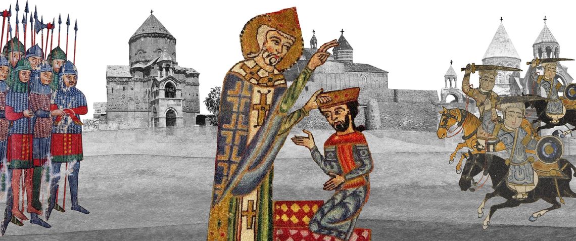
The region is quite interesting in 1337, as there are plenty of countries to play with. The Ilkhanate is still alive, but in name only, the real power being hosted by the Jalayirids, who are overlords of some of their neighbors (the Chobanids, and the Eretnids). Other countries, such as Gurgan, the Kartids, and Muzaffarids are also struggling to get the hegemony over the region. Meanwhile, the strongest power in the Caucasus is the Kingdom of Georgia, although the region is also quite fragmented among different polities.

Ilkhanate.png

And speaking of the Ilkhanate, you may have wondered why isn’t it a unified tag… Well, it’s because we consider that it is clearly in decadence, having lost any grasp of authority over the provinces, so the best way of portraying it is through an International Organization. What we can see in this mapmode is that there are two pretenders to get the power, the Jalayarids and Gurgan, with the other countries still being formally part of it. I won’t talk more today about how it works and its features, but I’ll just say that there are two clear fates for the Ilkhanate: being dissolved, as historically happened, or being restored in full power as a unified country.

Dynasties:
Dynasties.png

Not much to say today about the dynasties, as they’re akin to the country names, in most cases. Well, you might wonder which one is the yellow one, ruling over Gurgan… That country is ruled by the Borgijin, heirs of Genghis Khan. Now you get the full picture of their rule over the Ilkhanate being challenged by the Jalayirids, I think…

Locations:
Locations.png

Location 2.png

Locations 3.png

Locations 4.png

Locations 5.png


Provinces:
Provinces.png


Areas:
Areas.png


Terrain:
Climate.png

Topography.png

Vegetation.png

We’re back to a region with lots of different climates, topography, and vegetation. This will make it very unique, gameplay and looking-wise.

Harbors:
Harbor.png

You might notice that there are ports in the Caspian Sea… Because, well, it’s considered a sea in our game, so there can be ships and navies over it.

Cultures:
Cultures.png

There's quite a lot of cultural division throughout the region... The Caucasus is, well, the Caucasus, divided among lots of different people. Then we have the Iraqi and Kurdish in Iraq, Persian and a number of other cultures in Iran, Baloch in Balochistan, Afghan in Afghanistan, and Khorasani, Turkmen, Khorezm, Hazara, and Tajiks, among others, in Khorasan and Transoxiana.

Religions:
Religion.png

Another interesting religious situation. Orthodox is the main religion in Georgia, and Miaphysitism in Armenia, with other confessions spread here and there throughout the Caucasus (Khabzeism, and three 'Pagan' confessions, Karachay-Balkar, Vainakh, and Lezgin). Then Iraq is divided among Sunni, to the north, and Shiism, to the south. And Iran is in an interesting situation, having a Sunni majority, but with some important Shiite pockets here and there. And Zoroastrianism, of course. It was not trivial to properly portray them, as we don't have good data for the 14th century. So what we did was some calculations, between sources that tell that there was still a majority as late as the 11th century, and the religion becoming severely reduced by the 16th century. Therefore, we decided to go with 20% of the population as a general rule of thumb; however, we're quite open to feedback over this matter.

Raw Materials:
Raw Materials.png

This region is full of rich resources, in stark contrast to the one we showed last week, Arabia. There are a couple of bugs on this mapmode that you might spot, I think.

Markets:
Markets.png

This region has several markets: Tabriz, Baghdad, Esfahan, Hormuz, Nishapur, and Zaranj., This will make for regionally fragmented-but-integrated economies (that is, good market access everyhwere, but with regionally diverging economies).

Population:
Population.png

Population 2.png

Population 3.png

Population 4.png

Population 5.png

The total population of the region is around 9M, taking into account all the different areas that we’re showing today. That is divided into about 4.5M in Iran, 2M in Iraq, 1.5M in the Caucasus, and around 1.5M in Transoxiana.

And that’s all for today! Next Friday we will be taking a look at India! Yes, in its entirety; we think that it is the best way to do it, although we’ll talk more about it next week. Another change, only for next week: the DD will be published at 10:00 instead of the regular 15:00, as I won’t be available in the afternoon to reply. Letting you know so there’s a proper wow-pole-run, yes. See you!
 

Attachments

  • Cultures.png
    Cultures.png
    3,1 MB · Views: 0
  • Religion.png
    Religion.png
    3,2 MB · Views: 0
  • 86Love
  • 84Like
  • 5
  • 3
  • 1Haha
  • 1
Reactions:
Okay, I suppose it would be the most reasonable to give the location of Amberd to a Vachutian OPM, while giving Artashavan to Alastani.

It's only through such a delineation which doesn't contradict what our sources tell us.


You said it, mate.
I was referring to the Amberd localisation from your map, but as usual the text disappeared somewhere during translation.
 
Last edited:
I leave it to @SuperLexxe to interpret our texts as a neutral third party and come up with their borders for the map.

I genuinely think I am finished with Georgia's research. I've studied and posted all about its borders, resources and demography for the time frame of 1337.

Only flavour left, I suppose.
 
  • 1Like
  • 1
Reactions:


Besides the Kurds already being organized societies, turning them into SoPs would remove the "Kurdish Zone", which was essentially the diplomatic battlefield of the Mamluks and the Ilkhanate in trying to sway them to their side. Later they would be key pawns between the Ottomans and the Safavids, but also occasionally making their own, though limited, territorial overtures.


When you think about it, this is a really weird sentence and kind of highlights my problem with SOPs in this game. You're basically implicitly admitting that SOPs can't actually function as buffer zones outside the control of neighbouring larger states, which doesn't make any sense at all. This is a bit off topic I guess, but it's one of the main reasons I deeply disagree with the implementation of SOPs being "ghost polities" that live in the spirit world while landed tags actually control the land they live on (the other main reason is that the people who comprise an SOP absolutely do occupy land and I completely do not understand what it is meant to represent when all the pops in a location belong to SOPs while the location itself is owned by another tag)
 
  • 1
  • 1
  • 1Love
Reactions:
I don't know if this kaj is suitable to be added or not, but since I already found such information it seems a shame not to share it.

It seems that the Sefedinyans dynasty has its capital on the island of Akdamar in Lake Van; this dynasty also owns some land outside the island on the mainland.
List of rulers
1742157244474.png

The island used to be slightly larger, but due to the increasing water level in the lake it has become smaller.
Zrzut ekranu 2025-03-16 183901.png

In this text two principalities are mentioned, the Principality of Sassoun and Makvi(Maku)

arm 1-2.png

sas-mok.png

gist.png

Zrzut ekranu 2025-03-16 190826.png

Locations of Principalities mentioned in the texts
Zrzut ekranu 2025-03-16 202730.png

armenian est.png

Zrzut ekranu 2025-03-18 211117.png

Moks
 
Last edited:
  • 3
  • 1Like
Reactions:
Apparently a small Zoroastrian community survived amongst Armenians as late as the 20th century - not sure if they're represented already, as they would likely be too small to produce the stripes on the religious maps in most places, but it would be very cool to have them in. Arewordik could even be at separate faith within the Zoroastrianism umbrella
Screenshot_20250317_113143_Wikipedia.png


By location, they should be particularly present in Mardin, Merzifon, Samsat, Kayseri and Diyarbakir, though with how far apart those cities are, it's quite probable that at this point, small populations existed in other parts of Western Armenia
Screenshot_20250317_113226_Wikipedia.png

Screenshot_20250317_113801_Samsung Internet.png
 
  • 6Like
  • 1
Reactions:
Apparently a small Zoroastrian community survived amongst Armenians as late as the 20th century - not sure if they're represented already, as they would likely be too small to produce the stripes on the religious maps in most places, but it would be very cool to have them in. Arewordik could even be at separate faith within the Zoroastrianism umbrella

By location, they should be particularly present in Mardin, Merzifon, Samsat, Kayseri and Diyarbakir, though with how far apart those cities are, it's quite probable that at this point, small populations existed in other parts of Western Armenia
Are the article's listed sources reliable? While I'd love it to be true, I find it hard to believe given the last Hellenic peoples were converted in the 8th century and the Celtic religion in a time when places like Ireland were much less developed than Armenia didn't even last that long.
 
Are the article's listed sources reliable? While I'd love it to be true, I find it hard to believe given the last Hellenic peoples were converted in the 8th century and the Celtic religion in a time when places like Ireland were much less developed than Armenia didn't even last that long.


I wouldn't doubt it that much. The Zoroastrians survived much longer than the Hellenics, considering Zoroastrianism is still practised today.

And by 1337, there were still large minorities of Zoroastrians in Persia, so why not Anatolia/Armenia?


  • 5Like
  • 1
Reactions:
Haven't checked in on this forum in a while. I like that the Caucasus region is getting some recognition. This is some amazing change that I couldn't have imagined a few years ago. Great job!

@GenericUsername1444 Your researches are amazing, keep it up bro :)
 
  • 1
  • 1Love
Reactions:
მადლობა ბრო

I just hope the devs take notice of the things we write. I felt as though I had to spoonfeed them on everything, since researching stuff about this region even in English is extremely difficult.

If anything @ SuperLexxe, @ giorgi1999, @ Georgian_Noble and @ Ispil carried this thread, not me.
 
  • 3Like
Reactions:
It seems that the father of the founder of the Hakkari Emirate rules the city of Gevas (Vostan) in 1337?
The family ruling the city of Gevas may have had some family connections with the Sefedinyans (Artsruni) dynasty
Zrzut ekranu 2025-03-18 221405.png

Zrzut ekranu 2025-03-18 220837.png

Zrzut ekranu 2025-03-18 220935.png

Countries:
1:Red- Gevas/Hakkari
2 Dark blue - Akdmar
3:Light blue - Moks
4:Light green- Shatakh
5 Pink - Hizan
6:Orange - Bitlis

Zrzut ekranu 2025-03-18 220731.png
 
  • 2Like
  • 1
Reactions:
მადლობა ბრო

I just hope the devs take notice of the things we write. I felt as though I had to spoonfeed them on everything, since researching stuff about this region even in English is extremely difficult.

If anything @ SuperLexxe, @ giorgi1999, @ Georgian_Noble and @ Ispil carried this thread, not me.
nah man u outdid us all
 
  • 1Haha
Reactions:
Last edited:
It would probably be better to use an event to change the name of the emirate from Gevas (Vostan) to Hakkari, of course if the emirate of Gevas existed in 1337?
Ah, I reviewed my initial post.
Hakkari; 4000 strong. Ruled by amir Xars al-Din ibn Ali ibn Tarawusi. Notably not going to remain around much longer; historically replaced with Bahdinan in 1339 (there's a claim that it was ruled by Bahdinan since the Abbasids but besides the fact that this doesn't square up with my source, I found the original source of that and it seems the author gleaned it from "natives in the area" without ever actually visiting the place)
Jolemark/Colemerg. Numbering more than 3000. Hakari by origin. Ruled by the son of Kutb al-Din ibn Baha al-Din (this son goes unnamed in the text)
I was confused since what you refer to as Hakkari I refer to as Jolemark. I suspect your "Emirate of Gevas" was an appanage of Jolemark; it would not exist in 1337.

I suggest reading this paper; it'll clear up a lot of things and I've forgotten many of the details.
 
  • 1
Reactions:
The location of Kashatagh should belong to the Orbelian dynasty.
The Shahurnetsi family(dynasty?) is dependent on the Orbelian dynasty.
Zrzut ekranu 2025-03-19 192502.png

Zrzut ekranu 2025-03-19 194528.png

Zrzut ekranu 2025-03-19 193938.png

Zrzut ekranu 2025-03-19 192123.png

I also wonder if the Mongols shouldn't have control over Julfa and Nakhchivan?
 
Last edited:
  • 1
Reactions:
Some offtop Orbelian dynasty that are originally from Georgia (per Minorksy, Toumanoff) got expelled to Eldiguzid state during the rebellion and got pardoned by Tamar only after liberation of much of Armenia from Eldiguzid atabegate. One of the member of the dynasty Tarsaich Orbeliani basically swtiched power balance in Georgia’s Armenian holdings and assumed highest royal title of Atabagi from Georgian monarchy, basically overshadowing other contenders such as Mkhargrdzeli-Zakarids or Mankaberdeli-Artsrunids for a while. The title of Atabeg was finally assumed by Jaqelis but that’s another story. It also interesting that according to the family legend they claimed to originate from Cenk or China probably to please new Mongol overlords?. Adontz believes that by doing this they linked themselves to Mamikonids, which according to him are Tzan/Chan aka Laz origin. Ancient Chaneti included not only modern day Rize province but also Coruh river up to Gumushane province where various Chan tribes survived up to 14th century. Procopius knows at least two Tzan tribes from Coruh river basin: Okenite (Bayburt-Gumushane) and Koxyline (Parkhali gang). Mamikonids were probably member of one of those Chan tribes that got expelled from one of those groups and established themselves in Tao/Tayk and expanded their power through allying Armenia. Anyways, at some time period, Gumushane was ruled by Chanikhites family autonomously (most probably of local Tzan family). Another probable Tzan family known as Kavkasidze in Georgian and Kavasites in Trebizond ruled in Parkhali valley, could this info be somehow useful? :D

Btw can’t see culture map clearly. I am mostly concerned about Tao. Hopefully its majority Orthodox and Georgian during game start :))

This is view on earlier demographics of Tao: According to Robert Edwards, during the reigns of the Artashesid and Arsacid dynasties, as well as during the period of Persian suzerainty (approximately from 387 to 591), part of the northwestern border of Tao extended to the Chorokhi River, where, most likely, the majority of the population was Georgian.

According to R. Hovhannisian, in the era of the Mamikonians, Tao and Kola were probably mostly Georgian regions, while Bolkha and its surrounding areas, Berdats-Por and Partizats-Por, may have been predominantly Armenian.

So basically Armenian population before Georgian Bagratids came to power lived around Olti-Penek valley(!). The rest areas like Panaskerti, Parkhali and Tortumi were Kartvelian / Tzanian-Georgian. Throughout of latter centuries local Chalcedonian Armenians got heavily Georgianized (the latter are also speculated to be in fact Kartvelians and Chalcedonian refugees from Persarmenia) and there is no need mess its population during start date.
 
Last edited:
  • 1
  • 1Like
Reactions:
Now that there's a week remaining before the feedback post, I'll compile all my suggestions for the convenience of the developers, who might be doing some finishing touches on the region.


If the map which we saw on TT #52 is indeed the final version of the map (which I hope it isn't), I'll quickly summarise my suggestions on the part of the map which I can comment on:


trvke.png


  1. The Georgian coastline should extend to the location of Tuapse, as the location of Nicopsis is purported to be near modern Novomikhaylovsky, 35 Kilometres north of modern Tuapse.​
  2. The duchy of Saarishiano/Shaki should extend to include all of the province of Shaki (as modelled in-game), as according to the principal historian of the time period, Hamdallah Mustawfi Qazvini, the land was only lost to Shirvan in 1339. I presume this mistake was made due to the legend of the first map below stating that it was lost in the "1330s", alongside Shamkori and Gardmani. I've written more about this in "Georgia map feedback" above.​
  3. I suggest adding some locations in northeastern Caucasus. As it stands, Chechnya and especially Dagestan are woefully underrepresented in terms of their cultures, religions, and languages.​
  4. Due to how zoomed out the map is, I can't tell whether Samtskhe exists as a playable country or not, but presuming it is, it should cede some territory to the Principality of Ani, which must've existed until 1350. In addition, the land not held by the Jaqeli dynasty, as seen on the 1st map below, may either be given to a Georgian vassal, the Duchy of Tao, or be directly integrated in the country.​
  5. The Duchy of Ksani should be created and given control of some territory in the northern Caucasus, as seen on the 2nd map below.​
  6. Alastani shouldn't have control over Amberd, as @ Aramenian and I have found out. The territory should instead be held by the Vachutian Principality, with the border running in the location of Artashavan. Alastani should function with mechanics of French appanages, as the principality was similar to the French fiefdom of Dauphine, held by the heirs of the throne.​
  7. More Armenian principalities should be created as per the 2nd map. They should start as vassals of Georgia.​


bleh.png
super mega hyper ultra autism.png
 
  • 2Like
  • 2Love
  • 1
Reactions:
Now that there's a week remaining before the feedback post, I'll compile all my suggestions for the convenience of the developers, who might be doing some finishing touches on the region.


If the map which we saw on TT #52 is indeed the final version of the map (which I hope it isn't), I'll quickly summarise my suggestions on the part of the map which I can comment on:


  1. The Georgian coastline should extend to the location of Tuapse, as the location of Nicopsis is purported to be near modern Novomikhaylovsky, 35 Kilometres north of modern Tuapse.​
  2. The duchy of Saarishiano/Shaki should extend to include all of the province of Shaki (as modelled in-game), as according to the principal historian of the time period, Hamdallah Mustawfi Qazvini, the land was only lost to Shirvan in 1339. I presume this mistake was made due to the legend of the first map below stating that it was lost in the "1330s", alongside Shamkori and Gardmani. I've written more about this in "Georgia map feedback" above.​
  3. I suggest adding some locations in northeastern Caucasus. As it stands, Chechnya and especially Dagestan are woefully underrepresented in terms of their cultures, religions, and languages.​
  4. Due to how zoomed out the map is, I can't tell whether Samtskhe exists as a playable country or not, but presuming it is, it should cede some territory to the Principality of Ani, which must've existed until 1350. In addition, the land not held by the Jaqeli dynasty, as seen on the 1st map below, may either be given to a Georgian vassal, the Duchy of Tao, or be directly integrated in the country.​
  5. The Duchy of Ksani should be created and given control of some territory in the northern Caucasus, as seen on the 2nd map below.​
  6. Alastani shouldn't have control over Amberd, as @ Aramenian and I have found out. The territory should instead be held by the Vachutian Principality, with the border running in the location of Artashavan. Alastani should function with mechanics of French appanages, as the principality was similar to the French fiefdom of Dauphine, held by the heirs of the throne.​
  7. More Armenian principalities should be created as per the 2nd map. They should start as vassals of Georgia.​


Shouldn't the locations of Julfa and Nakhchivan be the property of the Jalayirid dynasty?

Zrzut ekranu 2025-03-21 190304.png

 
Last edited:
  • 1Like
Reactions:
Yeah, that strip of land (which was probably already majority Muslim at the time) was most likely under the control of the Jalayirids. According to the "Historical Atlas of Georgia", by the end of the 13th century: "Hamdallah Qazvini places Surmari in Nakhchivan tuman of the province of Adharbayjan". I think a few locations should be added to the province to simulate the borders of the time period more accurately.

Historically, Georgia never really ever controlled Nakhichevan. During the golden age, it was a tributary, the lowest level vassal. After that, it was subjected to direct Mongol overlordship.
 
  • 2
Reactions: