Hello, and welcome to another week of Tinto’s fun Maps. This week it will be a huge one, as we will take a look at the entirety of China. It is a really big area, but it didn’t make sense to split it into multiple parts to present it separately, so we are showing it all at once. So, without further ado, let’s get started.
Countries


Obviously the territory is dominated by Yuán, with Dali as its vassal. They appear big, strong, and scary, but they will have their own fair share of problems for sure. I will not go into detail into the countries that can be seen further south, as we will talk about Southeast Asia in a future Tinto Maps.
Societies of Pops

Quite a variety of peoples in Southwest China, as you will see later in the culture maps.
Dynasties

Here we finally have managed to catch the full name of the Borjigin dynasty in all its glory.
Locations


 Before you ask, there are around 1800 locations in China proper, not counting impassables and barring possible counting errors.
Provinces


Areas

Terrain


You will notice here that there are few locations assigned as "farmlands", that's because when we did this part of the map there was yet not a clear criteria on how we would be defining the farmlands and their placement here hasn't been reviewed yet.
Development

As mentioned before, the harsh changes of development at the end of China proper is probably too strong right now and it’s something that will have to be reviewed, especially at the Liáodōng area.
Natural Harbors

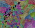
Cultures


There is a lot of cultural variation in China, not only among the sinitic peoples (which have been divided according to their linguistical and dialectal differences) but also having many other types of non-sinitic peoples. The resulting pie chart for the cultures of the country is a wonder to see indeed. And even if Yuán itself is Mongolian, there are actually very few Mongolian people in the country, as only the ruling class would belong to it. That is one other source of further trouble for Yuán.
Religions

 Considering religion, there is also a lot of variation in the South West, and one thing you will notice is the clear lack of “Animism”. We have finally eliminated Animism as a religion from the game and have divided it into many multiple ones. Besides this, and some Muslim presence in some areas, there are other small pockets of religions that do not get to appear in the map, like Manichaeism, Nestorianism, Judaism and Zoroastrianism. And the elephant in the room is the Mahayana, that we have already mentioned that we have plans on dividing it, but more on it at the end.
Raw Materials


 A very resource rich region, which makes it understandable that China was able to basically be self-sufficient in terms of resources for long periods in history, and with many sources of highly appreciated resources like silk, tea, and even soybeans. Another interesting thing is the division on the preference of grain cultivation, with rice being more prominent in the south while the north tends to favor wheat and sturdy grains (millet, basically).
Markets

Population


 Yes, there’s a lot of population in China, and with that many people and that many resources it obviously has a lot of potential. We have been following population census of 1351 and 1393, which allows us to have the most accurate values we can have.
Now, before closing off, let me turn back once again to the subject of religion, as it has already been pointed out that having a single Mahayana religion covering both China and Tibet (and parts of India) may not be the best both for accuracy and gameplay reasons, and we basically agree with it so we are planning on reworking a bit but it hasn’t been done in time for this Tinto Maps. However, as we are aware that you are not able to provide proper feedback unless we present you something, let me now share with you what are our plans with it. Please keep in mind that I will NOT go into details about their mechanics, and only talk about their distribution.
First of all, Tibetan Buddhism will be split and turned into its own religion. Although it “technically” is part of the Mahayana branch, it is true that its practices have distinguished it from Chinese Buddhism enough to represent it as its own religion, starting from the fact that they do not follow the same canon. The Mahayana that was present in India was already an outlier from start, so it will be made into its own religion.
That leaves out that the current “Mahayana” remaining in game will be Chinese Buddhism, that is, those following the Chinese Buddhist canon, and it will be present in China, Korea, and Vietnam. The question remains on what to call the religion, and several things have to be considered for that:
So, for now, the current name we are considering for the religion is directly “Chinese Buddhism”, or even leaving it as “Mahayana”, understanding that the main current of Mahayana is the version following the Chinese canon anyway. But feel free to suggest any alternative naming if you feel that there may be a better option we haven’t thought of, as long as it takes into consideration the previous points. And of course, let us know your feedback on the proposed representation and distribution too.
And that’s it for today, after a bit longer closing than usual. Next week we’ll be back a bit further east, taking a look at Korea and Japan. Hope to see you there!
Countries
Obviously the territory is dominated by Yuán, with Dali as its vassal. They appear big, strong, and scary, but they will have their own fair share of problems for sure. I will not go into detail into the countries that can be seen further south, as we will talk about Southeast Asia in a future Tinto Maps.
Societies of Pops
Quite a variety of peoples in Southwest China, as you will see later in the culture maps.
Dynasties
Here we finally have managed to catch the full name of the Borjigin dynasty in all its glory.
Locations
Provinces
Areas
Terrain
You will notice here that there are few locations assigned as "farmlands", that's because when we did this part of the map there was yet not a clear criteria on how we would be defining the farmlands and their placement here hasn't been reviewed yet.
Development
As mentioned before, the harsh changes of development at the end of China proper is probably too strong right now and it’s something that will have to be reviewed, especially at the Liáodōng area.
Natural Harbors
Cultures
There is a lot of cultural variation in China, not only among the sinitic peoples (which have been divided according to their linguistical and dialectal differences) but also having many other types of non-sinitic peoples. The resulting pie chart for the cultures of the country is a wonder to see indeed. And even if Yuán itself is Mongolian, there are actually very few Mongolian people in the country, as only the ruling class would belong to it. That is one other source of further trouble for Yuán.
Religions
Raw Materials
Markets
Population
Now, before closing off, let me turn back once again to the subject of religion, as it has already been pointed out that having a single Mahayana religion covering both China and Tibet (and parts of India) may not be the best both for accuracy and gameplay reasons, and we basically agree with it so we are planning on reworking a bit but it hasn’t been done in time for this Tinto Maps. However, as we are aware that you are not able to provide proper feedback unless we present you something, let me now share with you what are our plans with it. Please keep in mind that I will NOT go into details about their mechanics, and only talk about their distribution.
First of all, Tibetan Buddhism will be split and turned into its own religion. Although it “technically” is part of the Mahayana branch, it is true that its practices have distinguished it from Chinese Buddhism enough to represent it as its own religion, starting from the fact that they do not follow the same canon. The Mahayana that was present in India was already an outlier from start, so it will be made into its own religion.
That leaves out that the current “Mahayana” remaining in game will be Chinese Buddhism, that is, those following the Chinese Buddhist canon, and it will be present in China, Korea, and Vietnam. The question remains on what to call the religion, and several things have to be considered for that:
- The religion will already include blended into it Confucianism and Daoism besides Buddhism, so all three religions are included. That means it can’t be named either Confucianism or Daoism, as they have been bundled in. Buddhism was taken as the base name because, from the three, it was considered as the one mostly oriented towards the “religious” (Confucianism being more focused on administration and Daoism on rituals), and the most similar to what an organized religion would be outside of China.
- As a subpoint on that, and I can’t go into details for it yet, but there will also be options inside it to favor Buddhism over Confucianism or the opposite, so that is already covered too.
- As mentioned, it will be present not only in China but also in Korea and Vietnam (and any other country that may convert too, like for example Japan), so naming it something that’s too intrinsic to Chinese identity would not be ideal. That would mean that a term like Sānjiào, although good, would feel a bit out of place when playing for example as Korea (we know that the concept spread there too, but it was more prominent inside China and regardless having the name be directly in Chinese would be the main issue when playing outside China)
So, for now, the current name we are considering for the religion is directly “Chinese Buddhism”, or even leaving it as “Mahayana”, understanding that the main current of Mahayana is the version following the Chinese canon anyway. But feel free to suggest any alternative naming if you feel that there may be a better option we haven’t thought of, as long as it takes into consideration the previous points. And of course, let us know your feedback on the proposed representation and distribution too.
And that’s it for today, after a bit longer closing than usual. Next week we’ll be back a bit further east, taking a look at Korea and Japan. Hope to see you there!