• We have updated our Community Code of Conduct. Please read through the new rules for the forum that are an integral part of Paradox Interactive’s User Agreement.

Tinto Maps #24 Korea and Japan Feedback

Hello and welcome to another week of Tinto Maps Feedback. Today, we will take a look at Korea and Japan. This area has required less rework than other ones, but still some adjustments have been made.

ADDITIONS

Added the following:
  • Locations
    • Tamura
    • Seongwi
    • Jindo
    • Heungyang
    • Namhae
    • Geoje
  • TAGs
    • Shěnyáng
  • Characters
    • ssg_jo_hwi
    • ssg_jo_yanggi
    • ssg_jo_rim
    • ssg_jo_sosaeng
    • ssg_jo_don
    • ssg_jo_inbyeok
    • kor_ja
    • kor_ko
CORRECTIONS

Renamed the following:
  • Locations:
    • Renamed Aira to Kuwabara
    • Renamed Jeju to Tamna
Areas and Provinces
  • Total rework of areas and provinces of Korea
  • Renamed Tōhoku to Ōu
Cultures
  • Renamed Jeju culture to Tamna
Raw Goods
  • Changed several Raw Goods as suggested
Terrain and Vegetation
  • Total Review
Locations
  • Redrew several Locations
Minorities
  • Added someminorities

Countries:
Countries.png

Countries color.png

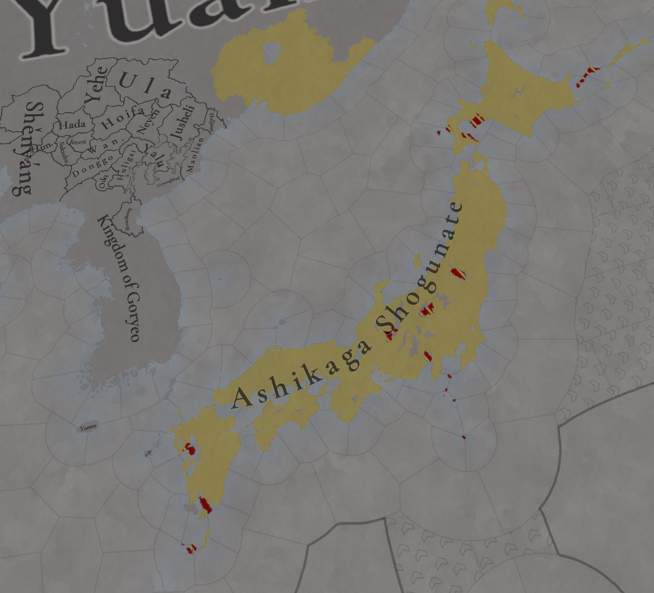
Not many changes here, only the addition of Shenyang.

Dynasties:
Dynasties.png

Not many changes here either, but you can see that Shenyang has the same dynasty as Goryeo.

Country ranks and Government Types:
Country Ranks.png
Government Types.png


Locations:
Locations.png

As I said, no major changes here, only minor adjustments.
Locations zoom 1.png

Locations zoom 2.png

Locations zoom 3.png

Locations zoom 4.png

Locations zoom 5.png

Locations zoom 6.png

Locations zoom 7.png

Locations zoom 8.png

Provinces:
Provinces.png


Areas:
Areas.png

Provinces and areas of Korea is what has received the most change here.

Terrain:
Topography.png
Climate.png
Vegetation.png


Development:
Development.png


Harbors:
Harbors.png


Cultures:
Cultures.png

Not much change in the major cultures, although a bit of adjustment of minorities.

Languages:
Language.png

Court Language.png

Location’s language first, Court Language second.

Religions:
Religion.png


Raw Materials:
Raw Materials.png

Raw Materials zoom 1.png

Raw Materials zoom 2.png

Raw Materials zoom 3.png

Raw Materials zoom 4.png

Raw Materials zoom 5.png

Markets:
Markets.png


And not much has changed with the clans distribution, but here you have it:
Clans.png


That is all for today, this week we will not move far from these areas, here’s the schedule:
  • Tuesday: Tinto Flavour for Korea and Manchuria
  • Wednesday: Tinto Talks for Shintō and the Shogunate
  • Thursday: ‘Behind the Music of Europa Universalis V - Composing the Grandest Score’ video!
  • Friday: Tinto Flavour for Japan and the situations of the Nanbokuchō and Sengoku Jidai

And always as a reminder: Wishlist Europa Universalis V now!
 
  • 128Like
  • 31Love
  • 9
  • 3
  • 1
Reactions:
Can we get a detailed map of Ryukyu? There was a good suggestion on how to divide it further: https://forum.paradoxplaza.com/foru...october-japan-and-korea.1710914/post-30175219

As for Japan, the location density was already pretty good but I think it could enjoy a few more small mountain wastelands, it's especially strange that Chugoku, Kyushu and Tohoku almost don't have any.

Could we please get zoom-ins for the clan map? It's very hard to read.
 
Last edited:
  • 8Like
  • 1
Reactions:
What's the basis for the Ainu in northern Honshu? Is there some specific piece of evidence that suggests they were in those specific localities?
Nothing specific, but besides the fact that there was constant trade between Honshu and Hokkaido, there's also the Ando rebellion of 1320-1328, suggesting that there were some Ainu at least on the northern tip of Honshu.
 
  • 45Like
  • 7
Reactions:
Korea and Japan are already extremely detailed, Korea is approximately the same density as the European average and Japan is on par with the densest parts of Europe. Thinking that this is "not enough" based purely on raw numbers of added locations, in this particular case, is (hot take) rooted mostly in jealousy, tbh
It's not so much jealousy as a little sadness.
:'(
 
  • 14Like
Reactions:
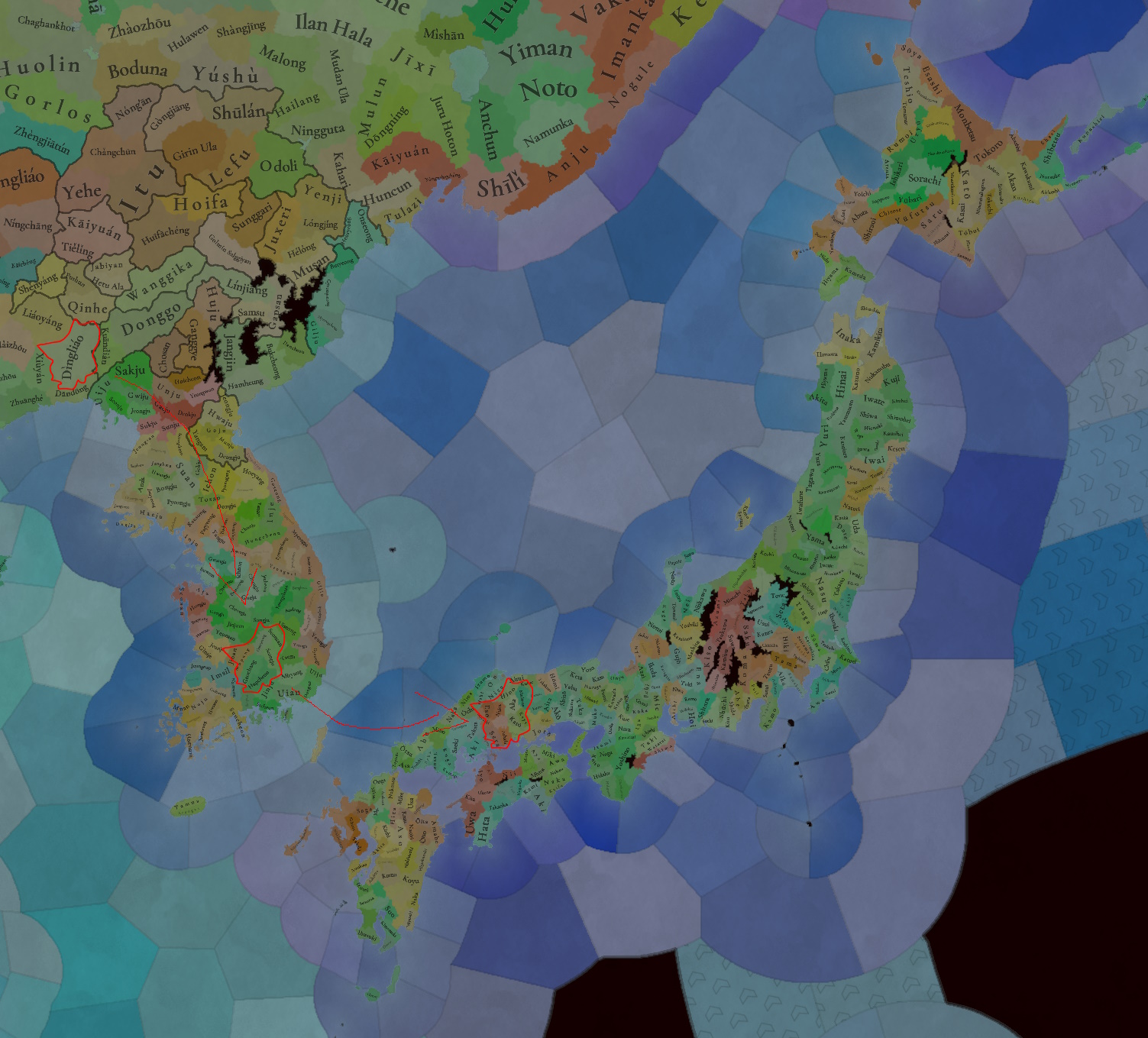
location in Liaodong is equal to seven Korean locations or ten Japanese locations.Any normal person would not consider this reasonable.China needs more locations.
Locations.jpg
 
  • 19
  • 14Like
  • 5Haha
  • 3
  • 3
Reactions:
Nothing specific, but besides the fact that there was constant trade between Honshu and Hokkaido, there's also the Ando rebellion of 1320-1328, suggesting that there were some Ainu at least on the northern tip of Honshu.
Interesting, I cannot find much if anything on this rebellion sadly
 
  • 1Like
  • 1
Reactions:
There will be a dedicated post to Buddhism.
Thanks!
For the second question, are there any minority religions we're not seeing on the map, like Korean Shamanism?
 
  • 2Like
  • 1
Reactions:
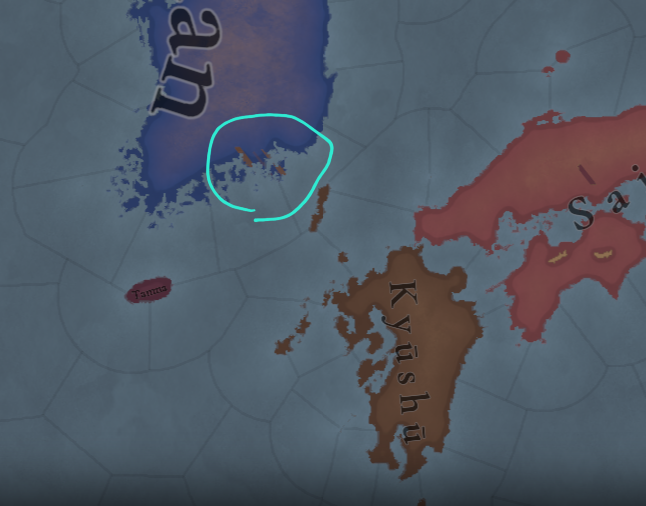
On Jeju Island, Seongwi is an inappropriate name from the past, and it's spelt incorrectly (Seo'gwi is correct).

The name Tamna is appropriate, though,
it is more appropriate as the name of the entire island (the name of the province) rather than just the northern part.

Sanbuk (山北, north of Mt. Halla) is an appropriate name for Tamna territory.

Seongwi territory is better named Sannam (山南, south of Mt. Halla).

Talk about resources, Jeju is famous in Korea for its fish, but it's more famous for its citrus, which is hard to find on the mainland.

And since the southern part of the island produces citrus and was presented to the king, can you switch from fish to fruit?
 
Last edited:
  • 8Like
  • 1
  • 1
Reactions:

Regarding Mod Detail (Clan Elements)​

I propose to introduce detailed Clan elements, similar to the NMIH mod. I believe a detailed Clan system would be very effective in allowing players to deeply immerse themselves in history and experience the complex human relationships and power structures of medieval Japan. It offers several benefits:
  • Enhanced Historical Immersion: By accurately replicating the historical backgrounds of individual clans and their ties to branch and cadet families, players can experience a more realistic medieval Japanese political and social landscape, beyond just inter-faction conflicts.
  • Added Strategic Depth: Integrating intra-clan rivalries, loyalty dynamics, and marital alliances into the game system would expand diplomatic and internal affairs options, leading to more complex and nuanced strategic possibilities.
  • Stronger Character Role-Playing: When a player's character belongs to a specific clan, it becomes easier to role-play in alignment with that clan's traditions and goals, enriching the overall game experience.
Of course, with NMIH as a precedent, referencing it could alleviate development complexity, making the effort well worth it.

Regarding the Historical Accuracy of the Map​

Regarding the current map's discrepancies, such as the Noto Hatakeyama clan's presence in 1337, I want to emphasize that this point is crucial. The Noto Hatakeyama clan is merely an example, and I recognize this as an important aspect of the game's initial setup.
I believe that the placement of forces on the map should be as historically accurate as possible, and a separate system should be implemented for shugo (provincial governor) appointments and changes. Here's why:
  1. Emphasis on Historical Accuracy: If the initial map deviates from historical fact, it could confuse players starting the game with historical context in mind. For historical strategy games like the EU series, the accuracy of initial settings greatly impacts the realism of the game experience.
  2. Creation of Dynamic Gameplay: A separate shugo appointment system would allow for more dynamic and historically consistent events within the game, such as changes in shugo, or multiple clans vying for the same shugo position. This would lead to much more diverse gameplay than simply fixing a static initial placement.
  3. Expansion of Player Choices: Making the acquisition and maintenance of shugo positions in-game objectives provides players with new strategic goals as they develop their own forces.
If there are other instances where the initial settings differ from historical fact, please share that information. It would greatly contribute to creating a more accurate map.

Conclusion​

Implementing clan elements is a great way to enhance both the historical immersion and strategic depth of the game. Additionally, the map's initial settings should prioritize historical accuracy, and dynamic elements like the shugo appointment system should be handled separately to achieve a more realistic and diverse gameplay experience.
 
Last edited:
  • 4Like
  • 2
Reactions:
It's not so much jealousy as a little sadness.
:'(
Yes, but why are you sad about it? It has a very respectable location density.

Italy got a lot of new locations because it was likely one of the most shattered and divided regions in the Western world with also a considerable population size, Carpathia and Balkans got so many because the Carpathian region's density was criminally low compared to the rest of the surrounding regions and was essentially doubled, idk about France, but overall the final density of Europe and Korea-Japan is essentially the same, there is nothing to be sad about, in my opinion.
 
  • 10
  • 5Like
Reactions:
Absolutely awesome edit of the topography!

My final nitpicks:

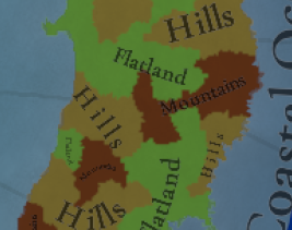
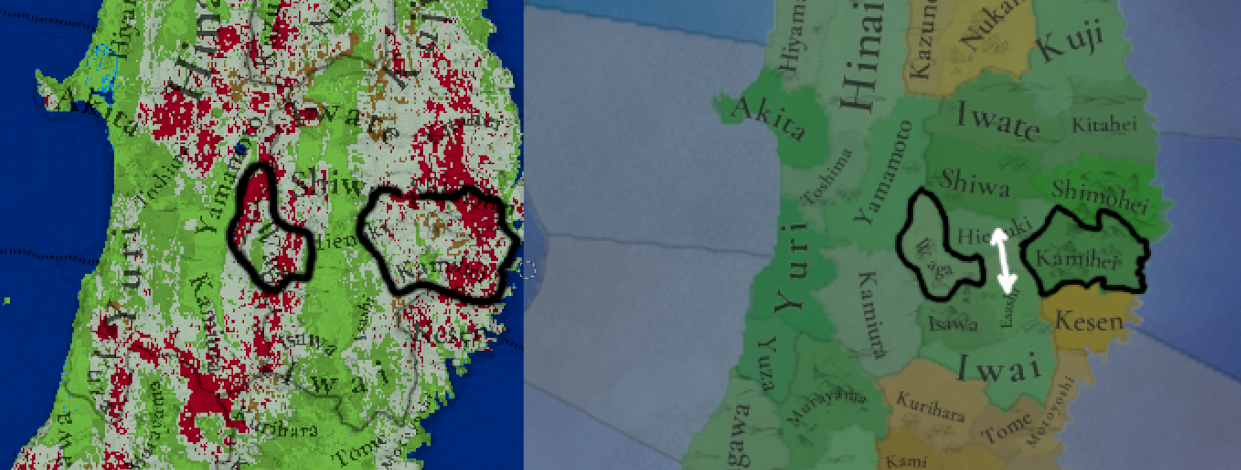
1. Readjust the shape of Waga, Hienaki and Esashi a bit, so that Hienuki - Esashi is not a mountain crossing, the valley is easily traversible IRL.
1749476127528.png
1749475927435.png


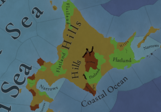
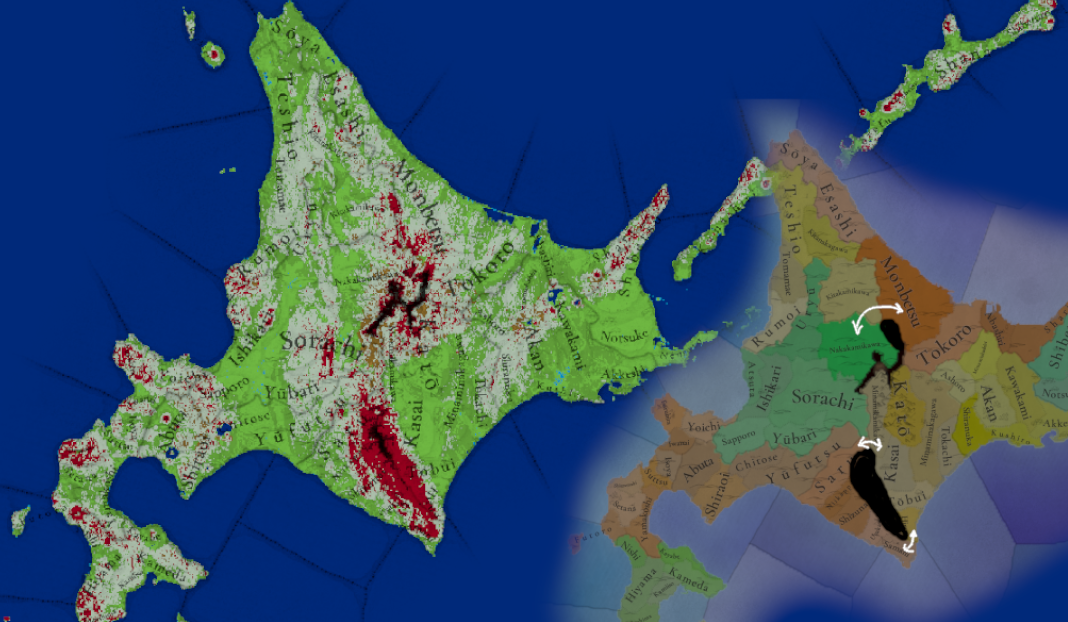
2. Adjust the impassables in Hokkaido just a bit more to truly capture the scale of especially the Hidaka mountain range in the South. I can't imagine anyone realistically crossing that, even today there is only 1 road in the south (which is tunneled, so a recent addition).
I'd Also remove the mountains designation for Kato. to either hills or even flatlands.

The location sizes of Monbetsu and Sorachi are perhaps a bit too large in comparison to other locations in the area. Especially because there's some more granular topography hidden within each of them (ranging between mountains and flatlands).
If location splits for Monbetsu is not achievable, I'd add one more impassable edge, so travel has to go from Kitakawikama.
1749476993565.png
1749476954368.png
 
  • 26Like
  • 13
  • 3
Reactions:
Very interesting work!

I have a question regarding the decision of Court Language for the Korean kingdom at this time (1337 opening). As we all know, the Hangul (or Korean alphabet) is developed by Sejong the Great in 1443, and therefore does not exist in1337. The Court language in 1337 is effectively Chinese (classical Chinese if to be exact).
I feel it would be more historically accurate and appropriate to set the Court Language in Korea at the start to be Chinese, and introduce an event to fire around 1443-ish to describe the development of Hangul and allow the player to change the Court Language from Chinese to Korean. The development of Hangul is an important culture and history event in Korea and I believe it deserve some attention. It also fits the EU5 timeline very well.

In fact, the development and usage of Hangul cause quite some disturbance in the Korean nobles and scholars and had a few pushbacks. For example, a famous Korean scholar and noble at that time, Ch'oe Malli (he has a Wiki page), had written a few formal protest against the implementation of Hangul (original text can be checked at this wiki page and wiki sources too). For a few reasons, including rejection from the noble class, the Prince Yeonsan and King Jungjong actually abolished the usage of Hangul in 1504/1506. The Hangul sees its revival only a few hundreds years later, mainly in the 19-20th century.

If the team has the time and resources, these may even provide a flavour event chain revolving around Hangul between 1440s~1510s to show the struggle between the King and noble class in Korea.
 
  • 12Like
  • 12
  • 4
Reactions:
Yes but those placenames are not specifically located in the northernmost localities shaded in the maps, why not make the entire northern region shaded if this is the reason.

Edit: Do you remember where you've read the Tsugaru strait part?
"Though the Ainu land once included southern Kamchatka, the northern part of the main Japanese island (Honshu), northern Sakhalin and the lower Amur region (Kodama 1972:17-25, Takakura 1955:57-58, 66), the Ainu homeland in the recent past consisted of the islands of Hokkaido, southern Sakhalin and the Kuriles..."
Ohnuki-Tierney, Emiko. “Another Look at the Ainu—A Preliminary Report.” Arctic Anthropology 11 (1974): 189–95.

"Trade across Tsugaru strait between Japan and Hokkaido started quite early. The SDE vol. 3 written in 1356, says that the Ezo living near Matsumae "went out to trade at the ports of Tsugaru in the Ou region." Tosa in Tsugaru (an auxiliary naval port located at the mouth of Tosa Bay in Tsugaru) was the center of trade between the mainland and Hokkaido. It was the largest seaport in Ou with ships from both Ezo and the capital of Japan going in and out"...
Shinichirō, Takakura, and John A. Harrison. “The Ainu of Northern Japan: A Study in Conquest and Acculturation.” Transactions of the American Philosophical Society 50, no. 4 (1960): 1–88.
 
  • 3
  • 1Like
Reactions: