• We have updated our Community Code of Conduct. Please read through the new rules for the forum that are an integral part of Paradox Interactive’s User Agreement.

Tinto Maps #26 - 15th of November 2024 - Indonesia

Hello, and welcome to another week’s edition of the maps of Project Caesar. I hope you have your boat prepared, because today we’ll be doing some island hopping looking at all the archipelago of Indonesia.

Countries
Countries.png
Colored Wastelands.png

Countries zoom 1.png
Countries zoom 2.png
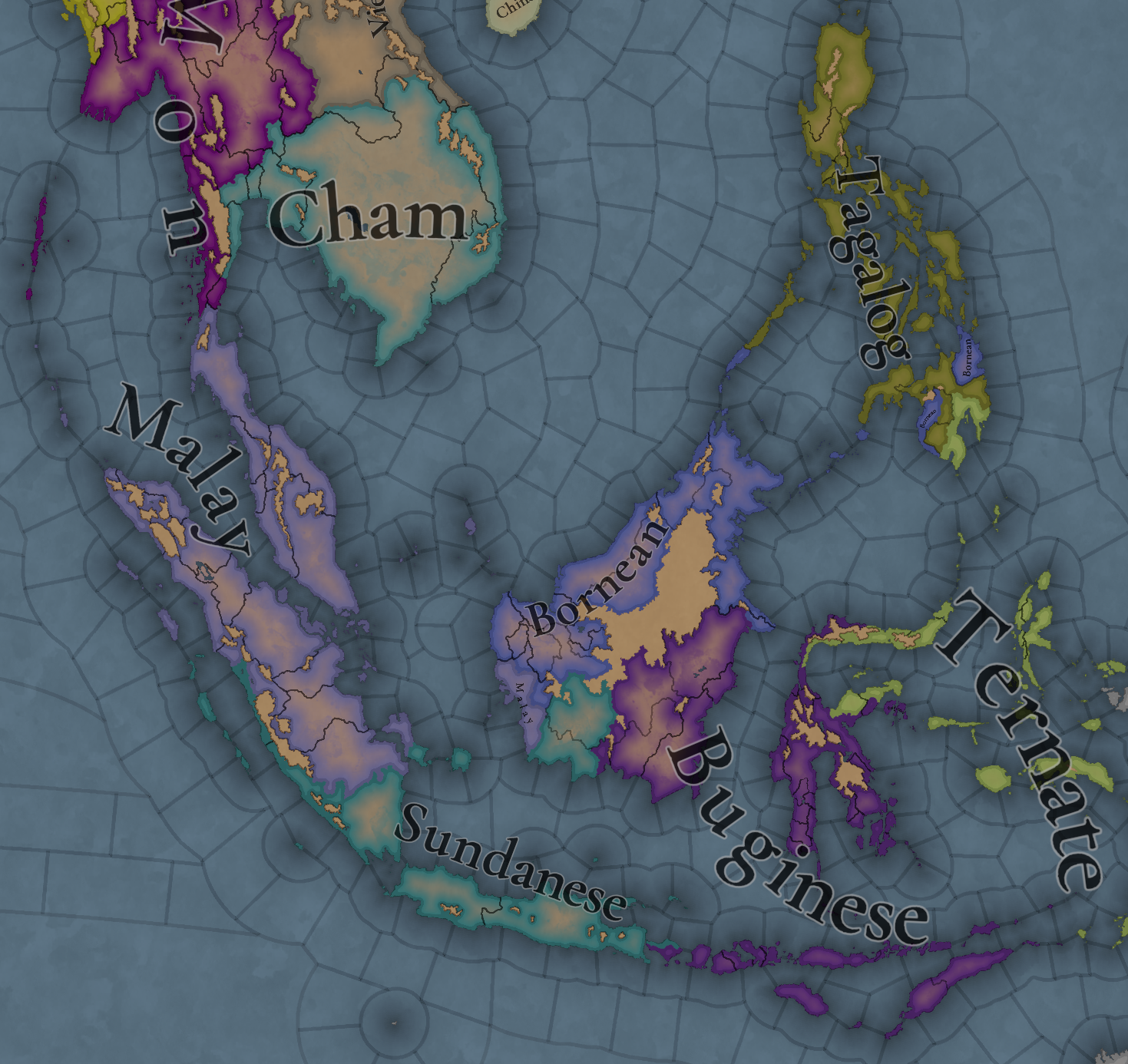
A very wide area filled with many countries. Obviously, the most important emerging power is Mahajapit, Majahapit, Mapajahit, Mahapajit, Mapajahit… Majapahit, originating from Java and who are taking advantage of the vacuum created by the disappearance of the Srivijaya Empire to conquer or subjugate many of the Malay polities to establish a new thalassocratic empire. In the island of Borneo, the Kingdom of Brunei is extending its territory with the subjugation of many countries in the Philippines, where the Kingdom of Tondo establishes a certain hegemony but still with many other polities in the islands that could easily take its place. On the Celebes, the island is divided into multiple countries, with the Kingdom of Luwu (starting with L) establishing a firm presence. Further east, Tidore and Ternate are ready to also be very influential polities in the region, despite their humble origins in their small islands.

Societies of Pops
Societies of Pops.png

Not much in here, only the Orang Asli in the Malay peninsula and the Ilocos people in north Philippines.

Dynasties
Dynasties.png

Not much to say here, as much of the dynasties are generated due to the lack of data. Notable exceptions to that are, of course, the Rajasa dynasty of Majapahit and the Mauli dynasty of the Melayu kingdom.

Locations
Locations.png

Locations zoom 1.png
Locations zoom 2.png
Locations zoom 3.png
Locations zoom 4.png
Locations zoom 5.png
Locations zoom 6.png
Locations zoom 7.png
Locations zoom 8.png

Provinces
Provinces.png

Provinces zoom 1.png
Provinces zoom 2.png
Provinces zoom 3.png
Provinces zoom 4.png

Areas
Areas.png

The name of the sea is still encroaching on the land, but this will be solved eventually. Fortunately, the islands make it quite easy to define the areas in this region.

Terrain
Topography.png
Vegetation.png
Climate.png

Vegetation and climate is quite (almost) uniform with tropical jungle, while the topography makes it generally to be quite rugged, with flatlands being present almost only on the bigger islands.

Development
Development.png

As one would expect, these parts are not as developed as what we’ve been seeing recently.

Natural Harbors
Natural Harbors.png

I don’t think it’s to anyone’s surprise that Singapore or Manila turned out to be such good harbors.

Cultures
Cultures.png

Cultures zoom 1.png
Cultures zoom 2.png
Cultures zoom 3.png
Cultures zoom 4.png
Cultures zoom 5.png
I think this may be the most culturally diverse area we’ve presented until now. Keep in mind though that minorities have not been done here yet, so there will probably be more blending and variation in the end.

Religions
Religion.png

Religion zoom 1.png
Religion zoom 2.png
Religion zoom 3.png
Religion zoom 4.png
A foreword before presenting the religions of Indonesia. You might notice that the promise to break the Animist religion into smaller ones is now in full effect. However, this is not going to be the final step, but an intermediate one. We created a lot of different 'culture-based religions' where we knew that people had different believes and rites; now we want to group them into broader categories, that would make sense gameplay-wise, following similarities in beliefs, practices, or mythologies - take as an approximate example the Northern American religions shown in the Religious Overview Tinto Talks. In this regard, we will appreciate any feedback about how to better group these religions, as it will be much easier for us to do it with your help.

With that said, let's focus on Indonesia again. This region is also one of the most varied religion-wise. It is notable the presence of Hinduism and Mahayana, as the prominent countries in this area were Hindu-Buddhists before the arrival of Islam, which is currently just starting to make its entrance through the north of Sumatra.


Languages
Languages.png

One thing I want to say here regarding languages (as for example I saw someone getting surprised by the Mon language presence in the south of the Malay peninsula) is that we have had to make some grouping of languages in certain cases. Among many other issues, languages need to have sets of names for characters, so in cases that we couldn’t find a suitable big enough group of names for a language, we were forced to group it with another one close in their linguistic group (even if just temporarily). We are currently working on improving this, so that we can have the best possible representation without having to compromise gameplay, so it is quite possible that some of the languages that we have been forced to group into bigger groups get further splits in the future. Also, dialects were not a thing yet when we did this area, so nothing about that is implemented here yet.

Court Languages
Court Language.png

Not much difference with the normal languages map, except only in those cases where a country is ruling over another culture (which will be mitigated once minorities are done)

Raw Materials
Raw Materials.png

Raw Materials zoom 1.png
Raw Materials zoom 2.png
Raw Materials zoom 3.png
Raw Materials zoom 4.png
Mainly lumber due to so many jungle, but also some other interesting resources here. And obviously also quite a bit of spices in the Spice Islands.

Markets
Markets.png

Market Languages.png
Added here also the market languages, although keep in mind that it is just the language of the culture of the market center.

Population
Population.png

Population zoom 1.png
Population zoom 2.png
Population zoom 3.png
Population zoom 4.png
Population zoom 5.png
Population zoom 6.png
Population zoom 7.png
Population zoom 9.png
Population zoom 10.png
Majapahit is the most populated, which will help them become the regional hegemon they historically were.

That is all for this week. Don’t put away your boats yet though, as next week we will continue our seafaring adventures and take a look at Oceania. See you there.
 
  • 125Like
  • 44Love
  • 5
  • 3
Reactions:
I am also surprised this has not been mentioned (Maybe it has and I actually missed it?) But I believe the different animistic religions of the Philippines (Including Gorontalo and Mongondow cultures) could be united in a regional religion call either Anito/Anitism or Dayawism. Anito/Anitism is an earlier grouping name for basically all the Filipino local faiths, Dayawism is a newer term used as Anitism has come to have some negative connotation from the colonial era and in modern history (According to Wikipedia) I know it's not the greatest source, but I do feel this would be an excellent representation to reduce the hundreds of simple animistic faiths created into more unified regional ones that could perhaps get a little flavor. Likewise, if Faiths needed to be broken down in this region some more, Religions names could be created from the supreme gods from different groups. Tagalog has Bathala, could be called Bathalism, also other groups of the Kapampangan and Sambal would be a part. Igorot groups (The rest of North Luzon) could follow Lumawism/Lumawigism. Visayan People groups could follow Laonism. While this would still allow for more diverse faiths in the Philippines, my issue with this is it still doesn't quite acknowledge the diverse names of Creators between different dialects and languages, as well as omitting the fact that different Gods and Mythology existed even within the same local peoples and cultures. Because of this, I would still find myself a proponent for trying to make it a more Regional faith for the Islands, again being either Anitism or Dayawism.


Further south, I Would like to suggest something that could work as a Regional faith for the Eastern and Southeastern Moluccas (Halmahera, Sula, Buru, Seram, Yamdena, Aru Islands specifically) AS WELL AS Western Papua is Demaism, though is based on the idea of Dema Deities which were common in this specific region. However an issue with this one is Dema Deities were a thing all around the globe, so I could see this going either way in terms of being used, or could even be used globally AS a Subdivison of animism relating to a specific idea.
 
Last edited:
  • 4Like
  • 1
Reactions:
One thing to note here, despite being majority Muslim, the people still practiced Hindu-Buddhist rites, even using Buddhist symbols in their arts/architecture, being syncretized with Islam.

Yes, I agree. Some traditions are still even carried over to the present day. However, presenting the whole of East Aceh as Hindu-majority (aside from Banda Aceh) is inaccurate. Marco Polo wrote that the people of Perlak and Samudra Pasai (Eastern Aceh) were predominantly Muslim, along with those in the coastal area of Linge.

I think if Paradox wants to show Aceh's incomplete Islamization, the best way would be to make Western Aceh predominantly Hindu or Buddhist. However, I still feel this is a stretch, as the Hindu-Buddhist Kingdom of Indrapurwa was defeated more than 100 years ago.

I also read am Acehnese historian named M Junus Djamil claimed that people of Eastern Aceh converted during the 14th Century, but I don't know how credible this source is.

Pidie and Daya haven't been established yet during the game time I believe (at least a quick Wikipedia search says so), but Tamiang was one of the oldest kingdoms in Aceh and one of the kingdoms that refused (unsuccessfully) the Majapahit rule, so I vouch for it. Totally not because I am from Tamiang, absolutely not.

LOL, my first time meeting someone from Tamiang. But yes, you are correct. Pidie and Daya were vassals of Aceh that created later on. So at least, it should be: Aceh, Pasai, Tamiang, and Linge.

I also read about three Hindu Kingdoms of Aceh / Aceh Lhee Sagoe: Indrapurwa (Lamuri), Indrapatra, and Indrapuri. Indrapurwa was clearly defeated in 13th Century, but the rest is unclear. They don't even have a wikipedia page.
 
Yes, I agree. Some traditions are still even carried over to the present day. However, presenting the whole of East Aceh as Hindu-majority (aside from Banda Aceh) is inaccurate. Marco Polo wrote that the people of Perlak and Samudra Pasai (Eastern Aceh) were predominantly Muslim, along with those in the coastal area of Linge.

I think if Paradox wants to show Aceh's incomplete Islamization, the best way would be to make Western Aceh predominantly Hindu or Buddhist. However, I still feel this is a stretch, as the Hindu-Buddhist Kingdom of Indrapurwa was defeated more than 100 years ago.

I also read am Acehnese historian named M Junus Djamil claimed that people of Eastern Aceh converted during the 14th Century, but I don't know how credible this source is.


LOL, my first time meeting someone from Tamiang. But yes, you are correct. Pidie and Daya were vassals of Aceh that created later on. So at least, it should be: Aceh, Pasai, Tamiang, and Linge.

I also read about three Hindu Kingdoms of Aceh / Aceh Lhee Sagoe: Indrapurwa (Lamuri), Indrapatra, and Indrapuri. Indrapurwa was clearly defeated in 13th Century, but the rest is unclear. They don't even have a wikipedia page.
I don't mean the dev should make Aceh Hindu-Buddhist, my earlier comment actually suggested for them to make it fully Islamized (or at least majority), but it's just a footnote that every single religion in Indonesia should be treated as syncretic, and the newly arrived Islam was no exception.

Oratory tradition in Tamiang told that the people were already Islamized before the Majapahit invasion, which was around the mid-14th century. Wikipedia did say it was converted to Islam by Pasai in the 14th century according to a Srivijayan Prasasti, but I've never seen that prasasti before. That being said, the page mentioned a war, but then continued on by saying the people were converted "peacefully". Honestly, as someone who lived through Aceh separatism time throughout my childhood and heard a lot of stories, there is probably some truth to this, and why the people were converted rapidly if you know what I am trying to say.

I don't know if they teach this in other places in Indonesia, but in Aceh, at least during my time, they taught that a Muslim kingdom (I don't remember if it was Pasai or Aceh) destroyed many Hindu prasastis, stupas, and basically traces of pre-islamic Kingdoms here. That being said, I don't know if Aceh should be named "Aceh" or "Lamuri" during this time, I suppose if the dev wants to represent them as an Islamic Kingdom, it should be Aceh, otherwise, they should use Lamuri instead.
 
@
Thank you for finally not having a single culture on the Philippine Island. I really appreciate that :)
Also I would like to point out that the locations for Madja-as are wrong.

Hamtik - is the biggest settlement on that area from the whole timeline. also it is the early capital of Madja-as

Irong-Irong - is also the biggest settlement on that area of the map and also became one of capital of Madja-as. Sinugbohan is one of the early settlements but on EU4 timeline it became irrelevant.

Akean - would be more accurate as Aklan was much a later name during the colonization

Araut - is the precolonial name of the whole group of settlements in the area. same as Aklan, it was changed to Dumngas during colonial times. Halawod is a settlement on that Area.

Locations zoom 2.png


Confederation_of_Madjaas.png

Another one is that you probably need to take another look at your Dynasties and First names you use for Madja-as. Please, Please do not repeat the one from EU4. like this one you use on this screenshot,
Dynasties.png


there is no Dumangas dynasty. This is not Europe, people don't take surnames/dynasty name from places they're from. almost all of Hiligaynon surnames of Dynasty names came from the name of a notable ancestor or his characteristic. I've listed below a list of Hiligaynon Dynasty names and Firstnames. some are Historical some are not but would pass as Hiligaynon name and surnames. I hope you use this.

Puti
Sumakwel
Bangkaya
Paiburong
Lubay
Padojinog
Dumangsil
Dumangsol
Balensucla
Magbanua
Mabilog
Mabunay
Magahum
Mahinay
Malabor
Malacaman
Macairan
Banaag
Bantug
Bitoon
Bucad
Dacanay
Latayan
Somogod
Sumogat
Sumilhig
Demasuay

Makusug
Madasig
Maaram
Mailom
Malapsi
Tegunuko
Omodam
Basalan
Owada
Maisog
Madako
Mataas
Maabtik
Paraaway
Bangkaw
Talum
Hangaway
Pangayam

Pinagpangan
Kapinangan
Alayon
Katorong
Pabulangan
Ribongsapay
Solangaon
Tanayon
Masadyahon
Matahom

Also, please do not use this on other FIlipino cultures as most of this names are uniquely Hiligaynon. Its gonna look weird man if you did, like king Carlos III of England. Its not wrong but also its not right. Cheers!
 
  • 5Like
  • 3
  • 2Love
Reactions:
Bases of the Five Hundred Lords of Ayyavole in Southeast Asia

The Five Hundred Lords of Ayyavole, though not at the apex of power they once were at under the Chola Empire, were still an influential guild in trade in Southeast Asia and in India during this time period. By the 1300s, they had subsumed basically every other major South Indian trade guild, and become by far the dominant entity amongst South Indian traders. They should definitely be a playable extraterritorial nation.

Sumatra:
1732165288836.png

1732165305916.png


1732164072957.png

1732164089557.png

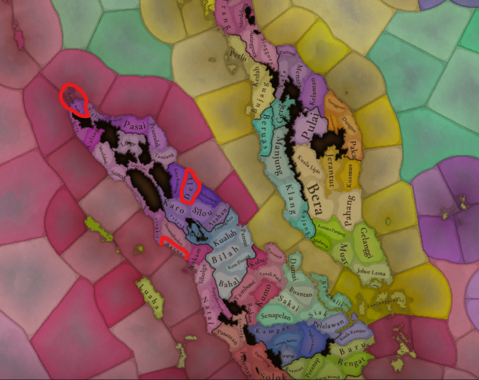
Tamil influence was concentrated mostly in Sumatra in particular throughout the entire period of Ayyavole trade in Southeast Asia. I've outlined locations of their trade settlements, based on archeological evidence and Tamil inscriptions. Perhaps these can be represented as special buildings called "Pattinams" which function similarly to Hansa kontors.

They also had an trade post in Pagan, Burma (as revealed by an Ayyavole inscription in the city dating to roughly the 1270s), but that's not relevant to this dev diary in particular.

For a player playing as the Ayyavole, they will have to deal with the various factors that lead to the eventual decline of the Ayyavole, including the recent increased regulations and taxes on foreign merchants in Yuan ports, the growing influence of Muslim traders and Turkic 'Ortogh' traders in Southeast Asia competing with Tamil traders, and the disturbances caused by the Delhi Sultanate in India, all of which should make for an interesting early game for the Ayyavole if implemented.
 
  • 2
  • 1Like
Reactions:
Maybe Palembang should have the Majaphait general Arya Damar as its regent instead of having a randomized dynasty based on a location, such as the Musi River Delta (Musi Hilir) shown in the Dynasty map. Palembang has three locations for the Musi River, which are not too appealing as dynasty names in comparison to the status of Palembang.


Excerpt from https://en.wikipedia.org/wiki/Majapahit

"According to Babad Arya Tabanan manuscript, in 1342 Majapahit troops led by Gajah Mada assisted by his general Arya Damar, the regent of Palembang, landed in Bali. After seven months of battles, Majapahit forces defeated the Balinese king in Bedulu (Bedahulu) in 1343."


There are further records indicating that his family took root in Bali afterward, and in the 15th century the name Arya Damar would be used again by the parent of Raden Patah, founder of the Demak Sultanate and successor of Majapahit.

While there is a semi-legendary status associated with the name Arya Damar, with some reason Palembang under Majapahit suzerainty could have a Javanese ruler in 1337, and Arya Damar would possibly be the regent five years before the war with Bali.


In the least there could be an elective succession between installed governors and native rulers. Javanese and Chinese governors were installed at times while a Malay ruler attempted to rebel against Javanese rule in the 1370's.
 
  • 2
Reactions:
We are aware that it is an area where a lot of syncretism was going on. Unfortunately, we have again the limitation that pops and countries can only have one religion, so we can't properly represent such blending. That being said, minorities have not been done here yet, and that will introduce a quite bit more blending of religions.
Going off of this week’s Tinto Talk, what if some religions or areas of the world got access to a new societal values slider: syncretism vs fundamentalism? To fit the format that the TT was in:

Syncretism vs. Fundamentalism
A syncretist country absorbs and adapts the cultures, religious beliefs, and philosophies of surrounding countries into their own. A fundamentalist country is more resilient to other ways of thinking.

A syncretist country will have a higher cultural capacity, an increased conversion speed, and countries following religions outside their religious group will have a higher opinion of them, but their cultural tradition growth will be decreased.

A fundamentalist country will have higher control, increased tolerance of the true faith, and faster cultural tradition growth, but their clergy will be much more powerful.

The modifiers are, of course, up for debate. I tried to make the slider distinct from Spiritualist/Humanist and Traditionalist/Innovative.
 
  • 1
  • 1
Reactions:
That's actually a very interesting suggestion, let's see what we can do about it.

I would suggest it would be best having 2 spices goods: Spices and Rare Spices.

low base price, high production rates
Spices
India, SE Asa, East Africa, Americas,...
all the other common spices​
high base price, very low production rates
Rare Spices
Persia, Central Asia, Maluka islands, Banda islands, central America
Saffron, Nutmeg, Mace, Cloves, Vanilla​

And Rare Spices are rare and expansive because it's highly difficult (Saffron) or almost impossible (Vanilla, Mace,...) to cultivate them except where they are naturally found.
The rest are easy to cultivate and adopt to new places, thus why they are cheap and common.
 
Last edited:
I know Philippines are more involved in the gameplay but it is still strange to see Philippines having tens of different religions and cultures while Taiwan only has 1 culture and religion despite having far more diversity. 9 of 10 branches of Austronesian are Formosan, Filippino, Malay, Bruneyan, Madagascar etc all belong to the one last branch of Austronesian. Maybe Taiwan can have more than 1 culture

Also, Orang Asli should be represented less on West Malay coast

View attachment 1216571
Just had to respond because your first statement is a bit fallacious, but Philippines is a tad bit too diverse (almost 200 ethnic groups) compared to Taiwan, that even I, a Filipino, didn't even know one of the cultures/ethnicities represented in the Philippines according to the maps here.
(sorry for late replying also, I only check Tinto Talks every once in a while)
 
Last edited:
  • 2
Reactions:
Interesting that Philippines' market has no stone, so the whole island will be unable to build Monasteries, Marketplaces, Tanneries, Bastions, Coastal Forts or Castles & maintain production of (stone) tools, unless it imports from the Brunei market.

I don't know what the masonry good is made of but there is uncolonized patch of land having marble. Without masonry, they cannot build market villages, tar kilns, wharfs, dye makers, distiller's guild and many other buildings.

Update: According to devs, Market size -> Base Production = Goods like clay, lumber, sand and stone are produced in every market, without the need for specific RGO’s, even if an RGO with that raw material can produce much more, and there are buildings that can be built to provide these as well.
 
Last edited:
  • 1Love
  • 1Like
Reactions:
Ok so ive decided to do alot of research and compile all of my findings regarding the Malayan Peninsula in one post including images.

The location density for the Malayan peninsula is really terrible it's literally over 5000sqkm per location and has one of the lowest EU4 differentials in density which is barely 2 whereas most places have 6-8 to sometimes even 15 like Hokkaido. The fact that Hokkaido has over 60 locations despite being half the size and more peripheral to civilization does i feel justify more locations in Malaya. Malaya’s location density especially when compared to even other regions in Asia let alone Europe is quite poor so i have made a map with about 60+ locations which i think is satisfactory


(It is a work in progress and the colors are not indicative of what the colors i think they should be i dont really care about what colors they are for now it was just a
1732934144176.png
placeholder thing additionally i have not filled out the Non Malaysian regions of the Malayan Peninsula such as Yala and Pattani this will be done in a later post,i also am planning on making some adjustments in Selangor)

Some of these locations have multiple possible names with some of them being historic and some of them not if anyone has any questions regarding these locations and the background of their etymology feel free to ask


Secondly the nomenclature for Orang Asli as a single culture group is really not historical or accurate calling a culture orang asli is the same as calling all of the Australian cultures aboriginal or all of the north american cultures “Native American” its a gross over generalization. There are like 30 or so different Orang Asli groups in Malaysia but obviously for gameplay purposes i have generalised them down to 3-4 groups which are as follows


Orang asli nowadays are categorised into 3 different categories
The Senoi the most populous
The Semang the least populous but most culturally and phenotypically distinct
And the Proto-Malay or Melayu-Purba the most culturally similar to the majority Malay culture

I have divided Proto-Malay into 2 different categories and along with Semang and Senoi that makes for a total of 4 categories.

The first culture would be Jakun which is one of the bigger groups with Proto Malays and they inhabit the inland regions of Johor along the Pahang river and other river basins in that area.

The second group of Proto Malays is a bit smaller but socio culturally distinct which are the Orang Laut who mostly inhabited the western coast

The lifestyles of the Proto Malay are somewhat similar to the regular Malays with small differences.

The Semang are the smallest of the 3 but are also the most culturally and phenotypically divergent. They are what some people call in Southeast Asia (Negritos) due to them having similar physical features to Africans and or Melanesians. They are said to have been genetically one of the oldest populations to have lived here preceding even the Austroasiatic migrants like the aforementioned Senoi who were then followed by the first wave of Austronesian migrations from Taiwan and Borneo such as the Proto-Malays which were finally followed by the current existing Malays from another austronesian migration wave.

Their lifestyle is highly nomadic and are akin to hunter gatherers
AD_4nXdz7yhL8CfIwpgL_jx5V-LRqwjC-jZD8NQkkk4eOsgRkITWzafEZyZ2ErwvcKN7KPFwRPat3ZUy3-4XNmB5Rv9nYqrjep8rwj3dMzMMoxbT-op2CdCs4BeLAfeE-xS3GFDzd0TZ5g


Lastly the Senoi are the largest group both most likely in history and today
They are supposedly the product of Austroasiatic migrations and they speak the corresponding language, They tend to look like this so more similar to Khmer and other austroasiatic peoples.

Their lifestyle is somewhere in between the Proto Malays and Semang in that they practice slash and burn agriculture which is also supplemented by some level of hunting. They would probably qualify for SOP status along with the Jakun

“slash-and-burn agriculture, which on a small scale is supplemented with hunting, fishing, gathering, and the processing and sale of jungle produce. In this respect, they differ from the Semangs (hunter-gatherers) and the Proto-Malays (settled farmers).”
AD_4nXf8vDgY9FEmZR-ZocWbzmmFPNMZtIn8HHLfDWBJsQiRHH7RWSTpvkmGz9_jSi9iN4HiZWfG3ui-8xBK5GJhpp2LsKQU81cxW0H6UXtn-wO6SwzR023Y4suivHuCHzmyIZwwUh2n


Another point the distribution of Orang asli is extremely ahistorical and really weird i do not know why they make up the primary culture of Selangor i know you guys haven't added minorities but if anything they were the minorities in this region. The only location i can imagine that they may be the majority in is the inland regions west of the Titiwangsa mountain range and in the jungles of the interior.

You should also make a new language called Aslian since it is extremely different from Mon only being in the same family, almost the equivalent of homogenizing Hindi and English. You could probably split it into dialects but the most important point is that they should not be generalised with Mon.

Now i have population distributions for the Orang asli based per location. It should be known that these estimates are literally just complete guesses based of the current population distribution in current day Malaysia that i have tried to extrapolate 700 years back in time by reducing the population by 70% in addition to some areas that have historically had orang asli populations (such as penang) but no longer have any and have really no historical backing but i still think is better than the current extremely ahistorical distribution.

The orang asli should not make up more than 10% anywhere along the western coast and should only conceivable make up a plurality in the deepest and most remote and forested parts of the interior
The distribution is as follows
For the Semang as the smallest i dont even think they form a plurality by themselves even in the interior locations because they are just very small even today they only have about 5-10,000 people. The locations i would put them in that are in location map i made would be 600 in Gerik which is probably the highest density location they are in probably around 20-30% of the locations population, 300 in Pulai or probably between 10-20% of the locations population and about 100-200 in Gua Musang or around 10% of the population and possibly also around 100 in another inland location that is Jerantut or around 5% of the population. There have also been some historical reports of them being present on Penang Island and the surrounding coasts so i would put around 100 each on the Island and the mainland coastal strip of Seberang Prai. They are also one of the only orang asli groups in Malaysia today that live in areas crossing international lines as the extend into Yala province in Thailand in its remote southern regions i would also put 100-200 of them there.

The Senoi are the largest of the 3 groups and the most likely group to form a majority somewhere in the interior the locations i would put them in are about 500 in Kinta 300 in Pulai 300 in Bernam, 1,900 in Kuala Lipis where they might form a majority or plurality 100 each in Johol Jehelu and Ulu Pahang 500 in Gerik 500 in Pahang 500 in Gua Musang and 100 each in Legeh and Ulu Kelantan 300 in Besut 100 in Kuala Berang 100 in Kampung Buloh

The Jakun which are the largest division of the Proto Malays would have about 1,500 in Gelanggi where they may possible form a plurality due to it being mostly dense jungle along river basins and about 500 in Kluang (location south of Gelanggi in peach) and about 100 to 200 peppered around in all the other Johor locations


The final proposal I would make is for the replacement of Lankasuka at least in the Kelantan region of the Jawaka Kingdom which is the name for the old Kingdom in that region. The leader would probably be Buddhist and his name was Raj Sang Tawal with his son Raja Bharubhasa. The source for this I will show is the Malay wikipedia but the actual source is a state sanctioned historical document made in the 1980’s by the Kelantan state government. Considering the lack of historical sources in this region i would suggest that this should suffice. This kingdom would consist of the locations of Tumpbat Bachok and Besut

In addition the same source states that in 1318 he rewarded his daughter Arduja Wijayamala Singa Cik Siti Wan Kembang I her own kingdom in the southern part of Kelantan due to her participation in the war against Sukothai which expelled Raja Sang Tawal from what is present day Singorra which caused him to retreat to Kelantan. I do not know what this Kingdom would be called as there is no suggested name but an interpretive name could be “Ulu Kelantan” which is just a region in the same area. This polity would probably consist of the locations of Machang Gua Musang and Ayer lanas

I would possibly make a hypothetical Terengganu state as well although this is highly subject to interpretation which i make mostly because of the Terengganu inscription stone existing and the fact that it was attributed to the “Leader of Terengganu” who was named “Seri Paduka Tuan”. Also because there should be a way to represent Terengganu as ground
zero for Islam in the Malayan peninsula due to it being the earliest recorded example of Islam taking hold on the peninsula and the neighbouring Kingdom of Jawaka being Buddhist (they would only convert about 10-20 years later under Bharubasa). This polity would probably consist of the locations of Trenganu Kuala Berang, Kampung Buloh Dungun and Kemaman

After this the remaining rump of Lankasuka in Pattani could either just be left alone as Lankasuka or could possible be turned into “Kota Mahligai” which was the predecessor polity of the sultanate of Pattani which had a more inland centre of power compared to coastal Patani this is seen in the Hikayat Pattani and is mentioned in several historical sources that are in English

In addition i would say Ulu Kelantan would definitely be a vassal of Jawaka and Terrenganu would probably be one as well i am unsure of Kota Mahligai so i will just let you guys decide

I have more suggestions but I need to refine them a bit more and do some more research on them.

Thanks for reading!
 
Last edited:
  • 7Like
  • 1Love
Reactions:
Ok so ive decided to do alot of research and compile all of my findings regarding the Malayan Peninsula in one post including images.

The location density for the Malayan peninsula is really terrible it's literally over 5000sqkm per location and has one of the lowest EU4 differentials in density which is barely 2 whereas most places have 6-8 to sometimes even 15 like Hokkaido. The fact that Hokkaido has over 60 locations despite being half the size and more peripheral to civilization does i feel justify more locations in Malaya. Malaya’s location density especially when compared to even other regions in Asia let alone Europe is quite poor so i have made a map with about 60+ locations which i think is satisfactory


(It is a work in progress and the colors are not indicative of what the colors i think they should be i dont really care about what colors they are for now it was just aView attachment 1224084 placeholder thing additionally i have not filled out the Non Malaysian regions of the Malayan Peninsula such as Yala and Pattani this will be done in a later post,i also am planning on making some adjustments in Selangor)

Some of these locations have multiple possible names with some of them being historic and some of them not if anyone has any questions regarding these locations and the background of their etymology feel free to ask
Most of the location names in your map are modern cities that didn't exist in the game's timeframe.
You switched Dinding and Kuala Kangsar (which was founded in the 1880s), also Manjung and Dinding are basically the same thing.
No Selangor is a strange choice, considering it was actually named in the 16th century as a settlement north of Malacca, together with Sungei Ujong, Klang, Bernam, Mjmjam(Dinding) and Beruas.
You can't really have both Pahang and Inderapura, since both were names for the same settlement, along with Pekan.
Johor Lama is situated east of the Johor river, so if you're going to split Kota Tinggi off like that (which by the way is barely inside the borders of the location), then Johor Lama has to be renamed. Batu Sawar is an option, but that one is very close to modern Kota Tinggi as well.
 
  • 2Like
Reactions:
Just had to respond because your first statement is a bit fallacious, but Philippines is a tad bit too diverse (almost 200 ethnic groups) compared to Taiwan, that even I, a Filipino, didn't even know one of the cultures/ethnicities represented in the Philippines according to the maps here.
(sorry for late replying also, I only check Tinto Talks every once in a while)
You'd be surprised how diverse people actually are. Like even in Tamiang, which is in Malay culture group, if I were to break it down further, I could stretch it to at least 6-8 different cultures, in that one OPM IRL. Not to mention Taiwan was scaled down in EU4 so I get the sense that people don't actually realize how big Taiwan/the world really is.
 
Most of the location names in your map are modern cities that didn't exist in the game's timeframe.
You switched Dinding and Kuala Kangsar (which was founded in the 1880s), also Manjung and Dinding are basically the same thing.
No Selangor is a strange choice, considering it was actually named in the 16th century as a settlement north of Malacca, together with Sungei Ujong, Klang, Bernam, Mjmjam(Dinding) and Beruas.
You can't really have both Pahang and Inderapura, since both were names for the same settlement, along with Pekan.
Johor Lama is situated east of the Johor river, so if you're going to split Kota Tinggi off like that (which by the way is barely inside the borders of the location), then Johor Lama has to be renamed. Batu Sawar is an option, but that one is very close to modern Kota Tinggi as well.
I would have to disagree in you saying that MOST of the locations are just modern cities. There are some particularly in the Northwest like Kuala Kangsar and Kinta which are modern cities (thank you for alerting to me i accidently swapped out Kuala Kangsar with Dinding i will fix that) but those are mainly due to my opinion that it would be quite important to represent these geographic configurations (Kuala Kangsar representing the valley corridor between these 2 mountain ranges) and the Kinta valley due to its potential future to becoming a major city (Ipoh) and also due to the significant tin resources in the region

My criteria for naming is mostly if the name existed within the games timeframe 1337-1837 it would be sufficient as long as it is the closest to 1337. You can see this in the southern parts of the peninsula and around Kelantan

Like i said in the post Selangor in case you missed it is the area i am the least satisfied with and am considering breaking it up into more locations like the somes you mentioned

Regarding Pahang and Inderapura, Inderapura was the ancient capital of the Old Pahang Kingdom most likely the predecessor city of Kuantan which i split of from Pahang, i dont think it is concrete necessarily that Pahangs etymology is wholly derived from Inderapura as there are many more etymological theories such as Khmer word for tin among others, It is a relatively inconsequential location though imo being the rump left after i split up Pahang into its more important locations (Inderapura) so if you think it should be renamed or even turned into a wasteland due to the jungle terrain i don't really mind.

Other cities in the area such as Alor Setar while are the modern capitals was founded within the games timeframe (1735) so i believe its appropriate unless i can find a location within the same approximate location dated earlier

In regards to Johor after further review i think you make a point i don't think i properly demarcated the eastern location precisely enough but its western borders supposed to be the johor river. So upon furhter review i would rename that eastern location to Johor Lama OR Kota Batu OR Bukit Seluyut

Regarding Central Johor or what is in tinto maps Johor Lama im not sure what to rename it to. obviously the first idea would be Johor Bharu but that is dated to 1862 another one is the original name Tanjung Puteri which is dated to 1855 which still seems to late. Another potential replacement would be Ujong Tanah which some people have interpreted as The southern end of Johor or possible even Singapore itself besides that i don't have much. Although i do still think Johor Lama should be split into 3 the eastern location representing the divide of the Johor river and the western location representing the southwestern coast of Johorwhich had alot of Orang Laut


1733464823861.png


After a bit more research i can also recommend the following changes
Kangar/Perlis could be renamed to Kota Sena a town dated to 1635

Bujang could possibly be renamed to Kota Bukit Meriam

Alor Setar while founded within the games timeframe could be renamed to Bukit Pinang which was the Kedah capital before Alor Setar or it could be renamed kota Naga which was the predecessor city of Bukit Pinang If it were to be renamed I would prefer the latter because the former is too similar to Penang
I have some more but i need to refine them a bit more including the Selangor locations
 
Last edited:
Its gonna look weird man if you did, like king Carlos III of England.
It's funny you should say that, because England came very close to having King Alphonso as ruler at game start. Over the first 25 years of Edward the 1st's marriage, he had either three or four sons, only one of which survived to see his second decade. Prince Alphonso died soon into that, however, so his younger brother Edward the 2nd became king.
 
Anyway, this is how i would change the Philippines.

First off, here's how i would change the locations in Luzon.
1734836216153.png


It is up to the developers whether they will or wont reduce provinces in the north. Agno is removed as a province since it is straight up in the wrong location, instead Agoo is moved down to make way for Aringuey, to better fit the extent of the Caboloan polity. Pakil is moved up to own historically related lands from Kainta. Tayabas is moved to the right to own the historical core of Tayabas. Tangway is spit from Maynila to emphasize importance on the core lands of Maynila (which is still too big here, however making it smaller would hamper gameplay). Namayan is created to inhabit the Namayan polity. Batangan is created to bridge the gap between Kumintang and Tayabas. The Ma-i locations are rearranged to fit the theoretical yet rather fictional borders of Ma-i.

And here is the new state of Luzon.
1734836284076.png


The multiple tribes that make up the Ifugao society may be made into an SOP, considering they were more advanced than surrounding tribes. Tondo had an alliance network that stretched into the north and (possibly) into Pakil, it wasnt a giant empire that some online maps show it as, and this interpretation is to bridge a gap between the two versions. Pailah was mentioned in the Laguna Copperplate, while Candawe is a filler polity to represent the Pampangan allies of Tondo. Namayan was possibly the overlord of Tondo in some way, although its up to the developers once again if they choose to make them. Ma-i could possibly either be in Bay or Mindoro, but both territories are merged here as per the interpretation of Paradox. I chose to also give Ma-i the Kumintang location, as this would be one of Tondo's future allies, possibly implying that it came to be their's after Ma-i's downfall. Smaller politees such as Pulilu and Sandao are added, aswell as Sandao (Busuanga) being a possible vassal of Ma-i. In addition, Ma-i could've been a vassal of Brunei

On the other hand, here's how i would change the locations in Visayas and Mindanao.
1734836303306.png


I have no idea of the origin of the name Sinugbohan, so the location's name is changed to Irong-Irong. Cebu is split into four locations to fit more politees. Lake Lanao seems to have been mistaken as wasteland by Paradox. In addition, I would give the Sumilao location a border with Lake Lanao for a certain future tag. Datu Piang was born in 1846, so its much moire fitting to give the location its former name, Buayan. The Buayan down south is renamed to Makar.

And here is the new state of Visayas and Mindanao.
1734836323947.png


Taytay is added as a polity, as its important in future events, same with Mairete. Madya-as is given the location Cebu formerly owned in Negros. Cebu splits its island with Siaro, Nahalin, and the more known Maktan. Butuan loses its southern locations and gains locations to the west, to reflect its small western settlements, its so-called wealth, and to connect it with the rest of Mindanao. Sanmalan is reduced in size to only include core territory and a connection to the other politees. Buayan is added since it was supposedly founded around the 1350s, while Maguindanao is a future tag that will appear sometime around the 1500s. The Lanao/Maranao nations of Unayan, Masiu, Baloi, and Bayabao are addad as future tags which would appear sometime in the 1600s. It is also imperative for each tag to border Lake Lanao, hence the previous change of location borders. Lastly, Sulu and Butuan may be vassals of Brunei.

see sources on my reddit post ( ), since theyre flagged as spam
 
  • 2Like
Reactions:
I think this map, although not perfect, represents pre-colonial Philippines far better than the current setup in Project Ceasar.

Some things I want to emphasize:
  • The "Uninhabited areas" of the map are obviously wrong
  • The map does not represent a specific year
  • Polities are generally speaking far smaller and numerous
  • Complex inter-polity relations are common
PreCol.png


Credit to Maharlikan_ and DeliriumMaps for making the map.
 
Last edited:
  • 13Like
  • 1
  • 1
  • 1
Reactions:
I think this map, although not perfect, represents pre-colonial Philippines far better than the current setup in Project Ceasar.

Some things I want to emphasize:
  • The "Uninhabited areas" of the map are obviously wrong
  • Polities are generally speaking far smaller and numerous
  • Complex inter-polity relations are common
View attachment 1246866

Credit to Maharlikan_ and DeliriumMaps for making the map.
I would usually refrain from talking about a map that I do not associate with, but this map is clearly not accurate, or at least, taken from a year which is not the game starting date.. (for stater, there is not Ming yet in the start date because the entire China is owned by Yuan). And also, unrelated, why was Sulu region take what should've been Berau territory in Borneo? They never fell under Sulu, only to Brunei and later Majapahit and Demak.
 
  • 2
  • 1Like
Reactions:
I would usually refrain from talking about a map that I do not associate with, but this map is clearly not accurate, or at least, taken from a year which is not the game starting date.. (for stater, there is not Ming yet in the start date because the entire China is owned by Yuan). And also, unrelated, why was Sulu region take what should've been Berau territory in Borneo? They never fell under Sulu, only to Brunei and later Majapahit and Demak.
Berau is not included on the map