• We have updated our Community Code of Conduct. Please read through the new rules for the forum that are an integral part of Paradox Interactive’s User Agreement.

Tinto Maps #29 - 13th of December 2024 - Central America

Hello everybody, and welcome to Tinto Maps, the happy Fridays for map lovers! Today, we will be looking at Central America, which includes the Caribbean. Before we start, I want to introduce you @RaulTrullenque , the only member of our Content Design team who had not yet gone public, and who worked really hard on the maps and content of the Central American and South American regions.

And now let’s get started without further ado!

Countries
Countries1.png

Countries2.png

Countries3.png

Countries4.png

Countries5.png

Countries6.png

Countries7.png

Tenochtitlan.png

Mayan.png
Welcome to the Mesoamerican Thunder Dome! This area is characterized by its numerous Altepetl, more or less comparable to city-states. Most of them are ruled in 1337 by peoples of Nahua origin, something that you may see much more clearly in the culture map. The biggest power in this moment is the Empire of P’urhépecherio, though, founded by the Purepecha people. In any case, you may notice that there’s a lot of detail in this area, including a tiny Nahua settlement recently founded on an island over Lake Texcoco, Tenochtitlan. This is the first time in a PDX GSG that we have the island itself present on the map, although the location covers some more land over the lake coast, to make it playable. Finally, we also have the Mayan polities of the Postclassic Period, of which Cocom, with its capital Màayapáan, was the most important, along with others, such as K’iche’ and its capital Q’umarkaj.

SoPs
SoPs1.png

SoPs2.png

SoPs3.png

SoPs4.png
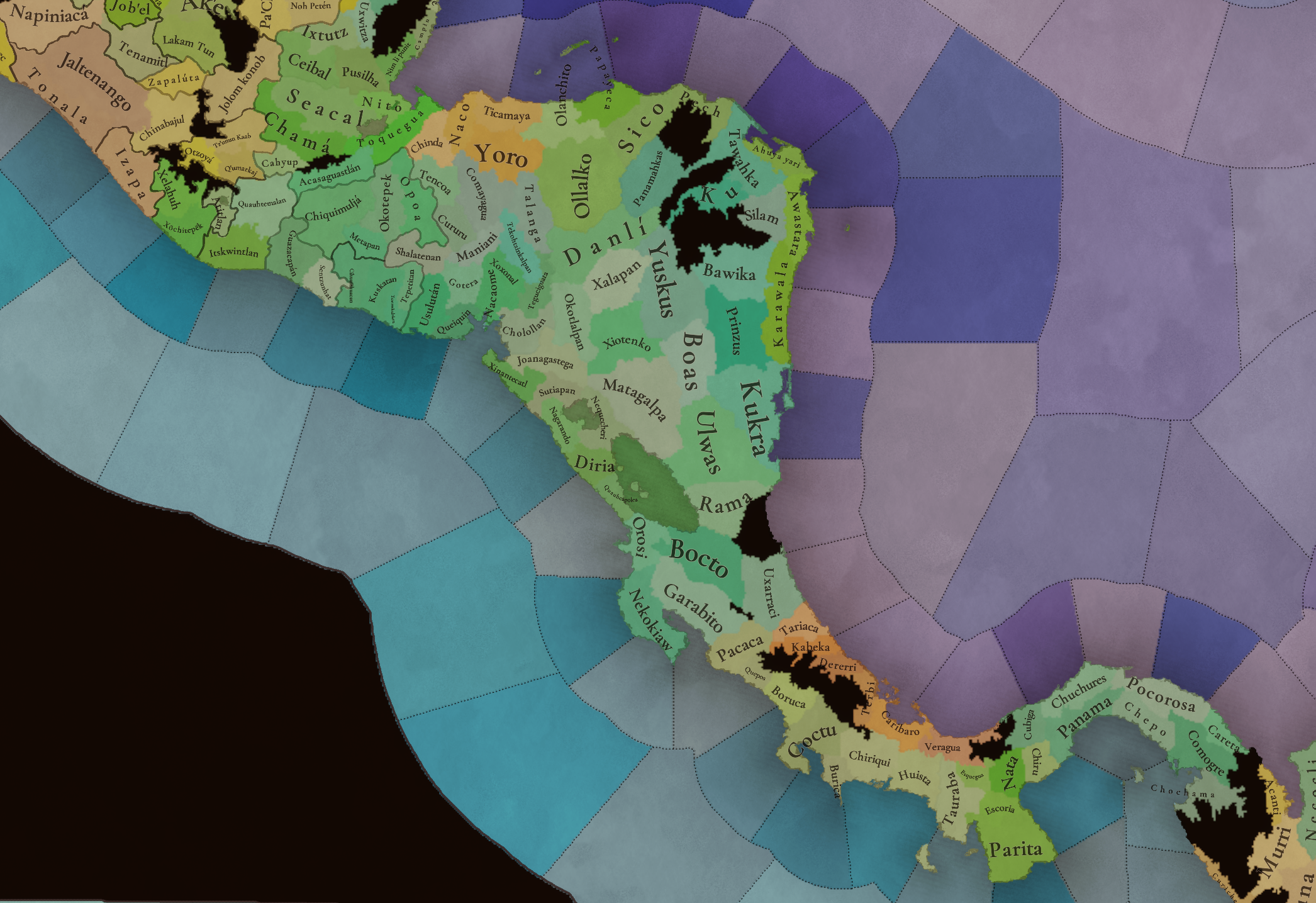
On the outskirts of the Mesoamerican polities, there are plenty of peoples organized on different ways. To the north, we have the ones that populate the area known as Aridoamerica, which were collectively termed by the Nahua as ‘Chichimeca’. We also have plenty of societies close to the Mayan lands and the Isthmus. And, finally, the Taíno people populate some of the biggest islands in the Caribbean.

Locations
Locations1.png

Locations2.png

Locations3.png

Locations4.png

Locations5.png

Locations6.png

Locations7.png

Locations8.png

Plenty of locations here! I just want no note that the Darien Gap is an impassable wasteland, which means that any army trying to cross from modern Panama and Colombia will need transport ships to be able to do it.

Provinces
Provinces1.png

Provinces2.png


Areas
Areas1.png

Areas2.png


Terrain
Climate.png

Climate2.png

Topography.png

Vegetation.png

Vegetation2.png

A very diverse region! Most of it is covered by Tropical Jungles and Forests, but Sierra Madre Occidental and Oriental make for very specific conditions in the Mexican Altiplano, which are not only visible in the Topography map but also in the climate and vegetation of the area.

Development
Development2.png

The most developed regions in Mesoamerica are the Valley of Mexico and the Mayan coastline.

Natural Harbors
Harbors.png

There are some good ports in the Caribbean, no surprise that most of them would later become important cities in the Colonial Period.

Culture
Cultures.png

Cultures2.png

Tons of cultures!

Language
Dominant Languages1.png

Dominant Languages2.png

Court Language.png

And also languages! The first two maps are the Dominant Languages per location, while the third is the Court Languages one. The dark blue language is ‘Totozoquean’, as it is not so easily readable (something we have to change).

Religions
Religions.png

This map is today in a more advanced state, as we have merged plenty of cultural religions into regional groupings. Of these, Tonalism, Nahua, and Mayan are part of the Tonalist religious groups, while the others are part of the Folk American group (a regional split of the former ‘Animist’ group). Nahua and Mayan have their different mechanics, which we’ll talk about in future Tinto Talks. Let us know what do you think of this design and any suggestions about the religious grouping!

Raw Materials
Raw Materials1.png

Raw Materials2.png

Raw Materials3.png

Raw Materials4.png

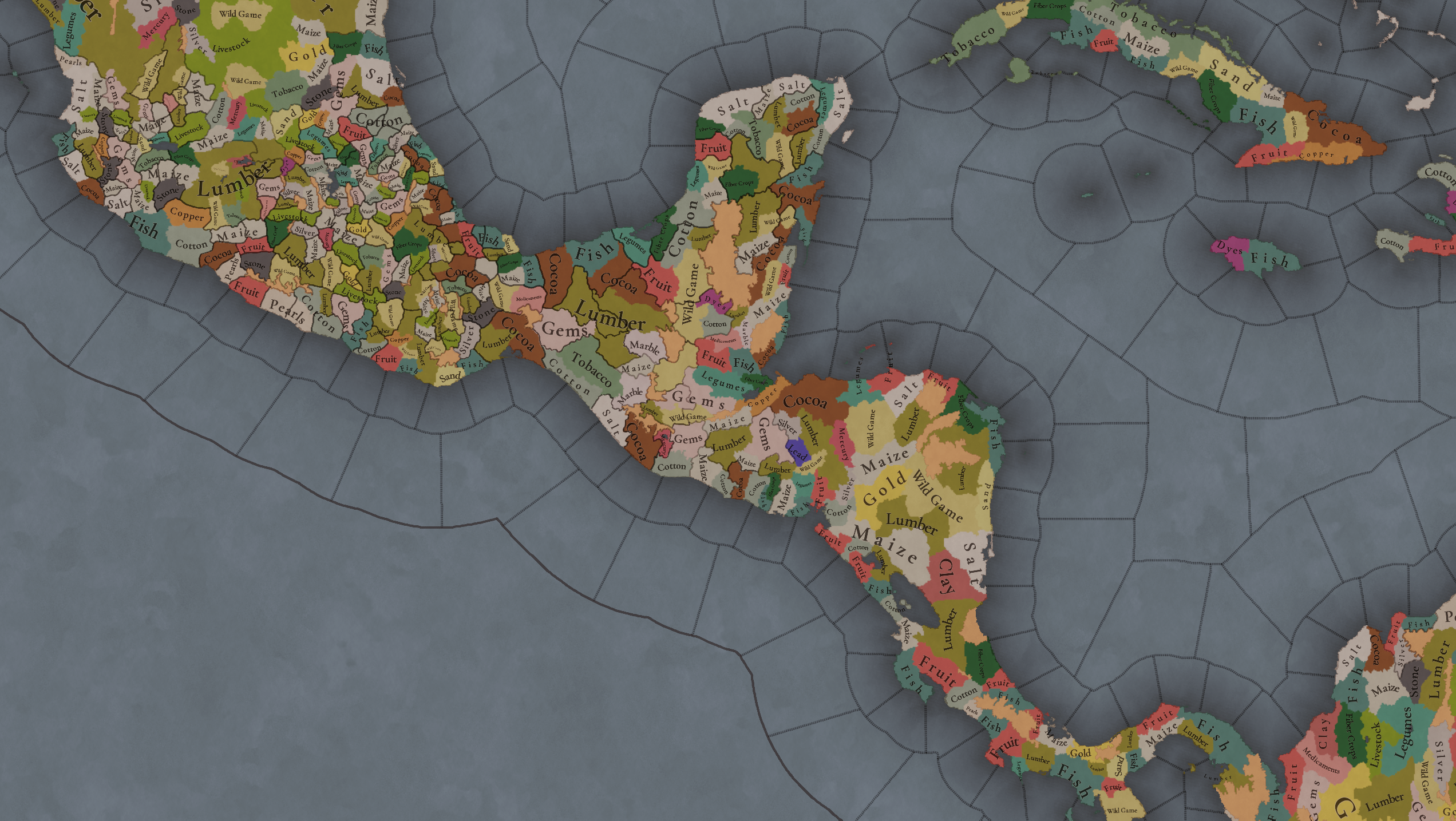
Maize is king in Mesoamerica, although there are plenty of other resources, including juicy Gold and Silver. Obsidian is not a separate resource, as it’s too regional-specific, so it’s included under the Gem coverage, but we have ways to represent it in-game; for instance, there’s a production method to produce Weaponry using Gems as an input.

Markets
Markets.png

A couple of bugs were reported while taking the screenshot of this map! But well, you can see that Azcapotzalco, Màayapáan, and Noh Petén (capital of the Itza people) are the most important ones.

Population
Population1.png

Population2.png

Population3.png

Population4.png

Population5.png

Population6.png

Population7.png

We have solved a couple of issues with the pop editor, and this week this map is in a decent state to be shown! Yay! Total numbers in the region are roughly 8.6M pops, distributed this way:
  • 523K in Aridoamerica (includes the lands to the North-West of the Purepecha Empire)
  • 6.947M in Mesoamerica (including North-Western Mayan lands)
  • 1.003M in Central America (including South-Eastern Mayan lands)
  • 151K in the Caribbean Islands

And that’s all for today! We hope you enjoyed these meaty maps! Next week we will be taking a look at the Levant Feedback, on Monday 16th, and South America, on Friday 20th! Cheers!
 
  • 117Like
  • 95Love
  • 5
  • 1
Reactions:
View attachment 1233297View attachment 1233298

Note: that value for Istanbul covers both Europe and Asian parts of it
Current İstanbul province (basically the metro area) isn't relevant at all, because back than İstanbul was what is called the historical peninsula. It is the small area below the Golden Horn mostly. The rest wasn't İstanbul back then, random villages and stuff.
 
  • 11
  • 4Like
  • 1
Reactions:
Current İstanbul province (basically the metro area) isn't relevant at all, because back than İstanbul was what is called the historical peninsula. It is the small area below the Golden Horn mostly. The rest wasn't İstanbul back then, random villages and stuff.
Yea, I know of course bruh I am Turk too , but I thought the guy meant the 5 locations as the Eu4 province of Istanbul 2700km^2 which is smaller than lake Texcoco 5400km^2 (which is half of the modern day İstanbul city borders, actually European side is divided into 5 locations now)
 
  • 2
  • 1
Reactions:
From what I understand from that same article, it says the following

“Jaragua was ruled by the cacique Bohechío (cacique) [es]. It had the largest area of the chiefdoms on the island. He had his seat at a place called Guava, near the present-day city of Léogâne, Haiti…

…The situation among the native people was that Bohechío, the brother of Anacaona, had to reside within the subchiefdom of Yáquimo.”

This seems to imply that Yáquimo was the southwestern half of what would be Jaragua/Xaragua as Léogâne, Haiti is in the southwestern part of the cacique, which leaves Zui in the northeastern half of that area.

Of course, I can’t neatly divide it but that’s what makes sense to me.
Thank you very much for that reminder! I'll see if there are more specifics written somewhere but even that much is good to work with.

After looking more info on the chiefdoms on Cuba and Jamaica, it seems like only the chiefdom(s) on eastern Cuba were as complex as the ones on Hispaniola and Puerto Rico (aka where the Taino are located on the Cultures map). Obviously you can let me know there's more info on this or if that assessment is incorrect. Does anyone know for sure which ones in Cuba are specified as complex? Looking at the map, it would appear to be the chiefdoms of Baracoa, Sagua, Maisi, and Bayaquitiri but I'd like to see that be mentioned somewhere.
 
  • 1Like
Reactions:
Are y'all aware that Hokan is a very very speculative language family that isn't really supported by modern scholarship? I get that you can't have a million language families, but Hokan is one that almost certainly isn't real.

Also worth noting that a 'Hokan' language, even if it was real, would be the same as having one 'Indo-Uralic' language across all of Europe, Iran, India and western Russia.
 
  • 2Like
  • 1
Reactions:
Hi, I'm no professional on Chibchan languages or culture but I have a significant portion of my life (about a quarter of it!) under my belt studying Muisca and generally northern andean chibchan language, culture and religion and this may or may not be the right dev diary, but it might be better to at least split ''Chibchan'' (in terms of religion and languages) into it's larger groupings; this is simply too large, like saying eg ''Indo-European'' or ''Sino-Tibetan''. These are:

Votic (Wetar, Malekú, Rama)

Isthmic (Cabécar, Guna, Boruca, Ngäbe (The spelling is Ngäbe, with an ä!))

Magdalenic (These are not all on the map, but I'd like to note them anyways) (Barí, Chimila, Nutabe, U'wa (Not Tunebo!), Muisca, Guane, Kogi, Ikʉ, Atanque, Wiwa)

It's not perfect but it'd be a bit better at least. It might also be a good idea to specifically separate Muisca religion from the other religions, as it had a pretty important doctrine that Bozica, the messenger deity, reformed the preexisting, older religion to be correct, and had some significant religious institutions such as a formal priesthood, head of faith and a temple and shrine system.
 
  • 4
  • 2Like
  • 2
Reactions:
Hi, I'm no professional on Chibchan languages or culture but I have a significant portion of my life (about a quarter of it!) under my belt studying Muisca and generally northern andean chibchan language, culture and religion and this may or may not be the right dev diary, but it might be better to at least split ''Chibchan'' (in terms of religion and languages) into it's larger groupings; this is simply too large, like saying eg ''Indo-European'' or ''Sino-Tibetan''. These are:

Votic (Wetar, Malekú, Rama)

Isthmic (Cabécar, Guna, Boruca, Ngäbe (The spelling is Ngäbe, with an ä!))

Magdalenic (These are not all on the map, but I'd like to note them anyways) (Barí, Chimila, Nutabe, U'wa (Not Tunebo!), Muisca, Guane, Kogi, Ikʉ, Atanque, Wiwa)

It's not perfect but it'd be a bit better at least. It might also be a good idea to specifically separate Muisca religion from the other religions, as it had a pretty important doctrine that Bozica, the messenger deity, reformed the preexisting, older religion to be correct, and had some significant religious institutions such as a formal priesthood, head of faith and a temple and shrine system.
I'm starting to think once this game comes out we'll need to get some linguists together to make a 'Realistic Languages' mod...
 
  • 1Like
Reactions:
Regarding the population estimates - maybe it would be reasonable to have a game rule setting, “low new world population estimate”, “medium new world population estimates”, “high new world population estimate”? I don’t know how much playtesting work this creates, but it makes the game a bit more robust to future research - if some new method comes out in five years that tells us that one of the more extreme (high or low) estimates is likely right, the game can have that already in place, rather than just looking out of date.

(I suppose it’s possible that higher early estimates should also mean higher fatality rates from the diseases that spread - not sure if that is flexible in the engine or if it breaks other disease actions in other places and times.)
Strong no to this. Game rules are bad for the overall health and balance of the game in normal cases but this would create a ludicrous delta in how any changes to the Americas or colonisation or Asia or any number of other game systems would impact gameplay from player to player or patch to patch

And the case you give where the set of options is resolved into one or another would cause a pointless wave of outrage that I personally don't want to experience
 
  • 8
  • 1
Reactions:
I'm starting to think once this game comes out we'll need to get some linguists together to make a 'Realistic Languages' mod...
Such a mod, taken literally, would have a very large amount of languages and would probably be bad for gameplay to be honest. I do of course agree with splitting most of the languages here besides Nahuatl, Tai-Arawakan and Purepecha.
 
  • 6
  • 1Like
  • 1
Reactions:
And also languages! The first two maps are the Dominant Languages per location, while the third is the Court Languages one. The dark blue language is ‘Totozoquean’, as it is not so easily readable (something we have to change).
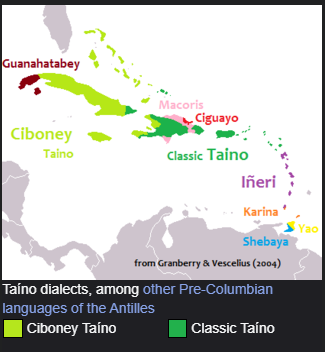
Do you think it's possible to change Ta-Arawakan to a name less synthetic? the name is a classification for a family of language, according to Wikipedia:

"They are distinguished by the first person pronominal prefix ta-, as opposed to common Arawakan na-"

Kalinago, which is part of the Ta-Arawakan family is presented as its own language.

1734654398842.png

Probably we could replace Ta-Arawakan with Taíno which already occupies most of the current Ta-Arawakan range on the current map.
1734654524881.png

1734654567709.png


If we can't call it taino because that is already the name of the culture, we could call it Tainonaiki, sure, that is the name given to the modern reconstruction of the language but it's a compromise I would be willing to accept and a lot better sounding and dare i say appropriate than Ta-Arawakan.
 
  • 7Like
  • 2
Reactions:
Updated my location suggestion. Feedback and constructive criticism welcome.

View attachment 1233534
(list under construction. please bear with me)

Capital R stands for rump location - these keep the names of the original location they were formed on top of. For example, both of the westernmost Rs should be called Tonala.

When you see a slash between two names for a location, that's the prehispanic versus colonial name.

Yes, I skipped a few letters without realizing, sorry.


Is this level of location density absolutely necessary? Of course not. This is a collection of potential locations that the devs can use to adjust the density of the region to what they feel is appropriate. I made a note of some of the most important ones (Mixco, Chinautla, Coban, Hocaba, Uxmal, Saklamakhal, Yalain, Belize). I also do feel that Chiapas, Tabasco, Peten and to a lesser extent Yucatan deserve more density, in order to make the transition from a high density region (Central Mexico) to presumably lower density regions down south a bit more smooth.
 
  • 5Like
  • 3Love
  • 3
  • 1
Reactions:
Kalinago, which is part of the Ta-Arawakan family is presented as its own language.
Ooh, this is a really good catch. The devs forgot that "Island Caribs" spoke an Arawakan language, as the Carib conquerors or immigrants were probably only a small minority among the Arawakan Iñeri people, and ended up adopting their language. Actually, the Lesser Antilles should possibly still be majority Iñeri, though I'm not too sure of the exact timing of the Carib migration.
 
  • 5
  • 2Like
Reactions:
Natural Harbors
View attachment 1230256
There are some good ports in the Caribbean, no surprise that most of them would later become important cities in the Colonial Period.
Do you think we can bump up the value of Marien Natural Harbor? I believed it complies with the defintion of "#100 - Closed Very Defensible Estuary - Ferrol"

1734699993070.png

It was deemed important enough that the French built 4 forts around it according to wikipedia:

Fort-Liberté is a natural harbour of the Saint-Domingue. It is strategically located in the centre of the bay facing the Atlantic Ocean. It was used as a naval base by the French, with four forts that "guarded the bay like beads on a string."

Also citing Wikipedia

Fresh water resource

Marion River empties into the bay about 1 mile (1.6 km) to the west of the Fort-Liberté and is the source of water supply to the town.

So do you think its possible to increase its level?
 
  • 1
  • 1Like
Reactions:
I'm working on a longer suggestion as to overhaul the Mesoamerican cultural setup, but as someone with a linguistics background I thought I'd go for the more obvious issues with the linguistic setup first.

Firstly - your "languages" are far, far too broad - the only ones I'd say that should be kept as a single language in the region are Nahua and Purépecha. I understand why this has been done - it's a lot of work to source names for languages that are poorly-attested and probably won't see much play - but this gives the whole region a level of homogeneity that actually hinders the simulationist aspects of gameplay, and the languages of Mesoamerica are some of the best-attested on the entire continent, given the effort of Spanish missionaries to understand them and the fact that most of them are still actively spoken.

I'll try to order my issues from most important to most nitpicky.

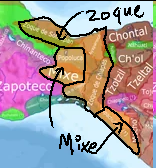
First of all - your Totozoquean language is just a monstrosity. Not only is the hypothetical Totozoquean family still a hotly debated and recent proposal amongst linguists, but the language doesn't even represent the proposed family accurately. It is universally uncontroversial that the Zapotec and Mixtec subfamilies (Ñuu Savi here) are both Oto-Manguean, and fairly typical examples of it. Itook is a language isolate, and frankly an extremely minor one - they exclusively lived on sand spits on the southern coast of the region you have them in - their locations should mostly be Zapotec-speaking, with Mixe inland and Zoque and Nahua to the south-east. Beyond that, grouping Totonac with Mixe-Zoque was first proposed in 2011, and any split would have to happen before the split between Mixe and Zoque, which itself is likely to have occurred before the Olmec period (The Olmecs are thought to be speakers of a Zoquean language) - i.e. the split is likely to be nearly 3000 years old at a minimum by this point. There's 0 chance of any mutual intelligibility between Totonac and Mixe-Zoque here. Setting aside Zapotec and Mixtec in Otomanguean here, I would split Totozoquean into Totonac, Mixe, and Zoque. The Mixe and probably Olutec cultures should be added too - they're glaring omissions from the region.
Here's a map of the area they should cover - Zoque and Texistepecan are Zoquean, and Mixe, Olutec, Sayultec, and likely Tapachultec are Mixean. Again, linguistic evidence suggests these two subgroups split in the pre-Olmec period. I would also include Zoque minorities throughout the Nahua areas of the southern Veracruz region.
1734700000131.png


And here's a graphic based on another reconstruction. It's a little blurry, so I've annotated it.

1734700407612.png

Other sources include a larger Nahua presence in the coastal parts of the isthmus. (Mije is Mixe and Soke is Zoque, if that wasn't obvious.) All sources put the Mixe-Zoque border with Mayan languages significantly further east than you do, though. Also note the very small and coastal region inhabited by Huave/Wavi/Itook-speakers - Tehuantepec was a Zapotec city!
1734700445162.png


Next post I'll focus on the Oto-Manguean setup you have, which also needs a lot of work.
 
Last edited:
  • 4Like
  • 3
  • 2
Reactions:
As for Oto-manguean:

As stated before, Mixtec and Zapotec are very much part of this family, and have no relation to Totonac or Mixe-Zoque.

Oto-manguean is a very old and broad language family, dating back to at least 2000 BC, with several splits occurring very early on. Even smaller subfamilies like the Chinantecan contain dozens of mutually unintelligible languages. Representing that level of granularity is both impossible and undesirable, but I think breaking it down into 4-6 languages is both doable and desirable.

I'd break in down like this:

Oto-Pamean

Currently the Otomi culture is represented as a nondescript Otomanguean culture along with, mildly inexplicably, what is supposed to be Amuzgo. This is kind of like making any Indo-European culture that was made up of just Germans and Albanians - I'll charitably assume this is a relic of an older setup. Nevertheless, the Otomies were one of the most important peoples in this period, making up important parts of both the Aztec and Purepecha empires, and would settle widely across central Mesoamerica. They very much deserve their own culture. So do the Mazahua, a hunter-gatherer people of the highlands between the Toluca valley and Michoacan - they'd make a good SoP here. Also included in this language should be the Pame (Xi'oi) and the Matlazinca, as well as perhaps the Chinantecs of north-east Oaxaca (who are currently represented inexplicably as Mixtecs).

Manguean

The Manguean languages are a small family found in Central America, far from the Otomanguean homeland of central Mexico. I'd keep them separate, but as this family is extinct and may have only recently migrated south-east you could also group them with the Me'phaa.

Tlapanecan

These are the Me'phaa, speakers of a divergent branch related to Manguean. I'd keep them separate due to their long isolation from Manguean-speakers.

Now we get to the Otomanguean languages of Oaxaca, a fantastically diverse region that's pretty poorly-represented presently.
Here's a few maps to start us off:

1734705356605.png

1734705395652.jpeg

1734705907509.png

The two main groups are the Mixtecs and Zapotecs, which is predominantly an West-East split, with smaller groups on the coasts and in the highlands to the north. However, the current split seems to lump in all the smaller groups with the Mixtecs - even the ones linguistically closer to Zapotecs - whilst not representing the large Zapotec presence in coastal Oaxaca.

Zapotecan

The Zapotecan languages had split from the Mixtecan languages by the time of the dominance of Monte Alban - i.e. between 100 BC and 200 AD. They would be unintelligible from each other by this time, and also had distinct cultural identities. You could also add the Chatino culture to southwestern Oaxaca - a group that spoke a distinct but related variety and had a separate cultural identity. Additionally, the various small Popoloca groups and Mazatecs of Northern Oaxaca spoke dialects closer to Zapotec than Mixtec. I would add both a Popoloca and Mazatec culture, and make them Zapotec-speaking, rather than grouping them as Mixtecs.

Mixtecan

This should essentially be what's left of the big Ñuu Savi blob. As I assume the single Otomanguean location between them and the Me'phaa represents the Amuzgo, I'd add that culture and make them Mixtecan-speaking, as their language is closely related to the Mixtecan family.


Additionally I'd add a Pochutec culture for the Nahua-speaking city in Southern Oaxaca - I've got proposals for splitting the Nahua culture I'll elaborate on later but this one seems obvious. They had a distinct identity and never seem to have come under Aztec dominion, much like the Tlaxcaltecs and Pipil that have their own culture.

Next I think I'll handle the setup of the Uto-Aztecan family - whilst Nahua should remain its own language that "Yutonahua" language really has to go!
 
  • 5Like
  • 2
  • 2
Reactions:
As for Oto-manguean:

As stated before, Mixtec and Zapotec are very much part of this family, and have no relation to Totonac or Mixe-Zoque.

Oto-manguean is a very old and broad language family, dating back to at least 2000 BC, with several splits occurring very early on. Even smaller subfamilies like the Chinantecan contain dozens of mutually unintelligible languages. Representing that level of granularity is both impossible and undesirable, but I think breaking it down into 4-6 languages is both doable and desirable.

I'd break in down like this:

Oto-Pamean

Currently the Otomi culture is represented as a nondescript Otomanguean culture along with, mildly inexplicably, what is supposed to be Amuzgo. This is kind of like making any Indo-European culture that was made up of just Germans and Albanians - I'll charitably assume this is a relic of an older setup. Nevertheless, the Otomies were one of the most important peoples in this period, making up important parts of both the Aztec and Purepecha empires, and would settle widely across central Mesoamerica. They very much deserve their own culture. So do the Mazahua, a hunter-gatherer people of the highlands between the Toluca valley and Michoacan - they'd make a good SoP here. Also included in this language should be the Pame (Xi'oi) and the Matlazinca, as well as perhaps the Chinantecs of north-east Oaxaca (who are currently represented inexplicably as Mixtecs).

Manguean

The Manguean languages are a small family found in Central America, far from the Otomanguean homeland of central Mexico. I'd keep them separate, but as this family is extinct and may have only recently migrated south-east you could also group them with the Me'phaa.

Tlapanecan

These are the Me'phaa, speakers of a divergent branch related to Manguean. I'd keep them separate due to their long isolation from Manguean-speakers.

Now we get to the Otomanguean languages of Oaxaca, a fantastically diverse region that's pretty poorly-represented presently.
Here's a few maps to start us off:

View attachment 1233697
View attachment 1233698
View attachment 1233706
The two main groups are the Mixtecs and Zapotecs, which is predominantly an West-East split, with smaller groups on the coasts and in the highlands to the north. However, the current split seems to lump in all the smaller groups with the Mixtecs - even the ones linguistically closer to Zapotecs - whilst not representing the large Zapotec presence in coastal Oaxaca.

Zapotecan

The Zapotecan languages had split from the Mixtecan languages by the time of the dominance of Monte Alban - i.e. between 100 BC and 200 AD. They would be unintelligible from each other by this time, and also had distinct cultural identities. You could also add the Chatino culture to southwestern Oaxaca - a group that spoke a distinct but related variety and had a separate cultural identity. Additionally, the various small Popoloca groups and Mazatecs of Northern Oaxaca spoke dialects closer to Zapotec than Mixtec. I would add both a Popoloca and Mazatec culture, and make them Zapotec-speaking, rather than grouping them as Mixtecs.

Mixtecan

This should essentially be what's left of the big Ñuu Savi blob. As I assume the single Otomanguean location between them and the Me'phaa represents the Amuzgo, I'd add that culture and make them Mixtecan-speaking, as their language is closely related to the Mixtecan family.


Additionally I'd add a Pochutec culture for the Nahua-speaking city in Southern Oaxaca - I've got proposals for splitting the Nahua culture I'll elaborate on later but this one seems obvious. They had a distinct identity and never seem to have come under Aztec dominion, much like the Tlaxcaltecs and Pipil that have their own culture.

Next I think I'll handle the setup of the Uto-Aztecan family - whilst Nahua should remain its own language that "Yutonahua" language really has to go!
Another thing - be careful of the word "Popoloca"/"Popoluca" - it's a broad term used by Nahua-speakers that means "babbling", used similarly to how the Greeks used "barbarian". It was and is used to refer to a variety of unrelated non-Nahua groups. In Oaxaca and Pueblo it refers to several small groups closely related to the Mazatec. It's also used to refer to speakers of both Mixean and Zoquean languages in southern Veracruz.
 
  • 2
  • 1Like
Reactions:
Does anybody else think there should be more impassable mountain ranges in Mexico? The Huasteca region has none, the Oaxaca-Veracruz border could use more, the Sierra Madre Oriental barely exists. Obviously not advocating for giant swathes of wasteland like the current Brazil fiasco but just some more strategic barriers.
 
  • 3
  • 2Like
Reactions:
Another thing - be careful of the word "Popoloca"/"Popoluca" - it's a broad term used by Nahua-speakers that means "babbling", used similarly to how the Greeks used "barbarian". It was and is used to refer to a variety of unrelated non-Nahua groups. In Oaxaca and Pueblo it refers to several small groups closely related to the Mazatec. It's also used to refer to speakers of both Mixean and Zoquean languages in southern Veracruz.
same with Chontal, it means "foreigner/stranger". Some sites will describe the "Chontal Maya of coastal Oaxaca" - not realizing the Chontal of Tabasco and Chontal of Oaxaca are totally unrelated. Not to mention the extinct group in Guerrero or its use in Nicaragua.
 
Last edited:
  • 1
  • 1Like
Reactions:
Does anybody else think there should be more impassable mountain ranges in Mexico? The Huasteca region has none, the Oaxaca-Veracruz border could use more, the Sierra Madre Oriental barely exists. Obviously not advocating for giant swathes of wasteland like the current Brazil fiasco but just some more strategic barriers.
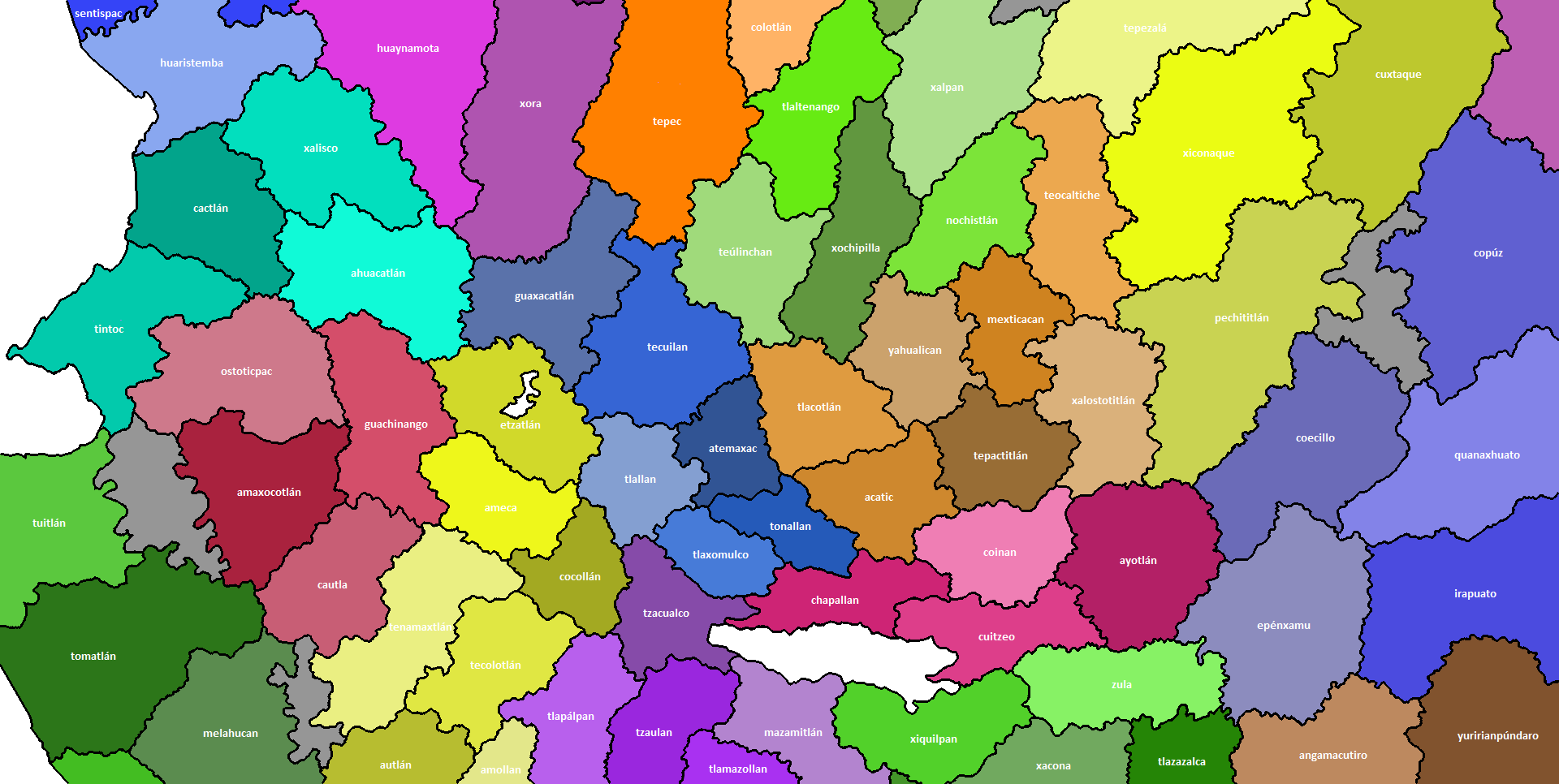
Definitively there are some sierras to add and move to their right area. For example I am working on a more detailed suggestion so I think this is a chance to show some advances.
TONALA sites.png
TONALA locations.png
Here the Comanja Sierra (to the east) have a proper shape, added Sierra El Cuale between Tuitlán (El Tuito) and Amaxocotlán (Mascota), the Sierra de Cacoma on its right place between Melahuacan (Purificación) and Tenamaxtlán, to the south should be the Sierra de Manantlán between Amollan and Cuzalapa. At the north we can see the southern tip of the Sierra Fría to the next to Xalpan (Jalpa) and west to Tepezalá.
Also the lake of Magdalena-Etzatlán.

  • Castro-Gutiérrez, F. 2006. La colonización del pasado: Pénjamo y la memoria del poblamiento de las fronteras novohispanas. Fronteras de la Historia. n.º 11. pp. 121-151.
  • Diguet, L. 2013. Por las tierras occidentales: entre sierras y barrancas. Centro de estudios mexicanos y centroamericanos.
  • Enriquez-Valencia, R. 2018. Fronteras imaginarias y representación de la alteridad en la conquista y evangelización del Gran Nayar. Oficio. Revista de historia e interdisciplina. n.°6. pp. 55-74.
  • García-Ayala, G. 2018. El lago Magdalena-Etzatlán: Un análisis del paisaje a través del tiempo. Universidad Nacional Autónoma de México.
  • Gerhard, P. 1986. Geografía Histórica de la Nueva España, 1519-1821. Universidad Autónoma de México.
  • Gerhard, P. 1996. La frontera norte de la Nueva España. Universidad Autónoma de México.
  • Goyas-Mejía, R. 2011. Pueblos indios y propiedades en la alcaldía mayor de La Barca durante el virreinato. LiminaR, Estudios Sociales y Humanísticos. vol. IX. n.°2. pp. 165-180.
  • Goyas-Mejía, R. 2013. Asentamientos y pueblos indios desaparecidos en Los Altos de Jalisco durante el virreinato. Signos Históricos. n.°30. pp. 32-63.
  • Goyas-Mejía, R. 2017. Selvas yermas. Los pueblos de indios desaparecidos en la costa sur de la Nueva Galicia durante el periodo colonial. Revista de Historia Regional y Local. vol. 9. n°17. pp. 407-440.
  • Goyas-Mejia, R. 2023. Conquista y desaparición de los indígenas coanos en la Nueva Galicia. Revista de historia de América. n°2. pp. 2-28.
  • Jaramillo-Arango, A., Cossich-Vielman, M. and Navarrete-Linares. 2021. Un mapa de la conquista de la Nueva España: El ‘Lienzo de Tlaxcala’, Glocalism. Journal of Culture, Politics and Innovation.
  • Martín-Ruiz, J. 2010. Irapuato. Colección Monografías Municipales de Guanajuato. Guanajuato, Gobierno del estado.
  • Martínez, R., and Valdez, I. 2009. Guerra, conquista y técnicas de combate entre los antiguos Tarascos. Tzintzun, Revista de estudios históricos. n.º 49. pp. 17-52.
  • Medina-Arandas, H. 2020. Tras la pista de los Wixaritari: Los pueblos indígenas de la Sierra Madre Occidental en las crónicas tempranas (S. XVI-XVII). Revista Euroamericana de Antropología. n°9. pp. 45-60.
  • Meyer, J. 1997. Breve historia de Nayarit. El Colegio de México.
  • Mota-Padilla, M. Á. 1742. Historia de la conquista de la provincia de la Nueva Galicia. (Edición 1870. Imp. de Gobierno).
  • Nicolás-Caretta, M. 2012. Asentamientos caxcanes en el Cañón de Juchipila y el primer intento del camino Real de Guadalajara a Zacatecas. Relaciones. n°130. pp. 66-90.
  • Pulido- Méndez, S. 2002. Etnias, lenguas y lugares en el Estado tarasco. Una revisión sobre los habitantes y sus idiomas en el Michoacán prehispánico a partir de la lectura de las Relaciones geográficas del siglo XVI. Estudios Mesoamericanos. n°3. pp. 23-33.
  • Rodriguez-Palma, B. and Gerardo-Santos, L. 2019. Bartolomé Rodríguez Palma, un clérigo minero portugués en Nueva Galicia, 1676-1698. Historia y Grafía, Universidad Iberoamericana. n°52. pp. 159-186.
  • Salinas-Ramos, M. S. 2014. El Camino Real de Tierra Adentro y la colonización en la jurisdicción de las villas de San Miguel y San Felipe en el siglo XVI. Legajos. n.°3. pp. 45-71.
  • Téllez-Lozano, V. M., Miranda-García, C. M., and Fregoso-García, V. M. 2019. La construcción de paisajes políticos en la Pintura del Nuevo Reino de Galicia. Letras históricas. n.°20. pp. 239-296.
  • Weigand, P. C., García de Weigand, A. 1997.Un legado prehispánico del municipio de Magdalena. Estudios Jaliscienses n.° 29. pp. 5-15.
  • Wright-Carr, D.C., and Vega-Macías, D. 2014. Los pueblos originarios del estado de Guanajuato. Pearson Educación. Universidad de Guanajuato.
 
  • 3Like
  • 2Love
  • 2
Reactions: