The one thing I dislike about having on map holdings is that every county will have a fixed max number of holdings, being impossible to increase them.
I love turning my tribal two max holdings capital into a seven holdings megalopolis through the course of a game in CK2.
Hopefully the map will as granular as Imperator Rome then.
It seems you're in luck then, in Imperator there are 16 territories in Wales, but in the screenshot I counted ~30 "provinces" (holdings) there.
So CK3's map seems to be even more granular than Imperator's.
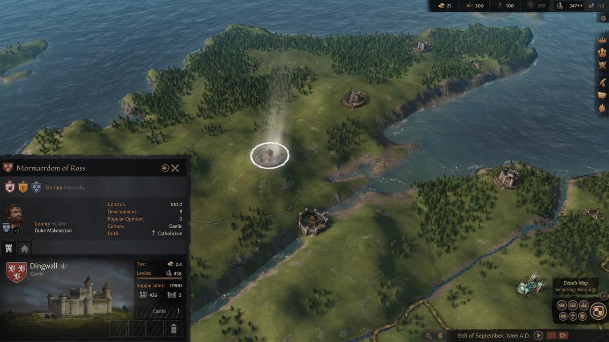
So I would see it as the base provinces on the map are barony level. The selection in this screenshot is a county, composed of two baronies. A castle and a city, and those two tabs below the character portrait are to switch to the respective baronies in the county.
This makes a lot more sense to me, I was in some serious doubt, thinking "how could each 'province' be a holding, with the selected 'province' having multiple holdings?", but seeing your post, it seems to be correct, the selected holding shows in the county window.
Even going into CK2 to check the county of Ross, it is precisely where those borders indicate as you pointed out, with exactly two holdings (difference being that one of them is a bishopric, not a city, though I doubt the house symbol would be a temple).
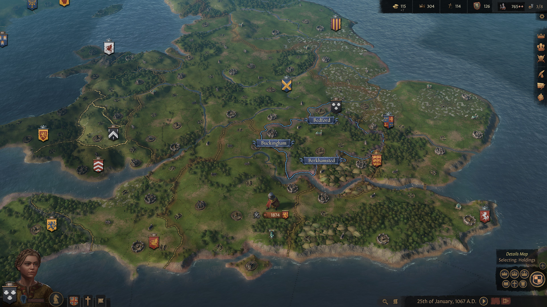
London seems to be the city right under the castle that's besides the English banner, which should be Westminster. Those two, together with the bishopric below the word "Berkhamsted" and what seems to be one or two empty holdings, should to be the county of Middlesex.
From the current setup in CK2, it seems that only the barony of Tottenham is missing.
Constantinople could be dealt in a few ways.
As the map is more granular, the holding of Constantinople itself (should be a city instead of a castle, with a special upgrade that represents the Theodosian walls, giving it very high defensiveness) should be located only where the golden horn is, perhaps tightly packed with the bishopric of Constantinople, but surrounded by the many cities that compose the county of Constantinople to encompass roughly the same area as the county does in CK2.
You can even see the blue borders and names. You can see the names of only three of all the holdings on the map inside the county. Why? Well I guess because those are the three fortresess or castles, and the other ones are towns and parishes (or churches) I suppose, whose names don't show up maybe? But yeah, thats the county. The country is a bunch of on-map provinces, or holdings, that are now the baronies, towns and churches.
It seems to me like the blue lines are the realm of the player character, with the banner resting on top of the capital (making her, in this case, the countess of Bedford).
The character seems to own three counties (as we can see with the double lines), and the names appear in the county capitals, the castles.
The harder lines seems to indicate the realm of direct vassals of the ruler (in this case, the King of England) with their respective banners, and an even harder external border, as we can see in Wales.
Though it's strange how England seems to own more chunks of Wales than it did in 1066 in CK2, and even more strange how there isn't a banner for the vassal who owns the central part of Wales.


 )
)