• We have updated our Community Code of Conduct. Please read through the new rules for the forum that are an integral part of Paradox Interactive’s User Agreement.

Tinto Maps #9 - 5th of July 2024 - Carpathia and the Balkans

Greetings, and welcome to another Tinto Maps! This week we will be taking a look at Carpathia and the Balkans! It will most likely be an interesting region to take a look at, with a lot of passion involved… So I’ll just make an initial friendly reminder to keep a civil discussion, as in the latest Tinto Maps, as that’s the easiest way for us to read and gather your feedback, and improve the region in a future iteration. And now, let’s start with the maps!

Countries:
Countries.png

Carpathia and the Balkans start in a very interesting situation. The Kingdom of Hungary probably stands as the most powerful country in 1337, but that only happened after the recovery of the royal power enforced by Charles I Robert of the House of Anjou, who reined in the powerful Hungarian nobility. To the south, the power that is on the rise is the Kingdom of Serbia, ruled by Stefan Uroš IV Dušan, who has set his eyes on his neighbors to expand his power. The Byzantine Empire, meanwhile, is in a difficult position, as internal struggles ended in Andronikos III being crowned sole emperor, at the cost of dividing the realm; both Serbia and Bulgaria have in the past pressed over the bordering lands, while the Ottomans have very recently conquered Nicomedia. The control over the Southern Balkans is also very fractioned, with a branch of the Anjou ruling over Albania, the Despotate of Epirus under the nominal rule of Byzantium as a vassal, Athens, Neopatria and Salona as vassals of the Aragonese Kings of Sicily, Anjou protectorates over Achaia and Naxos, and only nominal Byzantine control over Southern Morea. It’s also noticeable the presence of the Republics of Venice and Genoa, which control several outposts over the Adriatic and Aegean Seas. A final note: in previous maps, Moldavia was shown in the map, but we’ve removed it from it, and it will most likely spawn through a chain of events in the 1340s.

Dynasties:
Dynasties.png

The House of Anjou rules over Naples, Hungary, Albania, Achaia, and Cephalonia; they’re truly invested in their push for supremacy over the region. Apart from that, each country is ruled by different dynasties, except for Athens and Neopatria, ruled by the House of Aragón-Barcelona.

Locations:
Locations 1.png

Locations 2.png

Locations 3.png

Locations 4.png
This week we’re posting the general map of the region, along with some more detailed maps, that can be seen if you click on the spoiler button. A starting comment is that the location density of Hungary is noticeably not very high; the reason is that it was one of the first European maps that we made, and we based it upon the historical counties. Therefore, I’m already saying in advance that this will be an area that we want to give more density when we do the review of the region; any help regarding that is welcome. Apart from that, you may notice on the more detailed maps that Crete appears in one, while not being present in the previous one; because of the zooming, the island will appear next week along with Cyprus, but I wanted to make an early sneak peek of the locations, given that is possible with this closer zoom level. Apart from that, I’m also saying in advance that we will make an important review of the Aegean Islands, so do not take them as a reference for anything, please.

Provinces:
Provinces.png

Provinces! Nothing outstanding to be commented on here; as usual, we’re open to any feedback regarding them.

Terrain:
Climate.png

Topography.png

Vegetation.png

Terrain! The climate of the region is mostly divided between Continental and Mediterranean, with some warmer and some colder regions. Regarding the topography, the Carpathian mountains are famously important and strategic, while the Balkans are a quite hilly and mountainous region, which is also greatly covered by woods and forests.

Cultures:
Cultures.png

Here comes the fun part of the DD: The cultural division of the Balkans! A few comments:
  1. Hungary is full of different minorities. Transylvania, especially, is an interesting place: there we have a mix of ‘Hungarians’, ‘Transylvanians’ (which are the Romanian-speaking inhabitants of the region), ‘Transylvanian Germans’, and ‘Szekely’ people.
  2. We have divided the Southern Slavic-speaking region into their dialectal families of Slovene, Croatian, Bosnian, and Serbian.
  3. The Southern Balkans are mostly divided among Bulgarian, Albanian, and Greek cultures.
  4. We’re also portraying plenty of other cultures, such as Dalmatians, Aromanians, Sclavenes, Arvanites, Cumans, Jasz, or Ashkenazi and Romanyoti Jews.

Religions:
Religion.png

This one is also interesting. Apart from the divide between Western Catholicism and Eastern Orthodoxy, we have the Krstjani in Bosnia, Bogomils (the pink stripes both in Bosnia and Macedonia), and Paulicians in Thrace. The Jewish populations do not pass the threshold percentage to appear on the map, but there are plenty of communities across the region.

Raw Materials:
Raw Materials.png

The materials of the region. Something very noticeable is the richness of minerals, with plenty of Iron, Copper, Tin, Lead, Gold, and Silver. Specifically, Slovakia is very rich, and you definitely want more settlers to migrate to the region, and exploit its resources. The region is also very rich in agricultural resources, as you can see.

Markets:
Markets.png

The region is mostly divided among four markets: Venice, Pest, Ragusa and Constantinople.

Country and Location population:
Population 1.png

Population 2.png

Population 3.png

Population 4.png
Country and location population (which I’ve also sub-divided, and is under the Spoiler button).

And that’s all of today! I hope that you find the region interesting; we certainly think that it is. Next week we will go further south, and we will take a look at the Syrian Levant and Egypt. Cheers!
 
  • 193Like
  • 69Love
  • 7
  • 4
  • 3
  • 1Haha
Reactions:
Rusyn culture was propagated by the Habsburgs to undermine Russian and Ukrainian nationalisms, and Transylvanian is an eyesore too
No, if someone was promoted by the Habsburgs it was the Ukrainian national movement. Russophiles were closely kept in sight and repressed after the outbreak of WW1 (e.g. Thalerhof). Rusyns were not very organized at that time and mot very nationally conscious and declared only one country-like territory after WW1 (Florynka Republic). To be fair they just kept using original "ethnonym" for the East Slavs - the Rusyns or Ruthenians, as the nationalism didn't reach them; it is nothing new in this name, while names "Russians", "Ukrainians" and "Belorussians" in the ethnic meaning are products of 19th century national movements. I'm not a fan of the division of East Slavs, but it cannot be potrayed in another way, as it would surely spark many shitty conflicts.

Yeah, if the Moldovan/Bessarabian Vlachs are counted as Wallachians, then the Transylvanians should also be counted as such.
 
  • 7
  • 1Haha
  • 1
Reactions:
To be honest, we aren't completely happy with the concept either, as we have four different cultures for the 'Germans of the East': Baltic German, Silesian German, Carpathian German, and Transylvanian German. But we think that it's the 'less bad' solution to portray the cultural melting pot that these places were for the different German settlers.
For Carpathian germans I would suggest: Zipser
A wiki article:

And for the Transylvanian ones: Siebenbürger
 
  • 7Like
  • 2
  • 2
  • 1Love
  • 1
Reactions:
this doesnt match some ancient descriptions of the region . if the Huns and magyars loved that plateau it was because it was to them like the great steppes south of Russia and kazakhstan .
if it was a true swampfest no nomadic tribe would ever care about it yet this region + south Russia and ukraine are the 3 regions most preffered by nomads for having enough flat lands for their horse cultures
That's why you sometimes have to challenge your assumptions based on current circumstances. The existence of marshlands in Hungary is beyond doubt since we have the records of the mentioned engineering projects not to mention the visible remains left by them such as the cut-off river segments or the topographical names that still reference marshes where there aren't any.
The ancient Hungarians came to the Carpathian because they were fleeing the Pechenegs; what they wanted foremost was a defensible location, which it was and which the completely open plains weren't. After they arrived here they were already following a semi-settled lifestyle, which turned into fully settled fairly quickly.
 
  • 2Like
  • 2
Reactions:
@Pavía , will we have autonomously administered regions represented in this game?

The whole concept came to my mind reading the subject/Hungarian-Transylvania debate, but I think we would make use of it in many more cases.

In my perception, Transylvania was clearly not a vassal of Hungary, as its ruler the Voivode was neither a hereditary nor a locally elected lord, but appointed by the king - like a governor. However, we also can’t say that the region was a fully integral part of Hungary, not the same as for example Pest county.

For such states, I recommend the introduction of some kind of autonomy. I guess in the moment it’s just low control, but I think there could be a decision to make an autonomous area out of some locations/provinces thus making the low control permanent. It could have a permanent negative control gain modifier or a control cap, in hand with some other related maluses. It would of course make some positive effects as well. To revoke it, you would have to push it through the local estates, otherwise count with some unrest, rebellions.

I think this system could be made great use of by any country in the later, “enlightened” phase of the game, as well as the scripted feudal-type autonomies and freedoms in the early phase. I don’t know the English-Welsh history, but I know there was also a thread/debate regarding that, and maybe it could be used for that and later even for the UK or French appanages to list some historic examples.
 
Last edited:
  • 5Like
  • 2
  • 1Love
  • 1
Reactions:
Regarding the location of Cuhea in the north of Transylvania, a much more fitting name and representing settlement would be Sighet. Cuhea was a very small village (also called Bogdan Voda) which I think was chosen as it was one of the possessions of Bogdan Voda, one of the lords which would later cross the Carpathians and according to the legend establish Moldova (or at least a very early form of Moldova). After this, the village becomes kind of forgotten to history and is not mentioned at all until later centuries.

Sighet on the other hand would, over the span of the game period, become the main urban center of the area, is first attested in official documents in 1326 and is officially recognized as a city in 1352. In 1334, papal lists mention a "Benedict, parish of Sighet" and in 1346, Benedict is mentioned as "rector eclesie Zygeth". From the middle of the 14th century, Sighet became a flourishing center, along with the urban development and the intensification of crafts and trade. There is still important documentary evidence of the city's guilds, especially of shoemakers from the 17th - 19th centuries. A statistic from 1700 showed that there were 14 guilds in Sighet. The continuous development of the city leads to the granting of important privileges and in 1611, Prince C. Bathory strengthened the privileges of Sighet, and in 1659, Emperor Leopold I granted the city the right to a coat of arms, the head of the aurochs; it is gradually mentioned by Miron Costin (a very important early Moldovan chronicler) who states that Sighet, the capital of Maramureş (Maramaros), has as its coat of arms the head of the aurochs, as the coat of arms of Moldova. The similarity comes from the fact that Sighet was part of the fiefs of Dragos Voda (who, similar to Bogdan Voda, was one of the lords which crossed the Carpathians and is considered one of the founders of Moldova around 1340-1350).

During the game period, the city's population grew constantly, from 1,000 inhabitants in the 14th century , to 2,300 in 1778, 3,495 in 1785, 5,908 in 1840. The first attested school in the city is mentioned in 1540 (the Calvinist school) and after the religious reform, Catholic education developed as well.

Some other names include Sighetu Marmatiei (something along the lines of Sighet of Maramaros, Marmatia is latin for Maramures/Maramoros and was also used in the period), Maramorossziget (the hungarian version, which is also used in Crusader Kings 3 for the area) and Sziget.
 
Last edited:
  • 2Like
  • 2
  • 1
Reactions:
Minor feedback:
Strehaia location in Oltenia (Wallachia) is too much to the left. The city's location on the maps is pretty much at the intersection between Severin, Calafat and Strehaia location. I would take more land from the Calafat location and give it to Strehaia since Calafat wasn't of that big importance. Even later in the timeline (1477) the Customs in Calafat (while it was the most important transit point between the Balkans and Wallachia) was given to Tismana Monastery by Basarab the Young.
Tl;dr: expand Strehaia lcoation west and south, make Calafat location smaller.
 
  • 1Like
  • 1
Reactions:
Were Bosnians really separate from Serbians or Croats at that point in time? Wasn't a Bosnian cultural identity only shaped later, during the ottoman times?
As a Bosnian, yes. The religious difference of following the Bosnian Church (which I believe should be the name of the religion as that was the official name, while Krstjani essentialy means Christians, which the Bosnian Church followers did call themselves but so did every other christian denomination), was more than enough to differentiate the Bosnian population from other ethnicities such as Serbs and Croats.

Also the isolation of Bosnia and constant crusades and excomunication from both the Orthodox and Catholic religions created a very specific identity.

Also the name Bosnians appears in numerous documents, and the name Bosniaks starts appearing in early 1400s as the language evolved and is present in documents far before the Ottomans came to Bosnia.

It's a non-issue really that is only brought into question by the nationalistic rewriting of history, and it should not be taken into consideration.
 
Last edited:
  • 5
  • 3Like
  • 2
  • 1
Reactions:
I really wish Romani people could be added to the game but I suppose addition and proper representation of the Romani people would require a separate mechanic to properly display the difference between these peoples and the surrounding European cultures. Simple culture group mechanics may not suffice. Given the timescale of this game, and that colonization becomes a very important part of the gameplay later on - will there be a system depicting race? I know that it's a very convoluted thing to depict but it helps portray the population dynamics in the colonial-era new world much more efficiently as new cultures emerge. The same mechanic can thus portray Romani people more accurately, but then again, nested grouping of pops might be a bit too crazy.
Why should race be depicted for gypsies? In Spain many were "succesfully" pressured into integrating in general society and "become spanish" by the crown, with the crown being more than happy to receive new migrants as long as they abandoned their nomadic ways and paid taxes (many would keep to their nomadic ways ofc and face discrimination as a result), their differences could be represented by gypsy/roma people being tribal pops.
 
  • 2
  • 1
Reactions:
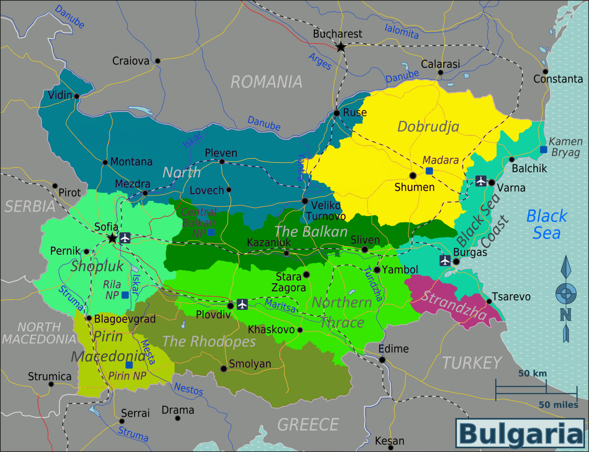
It seems to me that the border between the Zagore, Rhodopes and Evros provinces was chosen to reflect modern day borders, but in that case Rhodopes should extend further east, and Zagore further south.
Bulgaria – Travel guide at Wikivoyage
^The best comparison I could find.

Then again, I could be wrong. I'm not an expert.
 
  • 1Like
Reactions:
A few things I noticed regarding locations in modern Serbia borders, from north to south:

1. Change Zenta to Subotica (don't know the Hungarian name), Subotica is more important and one of the bigger cities in Vojvodina
2. Can't read the location name above Kovin, west of Timisoara, what is it?
3. Kovin is even today a small town, not bigger than 10k inhabitants, better to change it to Pančevo (wiki link - Pančevo was first mentioned in 1153 and was described as an important mercantile place)
4. Debrc is a small village south of the Sava, only known because of a medieval church and nothing else. The location should either be changed to Novi Sad, or Srem (Syrmia, Szerem), as Srem is geographically right in between Sava and Danube
5. Instead of Jagodina (not sure if it is, but looks like it), place Kragujevac, it was a settlement already settled by the end of 12th century
6. Ravno - first time hearing of this, Zaječar much better suited, 3 Roman emperors were born there
7. Trgovište - not to be confused with Romanian Targoviste, Ras or Raška would be much much better
8. Peč should be Peć
9. Glubočica can be Leskovac instead, Leskovac is just center of the area. If not, then Dubočica is most commonly used

Provinces:

1. Donji-Kraji sounds very unnatural, maybe just Krajina?
2. Usora and Soli - Slavonija?
4. As per the current locations - Syrmia - existing + Debrc, Mačva - Krupanj, Valjevo, Gradac, Belgrad, Šumadija - Smederevo, Rudnik, Jagodina, Žiča, Braničevo - existing + Stalać, Niš - existing + Kruševac, Toplica can be scrapped
5. Podrinje can be renamed to Hercegovina
6. Serbian / Slavic version of Illyria is Ilirija
 
  • 4
  • 1Like
  • 1
Reactions:
Sremska Mitrovica - (hungarian) Szávaszentdemeter (serbian) Dmitrovica

How are people feeling about PROVINCE names like "Zagreb and Varaždin". Should it be i instead of and?
 
  • 1
Reactions:
What do you think about the suggestion by @Fehervari in his thread:

I assume he will also post it here, but I wanted to highlight that someone has already made a redrawing of locations and provinces.
I dont think he goes into enough detail. I would prefer if they used the counties as provinces and made the most important settlements into locations.

And most of all depicting Anjou Hungary without including the Capital, which was Visegrád should not be done.
 
  • 4Like
  • 2
  • 1Love
Reactions:
Have you considered sub-dividing the climate even further?? I imagine that Belarus and Russia would have way more severe winters that for example Bohemia or Hungary, and yet they are all classified as 'Continental'.. I really want climate to be a significant factor in the game as it would have been historically.. Stuff like frozen rivers in the winter and a shorter growing season for crops are things which has historically played a big part in why Russia had a harder time developing than Western Europe.. I just feel like a complex climate system(coupled with complex terrain) would be very beneficial for the game..
 
  • 5Like
  • 3
Reactions:
This is a problem in other games too, I just assumed that the letter ő is not in the paradox alphabet.
We have it in Project Caesar, there is a Küküllővár location present on the map, in Transylvania.
 
  • 35Like
  • 5Love
  • 2
Reactions:
Greetings, and welcome to another Tinto Maps! This week we will be taking a look at Carpathia and the Balkans! It will most likely be an interesting region to take a look at, with a lot of passion involved… So I’ll just make an initial friendly reminder to keep a civil discussion, as in the latest Tinto Maps, as that’s the easiest way for us to read and gather your feedback, and improve the region in a future iteration. And now, let’s start with the maps!

Countries:
View attachment 1158260
Carpathia and the Balkans start in a very interesting situation. The Kingdom of Hungary probably stands as the most powerful country in 1337, but that only happened after the recovery of the royal power enforced by Charles I Robert of the House of Anjou, who reined in the powerful Hungarian nobility. To the south, the power that is on the rise is the Kingdom of Serbia, ruled by Stefan Uroš IV Dušan, who has set his eyes on his neighbors to expand his power. The Byzantine Empire, meanwhile, is in a difficult position, as internal struggles ended in Andronikos III being crowned sole emperor, at the cost of dividing the realm; both Serbia and Bulgaria have in the past pressed over the bordering lands, while the Ottomans have very recently conquered Nicomedia. The control over the Southern Balkans is also very fractioned, with a branch of the Anjou ruling over Albania, the Despotate of Epirus under the nominal rule of Byzantium as a vassal, Athens, Neopatria and Salona as vassals of the Aragonese Kings of Sicily, Anjou protectorates over Achaia and Naxos, and only nominal Byzantine control over Southern Morea. It’s also noticeable the presence of the Republics of Venice and Genoa, which control several outposts over the Adriatic and Aegean Seas. A final note: in previous maps, Moldavia was shown in the map, but we’ve removed it from it, and it will most likely spawn through a chain of events in the 1340s.

Dynasties:
View attachment 1158528
The House of Anjou rules over Naples, Hungary, Albania, Achaia, and Cephalonia; they’re truly invested in their push for supremacy over the region. Apart from that, each country is ruled by different dynasties, except for Athens and Neopatria, ruled by the House of Aragón-Barcelona.

Locations:
View attachment 1158264
This week we’re posting the general map of the region, along with some more detailed maps, that can be seen if you click on the spoiler button. A starting comment is that the location density of Hungary is noticeably not very high; the reason is that it was one of the first European maps that we made, and we based it upon the historical counties. Therefore, I’m already saying in advance that this will be an area that we want to give more density when we do the review of the region; any help regarding that is welcome. Apart from that, you may notice on the more detailed maps that Crete appears in one, while not being present in the previous one; because of the zooming, the island will appear next week along with Cyprus, but I wanted to make an early sneak peek of the locations, given that is possible with this closer zoom level. Apart from that, I’m also saying in advance that we will make an important review of the Aegean Islands, so do not take them as a reference for anything, please.

Provinces:
View attachment 1158268
Provinces! Nothing outstanding to be commented on here; as usual, we’re open to any feedback regarding them.

Terrain:
View attachment 1158270
View attachment 1158271
View attachment 1158272
Terrain! The climate of the region is mostly divided between Continental and Mediterranean, with some warmer and some colder regions. Regarding the topography, the Carpathian mountains are famously important and strategic, while the Balkans are a quite hilly and mountainous region, which is also greatly covered by woods and forests.

Cultures:
View attachment 1158273
Here comes the fun part of the DD: The cultural division of the Balkans! A few comments:
  1. Hungary is full of different minorities. Transylvania, especially, is an interesting place: there we have a mix of ‘Hungarians’, ‘Transylvanians’ (which are the Romanian-speaking inhabitants of the region), ‘Transylvanian Germans’, and ‘Szekely’ people.
  2. We have divided the Southern Slavic-speaking region into their dialectal families of Slovene, Croatian, Bosnian, and Serbian.
  3. The Southern Balkans are mostly divided among Bulgarian, Albanian, and Greek cultures.
  4. We’re also portraying plenty of other cultures, such as Dalmatians, Aromanians, Sclavenes, Arvanites, Cumans, Jasz, or Ashkenazi and Romanyoti Jews.

Religions:
View attachment 1158274
This one is also interesting. Apart from the divide between Western Catholicism and Eastern Orthodoxy, we have the Krstjani in Bosnia, Bogomils (the pink stripes both in Bosnia and Macedonia), and Paulicians in Thrace. The Jewish populations do not pass the threshold percentage to appear on the map, but there are plenty of communities across the region.

Raw Materials:
View attachment 1158275
The materials of the region. Something very noticeable is the richness of minerals, with plenty of Iron, Copper, Tin, Lead, Gold, and Silver. Specifically, Slovakia is very rich, and you definitely want more settlers to migrate to the region, and exploit its resources. The region is also very rich in agricultural resources, as you can see.

Markets:
View attachment 1158276
The region is mostly divided among four markets: Venice, Pest, Ragusa and Constantinople.

Country and Location population:
View attachment 1158277
Country and location population (which I’ve also sub-divided, and is under the Spoiler button).

And that’s all of today! I hope that you find the region interesting; we certainly think that it is. Next week we will go further south, and we will take a look at the Syrian Levant and Egypt. Cheers!