• We have updated our Community Code of Conduct. Please read through the new rules for the forum that are an integral part of Paradox Interactive’s User Agreement.

Tinto Maps #15 - 23rd of August 2024 - Horn of Africa

Hello, and welcome one more week to Tinto Maps! After a short break, we’re back to the duty of sharing more maps! Today the region we will look at is the Horn of Africa! So let’s take a look at it, without further ado:

Countries:
Countries.PNG

Here we have the countries around Nubia, Ethiopia, and Somalia. The first ones are organized around the ancient kingdoms of Makuria and Alodia, which control the Upper Nile region. In the second area, the Empire of Ethiopia stands as the main power, with some smaller countries around it. Finally, the two Islamic sultanates of Ifat and Ajuraan stand as the main powers in the Horn and Somalia. Finally, around the African Great Lakes, there is a country that can be considered a ‘settled’ one, Kitara.

Dynasties:
Dynasties.PNG

The dynasties of the Horn. There are some historical ones, while others are randomly generated. The most famous one is probably the Ethiopian House of Solomon, from where all their Negus come. The Walshma ruler over both Ifat and Ajuraan and we have some others, such as the Medri of Medri Bahri, the Umar of Mogadishu, the Banu Kanz of Makuria, or the Baranzi of Kitara.

Societies of Pops:
Pop-Based.PNG

A new map has popped up! Here you can see the countries that we consider as ‘Societies of Pops’, as they were presented in the last Tinto Talks. We have the famous Oromo people in the lands between Ethiopia, Ifat and Ajuraan; the Kunama, Gumuz, and Berta in the lands between Ethiopia; and Alodia, and the Zaghwa to the north of Wadai; there are a few more to the west, but I’ll share that picture in the Western Africa thread, as it’s more appropriate there. There are more Stateless Societies of this kind that we would like to add in the future, if it is possible due to our schedule.

Locations:
Locations.PNG

Locations 2.png

Locations 3.png

Locations 4.png

Locations 5.png
Locations! You might notice that the density is quite unequal. Unfortunately, the archaeological findings for the period are scarce, specially out of the most known areas and a lack of urbanization in most of the territory has made the finding of proper non-anachronistic settlements quite a challenge. Keep this in mind when making suggestions. ;) It has been that dramatic in some areas that we had to use names of tribes and rivers, a bit contradicting our own rules, but the areas had to be represented as they were active parts in the development of the region.
One thing: a big chunk of the Arabian peninsula can be seen in today’s Tinto Maps; but, please, reserve the feedback for its future DD, when we’ll show all of the peninsula. Apart from that, you can see more detailed maps if you click on the spoiler button, as usual.


Provinces:
Provinces.png


Areas:
Areas.png


Terrain:
Climate.png

Vegetation.png

Topography.png

The terrain types of the region are quite interesting and diverse. It is marked by the Rift Valley, which creates different biomes, such as the Ethiopian Highlands and Plateau, or the African Great Lakes. That also marks a divide between Arid, Tropical, and Oceanic climates. The vegetation of the region also ranges from desertic and sparse, to jungle forests. And one more note: you may also note that 'Marshes' have been renamed into 'Wetlands', as we could put some work into that suggestion the last week.

Natural Harbors:
Natural Harbors.png


Cultures:
Cultures.png

Another interesting map this week… You might notice that the lands of Ethiopia have a very mixed cultural situation. While more to the west and south, we are representing ‘tribal lands’ in a more homogeneous way, with kind of fixed boundaries to represent the different groupings. This doesn’t mean that there wouldn’t be a mixing of cultures, but this was one of the first areas to receive a minority's review and the scope was limited mostly to Ethiopia.

Religion:
Religion.png

Another interesting map! Miaphysite and Sunni are the more widespread religions in the region (while not all areas have their mixed populations, such as Nubia as you might notice, they eventually will as we cover more of the map in our sprints). Animism is completely placeholder, as usual, and you might see some pockets here and there (If you have specific suggestions, please do them). You may also notice a purple minority inside Ethiopia… That is representing the Beta Israel Judaism in the provinces of Semien, of course!

Raw Materials:
Raw Materials.png

The raw materials of this week! A big chunk of the region has livestock as its main raw material, while also having some agricultural goods as Wheat or Sturdy Grains here and there. The most unique good in the region is Coffee, which is cultivated in the Ethiopian highlands. And there are also some precious resources spread here and there, such as Gold, Ivory, Gems, and Incense.

Markets:
Markets.png

The main market centers of the region are Axum and Mogadishu, with ‘Adan/Aden being the main one controlling the access to the Red Sea. There are some weird calculations ongoing on the Somalian inner lands, that are already reported, and we’ll take a look at why is that happening.

Population:
Population.png

Population 2.png

Population 3.png

Population 4.png

Population 5.png
The population of the region! There are approximately 12.3M people in the Eastern African subcontinent; although take into account that it also comprises the regions of the Southern Great Lakes and the Swahili Coast, which we haven’t shown today, so we probably have to discount around 4M people from it (Swahili Coast accounts for 1.7M, and the Great Lakes for 4M, although that region is divided between today’s and next week’s Tinto Maps), for a total of around 8M.

That’s all for today! Speaking of next week’s Tinto Maps, it will be meaty, as it will cover Central, Eastern, and Southern Africa! See you!
 
  • 126Like
  • 39Love
  • 5
  • 4
  • 1
Reactions:
Regarding Somalia, there's an article by Wayne Durrill that may have been missed by researchers because of it's title.

The Great Whirl is a cyclone that forms off the coast of Somalia annually around April-May. It's a key element of how the Monsoon system works, and is why daring and skilled sailors of either side of the western Indian ocean can travel at otherwise unattainable speed to and from certain spots in southern India and the Somali coastline / why there are these windows for traverse the Indian Ocean, giving importance to ports on the Swahili coast/Madagascar and Mozambique. The article by Durrill explains how the Great Whirl is so reliable, and perilous, that as the amount of European sea traffic really ballooned in the 19th century, a certain clan was able to systematically pillage European wrecks for wealth every year, and eventually the nominal chief managed to centralise power and construct something of a state... the Majeerteen Sultanate!

Could complement some of these new trade wind mechanics well

Source

Wayne K. Durill, The African Origins of Famine in Northern Somalia, 1839-1884 (1986)
 
Last edited:
  • 6Like
  • 3
Reactions:
The southern rivers of the Juba and the Shabelle are significant for being the only perennial rivers in Somalia. Maybe those areas should be depicted as "oceanic" rather than arid, or at least the areas between the Shabelle and Juba shouldn't be arid.

Love that cotton is represented there as there's an export-driven textiles industry in Mogadishu attested to by Ibn Battuta's first hand account, active also in the 19th Century. But perhaps there's a bit too much cotton there and more food resources should be there, whereas elsewhere in Somalia cultivated crops should maybe be trimmed back and replaced by livestock, because it's all about camels in the north. Also goats, but camels are king in Somali society, as a currency of sorts, for food, hydration (milk) and transit. Looking at the legumes south of Zayla, not sure if they should be there. Mangoes are grown in the south riverlands and are attested by Ibn Battuta as part of the food he was served there, so maybe fruit could replace one of the cotton resources.

Sidenote, not sure if wheat is accurate for Ethiopia. Sorghum/millet/teff seems more like hardy grains, but if the choice is to represent that as wheat then the Shabelle river area should be shown as wheat as well. They also farmed barley down there.
 
Last edited:
  • 3Like
Reactions:
There are mangroves perhaps in Pate and to it's coast, which could be depicted as wetland as well as jungle to better convey that. Berbera in the north should be a natural harbour, it was an ephemeral transit market for Indian ocean trade to interact with the Horn interior.

A Chinese second-hand account refers to multi-storied stone buildings, as does Portuguese sailor Duarte Barbosa in the 16th Century. Several Arabic sources including Battuta, and slightly later Portuguese sources, emphasise that Mogadishu was a very large city and regional centre at the time. Perhaps the population is too small, or distribution could be adjusted to reflect this relative scale.

There should be Arab, Persian and Swahili pops added to the Banaadir, the greater Mogadishu area. It could perhaps also be more accurate to depict the Ajuran and Ifat as hordes? Or make the arid interior areas vassal societies of pops, if that works mechanically? Somali culture is traditionally nomadic pastoralist and organised around kinship ties and customary law, xeer. It's in a way dogmatically pastoralist, yet quite cosmopolitan. Travelling across long distances for markets or festivals was a things, as was young men going to the sea or to the city and returning back years later to become a pastoralist. Agro-pastoralism isn't really a thing practiced by choice, maybe with the exception of the south, (see Cassanelli). It's more of an unfortunate circumstance for those family units which do not have enough camels to be safely mobile.

Coastal towns were ephemeral markets that ebbed and flowed when monsoon winds to allow overseas trade, rather than sedentary towns. If the monsoon came without giving a wet seasons, they could exchange livestock that will otherwise die for grain on unfavourable terms. Frankincense was also harvested and traded for in the north, which is the closest thing you get to Agro-pastoralism there.

Mogadishu is a well-attested city, and a few others sites with strong water resources could be said to be settled towns. But sultanates with wide territorial control doesn't really reflect what polities are accounted for in the actual historiography, and settled societies isn't really a well-founded idea for anywhere apart from these riverine southern regions around the Banaadir and Shabelle and a scant few sites in the north, where there aren't that many reliable water resources that can sustain large numbers of sedentary people. The drilling of wells in the north is a quite modern phenomena which hasn't done many favours for the groundwater levels.

It would be misleading to trust much of the Wikipedia sources, loads of the references are not to anything meaningful for what is being claimed. For example, Ajuran is pretty poorly accounted for. It's really through oral accounts that we have any idea of who they were, we know a lot about Mogadishu, but not much about Ajuran. Oral accounts suggest they built wells and mediated access for tribute, and controlled the arable riverlands, and were overthrown for being tyrannical about this access. But it's not that clear from evidence whether the few Portuguese engagements with Banaadir coastal settlements could really be said to have been against the Ajuran.
 
Last edited:
  • 4Like
Reactions:
Credentials: I wrote a dissertation on Somali environmental economic history for a module last year, I'm an Economic Historian procrastinating finishing their totally unrelated final masters dissertation

Sources

Cassanelli, Lee V. “Pastoral Power: The Ajuraan in History and Tradition.” In The Shaping of Somali Society: Reconstructing the History of a Pastoral People, 1600-1900, 84–118. University of Pennsylvania Press, 1982.

Chittick, Neville. “Mediaeval Mogadishu”. Paideuma 28 (1982): 45–62.

Gonzalez-Ruibal et al. "Asia in the Horn. The Indian Ocean trade in Somaliland". Archaeological Research in Asia 27 (2021)

Lewis, I. M. “The Somali Conquest of the Horn of Africa.” The Journal of African History 1, no. 2 (1960): 213–30.

Mukhtar, Mohamed Haji. “Arabic Sources on Somalia.” History in Africa 14 (1987): 141–72.

Mukhtar, Mohamed Haji. “The Plight of the Agro-Pastoral Society of Somalia.” Review of African Political Economy 23, no. 70 (19
96): 543–53.
 
Last edited:
  • 7Like
Reactions:
Proposal to Add a New Province of Wadi Nuba
This region is inhabited by the Halfawi(Faadicha) a Nubian tribe.
The name of the region probably comes from the fact that the Halfawi(Faadicha) Nubians call themselves Nobī, i.e. Nubians.
Probably the Batn-El-Hajar and Wady Nuba regions were the last territories of the Christian kingdom of Makuria (Dotawo) before it fell.
Descendants of Hungarians also live in this region.
Wadi Nuba.png

wADI P.png

wad nub.png

Wadi Nuba Province
-Ibrim
The city's name on old maps is Ibrim, so I suggest shortening the city's name.
- Derr
Around 1870 the kashiflik of Barabra was dominated by three brothers with capital in Darr/Derr while Aswan, Ibrim and Say were under the authority of Bosnian aghas.
-Gebel Adda
Gebel Adda, the capital of Makuria in 1365.
-Faras
Zrzut ekranu 2025-01-04 202250.png
 
Last edited:
  • 2
  • 1Like
Reactions:
In my understanding, the Kingdom of Damot might also make more sense as an Ethiopian vassal state
Possibly yeah. And this is also the only time where an actual king of Damot got mentioned. Mentioned as "Motälämi/Motelemi", which literally means king in their language. He fought against the Ethiopian military leader Zena Petos, possibily around 1317. Couldnt find any more details about the whole thing sadly, but one thing is guaranteed. Ethiopia was never unified, but was a de-centralized state, which had multiple local chiefs, that swore their loyalty to the Ethiopian central government.
 
Last edited:
To make it entirely clear, the 'we would like to make this' doesn't mean that 'we will be able to do this'; as Johan said, right now we're leaning toward the Societies of Pops being AI-only at release, as anything related to horizontal societies, because there's a non-trivial amount of issues and work to be done to create a 'good enough' gameplay experience for them.
Even if they are unplayable, they will still have interactions at least right? Like raiding territory, defending their territory from colonizers, participating in trade etc. I;d hope they'd be more relevant than Vicky 3's Decentralized Nations.
 
Wadi Nuba Province
-Ibrim
Wadi* Ibrim = Province of Ibrim
Ibrim = Settlement of Ibrim
Qasr Ibrim = Fortress of Ibrim

*Wadi because it is a river valley.

Wadi Nuba Province
-Ibrim
The city's name on old maps is Ibrim, so I suggest shortening the city's name.
- Derr
Around 1870 the kashiflik of Barabra was dominated by three brothers with capital in Darr/Derr while Aswan, Ibrim and Say were under the authority of Bosnian aghas.

That was the result of Ottoman invasion in Nubia in 16th century. I guess, you mean the year 1820.
 
Whoops, forgot to mention that. Before the Sultanate of Wadai was founded, the region we consider as "Wadai" most often was connected with neighbouring Darfur in governing matters, i can't quite cite an authoritative source about that, but there are multiple mentions of the fact on and about:
- "The history of Ouaddaï before the 17th century is uncertain, but about 1640 a Maba chieftain, Abd-el-Kerim, conquered the country and overthrew the Tungur, a dynasty originating in Darfur to the east." in the Wadai article of the Encyclopaedia Britannica
- German explorer Gustav Nachtigal's Sahara and Sudan: Kawar, Bornu, Kanem, Borku, Enned goes a bit more in length about it, but it's important to note that it instantiates the later-coming Tunjur ruling both Darfur and Wadai, not the Daju, but one can argue (and i am arguing) very easily that the relatively smooth transition between Daju and Tunjur in Darfur makes it likelier that it was also the case in Wadai (and this means that the pre-Tunjur Daju polity had also control/influence over the region).
- "By the early 16th century the Tunjur kingdom ruled Darfur and Wadai. Capitals of the kingdom were in northern Darfur. The cities of Uri and Ain Farah are associated with the kingdom." in the Tunjur Kingdom wikipedia page, which, i must stress, is a bad wikipedia page, not necessarily (only) in scientific merit, but simply because despite citing reasonably good (and recent!) sources, it is very poorly formatted, and, in a way, poorly written. But this passage specifically cites both Kingdoms of the Sudan (which i've read, and it's very good) and The Nile: An Encyclopedia of Geography, History, and Culture (which i have not), and can be easily verified.

My problem is not exactly that there should be half a dozen cultures in the place of Nuba, but that there should be something more than only a monolithic Nuba culture. At the very least there should be an appropriate representation of the different macrogroups as minority pops, and most importantly, "Nuba" culture is basically taking the complexity of an area and saying that everyone there (including those from groups which currently ARE cultures in-game outside the area) is the same just because they live in the same mountains...If here was at the very least something to differentiate the peoples often associated with the Niger-Congo language family (Katla, Rashad, Lafofa and Talodi-Heiban) and the Kadu, it would already be much better, and would require only a single new culture (no "net" new cultures if you portray the Dinka and Nuer correctly as the same culture), since the Temein can be abstracted as Daju pops, and the Hill Nubians can be abstracted (well, it's not really an abstraction, is it?) as Nubian pops, the only "missing" culture would be Nyima, so, uh...Nyima please ☝? Heh. Anyway, Pavía did say that the minorities outside of Ethiopia were not done, but the Nuba Mountains are a region where the lack of any minorities whatsoever makes it the more strikingly innacurate portrayal of anywhere in this TM.
By the way, do you have any idea about where Fur culture should exist in 1337? It's just entirely absent right now, and I don't know if that was accurate.
 
  • 1Like
Reactions:
Wadi* Ibrim = Province of Ibrim
Ibrim = Settlement of Ibrim
Qasr Ibrim = Fortress of Ibrim

*Wadi because it is a river valley.
I know what a wadi is, but I think that shortening the name of the location Qasr Ibrim to Ibrim makes sense because I want to present a city, not a fortress.

That was the result of Ottoman invasion in Nubia in 16th century. I guess, you mean the year 1820.
The only thing I want to point out is that adding the city of Darr/Derr makes sense because it was an important city at a later time especially under Ottoman rule.
 
Proposal to Add a New Province of Wadi Kenuz/Kunuz
This region is inhabited by the Nubian Kenuz tribe, which was formed from the marriages of Arabs and local Nubians.
In 1337, the region may have been controlled by the emirate of Assuan of the Banu Kanz dynasty because in 1333 Kanz el-Dawla lost power over Makuria.
Zrzut ekranu 2024-08-28 185956.png

kunz.png

bkunz.png

kuny.png

kun.png

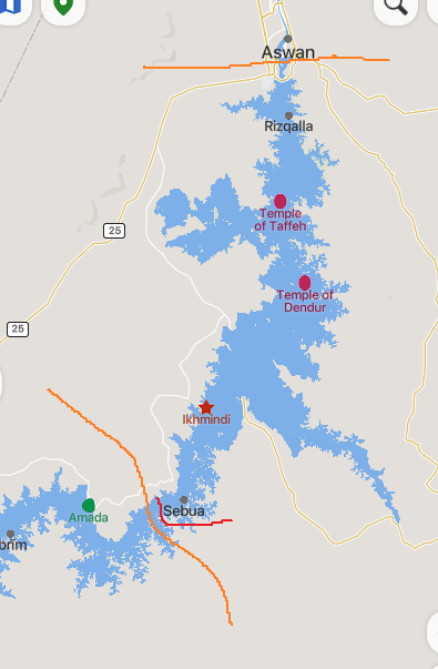
This region is problematic because most of the villages in this region were flooded during the construction of the Aswan Dam, which makes it difficult to find any information about these settlements, only old maps show these settlements.

Nubian villages flooded by Lake Nasser

1-s2.0-S1110982323000054-gr1_lrg.jpg

Wadi Kenuz /Kenuz Province
-Al-Subu - Sebou
-Qurta - Korty/Corte
-Al-Dakka - Dakke
- Kalabsha - Kalabsheh
Zrzut ekranu 2025-01-04 202503.png
 
Last edited:
  • 2
  • 1Like
Reactions:
By the way, do you have any idea about where Fur culture should exist in 1337? It's just entirely absent right now, and I don't know if that was accurate.
I have no authoritative knowledge on the issue, but IINM they should already be in the Jebel Marra (i.e. the heartland of Daju itself), after looking up a bit further, in the Daju people wikipedia page, there's this unsourced referrence "The Daju appear to be the dominant group in Darfur from earliest times vying for control with their northern Marrah Mountain later rivals, the agricultural Fur people.", which seems corroborated by the Fur's own wikipedia page (it says "The traditional heartland of the Fur is the mountainous region around Jebel Sî and Jebel Marra Wadi Salih and Zaligi; today, however, most of them live in the lower country west and southwest of that area") it all points to the Fur coexisting inside the Daju state, in the "Northern Marrah Mountains", which i think correlates roughly with Kebkabiya, Aim Farrah and Towing locations. I also must clarify that there should be Fur pops in the Waddai region as well (they should be a minority between Abesehir and Ouara locations), to portray the closely-related Amdang people in the Wadi Fira region of Chad.
 
  • 3
  • 1Like
Reactions:
Proposal to Add a New Province of Dar al-Shayqiya/Shaigiya
This region is inhabited by the Shaiya tribe, from which the name of this rgion comes.
The Shaigiya tribe has four kingdoms in this region.
Kingdom of Adlanab/Merawi
Kingdom of Hanak/Hannek Its capital is Hazima
Kingdom of Kagbe/Kajebi Its capital is Kagbe

Kingdom of Amrab
/ Amri Its capital is Amri
I am unable to locate the kingdom of Amrab/Amri on old maps.
shaki.png

sheg.png

It is possible that the island of Amri is the place where the kingdom of Amrab existed. The construction of the Merowe Dam flooded the region and created Lake Merowe.

Zrzut ekranu 2024-08-29 195943.png

Although on this map the kingdom is located in a different place.
Zrzut ekranu 2024-08-29 201359.png

3. The " Dar El Shaikiya " stretched along
both banks of the river, from Mount Dager to
the upstream end of the fourth cataract, and
contained the four kingdoms of Hannek,
Kajebi, Merawi, and 'Amri.

This district was inhabited entirely by the
Shaikiya Arabs, with a few Nubas in a state of
semi-slavery. Unlike the people of the other
dars, the people of the Dar Es-Shaikiya,
though split up into four separate kingdoms,
and though their four kings often fought with
one another, yet, on the approach of a common
enemy, they always put aside their private
quarrels, and joined together under one leader
to meet him. Herein lay their strength.
shag-1.png

shag2.png

shag.png

Shaigiya Province
- Merawi/Merowe
- Hannek/Huzaymah
-Kagbe
-Amri
Zrzut ekranu 2025-01-04 223440.png
 
Last edited:
  • 3Like
  • 1
Reactions:
Proposal to Add a New Province of Dar al-Manasir/Manasir
This region is inhabited by the Manasir tribe, which gives the region its name.
This tribe had a kingdom during the Funj/Senar Sultanate, extending from Shamkhiya to the fourth cataract of the Nile.
mans.png

selmi.png

Kab.png

manss.png
Ket.png

fgh.png


Manasir Province
-Daghfali -Dakehaleh
-Salmiyah/ Salmi
- El Kab
-Kamsab
-Salamat - The capital of the kingdom of Manasir.
Zrzut ekranu 2025-01-04 193738.png

Zrzut ekranu 2025-01-04 194952.png
Zrzut ekranu 2025-01-04 230906.png

manasir.png
 
Last edited:
  • 3Like
  • 1
Reactions:
Proposal to Add a New Province of Dar al- Rubatab/Rubatab
This region is inhabited by the Rubatab tribe, which is where the name of the region comes from.
The Rubatab tribe also had their own kingdom in the region, the capital was on the island of Mograt, the kingdom was called Takaki.
The borders of this kingdom in the north are the city of Al-Shemkhiya and in the south the Fifth Cataract of the Nile.
Takaki on old maps.

Takaki.png

Takakii.png

gg-2.png

gg-1.png

ggg.png
ruba.png

Zrzut ekranu 2025-01-04 190620.png

I managed to find only four locations consistent with the old maps, i.e. Mograt, Nedi and Abu Hamad,Solimanieh I cannot find the rest.

Rubatab Province
-Mograt
- Abu Hamad
-Nedi - Nadi
-Sulaymaniyah/Solimanieh
Zrzut ekranu 2025-01-04 185824.png


The fifth cataract on the Nile River appears to be the boundary of Makuri and Al-Abwab

Al Abwab.png
Help comes from other written sources describing the escape of King Semamun from
Dongola to Al-Abwab.41 The account gives the number of days which the King needed
to travel to the Al-Abwab border. He arrived first on the island which was fifteen days
journey from Dongola. The river route was supposed to have been much more difficult
due the rocky waters of the Nile. The island itself was long and three days were necessary
to travel across it. According to D. A. Welsby the island described should now be linked to the Mograt island
In order to reach it from Dongola the difficult terrain of the
Fourth Cataract had to be crossed. If indeed we are dealing with the Mograt island, then
the King would have had to travel approximately 375 km in fifteen days, assuming that
he travelled along or on the river. This means that the daily average covered had to be
around 25 km. For granted, it would have taken much more time to cross the Fourth
Cataract region than cover a similar distance further beyond. From the island Semamun
then headed for Al-Abwab which was no longer under his jurisdiction. Al-Abwab was
three days journey more. Presuming the King was travelling at the same speed – 25 km
per day – then Al-Abwab would have been located within the region of Artul island (Fig. 3).
It is important to take note, however, of further information which appears in written
sources. The King covered this section of the journey with a much smaller group. According to the description he had left behind the majority of his subordinates and those accompanying him in the earlier part of the journey to the island. The area south of Mograt
is for certain easier to cross than the Fourth Cataract region, hence the conclusion that the
King could have covered more than 25 km per day. Barely 14 km south from Artul island
are Wadi Dam Et-Tor and Tarfaya. Perhaps this is where Ibn Al-Furat means, when he
mentions the zones which are beyond the jurisdiction of Semamun. Perhaps this is the
region where his rule ends and further south Al-Abwab begins.
It is important however to note that the current level of information about these sites
does not permit one conclusive description of whether during King Semamun’s flight, in
approximately 1290 AD, these fortifications were actually in use. The only piece of information that we do have on their chronology is that fragments of pottery typologically
linked to the Christian era in general were found there.
 
Last edited:
  • 3Like
Reactions:
Proposal to Add a New Province of Dar al- Berber/Meyrifab
The name of the region comes from the Meyrifab/Berber tribe
They had a small ancient kingdom affiliated with the Sultanate of Sennar , and its king, affiliated with Sennar, was called “ Mak ,” meaning king. Its capital was Berber, and it continued until the arrival of the Turks .
The Berber Tribal Territory was the name given to the country of the Mirafab (or Mayrafab) in Sudan . The Mirafab was an Arabic-speaking tribe that claimed to be related to the Djaliyin and spread on both sides of the Nile through the lands of the fifth cascade of the Nile at Atbara .The Mirafab was ruled by a makk , who was appointed by the Funj Sultan of Sennar of which he was a vassal, within the ruling family of the Timsah. The makk had to pay every four or five years a tribute in gold, horses or camels. In the 18th and 19th centuries the southern part of its territory formed a separate vassal kingdom called Ras al-Wadi, ruled by a member of the Timsah family. The Berber territory was a transit for trade with Dongola , but in the 19th century the route became too dangerous and was no longer used; the main threat was the attacks of beges and bisharins. Until then the tolls of caravans to the south were the main income of the Makk (those coming from the south to the north were exempt from payment). The last makk was Nasr al-Din, expelled from the throne, who asked the viceroy of Egypt Muhammad Ali for help . Egyptian troops occupied the country on March 5 , 1821 .
berber1.png

Map with the division of the lands of the Meyrifab/Berber tribe into two parts.
Berber2.png

mir.png

Berber3.png

ber.png

Zrzut ekranu 2025-01-04 182835.png

Zrzut ekranu 2025-01-05 142926.png

Berber/Meyrifab Province
- Berber - Ankheyre /al-Mekheir
Initially the capital of the region was Gooz (Kuz al-Funj) but this was in decline by 1814 and the capital had moved to Ankheyre further north, an unknown city which is probably a mistranscription of al-Mikhayrif (or el-Mekheyr ). The Mahdists established their quarters here; the town of Berber arose a little further north, on the site of the Mahdist camp. It lost importance after 1897 and the capital was transferred to al-Damir(Damer) in 1905
-Goz/Goos
-Wawissi/Wawssi
-El Damer/Damer
Ad-Damir is the center of a local Sufi order. The Moroccan -born sheikh and founder of a brotherhood ( Tariqa ) Ahmad ibn Idris (1760–1837) lived for a long time in Mecca . Three of his students spread his teachings in modified form in different places in Sudan. One of them, Muhammad al-Majdhub as-Sughayir (1796–1833), settled in Ad-Damir, where his tomb in the center of the city is still venerated today. [ 2 ] His full name is spelled differently: Muhammad bin Ahmad Qamer al-Dīn bin Hamad al-Majdhūb al-Ṣaghīr. Al-Ṣaghīr means "the younger", [ 3 ] because during the time of the Funj Sultanate his grandfather Hamad ibn al-Majdhub (1693–1776) had founded the Sufi order called Majdhubiya in the area of ad-Damir. Hamad ibn al-Majdhub gained the trust of the population through asceticism, meditation and good relations with the local clan leaders. For Ad-Damir this brought self-government, a reputation as an educational center and a place to settle disputes between the clans. The leaders of the order rose to become regional rulers in the area around ad-Damir, their followers remained within the surrounding tribal areas. At the time of Turkish-Egyptian rule over Sudan, the Majdhubiya fought on the side of the Mahdi against the Egyptians and against the Khatmiyya brotherhood, which cooperated with the Egyptians . The explorer Jean Louis Burckhardt came to ad-Damir in 1812. Sudan had not yet been conquered by Egyptian rulers at that time . Burckhardt mentioned the positive influence that Muhammad al-Majdhub would have on social morality as Faqir el Kebir ( Arabic : "great fakir", an Islamic scholar and healer, called "high priest" by Burckhardt). In the nearby towns of Berber and Shendi he found alcohol and prostitution widespread, except among religious men. Not so in Ad-Damir, as a result of this moderating influence of religion he cited prosperity in trade and agriculture. Carl Ritter described Damer in his standard geographical work of 1822 under the title The Priestly State : The Grand Fakir lived on a square in the center of the town in a small square building. Several prestigious Koran schools ( Madrasa ), whose students traveled from far away, were set up around a large mosque. There was intensive agriculture with irrigation by treadmills ( Sakia ) , which were powered by oxen and enabled two harvests a year, a duty-free market and thus lively trade.
-EL Fahalab/Ad Fahalab
fadlab.png
 
Last edited:
  • 1Like
Reactions:
Proposal of two new provinces crossed by the Nile River.
The northern province is Matamma and the southern province is Shendi.
Both provinces are inhabited by the Ja'alin tribe.

The division of the Ja'alin region into two is probably related to the fact that in 1801 a rival faction of the Sadab family took power in Matama. Matama was ruled by King Musaid, who was subordinated to King Shendi to his cousin Makk Nimr.
This tribe had its own kingdom which is called Djaaliyyun/Shendi/Al Gal.
ja1.png

ja2.png

ja3.png

ja4.png

ja alin.png

der.png

Zrzut ekranu 2025-01-05 140428.png

Shendi Province

-Qabati/Gabaty
- Saqadi/Sakady
- Shendi/Shendy
Matamma Province

- Matamma
- Dereira/Derreira
- Kitayab/Katayab
Zrzut ekranu 2025-01-05 140922.png
 
Last edited:
  • 1Like
Reactions:
Proposal to add a new province Halfayat /Abdallab
This region became dominated by the Arabs after the destruction of the Alodia kingdom

The Arab Abdallabi tribe lives in this region. The name of the region comes from their second capital, Halfayat al-Muluk; they moved the capital from Qarri to Halfayat al-Muluk in the mid-18th century.
According to local stories, it was the founder of the tribe, Abdallah Jamma'a, who was responsible for the destruction of the Alodia country.

Abdullah won over all the Arab tribes in Sudan and united their word under a ruler who would manage their affairs and bring them out of the extreme weakness that surrounded them from the kings of the Anj, so they pledged allegiance to him to fight the Anj and he began to conquer their cities one after the other. Then he saw that it was more appropriate to make a treaty with the king of the Funj called Amara Dongos who resided in the Funj Mountains in the direction of Lul. They agreed that the king of the Funj would provide him with assistance from his soldiers. He equipped himself with huge armies from the Arab tribes and advanced to war against the Anj with this great army and fought them in several battles until he defeated them and conquered the country from any direction in the north to Soba and killed their king Alwa. The king of the Anj had a great leader called Hasab Allah, so he fled with the rest of the army to the Qerri that had a great wall in the mountains. Then Abdullah Jama’ caught up with him and besieged him until he surrendered. After that, all the countries of Sudan submitted to him except for the coasts of the Red Sea - which his son Sheikh Ajib conquered after him - and he seized many spoils, including the crown of the king studded with jewels and the necklace of the temple detailed with pearls and rubies, which became It was inherited by the kings of the Abdallab until Ahmed Pasha, the first governor of Sudan, received it from Sheikh Idris bin Nasser. Then they divided the kingdom, and the island was only for Amara Dongos, who moved from the south to the Funj Mountains, the seat of his kingdom, and designated Sennar as his capital and all the other parts of Sudan for Sheikh Abdullah Jama’. Sheikh Abdullah Jama’ ruled for sixty years until he died.

The Arab penetration of Alwa met with little local resistance. [59] The Funj Chronicle describes the final defeat of the “kings of Soba and Querri” by Umara Dunqas in league with Abdallah of the Qawasma Arabs. The Abdallab Arabs preserve a tradition that the Christian survivors of the attack on Soba made a last stand at Querri, which Chittick described as the Sabaloka Gorge site in the Sixth Cataract.
abd al.png

hal.png


Zrzut ekranu 2025-01-05 155934.png

Halfayat /Abdallab Province
-Tuti/Omdurman
-Qerri
- Halfayat al-Muluk/Halfayat
-Bashaqra/El Bishakrah
capital 2.png
Zrzut ekranu 2025-01-05 155358.png
- Soba
- Abu Haraz
Abu Haraz.png

Passages through the Bayuda deserts
The passages are located in places most frequently used by Trade Caravans. Passage through the middle of the Bayuda Desert It was used by Shaigiya warriors to attack the Ja'alin, Meyrifab and Abdallab tribes.

Zrzut ekranu 2025-01-05 160038.png

b1.png

d2.png

d3.png
 
Last edited: