• We have updated our Community Code of Conduct. Please read through the new rules for the forum that are an integral part of Paradox Interactive’s User Agreement.
Well. Its offtopic from the map design here so I wont anything to the discussion about the "french problem" here ;)
I just have it in my mind because from my point of view the map designs isnt helping here at the moment.
 
If you wants WWII maps for France, here it is :

carte-occupation.jpg
Capture d’écran 2025-03-28 132843.png


In details this is a modern map of french departements :

Capture d’écran 2025-03-28 164740.png
 
Last edited:
[Maps deleted]

My 2 cents:
ITALY:
New: Ortona - The "Stalingrad" of Italy was a small coastal town and formed a natural blocking at the east coast. Province added for the historical battle layout.
New: Rimini - part of the Gothic line and added to get the historical frontline. In combination with the reworked Florence province there is now a sort of cut by the Apennine Mountains. ITs not perfect but its splitting the historical british and american attack routes.
New: La Spezia was added for infastructural reasons: To get from Florence to Parma u have to take the route via Bologna or via La Spezia to Parma.
New: Ravenna was added to get the "Bologna salient"; Ravenna was a province ignored by the Wehrmacht because the germans were convinced that the allies couldnt move at the coast. Bologna is now a more important key position but it will force the players to keep an eye on Ravenna to prevent more attack provinces against Bologna.
New: Aosta was added for the alps blocking adjust the french boarder crossing routes.
New: Cuneo was added for the alps blocking adjust the french boarder crossing routes.
> Both provinces have traditional reasons. Here the elite Alpini men were recruited. The Cuneo and Aosta area were part of the italian Alps wall.
Adjusted: Foggia and Pescara were adjusted to add Ortona.
Adjusted: Ancona was edited to get in a more historical Rimini province.
Adjusted: Florence, Bologona, Parma and Genoa > all 3 provinces were added to adjust the changes caused by adding La Spezia and Rimini for a more historical frontline setup.
Adjusted: Torino was adjusted and reduced to the Torino - Po river valley.

BELGIUM
New: Bastogne was added to get an additional province with geocoords for a german push and to get the famous battle of the bulge town to the map.
New: Dinant was added as historical Maas river crossing town. The small town was an important crossroad town from north to south.
Adjusted: Liege and Eupen were adjusted for the new provinces. The Eupen change shouldnt influence the frontline.
New: Charleroi was added to get another geocoord in favor of an eastern attacking force. Witn Charleroi an attacking force can now threat Sedan, Hirson and Cambrai at the same time forcing the defender to split his forces.
New: Cambrai and Arras were added for historical reasons. An invasion force can use more provinces now for a push plus the defender had to split its forces.
Adjusted: Amiens, Dunkirk, Lille, Laon, Hireson and Mons were adjsuted for the new provinces.
Adjusted: Le Havre and Dieppe were adjusted for the new passing province Rouen.
New: Rouen was added to reduce the deep infilitration in case of a Dieppe raid and to get the historical "counter attack" province for a potential battle in the area. Rouen will allow a second attacking path into Evreux.
New: Alencon was added to get another position in the depth for Normandy or Bretagne battles
Adjusted: Le Mans, Angers and Chartres were adjusted for the new province and to allow the Patton France race.
Adjusted: Orleans and Auxerre were adjusted for the new Nevers province.
New: Nevers was added for a short and faster movement in the area for a potential meeting of western and southern invasion units.
Adjusted: Chaumont and Verdun were adjusted to get room for the Dijon province.
New: Dijon was added. Because of the french mountains. The Côte d'Or mountains are forcing the routes in the Dijon area a narrow lines allowing for the most time only movement from north to south. Dijon is one of the two major lanes to Lyon and the South.
Overall with the new provinces the defender news more units to defend longer front when an invasion force has pushed into France.

These are my ideas. Not perfect but perhaps an inspiration.
 
Last edited:
  • 1Love
Reactions:
View attachment 1273173
My 2 cents:
ITALY:
New: Ortona - The "Stalingrad" of Italy was a small coastal town and formed a natural blocking at the east coast. Province added for the historical battle layout.
New: Rimini - part of the Gothic line and added to get the historical frontline. In combination with the reworked Florence province there is now a sort of cut by the Apennine Mountains. ITs not perfect but its splitting the historical british and american attack routes.
New: La Spezia was added for infastructural reasons: To get from Florence to Parma u have to take the route via Bologna or via La Spezia to Parma.
New: Ravenna was added to get the "Bologna salient"; Ravenna was a province ignored by the Wehrmacht because the germans were convinced that the allies couldnt move at the coast. Bologna is now a more important key position but it will force the players to keep an eye on Ravenna to prevent more attack provinces against Bologna.
New: Aosta was added for the alps blocking adjust the french boarder crossing routes.
New: Cuneo was added for the alps blocking adjust the french boarder crossing routes.
> Both provinces have traditional reasons. Here the elite Alpini men were recruited. The Cuneo and Aosta area were part of the italian Alps wall.
Adjusted: Foggia and Pescara were adjusted to add Ortona.
Adjusted: Ancona was edited to get in a more historical Rimini province.
Adjusted: Florence, Bologona, Parma and Genoa > all 3 provinces were added to adjust the changes caused by adding La Spezia and Rimini for a more historical frontline setup.
Adjusted: Torino was adjusted and reduced to the Torino - Po river valley.

BELGIUM
New: Bastogne was added to get an additional province with geocoords for a german push and to get the famous battle of the bulge town to the map.
New: Dinant was added as historical Maas river crossing town. The small town was an important crossroad town from north to south.
Adjusted: Liege and Eupen were adjusted for the new provinces. The Eupen change shouldnt influence the frontline.
New: Charleroi was added to get another geocoord in favor of an eastern attacking force. Witn Charleroi an attacking force can now threat Sedan, Hirson and Cambrai at the same time forcing the defender to split his forces.
New: Cambrai and Arras were added for historical reasons. An invasion force can use more provinces now for a push plus the defender had to split its forces.
Adjusted: Amiens, Dunkirk, Lille, Laon, Hireson and Mons were adjsuted for the new provinces.
Adjusted: Le Havre and Dieppe were adjusted for the new passing province Rouen.
New: Rouen was added to reduce the deep infilitration in case of a Dieppe raid and to get the historical "counter attack" province for a potential battle in the area. Rouen will allow a second attacking path into Evreux.
New: Alencon was added to get another position in the depth for Normandy or Bretagne battles
Adjusted: Le Mans, Angers and Chartres were adjusted for the new province and to allow the Patton France race.
Adjusted: Orleans and Auxerre were adjusted for the new Nevers province.
New: Nevers was added for a short and faster movement in the area for a potential meeting of western and southern invasion units.
Adjusted: Chaumont and Verdun were adjusted to get room for the Dijon province.
New: Dijon was added. Because of the french mountains. The Côte d'Or mountains are forcing the routes in the Dijon area a narrow lines allowing for the most time only movement from north to south. Dijon is one of the two major lanes to Lyon and the South.
Overall with the new provinces the defender news more units to defend longer front when an invasion force has pushed into France.

These are my ideas. Not perfect but perhaps an inspiration.

Well, in general, it is quite good.

I notice two problems :

- Troyes would be connected to 8 provinces. It would be better to add another province.

- Rouen would be connected to 7 provinces. It would be better to add another province.

In general, it is very interesting, great work !
 
  • 1
Reactions:
Lord Rommel,


Here is the counties map of UK. What do you think of previous proposal to change provinces in UK ? :


Map_of_the_administrative_geography_of_the_United_Kingdom.png


Here is only England counties map :

England_Administrative_Map.png


Here is only Wales counties map (before 1961) :

Wales_Administration_Map_1947.png


Here is Scotland counties map :


Capture d’écran 2025-03-28 201607.png


Here is North Ireland counties map :

1024px-Northern_Ireland_-_Counties.png
 
Lord Rommel,

Here is the Polish second republic territorial map. What do you think of previous suggested map changes :
(My suggested changes were very roughly done)

PolishRepublicAdminMap1939.png
 
Last edited:
Following Historicity, it is Me who should propose to Lord Rommel to divide Poland!
 
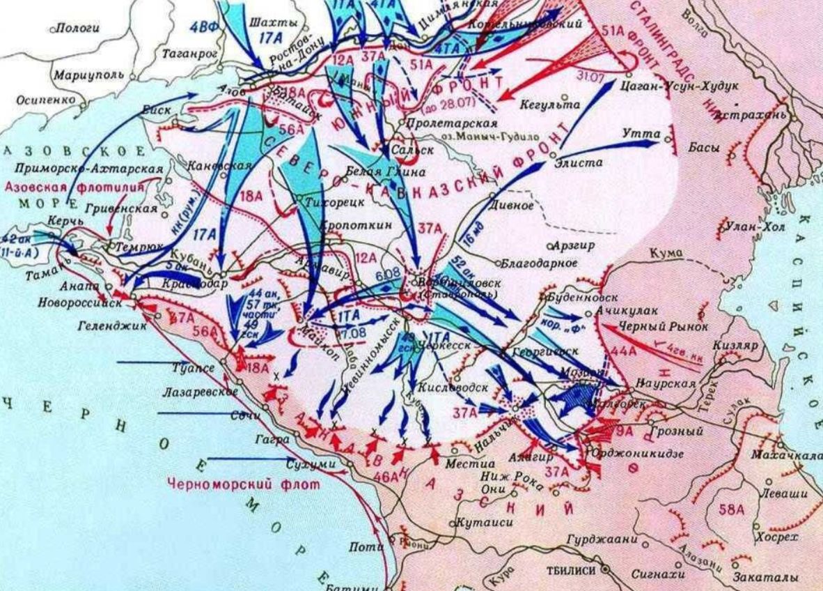
Well, after studying road map and routes of German offensive, I got this result for Stalingrad-Caucasus area:

1. Salsk! The expected for 14 years miracle happened! Salsk no longer blocks direct way to south to Krasnodar!! It was very annoying for me, this absolutely ridiculous detour that greatly increased the path to the south. This was probably one of the most ridiculous province design of the vanilla Map.

2. Two excessively huge provinces are divided into five. Now important logistics points are on the map. Now this area looks definitely more interesting for gameplay.

3. Atmospheric/historical tactical block of Rostov-on-Don - Zimovniki. They are not connected by direct road, and (probably for this reason) the German offensive went through Konstantinovsk.

4. Two useless provinces have been removed:
- Tskhinval makes no sense, because the strategic tunnel through the Caucasus was build there only in 1984.
- Nazran also is a meaningless province. In Soviet times, Nazran (Ingush ethnic people) were merged together with the Chechens into one Chechen-Ingush Republic, which we will make the same.

5. The excessively huge province of Baku is divided into two key points of this region Baku and Kirivabad.

Caucasus — 4.jpg


Maps to the north from Caucasus
North Caucasus.jpg


routes.jpg


routes2.jpg

Map of Southern Caucasus
South Caucasus.jpg

My Caucasus blocks are set manually.
Do you need all Caucasus blocks to be preset at the map level?
 
Last edited:
  • 1
Reactions:
Well, in general, it is quite good.

I notice two problems :

- Troyes would be connected to 8 provinces. It would be better to add another province.

- Rouen would be connected to 7 provinces. It would be better to add another province.

In general, it is very interesting, great work !
[Maps deleted]

Adjustments:
ITALY:
Florence updated.

FRANCE:
Adjusted: Troyes - now down to 4 connections (Reims, Chaumont, Auxerre and the new Fontainebleau.
New: Fontainbleau was added to cut the super province Troyes. Fontainebleau is connected with Paris, Cheateau Thierry, Trpyes, Orleans and Chartres.
New: Saumur was added. Saumur is one of the oldest Loire crossings. Saumur is now a 4 direction crossing (like its real situation today) adding an addtional defensive river position in case of a large scale france battle.
Adjustment: Tours and Chateauroux were adjusted to set the conncetions to 5 for Tours (Saumur, Le Mans, Bourges, Chateauroux, Portiers) and to 5 for Chateauroux (Tours, Bourges, Nevers, Vichy, Limoges).
Adjustment: Dieppe was changed to a hill terraine more fitting to the area. U can argue for a forrest province when a Hill is too extreme.

I think the new cuts should have eleminated most of the "super provinces". Thx @Rodolphe123 !
 
Last edited:
  • 1
Reactions:
Following Historicity, it is Me who should propose to Lord Rommel to divide Poland!

Mr Nick3210, I am pushing for improvement of the map, but I am fully aware that you and Mr Vilochka will decide at the end. There is no lack of respect in my actions, only a great enthousiasm to suggest improvement.

Please, study our proposals, I think that it worth it. But again, I know changes will be done in accordance with your mod !
 
  • 1Like
Reactions:
Well, after studying road map and routes of German offensive, I got this result for Stalingrad-Caucasus area:

1. Salsk! The expected for 14 years miracle happened! Salsk no longer blocks direct way to south to Krasnodar!! It was very annoying for me, this absolutely ridiculous detour that greatly increased the path to the south. This was probably one of the most ridiculous province design of the vanilla Map.

2. Two excessively huge provinces are divided into five. Now important logistics points are on the map. Now this area looks definitely more interesting for gameplay.

3. Atmospheric/historical tactical block of Rostov-on-Don - Zimovniki. They are not connected by direct road, and (probably for this reason) the German offensive went through Konstantinovsk.

4. Two useless provinces have been removed:
- Tskhinval makes no sense, because the strategic tunnel through the Caucasus was build there only in 1984.
- Nazran also is a meaningless province. In Soviet times, Nazran (Ingush ethnic people) were merged together with the Chechens into one Chechen-Ingush Republic, which we will make the same.

5. The excessively huge province of Baku is divided into two key points of this region Baku and Kirivabad.

View attachment 1273302

Maps to the north from Caucasus

Map of Southern Caucasus

My Caucasus blocks are set manually.
Do you need all Caucasus blocks to be preset at the map level?

I'd say yes to your last question !

Very interesting changes. the Caucasus is strategically important. It good to learn the geography/roads of that place.
 
  • 1Like
Reactions:
Please, study our proposals
Absolutely, it's great that you and Mr Rommel are digging the map! I just like to joke. :D

But I will definitely check the roads map that all your suggestions (and existed vanilla Provinces) have true logic and visual connections/disconnections. ;)
Although, however, probably the whole of Europe is entangled with roads and there are much fewer such problems than in other regions of the world.

I also noticed an interesting detail when I was fixed distances and connections between provinces - some regions of the world were surprisingly made with almost no gross errors, other regions of the world were perfect with a huge number of errors.
I got the feeling that different people were working on the map, and some were doing their job good, and some did not good.

If I remember correctly, China was made surprisingly correctly. At that time, the map of Europe were riddled with a huge number of ridiculous errors.
 
Last edited:
Hello, gentlemen, you are making a map not only for players, but also for AI, which does not really understand blocked crossings. Therefore, maybe we should not make pockets like Ukhta-Vorkuta and block crossings on the basis that large roads have not yet been built between the provinces? Maybe for Alaska, deserts and the Far North we should prescribe infrastructure 0? Some roads were built during the war. You can increase the infrastructure during the event, but you can't change the transition blocking during the game. For example, the railway to Murmansk was built during the First World War. WW2 By Allies: Burma Road + Ledo Road, Alaska Highway. Japanese: Burma Railway...
 
View attachment 1273308
Adjustments:
ITALY:
Florence updated.

FRANCE:
Adjusted: Troyes - now down to 4 connections (Reims, Chaumont, Auxerre and the new Fontainebleau.
New: Fontainbleau was added to cut the super province Troyes. Fontainebleau is connected with Paris, Cheateau Thierry, Trpyes, Orleans and Chartres.
New: Saumur was added. Saumur is one of the oldest Loire crossings. Saumur is now a 4 direction crossing (like its real situation today) adding an addtional defensive river position in case of a large scale france battle.
Adjustment: Tours and Chateauroux were adjusted to set the conncetions to 5 for Tours (Saumur, Le Mans, Bourges, Chateauroux, Portiers) and to 5 for Chateauroux (Tours, Bourges, Nevers, Vichy, Limoges).
Adjustment: Dieppe was changed to a hill terraine more fitting to the area. U can argue for a forrest province when a Hill is too extreme.

I think the new cuts should have eleminated most of the "super provinces". Thx @Rodolphe123 !

You are welcome, keep on with this great work !
 
  • 1Like
Reactions:
Cewntral russia is done. Caucasus - almost done! But I have some question about croos-locked way
Wowowow, not so fast it was not still technical assignment, therefore, I did not gave all detailed notes!! )))

Well, then - use Tshinval and Nazran ID to make for example Kirovabad and Pyatogorsk. For other new provinces let's start to add new more ID !
( I think it will better to use British donor ID for Britain, Japaneese donor ID fo Australia and japan and so on.)

Konstantinovsk - Kotelnikovsky needs to make visual connecting, as I painted there! Therefore there must be no Surovikino - volgodonsk connection!

Astrakhan and Yerivan cross-points must have both blocked cross- connection.

#########

Ah, I saw you alreade divided provinces, very cool, nice!
 
Last edited:
Hello, gentlemen, you are making a map not only for players, but also for AI, which does not really understand blocked crossings. Therefore, maybe we should not make pockets like Ukhta-Vorkuta and block crossings on the basis that large roads have not yet been built between the provinces? Maybe for Alaska, deserts and the Far North we should prescribe infrastructure 0? Some roads were built during the war. You can increase the infrastructure during the event, but you can't change the transition blocking during the game. For example, the railway to Murmansk was built during the First World War. WW2 By Allies: Burma Road + Ledo Road, Alaska Highway. Japanese: Burma Railway...
Don't worry, I'm not planning to give an assignment to make true Ukhta or Alaska. Any modder can do this himself, so there is no need to give this job to Vilocka. In particular, you can always easily delete pre-installed blocks if they are not needed for you.
(At the same time, I am sure Ukhta or Alaska will not cause any problems with AI, as these useless territories are not even included in the list of AI targets. Just may be the Japanese won't be able to attack Canada from Alaska, but that's right and good.)

My only question for other modders is - Do you need all Caucasus blocks to be preset at the map level or not?
It doesn't matter to me, I've got it all done in my mod manually, just tell - do you need an empty map of the Caucasus or with properly pre-installed blocks?
 
Last edited:
Absolutely, it's great that you and Mr Rommel are digging the map! I just like to joke. :D

But I will definitely check the roads map that all your suggestions (and existed vanilla Provinces) have true logic and visual connections/disconnections. ;)
Although, however, probably the whole of Europe is entangled with roads and there are much fewer such problems than in other regions of the world.

I also noticed an interesting detail when I was fixed distances and connections between provinces - some regions of the world were surprisingly made with almost no gross errors, other regions of the world were perfect with a huge number of errors.
I got the feeling that different people were working on the map, and some were doing their job good, and some did not good.

If I remember correctly, China was made surprisingly correctly. At that time, the map of Europe were riddled with a huge number of ridiculous errors.

Your quest for realism is good, despite being difficult. Distances and road had a real impact on military operations.


Here I suggest some map changes or names changes to Eastern Canada.

I know that it is not an important theatre, but being a Canadian I suffer to see east of Canada so poorly done.

And Canada was in fact an industrial power during the war, and the whole Canadian forces reach an important size during the war.


Here is South-Eastern Canada :

Name changed :

- Baie James instead of Fort Rupert ;

- Lévis instead of Trois-Rivières (that is in fact at north side of St-Lawrence River) ;

- Truro instead of Glace Bay ;

I suggests (maybe) to make some map modifications (because the actual provinces are enormous and not representative at all) :

- To add from Montréal and Val d'Or two new provinces : Gatineau and Mont-Tremblay ;

- To add Trois-Rivières between Montréal and Québec. Trois-Rivière is one of the oldest city in Canada;

- To transform Montréal in an Island with the St-Lawrence River around it (it is an island, and it had 900 000 inhabitants in 1941) ;

- To change Sherbrooke terrain to a plain ;

- To expand new Lévis province southward, it is hills down to US border ;

- To add Baie-Comeau from these provinces Fort-Rupert, Chicoutimi, Sept-Iles ;

- To extend Glace Bay territory northward in Moncton territory ;

- To add Sydney instead if it could be separated from Glace Bay) ;


South-Eastern Canada.png


Here is North of Québec (only name is changed) :

- Salluit instead of Fort Georges ;
North of Québec.png


Here is Labrador & nord-east Québec :

Name changed :

- Labrador City instead of Goose Bay

- Fort Mackenzie instead of Fort Chimo (what is that ?)


Labrador & nord-east Québec.png


- Here is a road map of Canada, if useful :

old-map-of-canada-1930s-DGXJTX.jpg
 

Attachments

  • South-Eastern Canada.png
    South-Eastern Canada.png
    134,5 KB · Views: 0
Last edited:
  • 1Like
Reactions:
View attachment 1273173
My 2 cents:
ITALY:
New: Ortona - The "Stalingrad" of Italy was a small coastal town and formed a natural blocking at the east coast. Province added for the historical battle layout.
New: Rimini - part of the Gothic line and added to get the historical frontline. In combination with the reworked Florence province there is now a sort of cut by the Apennine Mountains. ITs not perfect but its splitting the historical british and american attack routes.
New: La Spezia was added for infastructural reasons: To get from Florence to Parma u have to take the route via Bologna or via La Spezia to Parma.
New: Ravenna was added to get the "Bologna salient"; Ravenna was a province ignored by the Wehrmacht because the germans were convinced that the allies couldnt move at the coast. Bologna is now a more important key position but it will force the players to keep an eye on Ravenna to prevent more attack provinces against Bologna.
New: Aosta was added for the alps blocking adjust the french boarder crossing routes.
New: Cuneo was added for the alps blocking adjust the french boarder crossing routes.
> Both provinces have traditional reasons. Here the elite Alpini men were recruited. The Cuneo and Aosta area were part of the italian Alps wall.
Adjusted: Foggia and Pescara were adjusted to add Ortona.
Adjusted: Ancona was edited to get in a more historical Rimini province.
Adjusted: Florence, Bologona, Parma and Genoa > all 3 provinces were added to adjust the changes caused by adding La Spezia and Rimini for a more historical frontline setup.
Adjusted: Torino was adjusted and reduced to the Torino - Po river valley.

BELGIUM
New: Bastogne was added to get an additional province with geocoords for a german push and to get the famous battle of the bulge town to the map.
New: Dinant was added as historical Maas river crossing town. The small town was an important crossroad town from north to south.
Adjusted: Liege and Eupen were adjusted for the new provinces. The Eupen change shouldnt influence the frontline.
New: Charleroi was added to get another geocoord in favor of an eastern attacking force. Witn Charleroi an attacking force can now threat Sedan, Hirson and Cambrai at the same time forcing the defender to split his forces.
New: Cambrai and Arras were added for historical reasons. An invasion force can use more provinces now for a push plus the defender had to split its forces.
Adjusted: Amiens, Dunkirk, Lille, Laon, Hireson and Mons were adjsuted for the new provinces.
Adjusted: Le Havre and Dieppe were adjusted for the new passing province Rouen.
New: Rouen was added to reduce the deep infilitration in case of a Dieppe raid and to get the historical "counter attack" province for a potential battle in the area. Rouen will allow a second attacking path into Evreux.
New: Alencon was added to get another position in the depth for Normandy or Bretagne battles
Adjusted: Le Mans, Angers and Chartres were adjusted for the new province and to allow the Patton France race.
Adjusted: Orleans and Auxerre were adjusted for the new Nevers province.
New: Nevers was added for a short and faster movement in the area for a potential meeting of western and southern invasion units.
Adjusted: Chaumont and Verdun were adjusted to get room for the Dijon province.
New: Dijon was added. Because of the french mountains. The Côte d'Or mountains are forcing the routes in the Dijon area a narrow lines allowing for the most time only movement from north to south. Dijon is one of the two major lanes to Lyon and the South.
Overall with the new provinces the defender news more units to defend longer front when an invasion force has pushed into France.

These are my ideas. Not perfect but perhaps an inspiration.

Will develop later editing the post
Karten rework EU concept.jpg
 
  • 1Like
Reactions: