• We have updated our Community Code of Conduct. Please read through the new rules for the forum that are an integral part of Paradox Interactive’s User Agreement.
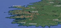
I wonder if its relational to say the alps, the alps is higher than everything there so they do not look as domineering. It's the same in Ireland the tallest 1038m mountain in Ireland looks like this

Its relative to heights, and also been smoothed out in many places, to make so that locations can handle cities and buildings properly, instead of looking crazy.
 
  • 16
  • 12
  • 4Like
Reactions:
Its relative to heights, and also been smoothed out in many places, to make so that locations can handle cities and buildings properly, instead of looking crazy.
I understand that's probably a good reason but some key geographic features do seem sort of left out like the Wicklow mountains beside Dublin,

1000026743.jpg

1000026742.jpg
 
  • 8Like
  • 4
  • 1
Reactions:
If the factor is only 2x, wouldn't a 16k heightmap with some noise to mask the low resolution go pretty far?
It's times 4: four height values for each pixel of the map. Combined to potentially 30 slope values for each and every pixel (six internal ones, and 24 with neighboring pixels).

They probably aren't using all of them, but still: plenty at the scale of EUV.
 
  • 3Like
  • 1
Reactions:
This is what south-west Ireland looks like on Google Earth:
Screenshot_20250717_182532_Google Earth.jpg
Screenshot_20250717_183040_Google Earth.jpg

And this is the area near Dublin:
Screenshot_20250717_183546_Google Earth.jpg


Yes, maybe a but taller than it is in EU5, but not that much really, at least I can't see that much of a difference, aside from some smoothing needed to get the buildings not look weird.
 

Attachments

  • Screenshot_20250717_182532_Google Earth.jpg
    Screenshot_20250717_182532_Google Earth.jpg
    207,8 KB · Views: 0
  • 4
  • 1Like
Reactions:
Tbh, I dont understand people excitement of this video.

Everything is so blurry\roundy, as many already said, why not to follow Imperator style?
When zoom out, forts look like pimples. Why not to show them as 2d pictures like in eu4 (with enable\disable shortcut)?
 
  • 20
  • 4Like
  • 2
Reactions:
This is what south-west Ireland looks like on Google Earth:
View attachment 1335265View attachment 1335266
And this is the area near Dublin:
View attachment 1335268

Yes, maybe a but taller than it is in EU5, but not that much really, at least I can't see that much of a difference, aside from some smoothing needed to get the buildings not look weird.
The point being these mountainous areas (for Ireland) are represented on the map as the same as a hill in the middle of the country which is basically completely flat. That's sort of the complaint not that they need to look like the alps.
 
  • 1
  • 1Like
Reactions:
The point being these mountainous areas (for Ireland) are represented on the map as the same as a hill in the middle of the country which is basically completely flat. That's sort of the complaint not that they need to look like the alps.
The thing is, those mountains are actually quite small. At school I was thought that you can cosider a relief a mountain when it's at least 800m above sea level, and here we're talking of ~1000m, so they're not that high.

The main thing I wanted to point out, however, is that while 1000m might sound like a lot, when you put that on a map it's actually very little, and maps showing mountains usually have some degree of exaggeration. There are people who don't realize this, or how much reliefs are exaggerated, and the whole point of my post is making these people aware of this fact.
 
  • 2Like
Reactions:
The thing is, those mountains are actually quite small. At school I was thought that you can cosider a relief a mountain when it's at least 800m above sea level, and here we're talking of ~1000m, so they're not that high.

The main thing I wanted to point out, however, is that while 1000m might sound like a lot, when you put that on a map it's actually very little, and maps showing mountains usually have some degree of exaggeration. There are people who don't realize this, or how much reliefs are exaggerated, and the whole point of my post is making these people aware of this fact.
Yeah they are a quarter of the height of the alps but again as a geographic feature of showcasing the country pointing to an area of Ireland that is at sea level and a 1000m mountain and making that look the same seems off.
 
  • 3
Reactions:
Yeah they are a quarter of the height of the alps but again as a geographic feature of showcasing the country pointing to an area of Ireland that is at sea level and a 1000m mountain and making that look the same seems off.
I think it's mainly a texture problem. It looks the same because it has the same texture as the surrounding lowlands.
 
  • 2Like
Reactions:
I feel like the map for Imperator was peak... this is good, but I feel like some textures are either low res or blurry. I'm not an expert, so no idea, but that's how it feels to me, subjectively.
 
  • 7Like
  • 4
Reactions:
The heightmap is not 16k x 8k, its 32k x 16k. This is needed to get the resolution up.
I think there is some very obvious clipping, especially in the transitions from the artificially flattened areas to some ranges of hills, as can be seen in the middle of England. And what's left is ugly and blocky,
1752777682092.png

I live somewhere in this image, and I can confirm it doesn't look like that ;)


Out of interest, I rendered a view of the region using a 40k Earth bump map. I'd say you've definitely anihilated too much detail, and you need to blend the edges of the areas you've deliberately flattened better.
1752779715530.png


Tighter in on southern Britain:
1752779939448.png


I've posted these to on one hand show what's possible from a map admitedly 25% larger than the one you're using, but also to highlight the limitations. Because I'm using displacement here, as you are in the game model. Only I have the freedom to use an insanely high-poly sphere.

The two images above were rendered with a stupidly high 1 trillion poly count (via dynamic tesselation). I've since worked out that it looks about the same with only 16 million, which is comfortably in the range that something like Unreal's Nanite would laugh at.

At only 260k polygons for the entire sphere you can begin to see a drop in detail, but it's still not terrible for a game. I don't know what kind of detail level your map mesh has....
1752781656154.png
 
Last edited:
  • 17Like
  • 5
  • 1
Reactions:
The blobby bits of raised land in Britain do a poor job of representing the hills. A lot of it looks more like plateaus than the rolling hills that you actually see.

The mountains in Scotland look off. It looks like Ben Macdui is much higher than Ben Nevis when Ben Nevis is 36 m higher. The Great Glen also looks to be missing so the North West Highlands merge into the Grampian Mountains rather than being split by a large valley. Some of the mountains, most notably Ben Macdui, also appear too sharply peaked for this relatively old mountains.
 
  • 1
Reactions:
1752785323560.png


not sure we need to gray overlay - otherwise the lines look really sharp, and rivers are looking better

the terrain map looks kinda blurry at times, not sure if that's something you can fix without requiring beefier computers though
 
Last edited:
  • 6Like
Reactions: