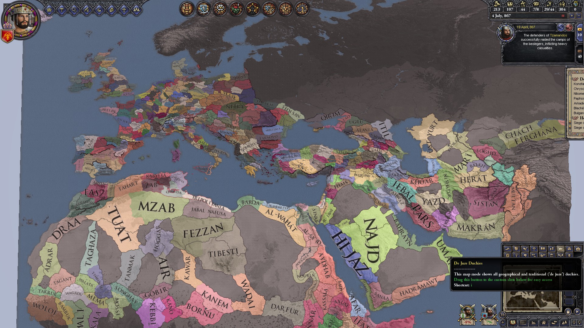
[Submod] Gaea 1.4.5d (Updated Map) - 04/08/2019
- Thread starter Marinakis
- Start date
-
We have updated our Community Code of Conduct. Please read through the new rules for the forum that are an integral part of Paradox Interactive’s User Agreement.
You are using an out of date browser. It may not display this or other websites correctly.
You should upgrade or use an alternative browser.
You should upgrade or use an alternative browser.
Okay, I have tried everything I can think of, so I am reaching out to anyone who may have some map modding experience/knowledge to help uncover what the issue is..
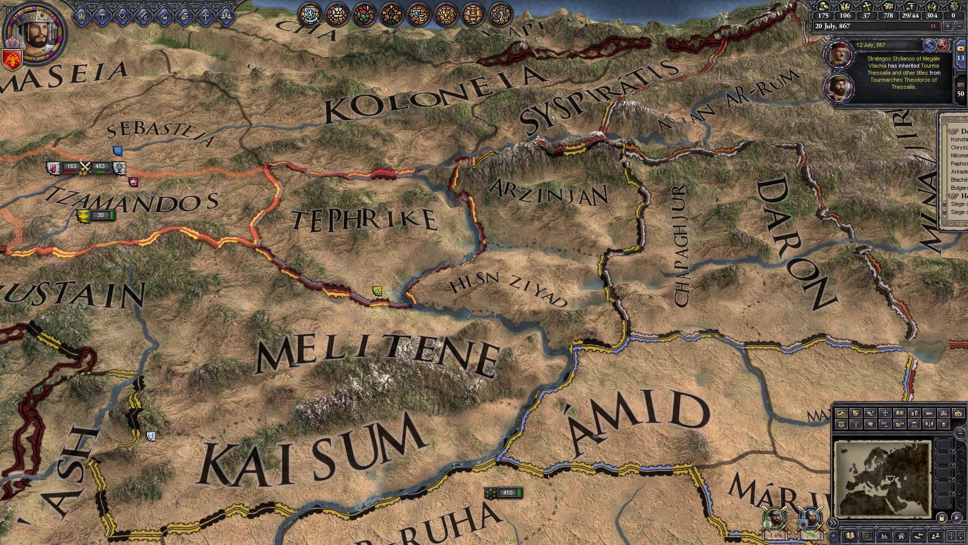
My problem is - There are certain parts of the map which cause a CTD (Loading Map Logic) when I place provinces on specific parts of the map (mostly mountainous regions). I have generally been able to work around it, but its been getting bad lately. Basically some file in the HIP or base game is conflicting with my map and causing a CTD if there is not impassible terrain between certain provinces or on top of certain pixels on my map. My instinct is its related to the silk route in some way, but I cant think of any files other then the one in the Trade_Route file.
It hasn't been too annoying to work around until I got to the Iranian plateau... this has become dreadful to freelance. I have tried erasing the trade_routes file and the adjacencies file with no effect on the CTDs.
Being that all I am altering are the map files, I cannot think of any other files which could be conflicting with my mod (outside of the obvious - provinces, rivers, terrain, topology, world_normal_height, colormap or colormap_water files...)
If anyone has ANY ideas, it would be much appreciated and speed up my progress significantly.
Thanks!


Last edited:
You're making awesome progress, sorry I can't help with the impassable error. My guess is some terrain file which states terrain, or maybe in the province files where it (I think) says the terrain of the province. You've probably checked those though, so sorry I can't help more.
Europe is ... finally... almost done.
Moving on to the lands of the Norse and Slavs next.


For Comparison, and giggles


Moving on to the lands of the Norse and Slavs next.


For Comparison, and giggles


how come you changed al-sham? and would this map be compatible with the SWMH-friendly EUIV converter?
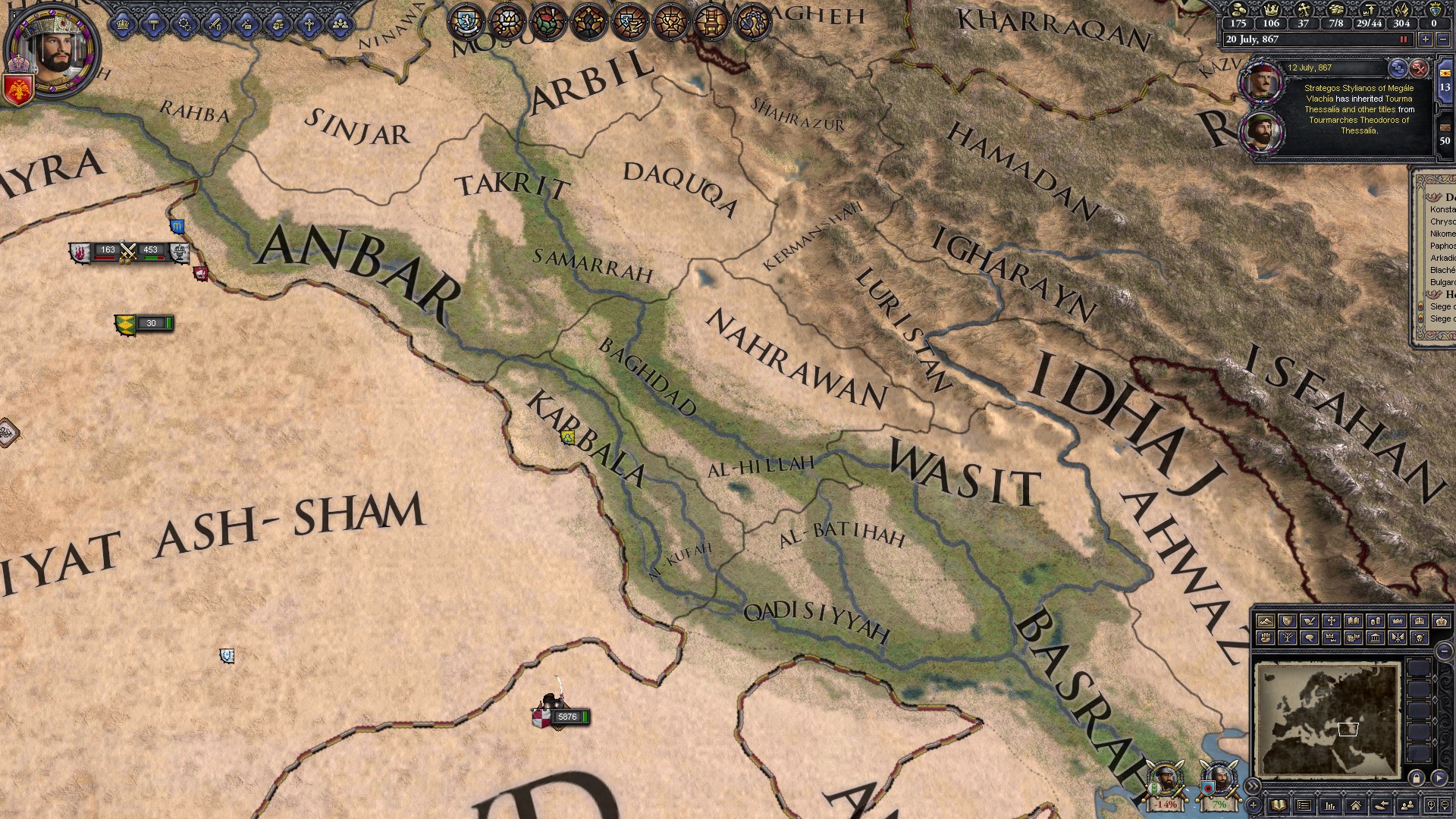
What do you mean "changed?" I mapped Syria more to my liking, but I didn't change the province count or duchy count.how come you changed al-sham? and would this map be compatible with the SWMH-friendly EUIV converter?
In terms of if it's compatible with EUIV converter - I have no idea. But, I'm not adding any new provinces, so I don't see why it wouldn't work.
Last edited:
Lands of the Rus and Turkic tribes coming together nicely


Started updating the topography a bit, removing some of the large-scale, modern-aged reservoirs (More tedious then you think).


Started updating the topography a bit, removing some of the large-scale, modern-aged reservoirs (More tedious then you think).


Speaking of modern-age reservoirs, there are two large reservoirs in northern Finland:
Lokka
https://en.wikipedia.org/wiki/Lokka_Reservoir
Porttipahta
https://en.wikipedia.org/wiki/Porttipahta_Reservoir
They connect to each other via a canal.
Lokka
https://en.wikipedia.org/wiki/Lokka_Reservoir
Porttipahta
https://en.wikipedia.org/wiki/Porttipahta_Reservoir
They connect to each other via a canal.
Amazing work, @Marinakis !
Are you willing to edit the borders of some provinces?
I have noticed that for instance Bohemia's borders are distorted. I also noticed some inaccuracies in North Africa (for instance Sijilmasa absolutely should not border on Tlemcen/Tilimsán and it shuold instead have direct connection to Taghaza etc.), would you be able to change these things? O might post suggestions, if you could show me more detailed look on Bohemia and surroundings, and screenie of Morocco with adjacent Saharan provinces (previous screens of Morocco don't have Saharan provinces painted yet)
Amazing work, @Marinakis !
Are you willing to edit the borders of some provinces?
I have noticed that for instance Bohemia's borders are distorted. I also noticed some inaccuracies in North Africa (for instance Sijilmasa absolutely should not border on Tlemcen/Tilimsán and it shuold instead have direct connection to Taghaza etc.), would you be able to change these things? O might post suggestions, if you could show me more detailed look on Bohemia and surroundings, and screenie of Morocco with adjacent Saharan provinces (previous screens of Morocco don't have Saharan provinces painted yet)[/QUOT
Sure, try to give me picture. I am never opposed to correcting borders.
As for Sijilmasa, here is how I think its borders would look betterSure, try to give me picture. I am never opposed to correcting borders.

but I don't have the whole picture with Saharan provinces - Touat and Taghaza. Could you upload a better screenie where I could suggest it?
And the same for Bohemia. It can be seen only roughly, but from what you have uploaded it is clear that the border doesn't follow the border mountains of Bohemia... which could roughly be like this

but that's very rough, I can hardly see the rivers and mountains there, so it is hard to draw a proposal. Perhaps map of Germany with provinces would help. It seems like there are many misplacements also in Germany (since Bohemia is evidently stretched this weirdly.
And the last thing is Egypt - for instance the town of Qus lies where the northern border of Ikhmin province crosses the Nile, so there are at least 3 largely misplaced provinces (Asyut, Ikhmin and Qus)
As for Sijilmasa, here is how I think its borders would look better

but I don't have the whole picture with Saharan provinces - Touat and Taghaza. Could you upload a better screenie where I could suggest it?
And the same for Bohemia. It can be seen only roughly, but from what you have uploaded it is clear that the border doesn't follow the border mountains of Bohemia... which could roughly be like this

but that's very rough, I can hardly see the rivers and mountains there, so it is hard to draw a proposal. Perhaps map of Germany with provinces would help. It seems like there are many misplacements also in Germany (since Bohemia is evidently stretched this weirdly.
And the last thing is Egypt - for instance the town of Qus lies where the northern border of Ikhmin province crosses the Nile, so there are at least 3 largely misplaced provinces (Asyut, Ikhmin and Qus)
Thanks, added to my "To Do" list. Those are exactly the kind of border adjustment suggestions I like. Much appreciated.
I'm going to head to the beach with the wife and kid this weekend, so I wont be getting much more done over the next few days,
But here's a tease of Scandinavia.


But here's a tease of Scandinavia.


Glad you like it.Thanks, added to my "To Do" list. Those are exactly the kind of border adjustment suggestions I like. Much appreciated.
So I hope I'm not annoying to ssk for a screenie of South Morocco and Central Europe soI could give you some more
Sorry Guys,
I have been away for a few days then avoided doing more for a few extra days to try and avoid burn-out.
Nevertheless, I got most of the Norse lands and Russian Steppes done today. The Iranian/Turkic Steppes and India are all that's really left of the provinces file
Enjoy the pics.
 View attachment 276652


I have been away for a few days then avoided doing more for a few extra days to try and avoid burn-out.
Nevertheless, I got most of the Norse lands and Russian Steppes done today. The Iranian/Turkic Steppes and India are all that's really left of the provinces file
Enjoy the pics.


Last edited:
Beautiful!
My only gripe with SWMH's province shapes is that too many of them are 'square' and blocky. Needs more squiggly borders.
My only gripe with SWMH's province shapes is that too many of them are 'square' and blocky. Needs more squiggly borders.
Beautiful!
My only gripe with SWMH's province shapes is that too many of them are 'square' and blocky. Needs more squiggly borders.
Remember mine is a first draft. I'm trying to not fall into the trap of perfect borders on the first go-around or I'll never get a playable version.
As a general rule, I try to make geographic boundries (Mountains, deserts, rivers, etc) serve as borders as they did until the modern era.


