

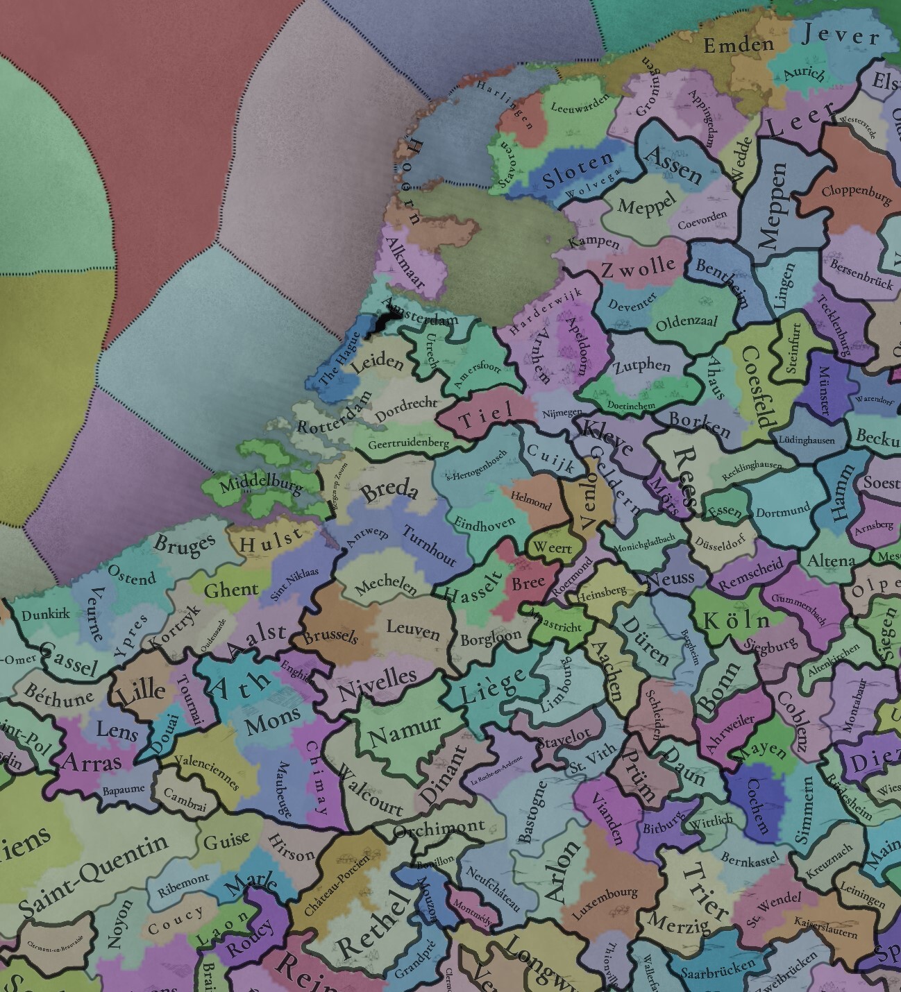
I think we agreed a few pages ago that Lordship of Mechelen should be its own tag? Then we have to set its borders right and not give it cities it never owned. At the game start, it was just Mechelen and surrounding area, the Heist enclave and the tiny Gestel enclave. Connect the rural lands in between if necessary to make Mechelen big enough to get them on the map. Can we agree on that already, then we can decide to do what we do with the "real" Brabantian cities?
Tinto Maps #1 Feedback
- Thread starter Pavía
- Start date
-
We have updated our Community Code of Conduct. Please read through the new rules for the forum that are an integral part of Paradox Interactive’s User Agreement.
You are using an out of date browser. It may not display this or other websites correctly.
You should upgrade or use an alternative browser.
You should upgrade or use an alternative browser.
Now that we know for a while already canals are available at game start, the Low countries had a few important canals already present:Considering the current state of implementation of natural harbors, I'd like to append @Koiodoros his post for Flanders natural ports and Northern France
River Ports:
Brugge - despite heavy siltation past the 1430s, Bruges always retained its coastal connection through a canal to Sluis. Although I agree Bruges should decline, Sluis, also within the location's borders, retained its river port position for much longer, as evident from Pieter Pourbus' map (1571) and the Frickx map (1712).
Veurne - Nieuwpoort was established in 1163 at the mouth of the Yser river and was an important river port.
Tancarville - Le Havre had a Coastal barrier system with plenty of protected gullies. Neighboring Harfleur also had a significant port connecting to Le Havre through a canal.
Abbeville - developed in the 11th century as the capital of Ponthieu and was a river port on the Somme river. The mouth of the Somme is situated in a Bay, while the port towns of Le Crotoy and Saint-Valery never became huge, they were strategically interesting for the French, English and Burgundians in their conflicts.
Bay:
I first considered Ostend to be a bay, with the Testerep coastal barrier island, but as it was destroyed by a storm surge in 1394, I think 'flat coast' remains the more approriate option.
unaltered screenshot of current harbor implementation
View attachment 1241841
Bruges-Ghent and Dordrecht-Utrecht should both start with a canal system (Lieve and Vaartse Rijn, respectively).
De Lieve canal started construction in 1251, and was finished in 1269. It was thé major trade route for Flanders until the decline of Bruges.
De Vaartse Rijn (and Doorslag) saw the light of day in 1127 and was vital in connecting the Zuiderzee with Dordrecht (instead of having to navigate around Holland).
IIRC locations require city rank to have canals. I remember seeing an early version of the towns/cities map mode somewhere, but can't find it. Does anyone have the link?
A small tangent: The inevitable polders advance should imo also give modifiers akin to a 'nerfed canals' system. The resulting ditch infrastructure for draining the water resulted in an extensive interconnected network that facilitated local trade and transport immensely and was vital for the economical growth of the Netherlands.
- 2

- 1
I would add to this list the Schie canal for Delft. The city of Delft did a lot of shipping through it to supply the local breweries with grain from down the river. Which then supplied beer to Holland, Guelders, Brabant, Zeeland, Flanders and England through the same canal.Now that we know for a while already canals are available at game start, the Low countries had a few important canals already present:
Bruges-Ghent and Dordrecht-Utrecht should both start with a canal system (Lieve and Vaartse Rijn, respectively).
De Lieve canal started construction in 1251, and was finished in 1269. It was thé major trade route for Flanders until the decline of Bruges.
De Vaartse Rijn (and Doorslag) saw the light of day in 1127 and was vital in connecting the Zuiderzee with Dordrecht (instead of having to navigate around Holland).
IIRC locations require city rank to have canals. I remember seeing an early version of the towns/cities map mode somewhere, but can't find it. Does anyone have the link?
A small tangent: The inevitable polders advance should imo also give modifiers akin to a 'nerfed canals' system. The resulting ditch infrastructure for draining the water resulted in an extensive interconnected network that facilitated local trade and transport immensely and was vital for the economical growth of the Netherlands.
- 1
Found a very cool map of the Low Countries, a few centuries than game start

- 3
- 1
- 1