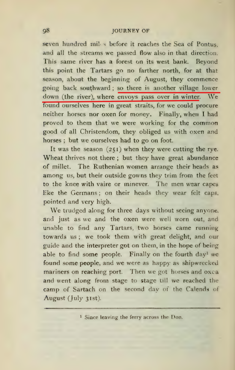
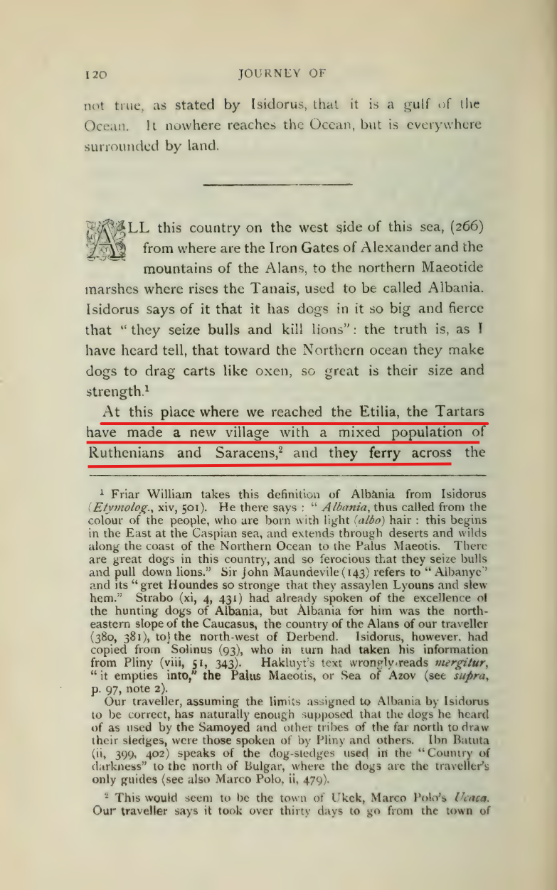
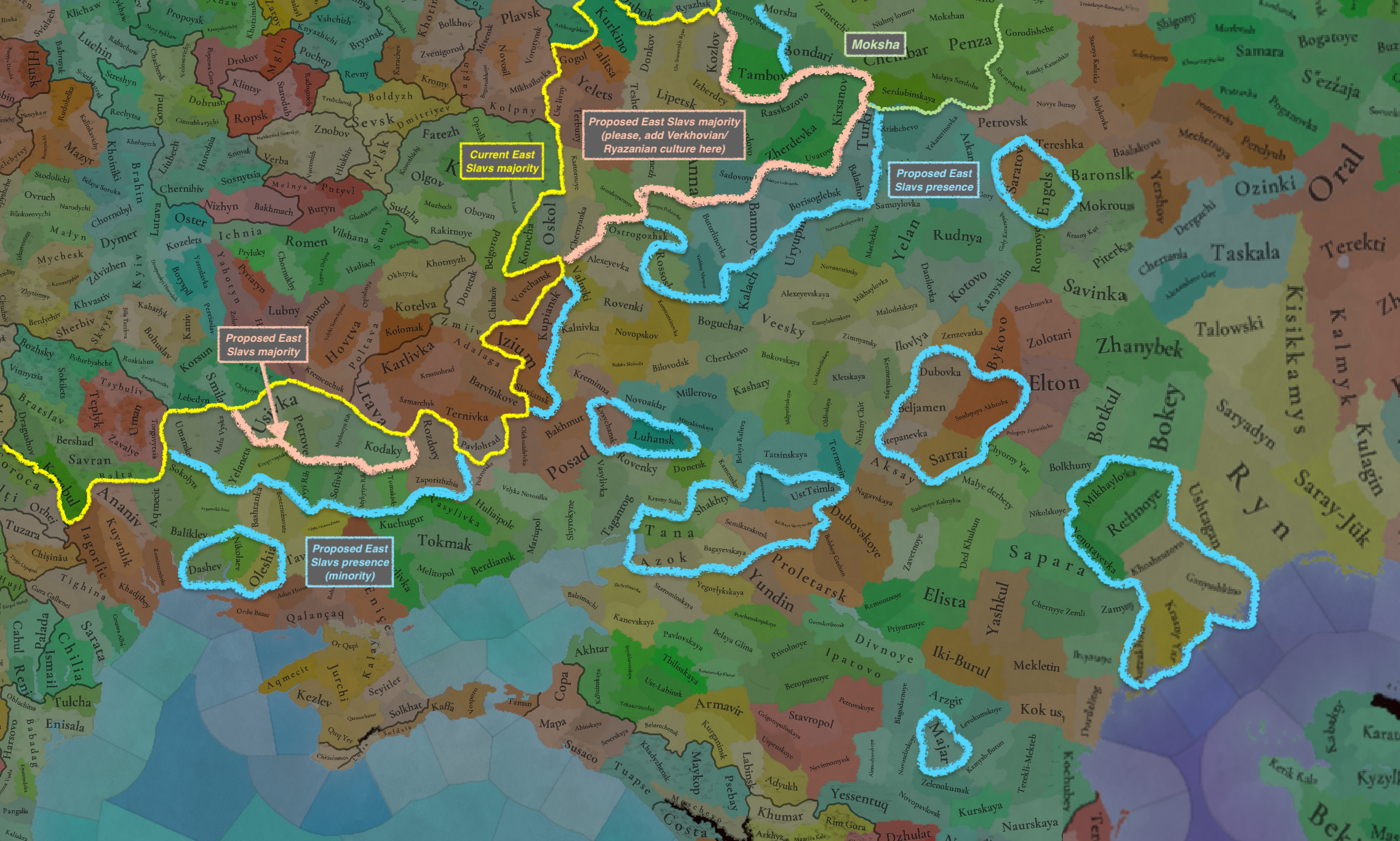
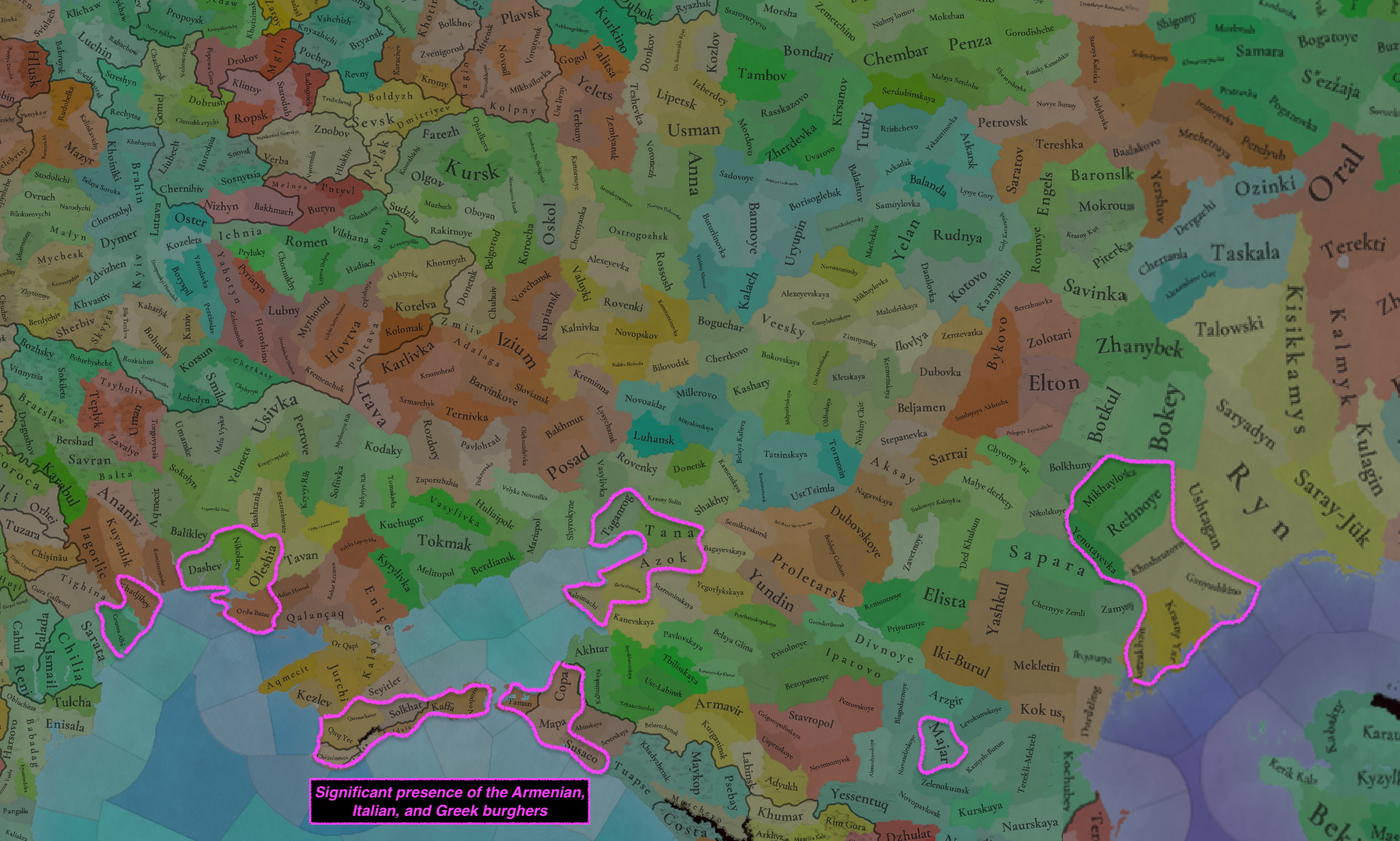
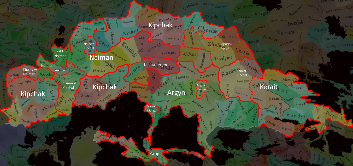
This is about as good as I can do for Kazakhstan for now. A lot of guesswork in the east especially around Upper Irtysh and Lake Balkhash but it does seem to line up pretty well with the sources I do have. Argyns are a bit anachronistic but they represent the Muslim Kipchak community of Saryarka and surrounding areas that would eventually (as in just a few decades after) become the first Argyns of Kara-Khoja. The rest of the Kipchaks are represented by a united Kipchak culture the western border of which goes along the Ural river, beyond which lie some sort of Tatar cultures which I am not going to delve into the setup of. Kipchaks are surprisingly well represented in archaeology of northernmost Kazakhstan but it does make some sense considering there are Kipchaks there today as well. The setup could always be better and some of the stuff here may be misinterpretation of the data but the connections of stone kurgans and memory complexes point to the Altai and thus Naimans, so it fits pretty well. Keraits aren't that well represented by archaeology but there are mentions of them going to the Irtysh and being there during the invasion of Timur.

 cyberleninka.ru

 cyberleninka.ru

 cyberleninka.ru

 egemen.kz


 cyberleninka.ru

 cyberleninka.ru

 cyberleninka.ru

 cyberleninka.ru


КЕНОТАФ ЗОЛОТООРДЫНСКОГО ВРЕМЕНИ НА МОГИЛЬНИКЕ КОТЫРТАС (Центральный Казахстан)
Малочисленность изученных памятников XII–XV вв. на территории Центрального Казахстана актуализирует введение в научный оборот любых новых материалов. В рамках данной статьи авторами освещаются результаты исследований золотоордынского кургана на могильнике Котыртас (Шетский р-н, Карагандинская обл.), содержавшего под земляной насыпью оградку из сырцовых кирпичей с пристройкой в виде «портала-пештака». Обращают на себя внимание выявленные следы двух кострищ, столбовые ямки, входная камера с выложенным кладкой порогом, облицовка фасадной стороны постройки, а также обмазка внутриоградного пространства тонким слоем глины. Погребальная камера была заложена в верхней части сырцовыми кирпичами и напоминает сагана, кладка которой опиралась на деревянное перекрытие. Захоронение выявлено не было, что позволяет определить объект как кенотаф. Высказаны некоторые критические замечания в адрес известной хронологии сырцовых оградок, опирающейся на наличие или отсутствие ряда конструктивных элементов. В выводах авторы приходят к необходимости предварительно датировать исследованное сооружение могильника Котыртас в рамках XIII–XIV вв.
ГОРОДИЩЕ БОЗОК — УНИКАЛЬНЫЙ ПАМЯТНИК СТЕПНОЙ САРЫАРКИ: ИСТОРИЯ ИЗУЧЕНИЯ И ОСМЫСЛЕНИЯ
Статья излагает историю открытия и исследований уникального археологического памятника степного Казахстана. Городище Бозок расположено на западной окраине г. Астаны, в болотистой пойме левого берега р. Ишим, на высоком восточном берегу оз. Бузукты, и датируется VII (VIII) — XVI вв. Открытие и первые годы исследования памятника связаны с именем известного казахстанского археолога К.А. Акишева. Последующие работы велись под руководством М.К. Хабдулиной. В пространственной организации и составе объектов памятника выделяются четыре части. Древнейшая часть — три квадратные площадки, обнесённые валами и окопанные рвами. Севернее площадок находится комплекс жилищ-землянок, южнее — некрополь с развалинами мавзолея и мусульманскими погребениями XIII—XVI вв. С востока и севера к руинам городища примыкает агроирригационная система. На протяжении длительного периода функционирования городище использовалось не столько как жилое пространство, сколько как особый сакральный центр степной части Евразии.
Золотоордынские погребения на территории городища и некрополя Бытыгай
В работе представлены результаты полевых археологических исследований на территории городища Бытыгай, где выявлены погребения периода Улуса Джучи. Два погребения установлены по косвенным признакам на поверхности земли, еще два погребения обнаружены методом сплошного вскрытия грунта; абсолютный возраст получен методом радиоуглеродного датированием. Использованы полевые материалы, полученные авторами в ходе проведения археологических изысканий в полевых сезонах 2021–2023 гг. на территории памятника. Основанием для интерпретации послужили надмогильные конструкции, описание погребальных камер, антропологический материал, а также погребальный обряд. Впервые в научный оборот вводятся материалы из городища и некрополя Бытыгай. Помимо традиционных методов, используемых в археологических исследованиях, таких как стратиграфия, аналогия, проведены междисциплинарные исследования. Результаты являются предварительными, так как ранее комплексное исследование такого сложного археологического объекта не проводилось. Городище и некрополь Бытыгай имеют специфические особенности, связанные со степным ландшафтом; структурные и архитектурные объекты, образующие городище, отличаются от других городов и городищ золотоордынского периода Поволжья, западного и южного Казахстана.
https://goldhorde.ru/wp-content/uploads/2019/01/%D0%9A%D0%BE%D1%81%D1%82%D1%8E%D0%BA%D0%BE%D0%B2.pdf

Алтын Орда хандарының қорымы
Солтүстік Қазақстан облысының Уәлиханов ауданындағы Сілеті өзенінің төменгі ағысындағы «Қызыл оба» деген жерді қазған М.Қозыбаев атындағы облыстық университет пен Павлодар мемлекеттік педагогикалық университетінің «Margulan centre» орталығының бірлескен археологиялық экспедициясы сенсациялық жаңалы
Great Steppe. Early 14th century // Atlas Tartarica. PPC "Intergroup". Kazan-Moscow-Saint-Petersburg. 2020. P. 220-221 [in English]
Great Steppe. Early 14th century // Atlas Tartarica. PPC "Intergroup". Kazan-Moscow-Saint-Petersburg. 2020. P. 220-221 [in English]
www.academia.edu
Сарыарқаның ортағасырлық археологиялық ескерткіштері: қысқаша талдау және мүмкіндіктер
Мақалада Сарыарқаның ортағасырлық археологиялық ескерткіштерін зерттелу тарихы талданады. Зерттелу тарихын шартты түрде бірнеше кезеңге бөліп қарастыруға болады. Алғашқы кезең XVIII ғ. басынан Орталық Қазақстан археологиялық экспедициясы құрылғанға дейінгі уақытты қамтиды және ескерткіштер туралы мәліметтер жинаумен сипатталады. Келесі кезең Ә.Х. Марғұлан басқарған Орталық Қазақстан археологиялық экспедициясының Сарыарқа өңірінде жүргізген археологиялық зерттеулерімен байланысты. Экспедиция көшпелі және отырықшы мәдениеттердің қатар дамығандығын дәлелдейтін көптеген жаңа ескерткіштер ашып, оларды зерттеуді жолға қойды. Соңғы кезең – жаңа заман кезеңі 1998 жылғы «Есіл археологиялық экспедициясы» құрылуы мен К.А. Ақышевтың Сарыарқа даласында археологиялық және палеоэтнографиялық зерттеулерді бастауымен ерекшеленеді. Жаңа заман кезеңінде Сарыарқа даласында отырықшы мәдениет орталықтары болған қала орындары Бұзық пен Бытығайда кең көлемде қазба жұмыстары жүргізілді. Зерттеу жұмыстарының нәтижелері Сарыарқа даласы отырықшы және көшпелі мәдениеттердің қатар және өзара тығыз байланыста дамыған орталық болғандығын дәлелдейтін тың материалдар беруде.
Зеркала в погребальной обрядности населения Сарыарки в эпоху Золотой Орды
Авторы анализируют зеркала, которые появились уже в древнетюркских погребениях, но только в эпоху Золотой Орды приобрели максимально широкое бытование, что было, в значительной мере, обусловлено активизацией контактов в связи с образованием Монгольской империи. Высококачественные китайские зеркала и их местные подражания повсеместно встречаются на обширной территории, где степняками в этот период создавались новые государственные объединения. Авторы согласщаются с мнением многих исследователей, считающих зеркала ритуальными изделиями. Имеются сведения, что в древнетюркское время зеркала были характерны для женских погребений. Эта информация отчасти, поскольку не всегда имеются палеоантропологические характеристики, подтверждается и для развитого средневековья. Приведены сведения об условиях обнаружения зеркал в погребениях рассматриваемого времени. Впервые выполнено полное описание некоторых из зеркал, обнаруженных в погребениях степной зоны Казахстана. Значительный интерес представляет обнаружение одного из зеркал, которое находилось под доской гробовища в женском захоронении по мусульманскому погребальному обряду. Авторы статьи преследуют цель выявить роль отдельных предметов в погребальной обрядности эпохи средневековья, в данном случае зеркал, как маркера гендерной принадлежности.
Монографии - Материалы и исследования по археологии Казахстана - ІІІ том. Очерки средневековой археологии Верхнего Прииртышья
Қазақстан археологиясының кітапханасы / Archaeological Library of Kazakhstan
arheology.kz
ҚАРАТАУДЫҢ ТЕРІСКЕЙ БЕТІНДЕГІ ОРТАҒАСЫРЛЫҚ ҚАЛАЛАРДЫҢ АРХЕОЛОГИЯЛЫҚ ЗЕРТТЕЛУ МӘСЕЛЕСІ
Мақалада Қаратаудың теріскей бетіндегі ортағасырлық қалалардың археологиялық зерттелу мәселесі қамтылған. Қарт Қаратаудың теріскей беті ежелден отырықшы-егінші және көшпелі-мал өсіруші мәдениеттердің шекарасы түйіскен аймақ болып келген. Өңір арқылы ұзақ уақыт бойы халықаралық сауда керуен жолының негізгі тармақтарының бірі өткен. Теріскей Қаратаудың бөктерлерін шығыстан батысқа қарай бойлай тізбектеле орналасқан Тамды, Саудакент, Құмкент, Бабаата, Шолаққорған, Созақ, Күлтөбе, Раң, Ақсүмбе қалашықтары керуен жолы бойында қалыптасқан үлкенді-кішілі қалалар мен мекендердің орындары. Керуен жолдары арқылы бір замандарда дипломатиялық елшіліктер де өтті. Сол елшіліктердің жазбаларында жоғарыда аталған қалашықтардың орнында болған бірқатар қалалардың аттары сақталған. Мақалада айтылған қалалар жайлы деректер мен олардың орнын анықтау мақсатында жазылған еңбектерге шолу да жасалады. Теріскей ескерткіштерінде жүргізілген археологиялық барлау және қазба жұмыстары өңірде мал шаруашылығымен қатар, егіншілік пен қолөнердің, өзара сауданың дамығандығын көрсететін материалдар берді.
ИССЛЕДОВАНИЕ СРЕДНЕВЕКОВОГО ПРОИЗВОДСТВЕННОГО ЦЕХА НА ГОРОДИЩЕ БЫТЫГАЙ
Статья посвящена изучению новых археологических данных, полученных в результате исследования городища Бытыгай. Памятник расположен в окрестностях села Коргалжин Акмолинской области (Республика Казахстан). В научный оборот вводятся материалы, полученные при исследовании производственного цеха. Памятник в сочетании с другими объектами образует единый городской и технологический центр, существующий на территории Тенгиз-Коргалжинского региона и даже всего Центрального Казахстана. Исследованный в 2021 г. объект и другие строения на городище Бытыгай обладают совокупностью характерных черт и признаков тимуридского архитектурного стиля и, по предварительным данным, датируются XIV-XV вв.
Средневековые кочевники.pdf
В монографии на основании комплексного анализа археологических и письменных источников рассматривается этнокультурная и этнополитическая история кочевников эпохи средневековья – огузов, печенегов, кыпчаков/половцев – в течение X XIV вв.
www.academia.edu
- 8
- 3


