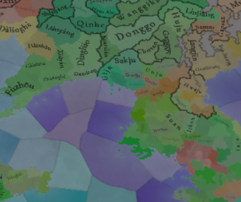
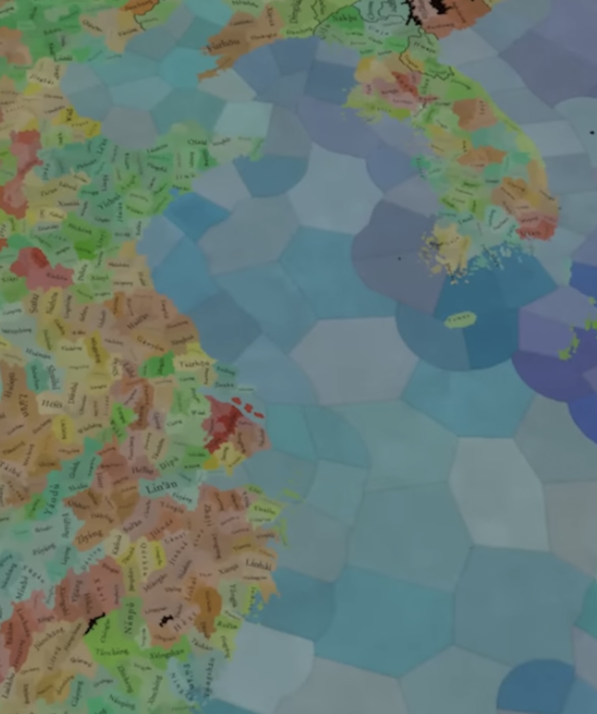
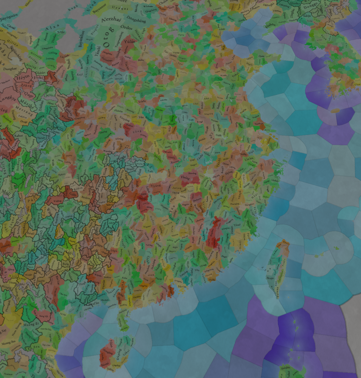
This is what it should have, and you still don't answer why the map of China is so rough, compared to the Korean Peninsula.>是游戏中人口最多的地区
>从接受额外的机构开始
>拥有几乎所有可能的原材料
>也从独特的制造产品开始
>(sorta)中心化
>内容最多的国家之一(IO、情况和事件)
为什么中国代表性不足?
- 11
- 2
This is what it should have, and you still don't answer why the map of China is so rough, compared to the Korean Peninsula.>是游戏中人口最多的地区
>从接受额外的机构开始
>拥有几乎所有可能的原材料
>也从独特的制造产品开始
>(sorta)中心化
>内容最多的国家之一(IO、情况和事件)
为什么中国代表性不足?
We decided to keep the Liang principality as directly owned by Yuan, as the title was mainly a nominal one and the Tusi setup was already complicated enough, but it is something that we may take another look at.
| 
|
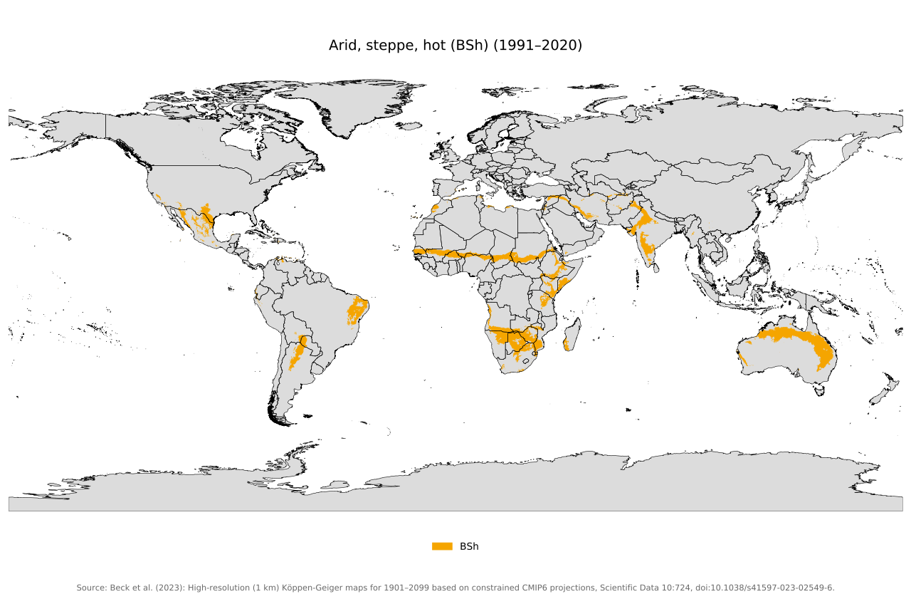
I actually think that’s a good idea, and I think I even suggested this once, though it seems to be missing a hyphen (Semi-Arid).Yes, it was renamed with the aim to avoid potential confusions, but we are aware that it is not the scientifically accurate naming.
How did you arrive at this figure? Korea looks like the same density. If it's more, it can't be by much. Are you including Manchuria, Inner Mongolia, Tibet, Xinjiang? Because those are not within the scope of this post and moreover were historically separate from China proper and not as relevant. The core of China has an awesome location density.
It's not 5x though
Someone once hypocritically said ,"We want to avoid Eurocentrism " Oh, that's hilarious.One finds certain 'European aristocrats' still clinging to their moth-eaten imperial delusions, trumpeting 'we are the dramatis personae in game' whilst decrying historically accurate depictions of Chinese territorial divisions as 'nationalist fever'. The sheer audacity of their double standards is laid bare – they can't even be bothered to trot out the tired old 'game balance' justification. These frightfully ill-mannered sorts cannot proffer a single equitable alternative to balancing China beyond reducing its states. All they manage is slapping labels on chaps like some common street-corner pamphleteer.
Let it be stated plainly: none deny Europe's colonialist 'Great Achievements' or Enlightenment-era contributions. Neither does one observe interlopers vandalising European tinto talks with accusations of nationalism. These tin-eared buffoons ought to crack open a history tome – though one shan't hold one's breath, given their congenital arrogance.
The world hasn't operated according to their old golden age fantasies since the sun set on their nations, dear boys.
It will now be called semi arid, but it will still represent Cold Arid (that is both BWk and BSk climates). Hot semi arid (BSh) will still be inside the normal Arid climate (which will represent Hot Arid, including BWh and BSh)I actually think that’s a good idea, and I think I even suggested this once, though it seems to be missing a hyphen (Semi-Arid).
Now, this climate could potentially also be used to represent hot semi-arid climates that so far have not been represented in the game. Have you considered doing that?
View attachment 1336967
Not same density
View attachment 1336964
Yea it is like 3x difference, 5x was for the Japan and Germany/Italy density, my bad
How about calling it "Cold Semi-Arid" then? Or is that too long/unwieldyIt will now be called semi arid, but it will still represent Cold Arid (that is both BWk and BSk climates). Hot semi arid (BSh) will still be inside the normal Arid climate (which will represent Hot Arid, including BWh and BSh)
Have they shown how the output of a location scales with the size of the population? None of the content creators indicated anything other than more locations = better (meaning that China won't have the appropriate resource output and power compared to any European power that manages to conquer a big portion of the continent).Comparing location densities of Europe and China is rather silly, when Europe was much more politically fragmented in this period. But I guess forum users here have for some reason decided that the number of locations is a metric for measuring how "important" and "valuable" a region is.
Parts of the Indo-Gangetic Plain (Central Punjab and Haryana) and the Deccan Plateau with the BSh climate type are lumped into the general Arid climate along with complete Arid BWh desert areas and given their maluses (lower life expectancy, no winters at all, lesser rainfall), which hardly seems accurate enoughIt will now be called semi arid, but it will still represent Cold Arid (that is both BWk and BSk climates). Hot semi arid (BSh) will still be inside the normal Arid climate (which will represent Hot Arid, including BWh and BSh)
Uh, yeah, many times. Population is what produces food and works in RGOs. You can also see in Generalistgaming's video about Korea for example how the high location density of Korea makes spreading control slightly more difficult, as each location has its own proximity cost.Have they shown how the output of a location scales with the size of the population?
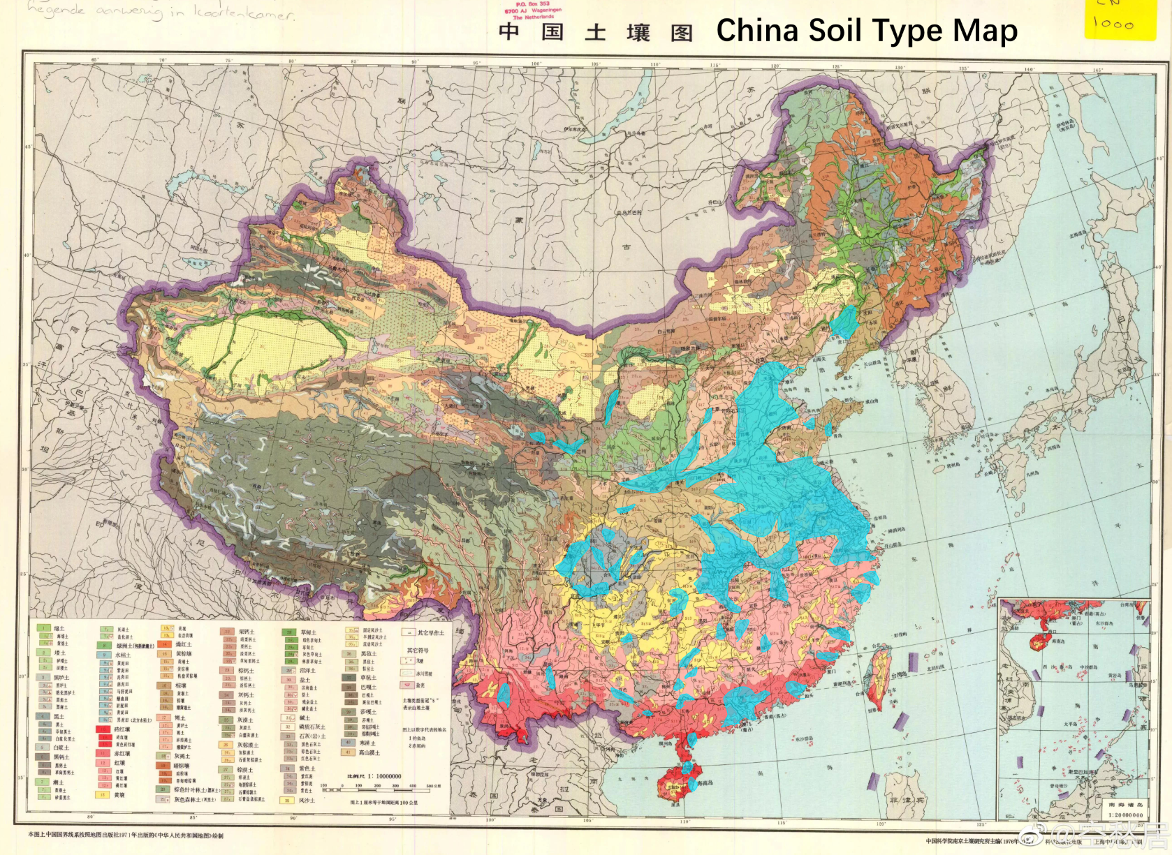
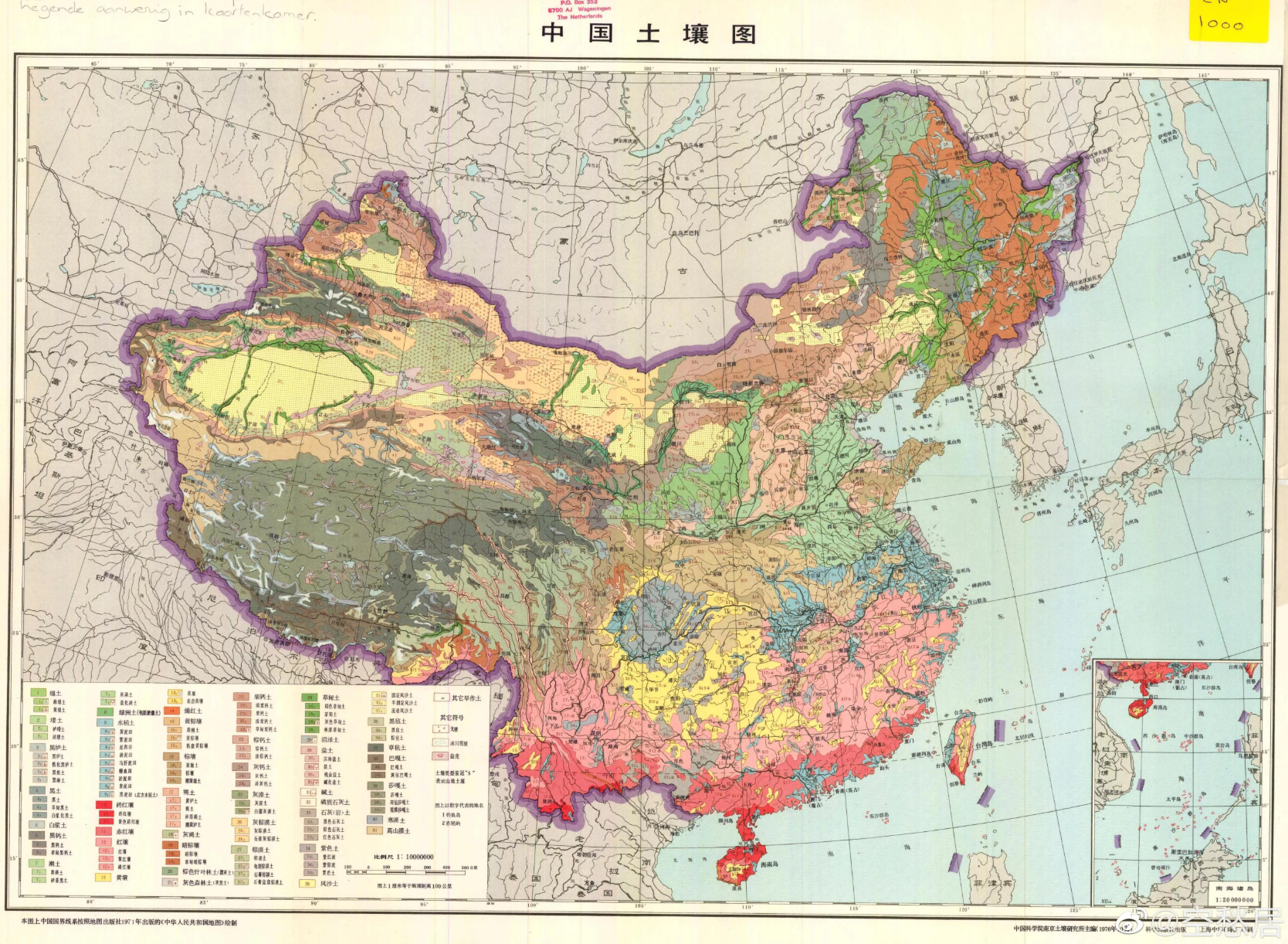
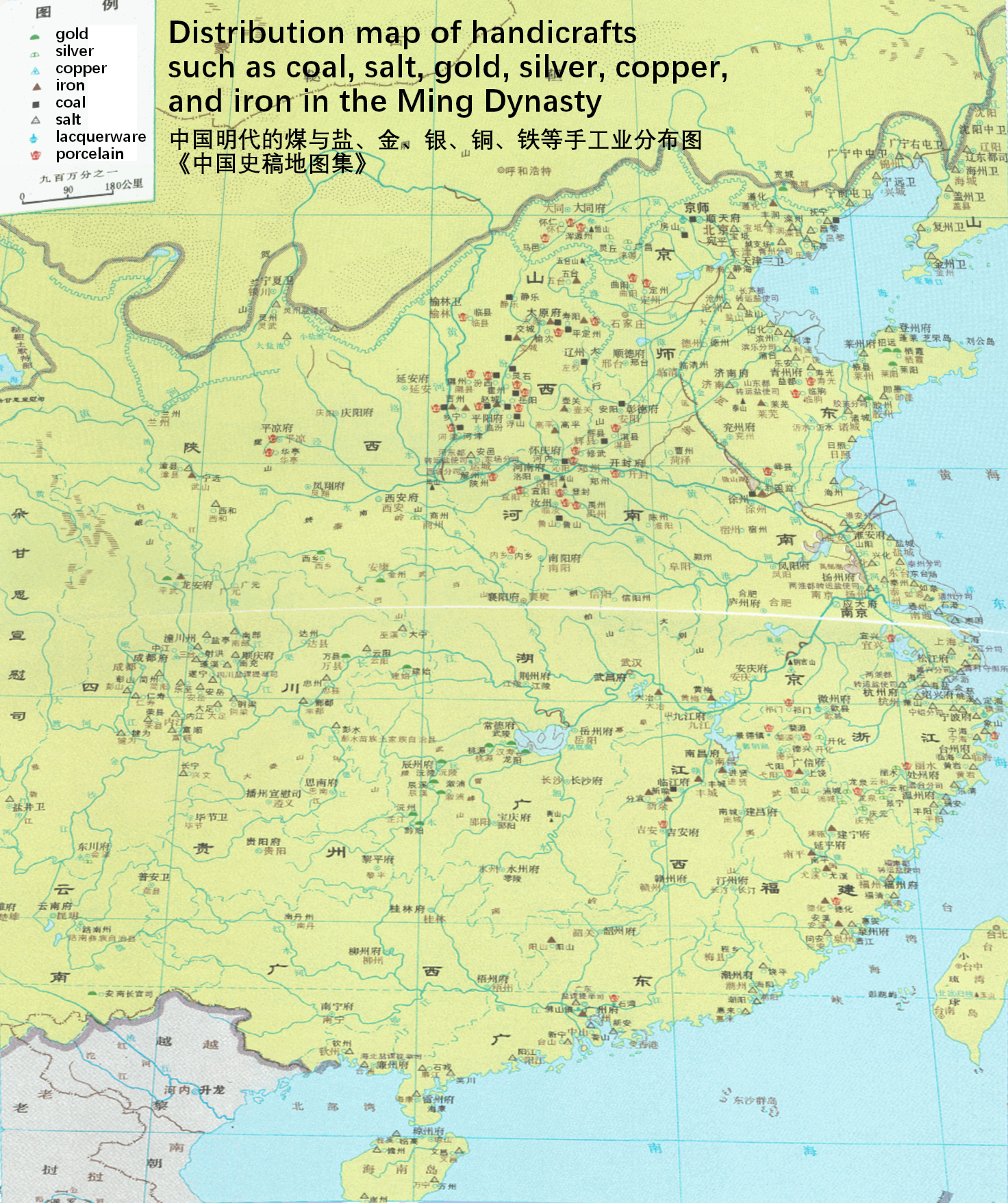
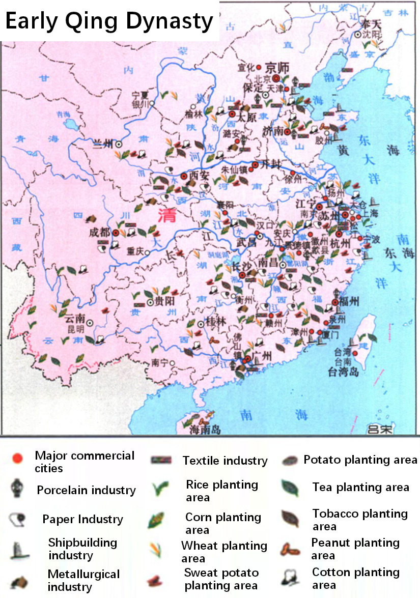
However, the game is not early China in the Qin and Han dynasties, since the Song Dynasty in the ck 3 period, China has completed the southward shift of its economic center of gravity. The Central Plains (Henan) and Jianghuai (Jiangsu, Zhejiang, Anhui, Hubei) have surpassed North China in economy and population. But from the existing map in the game, as you said, China does not show the name of the land is still only North China, The division of the entire Yangtze River basin does not conform to historical facts, unless the game is named ir.View attachment 1336968
Korea seems to be around the same density of northern China and Sinchuan(you can see it from the fact that locations names don't appear because the locations are too small) which is where the main population centers are, I think that's pretty fair

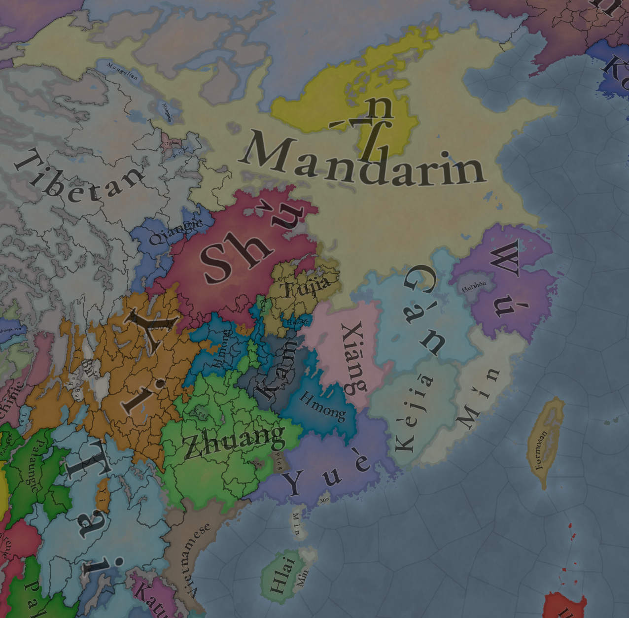
Korea seems to be around the same density of northern China and Sinchuan(you can see it from the fact that locations names don't appear because the locations are too small) which is where the main population centers are, I think that's pretty fair
