• We have updated our Community Code of Conduct. Please read through the new rules for the forum that are an integral part of Paradox Interactive’s User Agreement.

Tinto Maps #10 - 12th of July 2024 - Syrian Levant & Egypt

Hello everyone, and welcome to another Tinto Maps! We’re back after celebrating the most important victories over Germany and France since the 30 Years War a hard week of work, and we’re ready to share with you the region of the Syrian Levant & Egypt (actually, we’re revealing a bit more of what those regions would be, to cover the complete extension of the Mamlūk Sultanate). Let’s go!

Countries:
Countries.png

The Mamlūk Sultanate is the main power of the region, a situation achieved after the defeat of the Mongols at the Battles of Ain Jalut and Marj al-Saffar, and the fall of Acre, the last stronghold of the Crusader states in Outremer. The latter's legacy is still handled by the Kingdom of Cyprus, ruled by Hugues IV of Lusignan. Apart from that, we can see the realm of Candia, a subject governed by the Serene Republic of Venice, and some Arabic tribes, such as the Hutaym and the Anizah. Oh, and also, to the south-west, you might have noticed some oases ruled by either the Mamluks, or Fezzan; I opted for not coloring the wastelands, as usual, but also the corridors, a type of terrain present in other GSGs, that we have in Project Caesar. I’ll talk more about them under the ‘Locations’ section of the DD, but I just want to note one more thing: the connection down the Nile is a regular one, with a border existing between the Mamluks and Makuria (the country that controls the small chunk of land at the very south of the image).

Dynasties:
Dynasties.png

The Bahri Mamluks have ruled the Sultanate since they deposed the Ayyubids, almost a century before the start of the game. It could maybe be a bit more accurate to depict Sultan al-Nasir Muhammad as an ibn Qalawun (‘of the lineage of Qalawun’), but the dynastical dynamics of the Mamluk rulers are not so easy to portray, so we opted for the moment to better use Bahriyya. Apart from that, you may also see the neighboring dynasties, such as the already-mentioned House of Lusignan, or the Hethumian of Cilicia.

Locations:
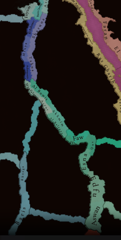
Locations 1.png

Locations 2.png

Locations 3.png

Locations 4.png
Here you can see the locations of the entire region, and also closer chunks behind the ‘Spoiler’ button. The most interesting feature to talk about is that of the corridors, something that some of you might remember from ‘Imperator: Rome’, but also something new to the rest. The corridors are empty locations, with no population or resources, but that allows connection between the locations at their sides, for some mechanics that we’ve already mentioned (market access, control), and some others that we haven’t (army movement). This is the way that we’ve chosen to portray the Saharan corridors, that allow for a connection between the Maghreb and the Mashreq, and Western and Central Africa. There are also some regular locations over those corridors, with population, resources, etc., that can be controlled by countries, which portray the desert oases that made for important outposts in the different Saharan routes. Not all the connections are throughout corridors, though; outside of the image, the Nile River valley allows for regular locations all the way down from Egypt to Nubia, the last location held by the Mamluks being that of Aswan, while the first held by Makuria, not shown in the screenshot, being Qasr Ibrim. We will talk more about Nubia and Ethiopia in a future Tinto Maps.

Provinces:
Provinces.png

Usual provinces mapmode; please let us know of any spelling or naming suggestions that come to your mind.

Areas:
Areas.png

A new mapmode that has been requested in previous Tinto Maps, and that we’re now incorporating.

Terrain:
Climate.png

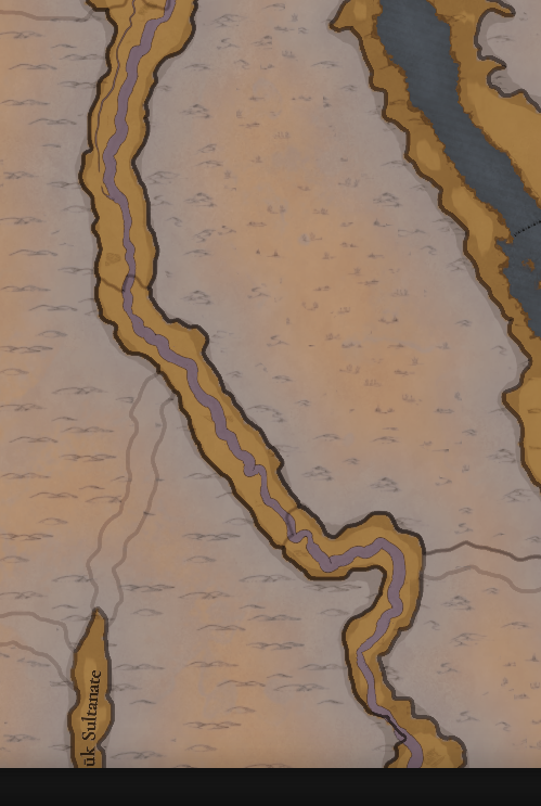
Topography.png

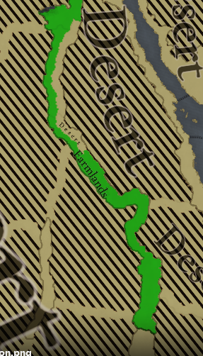
Vegetation.png

The climate is dominated by a mix of Mediterranean, Arid, and Cold Arid. The topography of the region is quite flat, with some hills and mountains on Mount Lebanon and Anti-Lebanon, Mount Sinai, and the verge of the Arabian plateau; and some marshland over the Nile Delta, of course. Regarding the vegetation, desert and sparse vegetation dominate most of the region, with some woods and forests over Levant, and the Nile fertile farmlands, the bread basket of the Eastern Mediterranean.

Cultures:
Cultures.png

Here starts the fun… Those countries ruling over the Middle East will face the challenge of managing several different cultural minorities. Libyan, Egyptian, Sa'idi, Bedouin, Ḥijāzī, Najidi (the green one to their right), Levantine, and Iraqi (the light blue at the top right of the picture) are all different regional cultures of Arabic-speaking people. Something interesting is that most of Bedouin pops are tribesmen, instead of peasants, portraying their traditional social organization. Coming to important minority groups, Coptic people are quite important in Egypt, accounting for about 10% of the population of the Mamlūk Sultanate. The other important minority are the Syriacs, as they also account for another 10% of the population, and are a cultural majority in a few locations. Apart from those, there are also Armenians, Kurds, and Turkomans on the divide between Anatolia, Syria, and Jazira, Alawites Shiites in Syria, Mizrahi Jews all over the region, Samaritans in Palestine, and Greeks in Crete, Cyprus, and some in Alexandria. Oh, also the Saharan cultures of the Eastern Berbers and the Toubou over some of the Saharan oases.

Religions:
Religion.png

More fun. In this region, we have:
  • Sunni Muslims
  • Miaphysite Christians
  • Orthodox Christians
  • Shia Muslims
  • Catholic Christians
  • Druzes
  • Jews
  • Nestorian Christians (the ‘label’ we’re using to depict the Church of the East)
  • Samaritans
  • Yazidi

Relating these religions to the previous cultures, we can tell you most of the Arabic-speaking cultures are Sunni Muslims, with some Shia Muslims in Syria and Lebanon. Most of the Coptic are Miaphysite, adhering to the Patriarchate of Alexandria, although some of there still follow the Orthodoxy of Constantinople. The Syriacs are also religiously divided, with some being Nestorians (the current name we have to cover the confessions related to the Church of the East), some Miaphysites, some Orthodox, and even some Catholics in Lebanon. And then we have some cultural-religious minorities, such as the Alawite Shiites, the Druzes (which are of Levantine culture), the Mizrahi Jews, the Samaritans, and the Yazidi (which are of Kurd culture).


Raw Materials:
Raw Materials.png

There are some materials that are more unique to this region, such as the Dates in the arid fringes. The Nile Valley and Delta are incredibly fertile, having plenty of different crops: Wheat, Rice, Legumes, Sugar, Cotton, Fiber Crops (=Linen), etc. Livestock, Wool, and Horses are also important resources for the people across the region. There are also some metals present in the region, such as Copper in Cyprus and around the Red Sea, Iron, Tin, some Lead, and some interesting sources of Alum.

Markets:
Markets.png

The main market centers of the region are Alexandria (yeah, it’s there! I’ve already reported its weird name-wrapping and one of our programmers is going to take a look at it) for the Mashreq, Damascus for the Syrian Levant and Mecca for the Hejaz.

Country and Location Population:
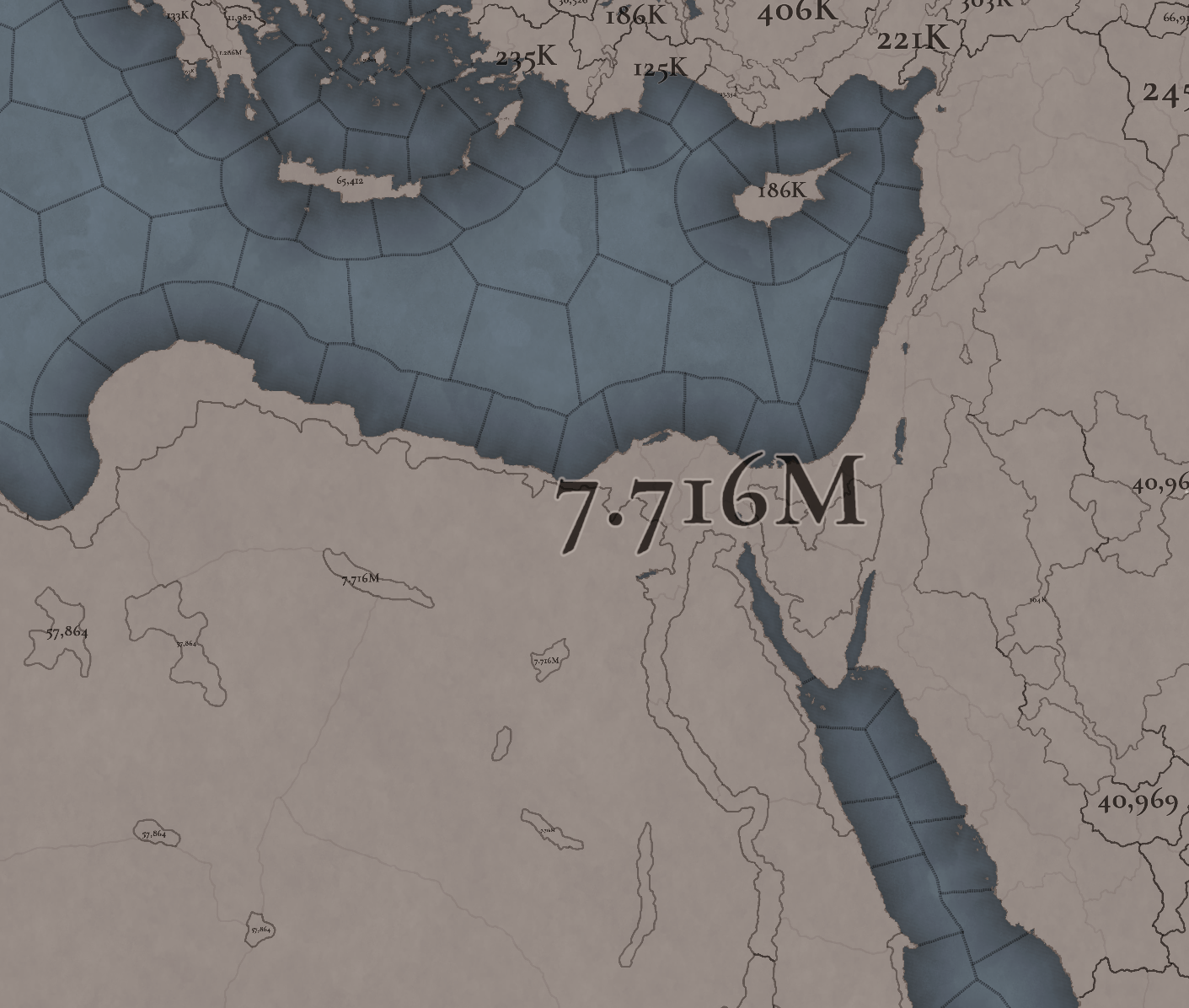
Country Population .png

Location Population 1.png

Location Population 2.png

Location Population 3.png
The population of the region points to Egypt being its powerhouse, with several million people being supported being the Nile Valley and Delta. Apart from that, the Syrian Levant has a very decent population, making the Mamlūk Sultanate a dreadful rival to have in 1337. The arid fringes make for a way more difficult food production and population sustainability, making them more of strategic value, by their position, resources, etc.

And that’s all for today! Next week @Johan will show you Scandinavia, the very first map that was crafted for Project Caesar! Cheers!
 
  • 176Like
  • 54Love
  • 7
  • 4
  • 4
  • 1Haha
Reactions:
Will the Al Fadl tribe be added as a Mamluk Vassal?
The same applies to the Al Ali and Al Mira tribes.
During the Mamluk era, the Al Fadl's territory spanned the area between Homs in the west to Qal'at Ja'bar in the northeast and all along the Euphrates valley through the countryside of Basra southward to the Washm region in central Najd.[13] Mamluk patronage of the Al Fadl enabled them to dominate the other Bedouin tribes of the Syrian Desert.[14] A rival sub-branch of Al Fadl, the Al ʿAli, controlled the Ghouta region of Damascus and the northern Arabian regions of Tayma and al-Jawf, while Al Mira controlled the area of Jawlan southward to the al-Harrah hot springs in Hejaz.[13] Other branches of the Banu Tayy controlled regions within the Banu Rabi'ah's territory. Among them were the Shammar and Banu Lam in the north Arabian mountains of Jabal Ajaʾ and Jabal Salma.
Will the Emirate of Kilis be added to the game?
Will the Ayyubid ruler of the emirate Hama Al-Afdal Muhammad be represented in any way?
Will Lebanon be filled with small principalities that are Mamluk vassals?


View attachment 1163098
These seem very interesting, breaking up Mamluk control over the Levant while still giving them plenty of vassals and a dominant position would seem to make a lot of sense, and they'd still own plenty of it themselves.
 
  • 6Like
Reactions:
I like the color of Mamluk. The color of Egypt in EUIV hurts my eyes and thus stops me from forming it.
 
  • 2Like
Reactions:
also on the yezidis, what literature do you use to justify their existance as an organized religion in 1337?
Given their religion has its roots in pre-Zoroastrian Iranian mythology, it would seem pretty easy to justify. Yazidis as an ethnic group with distinct religious practices and figures associated with it are well-attested prior to 1337. Why wouldn't they?

Putting it another way, if you didn't have Yazidis already in 1337, you'd have to have proto-Iranian religion represented that would become Yazidi sometime after the start date, which is cool but seems unnecessary since that process was already at the very least well underway (unless there's other extant examples of it that didn't become Yazidi I'm unaware of).
 
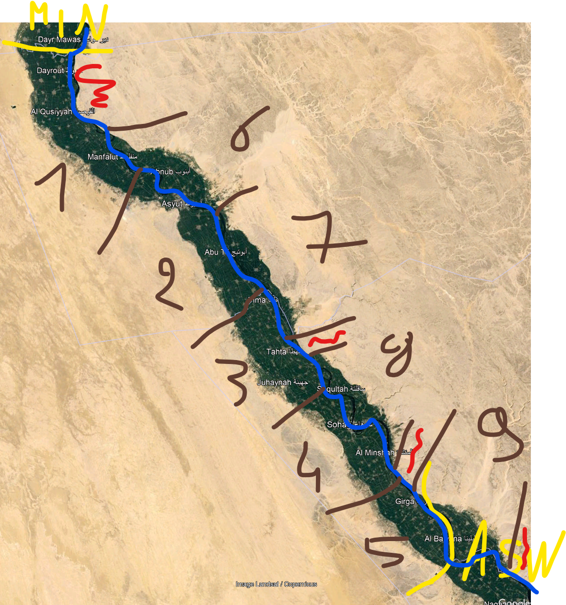
Some suggestions about the locations in upper egypt.

Location map right now

1720953230345.png
1720953297945.png
1720953353166.png

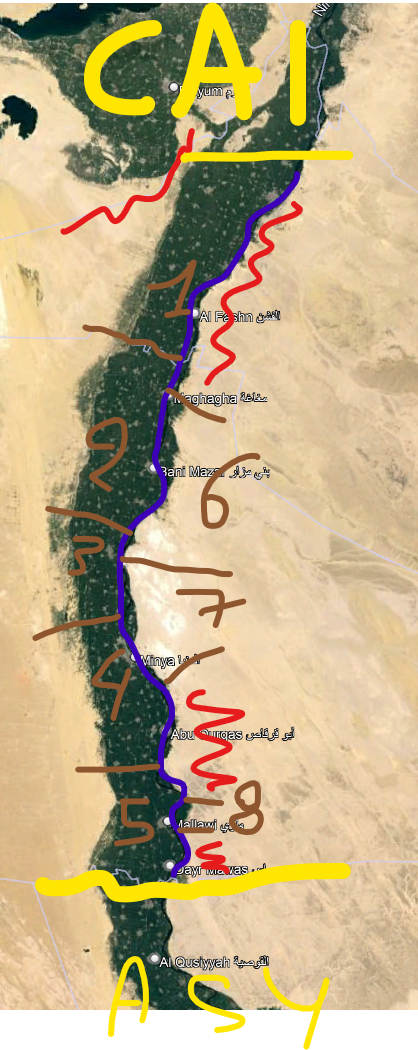
In this post I'll go through province of Minya, I'll do Asyut (#387) and Aswan (#410) as follow-ups
In the tinto proposal, this whole province has left bank farmland locations, right bank desert locations

In this part, the left bank definitely is the fertile one, no issues there. Population maps are not readable, but seeing this area comprises today most inhabitants of 2 governorates comprising around 10 million people, 5 locations seems really minimalistic... - especially since almost all of those people live in the three left-bank locations
Right bank is mostly uninhabitable desert, with a few chunks of farmland. Right now, it's drawn as completely connected (and probably really low population?) "desert" locations. I think it would be more sense to make a couple of small farmland locations, encircled by the desert impassible terrain.

This results in :
1) Beni Suef (new province, wasteland or corridor connection with Faiyum). Maybe even split in two ?
2) Al Bahnasa
3) Samalut (new province to make the border on the right bank work)
4) Minya
5) Mallawi
6) Sharunah
7) Tahna
8) Dayr (maybe too small ?)

yellow = other provinces, bleu = Nile, red = impassable, brown = location borders
1720956304781.png


edit : location 8 can be ignored, WAY too small. 6 and 7 probably like "arid" or something, might be to generous to give the little bit of farmland they have a "farmland" marker...
As per @Dualninja , it might be a good idea to have a "desert" location behind 1 and 2,(and probably also one behind 4 and 5). since the inhabited part is really wide there. As long as they're not ahistorically connected to Faiyum - so probably not really possible :p
 
Last edited:
  • 6Like
  • 3
  • 1Love
Reactions:
Given their religion has its roots in pre-Zoroastrian Iranian mythology, it would seem pretty easy to justify. Yazidis as an ethnic group with distinct religious practices and figures associated with it are well-attested prior to 1337. Why wouldn't they?

Putting it another way, if you didn't have Yazidis already in 1337, you'd have to have proto-Iranian religion represented that would become Yazidi sometime after the start date, which is cool but seems unnecessary since that process was already at the very least well underway (unless there's other extant examples of it that didn't become Yazidi I'm unaware of).

yazidism as the religion/ethnic group we know today did not exist before islam and most likely started as one of many offshoots of islam (there are different theories though). having elements from a pre-zoroastrian iranian mytholgy doesnt mean it existed before zoroastrianism, let alone islam.
 
  • 1
Reactions:
The map looks amazing, but here's some suggestions coming from an Egyptian:

1. Rename the "Egyptian" culture into "Masri" instead, and merge Sa'aidi into them since, as vyshan said, if Greek isn't subdivided into Cretan and Cypriot why should Sa'aidi be subdivided from "Masri" when the main differences is the accent.

2. In the Area map mode rename upper Egypt into "Al Sa'aid" or "Sa'aid Masr" and for lower Egypt it can be either "Al Wajh Al Bahri" , "Bahri" or "Reef Masr" all of these are historical names of lower Egypt.

3. In the provinces map mode Western Oases can just be simplified to "Al Wahat" and Red Sea Coast is a pretty modern name (check the current red sea governorate) a better name for it would be "Khalij As Suways" which means the Gulf of Suez, or for a more historical name you could do "Bahr Al Qulzum" although I am not too sure if Qulzum would be the name of the settlement at this point and anyone can feel free to correct me on this.


Other than that, here's some suggestions for more locations:

Sharqiya Province:
1. Tannis is a bit weird, I assume you mean San Al Hagar which is an ancient Egyptian city and currently a small village. In that case you could do Al Farma, which has since lost it's importance due to neglect from the local sultans, but it would be better than San Al Hagar

Gharbiya Province:
1. Tidah can be replaced with either Dumaynaqun (older name for Kafr El-Sheikh) or Al Faragon (older name for Sidi Salem)

2. Damietta (Dumyat) should take most of the north eastern pixels of the Mansoura location, since it's on the eastern side of the nile, and most of the pixels of of Damietta that is on the west of the Nile should be a new location called Sherbin (شربين)

I have no idea what that strip of land north of Fuwa is, and I think it should just be part of Fuwa as there isn't really any settlement of historical note in that region

Red Sea Coast Province:

Looks fine, but you could rename Suez to Qulzum like I said before in my 3 point

Cairo Province:

I would make Fayyium accessible by one location, that is called "Al Lahun" as it's on a plateau, and there's pretty much one or two ways to access it at this time period.

Upper Egypt looks great, I would just add new locations to make it longer and harder for armies to access, as it historically (for instance when Napoleon invaded Egypt) was a very tough valley to occupy. That's basically it, thank you for reading this and I hope to see another map of Egypt after it's updated.
North of Fuwa is the old port town of Burullus (El Burullus), Lake Burullus is named after it. The town doesn't exist anymore.
 
Last edited:
Asyut province, today almost the entirety of 2 governorates, 11 million people (and I'll pull in the bit that's missing). Follow-up from post 384, continued in post 410

Similar remark, northern bit has desert on right back, southern bit farmland. Should more accurately be smaller farmland provinces (but not as small as in Minya province). On left bank, there's clearly 4 chunks in these governorates : splitting Abnub from Buwit, keeping Akhmim, and taking the Sohag part of Faw location, which I'll name "Al Qush". It looks like there should be impassible areas north and south of each of them, except between Abnub and Buwit.

Going to left bank, I'd also aim for 5 locations as in the previous province.
With the addition of Mallawi, Manfalut is ok, as is Asyut. I'd definitely cut Al Balyana in two or three, depending on gameplay reasons.
That gives :

1) Manfalut
2) Asyut
3) Tahta (maybe too small, might be combined with 4 or with part of 2)
4) Sohag
5) Al Balyana
6) Abnub
7) Buwit
8) Akhmim
9) Al Qush

1720957835017.png


For the connection to Kharga oasis, that seems historically indeed through Asyut. It seems a good result from this map, that Asyut is bypassable, so people conquering the oasises can get Asyut as a fortress.

edit : upon reflection, I'd definitely put the border between locations 2 and 3 more north, or even just split location 2
 
Last edited:
  • 3Like
  • 3
  • 1Love
Reactions:
Expect the longer post probably middle to end of next week. Got my own academics thesis stuff to do as well

You should be able to find the bottom paper free online, last i checked. Forgive im not gonna continue to respond to each section of your comment ill include it in my longer post as it might be a good structure to address certain points.
got ya

Just wanted to make a quick comment, I think its a more generally accepted that the Yazidis likely adapted islamic customs on top of their religion then the opposite of adopting other religious customs on top of Islam.
both are possible, and many areas being converted by outsiders have done the same - keeping old customs and incorporating with the new religion. this is why different cultures practice same religion differently.


They have very few religious similarities to Islam, outside of some cultural practices.
yes they do - today. i am not claiming they are a muslim ghulat sect, just i suspect that they might have started as such.

Also if you want to get nitty gritty there are many different types of Yazidis. Alevi, Adawis, etc.
i have never heard of adawis, but alevis are 100% not "a type of yazidi", they are their own sect and claim they are muslim. they are regaraded by mainstream muslims as ghulat, just like druze, alawites (in syria) and other now dead sects.

The aspect of the revival of the 12th Century seems to have been a kind of religious reformation of the older more "decentralised" old iranic (i.e. Zoroastrian rooted) religions that were still widely practiced in the region. This is why Yazidis claim to have a long heritage and why archaeological evidence at least supports this in that the old iranic religions the Yazidis grew out of existed before Islam in the region. You are correct in your characterisation this was largely due to the weird religious experimentation and mixing of the time, but that doesnt mean all were Islamic rooted. Sure Islam had an influence on the development of Yazidis but to call it the root, is like calling Islam a root religion from Judaism. There is evidence of its influence, but Islam mostly grew out of the pre-islamic Arabic religions with some Abrahamic influence.
i agree with basically everything you are saying. what i have read is that many (from muslim point of view) "secretive" sects/ethnic group outward claimed to be muslim for survival reason, and due to this secrecy there have been many theories of their origins/beliefs etc.

what i am doubful about is whether yazidism we have today actually existed widespead (like today) in 1337. and i was also curious which other ethno-religous groups from the region will be in the game?
 
I don't think that the wastelands west of the Nile should reach all of the way to the Nile. Many important towns and inhabited locations are currently shown as wastelands; despite some of them being not only inhabited, but extremely important.

IMG_3968.jpeg


I think these 3 highlighted regions should be made locations, for several reasons that I'll go through location by location.

The Red location is Natrun, which should be a majority Coptic, sparse flatlands location with an arid climate. The land is arable today, but that is mostly due to modern irrigation projects. It was more arid in the 14th century, although not fully a desert so I'd classify it as sparse. Modern day El Sadat city is also within the location, which although a modern city does show that the region is inno way uninhabitable. The population would be majority Copts due to it's remote and arid nature. Which made it a hub for Coptic monastic communities to thrive in the region.

The blue location is Saqqara, which I expect many have heard of. For those who haven't, it was an Ancient Egyptian complex which included the Saqqara necropolis and many famous pyramids only a few kilometres south. Although the valley used to be much more stable when the necropolis was built, it was mostly dessert by the 14th century. Except for the very eastern fringes of the location, which could sustain some agriculture due to being on the fringes of the Nile valley. Also yes the Saqqara region was still inhabited at this time, with small settlements springing up in some of the only arable areas and along a few caravan routes. For these reasons I would classify the location as being desert, as there was very little agriculture. But it certainly wasn't a wasteland, as it could sustain human settlement.

The yellow location is Qalamun, famous for housing the monastery of Saint Samuel the Confessor. Similar to Natrun it was a centre for Coptic monasticism in the harsh landscape. Though it was much harsher than Natrun, which is why I would classify it as desert. The region also has a fair few hills, so I would make it hills instead of flatlands. I've also included the lake of Wadi El Rayan and the surrounding hills in the location, as they were also used for similar monastic reasons. Because of its monasticism I would make it majority Copt, with very few Masri in the location. The passage to Bahariya should also be changed so that it's a Qlamun-Bahriya passage, as it wouldn't make much sense for the passage to connect to Faiyum.

Overall there should just be some more locations west of the Nile, as these areas were and are still inhabited. They lie on the fringes of the Nile, where the lush valley meats the harsh dessert. Because of this they were inhabited and settled, despite the wastelands which live just to their west.
 
  • 10
  • 6Like
  • 1Love
Reactions:
Cyrenaica should be split into at least two provinces. One for the eastern portion now in Egypt, and another for the western part now in Lybia. A single province representing an entire region is odd and beyond that it’s such a stretched province as to be unusual. Ten locations is a lot more than most provinces get.
The Cyrenaica area appears to only have one province (Barqa) which feels like an oversight.

The only area I think definitely needs a split is probably the Levant. It is just simply extremely massive both in area, population and amount of locations compared to anything else we have seen from the map, and I don't know the gameplay implications of it, but I am afraid of its implications
The Levant (Ash-Shām) could be maybe split into Syria (Sūriya) and Palestine (Filistin), but I assume that the Levant+Sinai+Iraq are being grouped into a single "Mashriq" region.

Speaking of Palestine: assuming the late 18th century will be part of the timeline, will Zahir al-Umar's revolt be represented somehow? He was basically Muhammad Ali Pasha before Muhammad Ali Pasha and basically turned the Galilee into a nominally independent state.
 
  • 4
  • 1Like
Reactions:
I don't think that the wastelands west of the Nile should reach all of the way to the Nile. Many important towns and inhabited locations are currently shown as wastelands; despite some of them being not only inhabited, but extremely important.

View attachment 1163334
Very interesting points, however when looking at it closely, I kinda disagree on all three :(

- red location: was very lightly inhabited/able in 14th century (2 of the three towns had been abandoned for centuries by then). The Alexandria canal passed more north, it could definitely be argued that its borders were the limit of civilization. The current city only makes sense in the age of the automobile.

- blue location: locations in this region definitely are too large, Saqqara seems to be intended part of Gizeh, should definitely be separated out (though definitely less connected than in your proposal)

- green location: this one is really basically nothing (today), with the added (for me huge) disadvantage of making Fayoum less of a special place. From wiki, the monastery was largely abandoned within about a century of game start... Wadi al rayan could be made part of a "West Fayoum" location
 
Last edited:
  • 3
  • 2
  • 1
Reactions:
I ought to ask because I forgot: did you guys remember to stick some Armenian and Moroccan pops in the Jerusalem location to represent their respective quarters?

Also, realistically speaking, not all Jews living in Palestine at the time should be Mizrahi. Aliyah was already a concept at this time, and there was a (very negligible, but still existant) stream of Jews from Europe and other regions settling in Palestine at the time, joining with the survivors of the Crusades to form what's called the Old Yishuv.
Unfortunately, I can't give you an accurate report of settlements and individuals, but maybe someone else can back me up on this. What's interesting to me is that it doesn't seem like these Ashkenazi communities ever fully merged into the Mizrachi communities and the two were always somewhat distant. By contrast the Mizrachi community of Palestine was, like many others all over the Islamic World, "Sephardized" after the expulsions of the 1490s.

Will there be a Syriac releasable? Or maybe a Syrian releasable that we can culture-swap?
"Assyria" could maybe be a formable/releasable. But alternatively, Syriacs could also just be able to form the Syria tag. Lower Egyptians, Upper Egyptians and Copts should all be able to form the Egypt tag as well.
Only issue might be if there's explicitly religious imagery on the flag or flavor texts, but that can be adjusted.
I found it weird that there were separate tags for Muslim Iran and Zoroastrian Iran in EU4. Hindustan and Bharat being separate tags was also weird.

Not sure that a Mizrahi culture makes sense. The speech, food, etc of Arabophone Jews was much closer to their non-Jewish neighbors than to Jews of other Arab countries. Not to mention there's also at least Aramaic, Persian, and Berber-speaking Jews. I suppose it could make sense from a gameplay perspective, to make them hard to convert simply because they're a distinct culture - but you could also just give Judaism strong buffs against conversion.
I think there should be a mechanic wherein pops of Jewish culture but of non-Jewish religion have a high chance to revert to Judaism once finding themselves in a more tolerant country (either by emmigration or by change of government). This happened all the time irl. It could even apply to other religions like the Kirisitan in Japan or the Recusants in England.

I'm curious, why isn't Levantine culture broken up into Syrian/Palestinian? I don't know how apparent the cultural differences were (especially in 1337) but it seems conventional to break it up that way. Also, how large is the Jewish population in the Levantine region?
What I'm going to say is going to sound a bit demeaning, but both of those identities are essentially the product of colonialism. Settled Arabs living in the Levant at this time would've identified as either just "Greater Syrian" (Shāmi) or with their city/immediate locality (Qudsi, Majdali, Ghazzati, etc.), which is obviously too granular to be represented.
 
Last edited:
  • 8Like
  • 2
Reactions:
The Levant (Ash-Shām) could be maybe split into Syria (Sūriya) and Palestine (Filistin), but I assume that the Levant+Sinai+Iraq are being grouped into a single "Mashriq" region.
I guess that too, that's the most likely version for a region there. I still do think though that Levant should be split to Syria and Southern Levant/Palestine
 
  • 1Like
Reactions:
What I'm going to say is going to sound a bit demeaning, but both of those identities are essentially the product of colonialism. Settled Arabs living in the Levant at this time would've identified as either just "Greater Syrian" (Shāmi) or with their city/immediate locality (Qudsi, Majdali, Ghazzati, etc.), which is obviously too granular to be represented.
I am not talking about regional identities and cultural identification, I am talking about areas and their gameplay effects. Because if areas are used as a basis for "states" as in EUIV, or some other (more dynamic) forms of administrative division, or perhaps even some sort of "casus belli" sort of deal like in CK3, these are mechanics where its comparatively enormous size (both in population, area, and number of provinces and locations) might make it unbalanced. Plus, neither the Mamluks not the Ottomans treated the Levant as a single administrative division/eyalet (the closest to it was the Šām or Damascus Eyalet of the Ottoman Empire, but that didn't cover most of Syria either, only Palestine and the portion of Syria which contains Damascus).
 
  • 1Like
Reactions:
After going through some of the Ottoman/Mamluk administrative divisions, I had a couple suggestions/ideas that - in part - might help break up some of the larger locations:

EGYPT
  • Ibyar - Change to Menouf, capital of the Menoufiya/Monufia province
    • Currently has Rice; Ibyar was known for its linen and natron, and Menouf for its cotton and wheat; so fiber crops, salt, cotton, or wheat would make sense?
  • Al-Balyana - Change to Girga, capital of its eponymous province; center for Ottoman Upper Egypt
    • Currently has Wheat; Sugar was apparently also introduced under the reign of Barquq in the late 1300s
  • El Burullus - Change to Baltim. Baltim was noted by Ibn Battuta to be the "capital of the district of Burullus." This is also just a weird shaped province in general; might be worth splitting between Fuwa (Fuwwah) and Tidah (not sure what this is - maybe Duminqun/Kafr El Sheikh)?
SOUTHERN LEVANT
  • Sughar (AKA Zughar, Zoara, Zoar) - change to Shoubak; Zoara disappeared at some unknown time during the period, probably in the earlier part of it. Shoubak was a town or regional importance, and hosted an Arab Christian population that left to Gaza in the early 16th century
    • Currently has Livestock; Shoubak was famed for its orchards, and was known as the City of Apples, so Fruit; also olives and vegetables were produced here
  • Al Majdal - Split northern part off into Ramla. Ramla was the center of the northern half of the Sanjak of Gaza; the commercial center of the region before the Crusades, but lost its prominence after that.
    • Would recommend Olives
  • Amman/Irbid - Split from these two to create Ajloun, center of the Sanjak of Ajloun in Damascus Eyalet.
    • Circa 1600, paid taxes on olives, vineyards, vegetables and fruits
  • Safed - Split southern half into Tiberias, one of the Nahiya of the Safed Sanjak (along with Acre, Jira (Safed), Tebnine (see below), and Shaqif (likely too small to include)). The Nahiya of Tiberias covered the lower Galilee region. Tiberias itself had a rough time during the game period.
    • Could produce Wheat? It is noted as the main product of Tiberias in 1596.
NORTHERN LEVANT
  • Sakhad - I think this is supposed to be Salkhad? The geography here of Irbid-Daraa-Busra-As Suwayda-Salkhad looks a bit askew though.
  • Sidon - Split southern half into Tyre (or Tebnine, another Nahiya of Safed Sanjak (see above)). Tyre is largely in ruins at game start, being a source of stone used to construct buildings in Sidon, Acre, Beirut and Jaffa - it doesn't really begin to recover until the the second half of the game period. Tebnine has less name recognition, but I'd recommend it for the period based on what I've read.
    • Would recommend Wheat; it was taxed on wheat, barley, fruit, goats, and beehives in 1596
  • Baalbek - A big long province! I'd recommend chopping off the southern half. I can't find too much info on the Ottoman administration here, but I might recommend Rashaya as a period-appropriate settlement (one of the Nahiyas of Damascus Sanjak)? Zahlé is the predominant modern settlement in the region, but it wasn't found until 1711. Anjar appears to be in ruins and deserted at games tart.
    • Could produce Lumber from the Faqaa forest, but Rashaya seems to produce numerous fruits including cherries, olives, apricots, and grapes. As a whole, the southern Beqaa valley is known for its agricultural products - including wine as well as wheat, maize, cotton and vegetables.
  • Masyat - Local pronunciation of Masyaf or typo?
  • Al-Jabbul - might be worth changing to Asfirah/As-Safira? Seems to be a more important settlement and it looks like it falls within the boundaries of the location.
    • Should produce Salt. The Sabkhat al-Jabbul, a saline lake, is a major source of salt for Syria.
  • Toprakkale/Arsuz - I think I saw this was brought up in the Anatolia dev diary, but İskenderun/Alexandretta could be carved from the southern half of Toprakkale and the northernmost bits of Arsuz. During the Ottoman period, it developed into a major port for overland trade to/from further east.
    • Fruit (oranges) and Olives appear to be its most important agricultural products, although there are also notable forests for potential lumber nearby as well apparently.
(Sourced from Wiki mainly)
A good suggestion, but about Baltim: It quite obviously became the capital of Burullus district during the 19th century, as Burullus itself was lost/abandoned. The quote is from somewhere in the 19th century, too. It thus doesn't portray the situation in the 14th century, when El Burullus still existed.
 
Forgot to ask again... I assume "Mamlūk Sultanate" is a title and that the actual tag is Egypt, right? Will Mamluke Iraq also be represented as the "Mamlūk Sultanate of Iraq" and a semi-independent region of the Ottoman Empire?
(Edit: I just realized that the smallest text display is "Mam." so the Egypt and Mamluk tags are not the same. Tough this means I assume, that individual tags might have individual long-form names, which is arguably even more exciting)

Now that I think about it, there were a lot of these "nominally an integral part of the Ottoman Empire but in practice functionally independent" states throughout history, Muhammad Ali's Egypt, Zahir al-Umar's Galilee, etc. I wonder how they'll be represented. Rebels? A special kind of vassal? Whatever the situation calls for?

I guess that too, that's the most likely version for a region there. I still do think though that Levant should be split to Syria and Southern Levant/Palestine
The region was known as "Syria-Palestine" to westerners for over a millenium at that point, but I think the Arabs might've just called it "North Sham" and "South Sham". Filasṭīn was indeed used as a name for the southern Levant, but Sūriya is I think a neologism.

I am not talking about regional identities and cultural identification, I am talking about areas and their gameplay effects. Because if areas are used as a basis for "states" as in EUIV, or some other (more dynamic) forms of administrative division, or perhaps even some sort of "casus belli" sort of deal like in CK3, these are mechanics where its comparatively enormous size (both in population, area, and number of provinces and locations) might make it unbalanced. Plus, neither the Mamluks not the Ottomans treated the Levant as a single administrative division/eyalet (the closest to it was the Šām or Damascus Eyalet of the Ottoman Empire, but that didn't cover most of Syria either, only Palestine and the portion of Syria which contains Damascus).
I was responding to someone else, I'm talking about cultures, not regions.
I think it's good to base locations, provinces, areas, etc. on administrative regions whenever feasible. But the thing about administrative regions is they're rather malleable, so it's kind of difficult to fully represent their dynamism in this sort of game. Same reason I really dislike the way colonies work in EU4, their borders shifted all the time like other administrative regions.
There's also the fact that administrative regions, especially historically, can be rather poorly defined, and are often based on existing historical regions anyway.
 
Last edited:
  • 3Like
Reactions: