• We have updated our Community Code of Conduct. Please read through the new rules for the forum that are an integral part of Paradox Interactive’s User Agreement.

Tinto Maps #12 - 26th of July 2024 - Germany

Hello, and welcome to another new Tinto Maps! I’m back to duty, after the review of Italy that we posted last Thursday, and Johan taking care of Scandinavia last Friday. Today we will be taking a look at Germany! This region comprises the modern territories of Czechia, Austria, Switzerland, and Liechtenstein. However, for most of the timeline in Project Caesar, it was better known as the Holy Roman Empire. This organization once was a feudal empire elevated from the Kingdom of the Germans, but by 1337 was mostly disaggregated into a multitude of temporal and ecclesiastical jurisdictions, with only a tenuous feudal relationship with their Emperor.

Let’s start diving deep into this nightmare, then…

Countries:
Countries.png

I’m showing here a bit more of what the region is, so you can have a clear depiction of how it looks compared to the neighboring regions we’ve previously shown (and so that the Reddit guy who is patchworking the world map has an easier day ). What I can say about this when the map speaks for itself… The lands of Germany are highly fractured among different principalities, making for an extremely complex political situation. The Emperor in 1337 was Louis IV von Wittelsbach of Upper Bavaria… Because, yes, Bavaria is also divided. He is married to Margaret of Avesnes, daughter of Count William of Hainaut, Holland, and Zeleand, while his son Louis is the Margrave of Brandenburg. But probably the strongest power of the period is the Kingdom of Bohemia, whose king John also Duke Luxembourg and rules over both lands in a personal union, while also being overlord of the Margraviate of Moravia, ruler by his son Charles, and the Silesian principalities. The third contender probably is the Duchy of Austria, ruled by Albert II von Habsburg. He also rules over some lands in the formed Duchies of Swabia and Carinthia. There are also plenty of medium and small countries all over the region, with very different forms of government, which will probably make this HRE a very replayable experience…

Dynasties:
Dynasties.png

The dynastical map of the HRE gives a nice picture of the situation explained in the previous one. The von Wittelsbach, de Luxembourg (John of Bohemia is considered of French culture, therefore it uses the French toponymic article ‘de’; if he would change to the German culture, then it would be the ‘von Luxembourg’ dynasty), and von Habsburg cover much of the map; you may note that the Wittelsbach rule over five different countries (Upper Bavaria, Lower Bavaria, the Palatinate of the Rhine, and Brandenburg); while the House of Luxembourg also control the Archbishopric of Trier through Balduin, uncle of King John. Other important dynasties, although in a secondary position, are the Welfen, von Mecklenburg, and Gryf, present in multiple countries to the north; the Askanier, who happen to control half of Upper Saxony, while the rest is in the hands of the von Wettin; and the von Görz, who rule over the Duchy of Tirol and the County of Gorizia.

HRE:
HRE.png

We obviously have to repost the HRE IO map again here. The purple stripes mark the imperial territory, while the different types of members use different colors. We currently have these divisions in the IO: the Emperor (1, dark blue), Prince-Electors (4, light blue), Archbishop-Electors (3, medium blue), Free Imperial Cities (23, light green), Imperial Peasant Republics (2, orange), Imperial Prelates (44, white), and Regular Members (280, dark green). So, yeah, that make for a total of 357 countries that are part of the HRE. And before you ask: No, we won’t talk about its mechanics today, that will happen in future Tinto Talks.

Locations:
Locations.png

Locations 2.png

Locations 3.png

Locations 4.png

Locations 5.png
Germany has the highest density of locations in the world, as we wanted to portray the historical fragmentation of the HRE at the most detailed level of any Paradox GSG. There are a couple of things that we are aware of and we want to rework: the location connections (as in some places they are not obvious at all, and we want to make warfare in the HRE not impossible); and the transition between the German locations and those at their east, making it smoother (something that we will be doing in the review of Poland, Hungary and this region [e.g. for Bohemia]). A final comment: if you click on the spoiler button, you may be able to see 4 more detailed maps of the region.

Provinces:
Provinces.png

Map of provinces. As usual, suggestions are welcomed.

Areas:
Areas.png

Areas. We are currently not happy with the area borders (or at least, one of our German content designers isn't, and let me note it while preparing the DD... ;) ), as they reflect more modern areas so we will be looking into an alternative setup for them with your feedback. They also currently use their German names, which will change to English ones to be in line with other areas, as usual.

Terrain:
Climate.png

Topography.png

Vegetation.png

Terrain mapmodes. The region is quite forested, in comparison to other parts of Europe.

Culture:
Cultures.png

Let’s open the Pandora box and take a look at the cultures! The German cultures have come through a couple of reworks, until we’ve found a spot in which we’re kind of happy (or, at least, our German content designers do not complain!). The German cultures are very linguistically related, as we thought that it would be the best starting point for 1337. Please let us know about your thoughts on them.

Religion:
Religion.png

Boring religion map this week, as the region is overwhelmingly Catholic. There are Ashkenazi Jews in a bunch of places (a quick account: they’re present in 204 locations all over Central and Eastern Europe), and you may also see the Waldesians we added in the review of Italy last week.

Raw Materials:
Raw materials.png

Raw materials! Plenty of!

Markets:
Markets.png

The main market centers of the region are Cologne, Lúbeck, and Prague. We have reviewed them a couple of times, and this is the configuration that makes for a good setup historical and gameplay-wise. And you may also see Bruges, which has been reinstated as the main market of the Low Countries, after some tweaks.

Country and Location Population:
Population.png

Population 2.png

Population 3.png

Populations 4.png
The population of the HRE is… Fragmented. In that regard, Bohemia starts in a very strong position, with a strong competitor to its south (Austria) and north (Brandenburg).

And that’s it for today! I hope that we didn’t drive you into madness with this map… Next week we will take to a very different region, the Maghreb! See you then!
 
  • 175Love
  • 118Like
  • 4Haha
  • 4
  • 3
  • 2
Reactions:
FIrst of all, great map. I really hope the devs take note of your rich and extensive feedback. While I was making some of my own proposals I discovered a slight potential inaccuracy. Based on my research, the location of Windishgraz / Slovenj Gradec should still be owned by the Archbishopric of Aquilea in 1337.

According to one source the castle of SG was only obtained by the Habsburgs in 1425.
While a second in my opinion more reliable source (page 29/34 in the linked pdf) states: The archbishop loaned the town to the bishop of Krško in 1335 and to Ulrik of Pfannberg in 1342. Albrecht II. of Habsburg only occupied the town in 1350 with Rudolf IV. of Habsburg annexing it in a peace treaty in 1362. (Začetki mesta Slovenj Gradec : prispevek k nastanku mest na jugovzhodnem Koroškem v srednjem veku, Kosi, Miha, 2008)

While I understand that this change would break the connectivity of the Habsburg holdings in your proposal, which seems conflicting with the map provided by "Historischer Atlas Österreich" which you used as your source, I would nevertheless argue that at game start this (potential) location (which I hope is added) should be transfered to Aquilea. Once again, I really liked your suggestions, hope you find this feedback useful.
 
Last edited:
  • 4Like
Reactions:
FIrst of all, great map. I really hope the devs take note of your rich and extensive feedback. While I was making some of my own proposals I discovered a slight potential inaccuracy. Based on my research, the location of Windishgraz / Slovenj Gradec should still be owned by the Archbishopric of Aquilea in 1337.

According to one source the castle of SG was only obtained by the Habsburgs in 1425.
While a second in my opinion more reliable source (page 29/34 in the linked pdf) states: The archbishop loaned the town to the bishop of Krško in 1335 and to Ulrik of Pfannberg in 1342. Albrecht II. of Habsburg only occupied the town in 1350 with Rudolf IV. of Habsburg annexing it in a peace treaty in 1362. (Začetki mesta Slovenj Gradec : prispevek k nastanku mest na jugovzhodnem Koroškem v srednjem veku, Kosi, Miha, 2008)

While I understand that this change would break the connectivity of the Habsburg holdings in your proposal, which seems conflicting with the map provided by "Historischer Atlas Österreich" which you used as your source, I would nevertheless argue that at game start this (potential) location (which I hope is added) should be transfered to Aquilea. Once again, I really liked your suggestions, hope you find this feedback useful.
I am thinking of updating my map with this information.

Thanks for the information, because this map below only shows the territories acquired by the Habsburgs between 1456 and 1500. So, if Slovenj gradec was annexed in 1362, it is not shown here. And with "krškemu škofu" it means Prince-Bishopric of Gurk (Krka). Vitanje on the map was under Gurk which is logical that they also leased Slovenj Gradec.

1723373229519.png
 
Last edited:
  • 1Like
Reactions:
FIrst of all, great map. I really hope the devs take note of your rich and extensive feedback. While I was making some of my own proposals I discovered a slight potential inaccuracy. Based on my research, the location of Windishgraz / Slovenj Gradec should still be owned by the Archbishopric of Aquilea in 1337.

According to one source the castle of SG was only obtained by the Habsburgs in 1425.
While a second in my opinion more reliable source (page 29/34 in the linked pdf) states: The archbishop loaned the town to the bishop of Krško in 1335 and to Ulrik of Pfannberg in 1342. Albrecht II. of Habsburg only occupied the town in 1350 with Rudolf IV. of Habsburg annexing it in a peace treaty in 1362. (Začetki mesta Slovenj Gradec : prispevek k nastanku mest na jugovzhodnem Koroškem v srednjem veku, Kosi, Miha, 2008)

While I understand that this change would break the connectivity of the Habsburg holdings in your proposal, which seems conflicting with the map provided by "Historischer Atlas Österreich" which you used as your source, I would nevertheless argue that at game start this (potential) location (which I hope is added) should be transfered to Aquilea. Once again, I really liked your suggestions, hope you find this feedback useful.
Ah, interesting. My sources only mentioned that the Mark an der Sann was bought by the Habsburgs from Meinhard of Görz in 1311, and that Windischgrätz was acquired "some years later from Aquileia". Who would've thought that this would mean nearly 4 decades. I should've probably looked for a more precise date, but thanks for pointing it out.

I'm not sure it should be Aquileian, because currently all those loans are represented as direct control, so Salzburg would get it then. I'm not sure there is a mechanic like that for EU V's initial release but maybe later on?

There actually is no lost connectivity, because Marburg would be reachable via Styria. Carniola would be reached via Carinthia, though it actually should not be possible because ther was no pass there.

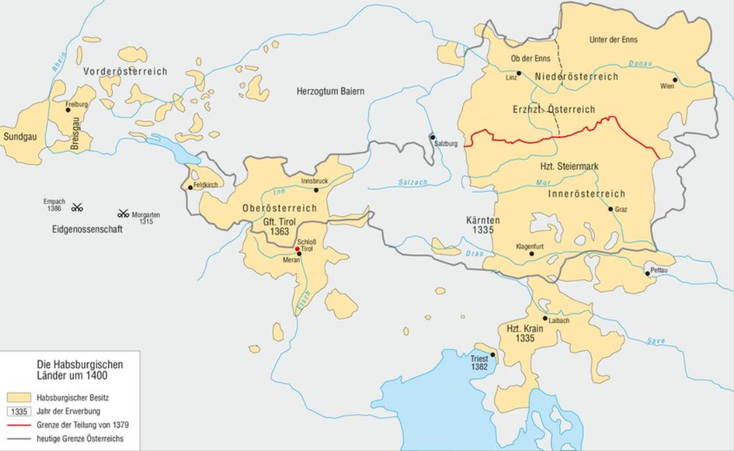
You mean this map from 1400, don't you? It doesn't include absolutely all "holes" because it's not that detailed.
1716142191641.png

I am thinking of updating my map with this information.

Thanks for the information, because this map below only shows the territories acquired by the Habsburgs between 1456 and 1500. So, if Slovenj gradec was annexed in 1362, it is not shown here.

View attachment 1174152
 
  • 1Like
Reactions:
When you compare the locations in hungary or the balkans to germany they are way way bigger. I feared that this game would have the same problem as eu4 where the location balance is way off. Please make the big locations the smaller.
 
  • 1
  • 1
Reactions:
When you compare the locations in hungary or the balkans to germany they are way way bigger. I feared that this game would have the same problem as eu4 where the location balance is way off. Please make the big locations the smaller.
They will become smaller, Spain was also condensed after feedback.
 
  • 1Like
Reactions:
When you compare the locations in hungary or the balkans to germany they are way way bigger. I feared that this game would have the same problem as eu4 where the location balance is way off. Please make the big locations the smaller.
There will definitely be some additional locations added to those areas.
However, do not forget that smaller locations can also become quite a hindrance when the most relevant stat is population. In EU4, more provinces generally were a good thing, as development was cheap and many buildings gave flat returns. In PC/EU5, the balance will likely (hopefully) shift away from that. That said, locations that are too large are bad for specialization and maneuvers, and the switch from tiny locations in the HRE to large ones in Hungary should be addressed.
 
  • 2Like
Reactions:
Ah, interesting. My sources only mentioned that the Mark an der Sann was bought by the Habsburgs from Meinhard of Görz in 1311, and that Windischgrätz was acquired "some years later from Aquileia". Who would've thought that this would mean nearly 4 decades. I should've probably looked for a more precise date, but thanks for pointing it out.

I'm not sure it should be Aquileian, because currently all those loans are represented as direct control, so Salzburg would get it then. I'm not sure there is a mechanic like that for EU V's initial release but maybe later on?

There actually is no lost connectivity, because Marburg would be reachable via Styria. Carniola would be reached via Carinthia, though it actually should not be possible because ther was no pass there.

You mean this map from 1400, don't you? It doesn't include absolutely all "holes" because it's not that detailed.
1716142191641.png
Yes, you are right given that it was loaned to the bishopric of Gurk (a "vassal" of Salzburg) it should actually be owned by Salzburg. I do hope that leases and the ability to buy (not just sell as in EU4) will be mechanics in PC. Maybe even a ministeriales mechanic for HRE, even as a dlc would be cool.

For the connectivity there are actually no problems yes, if I remember correctly, control will work a bit differently in the HRE anyway.

@Inzano
Pinpointing the precise location is quite hard this source from the Slovenian archives gives the direct holdings (58 hub, 3 polovične hube, 23 domce in 67 pušč) with 3 administrative divisions (Razbor - Zgornji in Spodjnji, Golavabuka and Šentilj pod Turjakom) which kind of outline the southern border (to Mislinja). I think the blue area around the map you supplied would be a good guess.
SG.png
Here is how I would draw it (for gameplay and historical reasons). Kind of combining it with Ravne (Gutenštejn) and Dravograd (Drauburg) as SG was the most prominent location of the three at game start. I think your original proposal was not far off.

It's not the most detailed answer, but I am quite busy until next week, so I might get back to it later.
 
Last edited:
  • 2Like
Reactions:
With the current regions looking like post-napoleonic post-ww2 drawn regions; I want to offer some historical maps for some alternative optiosn how to draw regions. I think it makes more sense to use regions used within the time series of before, not regions from after the time series.
1723387949327.png

1723387966223.png
1723387978199.png
1723388002046.png
1723388017863.png
1723388037351.png

1723388074446.png

1723388161027.png

1723388355971.png

1723388438790.png
 
  • 8Like
Reactions:
why call Werle as Waren? and Güstrow should be with ü
Werle-Güstrow and Werle-Waren (actually Werle-Goldberg at this point) were both cadet principalities split out of the original Werle principality (which would be Güstrow, given that it was the largest town and the location contains the actual original seat at Werle). I think that we want to avoid too many hyphenated country names.
 
  • 2Like
Reactions:
@Pavía
can we get either an acknowledgment of error or an explanation as to why Germany is so heavily forested and light on farmland? This is the first time I’ve actually been shocked at a Tinto Map and I’m unsure how it ended up like this.
We will review it; we'll probably Mef's proposal as a guideline, as we already did in Tinto Maps #1.
 
  • 7Like
  • 2Love
  • 1
Reactions:
So I had planned to also have a look at Upper and Lower Austria. The most important thing would be to rename Mariazell to Waldhofen an der Ybbs, as Mariazell is a Styrian pilgrimage site and not a Lower Austrian one.

1723456410364.png


Upper Austria:
The counts of Schaunberg could be included as vassals of the Habsburgs. The Luxembourg Emperors tried weakening the Habsburgs by granting them more priviliges but this failed. However, they retained several exemptions until the reign of Maximilian I. Schaunberg bought the city of Eferding from Passau in 1367, which at that time was actually the most important town of the area.

I would propose to follow the Upper Austrian quarters which were established by HREmperor Frederick III and were valid until the end of the 18th century when the Innviertel was conquered by Austria (War of the Bavarian Succession of 1778/9). Linz should be a province south of the Danube, so I opted for removing Lambach (and renaming Grieskirchen). Sadly, there is no place to add Enns because of its proximity between Steyr and Linz.


Archiducatus_Austriae_Superioris_in_suas_Quadrantes_Ditiones_exacte_divisi_accurati%C3%9Fima_Tabula.jpg


Internally, there was the Riedmark and the Machland within the north-eastern quarter, the Schwarzviertel, though Freistadt was also part of the Riedmark at an earlier point but was part of the Mühlviertel. The Hausruckviertel contained the County of Schaunberg in the west and Linz and Enns in the east. The Traunviertel contained Steyr, Mondsee, the Salzkammergut (which was directly ruled by the Habsburgs and an important salt mining area) and the Bamberger territories of Kirchdorf, Windischgarsten and the Attergau.


1723454433166.png


The Bishopric of Passau owned the County of Ilzgau in 1220, but later the Habsburgs took away the County of Falkenstein (between Kleine Mühel and Ranna, except for Pützleinsdorf). The Passauer judicial and administrative centre was Velden (today: Altenfelden), so I would rename the province. Rohrbach was the Habsburg's try to repell Passau which worked over the years.

Artikel_45683_bilder_value_2_passau_territorium2.jpg


(more details: https://www.historisches-lexikon-bayerns.de/Lexikon/Passau,_Hochstift:_Territorium_und_Struktur )

As mentioned earlier, Passau owned Eferding and also Riedegg (with Gallneukirchen), so I opted for giving Passau Riedegg but gave Schaunberg (with Eferding) to Schaunberg, because it was Schaunberg's capital. The alternative for Riedegg would be Pregarten when it should rather go to the Habsburgs.


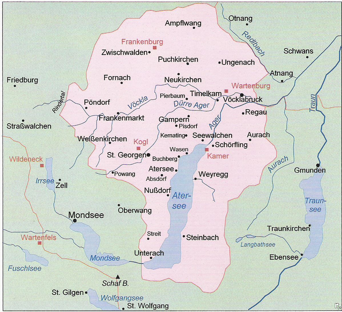
Even more obscure was the situation around the Mond- and Attersee. The former was owned by Bavaria until the Bavarian unification in the early 16th century (and then by Salzburg until 1565), whereas the other was held by the Bishopric of Bamberg until it was bought by the Habsburg.


1721754314461.jpeg

1721754328532.jpeg

For the end of the 12th century:
Attergau_Besitz.jpg


Lower Austria:
So I noticed that Mariazell is in Lower Austria, although it has always been part of Styria, so the province should be renamed to Waidhofen an der Ybss, as it was the most important city there. Waidhofen an der Ybbs, Ulmerfeld, Hollenburg and Göstling an der Ybbs were owned by the Bishopric of Freising, so maybe the provinces could be split there and Scheibbs for Habsburg could be added.

Furthermore, the Bishopric of Freising also owned Enzersdorf so maybe that could be added, too. I would opt for it not having a border with Hungary. As Mistelbach is a rather huge province and oddly shaped, maybe Laa an der Thaya could be added, too. Salzburg also had some small holdings north of St. Pölten with Traismauer, Arnsdorf and Wölbling, but this would be rather optional for me, as Salzburg already owns a varied plethora of territories.
 
Last edited:
  • 13Like
Reactions:
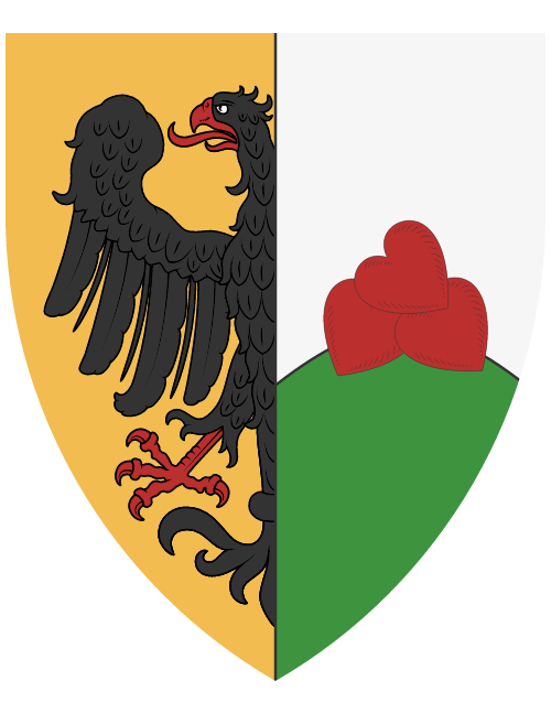
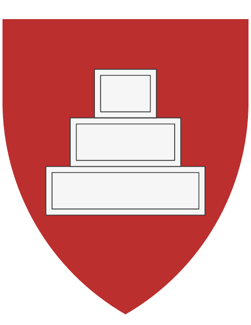
Maybe I'm getting a little ahead of myself, but considering that the tag will be divided during the succession, the new tags will need COAs. That is why I present my proposal for the coat of arms of Carniola. I will do more for the other areas of my proposal. The idea is that I tried to find the coats of arms of the local nobility in these locations, if there were none, I decided on the coat of arms of the city or lordship. I gave the provinces either the historical coat of arms of the county or a combination of them.

I use the approach to eliminate town coats of arms with castles, people, etc., because we know that not every castle will be drawn by developers, but if used generic ones, it would happen that we would have several identical coats of arms. That's why I didn't look for coat of arms of noble families in locations like Krainburg, because the coat of arms contains an eagle and it looks a decent coat of arms for a tag. For Laibach, Bischofslack and Mooswald I couldn't find any native nobles, so I used the town coat of arms.

Tolmin received a coat of arms a little outside the rules, because Tolmin does not have a historical coat of arms, so inspired by Tolmin castle, which is called the goat's edge (Kozlov rob or German name Bockstain), I decided that the coat of arms will be a white goat with golden horns with a blue shield, inspired by the colors of Patriarchate of Aquileias COA and the legend of the golden horn ( ibex with golden horns).

I got some coats of arms from WppenWiki and made some on Heraldicon.
Carniola
1723494092391.png
Gorizia (Province)Gorizia (Location, without lion)Idria (Mercury symbol from Idria mine)Tolmino (Bockstain)
1723494108894.png
Görz.png
Idria.png
Bockstain.png
Oberkrain (Krainburg with crescent)KrainburgBischoflackLaibachStain (von Gallenberg)Veldes
1723494172519.png
1723494243060.png
Škofja_Loka.png
Laibach.png
Gallenberg.png
Veldes.png
Unterkrain (Windic March)Landstraß (von Graben)Möttling (von Tschernembl)Weixelburg (von Weixelburg)
1723494184005.png
1723494433665.png
Möttling.png
Weixelburg.png
Mitterkrain (von Ortenburg inverted colors)ReifnitzLaas (von Schneeberg)Mooswald
1723494193903.png
Reifnitz.png
Laas.png
Gətscheab.png
Innerkrain (Adelsberg with crescent)AdelsbergZirknitzPrem (von Oberburg, Carniolian branch)
1723494216672.png
1723494229652.png
Zirknitz.png
Prem.png

Styria
Styria.png
Sanntal (von Sanneck)Cilli (von Cilli)RannSchönstein
Sanneck_Ancient.png
Cilli.png
Rann.png
Schönstein.png
Drauwald (Red Styria)MarburgPettau (von Pettau)Feistritz (Vetter von der Lilie)Windischgrätz (von Windisch-Grätz)Eibiswald (von Eibiswald)
Drauwald.png
Marburg.png
Ptuj_Ancient.png
part Vetter von der Lilie.png
Windisch-Graetz_Ancient.png
Ebiswald.png
An der Mur (Inverted Styria)GrazVoitsberg (Voitsberg "Tachgrube ober Ritten")Leibnitz (von Herberstorff)Weiz (von Stadl)Fürstenfeld (von Herberstein)Feldbach (Steinpeiss)
An der Mur.png
Graz.png
Voitsberg.png
Herberstorff.png
Stadl.png
Herberstein.png
Steinpeiss.png
Mürztal (von Stubenberg)Bruck an der Mur (von Stubenberg inverted)Mürzzuschlag (von Schrattenbach)
Stubenberg.png
Stubenberg2.png
Schrattenbach.png
Murtal (Eppensteiner)LeobenJudenburg (von Pranckh)Zeiring (Galler)Oberwölz (von Teuffenbach)Murau
Eppenstein.png
AUT_Leoben_Coat_of_arms.png
Pranckh.png
Galler.png
Teuffenbach.png
Murau.png
Ennstal (Inspiration of Mayerhofer von Grünbühel)Liezen (von Stainach)RottenmannGröbming
Ennstal.png
Stainach.png
AUT_Rottenmann_COA.jpg
Gröbming.png
 

Attachments

  • 1723494123012.png
    1723494123012.png
    24,1 KB · Views: 0
  • 1723494137048.png
    1723494137048.png
    31,6 KB · Views: 0
Last edited:
  • 7Like
  • 2Love
Reactions:
COAs for Istria, Fiume and Friuli

Lika
IstriaPolaAlbonaPisinoRovignoCapodistriaPiquentum (von Ratspurch)
1723740291855.png
Pola.png
Albona.png
Pisino.png
Rovingo.png
Capodistria.png
Ratspurch.png
Fiume
1723740390428.png
Friuli (Area, Patriarch of Aquileia)
1723740411828.png
Friuli (Province)Udine (Savorgnani)CividaleLatisanaGemonaPordenonePortogruaroSpilimbergo
1723740433998.png
Udine.png
Cividale.png
Latisana.png
Gemona.png
1723740615190.png
Portogruaro.png
1723740629880.png
Trieste (province)Trieste (Location)Duino (von Tybein)Aquileia (Gradisca)
Trieste.png
Trieste2.png
1723740810034.png
Gradisca.png
Carnia (Savorgnani inverted)TolmezzoForni di Sopra
Carnia.png
Tolmezzo.png
Forni di Sopra.png

COAs for Carinthia

Carinthia (Old von Spanheim Car. branch)
Carinthia.png
Mittelkärnten (von Spanheim Car. branch)Klagenfurt (von Hallegg)Sankt Veit (Kraiger von Kraigk)Friesach (Parish of Friesach)Gurk (Prince-Bishopric of Gurk)Feldkirchen (von Dietrichstein)
Mittelkärnten.png
Hallegg.png
Kraiger_von_Kraigk.png
Friesach.png
Gurk.png
Dietrichstein.png
Unterkärnten (von Heunburg)WolfsbergVölkermarkt (von Reinegg)
Heunburg.png
Wolfsberg.png
Reinegg.png
Oberkärnten (Carinthia inverted)VillachSpittal (von Ortenburg)Gmünd (von Mallenthein)Obervellach (von Falkenstein)Hermagor (von Kuenburg)Greifenburg
Oberkärnten.png
Villach.png
Ortenburg.png
Mallenthein.png
Falkenstein.png
Kuenburg.png
Greifenburg.png
Iseltal (Alt. von Görz)Lienz (von Lueg)Matrei (von Auffenstein)
Meinhardiner_Gorz.png
Lueg.png
Auffenstein.png
 

Attachments

  • Kraiger_von_Kraigk.png
    Kraiger_von_Kraigk.png
    38,4 KB · Views: 0
Last edited:
  • 6Like
  • 1Love
Reactions:
Speaking of Istra,
Capodistria (Koper) should be added as a territory on the north coast of Istria, because it was an important port, trade and administrative city in the wider region. Back then it was an sea island city, located at the mouth of the river. It's strategic location overlooking a trade route going inland and defensive position made it prosperous. At the end of middle ages it had around 10.000 inhabitans. By the 1337 it was administrative capital in Stato de Mar region of Istria as part of Venetian Republic. Around 1380 the Jews opened first bank. So, I think it more then deserves it's own location.

2 pictures from 15. century I think:

Konrad_von_Grünenberg_-_Beschreibung_der_Reise_von_Konstanz_nach_Jerusalem_-_Blatt_09v-10r.jpg

Veduta_Kopra_1781.jpg


Few sources for those who like to read:
  • Atti del VI Convegno internazionale Venezia e il suo Stato da mar : Venezia, 22-24 febbraio 2018 = Venice and its Stato da mar : Venice, 22-24 February 2018 / a cura di Ester Capuzzo e Bruno Crevato-Selvaggi.
  • Mestne elite v srednjem in zgodnjem novem veku med Alpami, Jadranom in Panonsko nižino = Urban elites in the Middle Ages and the Early Modern Times between the Alps, the Adriatic and the Pannonian plain. 2011. Let. 42. Ljubljana: Zveza zgodovinskih društev Slovenije. https://hdl.handle.net/11686/file32523.

...And my proposal how to do province of Istra:...
Province of Istra has 6 territories (if 6 is too much, I would merge the inland territories 5 and 6 if needed). Now, I know there are good arguments to be made wahtever Trieste and Rijeka should or shouldn't be in Istrian province. But I think it's best if Trieste is part of Gorizia province and Rijeka part of Zara province, for historic and gameplay reasons.
And even bigger question, should province of Istra be in ''Italian'', ''Slovene'' or ''Croat'' area??? well.... i would advice to follow the gameplay & balance and distribute as needed.....

1723760880070.png

  1. Capodistria/Koper - Republic of Venice - Salt - Hills & Woods - city with very good harbour location
    2, 3, 4 - also Rep.of Venice; 5 & 6 - Counts of Gorizia
 
Last edited:
  • 5Like
Reactions:
Suggestion for redestribution of locations in western swabia

Tldr my suggested changes are:
Bruchsal location to Kraichgau province
Heidelberg location to Rheingau province
Renaming Rheingau province to (western) Odenwald
Buchen and Mosbach location to Spessart province
Heilbronn location to Kraichgau province
Vaihingen location to Strohgäu province
Baden location to Ufgau province
Optional
Hanau and Erbach locations to Spessart province
Split Spessart province in two provinces:
Spessart provincce with Hanau, aschaffenburg and Lohr am Main locations and
Eastern Odenwald province with Erbach, Miltenberg, Buchen and Mosbach locations.

Hi team, I would like to make a suggestion for the provinces in western Swabia, as you said that would be welcomed.
First the Kraichgau province should have a more north south stretched area.
Herefore i suppose to switch the Bruchsal location over to the Kraichgau as in this location is also the Kraichtal city located as well as Bretten if I see correctly. Bruchsal itself is usually also seen as part of the Kraichgau, despite it lying at the edge of it. As one of the largest if not the largest city in Kraichgau, it should be included in the Kraichgau province.
As the southern tip of the Bruchsal location is around Pforzheim (if I see correctly) it would also represent the southern edge of Kraichgau.
You can see a map of the geographical Kraichgau (the red lining in the border of Kraichgau):
1723768321806.png


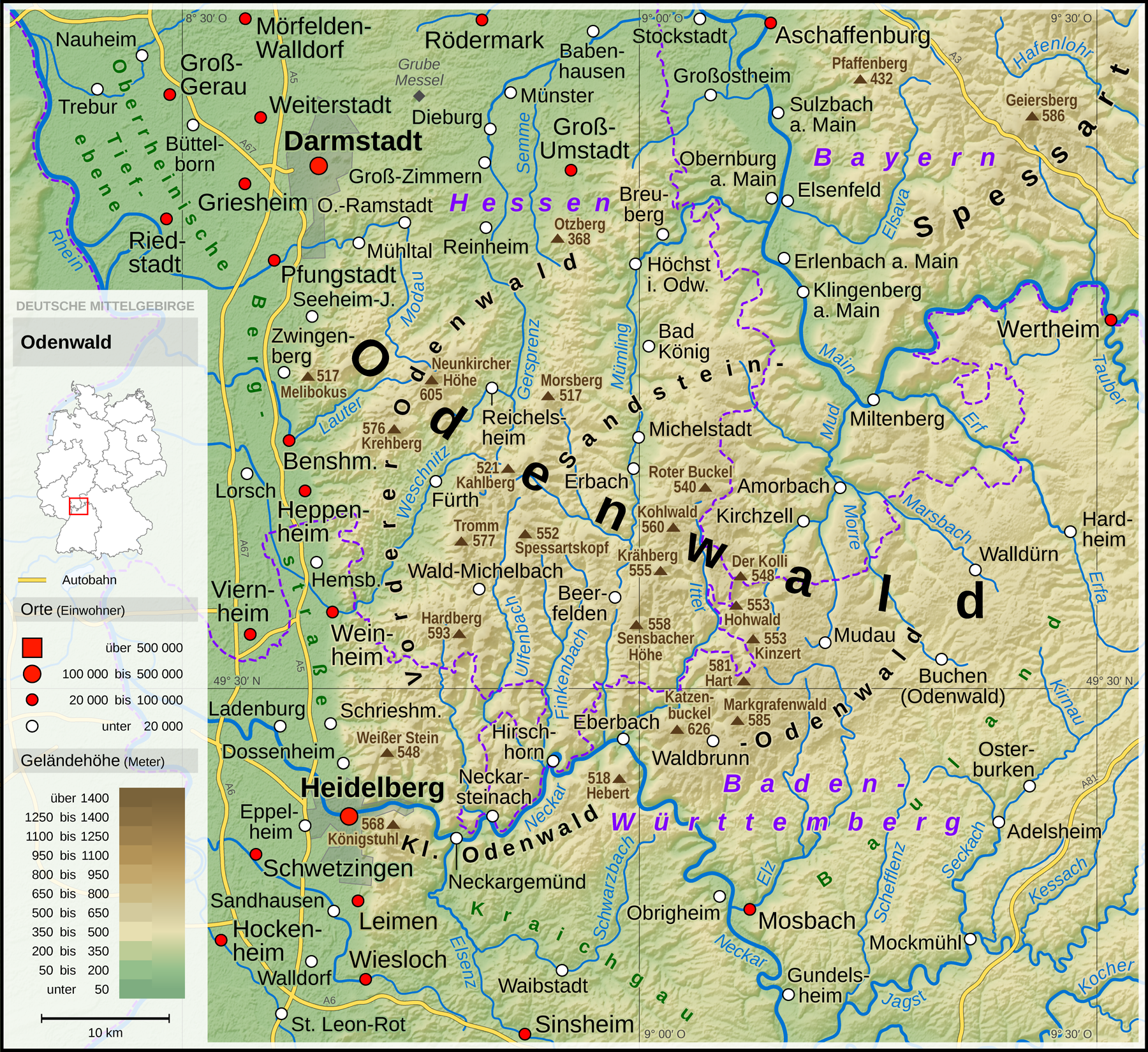
Second Heidelberg should be moved to the Rheingau province instead. Kraichgau is the hilly area between the Odenwald to the north and the black forest in the south bordering on the west to the flatlands around the rhine. Heidelberg is to far north and a part of the Odenwald where it goes over to the rhinish flatlands. Heidelberg is more known for its more mountainlike area opposed to the hilly Kraichgau.
Attached are two maps of the Odenwald area:
First geographical area of the Odenwald mountains (at the bottem you can also see the northern parts of the Kraichgau)
1723768388427.png


Second a map of geo naturpark Odenwald where the borders can be better seen but are less accurate
1723768460556.jpeg


Third you could rename the Rheingau province to western Odenwald, as the Rheingau should be more up north somwhere west to Wiesbaden, around the location of Rüdesheim. Darmstadt, Bensheim and Erbach are major cities in the western Odenwald area. Only Offenbach would be out of the Odenwald area, as it is next to Frankfurt, but I see no other fitting province for the Offenbach location. Please see the Odenwald map above.
See a map of Rheingau - Kreis
1723768656219.jpeg


Fourth the Mosbach and Buchen locations should be moved to the Spessart province. As is seen in the Odenwald map, they are part of the Odenwald.
Here I see 2 good options for the province name of Spessart.
1. leave it with 5 locations and keep the name or
2. what I would recommend: rename it to eastern Odenwald and create a new province with the locations of Aschaffenburg, Hanau and Lohr am Main as they are normaly the Spessart area. Miltenberg could also be part of Spessart, but it would be more fitting for eastern Odenwald.
The location of Erbach could be a part of either western or eastern Odenwald, though to put Erbach with eastern Odenwald would even the locations out with 4 locations in eastern and western Odenwald each.

Map of the Spessart area
1723771763567.png


Fith for the locations of Heilbronn and vaihing they should be redistributed aeay from the ufgau province as they would be lacking a land connection with the western locations without bruchsal location.

For heilbronn I suggest to add it to the kraichgau province, as it is at the edge of the geographical border and heilbronn was also from 1619 until 1806 the seat (kantonsarchiv) of the knight kanton kraichgau. Because of that a placement with the kraichgau province should be fine for heilbronn
Source was the Landesarchive of Baden-Württemberg

For the Vaihingen location a placement with the Strohgäu province should be ok, as Vaihingen is a part on the edge of the Strohgau. It is also way closer than Horb location wich is already part of the Strohgäu province.

Map of the Strohgäu province
1723771513009.jpeg


Lastly as the Ufgau province is left with only 2 locations the Baden location should be moved to the Ufgau province from the Ortenau province. The Ortenau province has currently 5 locations so one less would not be bad. A supporting fact for this is the modern Ortenau kreis which has its northern edge north of Offenburg and Oberkirch location but without Baden. The Ufgau also seems to be more in a north south orientation along the rhine flatlands around the Murg. Major cities of Ufgau are Baden and Durlach (today Baden-Baden and Karlsruhe-Durlach).

Maps showing Ortenau and the regions of baden württemberg (as I can not find a urgau map)

Ortenau map
1723771548199.png

Baden-Württemberg regions map (it is lacking any city names on it)
1723771573318.png


Thanks for reading and have a nice day :)
 
Last edited:
  • 3Like
Reactions:
Yes, you are right given that it was loaned to the bishopric of Gurk (a "vassal" of Salzburg) it should actually be owned by Salzburg. I do hope that leases and the ability to buy (not just sell as in EU4) will be mechanics in PC. Maybe even a ministeriales mechanic for HRE, even as a dlc would be cool.

For the connectivity there are actually no problems yes, if I remember correctly, control will work a bit differently in the HRE anyway.

@Inzano

Pinpointing the precise location is quite hard this source from the Slovenian archives gives the direct holdings (58 hub, 3 polovične hube, 23 domce in 67 pušč) with 3 administrative divisions (Razbor - Zgornji in Spodjnji, Golavabuka and Šentilj pod Turjakom) which kind of outline the southern border (to Mislinja). I think the blue area around the map you supplied would be a good guess.
View attachment 1174179
Here is how I would draw it (for gameplay and historical reasons). Kind of combining it with Ravne (Gutenštejn) and Dravograd (Drauburg) as SG was the most prominent location of the three at game start. I think your original proposal was not far off.

It's not the most detailed answer, but I am quite busy until next week, so I might get back to it later.
IIIRC, there was a dev comment a while ago stating that there will be tons of different types of political-vassal systems represented, so I have high hopes for all kinds of weird things that HRE feudalism came up with...

I agree, all ecclesiastical lands far away from their seats of power (e.g., Aquileia and Salzburg) were never and shouldn’t be directly owned or managed by them.

Good examples are how both the Counts of Gorizia and Lords of Ptuj started as low/landless nobility who were given a single fief in the HRE border region to defend and govern as vassals (ministeriales) of their respective Prince-Bishop.

Of course, over time, with capable management and the expansion of the HRE border, those families were given, entrusted, or leased more and more land to the point where they became powerful enough to first gain new possessions by themselves, independent of their ecclesiastical masters, and then to seek complete independence from them—some more successfully than others...
 
Last edited:
  • 1
  • 1Like
Reactions: