• We have updated our Community Code of Conduct. Please read through the new rules for the forum that are an integral part of Paradox Interactive’s User Agreement.

Tinto Maps #15 - 23rd of August 2024 - Horn of Africa

Hello, and welcome one more week to Tinto Maps! After a short break, we’re back to the duty of sharing more maps! Today the region we will look at is the Horn of Africa! So let’s take a look at it, without further ado:

Countries:
Countries.PNG

Here we have the countries around Nubia, Ethiopia, and Somalia. The first ones are organized around the ancient kingdoms of Makuria and Alodia, which control the Upper Nile region. In the second area, the Empire of Ethiopia stands as the main power, with some smaller countries around it. Finally, the two Islamic sultanates of Ifat and Ajuraan stand as the main powers in the Horn and Somalia. Finally, around the African Great Lakes, there is a country that can be considered a ‘settled’ one, Kitara.

Dynasties:
Dynasties.PNG

The dynasties of the Horn. There are some historical ones, while others are randomly generated. The most famous one is probably the Ethiopian House of Solomon, from where all their Negus come. The Walshma ruler over both Ifat and Ajuraan and we have some others, such as the Medri of Medri Bahri, the Umar of Mogadishu, the Banu Kanz of Makuria, or the Baranzi of Kitara.

Societies of Pops:
Pop-Based.PNG

A new map has popped up! Here you can see the countries that we consider as ‘Societies of Pops’, as they were presented in the last Tinto Talks. We have the famous Oromo people in the lands between Ethiopia, Ifat and Ajuraan; the Kunama, Gumuz, and Berta in the lands between Ethiopia; and Alodia, and the Zaghwa to the north of Wadai; there are a few more to the west, but I’ll share that picture in the Western Africa thread, as it’s more appropriate there. There are more Stateless Societies of this kind that we would like to add in the future, if it is possible due to our schedule.

Locations:
Locations.PNG

Locations 2.png

Locations 3.png

Locations 4.png

Locations 5.png
Locations! You might notice that the density is quite unequal. Unfortunately, the archaeological findings for the period are scarce, specially out of the most known areas and a lack of urbanization in most of the territory has made the finding of proper non-anachronistic settlements quite a challenge. Keep this in mind when making suggestions. ;) It has been that dramatic in some areas that we had to use names of tribes and rivers, a bit contradicting our own rules, but the areas had to be represented as they were active parts in the development of the region.
One thing: a big chunk of the Arabian peninsula can be seen in today’s Tinto Maps; but, please, reserve the feedback for its future DD, when we’ll show all of the peninsula. Apart from that, you can see more detailed maps if you click on the spoiler button, as usual.


Provinces:
Provinces.png


Areas:
Areas.png


Terrain:
Climate.png

Vegetation.png

Topography.png

The terrain types of the region are quite interesting and diverse. It is marked by the Rift Valley, which creates different biomes, such as the Ethiopian Highlands and Plateau, or the African Great Lakes. That also marks a divide between Arid, Tropical, and Oceanic climates. The vegetation of the region also ranges from desertic and sparse, to jungle forests. And one more note: you may also note that 'Marshes' have been renamed into 'Wetlands', as we could put some work into that suggestion the last week.

Natural Harbors:
Natural Harbors.png


Cultures:
Cultures.png

Another interesting map this week… You might notice that the lands of Ethiopia have a very mixed cultural situation. While more to the west and south, we are representing ‘tribal lands’ in a more homogeneous way, with kind of fixed boundaries to represent the different groupings. This doesn’t mean that there wouldn’t be a mixing of cultures, but this was one of the first areas to receive a minority's review and the scope was limited mostly to Ethiopia.

Religion:
Religion.png

Another interesting map! Miaphysite and Sunni are the more widespread religions in the region (while not all areas have their mixed populations, such as Nubia as you might notice, they eventually will as we cover more of the map in our sprints). Animism is completely placeholder, as usual, and you might see some pockets here and there (If you have specific suggestions, please do them). You may also notice a purple minority inside Ethiopia… That is representing the Beta Israel Judaism in the provinces of Semien, of course!

Raw Materials:
Raw Materials.png

The raw materials of this week! A big chunk of the region has livestock as its main raw material, while also having some agricultural goods as Wheat or Sturdy Grains here and there. The most unique good in the region is Coffee, which is cultivated in the Ethiopian highlands. And there are also some precious resources spread here and there, such as Gold, Ivory, Gems, and Incense.

Markets:
Markets.png

The main market centers of the region are Axum and Mogadishu, with ‘Adan/Aden being the main one controlling the access to the Red Sea. There are some weird calculations ongoing on the Somalian inner lands, that are already reported, and we’ll take a look at why is that happening.

Population:
Population.png

Population 2.png

Population 3.png

Population 4.png

Population 5.png
The population of the region! There are approximately 12.3M people in the Eastern African subcontinent; although take into account that it also comprises the regions of the Southern Great Lakes and the Swahili Coast, which we haven’t shown today, so we probably have to discount around 4M people from it (Swahili Coast accounts for 1.7M, and the Great Lakes for 4M, although that region is divided between today’s and next week’s Tinto Maps), for a total of around 8M.

That’s all for today! Speaking of next week’s Tinto Maps, it will be meaty, as it will cover Central, Eastern, and Southern Africa! See you!
 
  • 126Like
  • 39Love
  • 5
  • 4
  • 1
Reactions:
Some surprising choices in Somalia. Why is Ajuuraan Walashma? The Ajuran Clan, specifically the ruling House of Garen, is part of Hawiye. Meanwhile the Walashma are part of Dir. They're completely unrelated except for being the same ethnic group, you may as well put Napoleon in the de Medici family.

Also, the territory of Ifat has been significantly exaggerated, where is Warsangali?

In relation to Ajuran too, there are some strange decisions. Mogadishu has been made an independent state, but in control only of the city and a small area surrounding it. This isn't really accurate at all. Mogadishu was quite autonomous but was part of Ajuran during this period, albeit it became independent later. I note that when Portuguese soldiers, following an attack of Barawa, attempted to attack Mogadishu, Ajuran forces gathered from all over the country to defend the city, because it was Ajuran core territory.
 
  • 6Like
  • 1
Reactions:
Countries: Medri Bahri, which is correct and it means Land Of The Sea (Medri means Land, Bahri means Sea).

Dynasties: The ruler of Medri Bahri was titled Bahr Negus (meaning "King of the Sea," with Bahr = Sea and Negus = King), not "Medri." This title dates back to the Zagwe Period (~12th Century AD). Evidence for this comes from a land grant by Emperor Ṭänṭäwǝdǝm (Tantawedem), which mentions: "The king threatened excommunication against several śǝyyuman (literally, 'appointed ones') if they contravened the acts he had established: those of ʿAgamä, Bur, and Särawe, as well as an officer with the title of baḥǝr nägaśi, the viceroy (literally 'king') of the coast. He also mentioned a region called Gwǝlo Mäkäda, over which several śǝyyuman exercised authority" (Source: A Companion to Medieval Ethiopia and Eritrea, pg. 43). This tradition of Bahr Negus continued on until the 19th century.

Locations in Medri Bahri:

  • Mendefera (traditionally called Adi Urgi)
  • Debarwa - Correct
  • Debre Bizen? (Too small to make out)
Additionally, there are no locations mentioned in the east, specifically in the province of Akele Guzai. A suggested location is Digsa, one of the oldest towns in Akele Guzai. According to Encyclopaedia Aethiopica: Volume 2: D-Ha (pg. 125), Digsa was settled by the son of the founder of the province of Akele Guzai. Also, Historical Dictionary of Eritrea by Tom Killion (pg. 165) notes: "DIGSA (Akele Guzai). A village of about three thousand between SAGENEITI and HALAI in the Deqi Digna district. According to tradition, Digsa was settled by the family of Weresenezghi in the fourteenth century."

Provinces: All Correct
Areas & Terrain: Correct

Natural Harbor in Medri Bahri:
Massawa, traditionally known as Basé/badi by the local Tigre tribes, was a significant harbor during medieval times, including the 14th century AD. In 891-2 AD, the Arab geographer Al-Ya'qubi mentioned Massawa, as did Al-Mas'udi in 953 AD (The Ethiopian Borderlands, pg. 37).

Cultures: Correct
Religion: Correct
Raw Materials: The text is too small to see for Akele Guzai, but there isn't much to comment on here.
Markets: Nothing to comment on here.
Population: Nothing to comment on here.

Note: During the reign of Amda Seyon, there is evidence of a claimed invasion into Medri Bahri, possibly making it a tributary state. Amda Seyon himself recorded: "I, King Amde-Siyon, went to the sea of Eritrea. When I reached there, I mounted on an elephant and entered the sea. I took up my arrow and spears, killed my enemies, and saved my people" (Church & State In Ethiopia, pg. 145).

Who am I? I am from the village of Halay in Akele Guzay. My expertise lies in the Aksumite Period rather than the Solomonic Era, so I don't have much to add regarding the latter. I write articles about the Aksumite Period and related topics on my website (HabeshaHistory.c0m)

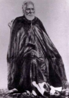
Attached Is a painting of Hailu of Tsazzega & a picture of Woldemichael of Hazzega the last Bahr Neguses (both claiming the spot) in the 19th century before the annexation by the Italians.
 

Attachments

  • degiat_hailu_of_tsazzega_ruler_of_mereb_melash.jpg
    degiat_hailu_of_tsazzega_ruler_of_mereb_melash.jpg
    115,7 KB · Views: 0
  • Screenshot_121.png
    Screenshot_121.png
    1,7 MB · Views: 0
  • 7Like
  • 5
Reactions:
Debre Bizen (north), Dekemhare (south), Debarwa (west).
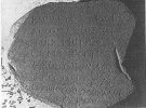
Nvm this is great, Dekemhare is an even older settlement than Digsa in Akele Guzai, it was founded during the Aksumite Era with an inscription of an Emperor named Sembrouthes, dating back to ~3rd century AD being found there. Gj paradox!
 

Attachments

  • 7e539b1c-2071-476c-8a6c-b3868108605b_696x518.jpg
    7e539b1c-2071-476c-8a6c-b3868108605b_696x518.jpg
    103,8 KB · Views: 0
  • 1
Reactions:
So
1. Not every indigenous/uncolonized nations get societies of pops? Like for example the ones in Sidamo
2. Do the ones that don't have them, have the option to "upgrade" into being societies of pops that might end up upgrading into countries proper?

+1 This is a personal opinion but I don't like Ethiopia's light blue colour. Can you change it to something like green or yellow or any colour that marches its "vibe" more? I suspect I'm not the only one with that opinion
 
  • 2
  • 1
  • 1
Reactions:
Because... it's not?

During the Messinian Salinity Crisis, when the connection between the Mediterranean and Atlantic closed some 5.96 million years ago, the Mediterranean dried up, and the Nile eroded down to the now-dry seafloor level of the then-dry Mediterranean basin. This created a huge canyon many thousands of meters/feet deep, all the way back to the Aswan area. After the Straits of Gibraltar formed (not re-formed, as the previous connection was through the Guadalquivir valley) and the Mediterranean re-filled 5.33 million years ago, this canyon was at first filled with sea water then, eventually, by sediment from the Nile. So Egypt is located on a rich sediment base very suitable for farmland, while areas further south are not. As an added result, the annual flood's effects are intensified in Egypt due to these wide, flat sedimentary plains, unlike the rocky, narrower river valley further south. Thus, the area around the Nile in Egypt is fertile farmland, while further south, it's mostly just rocky desert.

Really fascinating--Thank you for sharing this

On another topic, the raw trade goods around the great lakes look amazing. may have to make the area an early-ish campaign upon release
 
  • 1Like
Reactions:
I do not have any sources, but South Sudan should definitely see one culture blend into the other. Instead of hard borders where it's one culture in location A and another in location B, similar to how Ethiopia is portrayed. South Sudan has an "interesting" cultural history, in which different ethnic groups constantly overlap and often don't get along with eachother.
 
  • 1Like
  • 1
Reactions:
You specifically asked about what to fill the Animist void with, so here are some suggestions using information I scraped off of the Traditional African Religions portal of wikipedia. Take these suggestions with a grain of salt, as they are general approximations of where they existed and with which people they existed with.

Waaqeffannaa:
This should be an obvious inclusion, I think others have already dealt with this (better than I have) but I’ll put in my two cents anyways.

It should be present wherever the Oromo and Somali population exist, albeit with extremely varying percentages, as well as being marginally present in other areas bordering the Oromo or Somali culture areas, especially if they are Cushitic (Dahalo, Rendille, Sidama, Daasanach, Harla?). I am leaving the Afar culture group out of it because they seem to be thoroughly not-Waaqeffannaa by 1337 from what little information I can gather. The addition of a few (<1.5%) Waaqi pops may be fine in the Islamized areas, but I can’t find any evidence that they still existed by 1337. Feel free to tell me I’m wrong, especially since I'm going to be quite liberal in spreading Waaqeffannaa as far as I reasonably can because there isn't much else to fill the void.

Areas with a significant majority should be the following locations:
  • All the areas of the Oromo people Society of Pops which includes: Liban, Tulu Walal Tulu Naroa Dun, Dolo, Mormor
  • Anywhere that is Somali majority outside of a Somali majority nation: Garreh
Areas with a sizable Waaqeffannaa population:
  • The Rendille culture area: North Sakuye, South Sakuye, Gabra, Rendille (The Rendille people were converted to Islam very quickly, so it is possible that they had their own faith but I haven’t seen anything of it)
  • The Dahalo culture area bordering with Rendille and Somali: North Dahalo, Central Dahalo
  • Rural areas of Ajuran which are close to the Oromo and far from the coast: Garbahaarey, Bardera, Luuq (Given that the main theory is that Islam generally spread from the coast inland)
  • The Sidama culture areas which border Oromo: Goba, Harro Walabu
  • The Daasanach culture area: Daasanach (I am unsure of whether or not they were Waaqi, but considering they were Cushitic, its likely)
Areas with a large minority population:
  • The remainder of the Sidama culture area: Bossa
  • The remainder of the Dahalo culture area: Sanye
(These are both given their relative distance from the center of Waaqeffannaa belief, generally believed to lie within the Oromo and Somali people)
Areas with a small minority population (<5%):
  • Low population density inland areas of the Somali culture area: Limey, Gode, Kelafo, Hargaya, Degehabur, Geledi, Buuhoodle, Oodweyne, Burao
(These are added considering their proximity away from the coast and generally nomadic lifestyle meaning that the conversion to Islam was likely not finished by 1337 for small communities of nomadic pops, hence their addition)

Mwene Nyaga:
Mwene Nyaga was the precolonial religion of the Kikuyu, Embu, Meru, Kamba, and Maasai groups. This technically could be separated into two religions (considering the different types of worship these groups had, it isn't necessarily a stretch to separate them into two religions, as the Kikuyu, Embu, Meru, and Kamba worship was very different when compared to Maasai worship) but for the sake of this proposal, they will be considered as one since it is the most common interpretation, and there isn’t enough information on the differences between them.

Areas with a significant majority should be the following locations:
  • All of the area of the Maasai culture area: Samburu, Maasai, Ilehamu
Areas with a sizable Mwene Nyaga population:
  • Areas where the Kikuyu, Embu, Meru, and Kamba commonly lived (around & North of Mount Kenya): Agikuyu, Kitui, Oda Boru Ruva
Areas with a large minority population:
  • Areas where the Kikuyu, Embu, Meru, and Kamba lived in small numbers: West Ongamo
Areas with a small minority population (<5%):
  • Areas where the Kikuyu, Embu, Meru, Kamba, and Maasai influences may exist: Deloraine, Ilchamu, Ngibilai, Rendille, Central Dahalo, South Dahalo
(These were estimated based on general migration patterns, which were from the coast inland for the Embu, Meru, Kamba, and somewhere else for the Kikuyu)

Nhialicism/Dinka Religion:
Nhialic was the supreme god of the Dinka pantheon for the Dinka people. There isn’t a name for this religion as far as I can tell so the supreme deity is good enough of a stand in. Unlike the previous ones, the religion was practically inseparable from the culture during this time period, and thus wherever the Dinka people exist so should Nhialicism, hence I’ll be following the culture map without extrapolating much.

Areas with a significant majority should be the following locations:
  • Dinka majority culture area: Sobat, Naser, Gore, Fashoda, Kaka
Areas with a sizable Mwene Nyaga population:
  • None
Areas with a large minority population:
  • Dinka minority culture area shown on maps given: Assosa, Renk, Dabarqi
Areas with a small minority population (<5%):
  • None

Mebegeism:
Similar to Nhialicisim, it is the supreme deity plus -ism because it has no noted name I can find. This was the religion of the Fang people in the CAR. I am noting this here because you guys stated that the provinces for the CAR aren't ready yet, but similarly to Nhialicisim, it should go hand and hand with its culture group.

Almaqahism/Sabaeanism:
This one is a long shot, given how this religion was more than likely dead by game start, but the idea is that this is the vestiges of the ancient Yemeni religion that was spread to Tigray by the Sabaeans and evident by sites like the Temple of Meqaber Ga’ewa, or the Great Temple of Yeha. Given its likely, but unconfirmed, death by 1337, only a few pops where the temples are actually located is warranted.

Areas with a significant majority should be the following locations:
  • None
Areas with a sizable Mwene Nyaga population:
  • None
Areas with a large minority population:
  • None
Areas with a small minority population (<5%):
  • Locations where the Temples are located: Manadeley, Yeha


Also, if you’re looking for more locations to add, Naggalabi Buddo in Uganda is a good one to add considering its importance in crowning the Kings of Buganda.
 
  • 13Like
  • 4
Reactions:
Wouldn't it be nice when considering the immense replayability and product life of this release to give regions a second resource or even a third?
This to make regions more diverse and give economy an impulse.
 
  • 3
Reactions:
For a place with tons of history and cultures, I'm surprised there's less locations than the British Isles and the British Isles are way smaller than the Horn of Africa.
 
  • 4
  • 3Haha
  • 2
  • 1Like
Reactions:
Could you add separate locations to the bigger islands in the lakes? For example splitting Ukerewe Island away from the location of Jita and connecting it with a straight crossing. It’s a small detail that would add more flavour to the great lakes.
 
  • 1Like
Reactions:
Guys, but don't you read the TM? They struggled in finding locations to add, so instead of complaining of lack of locations, if you have any source, provide it; if don't, stay quiet and wait for others to do so
 
  • 23Like
  • 2
  • 1
Reactions:
I think Afgooye should be a seperate location to Mogadishu, since it served as the capital for the Slicis Dynasty (which could also be modelled as a vassal of the Ajurans to break up the homogenity), and the later Geledi Sultanate that overthrows the Ajurans. And its seperated from the city proper by hills.


On a seperate note, what is the policy on the Somali location names? In places like Poland and Romania, local spellings were used instead of English ones and it seems to be inconsistent here. For instance:

Mogadishu -> Muqdisho

Zeila -> Seylac

Erigavo -> Ceerigaabo

Buhoodle (I think this is mispelled since its Buhodle in English anyway) --> Buuhoodle

Berbera -> Barbara

Hargeisa -> Hargeysa

Galkayo -> Gaalkacyo

Kismayo -> Kismaayo

Ali Sabieh -> Cali Sabiix

Ras Hafun -> Ras Xaafuun

Theres more that I didnt spot, but its generally inconsistent between English and Somali (generally seen on using the Somali 'X' in some locations but the English 'H' in others) I think putting them all in one or the other is prefereable.

1000063858.jpg
 
Last edited:
  • 10Like
  • 2
Reactions:
May not technically be in the purview of this Tinto maps, but it seems a bit odd to have no natural harbor whatsoever at Al-Mukha.

Also, given its geography and very ancient history as a significant trading port, having some degree of natural harbor at Ras Hafun would make a lot of sense.
 
  • 1Like
Reactions:
@Pavía can portugueses sources be used to support feedback in Tinto Maps? Someone in the team knows how to read in portuguese?

Asking because non-english sources for Kongo Kingdom (next Tinto Map) and pre-columbian Brazil are more detailed and abundant in portuguese.
 
  • 5Like
Reactions:
To let you know, this is the criterion we've been using to assign people to the different tag categories:
So I don't think writing should be a criterion for settled societies, but I see you've been not following that rule either (eg. in the Kingdoms of West Africa like Benin which to my knowledge no written script)
 
  • 4Like
Reactions:
Those are lands inhabited by 'horizontal societies', which are not represented by any type of tag in our game, neither settled nor the society of pops. But they aren't empty lands, there are plenty of pops inhabiting those locations, as you may notice in the culture, religion, and population map modes.
What role do you expect these locations to contribute during a game, if they don't have Societies duking it out, interacting with and potentially threatening the settled nations? Then they do nothing but get colonized. Depending on how slow colonization speed is in this region, either every game will see Ethiopia and Somalia ahistorically blob deep into the African interior, or colonizing them will be such a tall order that nobody has a realistic chance it it most games- making including the locations as playable territory at all largely pointless.
 
  • 3Like
  • 1
Reactions:
@Pavía can portugueses sources be used to support feedback in Tinto Maps? Someone in the team knows how to read in portuguese?

Asking because non-english sources for Kongo Kingdom (next Tinto Map) and pre-columbian Brazil are more detailed and abundant in portuguese.
Fun story, at this time, Kongo didn't even exist yet as their own kingdom, so I'm curious to see how they'll handle that area and having Mbata and Mpemba since they were the precursors to Kongo.
 
  • 2Like
Reactions:
Being a former resident of Kisumu, I would enjoy seeing fish produced in Joluo. I don't know if people fished there in 1337, but the site of modern-day Kisumu was known as a food-trading location prior to colonial times, and fishing is a major activity there. Also, you could divide it into Kisumu County (flatland) and Homa Bay County (hills). Of course, those names would be anachronistic and I sympathize with the difficulty job of finding period-appropriate names for locations such as these.

Also, I don't think Mumias has sparse vegetation. It would be woods or forest. It's quite lush, and the deforestation of the area was more recent.
 
  • 3Like
Reactions: