• We have updated our Community Code of Conduct. Please read through the new rules for the forum that are an integral part of Paradox Interactive’s User Agreement.

Tinto Maps #18 - 13th of September 2024 - Persia & Caucasus

Hello everyone, and welcome to one more Tinto Maps! Today we will be taking a look at Persia and the Caucasus! These are regions that encompass several modern-day countries and regions (Iraq, Iran, Balochistan, Afghanistan, Transoxiana, etc.), but for the sake of simplicity, we decided to name this DD this. Let’s start, without further ado!

Countries:
Countries.png

Colored Wastelands.png

The region is quite interesting in 1337, as there are plenty of countries to play with. The Ilkhanate is still alive, but in name only, the real power being hosted by the Jalayirids, who are overlords of some of their neighbors (the Chobanids, and the Eretnids). Other countries, such as Gurgan, the Kartids, and Muzaffarids are also struggling to get the hegemony over the region. Meanwhile, the strongest power in the Caucasus is the Kingdom of Georgia, although the region is also quite fragmented among different polities.

Ilkhanate.png

And speaking of the Ilkhanate, you may have wondered why isn’t it a unified tag… Well, it’s because we consider that it is clearly in decadence, having lost any grasp of authority over the provinces, so the best way of portraying it is through an International Organization. What we can see in this mapmode is that there are two pretenders to get the power, the Jalayarids and Gurgan, with the other countries still being formally part of it. I won’t talk more today about how it works and its features, but I’ll just say that there are two clear fates for the Ilkhanate: being dissolved, as historically happened, or being restored in full power as a unified country.

Dynasties:
Dynasties.png

Not much to say today about the dynasties, as they’re akin to the country names, in most cases. Well, you might wonder which one is the yellow one, ruling over Gurgan… That country is ruled by the Borgijin, heirs of Genghis Khan. Now you get the full picture of their rule over the Ilkhanate being challenged by the Jalayirids, I think…

Locations:
Locations.png

Location 2.png

Locations 3.png

Locations 4.png

Locations 5.png


Provinces:
Provinces.png


Areas:
Areas.png


Terrain:
Climate.png

Topography.png

Vegetation.png

We’re back to a region with lots of different climates, topography, and vegetation. This will make it very unique, gameplay and looking-wise.

Harbors:
Harbor.png

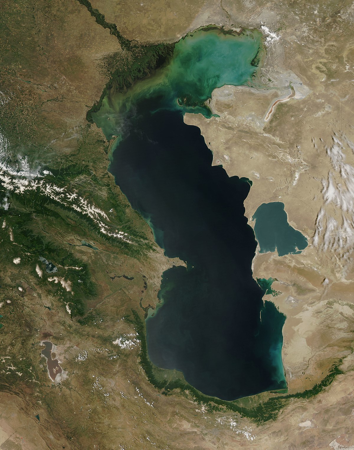
You might notice that there are ports in the Caspian Sea… Because, well, it’s considered a sea in our game, so there can be ships and navies over it.

Cultures:
Cultures.png

There's quite a lot of cultural division throughout the region... The Caucasus is, well, the Caucasus, divided among lots of different people. Then we have the Iraqi and Kurdish in Iraq, Persian and a number of other cultures in Iran, Baloch in Balochistan, Afghan in Afghanistan, and Khorasani, Turkmen, Khorezm, Hazara, and Tajiks, among others, in Khorasan and Transoxiana.

Religions:
Religion.png

Another interesting religious situation. Orthodox is the main religion in Georgia, and Miaphysitism in Armenia, with other confessions spread here and there throughout the Caucasus (Khabzeism, and three 'Pagan' confessions, Karachay-Balkar, Vainakh, and Lezgin). Then Iraq is divided among Sunni, to the north, and Shiism, to the south. And Iran is in an interesting situation, having a Sunni majority, but with some important Shiite pockets here and there. And Zoroastrianism, of course. It was not trivial to properly portray them, as we don't have good data for the 14th century. So what we did was some calculations, between sources that tell that there was still a majority as late as the 11th century, and the religion becoming severely reduced by the 16th century. Therefore, we decided to go with 20% of the population as a general rule of thumb; however, we're quite open to feedback over this matter.

Raw Materials:
Raw Materials.png

This region is full of rich resources, in stark contrast to the one we showed last week, Arabia. There are a couple of bugs on this mapmode that you might spot, I think.

Markets:
Markets.png

This region has several markets: Tabriz, Baghdad, Esfahan, Hormuz, Nishapur, and Zaranj., This will make for regionally fragmented-but-integrated economies (that is, good market access everyhwere, but with regionally diverging economies).

Population:
Population.png

Population 2.png

Population 3.png

Population 4.png

Population 5.png

The total population of the region is around 9M, taking into account all the different areas that we’re showing today. That is divided into about 4.5M in Iran, 2M in Iraq, 1.5M in the Caucasus, and around 1.5M in Transoxiana.

And that’s all for today! Next Friday we will be taking a look at India! Yes, in its entirety; we think that it is the best way to do it, although we’ll talk more about it next week. Another change, only for next week: the DD will be published at 10:00 instead of the regular 15:00, as I won’t be available in the afternoon to reply. Letting you know so there’s a proper wow-pole-run, yes. See you!
 

Attachments

  • Religion.png
    Religion.png
    3,2 MB · Views: 0
  • Cultures.png
    Cultures.png
    3,1 MB · Views: 0
  • 86Love
  • 84Like
  • 5
  • 3
  • 1Haha
  • 1
Reactions:
Shirvan seems wrong. As a location it should not extend beyond the Kura. As a province it should be south of where you've placed it - its historical capital was Shamakhi. As for the location, was there ever a city called Shirvan, and did it still exist in 1337? If Shirvan meant something different in 1337, can someone enlighten me on this?


Abkhazia should be Apkhazeti. Samegrelo should be Odishi. Samtskhe should be Meskheti.

Kermânšâh province could possibly be Kermanshahan. Also, the location it's named after is spelled as Kermānšāh. You really have to do something about that romanization.

Amadiya province should be enlarged with Duhok and renamed Hakkari & Bahdinan.

Ciildir should be Tao & Klarjeti, and it should be part of Georgia.

Ġaznī province should be Zabulistan.

A province of Larestan should be created out of Lār, Bastak, Jahreh, Darz, Alamarvdasht, Bāgh, Khunj, Dehtal, and Ahel. The remaining locations of the 3 abolished provinces can be redistributed between the neighboring provinces.

Syunik should be expanded with the location to the north whose name I can't make out. Obviously a mountain pass needs to be added.

Erāq-e Ajam should be Persian Iraq. Irâk al-'Arabi should be Arab Iraq.
 
I hope posting all of these in quick succession doesn't get flagged as spamming.

Kars province should be Vanand. In fact, all territory within Armenian political control should be divided into provinces based on the historical divisions of Greater Armenia.


Believe it or not, I'm actually not a fan of Armenian nationalism. But this is 1337, and having an Armenia province that just so happens to end around the modern-day Turco-Armenian border, and to the west of it an Armenian Highlands province, is incongruous at best and a political decision at worst. Join them together, add Bayazıt (which didn't have that name yet, so call it Daruynk or something else) and Shirvan west of the Kura, and reorganize the whole into West, East and South Armenia. The people who are going to hate it were going to hate this part of the map anyway, because of the Armenian Highlands (which were obviously not in Armenia, just like the Scottish Highlands are not in Scotland).

Talīsh should be split up between Gīlan and Muğan (renamed Muğan & Talīsh), each getting half the locations. Muğan & Talīsh should be part of Āzarbāijān.
 
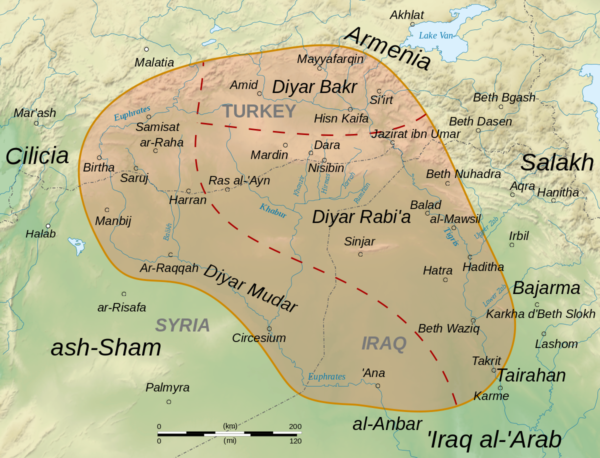
Jezira should be enlarged with Al-Tabqah (which I think you've put in the wrong place), Manbij and Deir ez-Zor. Its provinces could maybe be reorganized along the lines of the 3 traditional Abbasid divisions (Diyar Rabi'a, Diyar Bakr and Diyar Mudar) plus a Mosul province.


Kordestān is just the Persian word for Kurdistan, and there's nothing about this place that's inherently more Kurdish than, say, Erbil. Just call it East Kurdistan. And enlarge it with Safhat al-Jibal, because Arab Iraq did not extend north of Tikrit.

Transoxiana should be Mawarannahr.
 
The Caspian Sea should be the Khazar Sea.
The Caspian Sea has like 60 names, why should we choose that one? It'd be cool if we could dynamically change the name, but I don't think the game supports that for unowned places.
Gorgan and Astarabad are just different names for the same city - why are they different locations on the map?
Original Gorgan was a different city; Astarabad came to preeminence after Gorgan was devestated by the Mongols and was eventually itself renamed to Gorgan, according to Iranica this was by Reza Shah Pahlavi and therefore not until the 20th century.

"Our knowledge of the Dašt-e Gorgān becomes somewhat better for the medieval times, partly due to the political importance of the city of Gorgān/Jorjān near present-day Gonbad-e Qābus" Iranica

"The city of Gurgān, Jurjān in Arabic, straddled the river of the same name; the river divided it into two parts, Shahristān and Bakrābād... Astarābād is also mentioned, not as the trading center that it is today, but as a manufacturing town; the inhabitants were renowned for their mastery in silk weaving." Barthold, An Historical Geography of Iran, 116-7

Gonbad-e Qabus is indeed (just barely) within the game's Gorgan.

What's going on with the Aral Sea?
I'm halfway done with a proposal for the whole Aral Sea area; do you have a specific thing in mind here or just a general statement?

Shirvan seems wrong. As a location it should not extend beyond the Kura. As a province it should be south of where you've placed it - its historical capital was Shamakhi. As for the location, was there ever a city called Shirvan, and did it still exist in 1337? If Shirvan meant something different in 1337, can someone enlighten me on this?
I assume you mean the area shouldn't extend beyond the Kura? The location doesn't touch it. But yes all three Shirvans seem a little weird at first glance.
 
Last edited:
I'm proposing a new mountain wasteland location to represent the mountains and the "Iron Gate" of Buzgala on the road to Bukhara and Samarkand from the south.

ProposalTopo mapSatellite image
1728169748678.png
1728169765888.png
1728169756904.png

The borders of Akhisek would expand slightly eastward to take over the portion that is currently owned by Basand on the west side of the wasteland.

In gameplay terms this blocks passage between Akhisek and Basand, requiring travel by either the river route through Kelif to the south or northern route through Guzor and the Iron Gate. These were the historical routes described in the sources; I don't think long-distance travelers or armies were traversing the mountain which blocks the direct route.

These are mentioned by Barthold (1968, 137 and following) as the main two roads between Termez (whence further south) and Bukhara (through Nasaf) or Samarkand. While describing the route from Nasaf and Samarkand through the mountain district, which takes the Iron Gate, he says "[the town of Kandak] is not mentioned by Sam‘ānī and Yāqūt, the former of whom apparently neglected to visit this mountain district, but went from Nasaf to Tirmidh via Kālif." Neither the mountain route nor the Kelif route are direct as the crow flies, which implies the roads were avoiding the higher mountain here. Barthold also describes a number of instances of armies using the Iron Gate. The terrain was also important for trade, and sources describe tolls on the pass which made good income for the local rulers.

Stančo and Pažout describe the area as

the mountainous region around the present-day village of Darband, Baysun District was selected, including former check-post, which inherited its customs function from the historical border control point called the Iron Gate in Medieval written and epigraphic sources and represents without a doubt a strategical point on the assumingly easiest way through the mountains between Bactria and Sogdiana.
...
This location forms a hub of roads as it no doubt did in the past, connecting not only the main centres of historical Bactria (Medieval Tokharistan) in the south and Sogdiana in the north, but also lesser towns and villages situated to the east around present-day Baysun, to the north in the valley of Machay and beyond, and to the south-west in and around the Alamli Mountains. The key communication corridors are formed by river valleys, among them most prominently the manynamed stream known as Machay Darya in this area, while further south it becomes the Sherabad Darya and Kara Su respectively. This south–north axis cuts through the mountains north of Darband eroding a picturesque gorge 600 m deep in places, dramatically separating two formidable mountain massifs: that of the Sarymas (almost 2000 m a.s.l.) to the west and the Ketman Chapty to the east, the latter reaching as much as 3160 m a.s.l. Thus the region consists of several clearly delimited geographical units."

Sources

Barthold, V. V. Turkestan Down to the Mongol Invasion. Edited by Clifford Edmund Bosworth. 3rd ed. New Delhi, India: Munshiram Manoharlal Publishers, 1968.

Stančo, Ladislav, and Adam Pažout. “Which Way to Roxane: Mobility Networks in the Heartland of Central Asia.” Journal of Archaeological Science: Reports 32 (2020): 102391.
 
Last edited:
  • 2Like
  • 1
  • 1
Reactions:
Probably too few to be visible, but we know Mizrahi is a culture in the game. I am more worried about all Eastern non-Arabic speaking Jews being lumped under this catch-all umbrella...
I don't like lumping together all Arabic-speaking Jews either. It's not like the Ashkenazi community where they have a distinct dialect, cuisine etc despite living across several different countries. Their dialects were minor variations on the local dialects of Arabic and kosher versions of the local food.
 
  • 1Like
Reactions:
The Caspian Sea has like 60 names, why should we choose that one? It'd be cool if we could dynamically change the name, but I don't think the game supports that for unowned places.
Because it was historically the most common Arabic name, it's the official name in modern Turkish, Azerbaijani, Turkmen, Tajik (which is not that different from Persian), and Zazaki, and still seems to remain in unofficial usage in Persian.

The following designations are thus found among the Muslim authors: Abaskūn (or Ābaskūn), Astarābād, Jorjān (Gorgān), Ṭabarestān, Māzandarān (from the 6th/12th century, surviving in modern Persian as Daryā-ye Māzandarān), Sārī, Deylam, Jīlān (Gīlān), Moḡān, Bāb and Bāb al-Abwāb (Darband), and Šīrvān. In particular the name of the Khazars, a Turkic people that has predominated around the northern and western parts of the sea north of the Caucasus since Arab Islamic culture was established, appears in the designation Baḥr al-Ḵazar (Sea of the Khazars), the name most frequently used by Arabic authors of the classical period; it is still preserved in modern Turkish Hazer Denizi and the common Persian Daryā-ye Ḵazar. There were also less specific names like Baḥr al-Jabal (Mountain sea; Jabal being the name currently applied to the Persian plateau) or Baḥr al-Aʿājem (Barbarian sea). Maqdesī (Moqaddasī, III, p. 353) called it simply Boḥayra (The lake). Other designations were drawn from countries that, though not adjacent, were supposedly near the sea, like Khorasan (Baḥr al-Ḵorāsānī; Masʿūdī, Tanbīh, p. 90; Ebn Faqīh, p. 7) or even Ḵᵛārazm, owing to an obvious confusion with the Aral Sea. In the same way the Turkic tribes hesitated among several descriptive names, like Deniz (The sea), Ak Deniz (The white sea, i.e., The southern sea), Kuzgun Denizi (Sea of crows, or rather Sea of cormorants, which have black plumage like that of crows), and Qorzum Denizi (Sea of beavers; Demašqī, pp. 194-95), as well as ethnic names like Oğuz Denizi (Baḥr-e Ḡūz, Sea of the Oghuz). These Turkish names were also commonly used in Persia.
Khazar sea that is also called Caspian, Tabarestan and Mazandaran, is extended over the northern margin of Iran.

The question "why should we choose that one?" can be applied to any of those dozens of names. One will still need to be picked. None was in use in all the Turkic and Iranian languages spoken around the lake. But Khazar Sea seems to me to have the best pedigree, whereas Caspian Sea was probably not used by any of the surrounding peoples, and even among Catholic Europeans was only one of several names.

I don't speak Persian and I can't read the Arabic alphabet, and auto-translate isn't much use when it translates unofficial names to the official ones, so I'm having to go through this Persian Wikipedia article with a fine-tooth comb (comparing the translation to the transliteration whenever Caspian comes up). If I have a better idea when I'm done, I'll let you know.


If anyone has sources showing some other name being common in the languages spoken around the Caspian, I'll be happy to defer to them.
I'm halfway done with a proposal for the whole Aral Sea area; do you have a specific thing in mind here or just a general statement?
I mean the way it's depicted doesn't make sense. It's clearly large enough to contain several sea locations, but on almost all maps it's depicted as just one. The exception is the location map, where it's depicted as an impassable wasteland - but that's fairly typical of all lakes other than the Caspian.
I assume you mean the area shouldn't extend beyond the Kura? The location doesn't touch it. But yes all three Shirvans seem a little weird at first glance.
Agreed.

(Edited to add Tajik.)
 
Last edited:
Giorgio Interiano (1502) "La vita et sito de Zychi, chiamati Ciarcassi: historia notabile"
That's kind of late, but you did get me Googling other references to "ciarcassi" and I came across this.

Le mot « tcherkesse » n'était pas utilisé autrefois par les Caucasiens du Nord-Ouest ; les peuples de la Méditerranée, vraisemblablement à partir du XIIIe siècle, les nommaient autrefois, en lingua franco, Ciarcassi ou Circassiens et ils étaient connus chez les Géorgiens et chez les Russes sous le nom de « Tcherkesses ».
 
A small detail that I found: when Qazaghan invaded the Kartids, he did so since the Arlat and Apardi had evidently been fighting against them for 6 years at that point. Additionally, what I found is that Qazaghan was not only motivated by those two tribes requesting his help, but also the shaykh of Torbat-i Shaykh-i Jam also requested that he invade. Evidently this figure, alongside the shaykh of Andkhud, gave approval to Timur's invasion of Herat (he evidently sought out the approval of such figures across his whole realm, but those two are the ones known to actually have lent it).

So... maybe some extra clergy pops in Torbat-e Jam and Andkhoy (really should be Andkhud)?
 
I mean the way it's depicted doesn't make sense. It's clearly large enough to contain several sea locations, but on almost all maps it's depicted as just one.
It contains zero sea locations, as with every other lake we’ve seen except the Caspian; you can’t build ports or ships on it.

Which is probably correct, there was some level of fishing going on but no one built navies and considering the location of cities and how it gets treated in sources you get the impression it wasn’t that important to the neighboring empires.
 
Instead of calling the Baduspanid realm Tabaristan (to switch the Bavandid realm to Mazandaran instead), wouldn't Rostamdar make more sense for the country name? It's the current name of the province and this other source seems to confirm that it's Rosamdar.


Also, between the locations of Kojur and Amol, I'd want to include the locations of Lavij and Rostamrood or Nur if possible. I'm sure someone else on here has suggested it, but I agree with adding barriers/wastelands for the Zagros Mountains to show how much of an obstacle they were.
 
Last edited:
Would Ciscaucasia be a better name for the Northern Caucuses? It's certainly less cumbersome, and IMHO feels neater. I understand if it's not chosen for being too Russia-centric, but it's worth considering.
 
This could be a dumb question, and tell me if so, but should some of the tribes of the Caucuses be represented as societies of pops? It hasn't come up yet and it seems like an obvious thing to consider given how fragmented some were politically.
 
This could be a dumb question, and tell me if so, but should some of the tribes of the Caucuses be represented as societies of pops? It hasn't come up yet and it seems like an obvious thing to consider given how fragmented some were politically.
That's something I also thought.

The question here is, how decentralized can normal tags get?

Most of the peoples of the north Caucasus definitely fit the description of society of pops better.

What would happen sometimes is that these groups would consolidate for a short time, but then would go back to being heavily decentralized.

And for Alania, i.e. the Ossetians, they started off with a state, that transitioned into something that would definitely fit the society of pops description.