• We have updated our Community Code of Conduct. Please read through the new rules for the forum that are an integral part of Paradox Interactive’s User Agreement.

Tinto Maps #30 - 20th of December 2024 - South America

Hello and welcome to one Friday of map-loving! Today is special, as our 30th Tinto Maps, devoted to South America, is the last regular one. This implies that it won’t be the last, though - we plan to have two Tinto Maps Extra on December 27th and January 3rd, and then we will continue with the Tinto Maps Feedback posts as we progress with the map review.

But don’t worry, as on the first post-Christmas Friday, January 10th, I will start a new series, Tinto Flavor, in which we will show the content that we have been working on for Project Caesar. And I promise you, it’s a ton of content, so you will have to play the game in due time to discover it all…

Before we continue, one note: as we're covering a lot of lands today, don't be shy and ask for more detailed maps of the type you want wherever you want them, and I'll try to provide in the replies. And now, let’s start with the South American maps:

Countries
Countries1.png

Countries2.png

Countries3.png

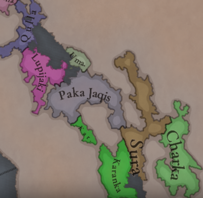
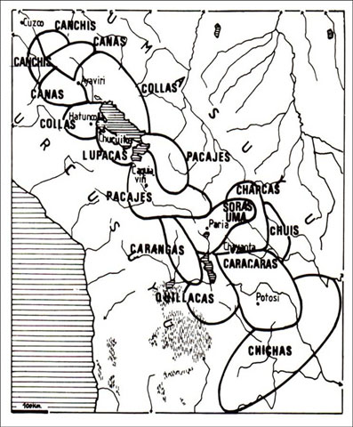
Most of the countries that can be considered being at a State-wise level in 1337 are mostly concentrated in what is today Perú. We have famous ones, as the Chimu or Chincha, and you may also see a tiny country, Qusqu, which would later become the Inca Empire, the long-term goal while playing in the region.

Dynasties
Dynasties1.png

Dynasties2.png


SoPs
Sops1.png

Sops2.png

Sops3.png

Sops4.png

Sops5.png

There are SoPs spread out all across the continent, making for a really interesting mix in the Peruvian area (again). We're already thinking about how to better visualize the coexistence of these two types of countries in the political layer, but it's going to take us some more time to get there.

Locations
Locations1.png

Locations2.png

Locations3.png

Locations4.png

Locations5.png

One note: I'll talk a bit more in-depth about the design of the Brazilian locations if you scroll down, in the Terrain section.

Provinces
Provinces1.png

Provinces2.png

Provinces3.png


Areas
Areas1.png

Areas2.png


Terrain
Climate.png

Topography.png

Vegetation.png

There are huge geographical variations in South America, being one of the most diverse continents. One of the things I wanted to discuss is that we've tried to portray the Mata Atlântica, the original forest cover that was present in Brazil before the Portuguese colonized it, and a different type of land exploitation started. In this regard, we've been reading the feedback of the Brazilian community, and I want to say that our intention here is to portray the most realistic situation for 1337. That said, we've already internally discussed that we may reduce its scope, so it doesn't look so extreme, but we'd like to hear your opinions about it. And here you have one of the images that we used as a reference for it, so you get a good grasp of our intention:
Mata Atlantica.png

Development
Development.png


Natural Harbors
Harbors1.png

Harbors2.png


Culture
Cultures1.png

Cultures2.png

Cultures3.png

Cultures4.png

Cultures5.png

Cultures6.png

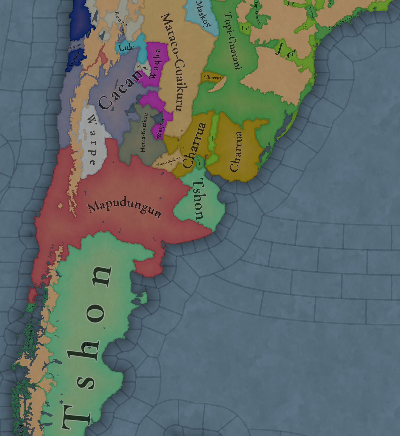
The jewel of the crown in this region. We've tried to portray the Pre-Columbian cultural diversity of these lands as accurately as possible, and, well, here you have the results.

Languages
Languages1.png

Languages2.png

Languages3.png

And the languages that group these cultures.

Religions
Religions1.png

Religions2.png

Religions3.png

We've tried to do our best to group the cultural religions of South America into different groups, based on common believes, gods, rituals, etc. Let us know what do you think of them. Oh, also, the Inti religion has its own differentiate mechanics, which we'll explain in the future!

Raw Goods
Raw Materials1.png

Raw Materials2.png

Raw Materials3.png

Raw Materials4.png

Lots of different natural resources in South America. You may note that some are more common compared to other regions (such as Medicaments). We've also been tweaking the color of different resources, with the help of your feedback!

Markets
Markets.png

The green market is centered around Teyuna, and the red one is Chinchay.

Population
Some issues with the map of the region this week (sadly), so let's discuss the numbers. The total in the continent is 10.22M, divided this way:
  • 1.66M in Colombia
  • 1.2M in Brazil
  • 5.07M in Andes
  • 877K in Chaco
  • 1.4M in La Plata
And that's all for today! We hope that you enjoyed the Tinto Maps series! We've definitely done, and it's also greatly helping us to make Project Caesar a much better game, with your help and feedback. Cheers!
 
  • 137Like
  • 57Love
  • 32
  • 9
  • 6
Reactions:
Why can there not be a location without a market assigned?

It is strange to see a gigantic one without any access
View attachment 1233727
we can have a threshold that a market can assign a location to itself only if the strength is at least 5.

Also as a solution, there can be "No Market" market
The basic logic of the economy requires a location to be part of a market, even if it's not efficient. Markets are mostly relevant to the way landed countries work, so it's not a hugely relevant issue.
 
Last edited:
  • 29Like
  • 3
Reactions:
Excellent work; I have some suggestions regarding Chile:

The border of Arica is not historical; the same with Ciakie; the way the location of Piren is defined also seems somewhat arbitrary, the impassable lands do not seem very realistic either, and I would change corn for potatoes due to the climate. Chubut cannot cross the Andes and be a province that reaches the Pacific, nor is there any historical justification for this. The Pacific islands and the continental plate in that part of Chile are called "AYSEN".


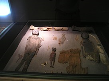
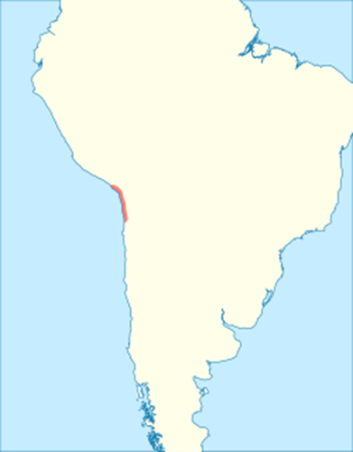
The Chono-Guaiteco language was unintelligible with the Kawésqar.There is a lot of missing copper in the southern Andes; Chuquicamata has been exploited since 450 BC, to give you an example.A bit of flavor about the Chinchorros (I don't even see them represented); the Chinchorro culture that inhabited the coast of northern Chile and southern Peru at that time in the current city of Arica and in the valleys of Azapa and Camarones. They are an ANCIENT culture, the oldest to mummify their dead; you can add it to their religion if you ever make them playable. IT SHOULD BE A POP SOCIETY.

1734712571187.png
1734712590898.png


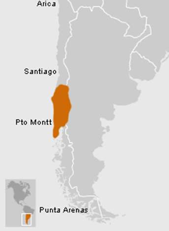
The Mapuche people need to be given a lot of flavor; they are a people who managed to resist the conquest and with a very particular organization. The Mapuche culture was a more or less organized people but only for war; it can be a pop society but when there was an external threat it had an organization similar to a centralized state; in Chile the culture could be distributed in this way in those years but had internal subdivisions. The first researchers recognized the Picunche, who inhabited from the Maule River to the Itata and Biobío rivers, the Araucanos, from the latter to the Toltén, the Pehuenche in the mountainous area, from Chillán to Antuco and the Huilliche between the Toltén River and the Gulf of Corcovado, including 1 Chiloé Island.Another thing about the language; when the Spaniards arrived, Mapudungun was in use from Coquimbo to Chiloé and from the mountains to the sea; this was due to the "Mapuchization" of the peoples by this culture.Now, some flavor; the Mapuche had a pre-Columbian domesticated gallina; a very strange thing in the New World; probably due to contact with Polynesians. The chickens are called "kollonca" and "ketro". This last hypothesis gained strength when, in early June 2007, Chilean and New Zealand anthropologists announced that they had found about fifty chicken bones in "el arenal", on the Arauco peninsula in southern Chile; you could put it as a unique production method. (It's a bit controversial; I know but it would be fun to include the detail)

1734712717229.png


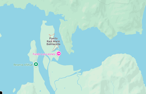
At the mouth of the Palena River there is a location called Puerto Raúl Marín Balmaceda, colonized in 1889; an excellent natural harbor that should be represented in the game; being one of the best unused ports in the Pacific due to its isolated location where even today large tourist ships can land.
1734712671946.png


Excellent natural port and is not even represent in the map!

There are grasslands in the Mediterranean center of Chile when there should be sparse vegetation. In that place, the "Mediterranean scrub" predominates, specifically sclerophyllous and spiny forests (matojo de espinos) ; then it was deforested. And speaking of that, there should be an event at some point in the early colony. There is a lot of vine where the Mediterranean climate predominates in Chile. Grapes from Bordeaux and Spain were brought, managing to "vinify the country a lot". As a fun fact, in the old world there was a crisis with an insect, the phylloxera; which completely extinguished the Carmenère; only isolated vines survived in Chile that were cultivated as Merlot until we realized that it was actually Carmenère in 1998. You could add some flavor to that historical event.

i will do more fedback in some time; nice work!
https://hexbear.net/comment/4236159
 
Last edited:
  • 12
  • 6Like
  • 4Love
  • 1
Reactions:
The natural ports by the Rio de la plata should not be there. The Rio Paraná and Uruguay bring in a lot of silt, which gets deposited in the Rio de la Plata. Therefore, the rio de la plata is mostly only a meter deep. A lot of dredging work needs to be done to access the historical ports of Buenos Aires, boca and puerto Madero. To call these harbours natural is a bit odd
 
  • 15
  • 5Like
  • 4
Reactions:
Is there any interest in representing the use of Terra Preta in the Amazonian basin?
 
  • 6Like
  • 5
  • 1
Reactions:
I'd also like to call on to all the Brazilian friends for your input regarding natural harbors, since, besides Rio de Janeiro and São Salvador, I'm a bit at a loss for accurate suggestions.
I'd imagine there are several in the Nordeste, as well as São Luís do Maranhão and Belém do Pará, but I'm not positive.
Cheers all.
 
  • 4Like
  • 1Love
Reactions:
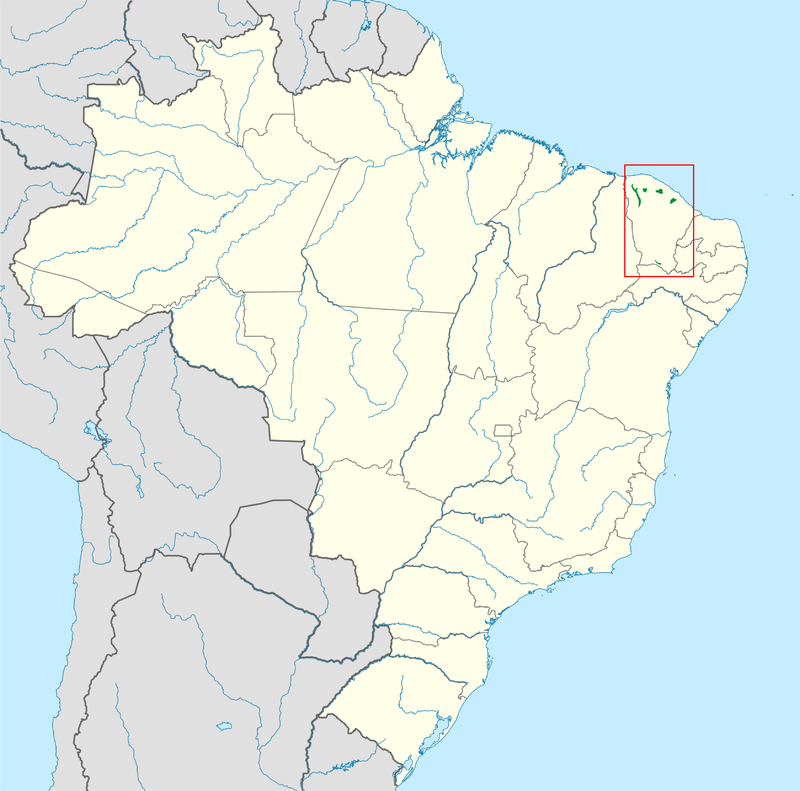
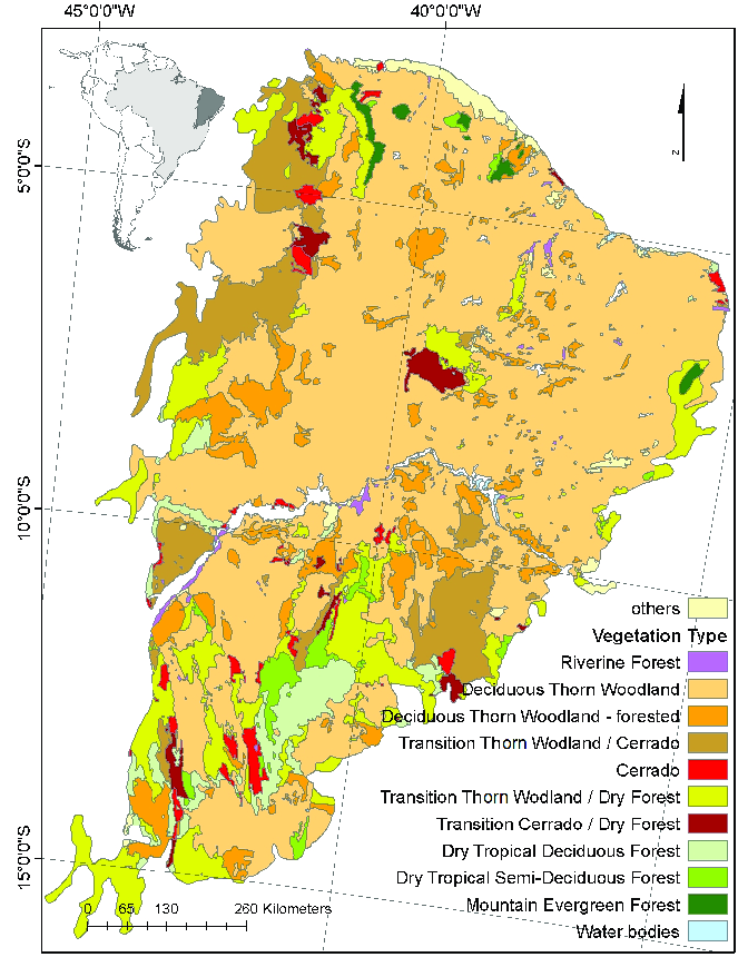
May I give a suggestion? As many people are already giving feedback about the Mata Atlantica (Atlantic Rainforest), the Brazilian Arid region in map is more of a semi-arid biome called Caatinga (meaning white woods in the native language). The vegetation is a complex mix of xeric shrublands, open wooddy savannas and proper thorn forests with small trees. There is no way it can only be represented as Grasslands. There are also small enclaves of Atlantic Forest vegetation on higher elevations (Between 600m and 900m or higher) called "Brejos de Altitude". These are moist broadleaf forests resembling a mix of amazonian and atlantic forest flora and fauna and should be better represented on the map.

Here is an example of the high elevation forests in the Ceara state
1734708902384.png


Also here is a vegetation map for the Caatinga biome. Source: Castanho et al. (2020) - A close look at above ground biomass of a large and heterogeneous Seasonally Dry Tropical Forest - Caatinga in North East of Brazil"
1734709902877.png


Now let's go to the Amazon, the Marajoaran population is estimated as 100k people in that island alone, there is evidence of complex matrilineal society, pottery making, agriculture and complex wood and mound buildings. Also, the Kambeba (or Omagua) people are not represented, despite being one of the most important tribes in the amazon basin, with a centralized rule, landless aristocracy, trade and complex terraforming (they used to create artifical islands and did soil enrichment). In the 17th century there were more than 400 villages between the Javari and Jutai rivers and an estimated 91k to 100k people living in the region around the 15th century before the arrival of Europeans. The Amazon basin is not the wasteland described in the map, many different tribes used to live there, using the rivers as highways for trade (with andean civilizations mind you), wars, and to settle new places. Not developing these areas and just labeling as wastelands is not true to the rich and complex history of the amazon region.

Brazil's pre-colonial population is very underestimated overall, 10M people is the most recent estimative for native population before european arrival.

Some sources:
 
  • 10Love
  • 5Like
  • 4
  • 3
Reactions:
For reference, this is how my location map looked last time I updated my thread:

de9ula6.png
1734704288292.png
I do strongly believe this is a better approach. We do not need that many wastelands, the eastern wastelands should be restricted to the Serra do Mar/mar de morros (PT-BR only). What I would be more liberal with is the Amazon, however, precisely because we did not get much/any settlements far from the rivers until much later on (and for this, I have this Native Vegetation map which could be used as a reference, although limited to 1500).
I agree with what was said about the locations in Brazil entirely. The distribution of wastelands in Brazil not only feels excessive but also ahistorical. I live in a region of Brazil which currently is represented as Wasteland (Ouro Preto) and it was one of the most densely populated regions of Brazil with a population peak of 150 thousand people during the late Colonial era (at the time where Gold Mining was extremely important to the colonial economy). Other major cities of Brazil were also founded back in the colonial era in regions currently portrayed by the map as wastelands.

There's absolutely nothing climate, terrain, or vegetation wise that should prevent human settlement of the impassable regions and fact like others mentioned they were inhabited both by natives and later on by the Portuguese. It should not be the case that you can't settle those regions in game.

Now regarding the population numbers, I know I have already pointed it out in other threads, including two Tinto maps, but the population numbers are also way lower than should be expected. The Amazon is estimated to have houses between 6 to 10 million people according to recent historiography in regards to distribution of settlements and human development. The Amazon rainforest as a whole is stock full of evidence of prior human habitation and more than that *density*. It was after all a centre of pre-Columbian civilization in the Americas.

How is the Amazon supposed to grow in population at minimum 5 to 10 times the population it has in game in a span of only approximately 150 years? That's an absurdly big needed growth rate if paradox wishes to properly display the development the Amazon had when Europeans arrived to the continent.

Not to mention the Andes, which as much lower population than should be expected from the region which under the Inca Empire had approximately 12 million people according to the Encyclopedia Britannica.

I really hope concerns regarding the excessive distribution of wastelands as well as the excessively low population numbers are properly addressed by Paradox.
 
  • 19Like
  • 5
  • 2Love
Reactions:
I'm guessing it's probably next to impossible to allow for the look of the map to change, but wouldn't it be possible to allow for local terrain to change to (at least from a gameplay standpoint) deal with things like this? Forests into plains and plains into farmlands, for example?
 
  • 1
Reactions:
Wow potatoes and coffee more valuable than spices! I can't wait to see how the mechanics play out to make them more abundant
Fewer locations isn't the same as being more valuable. For example, the base price of spices is much higher, and costs much less to transport than potato (ever bought €10 worth of saffron?). Furthermore, the pop demand for spices is very high across the world which pushes the price up further.
 
  • 42Like
  • 8
  • 2
Reactions:
The shape of the areas in Brazil look quite...unintuitive. Especially Tupiniquim.
It's what you get with river basins! ;)

I like it for exploration and... Nothing else, really.
 
  • 4Like
  • 1
Reactions:
But what if there were settlements in the area founded by colonizers? I believe (very) small armies could cross these regions if whites managed to settle there, so bigger armies should be taken care of by attrition. At least that's the logic I used for my map: there was a white presence there and those areas were disputed by Europeans, even if far away from the centers of power.
It's not only those regions didn't have historical armies marching through them either. Just because we are yet to find evidence of large scale pre-Columbian battles in the Amazon doesn't mean they didn't occur. We have evidence that the Amazon was a well developed region of pre-Columbian South America after all and it is very unreasonable to say that an entire civilization didn't have battles or armies.
 
  • 11Like
Reactions:
May I give a suggestion? As many people are already giving feedback about the Mata Atlantica (Atlantic Rainforest), the Brazilian Arid region in map is more of a semi-arid biome called Caatinga (meaning white woods in the native language). The vegetation is a complex mix of xeric shrublands, open wooddy savannas and proper thorn forests with small trees. There is no way it can only be represented as Grasslands. There are also small enclaves of Atlantic Forest vegetation on higher elevations (Between 600m and 900m or higher) called "Brejos de Altitude". These are moist broadleaf forests resembling a mix of amazonian and atlantic forest flora and fauna and should be better represented on the map.

Here is an example of the high elevation forests in the Ceara state
View attachment 1233730

Also here is a vegetation map for the Caatinga biome. Source: Castanho et al. (2020) - A close look at above ground biomass of a large and heterogeneous Seasonally Dry Tropical Forest - Caatinga in North East of Brazil"
View attachment 1233742

Now let's go to the Amazon, the Marajoaran population is estimated as 100k people in that island alone, there is evidence of complex matrilineal society, pottery making, agriculture and complex wood and mound buildings. Also, the Kambeba (or Omagua) people are not represented, despite being one of the most important tribes in the amazon basin, with a centralized rule, landless aristocracy, trade and complex terraforming (they used to create artifical islands and did soil enrichment). In the 17th century there were more than 400 villages between the Javari and Jutai rivers and an estimated 91k to 100k people living in the region around the 15th century before the arrival of Europeans. The Amazon basin is not the wasteland described in the map, many different tribes used to live there, using the rivers as highways for trade (with andean civilizations mind you), wars, and to settle new places. Not developing these areas and just labeling as wastelands is not true to the rich and complex history of the amazon region.

Brazil's pre-colonial population is very underestimated overall, 10M people is the most recent estimative for native population before european arrival.

Some sources:
I'm from Ceará, and I was thinking about the same vegetation observations as you! I would also like to point out the Maguezais that were a lot more proeminent during the starting period. And also point out the Araripe, between Ceará and Pernambuco, where we have one of the few extant Mata Atlântica and historically very relevant to the state, it's a shame it's being portrayed as just one location.
 
  • 13
Reactions:
1. I'd suggest calling the Tupiniquim area Pindorama instead. Pindorama (or perhaps more properly Pindoretama) is an indigenous term used for the coastline of Brazil as a consequence of the Tupian migrations down the coast.
2. I'd also concur with the idea that the Mata Atlantica shouldn't be represented as a wasteland, its relatively low population from colonists has been explained in another post but also the area was occupied by the Portuguese at a time where most indigenous peoples had been practically destroyed by European diseases before any direct contact, meaning there was very little to register by the time that land came under authority of the crown.
3. The Amazon should be more traversable from the Andes, particularly along the main Marañón-Solimões branch from Peru and along the Rio Negro, through the (natural) Casiquiare Canal and into the Orinoco, not only were these routes frequently travelled by the colonists, settlements from the 1600s such as São Paulo de Olivença and São Gabriel da Cachoeira are completely impossible in the current map. Moreover, there is lots of evidence of trade from the Andes reaching the mouth of the Amazon and beyond so it would be representative of the state of the continent in the 1300s as well. Both of the crossings I suggest here were way more valuable and settled than the current corridor you have between Brazil and Venezuela crossing the territory of Roraima, which would only really be appropriate for the last 70 or so years of the PC timeline.
4. Corumbá and the west side of the Paraguay river (around the province of Eexiwa) should be reachable by Brazil very easily, it and a few other places were already occupied by Portuguese settlers even before the Treaty of Madrid established a new official border between Brazil and Spanish America, the existence of these small settlements across the Treaty of Madrid border (which in the treaty stated that it was meant to be based on uti possedis, ie he who has settled that land owns it) is the entire reason for the border dispute between Brazil and Bolivia well into the Victorian Era. Not having Portugal being able to access these lands would make sowing the seeds of that later dispute impossible.
5. Brazil seems to be missing representation of two of its major colonial natural harbors:
Angra dos Reis / Paraty (Rio de Janeiro) - Deep Bay, primary port of the Estrada Real until surpassed by Rio de Janeiro
Laguna (Santa Catarina) - Closed & Defensible estuary, also a pirate haven
6. Here's a map of Brazilian settlement dates, I think based on it the east coast of the Nordeste between Salvador and Natal as well as the Rio-São Paulo area deserve quite a bit more love, especially given its obviously higher colonial density straight from the get-go
7. Any future mechanic you may add that would be able to represent the Iroquois transitioning from a SoP to a state should also be applicable to southeast Brazil as a very similar thing happened with the Tamoios a century earlier
 
  • 15Like
  • 5
  • 2
Reactions:
1734713988008.png


WHY DO THE HET SPEAK MAPUDUNGÚN? The Het language was a Chonan language. And why are the querandí so far south? They never went beyond the Río salado.

Also, you named a coastal region "Tandil". Tandil is an inland city and the ONLY hilly region in the entirety of Buenos aires. That region should be called something else, like Mullún. Claromecó is also outrageously anachornistic... you can name it the region "Quequén" (a real historical mapudungún name for the region...)
 
  • 14
  • 5Like
Reactions: