• We have updated our Community Code of Conduct. Please read through the new rules for the forum that are an integral part of Paradox Interactive’s User Agreement.

Tinto Maps #9 - 5th of July 2024 - Carpathia and the Balkans

Greetings, and welcome to another Tinto Maps! This week we will be taking a look at Carpathia and the Balkans! It will most likely be an interesting region to take a look at, with a lot of passion involved… So I’ll just make an initial friendly reminder to keep a civil discussion, as in the latest Tinto Maps, as that’s the easiest way for us to read and gather your feedback, and improve the region in a future iteration. And now, let’s start with the maps!

Countries:
Countries.png

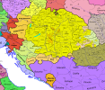
Carpathia and the Balkans start in a very interesting situation. The Kingdom of Hungary probably stands as the most powerful country in 1337, but that only happened after the recovery of the royal power enforced by Charles I Robert of the House of Anjou, who reined in the powerful Hungarian nobility. To the south, the power that is on the rise is the Kingdom of Serbia, ruled by Stefan Uroš IV Dušan, who has set his eyes on his neighbors to expand his power. The Byzantine Empire, meanwhile, is in a difficult position, as internal struggles ended in Andronikos III being crowned sole emperor, at the cost of dividing the realm; both Serbia and Bulgaria have in the past pressed over the bordering lands, while the Ottomans have very recently conquered Nicomedia. The control over the Southern Balkans is also very fractioned, with a branch of the Anjou ruling over Albania, the Despotate of Epirus under the nominal rule of Byzantium as a vassal, Athens, Neopatria and Salona as vassals of the Aragonese Kings of Sicily, Anjou protectorates over Achaia and Naxos, and only nominal Byzantine control over Southern Morea. It’s also noticeable the presence of the Republics of Venice and Genoa, which control several outposts over the Adriatic and Aegean Seas. A final note: in previous maps, Moldavia was shown in the map, but we’ve removed it from it, and it will most likely spawn through a chain of events in the 1340s.

Dynasties:
Dynasties.png

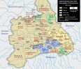
The House of Anjou rules over Naples, Hungary, Albania, Achaia, and Cephalonia; they’re truly invested in their push for supremacy over the region. Apart from that, each country is ruled by different dynasties, except for Athens and Neopatria, ruled by the House of Aragón-Barcelona.

Locations:
Locations 1.png

Locations 2.png

Locations 3.png

Locations 4.png
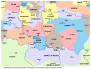
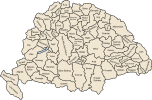
This week we’re posting the general map of the region, along with some more detailed maps, that can be seen if you click on the spoiler button. A starting comment is that the location density of Hungary is noticeably not very high; the reason is that it was one of the first European maps that we made, and we based it upon the historical counties. Therefore, I’m already saying in advance that this will be an area that we want to give more density when we do the review of the region; any help regarding that is welcome. Apart from that, you may notice on the more detailed maps that Crete appears in one, while not being present in the previous one; because of the zooming, the island will appear next week along with Cyprus, but I wanted to make an early sneak peek of the locations, given that is possible with this closer zoom level. Apart from that, I’m also saying in advance that we will make an important review of the Aegean Islands, so do not take them as a reference for anything, please.

Provinces:
Provinces.png

Provinces! Nothing outstanding to be commented on here; as usual, we’re open to any feedback regarding them.

Terrain:
Climate.png

Topography.png

Vegetation.png

Terrain! The climate of the region is mostly divided between Continental and Mediterranean, with some warmer and some colder regions. Regarding the topography, the Carpathian mountains are famously important and strategic, while the Balkans are a quite hilly and mountainous region, which is also greatly covered by woods and forests.

Cultures:
Cultures.png

Here comes the fun part of the DD: The cultural division of the Balkans! A few comments:
  1. Hungary is full of different minorities. Transylvania, especially, is an interesting place: there we have a mix of ‘Hungarians’, ‘Transylvanians’ (which are the Romanian-speaking inhabitants of the region), ‘Transylvanian Germans’, and ‘Szekely’ people.
  2. We have divided the Southern Slavic-speaking region into their dialectal families of Slovene, Croatian, Bosnian, and Serbian.
  3. The Southern Balkans are mostly divided among Bulgarian, Albanian, and Greek cultures.
  4. We’re also portraying plenty of other cultures, such as Dalmatians, Aromanians, Sclavenes, Arvanites, Cumans, Jasz, or Ashkenazi and Romanyoti Jews.

Religions:
Religion.png

This one is also interesting. Apart from the divide between Western Catholicism and Eastern Orthodoxy, we have the Krstjani in Bosnia, Bogomils (the pink stripes both in Bosnia and Macedonia), and Paulicians in Thrace. The Jewish populations do not pass the threshold percentage to appear on the map, but there are plenty of communities across the region.

Raw Materials:
Raw Materials.png

The materials of the region. Something very noticeable is the richness of minerals, with plenty of Iron, Copper, Tin, Lead, Gold, and Silver. Specifically, Slovakia is very rich, and you definitely want more settlers to migrate to the region, and exploit its resources. The region is also very rich in agricultural resources, as you can see.

Markets:
Markets.png

The region is mostly divided among four markets: Venice, Pest, Ragusa and Constantinople.

Country and Location population:
Population 1.png

Population 2.png

Population 3.png

Population 4.png
Country and location population (which I’ve also sub-divided, and is under the Spoiler button).

And that’s all of today! I hope that you find the region interesting; we certainly think that it is. Next week we will go further south, and we will take a look at the Syrian Levant and Egypt. Cheers!
 
  • 193Like
  • 69Love
  • 7
  • 4
  • 3
  • 1Haha
Reactions:
I'm going to put some feedback on Croatia as a Croatian
1. LOCATIONS
I'm going to put a reason for every location
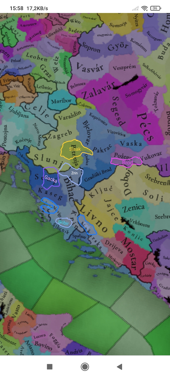
IMG_20240705_161018.jpg

- Nin was first Croatian "Capital".Nin produced Salt
- Bribir is center of Šubić Bribirski dinasty
- Sinj Makarska is just to big and it goes to much into Dalmatian interior
- Gacka you will see the reason
- Zrin fort that would fall into hands of one of Šubić branches and that will be more nowne as Šubić Zrinski family and Zrin has a Silver mine
- Sisak and Brod are bouth big Roman towns with big fortresses
- Or Petrinja should just be called Moslavina
2. PROVENCES
Lika is to big, Senj, Gacka and Kaseg should be Lika and Krk, Rijeka and Crikvenica should be Kvarner
3. TRADE GOODS
I already said abaut Nin and Zrin but Kaseg should hawe livestock ther is no wheat now in 2024 there was defenetly no in 1337
4. COULTURES
When slavs started coming to dalmatia before them in dalmatia lived Romanized ilyrians some of them stayed in dalmatian towns somo escaped to mauntens those who stayed in cityes are called Romani and those who escaped to mauntens wheare nown as Vlasi. Romani are Dalmatians but i dont se vlasi people they should be big minority in Bihać and small minority in Bosnian mauntens. Dalmatian should be majority just in bigger Dalmatian towns Zara and Spalato, Ragusa and Kvarner should bee the ssme and all ather locations that are not Istria shoulf be over 90% Croatian.
5. DIPLOMATIC MAP
So Croatia didnt own just coslal parts it owned a lot of northern western and northern central Croatia and remebmer Anjou managed to get control of croatia 1322 so 15 years before start date Croatia had a lot autonomy in personal union and Croatian ban Pavao Šubić Bribirski called Anjou dinasty to get Hungary. That means that Croatia was fully Independent, the only thing that Hungary and Croatia thogether had was same ruler. At this time Kvarner was ruled by Frankopan dinasty or at thid time better nown as Knezovi Krčki (dukes of Krk) in 1336 they counquered Rijeka and at this point had bichaprichy of Senj so they baisicly owned all of northern croatian coast.
IMG_20240705_182832.jpg

Sorry for bad English.
I hope that you see this beacose I was resrching all week for this, Thank you
 

Attachments

  • IMG_20240705_161018.jpg
    IMG_20240705_161018.jpg
    357,1 KB · Views: 0
  • IMG_20240705_161018.jpg
    IMG_20240705_161018.jpg
    357,1 KB · Views: 0
  • 12Like
  • 6
  • 1
Reactions:
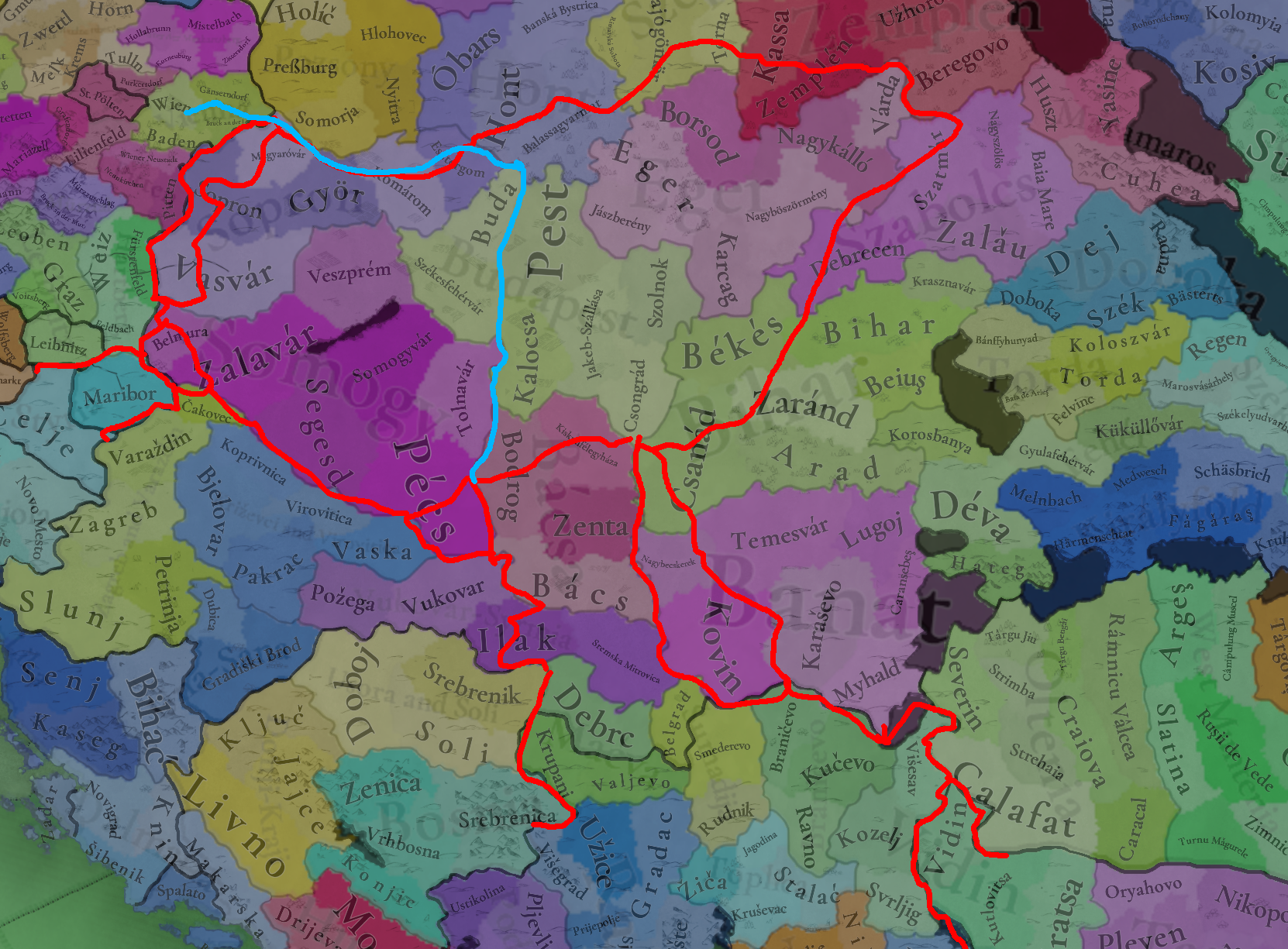
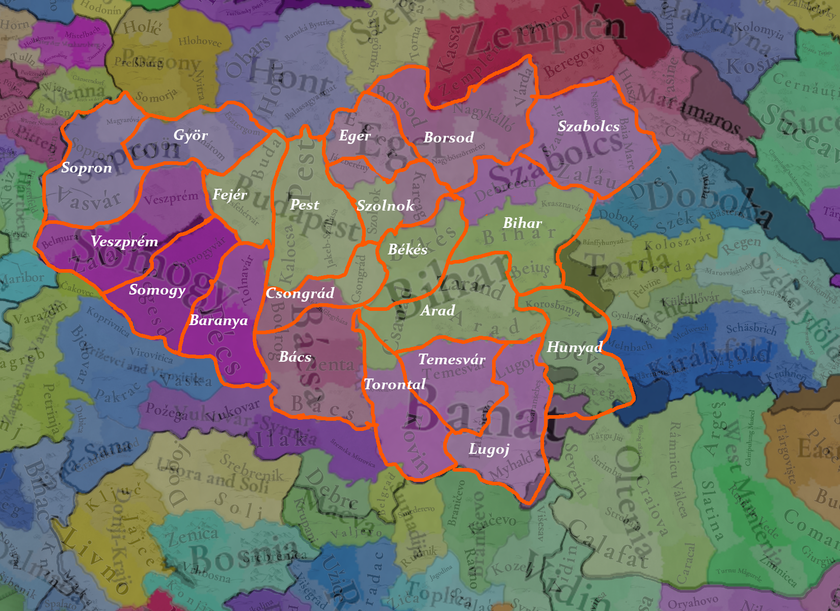
I have some propositions for Hungary, starting with a map I made for locations. Some of these are just spelling corrections or renaming propositions, but there's about 20 new locations in it:

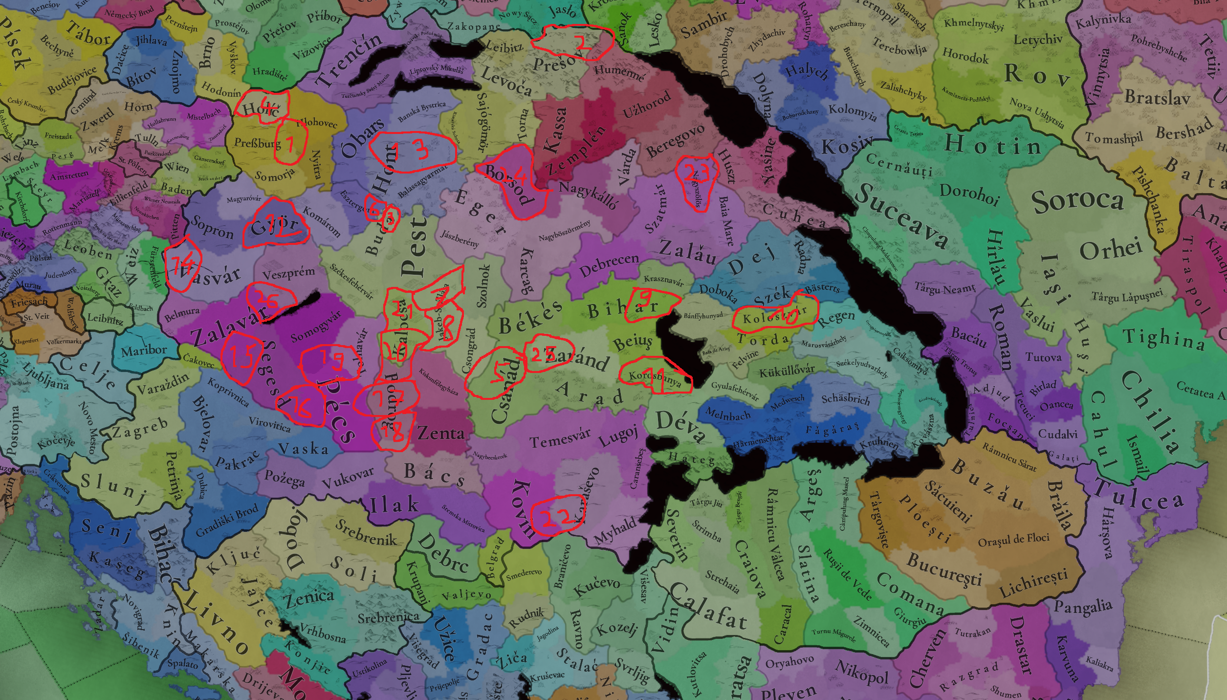
1720194540919.png


1. Nagyszombat/Trnava/Tyrnau
2. Bártfa/Bardejov/Bartfeld
3. Óbuda
4. Szakolca/Skalica/Skalitz (just a renaming)
5. Szeged
6. Visegrád
7. Cegléd
8. Kecskemét
9. Nagyvárad/Oradea
10. A typo, the correct spelling is Kolozsvár, not Koloszvár
11. Typo again, it's Körösbánya, or Kőrösbánya in some forms, not Korosbanya
12. Minor spelling again, it's Győr, not Györ.
13. Zólyom/Zvolen
14. Szombathely
15. Kanizsa
16. Szigetvár
17. Mohács
18. Szabadka/Subotica/Zabotka
19. Kaposvár
20. Kalocsa
21. Pentele
22. Versec/Vršac
23. Just spelling here, it's Nagyszőlős, not Nagyszölös
24. Miskolc (just a renaming proposition, although Borsod is also fine)
25. Makó
26. Keszthely

For the first five, I wanted to represent the medieval royal free cities, for which I used this 1514 document (the first two paragraphs list the royal free cities): https://net.jogtar.hu/ezer-ev-torveny?docid=51400003.TV&searchUrl=/ezer-ev-torvenyei?keyword=1514
For those unaware, a royal free city was a city that was land directly under the Hungarian monarch, so they wouldn't have to interact with it through the county system. These cities would pay taxes directly to the monarch and had some special privileges. Settlements would be granted royal free city status based on their importance, either economic or historic, so I think it's fair to represent all of them on the map. Not all of them already had this status in 1337, but to my knowledge it did happen in the first 50 years of the game's timeframe. Óbuda might be the hardest sell of these, as it is a relatively small location and was a royal free city more because of its historical role than its economic one.

Visegrád is also a small location, but it was the capital of Hungary at this point, until it was moved back to Buda in 1408, I think the royal seat should be represented by its own location.

"Jakeb-szállása" is a naming that I can't find anywhere and generally sounds wrong my ear as a Hungarian. If you want to keep this location, "Jakabszállás", its current name is probably a better fit, although I tried to break it up into two different locations which I found more fitting.

"Bodrog" is also an unfortunate name because there's multiple different settlements named Bodrog or Bodrogsomething all over the kingdom, so I tried to break it up into what I think are more topical locations. I also moved the Kalocsa location a bit to the south and added Pentele (the historical name for today's Dunaújváros) to fill the space.

And while I didn't mark it on the map, I think "Yasine" might also be an incorrect spelling. According to Wikipedia the English spelling is Yasinia, while the Slavic spellings are some form of Jasina. The Hungarian spelling is Kőrösmező if that gets added.

For the others I just tried to break up locations I thought needed some density and add some notable settlements, either larger towns or smaller locations where some better known events took place, like Mohács and Szigetvár.

As for provinces, Budapest is not a name that fits for the majority of the game's time frame. Either Buda or Pest works fine on its own. Bácsa should probably be Bács instead. "Zagreb and Varazdin" is a bit of a clunky name, I'd propose Slavonia.

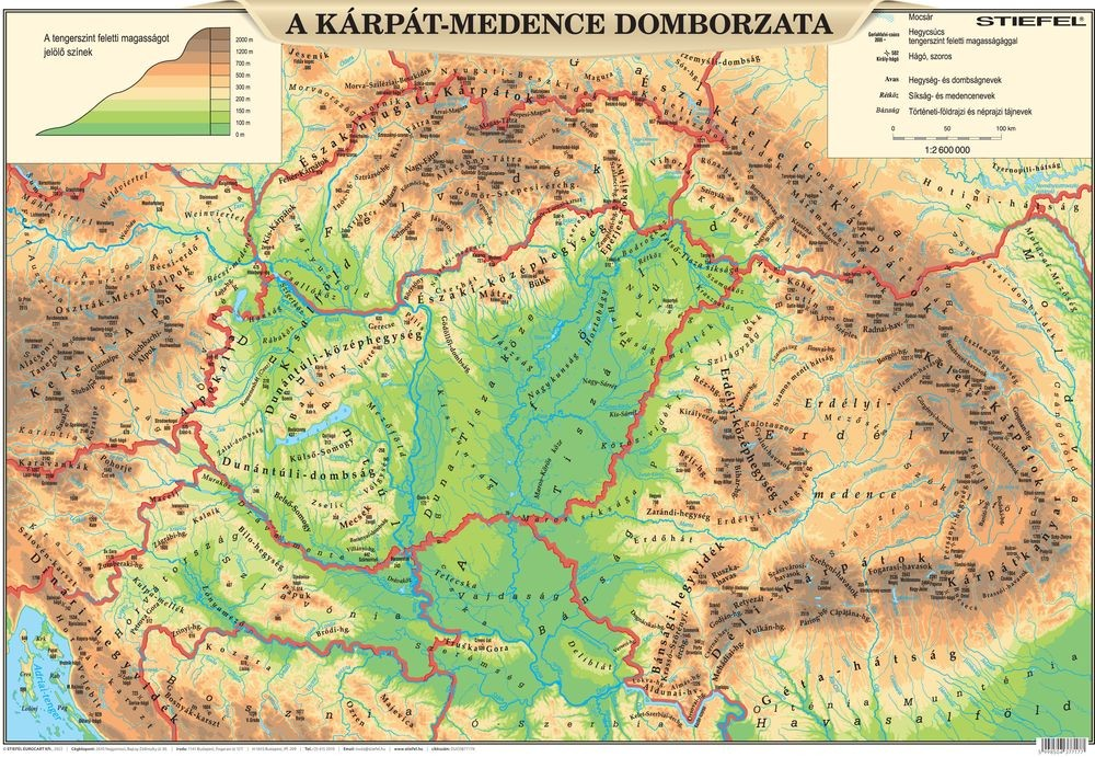
For topography, the hills and maybe even the mountains in the north could extend further south:

1720199138933.png


1720199346704.png

Maybe something closer to this?

As for the Transylvanian Germans, what about something like "Siwerbejer" or "Soxen"? These were generally the names they called themselves in their own dialect.
 
  • 17Like
  • 4Love
  • 3
  • 1
Reactions:
Great job as usual! :)
I have a couple of suggestions regarding the angevin territories.
- According to MacGillivray Nicol and Fine jr., the byzantine reconquest of Despotate of Epirus started (or was completed) only in 1338. In 1337 (cannot tell the month) only Ioannina was under Byzantine's control, maybe.
- Albania is controlled by Carlo, count of Gravina in Apulia, a vassal to the King of Naples, so I think it would be better represented as a subject of Naples. Abulafia in The Western Mediterranean Kingdoms (ch. 6) illustrates that Robert had influence on the territory, assigning Durazzo and surroundings as a fief in 1336-1337 to Luigi (Carlo's brother).
Sorry, Abulafia is in italian but spanish speakers won't have hard time translating it.
 

Attachments

  • MacGillivray Nicol - The Despotate of Epiros 1.png
    MacGillivray Nicol - The Despotate of Epiros 1.png
    49,9 KB · Views: 0
  • MacGillivray Nicol - The Despotate of Epiros 2.png
    MacGillivray Nicol - The Despotate of Epiros 2.png
    187,4 KB · Views: 0
  • Abulafia, I regni del Mediterraneo occidentale.jpg
    Abulafia, I regni del Mediterraneo occidentale.jpg
    183,8 KB · Views: 0
  • Fine jr., The Late Medieval Balkans.jpg
    Fine jr., The Late Medieval Balkans.jpg
    312,7 KB · Views: 0
Last edited:
  • 2Like
  • 2
Reactions:
1720197952911.jpegTo be honest, we aren't completely happy with the concept either, as we have four different cultures for the 'Germans of the East': Baltic German, Silesian German, Carpathian German, and Transylvanian German. But we think that it's the 'less bad' solution to portray the cultural melting pot that these places were for the different German settlers.

Is there any way to simply represent the original cultures of the migrants moving there? Wouldn't the pop system allow for this. It is around 200 ish years after some of the first migrations into these regions but it might be more desirable?
Regarding the melting pot aspect, well, maybe that should be a reason to have that be a cultural mechanic to allow closely related cultures to not be as "different" if they are surrounded by a lot of other more foreign cultures.

Migration is a very big aspect of this period of the game, the ostsiedlung being part of that, but of course the migration into america as well.

Having melting pots appear like they did historically in the lands of siebenburgen or in cities like new york would be much better as you wouldn't constantly have to create these nebulous cultures with awkward names based on what culture group moved to what region of the world. Aka, Baltic Germans vs Low Germans + Rhinelanders (Moselle/Rhine Franconian) and Transylvanian Germans vs Flemish/Low Franconian + Teutons + South Germans (Bavarians & Alemans)
.

Greetings, and welcome to another Tinto Maps! This week we will be taking a look at Carpathia and the Balkans! It will most likely be an interesting region to take a look at, with a lot of passion involved… So I’ll just make an initial friendly reminder to keep a civil discussion, as in the latest Tinto Maps, as that’s the easiest way for us to read and gather your feedback, and improve the region in a future iteration. And now, let’s start with the maps!
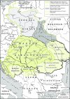
Locations:
View attachment 1158264
This week we’re posting the general map of the region, along with some more detailed maps, that can be seen if you click on the spoiler button. A starting comment is that the location density of Hungary is noticeably not very high; the reason is that it was one of the first European maps that we made, and we based it upon the historical counties. Therefore, I’m already saying in advance that this will be an area that we want to give more density when we do the review of the region; any help regarding that is welcome. Apart from that, you may notice on the more detailed maps that Crete appears in one, while not being present in the previous one; because of the zooming, the island will appear next week along with Cyprus, but I wanted to make an early sneak peek of the locations, given that is possible with this closer zoom level. Apart from that, I’m also saying in advance that we will make an important review of the Aegean Islands, so do not take them as a reference for anything, please.
I am glad you already pointed it out yourselves that the density is rather sparse compared to austria.

Provinces:
View attachment 1158268
Provinces! Nothing outstanding to be commented on here; as usual, we’re open to any feedback regarding them.

I think the same can be said for provinces as was said about locations. They are a bit sparse and cover massive regions.

The two banates of Oltenia and Banat covering so many locations and sheer square km. Somogy as well being huge. These areas should be much more detailed given that this is part of the great hungarian plain and danube valleys, not some mountain regions which are sparsely inhabited.

Now while some of these areas are hard to split up as many of them are already split up by the locations you showed, there are more modern groupings that at least do some of the work for it. Similarly, perhaps modern borders can form some inspiration into splitting up the massive locations and provinces. At the end of the day the game is going to be a map painter and people might want to create modern borders.

Pécs can use a second location showing off croatian baranya, similarly vojvodina can split bács up a bit and Banat can be split for that as well.

1720197580691.png


1720199870693.png

These are the province divisions I think wouldn't be too bad, now this was a rough sketch, but i think it gets a bit closer to the density of nearby regions.

I have dug somewhat deep in work i did years back with others to create a more dense balkans for an eu4 mod. Hopefully these sources are useful and not too outdated or ahistorical.
1720195442438.jpeg 1720198655283.png1720198592885.png1720198496715.png1720198425299.png1720198392444.png1720198368925.png1720198346071.png1720198179992.png1720198040333.png1720198129192.png1720198002111.png1720197824946.jpeg1720197879994.jpeg1720197759437.png1720195584778.jpeg
 
  • 12Like
  • 2
  • 2
Reactions:
hey @Pavía I have to note a few things related to Kosovo and Metohija and the surrounding area. The Serbian population is without question the majority in Kosovo, but I am interested in the size of the Albanian and Vlach minorities. In 1330, King of Serbia Stefan Decanski, father of King Dusan, together with the church issued a charter on the occasion of the construction of Visoki Decani monastery. the document states the legal status of the monastery and other administrative matters related to the monastery. The charter also contains a census of the population in that part of Kosovo, where it is stated that there are 2,666 houses, of which only 44 were Albanian.
In another document from 1455, the Ottoman population census, there were only about 46 houses inhabited by Albanians in the territory of Kosovo and the surrounding areas.
I hope you will find approximate data on the population in Kosovo, Macedonia and Montenegro.
Also, the location named Peč should be called Peć (oven in Serbian) and the location Shkoder should be Skadar and Province Illyria should be named something else as people at that time didn`t really know who Illyri were in my opinion.
thanks for the wonderful maps!
 
  • 4Like
  • 1
  • 1
Reactions:
If preventing Dusan's conquests is possible as Byzantium, I would really like to see a mechanics where you can strenthen your garrisons and harder sieges for coastal cities, considering that at the startdate, Byzantium couldn't challange Serbia into full scale battle, rather Byzantium should be able to at least keep Tessaloniki (large coastal town) and if byzantines play cards right some bigger cities like Serres or Trikala could survive Serbian sieges
Actually, the Romans were perfectly capable of holding their own against the Serbians in 1337. They might not have been able to push much beyond that, but they were very much capable of largely holding on to what they have in 1337.

Dusan's Conquests took place as the result of the 2nd Palaiologos Civil War during the 1340s following the death of Andronikos III in 1341 where the Serbians were invited in by John Kantakouzenos to help him win the civil war against the Regency. Without the civil war you don't get Dusan's Conquests.

That civil war is essentially the linchpin of 14th century Balkans and Anatolian history. Without it you don't see the reduction of the empire into a rump state by the brief Serbian Empire nor the rise of the Ottomans into the Balkans during the second half of the century.

In 1337 the Romans are a wounded animal, but they are more than capable of determining their own fate (which they ultimately decided with the above civil war). If the Romans avoid the civil war, they'll more than likely limp through the rest of the 14th century as a minor power in global affairs, but a fairly sizable power in regional (writ, Balkan and Anatolian) affairs.
 
  • 4
  • 1Love
Reactions:
Also there is no Evidence that Krsajani were as spread out as it is shown over here, Hum should be mostly orthodox while western Bosnian provinces were catholic, dont get me started on western Serbia.
There are material evidence, in form of stećci. Krstjani, opposite to catholics and orthodox, didn't have clergy, so the Bosnian church, didn't have large estates, and didn't built monumental churches. Lot of their religious rites were connected to the natural sites, like rivers, springs, caves, etc.
 
  • 1Like
Reactions:
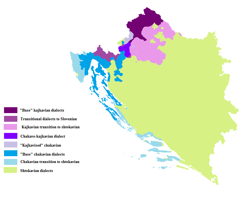
>We have divided the Southern Slavic-speaking region into their dialectal families of Slovene, Croatian, Bosnian, and Serbian.


While I believe this is a correct decision to avoid... issues, this grouping is not correct from the linguistic point of view. Slovene is definitely it's own thing, while Serbian, Croatian, Bosnian (and Montenegrin to add to the conversation) form a continuum with dialectical lines not following the borders between different people

Here you can see a map that shows three major dialects: Štokavski, Kajkavski and Čakavski. You can see, that the former is present in every country, while the latter two are located only in Croatian
Kajkavo_chakavian_in_Cro_and_BiH.png
 
  • 8Like
  • 1
Reactions:
Actually, the Romans were perfectly capable of holding their own against the Serbians in 1337. They might not have been able to push much beyond that, but they were very much capable of largely holding on to what they have in 1337.

Dusan's Conquests took place as the result of the 2nd Palaiologos Civil War during the 1340s following the death of Andronikos III in 1341 where the Serbians were invited in by John Kantakouzenos to help him win the civil war against the Regency. Without the civil war you don't get Dusan's Conquests.

That civil war is essentially the linchpin of 14th century Balkans and Anatolian history. Without it you don't see the reduction of the empire into a rump state by the brief Serbian Empire nor the rise of the Ottomans into the Balkans during the second half of the century.

In 1337 the Romans are a wounded animal, but they are more than capable of determining their own fate (which they ultimately decided with the above civil war). If the Romans avoid the civil war, they'll more than likely limp through the rest of the 14th century as a minor power in global affairs, but a fairly sizable power in regional (writ, Balkan and Anatolian) affairs.
At the startdate, Serbia was already stronger then Byzantium, Dusan already started expanding into Byzantium since 1333, where he almost took over Tessaloniki, only reason why Dusan peaced out in 1334 was Hungarian invasion from the north. Dusan was deffinentaly active in Albania in 1337 so its clear that Serbia was on it's way of taking territories from Byzantium even before the civil war.
 
  • 2Like
Reactions:
Hello!

I am a very hyped about the game, especially since im a historian and my main fields of research are the late medieval age and early modern history of Hungary.

While reading the dev diary I couldn’t help but notice a few things I found a bit, well weird/inaccurate, so I collected a few suggestions and comments for the region of Hungary, Croatia, Transylvania, Wallachia and Moldavia

I have tried to consider these suggestions to be respectful towards the mechanical limitations of the game as much as I can, while maintaining that my suggestions are based on recent academic works and studies, most which are used in contemporary higher education institutions in Hungary. (If you'd like citations, I could provide them, but I dont see much use in it since they are all in Hungarian)

Other than that I collected a few maps, which in my opinion would could prove useful for the devs.

My suggestions / comments in bullet points:

- As other comments said: Adding gypsy / roma / romani culture would be a nice, even though their exact date of appearance in the region is still uncertain (there are opinions that they first appeared in the middle ages, but they could also have arrived in large numbers only in the middle of the 18th century)

- Adding Moldavian culture would also be desireable to more accurately reflect the fine cultural and, in this era, very much existing political distinctions between Wallachia and Moldavia

- I also recommend adding Csángós, if possible.

-There should be a Hungarian-Bulgarian shared border near the western tip of thr southern Carpathians

- The portrayal of Transylvania leaves a lot to be desired, unfortunately:

I dont exactly understand the thought process behind naming the romanian population of Transylvania simply "Transylvanians", considering you decided to call Transylvanian Saxons "Transylvanian Germans".

It would be more logical to call them "Transylvanian Romanians". Using simply "Transylvanians" is a bit too vague, since there were (and are) distinct Transylvanian Saxons, Transylvanian Romanians, Transylvanian Hungarians, and Székelys (which are not ethnically different from Hungarians, their distinction came from their legal and societal privilages, which were called the Székely "Szék" . a Szék was an independent administrative, judicial and most importantly military unit with its own territory which were unlike the other counties in the kingdom.

Other than this I find the borders of the region (and by extension, most every provinces in Hungary a bit wacky. Not that I think this is particularily unhealthy gameplay-wise, but at least I would like to see a bit more accurate map of the borders of the nation, if possible.

- Seeing "Budapest" in the provinces map mode is an extreme inaccuracy because the term and the city didnt even exist until 1873. During Louis I's rule the royal court was in Visegrád, and, between 1347 and 1355 he ruled from Buda. Pest until the 19th century was a seperate city altogether, and it never was a capital city, nor any ruler ever decided to place their court there.

- I suggest renaming Pest market to Buda market, since Buda was a lot more important commercially and economically than Pest.


These are the main points I have. Unfortunately I have no time to explain these in further detail and also can't point out other, minor details I noticed at this time. I attached a few maps to my post, I hope they can be useful.

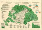
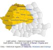
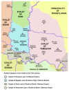
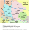
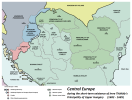
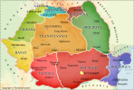
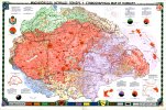
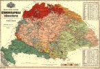
the first map shows the main settlements and trade routes of Hungary in the 14th century, the 2nd is just to show where the different groups of csángós were in the medieval period, the third and fourth map are mainly attached to show some of the more important settlements and borders (especially the borders of Transylvania.

Cheers.

Edit:
I've seen a few commenters argue that some of the location/province borders of Hungary would benefit a lot from a bit of corrections. I agree with these people, but I would also argue against trying to fit the national borders of the 20th or 21th century. I would argue in favor of borders which more accurately represent the time period of the Ottoman Occupation, or the reign of Mátyás Hunyadi. I attached a few maps. (nr. 5 for the Ottoman occupation, and nr. 6. for the period of Mátyás's reign. I'd also add that this last map also has very neat and accurate county borders, which I would very much appreciate seeing in-game
 

Attachments

  • 1.png
    1.png
    733 KB · Views: 0
  • 2..png
    2..png
    43 KB · Views: 0
  • 3.jpg
    3.jpg
    2 MB · Views: 0
  • 4..jpg
    4..jpg
    3,4 MB · Views: 0
  • 5.jpg
    5.jpg
    139,5 KB · Views: 0
  • 6.jpg
    6.jpg
    110,2 KB · Views: 0
Last edited:
  • 6
  • 5Like
  • 1
Reactions:
There are material evidence, in form of stećci. Krstjani, opposite to catholics and orthodox, didn't have clergy, so the Bosnian church, didn't have large estates, and didn't built monumental churches. Lot of their religious rites were connected to the natural sites, like rivers, springs, caves, etc.
The point wasnt that Krsjani didnt exist, the point is that they were concetrated around central bosnia and by no way did krsjani ever reach western serbia or hum
 
  • 2Like
  • 1
Reactions:
Thank you for the map of the Balkans! Firstly, the location you call Mitrovica in Kosovo should be called either Trepča (mining town, more important and bigger) or Zvečan (basically just a fort and a small-ish settlement) which was the administrative seat of the area. Mitrovica at the time was a small town of lesser importance than either of these two.

The location of Peč should be renamed to Peć (Ć), I don't know if you have this letter in the game. Pristina should be Priština.

The location of Trgovište in southwestern Serbia should be renamed to Ras (military/administrative seat). Žiča in central Serbia should be renamed to Maglič (military/administrative seat). Zenica in Bosnia should be renamed to Vranduk (military/administrative seat).

Vrhbosna province should have silver as the main RGO, thanks to the Fojnica mine, the second most important mine in medieval Bosnia. There is no exact historical data for what the mine produced, but according to Ragusan merchant ledgers and reports from the Ragusan mint from 1422, the Serbian and Bosnian mines at the time produced between 1/8 to 1/4 of European silver which is the most up to date estimate. In addition, the Bosnian mint was present for a long time in Fojnica and it had a huge merchant colony of Ragusans. While on the topic of mining, Transilvanian Saxons should be present in all locations in Serbia and Bosnia which produced silver. The estimates were that 100-200 of them existed in each location, precisely Novo Brdo, Trepča (Zvečan), Rudnik, Srebrenica and Fojnica (Vrhbosna). This is the result of them fleeing Transylvania after the Tatar invasion of 1241. and were invited into Serbia by charter of king Stefan Uroš I. Soon after, the Saxons would move to Bosnia as well. There were many more Saxons in Serbia and Bosnia as well but there were assimilated by the end of the 15th century. But at the start of the game and even later on, you still have individuals, usually miners, craftsmen or silver merchants, even catholic priests and town magistrates (only in mining towns) with obviously German names that were recorded in Ragusan merchant ledgers or final wills.

Also, I would like to argue for spitting Srebrenica location into Srebrenica and Olovo, Olovo was a large lead mine famed for its quality and it had a significant market town close by. It only started deteriorating because the price of lead started dropping during the early-mid 15th century and transporting it became more difficult as it was heavy and required large caravans to transport while the roads were getting more dangerous as a result of Turkish incursions so the lead caravans were an easy target.

The Drijeva province should have salt as the main RGO as it was the second most important market for salt in the region after Ragusa and one of the four salt markets that were allowed to sell salt in the region between the rivers of Neretva and Bojana. The regulation of the salt trade was the result of a charter between Ragusa and Serbia which Ragusa took as precedent and fought viciously against any attempt at selling salt by any party at a market which didn't have the license for it.

Jajce should have iron as the main RGO, there is little evidence of it in medieval historical sources because the main traders in the region, the Ragusans weren't interested in the iron trade because it wasn't profitable because of high weight and low value. On the other hand, in that location you have evidence of mining since the Roman times and early Ottoman surveys tell us of large iron mines they have encountered there, most notably Čajnič which was a big settlement but in the Ragusan archive there is no evidence of this settlement because of the aforementioned reasons.

And if you ask why wasn't there evidence in Bosnian or Serbian archives? The answer is that very little of anything was written in the first place because of a shortage of literate people and even less was conserved, mostly things about the church and in church archives.

The Bogumils in Bosnia shouldn't exist, they should all be Krstjani, for Krstjani are just Bogumils, they have just taken root more firmly unlike in other areas. Franky I don't see why would you differentiate the two, and the best solution should be to turn all Krstjani pops into Bogumils. If you are hellbent on differentiating the two for whatever reason, at least remove the Bogumils in Bosnia.
Edit: The reasoning for this was to improve performance, I have later found out that even Paulicians are present, that is very nice attention to detail and if you have differentiated Bogumils and Paulicians, then Bogumils and Krstjani should be separated as well as you have already done, good job!

Also, Kotor in Montenegro should be majority Catholic with a strong Orthodox minority and not the other way around.
While in Montenegro, it seems Budva is in the Kotor location so Budva (the location) should be renamed to Bar, or ideally, the two locations would be split into three, Kotor, Budva and Bar. At the very least, just rename Budva into Bar. Bar and Budva should be Orthodox and have a very strong Catholic minority.

I forgot to touch upon the presence of Vlachs (Aromanians) in the Western Balkans. Vlachs were the remnants of the Latin speaking population that turned "savage" and ran for the hills to escape the Slavic onslaught. There are no definitive numbers of Vlachs but they were largely slavicized by game start. Over time, their name became synonymous with shepard, their main profession. Thus the Ottoman censuses of katuns (semi nomadic Vlach/vlach settlements) are not of great use for estimating the number of Vlachs and neither is the fragmentary data from charters where churches, monasteries or nobles were given katuns. Vlachs could even ascend to nobility such as the Balšić family but the evidence of their heritage isn't conclusive, but the Balšić family spoke Serbian, and carried on the legacy of the Serbian empire. A rough estimate would be that on hilly terrain in the Western Balkans that Vlachs should be 5-10% and in mountainous regions about 10-20% of population.

P.S. I am once again asking for your support, will it be possible to have multiple suzerains as was quite common in the area. For example despot Stefan and despot Đurađ of Serbia were vassals of Hungary and the Ottomans, Stefan Kosača (Duchy of St. Sava) was a vassal of Bosnia, Hungary, Ottomans and Naples... I am not joking. Ragusa for most of the games timeframe was a vassal (tributary to be precise) of Hungary (later on Austria) and the Ottomans, or at one point Ragusa was a Serbian tributary and Venetian vassal. The Crnojević family in modern day Montenegro were vassals of Venice and the Ottomans and so on and so forth.

I could provide sources when I have the time if you want (really busy with my PhD :(), though they would be in Serbo-Croatian :)

Thank you again for making this dream game of mine and I hope the Balkans will get the representation they deserve.

P.P.S. I hope you noticed my edits, don't know if you have time to read comments again with such a huge number of them :)
 
Last edited:
  • 4
  • 3Like
  • 1
  • 1
Reactions:
The point wasnt that Krsjani didnt exist, the point is that they were concetrated around central bosnia and by no way did krsjani ever reach western serbia or hum
As already said, spread of stećci are proof for that. Map of stećci almost 100% coincide with Bosnian medieval state, spreading to the surrounding area too.
So, to claim there were no Krstjani ever in western Serbia or Hum, you should have bulletproof evidence.
 
  • 4Like
  • 1
  • 1
Reactions:
A few notes:

1. In Bulgaria, the town of Targovishte didn't exist. There was a fortress which controlled the region called Kosovo* (or Misionis, which is its ancient name). It's a few kilometers out of Targovishte.
Also Razgrad was not a significant location. This location should rather be divided between Tarnovo, Cherven, Kosovo* and Shumen. Or at least renamed to "Kapan/Kapansko"
You could also argue that the region south-eastern of Sofia was controlled by the fortress (and town) of Urvich, and not "Stipon".
Including the old capital of Preslav in the mix of locations would also make sense as it was still a big and powerful city through out the late medieval period, during the Second Bulgarian Empire.

2. Most of the "Hills" in Bulgaria are actually mountains.

3. The Wallachian population in Oryahovo... There is 0 evidence of such a thing. If you want to do it to spice things up, I'm ok with it. But otherwise it shouldn't be there. Also I'd argue there should be a Bulgarian minority in most of Wallachia, as it was just recently ruled by the Bulgarian crown and there's significant evidence of Bulgarian influence over the region.

4. I love how clean Bulgaria is religiously, but that was not the case back in the 14th century. At least Pavlikians and Bogomils had a few large populations in Bulgaria, so there should be more of this.

5. I have no remarks about the state borders as they seem pretty accurate.

That's at prima vista. Please do reach out to me if you have any interest in developing Bulgaria further both on the map and in flavor. I'd love to help! I have a lot of access to Scientific History literature and will be happy to assist you guys. I'd love to see an interesting and historical 14th century Bulgaria!
I also took an in-depth look at Bulgaria's locations, and I like what I see. Even if quite a few locations are fortresses/castles. I have some differences with your take, though:
- It seems the Bulgarians also called Stipon just that; Stipon. Until the Ottomans destroyed and rebuilt it.
- I also don't think Razgrad should be replaced by something else, the location adds some strategic depth. There's no real good alternative for it in the vicinity, and we've seen other smaller towns already.
- Targovishte is indeed a bit anachronostic, but I'm not necessarily against it. There was a settlement/castle there, and the Ottomans expanded upon it halfway through Project Caesar's timeline.
- Preslav was pretty much razed and abandoned by the end of the 13th century, its citizens moving to a village nearby.
 
Last edited:
Bosnia as a culture or ethnic group did not exist in 1337. It was only after religious conversion and turkification of the locals that they appear that too after 1460. I am being impartial because I am neither from the Balkans nor follow any form of christianity or islam. So having bosnian appear so many years ago is like having Russian identity in 1300
That's not true.
 
  • 1Like
Reactions: