• We have updated our Community Code of Conduct. Please read through the new rules for the forum that are an integral part of Paradox Interactive’s User Agreement.

Tinto Maps #9 - 5th of July 2024 - Carpathia and the Balkans

Greetings, and welcome to another Tinto Maps! This week we will be taking a look at Carpathia and the Balkans! It will most likely be an interesting region to take a look at, with a lot of passion involved… So I’ll just make an initial friendly reminder to keep a civil discussion, as in the latest Tinto Maps, as that’s the easiest way for us to read and gather your feedback, and improve the region in a future iteration. And now, let’s start with the maps!

Countries:
Countries.png

Carpathia and the Balkans start in a very interesting situation. The Kingdom of Hungary probably stands as the most powerful country in 1337, but that only happened after the recovery of the royal power enforced by Charles I Robert of the House of Anjou, who reined in the powerful Hungarian nobility. To the south, the power that is on the rise is the Kingdom of Serbia, ruled by Stefan Uroš IV Dušan, who has set his eyes on his neighbors to expand his power. The Byzantine Empire, meanwhile, is in a difficult position, as internal struggles ended in Andronikos III being crowned sole emperor, at the cost of dividing the realm; both Serbia and Bulgaria have in the past pressed over the bordering lands, while the Ottomans have very recently conquered Nicomedia. The control over the Southern Balkans is also very fractioned, with a branch of the Anjou ruling over Albania, the Despotate of Epirus under the nominal rule of Byzantium as a vassal, Athens, Neopatria and Salona as vassals of the Aragonese Kings of Sicily, Anjou protectorates over Achaia and Naxos, and only nominal Byzantine control over Southern Morea. It’s also noticeable the presence of the Republics of Venice and Genoa, which control several outposts over the Adriatic and Aegean Seas. A final note: in previous maps, Moldavia was shown in the map, but we’ve removed it from it, and it will most likely spawn through a chain of events in the 1340s.

Dynasties:
Dynasties.png

The House of Anjou rules over Naples, Hungary, Albania, Achaia, and Cephalonia; they’re truly invested in their push for supremacy over the region. Apart from that, each country is ruled by different dynasties, except for Athens and Neopatria, ruled by the House of Aragón-Barcelona.

Locations:
Locations 1.png

Locations 2.png

Locations 3.png

Locations 4.png
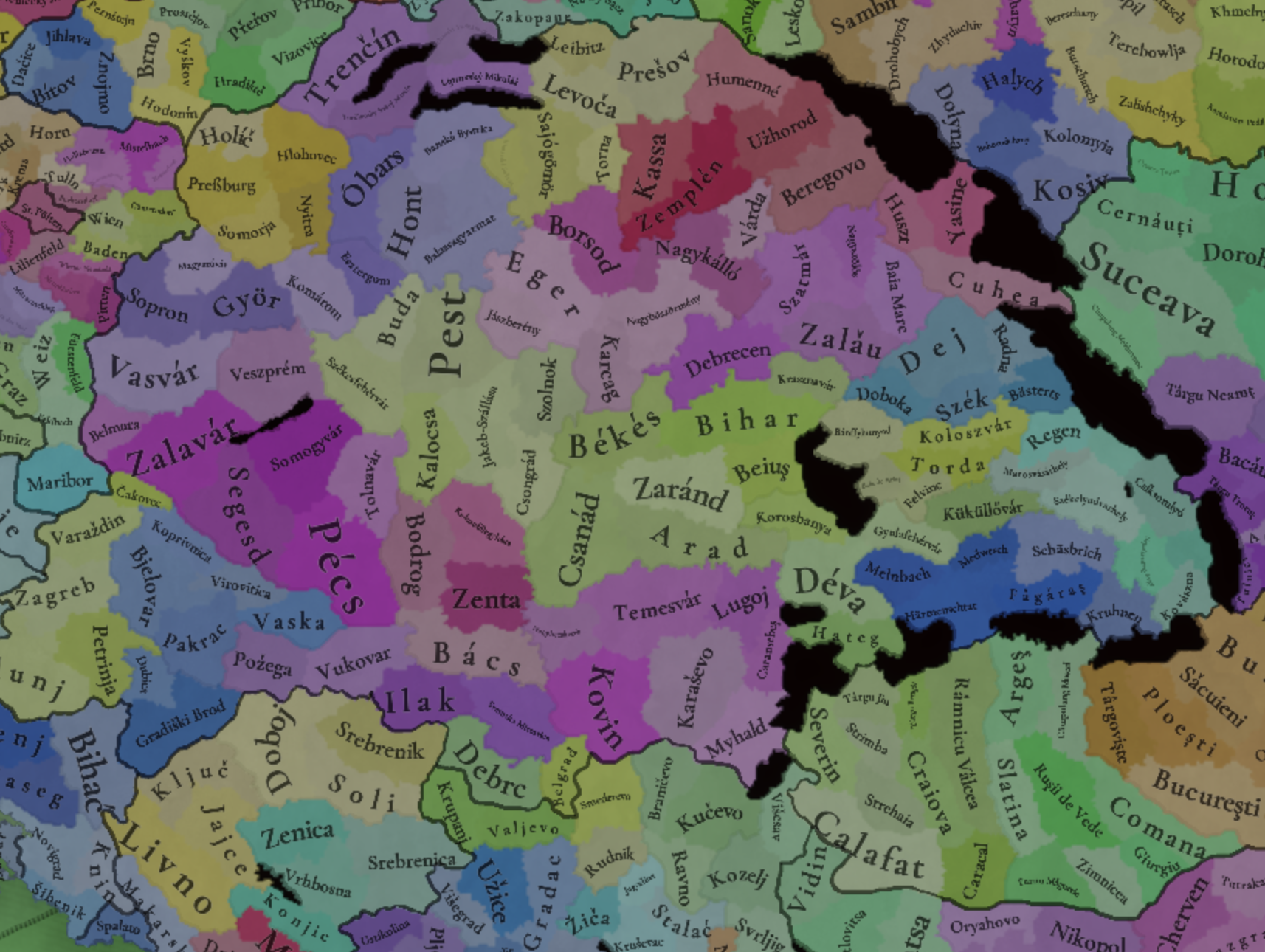
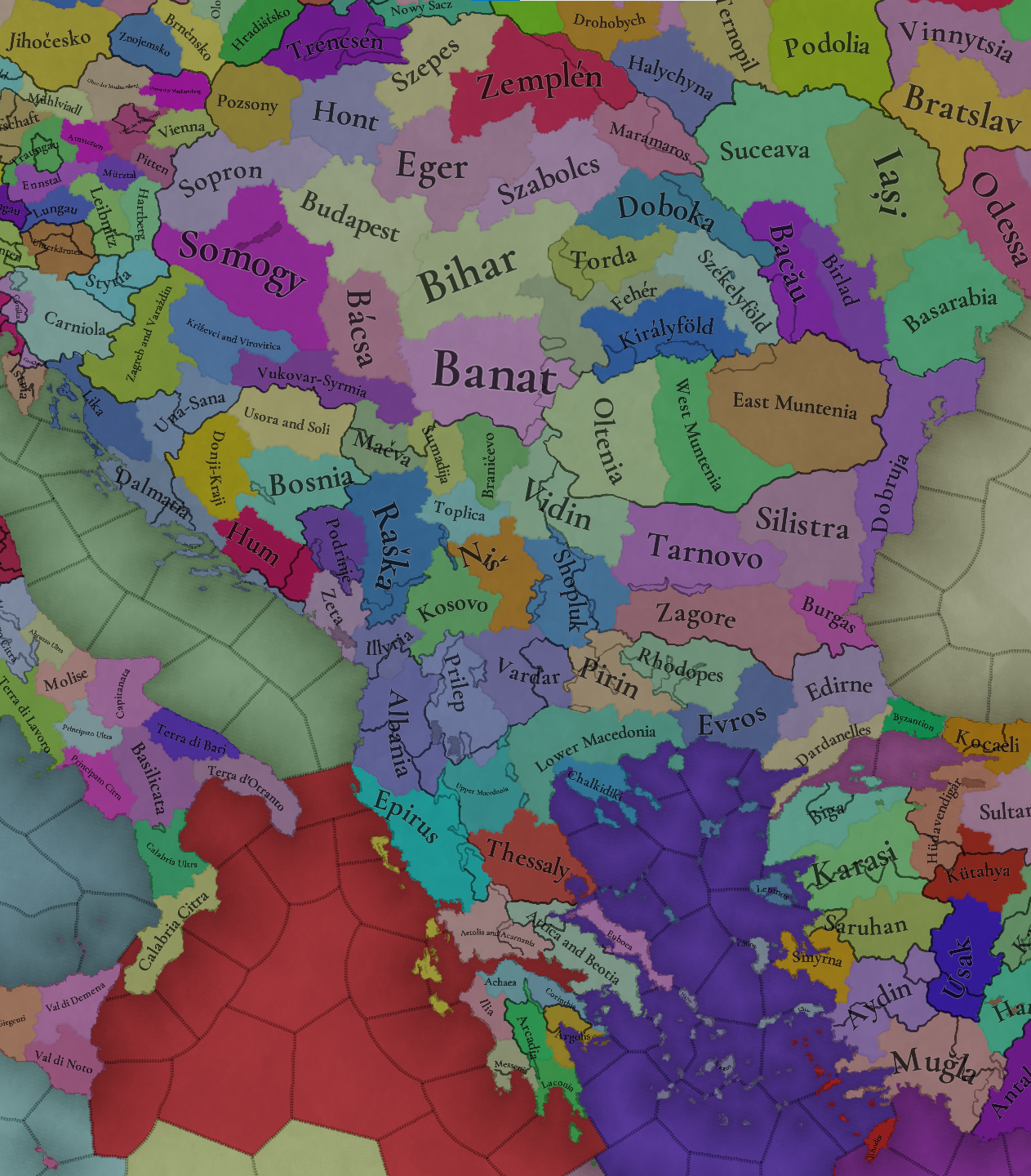
This week we’re posting the general map of the region, along with some more detailed maps, that can be seen if you click on the spoiler button. A starting comment is that the location density of Hungary is noticeably not very high; the reason is that it was one of the first European maps that we made, and we based it upon the historical counties. Therefore, I’m already saying in advance that this will be an area that we want to give more density when we do the review of the region; any help regarding that is welcome. Apart from that, you may notice on the more detailed maps that Crete appears in one, while not being present in the previous one; because of the zooming, the island will appear next week along with Cyprus, but I wanted to make an early sneak peek of the locations, given that is possible with this closer zoom level. Apart from that, I’m also saying in advance that we will make an important review of the Aegean Islands, so do not take them as a reference for anything, please.

Provinces:
Provinces.png

Provinces! Nothing outstanding to be commented on here; as usual, we’re open to any feedback regarding them.

Terrain:
Climate.png

Topography.png

Vegetation.png

Terrain! The climate of the region is mostly divided between Continental and Mediterranean, with some warmer and some colder regions. Regarding the topography, the Carpathian mountains are famously important and strategic, while the Balkans are a quite hilly and mountainous region, which is also greatly covered by woods and forests.

Cultures:
Cultures.png

Here comes the fun part of the DD: The cultural division of the Balkans! A few comments:
  1. Hungary is full of different minorities. Transylvania, especially, is an interesting place: there we have a mix of ‘Hungarians’, ‘Transylvanians’ (which are the Romanian-speaking inhabitants of the region), ‘Transylvanian Germans’, and ‘Szekely’ people.
  2. We have divided the Southern Slavic-speaking region into their dialectal families of Slovene, Croatian, Bosnian, and Serbian.
  3. The Southern Balkans are mostly divided among Bulgarian, Albanian, and Greek cultures.
  4. We’re also portraying plenty of other cultures, such as Dalmatians, Aromanians, Sclavenes, Arvanites, Cumans, Jasz, or Ashkenazi and Romanyoti Jews.

Religions:
Religion.png

This one is also interesting. Apart from the divide between Western Catholicism and Eastern Orthodoxy, we have the Krstjani in Bosnia, Bogomils (the pink stripes both in Bosnia and Macedonia), and Paulicians in Thrace. The Jewish populations do not pass the threshold percentage to appear on the map, but there are plenty of communities across the region.

Raw Materials:
Raw Materials.png

The materials of the region. Something very noticeable is the richness of minerals, with plenty of Iron, Copper, Tin, Lead, Gold, and Silver. Specifically, Slovakia is very rich, and you definitely want more settlers to migrate to the region, and exploit its resources. The region is also very rich in agricultural resources, as you can see.

Markets:
Markets.png

The region is mostly divided among four markets: Venice, Pest, Ragusa and Constantinople.

Country and Location population:
Population 1.png

Population 2.png

Population 3.png

Population 4.png
Country and location population (which I’ve also sub-divided, and is under the Spoiler button).

And that’s all of today! I hope that you find the region interesting; we certainly think that it is. Next week we will go further south, and we will take a look at the Syrian Levant and Egypt. Cheers!
 
  • 193Like
  • 69Love
  • 7
  • 4
  • 3
  • 1Haha
Reactions:
I think the number of locations in Hungary is just bizarrely sparse.

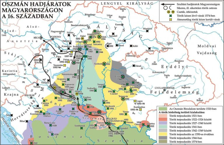
Screenshot 2024-07-05 at 15.50.55.png


Surely there should be at least one location for each of the castles marked on this map of the Ottoman conquest of Hungary? If I play as the Ottomans and reach this stage in the game I would prefer for there to actually be a detailed landscape to fight over, just as there was in real life.

1720209036434.png


Also some of the Slovak locations are missing Hungarian localisations. In fact in Slovakia some of the locations are so huge that several entire counties, like Árva and Túróz, don't even have a single location. It's hard for me to accept this.

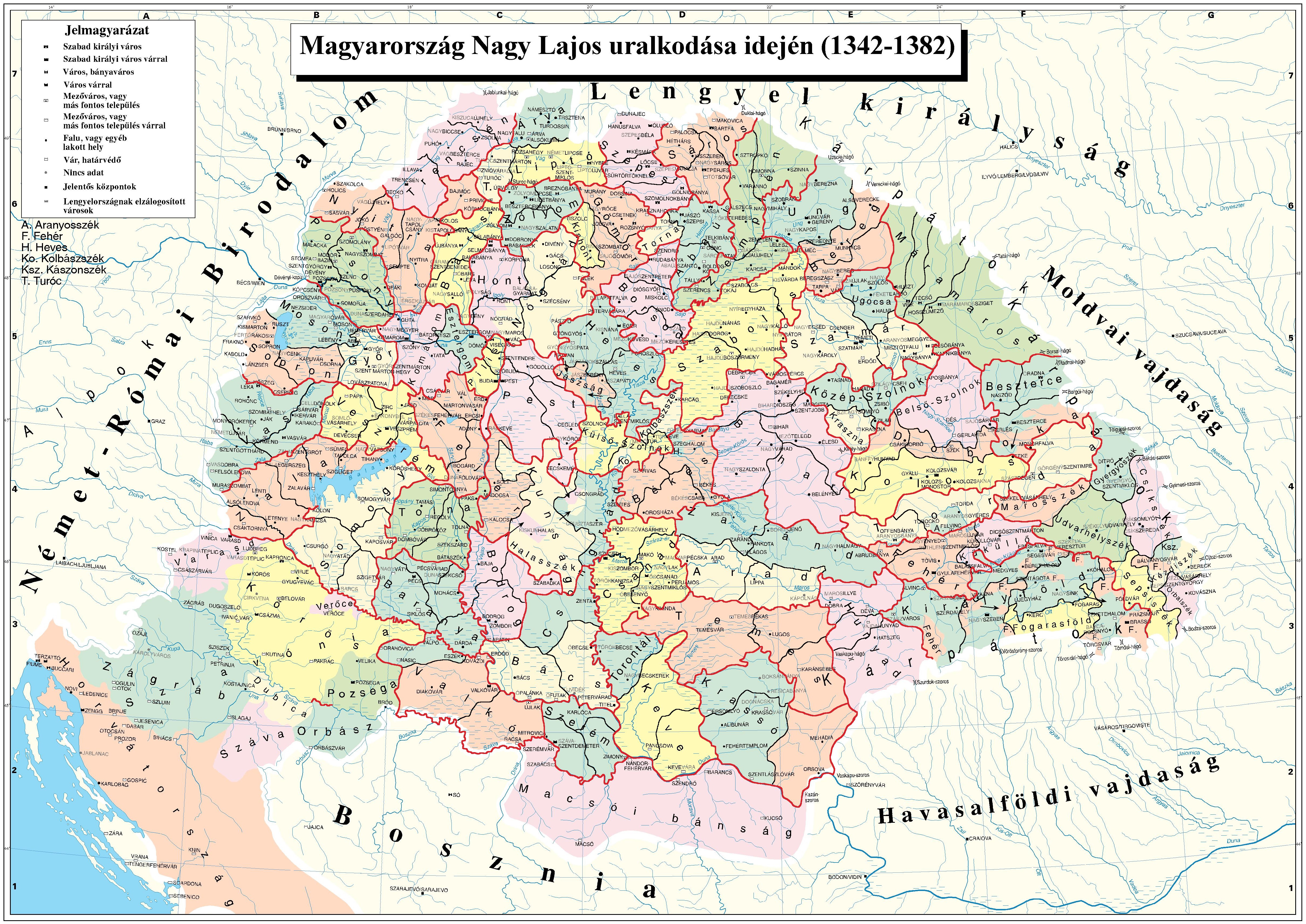
I also once again would like to request that the Areas in Hungary be made equivalent to the historical counties, as they are the perfect size and would be better than arbitrary fictional blobs. They would be perfectly consistent in size with the areas in Austria and Moravia as well. Why should Moravia have four areas while each Hungarian area is the nearly size of all of Moravia put together? Moravia wasn't even partitioned during the game timespan while Hungary was.

1720209224860.png
 
  • 8Like
  • 2
Reactions:
The Ban of Bosnia took the title of "King of Serbia", that's why Serbia was a Knezevina, and later a Despotate, because the Kingdom title was held by the Kotromanic dynasty. And the Kosaca dynasty of Hercegovina, who were orthodox, always said they were Serbs, not Bosnians, showing the the culture we see as "Bosnian" was nothing more than a different religion. But, if you want to represent them, sure, BUT also add the Shops, since their regional dialect is a mix of (old)Serbian and Bulgarian, or add Macedonian, also a mix of (old)Serbian and Bulgarian, to represent the melting of cultures. People forget, that before Buk Karadzic, Serbian language was closer to Bulgarian. Remember, some cultures managed to grow only under the Ottomans, not before them.
He took the title King of Serbia, since he was related to Nemanjić dinasty through his grandmother, which was often used in medieval times to claim a throne, and get support from nobles and clergy, not to mention that title of king is bigger than ban, so he elevated his status.
Sultan Fatih took the title Kayser-i Rum after conquest of Constantinople in same manner.
 
  • 2
  • 1
Reactions:
I have not yet seen a comment about this, so I will ask: Should Rhodes maybe be split up into two locations? Primarily owing to its historical importance, but also seeing as similarly sized Lesbos is made up of two aswell. The best candidate would probably be Lindos. Although I am not sure about the importance of the settlement in the timeframe of the game, the location certainly included a significant castle.
 
  • 2
  • 1
Reactions:
As a few people have pointed out so far, it doesn't make sense to not have Bulgaria border Hungary on the Danube near Orșova. Every map I've found seems to indicate this:

File:Second Bulgarian Empire under the rule of Ivan Alexander (1331-1371).png
File:Bulgaria-Theodore Svetoslav-es.svg

https://es.wikipedia.org/wiki/Teodoro_Svetoslav https://en.wikipedia.org/wiki/Second_Bulgarian_Empire

Map_of_the_Serbian_Empire%2C_University_of_Belgrade%2C_1922.jpg


The last time Serbia and Bulgaria were at war was in 1330, when Byzantium allied with Bulgaria to try and squash the rising Serbian power. In the battle of Velbazhd (modern-day Kyustendil), the Serbians scored a victory against the Bulgarian army, leading to the negotiation of a peace treaty in which Bulgaria did not lose any territory. One should therefore consider Bulgaria's 1337 border with Serbia to be the same as that of 7 years prior (above). After this, the two nations would remain on good terms until the Ottoman conquests, with there even being a marriage pact sealed between them.
https://en.wikipedia.org/wiki/Bulgarian–Serbian_wars_(medieval)

The locations of Višesav, Kozelj and Svrljg should belong to the Despot of Vidin (along with the remainder of the Vidin province) at the start of the game, which would either be a vassal of Bulgaria, or its own independent polity. There are sources which describe Svrljg as being Bulgarian as far back as 1278:
The Late Medieval Balkans A Critical Survey From The Late Twelfth Century To The Ottoman Conquest by John v. A. Fine Jr. (pgs 183-184).

In 1291, the deposed king of Serbia, Dragutin, allied with Hungary to wage war on the boyar princes, Darman and Kudelin, who controlled the principalities of Braničevo and Kučevo. After their annexation, Shishman of Vidin declared a retaliatory war against Dragutin, but was ultimately pushed back and his seat of power, the city of Vidin, was sacked, whilst he himself fled across the Danube into friendly Tartar lands. Ultimately, Dragutin and his Hungarian allies chose to reinstate Shishman rather than annex his lands, causing the Despotate of Vidin to become a Serbian client state until Shishman's death in ~1308 when his son was elected to the Bulgarian throne. This was the only war (besides Darman and Kudelin's failed incursion in 1284) between Serbia and Bulgaria from the year 1278 to 1330, which suggests, given the earlier sources regarding Bulgarian possession of Svrljg, that the territory never changed hands in that time. And nor was it exchanged after the battle of Velbazhd, as was already established. Thus Svrljg should be a Bulgarian territory in 1337, alongside the far minor territory of Kozelj, which can also be assumed to belong to the Despotate of Vidin. As for Višesav, it is stated that Shishman's domains extended as far west as the Iron Gates gorge.

Now, as for the locations themselves, I would argue that Višesav is an incredibly obscure name to use for the location. The only source I could find that cites this name is:
URBANIZATION AND TRADE AT THE TURBULENT BORDER: SERBIAN TOWNS ON THE DANUBE 1402-1459, Aleksandar KRSTIĆ, The Institute of History Belgrade (pg 368)
and even then, the paper highlights that the exact location of this fortified town is uncertain, not to mention its ultimate fate. The first time the name appears is in the 1400s, and it only seems to have lasted a couple of decades before being conquered and forgotten. I would argue that Negotin is a far better candidate, as it is at least a city that exists in the modern day with some historical significance (an alternative choice would be Rogljevo, which once was a Roman settlement called Selište).

The other thing missing from the map is the city of Orșova, which is also a location of historical significance (was once a Roman port city), and which controls the passage into Hungary. I would also argue that, by the same logic, Negotin should be split in two to allow for Kladovo to serve as the opposite side of Trajan's bridge at the Iron Gates (several different names can be chosen for Kladovo, see the source below).
https://en.wikipedia.org/wiki/Orșova

Here's what I propose:View attachment 1158994
Untitled.png
 
  • 7Like
  • 1
Reactions:
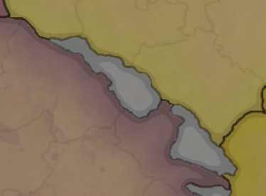
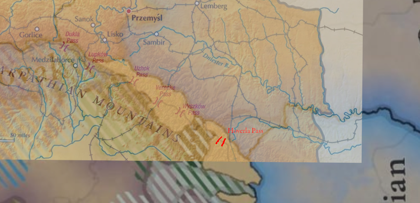
I also think that these impassable regions are excessively large. In real life there are several mountain passes that go right through this region. These passes are all traversable by armies and were used by the Soviets during WW2 to invade and conquer Carpathian Ruthenia.

Screenshot 2024-07-05 at 16.06.52.png


1720210110194.png


(Hoverla Pass is not called that I think, but I forget what it is really called).

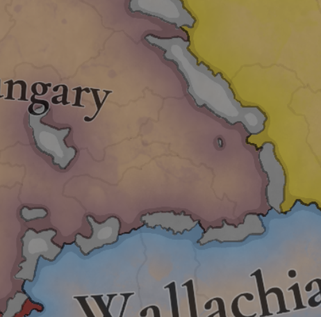
The configuration of impassable regions in the Romanian part of the mountains ones seem fine to me.

Screenshot 2024-07-05 at 16.10.59.png
 
  • 7
  • 2Like
Reactions:
Hello! I've been waiting for this thread ever since the first map of Europe dropped and I'm glad to see you've removed Moldavia from the map.
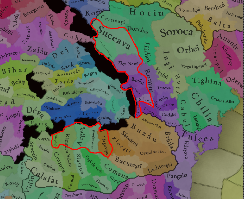
I would like to offer a bit of feedback for the extracarpathian area (Wallachia and Moldavia) in regards to geography and culture, as your current setup seems a bit inconsistent:
1. Geography
- Moldavia and Wallachia have very similar geographies, their big cities are all placed on river valley as close as possible to the entrance to the mountains (Targoviste, Ramnicu Valcea, Campulung, Suceava, Bacau). They are also similar when it comes to the gradual elevation change (in Wallachia its south to north, in Moldavia its east to west), so more hill provinces should be added near the mountains.
1720207428177.png

2. Locations and Provinces
-Some locations such as Ramnicu Valcea are too big and should be split (in RV's case the southern bit should probably go to Craiova, the capital of Oltenia)
-There should be a distinction between Moldavia west of the Prut and Moldavia east of the Prut, as it eventually becomes a natural border
-The proposed location Vișnița was part of Galicia/Pocuția until the late 15th century. Additionally, Hotin (and the location west of it) made up a region called Țara Șipenițului (Șipeniț Land), which also was subject to the Galicians in the 13th century but was subjugated by the Mongols during their invasion. It is highly likely it had a very significant Ruthenian minority (maybe even a majority)
-There should be a central location in Budjak (Bessarabia's province), as this area was isolated from Moldavia proper due to its poor infrastructure/ lack of resources and ease of access for steppe invaders (it was eventually conquered by the Nogai tatars and some of their descendents still live there today, aka the Gagauz)
-The most significant commercial route between Transylvania and Wallachia was the Valea Prahovei, a collection of priviledged cities (most importantly Sinaia) along the Prahova river which ended directly next to Brașov/Kruhnen
-București is not an appropriate name for the location, Ilfov is more suitable
-Also not depicted on the map, but Korosbanya should be in the Bihar province rather than the Feher one, since those would be Transylvania's de jure borders
1720208156833.png

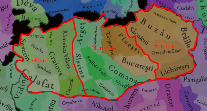
-Wallachia is split into 3 regions, Oltenia, Muntenia (the main area) and Bărăgan (a sparsly populated grassland)
1720208931755.png

3. Culture
-Since Transylvanian is its own group, so should Moldavian, as the national consciousness between the 3 groups didnt consolidate until the 17th and 18th centuries
-Dicians were Romanians living in Dobruja before the colonisation waves that started during the Ottoman empire and after the Romanian war of Independence, they no longer exist today.
-The Csangos were a hungarian-speaking population living in Moldavia, they probably settled the area during Hungary's attempts to convert the Cumans or when they established Moldavia as a defensive march in the mid 1300s
-The Myhald (Mehedia) location coresponds to an area where several Vlach sub-polities (voivodates/knezates) were granted privileges by hungarian kings, so it should probably be Transylvanian
-As I've mentioned before the northernmost-locations in Moldavia most likely had a Ruthenian minority or even more likely a majority
-The Gagauz (at this time they were more likely Nogais or just Tatars) should be shown
-There was a small Saxon minority in Targoviste which helped establish the city
-I'm not sure about the Bulgarian minorities in southern Wallachia, perhaps in important zones of transit like Giurgiu and Turnu Magurele, but the rest seem off to me
-The Regen location (Reghin) was a Saxon town outside of the Saxon Seats
1720210161640.png


A final note:
-Its called the House of "Basarab", not "Basarabs"

Thank you for your time and I hope you take into consideration my proposals, feel free to contact me if you need further clarification or sourcing!
 
  • 23Like
  • 5
  • 4Love
Reactions:
To be honest, we aren't completely happy with the concept either, as we have four different cultures for the 'Germans of the East': Baltic German, Silesian German, Carpathian German, and Transylvanian German. But we think that it's the 'less bad' solution to portray the cultural melting pot that these places were for the different German settlers.
Transylvanian Saxons could be a name option? That's how they were referred to by anyone I spoke to when I was there. Wikipedia says likewise (https://en.wikipedia.org/wiki/Transylvanian_Saxons) and the cities they build are known as the seven Saxon cities. They were organised into the Transylvanian Saxon University, formed by the Hungarian king, which governed the settlements and allowed them to be represented in the Diet of Transylvania
 
  • 1Like
Reactions:
Well explained DD, congrats! Would it make sense to give some more province density to Attica and devide it into Attica and Beotia? I understand that for gameplay purposes there may not be any need for those historical regions, but it bothers me that Peloponese and Eubea have so many tiny provinces while Athens, Thebes and Livadeia arae huge. :)
 
  • 2Like
Reactions:
Were Bosnians really separate from Serbians or Croats at that point in time? Wasn't a Bosnian cultural identity only shaped later, during the ottoman times?
I'm an ethnic Bosniak, here is my hot take.

The devs seem to be equating krstjani to bosnians which isn't the case.

My understanding is that there are two Slavic tribes that inhabited Bosnia, those being the Serbs and the Croats, It is also my understanding that said Slavic tribes intermingled with the previous native population in the region of Bosnia to a significant extent, hense the presence of the I2a2(Illirians I guess, maybe goths??) haplogroup instead of the R1a(Slavs) which is still the majority. This might not be too relevant since we are talking about culture, but it isnt as cut and dried in terms of ethnicity.

When It comes to the stecak(tombstones unique to the region) although the majority were carved at the time by the krstjans, it wasnt unique to them, as far as I know both catholics and orthodox people created them, it seems to be a cultural phenomenon at the time. But it also only seems to have started around the time the slavs settled the area, which to me indicates that serbs/croats who settled Bosnia in particular had diverged from other serbs/croats to some extent.

Its also around the start date of the game that "bosancica", a version of the cyrillic alphabet unique to bosnia was created.Bosnians spoke a different dialect.The Kingdom of Bosnia seemed to have an interesting political system with the "stanak". And it had a unique religion, the krstjani, tho it might be a version of coptic christianity of Armenia or smtn, it was unique to the region.

I do think there is enough evidence to show a divergent Bosnian culture in its infancy, most likely derived from the Serbian culture. Perhaps mostly due to the difference in religion, but surely other reasons as well, same as could be said of montenegrins but likely even more pronouced.

Just think of the Historical narative, 100+ years later after Bosnia fell, almost all of the people who converted to islam were "Bosnian" krstjani, in other words, those who were not accepted by the western catholics nor the eastern orthodox. And now think of a hypothetical where Serbia fell to the Ottomans, but Bosnia somehow didn't, the Bosnians Serbs would surely call themselves Bosnians given enough time. I just think that the Bosnian identity had not matured enough for Serbs and Croatians living in bosnia to stick to it when the Ottomans arrived.

So little is known about this region in general, its really hard to make a verdict at all.

All this being said, I do think that Both the north east of Bosnia(On this map), and Hum/Hercegovina should be majority Serb, So the provinces of Usora and Suli, as well as Hum should be majority Serb and more dalmatians. The province of Bosnia should be bosnian and Donji Kraj should be Bosnians Serbs and Croatians. To what extent these croats/serbs/bosnians should be made krstjani I don't know but the overall majority of the state of Bosnia should be krstjani I think.

So an infant culture spreding from Vrhbosna and Zenica, the core of Bosnia, the rest is dominated by serbs and croatians, I do believe that is the closest to the truth of the matter.

I did't mean to offend any Bosniak, Serb or Croatian, it boggles the mind how we fumbled this up in the first place.
 
  • 8
  • 7Like
  • 3
  • 1Love
Reactions:
First two points have been suggested, but I think it should be underlined:

1. Preßburg should be divided into two parts: Trnava (Nagyszombat) should be created: it was the first city in the territory of Slovakia to become a royal free city, later in the 17th century it was an important place of anti-reformation and humanism in Hungary (there was a Jesuit university).

2. Trenčín should be divided into two parts: Žilina (Zsolna) should be created: its history is quite well documented, it was a privileged city, a bit important also for Slovak history, as it was granted Privilegium pro Slavis.

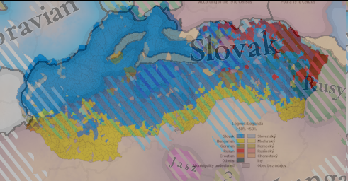
3. This may be rejected by some Hungarians, but... I believe that the Slovak minority line (shaded territory) should be moved + 1 or 2 provinces down to Pannonia, as there were minorities of Slavs/Slovaks in medieval Pannonia. There is an opus magnum of Slovak slavist Ján Stanislav: Slovenský juh v stredoveku I. – II. (1948; ²1999, 2004; fr. Les régions Slovaques méridionales au moyen âge, lit. transl. Slovak South in Medieval Age) which on the base of etymology of toponyms shows, there were Slovaks near Balaton in 14rd-15th century. The first volume is expert text on the topic, the second volume is a thorough dictionary analysis of various geographical names (toponyms) from the territory of Hungary. Stanislav wrote (Vol. I., p. 11-12)
"Our research has shown that the settlements of the Slovaks in Pannonia went past Lake Neusiedl to the west, then the Slovene-Slovak border curved through the Rabice area (Hungarian Répce, German Rafnitz) to the southeast, and then along the left side of the Ráby River to the south. In the Zalán county it followed the Krka (Hungarian: Kerka) basin in the west, better said, perhaps, rather, the watershed of the Krka and Zala, in the south it follows approximately the watershed of the Drava and Zala. In the Šomod county, the border between the Slovaks and the southern Slavs follows the watershed of the Drava and Lake Balaton, at the watershed of the right tributaries of the Kapoš and the eastern tributaries of the Drava. In the Baranya and Tolna county this direction is also maintained. On the Danube the Slovaks met the southern Slavs between Bogyiszló (*Buďislav), which still has a Slovak spelling, and Szeremle (*Srěmľani), which already has a South Slavic feature. This is, of course, just an ideal line between Slovaks and southern Slovenes. We follow it according to the spelling features of the various local names. We can see that this boundary has its justification also in geographical terms. We observe that the Slovak population kept to the tributaries of the Danube and Lake Balaton, but did not descend any further into the Drava area, which naturally belongs to the sphere of interest of the southern Slavs. This line may have deviated or diverged somewhat in places. It would be difficult to ascertain today. However, its general direction is more or less certain. Inside this territory we find several typically Slovak features. In some places Slovaks still live today. We have not ascertained whether they are a continuation of the old Slovaks, and whether they are perhaps a new colony. The continuation of the old Slovaks would certainly be the Slovak villages along the Danube around Esztergom, etc. In a word, the largest part of Pannonia was inhabited by Slovaks [...]
The development of the name Zobor shows us that the Hungarians in the 10th cent. did not stay in Nitra. The charter of the Zobor abbey from 1111 does not record 'not a single church dignitary with a Hungarian name. Apart from Christian and some German names, these dignitaries have Slovak names. These names, together with the development of the name Zobor, show that the Slovaks held their position in the cultural and ecclesiastical history of Nitra even after the great epoch of the 9th century. Only 25.7% of Hungarian settlements were found in the vicinity of Nitra in the XIIth century. The compact Slovak settlement reached as far as the Danube and from there it went, admittedly, further south. Along the Danube, from Vacov or so, a belt of Slovak villages stretches even today. In the past there were more of them. Below Pest, much to the south, around Kaloča, etc., there were also Slovaks, but there were not many of them. It seems to have been an infiltration from across the Danube, from Pannonia; Matra and Bakonyerdő were also quite densely populated by Slovaks before the arrival of the Hungarians. Their settlements extended as far as the Tisza. The Tokaj hills and the whole area between Tisza and Košice had a fairly regular Slovak settlement, i.e. as far as the terrain allowed it. Further to the east, the Slovaks reached far to the east along the Tisza. They also lived in today's Carpathian Ukraine, even from Uzhhorod eastwards, but mostly occupied important communication and strategic points. The guards on these borders of "old Slovakia" were the Central Slovak dialect. Russians were also encountered in eastern Slovakia before the arrival of the Hungarians. They settled on their present territory and also among the Slovaks. Some of the regions, today Rusyn, are originally Slovak. This is just an interesting finding.
(p. 16)

In the dictionary volume he shows how names from the old Slovak dialect were used in medieval manuscripts from Pannonia also in the 14th-15th century. There is also a map appendix to the books, which is difficult to reproduce here due to its size, division and the density of toponyms on it.
Great I am not only one, that is annoyed by how small area has Slovak population, it is even way smaller then in 1910
1720211193882.png
 
  • 5
  • 4Like
  • 1
Reactions:
@Pavía I went and looked at the Peloponnesos and I basically agreed with all location-names there, except Élis, which was the name of the geographical region. Not a town, castle or city (and not to be confused with ancient Élis, from the Classical period).

I propose to change the name to Pontikokastro (Belveder in Italian); A castle (and town) from which the crusaders controlled the area. It's already located within the location.

 
Last edited:
  • 5Like
Reactions:
We've been reading this thread. Transylvania is a tag than can revolt/spawn from Hungary, as it happened historically in the 16th century, when it was 'released as a subject' by the Ottomans.
I don't think this is a good way to summarise the emergence of the early modern Principality of Transylvania. The Ottomans never conquered Transylvania (at least in the 1500s), nor did they force Hungary to release it as independent. What actually happened is that after the Battle of Mohács, the Hungarian kingdom was divided into a western half ruled by the Hapsburgs (which was called Royal Hungary), and eastern half ruled by the Szapolyai dynasty, which competed to gain control of the whole kingdom. The eastern Hungarian kingdom was forced to become an Ottoman tributary because it needed their support against the Hapsburgs. However, the Ottomans used every conflict with the Hapsburgs as an opportunity to simply seize more land for themselves, which led to the eastern Hungarian kingdom shrinking in size until it only consisted of Transylvania and immediately adjacent regions. In 1572 the Szapolyai ruler signed a treaty with the Hapsburgs where they agreed that the Hapsburgs would be the Kings of Hungary and the Szapolyai ruler would abdicate that title, but Szapolyai was recognised as "Prince of Transylvania and part of the Kingdom of Hungary". There as we can see, the Principality of Transylvania is actually what was left of Hungary after it was mostly conquered by the Hapsburgs and Ottomans. In fact in late 1540, the voivode of Transylvania attempted to revolt against the eastern Hungarian kingdom.

The fact that the Principality of Transylvania is not a native Transylvanian state in origin, and certainly not the result of Transylvania being released from Hungary, is reflected in the fact that in the early part of its history none of its leaders were native Transylvanians (by which I mean Hungarians whose families were from Transylvania, as for Romanians there were ever fewer of those by which I mean none), the early Principality was controlled by people who had immigrated from Hungary proper during the Ottoman conquest.

Notably, Transylvania remained legally part of Hungary and therefore both an Ottoman tributary and a vassal of the Hapsburgs, though at least during the earlier half of its existence, Transylvania often pursued a mostly independent foreign policy. I would like for the game to be able to represent subject relationships that are fairly weak like this and might involve a country having multiple overlords, which can then be tightened over time, as in the later half of its existence Transylvania was brought more firmly under the Ottomans' grip. At various times during its existence Transylvania participated in attempts to liberate Hungary from the Hapsburgs.

I think the game should strive to at least have some way to represent this situation, though it would be difficult because you would have to both have a Hungary that is in a personal union under Austria, and another Hungary as well.
However, we don't think that it fits for the situation of 1337, as King Charles I Robert made a clear effort to rein in the different voivodes, and make them into appointed offices, not hereditary ones. Thus, we want to portray a more centralized Kingdom of Hungary because of that.
I agree.
 
Last edited:
  • 5Like
  • 2
  • 1
Reactions:
Were Bosnians really separate from Serbians or Croats at that point in time? Wasn't a Bosnian cultural identity only shaped later, during the ottoman times?
The Bosnian kings and nobles at the time considered themselves separate from neighboring Croatians and Serbians, and considered their lands politically and culturally distinct from the heritage of the neighboring countries. There were also many endemically Bosnian cultural developments, like the unique heretical religion (Bosnian Church/Krstjani), burial traditions (medieval tombstones called Stecci), own form of cyrllic script (Bosancica) and so on. Given that the culture maps include far smaller and less-distinct cultures than Bosnian (like the two Albanian sub-cultures), I think it is fair to keep it in as distinct.

Though yes, the distinctions between the cultures increased and crystallized during Ottoman times, but the differences were still there in the Middle Ages.
 
  • 5Like
Reactions:
Didn't serbs moved to Vojvodina only after Ottoman invasions?
No, Serbs and other South Slavs were quite an established population and nobility in South of Hungary (Syrmia, Pannonia, Banat), though you are right that a lot more moved in after 15th century.
 
  • 2Like
  • 2
Reactions:
in my opinion Albania's color shouldn't be brown , I was going to say if u could make it red but seeing that Serbia is already , maybe a color like charcoal or light cyan or something like that to counteract the major red and purple in the Balkans
 
Few notes on some stuff I'm familiar with in Croatia
  • Varaždin should probably be hills and not flatlands
  • Zagreb should be flatlands
  • Samobor should be split off from Zagreb- it should be hills and have Copper as a resource (my source(maybe not the best but))
  • The Historic City of Rijeka isn't inside the location of Rjeka(???) that should be fixed
    • by taking a bite of Crkvenica, it should then be hills instead of flatland
    • Rename Crkvenica to Rijeka and Rijeka to Opatija
    • Split of Rijeka from Crkvenica and rename Rijeka to Opatija
  • Zadar should be producing Salt to reflect the historic Nin Saltworks
also, why is Krk producing Salt (I might just not be familiar with Saltworks there)
 
  • 5Like
  • 2
Reactions:
Thank you for the map of the Balkans! Firstly, the location you call Mitrovica in Kosovo should be called either Trepča (mining town, more important and bigger) or Zvečan (basically just a fort and a small-ish settlement) which was the administrative seat of the area. Mitrovica at the time was a small town of lesser importance than either of these two.

The location of Peč should be renamed to Peć (Ć), I don't know if you have this letter in the game. Pristina should be Priština.

The location of Trgovište in southwestern Serbia should be renamed to Ras. Žiča in central Serbia should be renamed to Maglič. Zenica in Bosnia should be renamed to Vranduk (military/administrative seat).

Vrhbosna province should have silver as the main RGO, thanks to the Fojnica mine, the second most important mine in medieval Bosnia. There is no exact historical data for what the mine produced, but according to Ragusan merchant ledgers and reports from the Ragusan mint from 1422, the Serbian and Bosnian mines at the time produced between 1/8 to 1/4 of European silver which is the most up to date estimate. In addition, the Bosnian mint was present for a long time in Fojnica and it had a huge merchant colony of Ragusans. While on the topic of mining, Transilvanian Saxons should be present in all locations in Serbia and Bosnia which produced silver. The estimates were that 100-200 of them existed in each location, precisely Novo Brdo, Trepča, Rudnik, Srebrenica and Fojnica (Vrhbosna). This is the result of them fleeing Transylvania after the Tatar invasion of 1241. and were invited into Serbia by charter of king Stefan Uroš I. Soon after, the Saxons would move to Bosnia as well. There were many more Saxons in Serbia and Bosnia as well but there were assimilated by the end of the 15th century.

Also, I would like to argue for spitting Srebrenica location into Srebrenica and Olovo, Olovo was a large lead mine famed for its quality and it had a significant market town close by. It only started deteriorating because the price of lead started dropping during the early-mid 15th century and transporting it became more difficult as it was heavy and required large caravans to transport while the roads were getting more dangerous as a result of Turkish incursions so the lead caravans were an easy target.

The Drijeva province should have salt as the main RGO as it was the second most important market for salt in the region after Ragusa and one of the four salt markets that were allowed to sell salt in the region between the rivers of Neretva and Bojana. The regulation of the salt trade was the result of a charter between Ragusa and Serbia which Ragusa took as precedent and fought viciously against any attempt at selling salt by any party at a market which didn't have the license for it.

Jajce should have iron as the main RGO, there is little evidence of it in medieval historical sources because the main traders in the region, the Ragusans weren't interested in the iron trade because it wasn't profitable because of high weight and low value. On the other hand, in that location you have evidence of mining since the Roman times and early Ottoman surveys tell us of large iron mines they have encountered there, most notably Čajnič which was a big settlement but in the Ragusan archive there is no evidence of this settlement because of the aforementioned reasons.

And if you ask why wasn't there evidence in Bosnian or Serbian archives? The answer is that very little of anything was written in the first place because of a shortage of literate people and even less was conserved, mostly things about the church and in church archives.

The Bogumils in Bosnia shouldn't exist, they should all be Krstjani, for Krstjani are just Bogumils, they have just taken root more firmly unlike in other areas. Franky I don't see why would you differentiate the two, and the best solution should be to turn all Krstjani pops into Bogumils. If you are hellbent on differentiating the two for whatever reason, at least remove the Bogumils in Bosnia.

Also, Kotor in Montenegro should be majority Catholic with a strong Orthodox minority and not the other way around.
While in Montenegro, it seems Budva is in the Kotor location so Budva (the location) should be renamed to Bar, or ideally, the two locations would be split into three, Kotor, Budva and Bar. At the very least, just rename Budva into Bar. Bar and Budva should be Orthodox and have a very strong Catholic minority.

I could provide sources when I have the time if you want, though they would be in Serbo-Croatian :)

Thank you again for making this dream game of mine and I hope the Balkans will get the representation they deserve.
It's better to keep Krstjani separate from Bogomilism. It is an old (and debunked) hypothesis that the Bosnian Church was Bogomilist or Bogomilist-adjacent. There is hardly any written record about their practices, and what exists is not that similar to Bogomilism. There was a different religious hierarchy and the practices were informal and probably differed somewhat from region to region of Bosnia. See Noel Malcolm's book on Bosnia if you are interested in exactly why the religion is different from Bogomilism.
 
  • 3Like
Reactions:
:(

Why are the Romanians split into Transylvanians & Wallachians?

Cultures (1).png


And why there are so little of them in Transylvania? they are not the majority where even the Hungarians said they are a majority.

Essentially, this map is more pro-Hungarian than the Hungarians.

This map is a 1186 estimate from Ovidiu Drimba, a Romanian historian - light green Romanians:
View attachment 1142990

This is a 1495 Hungarian Academy of Sciences map:
View attachment 1142991

If we take the Hungarian, and overlap it with the one from the map showcases, this part of it would be Orthodox:
View attachment 1142992

Where as in the EU5 map, there's hardly any Orthodox majority in Transylvania.

:(
 
  • 12Like
  • 1Haha
  • 1
  • 1
Reactions: