• We have updated our Community Code of Conduct. Please read through the new rules for the forum that are an integral part of Paradox Interactive’s User Agreement.

Tinto Maps #9 - 5th of July 2024 - Carpathia and the Balkans

Greetings, and welcome to another Tinto Maps! This week we will be taking a look at Carpathia and the Balkans! It will most likely be an interesting region to take a look at, with a lot of passion involved… So I’ll just make an initial friendly reminder to keep a civil discussion, as in the latest Tinto Maps, as that’s the easiest way for us to read and gather your feedback, and improve the region in a future iteration. And now, let’s start with the maps!

Countries:
Countries.png

Carpathia and the Balkans start in a very interesting situation. The Kingdom of Hungary probably stands as the most powerful country in 1337, but that only happened after the recovery of the royal power enforced by Charles I Robert of the House of Anjou, who reined in the powerful Hungarian nobility. To the south, the power that is on the rise is the Kingdom of Serbia, ruled by Stefan Uroš IV Dušan, who has set his eyes on his neighbors to expand his power. The Byzantine Empire, meanwhile, is in a difficult position, as internal struggles ended in Andronikos III being crowned sole emperor, at the cost of dividing the realm; both Serbia and Bulgaria have in the past pressed over the bordering lands, while the Ottomans have very recently conquered Nicomedia. The control over the Southern Balkans is also very fractioned, with a branch of the Anjou ruling over Albania, the Despotate of Epirus under the nominal rule of Byzantium as a vassal, Athens, Neopatria and Salona as vassals of the Aragonese Kings of Sicily, Anjou protectorates over Achaia and Naxos, and only nominal Byzantine control over Southern Morea. It’s also noticeable the presence of the Republics of Venice and Genoa, which control several outposts over the Adriatic and Aegean Seas. A final note: in previous maps, Moldavia was shown in the map, but we’ve removed it from it, and it will most likely spawn through a chain of events in the 1340s.

Dynasties:
Dynasties.png

The House of Anjou rules over Naples, Hungary, Albania, Achaia, and Cephalonia; they’re truly invested in their push for supremacy over the region. Apart from that, each country is ruled by different dynasties, except for Athens and Neopatria, ruled by the House of Aragón-Barcelona.

Locations:
Locations 1.png

Locations 2.png

Locations 3.png

Locations 4.png
This week we’re posting the general map of the region, along with some more detailed maps, that can be seen if you click on the spoiler button. A starting comment is that the location density of Hungary is noticeably not very high; the reason is that it was one of the first European maps that we made, and we based it upon the historical counties. Therefore, I’m already saying in advance that this will be an area that we want to give more density when we do the review of the region; any help regarding that is welcome. Apart from that, you may notice on the more detailed maps that Crete appears in one, while not being present in the previous one; because of the zooming, the island will appear next week along with Cyprus, but I wanted to make an early sneak peek of the locations, given that is possible with this closer zoom level. Apart from that, I’m also saying in advance that we will make an important review of the Aegean Islands, so do not take them as a reference for anything, please.

Provinces:
Provinces.png

Provinces! Nothing outstanding to be commented on here; as usual, we’re open to any feedback regarding them.

Terrain:
Climate.png

Topography.png

Vegetation.png

Terrain! The climate of the region is mostly divided between Continental and Mediterranean, with some warmer and some colder regions. Regarding the topography, the Carpathian mountains are famously important and strategic, while the Balkans are a quite hilly and mountainous region, which is also greatly covered by woods and forests.

Cultures:
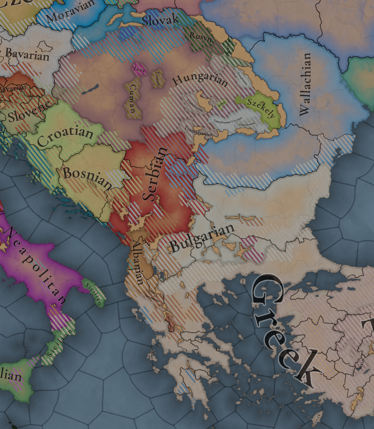
Cultures.png

Here comes the fun part of the DD: The cultural division of the Balkans! A few comments:
  1. Hungary is full of different minorities. Transylvania, especially, is an interesting place: there we have a mix of ‘Hungarians’, ‘Transylvanians’ (which are the Romanian-speaking inhabitants of the region), ‘Transylvanian Germans’, and ‘Szekely’ people.
  2. We have divided the Southern Slavic-speaking region into their dialectal families of Slovene, Croatian, Bosnian, and Serbian.
  3. The Southern Balkans are mostly divided among Bulgarian, Albanian, and Greek cultures.
  4. We’re also portraying plenty of other cultures, such as Dalmatians, Aromanians, Sclavenes, Arvanites, Cumans, Jasz, or Ashkenazi and Romanyoti Jews.

Religions:
Religion.png

This one is also interesting. Apart from the divide between Western Catholicism and Eastern Orthodoxy, we have the Krstjani in Bosnia, Bogomils (the pink stripes both in Bosnia and Macedonia), and Paulicians in Thrace. The Jewish populations do not pass the threshold percentage to appear on the map, but there are plenty of communities across the region.

Raw Materials:
Raw Materials.png

The materials of the region. Something very noticeable is the richness of minerals, with plenty of Iron, Copper, Tin, Lead, Gold, and Silver. Specifically, Slovakia is very rich, and you definitely want more settlers to migrate to the region, and exploit its resources. The region is also very rich in agricultural resources, as you can see.

Markets:
Markets.png

The region is mostly divided among four markets: Venice, Pest, Ragusa and Constantinople.

Country and Location population:
Population 1.png

Population 2.png

Population 3.png

Population 4.png
Country and location population (which I’ve also sub-divided, and is under the Spoiler button).

And that’s all of today! I hope that you find the region interesting; we certainly think that it is. Next week we will go further south, and we will take a look at the Syrian Levant and Egypt. Cheers!
 
  • 193Like
  • 69Love
  • 7
  • 4
  • 3
  • 1Haha
Reactions:
Yes, Slavic-speaking population was widespread. Stephan the Great translates his titles using Church Slavonic for his subjects. This land was an area of extensive colonization by estern slavic tribe congregation called Tivertsy, and by 14th century Moldavia consisted of Ruthenian population by about 1/3 to 1/2. First Moldovan Metropoly of Suceava was called "Rusovlakhian"

It is highly possible that Moldavian elites were considering themself Russian following disintegration of Galich-Volhynian Princedom (which resulted in a creation of Moldovan duchy in the first place)
According to chronicles Moldavia was half Romanian speaking, half East Slavic speaking in 15th century: https://ro.wikisource.org/wiki/Letopisețul_țărâi_Moldovei,_de_când_s-au_descălecat_țara

According to the same chronicles before the establishment of Moldavia it should be populated by Tatars and Cumans.
 
  • 1
  • 1
Reactions:
Therefore I think the naming of the cities should be german just like in the case of Bratislava, which had a German majority even in the 19th century. Also german looks better on the map. It's Kolozsvár not Koloszvár, and instead of Csongrád please use Szeged.

And I realy realy would love not to have Budapest (this world was invented in 1873), but the far cooler (and actually used that time) Pest-Buda as the name of the region.
If you need Hungarian localization just ask for help and please don't use those wierd names like Zalău or Baia Mare and there are many, many more.

Sadly I can't give you a full list of minecities since, I haven't found any credible source that sais which were given the status by 1342 (and I'm to lazy to individualy google), however I'm more than happy to help with in any further questions. Thank you for reading and have a great day.
In general a feature I want is for the naming of locations to be based on the majority culture there, or possibly the majority culture of all of the non-peasant pops. Paradox should at least make this a game option that could be turned on or off. I think all of the towns in Burgundy getting renamed to Czech because I inherited Burgundy as Bohemia is weird and confusing.
 
I know you united two Bohemian regions (Prácheňsko and Bechyňsko) into one, but please anything but "Jihočesko".
Until modern times "Česko" wasn't really a term. If anything, use Jižní Čechy for that province.
 
  • 1
Reactions:
There are multiple issues with the Romanians aka Wallachians/Transylvanians.

This is the map in question;
Cultures.png


Unfortunately, Paradox has a history of inaccuracy when it comes to the Carpathian region and Romanians specifically. We understand that Romania is not the most popular subject in western history, to put it mildly. Most westerners are interested in England, France, Spain, Portugal, Italy, Germany, Russia, Ottomans and maybe Hungary and Poland at best. But we would like to play as historically accurate Romanians:
- In CK2 Wallachia and Moldavia's rivers and regions were completely wrong to the point where it looked like a parody of a map.
- The Vlachs (Wallachians and Moldavians) were listed as slavic despite not being so.
- Moldavia didn't even exist as a formable kingdom despite other 100% made up formable kingdoms existing in CK2.
- Only the geographic regions being wrong were updated in one of the last patches.
- It took CK3 to add Moldavia, but the Vlachs were still south slavic.
- Only after a few updates they finally changed the Vlachs from South Slavic to their own cultural group.
- EU4 for example doesn't have Pokuttia as part of Moldavia despite Moldavia owning Pokuttia in 1444.
- If you look at EU4's map, Suceava is much lower than where it should be. It's basically in Neamt and where Suceava should be is Halicz. This is not even history just geography.

So there is a precedent. I aim to make this topic to correct such things. Not to mention when such topics are made about the Romanians, some forum users call it "ethno-nationalist posting". Perhaps if this part of the world would get as much attention as Western Europe does, ethno-nationalist posting wouldn't be a thing. But the devs said they are really looking forward to make EU5 as historically accurate as possible, so the future looks promising.

Content:
- 1) Is it historically accurate to call their culture "Romanian" in 1337?
- 2) Issue with Transylvanian and Wallachian as different cultures on the placeholder map
- 3) Transylvania Intro.
- 4) Issue with Romanian lack of presence in Transylvania and Maramures
- 5) Issue with lack of Transylvanian Autonomy/Voivodship within Hungary
- 6) Issue with the existence Moldova in 1337 (founded at the earliest in 1345)
- 7) Wallachia and the Bessarabia Region in 1337.
- 8) Extra sources.

1) Is it historically accurate to call their culture "Romanian" in 1337?

Yes. In the same way that Greeks don't call themselves “Greek”. Instead Greeks refer to themselves as Hellenes. The Romanians never called themselves "Vlach". Instead the Vlachs referred to themselves as "Romanians".

The Romanians is not a modern term, it’s an endonym. The Romanians have always called themselves Romanians since they were first mentioned. And Wallachia was called in romanian “Tara Romaneasca” meaning “The Romanian Land”.

Wallachians/Vlachs is an exonym. They were called as such by other people, but that’s not what they called themselves. It comes from a proto-Germanic word that means “stranger” and was generally used for romance-speakers. The Hungarians used to call the Italians olasz, and the Slovenians used to call the Italians Lahi, both having the same root as Vlachs.

So Romanians is not a modern term. Other nations also started to user the term Romanian to refer to Romanians since the little union of 1859, but it’s not like Romanians suddenly started to call themselves Romanians in 1859.

- Historiograph Johann Lebel attests in 1542 that "Common Romanians call themselves "Romuini".
- The Polish Humanist Stanislaus Orichovius notes as late as 1554 that "these left behind Dacians in their own language are called Romini, after the Romans, and Walachi in Polish, after the Italians"
- Another humanist, who took up residence in Transylvania, the Dalmatian Antonius Verantio, who later would become cardinal and viceroy of Habsburg Hungary, also states in 1570 that "the Wallachians call themselves Romans" and provides an example: "When they ask somebody whether they can speak Wallachian, they say: do you speak Roman? and [when they ask] whether one is Wallachian they say: are you Roman?".
- Jesuit Theology professor Martinus Szent-Ivany cites in 1699 Romanian expressions: "Sie noi sentem Rumeni" (modern standard Romanian "Și noi suntem români") and "Noi sentem di sange Rumena" (in modern standard Romanian "Noi suntem de sânge român".
- The geographer Anton Friedrich Busching writes in 1754 that "the Wallachians, who are remnant and progeny of the old Roman colonies thus call themselves Romanians, which means Romans".
- The Hungarian writer Andras Dugonics in 1801 states: "But those Romans who remained in Dacia mixed their Roman language with the language of the Sarmatians [of the Slavs] and that of the Dacians. Thus a special language was formed, the Wallachian language (oláh nyelv), which is nothing else but a mixture of the Latin language with the Slavic and Dacian language (dákus), and they themselves are today called the Romans (rómaiak), ie rumun".
- The English author John Paget, in 1839, in his book, "Hungary and Transylvania" writes: "the Wallack of the present day calls himself "Rumunyi" and retains a traditional pride of ancestry, in spite of his present degradation".

LATER EDIT: By the end of EU5's timeline, the Vlachs will begin to be called Romanians by others as well. Thus, using the "Vlach" exonym late game would be wrong. In the 14th you can make the argument that Romanians were called Romanians by the Romanians so that's the justification for the naming, using the endonym, but by the late 18th century the Romanians weren't called Vlachs by the non-Romanians for the most part.

- By the 16th century, the term "Romanian" started to appear in non-Romanian documents. A notable early use was in the writings of the humanist scholar Nicolaus Olahus (1493–1568), who referred to the inhabitants of the Carpathian-Danubian-Pontic space as "Romanians".
- By the 17th century the identification as "Romanians" became more widespread.
- By the 18th century the term "Romanian" was further popularized through literature, historical writings, and the influence of the Enlightenment. During the Enlightenment scholars started to note the Roman roots of the Vlachs and began to more consistently refer to them as "Romanians" in their works.
- By the 19th century, as Romanian national identity strengthened and gained international recognition, the term "Romanian" almost completely replaced "Vlachs" in the vocabulary of outsiders. This shift was influenced over the centuries by diplomatic interactions, scholarly works, and the broader movements of nationalism sweeping through Europe at the time.

Calling them Romanians would also help them separate from the Aromanians south of the Danube, which were a related but different culture. (more on that later)

Given that the Aromanians are confirmed in the game (thank you @CocoBZ )
View attachment 1144832
It would make less sense now to have the Romanians called Vlachs.

As both the Romanians and the Aromanians were called Vlachs, it was a common exonym.

It would be rather inconsistent to use the endonym for one culture, Aromanian, and the exonym for another similar culture, Vlachs. Especially when you consider that they were both called Vlachs.

At the same time, using the exonym Vlachs for both would be equally confusing given that both of them were Vlachs and you as the player have no way to differentiate them.

The simplest and most eloquent would be simply using the endonym for both, Romanian and Aromanian.

2) Issue with Transylvanian and Wallachian as different cultures on the placeholder map:

Looking at the map, I can see there is a "Transylvanian" culture in Transylvania (likely Romanians) and a "Wallachian" culture in Moldavia (likely also Romanians).

I find it a little weird that they separated Wallachian & Transylvanian cultures like that.

I don't think the Romanians from Wallachia, Moldavia and Transylvania were different enough to call for a different culture, they could have simply been all of them Vlachs/Romanians just like in CK3.

However, if they decided to go the separation route, it's strange that they decided to make Moldavia with Wallachian culture. And Transylvania with Transylvanian culture. I assume Wallachia doesn't have a Moldavian culture but also Wallachian.

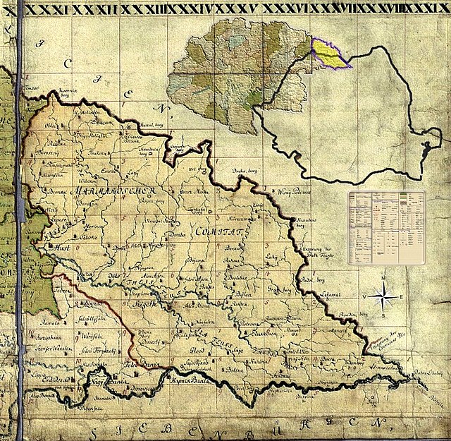
As for Maramures, according to the map it seems to be populated by the Rusyn people. This is the history of Maramures in that period:
Maramures_Josephinische_Landesaufnahme_1782-1785_Background.jpg


Maramures.png


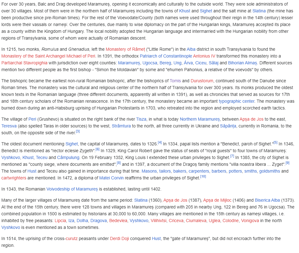
For context, Balc and Drag were Romanians.

How could it be populated by Rusyn people in 1337, but in 1343 have a Romanian Voivodeship established there?

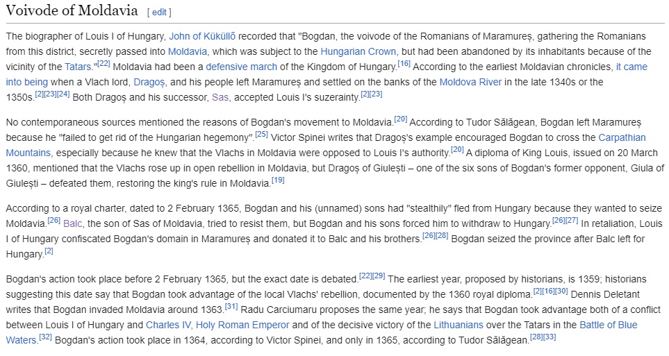
And how could Moldavia have a different "Wallachian" culture when the people who founded Moldavia were Vlachs from Transylvania?

Maramures2.png


I find it strange to have mostly Rusyn and Hungarian culture in a region said to be populated and ruled by Vlachs/Romanians at the time.

As far as I can read about the Rusyn, it seems they only started settling in Maramures in the 15th century. Thus I do not understand their presence on the map at this time.

3) Transylvania Intro:

This is an introduction to give context to the 4th point.

There were 4 main ethnicities in Transylvania: Romanians, Hungarians, Saxons and Szekely.
The Romanians were Orthodox and the Hungarians, Saxons and Szekely were Catholic.
The only disagreements are about population sizes.

t1.png

t2.png

t3.png

t4.png


4) Issue with lack of Romanian presence in Transylvania and Maramures:

While I touched a bit on point 3 about Maramures. I believe overall from what we can see on the map of Transylvania, the map is way too biased.

There is a debate. Because there is barely any data available and that leaves ample room for various theories and speculations.
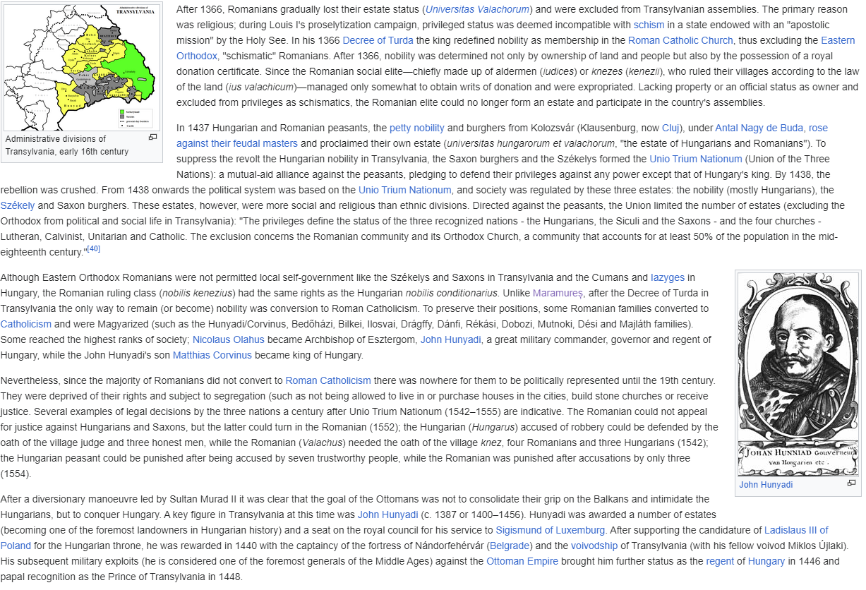
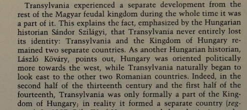
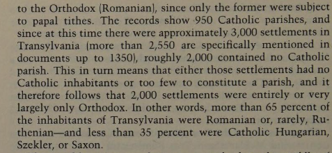
- Romanian historians claiming continuous Romanian majority in Transylvania and initially having a Romanian elite (nobility) with them gradually losing status and being treated as second class citizens by the Hungarians culminated with the Union of the Three Nations in 1438, with over the ages the numbers of Romanians decreasing and of Hungarians & Germans increasing but them never reaching a majority.
- Hungarian historians claiming the settlement of Romanians in Transylvania from Wallachia and Moldavia.... between the 9th and in the 13th century depending on the Hungarian historian (this last part will be important) with the Romanians only becoming a majority either after the Battle of Mohacs or 1750 depending on the Hungarian historian.

However, the last part is key, the game starts in 1337.

Meaning even if we ignore the whole debate even according to the Hungarian historians, the Romanians should have already arrived by now.

According to Hungarians, by 1337 the Romanians were already there, in what numbers when compared to Hungarians is still debated, but they were still already in Banat, Crisana, Southern Transylvania and Maramures. While the Hungarians were in the other parts of Transylvania.

For example:
1716101602576.png

1716101751176.png

Pages 66 and 68.

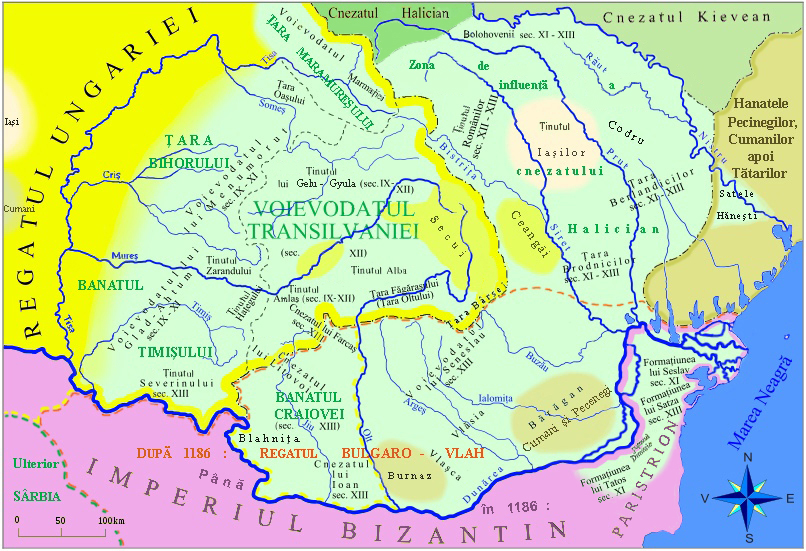
This map is a 1186 estimate from Ovidiu Drimba, a Romanian historian - light green Romanians:
estimateRo.jpg


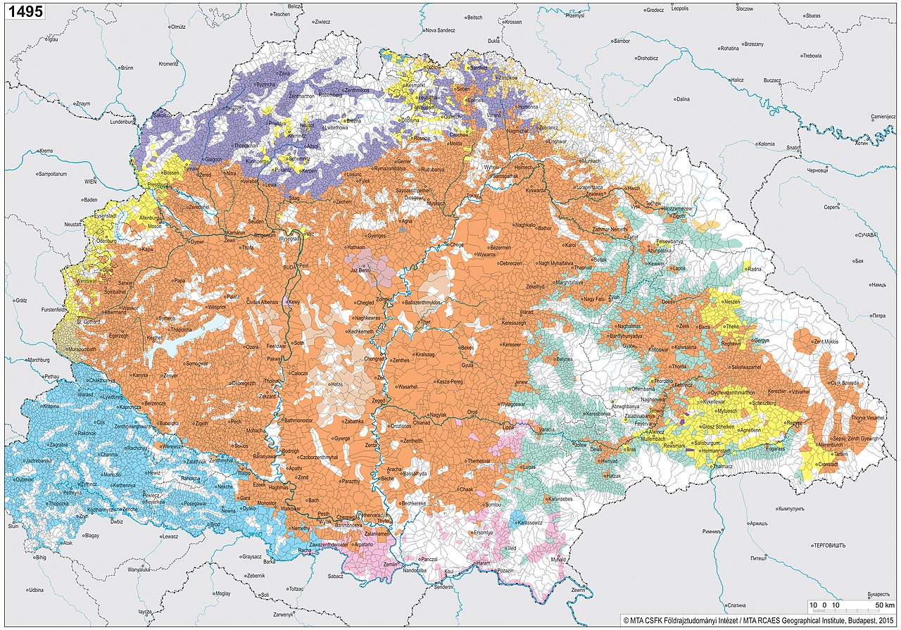
This is a 1495 Hungarian Academy of Sciences map:
EstimateHu.jpg


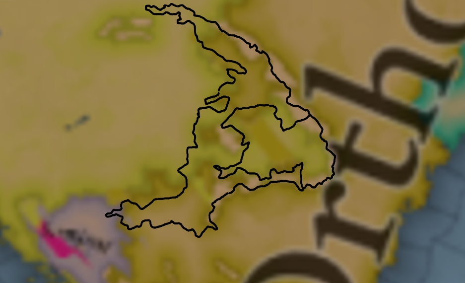
If we take the map from above for example, and overlap it with the one from the map showcases, this part of it would be Orthodox:
EstimateRel.png


There is a big contrast between the Romanian version and the Hungarian version looking at the maps.

However, both seem to agree on Crisana, Banat and South Transylvania having a Romanian majority. Those regions are consistent.

As for Maramures, there is strong documentation of Romanians by 1337. Also for Romanians in Carta, Turda, Crisana, Banat, etc.

5) Issue with lack of Transylvanian Autonomy/Voivodship within Hungary:

Transylvania should be a vassal state of Hungary in 1337 because it was the biggest autonomous region, ruled by voievodes, which are de facto rulers, with voievodes being of higher status and having more freedom than a ban, such as the Ban of Croatia, and Croatia is a vassal state in the maps.

6) Issue with the existence Moldova in 1337 (founded at the earliest in 1345):

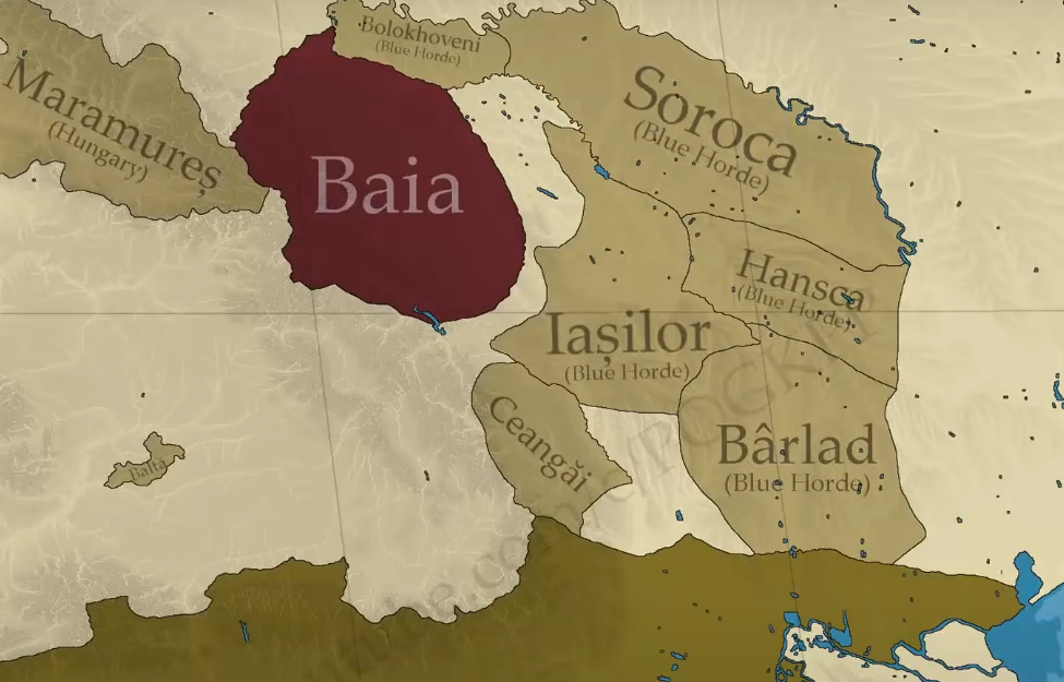
Moldova did not exist in 1337. The only thing that existed in 1337 that would later become Moldova is the Principality of Baia.

While territories of what would later become the principality of Moldova were populated by Romanians and had their own local aristocracies, they were under Tatar influence and there was no unified political entity. Moldova was founded in 1345 at the earliest (maybe 1352, maybe 1359, there is no consensus on the year due to scarce documentation, but it very likely didn't precede the military campaign carried out by Hungary east of the Carpathians in 1345-1347), when the king of Hungary established a defensive march under the rule of Dragoș. This early state only covered the north-western side of the region, where the eponymous Moldova river was located, and only after Bogdan's forceful occupation of the throne in the 1360s would Moldova start expanding eastwards towards the Dniester and southwards towards the sea, a process which would take a good number of decades. Either way, the main point to be made is that Moldova shouldn't exist on the map at the start of the game.

Moldova.png

The most accurate thing we could do is to have these Romanian vassal states under the Blue Horde (or the Golden Horde is if the devs decide not to split the Golden Horde into the Blue & White Hordes). With Maramures & Baia ruled by a Romanians but vassals of Hungary.

Soon after (in 10-20 years), what was said in the introductory video about Moldova would happen, so there should likely be an event for that. As I don't think the founding of Moldavia, unification of all these regions + Cetatea Alba & independence from Hungary would happen by normal AI EU5 play.

7) Wallachia and the Bessarabia Region in 1337:

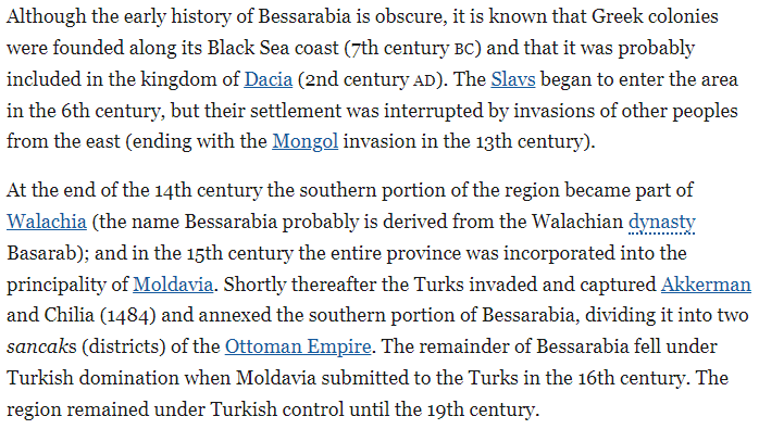
You can see in the south that Wallachia owns a region that would later be part of Moldova, this is Bassarabia. Also known as Budjak. Taken by Wallachia sometimes in the 13th century, date is debated. Could be 1337, could be later than 1337.

1715738801363.png

1715763242067.png

1715738801363 (1).png

Moldova2.png


8) Extra Sources:

Should you wish to go more in-depth:


There is also this Youtube channel:
Which quote: "This is the official channel of the international research project CORPUS DRACULIANUM, the main authority in the study of the life and times of the Wallachian voivode Vlad III the Impaler Drăculea (1431-1476). This channel provides exclusively scientific researched and referenced facts packaged in a format easy to absorb by the general public and history buffs: no vampires, no Balkan stereotypes, no commercial non-facts, only source-based history! We are professional historians from universities and scientific institutes in Germany and Romania. We spent more than a decade finding hundreds of medieval documents and chronicles on Vlad Drăculea in many archives and libraries.We are sharing our knowledge and the latest key findings, which help us look beyond the myths and legends of Drăculea."

 
  • 18Like
  • 6
Reactions:
There was already a strong Bosnian identity in the Late Middle Ages, with a Banate that became a Kingdom, a Church, and a dialect of their own.
And Moldavians didn't? Oh, come on, Paradox, you could have at least tried to hide your increasing politicization behind events or decisions, like that God-awful Victoria 3 game does
 
  • 15
  • 2
  • 1Haha
Reactions:
There was already a strong Bosnian identity in the Late Middle Ages, with a Banate that became a Kingdom, a Church, and a dialect of their own.
What about the non-existent Wallachian-Transylvanian difference?

All of them considered themselves Romanians. In their own language 'Romani' just living in different countries.

I simply have no idea what kind of historical reality or process this Wallachian/Transylvanian split supposed to reflect.
 
  • 3Like
Reactions:
I have to agree with the Romanians on this. Moldavia was founded by a Transylvanian Romanian, so why would it have Wallachian culture? Just give Moldavia its own culture or make it all Romanian, the current state of things seems totally arbitrary. Also, annexing Moldavia to the Golden horde is an extremely lazy solution to the problem of representing how the Moldavian state came to be. Moldavia wasn't the result of a revolt against the horde, it was the result of one autonomous polity uniting all the others. Moldavia should be a series of small states, possibly in a tributary relationship with the Golden Horde. The current state of affairs especially sucks because Moldavia was a very diverse and interesting place during the early 14th century, you had Vlachs, Slavs, Cumans, Csangos, Jasz people, etc... Voltaire's Nightmare handles this quite well. There's no reason for Eastern Europe to be this imprecise when other regions are so granular, please break up these ahistorical meme blobs. I'm especially disappointed because a while ago you said that Moldavia is one of the regions you were still "working on", but no real work seems to have been done on it at all.
 
Last edited:
  • 8Like
  • 2
Reactions:
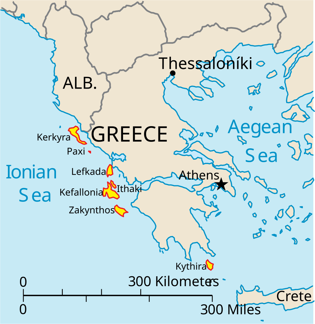
The Ionian Islands province should include Cythera, it's called the Heptanese for a reason.

View attachment 1159166

That's only a modern situation, as Cythera was only integrated with the other islands after 1718 and the Peace of Passarowitz, as the islands as a whole were now Venice's only possessions in the region. Before 1718, Cythera was administrated separately from the other islands, usually from Venetian possessions in Crete or the Peloponnese.
 
  • 1
Reactions:
Didn't expect the Romanians to be the most uppity over this map
Then you've not been paying attention to the many threads on the matter that have popped up over the past few months.

I personally have no stake in the matter (though I think people taking personal issue with the matter as if the map hasn't needed plenty of corrections already and I've only seen a grand total of... two pieces of map feedback make the map before the respective TM— Ragusa and the northernmost border of Bulgaria— were posted so expectations of a massive revision before the respective TM was foolhardy at best), so I'll leave it to those with better sources on the matter than what I have lying around.
 
  • 3Like
  • 2
Reactions:
Greetings, and welcome to another Tinto Maps! This week we will be taking a look at Carpathia and the Balkans! It will most likely be an interesting region to take a look at, with a lot of passion involved… So I’ll just make an initial friendly reminder to keep a civil discussion, as in the latest Tinto Maps, as that’s the easiest way for us to read and gather your feedback, and improve the region in a future iteration. And now, let’s start with the maps!

Countries:
View attachment 1158260
Carpathia and the Balkans start in a very interesting situation. The Kingdom of Hungary probably stands as the most powerful country in 1337, but that only happened after the recovery of the royal power enforced by Charles I Robert of the House of Anjou, who reined in the powerful Hungarian nobility. To the south, the power that is on the rise is the Kingdom of Serbia, ruled by Stefan Uroš IV Dušan, who has set his eyes on his neighbors to expand his power. The Byzantine Empire, meanwhile, is in a difficult position, as internal struggles ended in Andronikos III being crowned sole emperor, at the cost of dividing the realm; both Serbia and Bulgaria have in the past pressed over the bordering lands, while the Ottomans have very recently conquered Nicomedia. The control over the Southern Balkans is also very fractioned, with a branch of the Anjou ruling over Albania, the Despotate of Epirus under the nominal rule of Byzantium as a vassal, Athens, Neopatria and Salona as vassals of the Aragonese Kings of Sicily, Anjou protectorates over Achaia and Naxos, and only nominal Byzantine control over Southern Morea. It’s also noticeable the presence of the Republics of Venice and Genoa, which control several outposts over the Adriatic and Aegean Seas. A final note: in previous maps, Moldavia was shown in the map, but we’ve removed it from it, and it will most likely spawn through a chain of events in the 1340s.

Dynasties:
View attachment 1158528
The House of Anjou rules over Naples, Hungary, Albania, Achaia, and Cephalonia; they’re truly invested in their push for supremacy over the region. Apart from that, each country is ruled by different dynasties, except for Athens and Neopatria, ruled by the House of Aragón-Barcelona.

Locations:
View attachment 1158264
This week we’re posting the general map of the region, along with some more detailed maps, that can be seen if you click on the spoiler button. A starting comment is that the location density of Hungary is noticeably not very high; the reason is that it was one of the first European maps that we made, and we based it upon the historical counties. Therefore, I’m already saying in advance that this will be an area that we want to give more density when we do the review of the region; any help regarding that is welcome. Apart from that, you may notice on the more detailed maps that Crete appears in one, while not being present in the previous one; because of the zooming, the island will appear next week along with Cyprus, but I wanted to make an early sneak peek of the locations, given that is possible with this closer zoom level. Apart from that, I’m also saying in advance that we will make an important review of the Aegean Islands, so do not take them as a reference for anything, please.

Provinces:
View attachment 1158268
Provinces! Nothing outstanding to be commented on here; as usual, we’re open to any feedback regarding them.

Terrain:
View attachment 1158270
View attachment 1158271
View attachment 1158272
Terrain! The climate of the region is mostly divided between Continental and Mediterranean, with some warmer and some colder regions. Regarding the topography, the Carpathian mountains are famously important and strategic, while the Balkans are a quite hilly and mountainous region, which is also greatly covered by woods and forests.

Cultures:
View attachment 1158273
Here comes the fun part of the DD: The cultural division of the Balkans! A few comments:
  1. Hungary is full of different minorities. Transylvania, especially, is an interesting place: there we have a mix of ‘Hungarians’, ‘Transylvanians’ (which are the Romanian-speaking inhabitants of the region), ‘Transylvanian Germans’, and ‘Szekely’ people.
  2. We have divided the Southern Slavic-speaking region into their dialectal families of Slovene, Croatian, Bosnian, and Serbian.
  3. The Southern Balkans are mostly divided among Bulgarian, Albanian, and Greek cultures.
  4. We’re also portraying plenty of other cultures, such as Dalmatians, Aromanians, Sclavenes, Arvanites, Cumans, Jasz, or Ashkenazi and Romanyoti Jews.

Religions:
View attachment 1158274
This one is also interesting. Apart from the divide between Western Catholicism and Eastern Orthodoxy, we have the Krstjani in Bosnia, Bogomils (the pink stripes both in Bosnia and Macedonia), and Paulicians in Thrace. The Jewish populations do not pass the threshold percentage to appear on the map, but there are plenty of communities across the region.

Raw Materials:
View attachment 1158275
The materials of the region. Something very noticeable is the richness of minerals, with plenty of Iron, Copper, Tin, Lead, Gold, and Silver. Specifically, Slovakia is very rich, and you definitely want more settlers to migrate to the region, and exploit its resources. The region is also very rich in agricultural resources, as you can see.

Markets:
View attachment 1158276
The region is mostly divided among four markets: Venice, Pest, Ragusa and Constantinople.

Country and Location population:
View attachment 1158277
Country and location population (which I’ve also sub-divided, and is under the Spoiler button).

And that’s all of today! I hope that you find the region interesting; we certainly think that it is. Next week we will go further south, and we will take a look at the Syrian Levant and Egypt. Cheers!
Hi! I've been loving the updates so far! I was wondering if there is any news on the AI side of things? The game maps and various ideas seem amazing, but I think having a good balanced AI is key to making the game enjoyable too. Maybe adding an option there to make sure AI follows a historical path? Or at least a path of more realistic expansion where it doesn't swarm into everything. Something that happened too much in EU4 for example was that Spain or Portugal or the Italian countries would conquer all of North Africa in the 1500s, or with the last updates the Ottoman Empire almost always collapses... it would be great to know if there are novelties in the AI to make it perform in a flavor-rich manner, adding to the experience and to the "story" of each game.
 
Then you've not been paying attention to the many threads on the matter that have popped up over the past few months.

I personally have no stake in the matter (though I think people taking personal issue with the matter as if the map hasn't needed plenty of corrections already and I've only seen a grand total of... two pieces of map feedback make the map before the respective TM— Ragusa and the northernmost border of Bulgaria— were posted so expectations of a massive revision before the respective TM was foolhardy at best), so I'll leave it to those with better sources on the matter than what I have lying around.
Oh, I know how it all started with some of the early pre-tinto map posts, still, the atmosphere is just a bit ridiculous and the "how could you do this pdx... how could you" attitude like this is some grand insult towards them personally all feels incredibly sad and even a bit pathetic. The map was just posted, and it has been made clear many times that map changes are for the tinto map posts, all the posts are great, but it all is coming across extremely emotional and personal for a game that was said to be in development and is very clearly being worked on.
 
  • 8Like
  • 6
  • 2
Reactions:
(Snipped a lot of stuff that had already been posted previously, much of it multiple times)

You've posted pretty much all this several times already. It's obvious that you're passionate about this, but you're likely shooting yourself in the foot by continually posting walls of the same stuff over and over like this. You'll make the Tinto's eyes glaze over at the repetition, or, at worst, annoy them so much that they'll just ignore you. Starting out with a long list of grievances against previous games won't score you points either. If you want the best chance for change, it's probably best to post in a simple, dispassionate, and unemotional manner.
 
  • 16Like
  • 5
  • 1
Reactions:
Didn't expect the Romanians to be the most uppity over this map

The Transylvanian - Wallachian split is a bit weird and unconventional, so I'm not surprised.
 
  • 14Like
Reactions:
More maps in appendix, it is a bit difficult to get a full view as it is divided into many parts. The blue thick line shows the border between the claimed Slovak and South Slavic nations. Also, the map does not say that Slovaks lived in all this area in the 14th/15th century, as it was not meant to speak about certain centuries, but to help see where the discussed places were located (although in books dates often are used in certain locations).
The author thinks that Hungarian outright didn't border the German speaking region and that Slovakia and Croatia touched in the west? Or am I misunderstanding something? Like where exactly does the author claim Slovak majority ended and Hungarian majortiy started?

Edit: Looking at the maps made when googline the book it seem to me that Slovak nationalists really think the book is saying that the entire of Hungary was Slovak? What the fuck? Or is that before the Hungarians arrived? If so what does the book actually claim?
 
Last edited:
  • 5Like
  • 3
Reactions:
So excited to play in this region, excelent job on the map so far, I love it! I've got some feedback about Moldavia, but first a question - is there a good way to play as Moldavia from game start? Something like starting as the Golden Horde and releasing and playing as Moldavia, or via event? Maybe you start as Hungary and can invade the Golden Horde and release Moldavia as a march, and one of options is to switch to play as Moldavia (I guess that's technically possible via EU4 mechanics too, but it would be cool if it was part of the event chain)? If releasing from the Golden Horde is the only option, would the event chain still trigger to get Hungary to support your independence?

As for my feedback, for the cultures, I think people have already said everything I have to say, I think it should either be a single Romanian culture (strongly prefer this), or a separate Moldavian culture, or at the very least rename Wallachian to Vlach. The culture in the Moldavia should also be more diverse I think, from what I understand there were Slavic, Turkic, Hungarian and German people in the region as well, though it's really hard to tell how significant they were as most of the minorities living there nowadays only arrived much later.

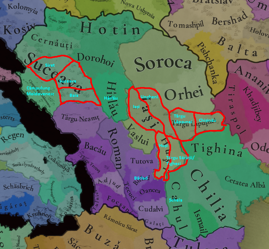
I'll mostly give feedback on the location distribution, as imo the locations in Moldavia are too big currently compared to its neighbors. First just some nitpicks, as other people have pointed out the diacritics for ă, ș, and ț are wrong. There's also a bunch of locations that have the letter î in the middle of the name - this is communist era orthography. Nowadays the rule is to use î if it's the first/last letter, â otherwise. In Moldavia I see 3 locations with this mistake, Cîmpulung Moldovenesc, Bîrlad, and Hîrlău, which should be Câmpulung Moldovenesc, Bârlad, and Hârlău respectively.

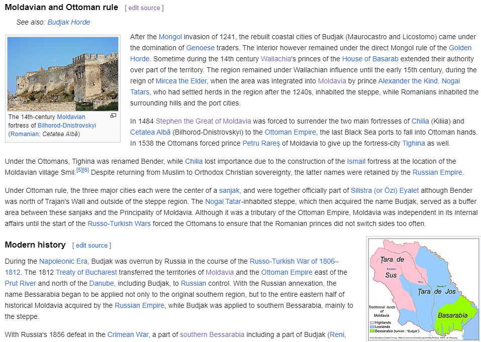
For my map changes, I've mostly based it off of this map (which I'll refer to further as the reference map), as well as English and Romanian Wikipedia (so take this feedback with a huge grain of salt, this is very shallow research haha). The map shows the biggest cities and the feudal lands partitions of the country in 1483. When creating the locations, I made sure all settlements I've used have been historically attested before 1500, which should match the current locations: Soroca (1499), Iași (1408), Orhei (1470) etc.
https://upload.wikimedia.org/wikipedia/commons/9/92/Moldova_(1483)-en.png
Moldova_%281483%29-en.png


These are the most important changes that I really hope to see to the map:
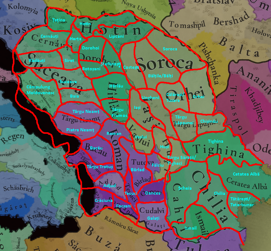
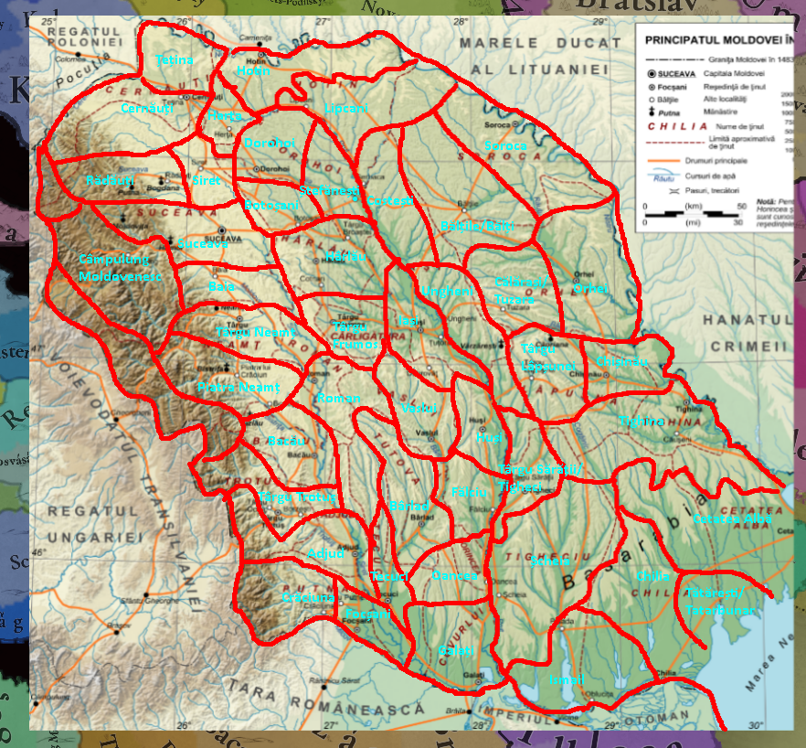
moldova1.png

  • Split off Siret and Baia from Suceava. These cities were capitals of the principality during the 14th century: Baia (1343–1354), Siret (1354–1388). I also think Cernăuți should go further south, so that recreating historical Romanian borders / the historical split of Bucovina in 1774 is possible. (source)
  • I am biased on this one as Chișinău is my hometown, but I really think it has to be included. It was first historically attested in 1436, and became the capital of the governogate of Bessarabia under Imperial Russian rule - granted this is in 1812 but that's still within the game's timespan. It'd be a shame not to include what is today the second largest Romanian city. On the reference map it shows up as the capital city of the Lăpușna feudal region, so it was an important city even in the 15th century. I've also seen it in most other medieval maps of Moldavia. (source)
  • I think the Prut river should cleanly split the provinces. It was a very important split in the early 1800s, as Russia annexed the land between the Prut and the Dniester as an important strategic position, creating a separation that lasts until today between Russified-Romanians to the right and the other Romanians to the left. Without this split, it would be impossible to end the game with accurate Russian Empire borders. For this, I split off Ungheni and Tigheci. Ungheni was attested in 1462, however for Tigheci I couldn't find more information other than it being present in the reference map as a feudal land "capital", along with seeing it on many other maps of the period. (Edit: someone in a later post also posted a source for the existence of a Tigheci Republic, though very dubious). As an alternative, Târgu Sărății could work - it was attested as the old name of Leova in 1489, but its existence is controversial. (source1, source2, source3, source4)
  • Finally, Cahul should be renamed to Șcheia, it was only named Cahul in 1835. (source)
  • EDIT: I didn't keep this in mind while drawing these maps but I think representing the yellow lines in this map within the locations is very important - they represent the Ottoman partitions of the land. The 1713 line and 1536 lines are basically already good, but the 1484 one isn't currently possible, Chilia would have to be split in two for that, or a redraw similar to what I have in the next maps.
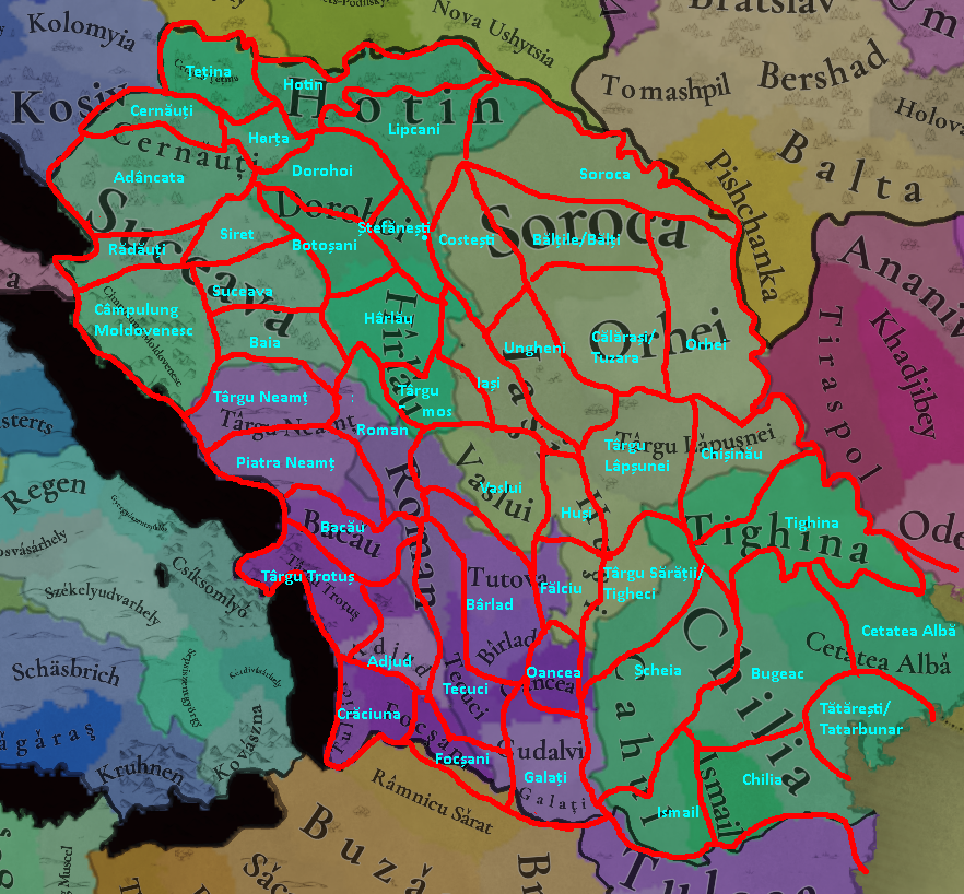
Now for my other suggestions, here's the map I managed to cook up:
moldova2.png
moldova3.png

  • Reshaped Șcheia, Tighina, Ismail, and Chilia to be able to recreate modern Moldova borders. This would also allow a better simulation of the Ottoman acquisitions in Bessarabia in the 1600s, as those would look awful on the current map - though maybe Tighina should be a different shape from the one in my map for this split to look better.
  • Provinces removed:
    • Tulnici - This one I might've just failed to find information about, but I didn't find any medieval attestation of this city. I think a better choice would be Crăciuna.
    • Tutova - This seems to be the name of the feudal region, as can be seen on the reference map, but I couldn't find an actual city named that, so I'd merge it with Bârlad, the capital of the Tutova region.
    • Cudalvi - Someone pointed out this might be a typo of Cudalbi, but even then I couldn't find any medieval attestation, so I'd merge it with Galați. EDIT: Nevermind i don't know how I missed this but it was attested in 1472, I'd edit the map to include it back but I'm too lazy.
  • Provinces added (in the order I value them as additions to the game):
    • Baia, Siret, Ungheni, Tigheci, Chișinău as discussed above, along with the renames mentioned above. Siret also likely had a monastery there at game start, while Baia had two churches. The wikipage also mentions that Baia would likely be the biggest city in Moldavia in 1339. It'd be cool if there were events to simulate the moving of the capitals Baia -> Siret -> Suceava in the 14th century, and Suceava -> Iași in the 16th.
    • Lipcani - attested in 1429, splits the province of Hotin nicely between what is now part of Moldova and part of Ukraine.
    • Some fortresses from this list: https://ro.wikipedia.org/wiki/Lista_cetăților_moldovenești
      • Crăciuna - this fortress dates from the 13th century, and provides a nice replacement for Tulnici.
      • Costești - attested in 1492, helps break up the giant Soroca province.
      • Piatra Neamț - attested in the late 1300s, and in the 1400s Stephan the Great built a Royal Court here. Its citadel was build at the end of the 14th century.
      • Tătărești - this one is more dubious, form the Wikipedia article it seems this fortress was build in the 16th century and was already in ruins by the 17th.
      • Fălciu - also pretty dubious, but seems to have been a settlement between 1466-1566.
    • Other settlements attested in those times that I could find:
      • Târgu Frumos - attested in 1448, was a feudal region capital according to the reference map.
      • Călărași/Tuzara - first attested in 1432 by the name Tuzara, it helps break up the giant Orhei province.
      • Bălți/Bălțile - this one is more dubious, it was only first attested in 1620, however it is nowadays the second largest city east of the Prut, and it shows up in the reference map. It also helps with splitting up Soroca. According to the map and the wikipage, it used to be called Bălțile originally.
      • Rădăuți - attested in 1393, it's home to a monastery build by Bogdan I in the 1360s. It was also the seat of the Moldovan metropolis until 1402. Whether this location is added or not, the border there should be adjusted to reflect the historical split of Bucovina.
      • Botoșani - trading city attested in 1350, was an important city in the 15-16th centuries, breaks up the huge Dorohoi location.
      • Ștefănești - attested in 1435.
      • Herța - attested in 1437.
  • I didn't include it in this map since it falls outside of the timespan of the game, but it might be nice to shape the provinces of Ismail / Chilia to be able to recreate these Romanian borders in 1864. EDIT: a similar border existed in the late 1300s, so now I feel more strongly about shaping the locations to allow this split.
  • In general, I think these historical splits should be mostly recreateable, they're all within the game's timeline.
  • Another thing I missed while making the map is that Ismail might've been called Oblucița or Smiliu during this time period. (source, source)
  • Some feedback outside of Moldavia:
    • Pishchanka and Tiraspol are pretty anachronistic, as they were first attested in the 18th century. I couldn't find good replacements however.
    • Some other cities to consider east of de Dniester are Balta, Rașcov, Yampil, Mohyliv-Podilskyi, Dubăsari.
    • Province Romanian names:
      • Kosiv - Cosău
      • Kolomyia - Colomeea
      • Halych - Halici
      • Bohorodchany - Bohorodceni
      • Dolyna - Dolâna
      • Zalishchyky - Zaleșcichi
      • Nova Ushytsia - Nova Ușîțea
      • Tomashpil - Tomașpil
      • Kamianets-Podilskyi - Camenița
      • Pishchanka - Pișceanca
      • Tiraspol - Tiraspol
      • Odesa - Odesa
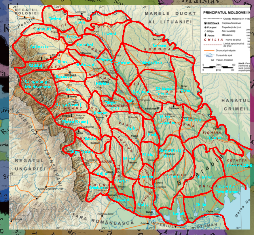
For the map above, I mostly tried to follow the current borders in game. I've also tried creating another map from scratch, only referencing the reference map and its feudal partitions. Thus this is what I'd ideally have in game if it were up to me:
moldova4.png

moldova5.png

  • In this version I also added the locations of Bugeac and Adâncita.
    • Bugeac - Not really the name of a settlement, I just added it to represent the "wastelands". Maybe a better location around there would be Palada, the medieval city where Bolgrad stands today, destroyed in the 16th century. The southern locations being shorter allows for the historical split of these provinces.
    • Adâncita - attested in 1438.

Setup at the start of the game:
  • Fortresses that existed: Cetatea Albâ (940/965), Bârlad (1174), Baia (1241), Chilia (1274), Hotin (1310), Ismail (1100s). (source1, source2)
  • The fortresses at the south of Moldavia should actually be controlled by the Genoese at game start, under the names:
    • Chilia - Licostomo (source)
    • Ismail - Licovrissi (source)
    • Cetatea Albă - Moncastro (source)
    • Tighina - Teghenaccio (source)
    • Galati - Caladda (source)
    • Other ones outside of Moldavia:
      • Ochakiv - a Genoese fortress in Ukraine that was taken over by Moldavia at some point in the 15th century.
      • Isaccea (Vicina)
  • Cetatea Albă came under Moldovan rule in 1359, while the other two remained under the Genoese until they fell under Wallachia at some point at the end of the 14th century by Basarab I (apparently this is why the regions was name Basarabia). They only came under Moldavia in 1426 under Alexandru cel Bun (same sources as above, also source).
  • Cultural minorities in Moldavia:
    • Given the above, there should probably be some Genoese burghers in the south.
    • Baia would probably have a significant German population, as it was a German city during the Mongol invasions. Germans and Hungarian were artisans in the city. (source, source)
    • Suceava had a minority of Germans, Hungarians and Armenians, the latter of which had some special rights. (source)
    • Piatra Neamț ws mostly inhabited by Germans and Hungarians in the 16th century. (source)
    • There was also a community of Germans and Hungarians near Iași. (source)
    • Roman had important communities of Armenians, Jews, and Catholics (guessing this means Germans and Hungarians). (source)
    • The region around Focșani had a German population. (source)
    • Csángó Land in Moldavia has a significant Hungarian presence, it probably dates from this time but I couldn't confirm that (source)
    • The north of Moldavia, around Soroca, had the Bolohovens living there just 100 years ago, it's theorized they were a Slavic-Vlach ethnic group. Therefore this region should probably have a Slavic minority. (source, source)
    • The forested and mountainous regions, mostly east of the Prut probably, should have a Slavic minority, as they where the other sedentary peoples in the region along Romanians. The steppe / flatland regions should probably have Turkic minority, especially around the Bugeac, although this is debatable as the current Turkic people living there (Nogai, Gagauz) only settled there and became a majority in the 16th century. That said by the 14th century there were already Crimean Tatar cities in Tulcea, but I couldn't find any information about similar settlements in Bugeac. (source, source, source)
    • There might be more Romanians in Pokuttia, currently only Kosiv is Romanian, but this is debatable. According to Romanian Wikipedia, "the new borderlands (Pokuttia) weren't a foreign land given the presence of the Romanian element in the region". However it seems the region only underwent a process of Romanianization after Moldavia took control of it in the late 14th century, according to the third source. My guess is that there should be some mix of Slavs and Romanians over the whole region, not just Kosiv. (source, source, source)
    • If Turkic peoples aren't present in the south at the beginning of the game, there should be some mechanic that would lead to them populating the Budjak over the game, they were probably the majority already by the 15th century. (source)
  • Resources:
    • There should probably be some Wild Game provinces, especially around Suceava. In fact, the founding myth of Moldavia is that Dragos I came to Moldavia chasing an aurochs, which became the coat of arms of Moldavia. I lost the source for this but I remember reading that Moldavia used to be the "hunting grounds" for Romanian lords in Transylvania. (source, source)
Events that happen soon after game start (ideas for scripted events):
  • Moldavia should not spawn with all the land it had in 1483 - it should be missing the locations in the south under the Genoese. It'd be nice to have an event for them going from the Genoese/the Horde to Wallachia to Moldavia at the end of the century.
  • There's a good collage of Moldavia's territorial evolution here, you can see Wallachia having a lot more influence over the southern cities at the beginning, as well as some influence in Transylvania. I think it'd be a fun player experience as Moldavia to slowly push the influence of the Horde / Wallachia away form these lands, rather than immediately spawn with them in 1359. As Wallachia it'd be fun to benefit from Hungary's pushes into the Golden Horde to gain control of the Genoese cities, and try to assert over your influence of Dobruja.
  • The despotate of Dobruja became independent in 1356, shortly came under Wallachian rule in 1406, and got incorporated into the Ottoman empire in 1413. (source)
  • As shown in that collage, there was a semi-independent land before Moldavia called Țara Șipețului, likely under Polish influence, that might make sense to be represented at game start. (source)
  • The change of capitals: Baia (1343) -> Siret (1354) -> Suceava (1388) -> Iași (1564).
  • The Siret fortress will be build in 1340. (source)
  • A church is build by Armenian colonists in Botoșani in 1350. (source)
  • 1352, 1359 - the establishment and independence of Moldavia obviously.
  • After this, Bogdan I establishes camps of Szekely soldiers in Orhei and Chișinău, the names of these cities coming from Hungarian (source).
  • It'd be fun to have an event for the exchange of Pokuttia between Poland and Moldavia due to debt (source)

I probably got some things wrong, I'm by no means an expert on this, I'm sure I also skipped some possible settlements, but I hope I was able to help a little bit with increasing the province density.
 

Attachments

  • moldova1.png
    moldova1.png
    932,1 KB · Views: 0
Last edited:
  • 23Like
  • 5
Reactions: