• We have updated our Community Code of Conduct. Please read through the new rules for the forum that are an integral part of Paradox Interactive’s User Agreement.

Tinto Maps Special Edition - 6th of January 2025 - The World

Hello, and welcome to a Special Edition of our Tinto Maps series! Today, as a Three Wise Men present (a quite important tradition here in Spain), we'll be taking a look at how the different map modes look like throughout the entire world. Without further ado, maps!

Countries:
Countries1.png

Countries2.png


Building-based Countries:
Building-based.png


SoPs:
SoPs.png


Dynasties:
Dynasties.png


Country Governments:
Governments.png


Court Languages:
Language Court.png


Locations:
Locations.png


Provinces:
Provinces.png


Areas:
Areas.png


Terrain:
Climate.png

Topography.png

Vegetation.png

Johan will talk this Wednesday about the effects of each terrain type.

Development:
Development.png


Harbors:
Harbors.png

European Harbors.png

We're also showing the map of European harbors, as that was not shown previously. Feel free to give your feedback!

Cultures:
Cultures.png


Languages:
Language Dominant.png


Religions:
Religions.png

The Animism split was completed, and the grouping into bigger families is almost finished (there's some pending work on Western and Eastern Africa, but that's it).

Raw Materials:
Raw Materials.png


Markets:
Markets.png


Population:
There is a total of 421M pops worldwide, distributed this way (and pending review, as we have identified some duplicates and errors that we have yet to fix, as in Germany, plus some additions in other places, as discussed in the different Tinto Maps threads):
  • 99.203M in Europe
  • 262.270M in Asia
  • 37.204M in Africa
  • 20.499M in America
  • 1.885M in Oceania
And that's it for today! Although there's pending work yet to be done in the new year, we think that the progress since we started the Tinto Maps series last spring is noticeable, something that we wouldn't have achieved without your feedback. We will keep gathering, processing, and implementing it in the Tinto Maps Feedback posts, continuing with the Maghreb review, which will be shown tomorrow.

And this Friday 10th we will start a new series, Tinto Flavour, in which I will show and talk about the content that we have been creating for Project Caesar. We hope that you will enjoy this new series and that you can keep helping us make this a fun and engaging game. Cheers!

PS: Today is a bank holiday in Spain, so I will reply to the comments tomorrow.
 

Attachments

  • Language Liturgical.png
    Language Liturgical.png
    3,8 MB · Views: 0
  • Raw Materials.png
    Raw Materials.png
    4,1 MB · Views: 0
  • Language Common.png
    Language Common.png
    3,9 MB · Views: 0
  • Language Common.png
    Language Common.png
    3,9 MB · Views: 0
  • 172Love
  • 79Like
  • 7
  • 3
  • 1
Reactions:
Hello, and welcome to a Special Edition of our Tinto Maps series! Today, as a Three Wise Men present (a quite important tradition here in Spain), we'll be taking a look at how the different map modes look like throughout the entire world. Without further ado, maps!

Countries:
View attachment 1238978
View attachment 1238979

Building-based Countries:
View attachment 1238989

SoPs:
View attachment 1238981

Dynasties:
View attachment 1238982

Country Governments:
View attachment 1238983

Court Languages:
View attachment 1238984

Locations:
View attachment 1238976

Provinces:
View attachment 1238967

Areas:
View attachment 1238971

Terrain:
View attachment 1238985
View attachment 1238987
View attachment 1238988
Johan will talk this Wednesday about the effects of each terrain type.

Development:
View attachment 1238994

Harbors:
View attachment 1238995
View attachment 1238996
We're also showing the map of European harbors, as that was not shown previously. Feel free to give your feedback!

Cultures:
View attachment 1238997

Languages:
View attachment 1239000

Religions:
View attachment 1239003
The Animism split was completed, and the grouping into bigger families is almost finished (there's some pending work on Western and Eastern Africa, but that's it).

Raw Materials:
View attachment 1239004

Markets:
View attachment 1239005

Population:
There is a total of 421M pops worldwide, distributed this way (and pending review, as we have identified some duplicates and errors that we have yet to fix, as in Germany, plus some additions in other places, as discussed in the different Tinto Maps threads):
  • 99.203M in Europe
  • 262.270M in Asia
  • 37.204M in Africa
  • 20.499M in America
  • 1.885M in Oceania
And that's it for today! Although there's pending work yet to be done in the new year, we think that the progress since we started the Tinto Maps series last spring is noticeable, something that we wouldn't have achieved without your feedback. We will keep gathering, processing, and implementing it in the Tinto Maps Feedback posts, continuing with the Maghreb review, which will be shown tomorrow.

And this Friday 10th we will start a new series, Tinto Flavour, in which I will show and talk about the content that we have been creating for Project Caesar. We hope that you will enjoy this new series and that you can keep helping us make this a fun and engaging game. Cheers!

PS: Today is a bank holiday in Spain, so I will reply to the comments tomorrow.
Thank you for your hard work!
However, is it just me, or are NorthWest Pacific natives not present at all? They were literally settled and with stratified society and should IMO be not even SOP, but I can't see them.
Here's a great video about how they settled without need of agriculture
https://youtu.be/GSSX0Bc3Mvs?si=gcYqwwhrYWd334Y1
 
  • 17Like
  • 3
  • 1
Reactions:
There seems to be a big disparity in area sizes between Europe and the rest of the world. How will this affect gameplay?
Well it'll make moving around have less options and be less interesting, but you'll need fewer forts to cover a much wider front, things we've pointed out in the past.
 
  • 6
  • 2
Reactions:
Well it'll make moving around have less options and be less interesting, but you'll need fewer forts to cover a much wider front, things we've pointed out in the past.
This logic only applies for larger nations. The size of the provinces is entirely irrelevant if we are talking about smaller nations bordering each other. Even in case of large nations, you can pretty much just take let's say 5 provinces and sit on them, routinely beat the enemy army to get what you want. Warfare is different from EU4. You dont need to move as much and it doesnt matter if there are more forts. You dont have to occupy them all anyways.
 
  • 6
  • 1
Reactions:
Looking cool so far, can't wait for the polar bear DLC and you add Antarctica right ? : ] . I forgot to ask and its maybe been talked about. Will the "terrain" of water for certain sea/ocean provinces affect travel speed or is just simple algorithm of gotta go fast?
 
  • 3Like
  • 2
Reactions:
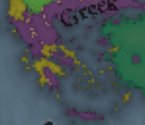
Screenshot_20250106_163903_Chrome.jpg

Athens and Crete have greek as their liturgical language which is obviously wrong as it should be latin because they are catholic
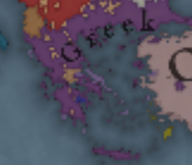
Screenshot_20250106_164323_Chrome.jpg

And maybe the same should be done for the court language since Crete is a Venetian colony(Gallo-Italic) and Athens a Catalan fief(Occitan)
 
  • 17Like
  • 2
Reactions:
1736178043015.png
1736178062756.png
1736179707474.png

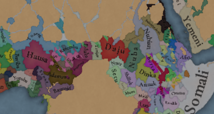
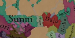
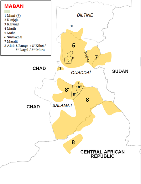
While Tunjur is indeed an Arabic-speaking group, this area shouldn't be majority arabic especially in this time period, especially considering they are non-Muslim in your map.
The area of Tunjur should be mostly Maban, here is the modern distribution:
1736178457360.png

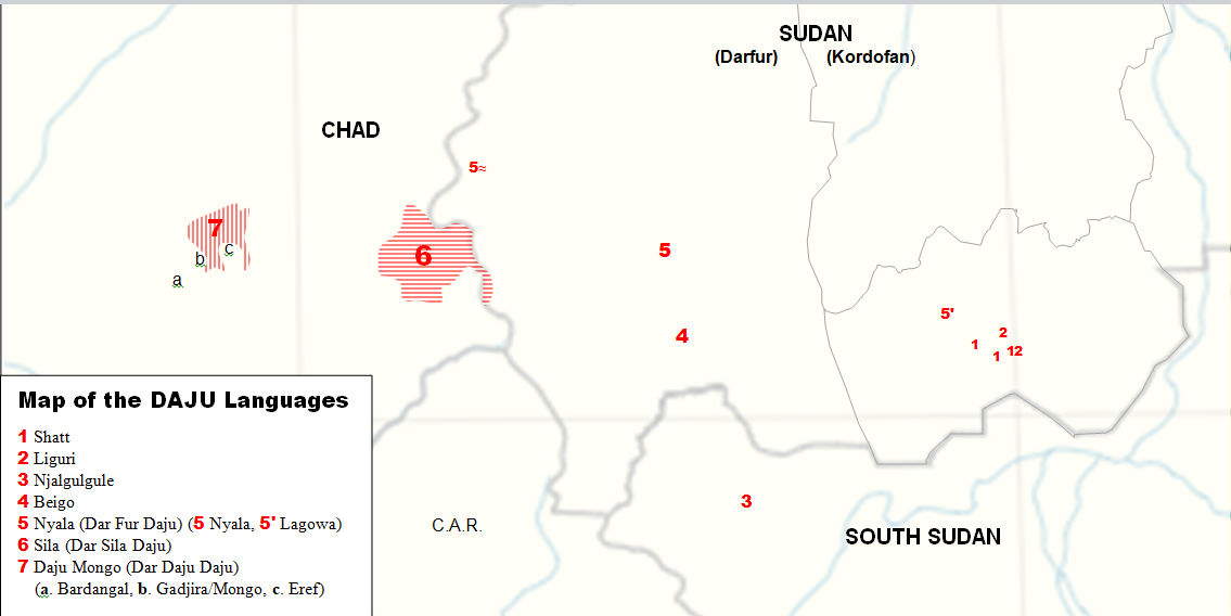
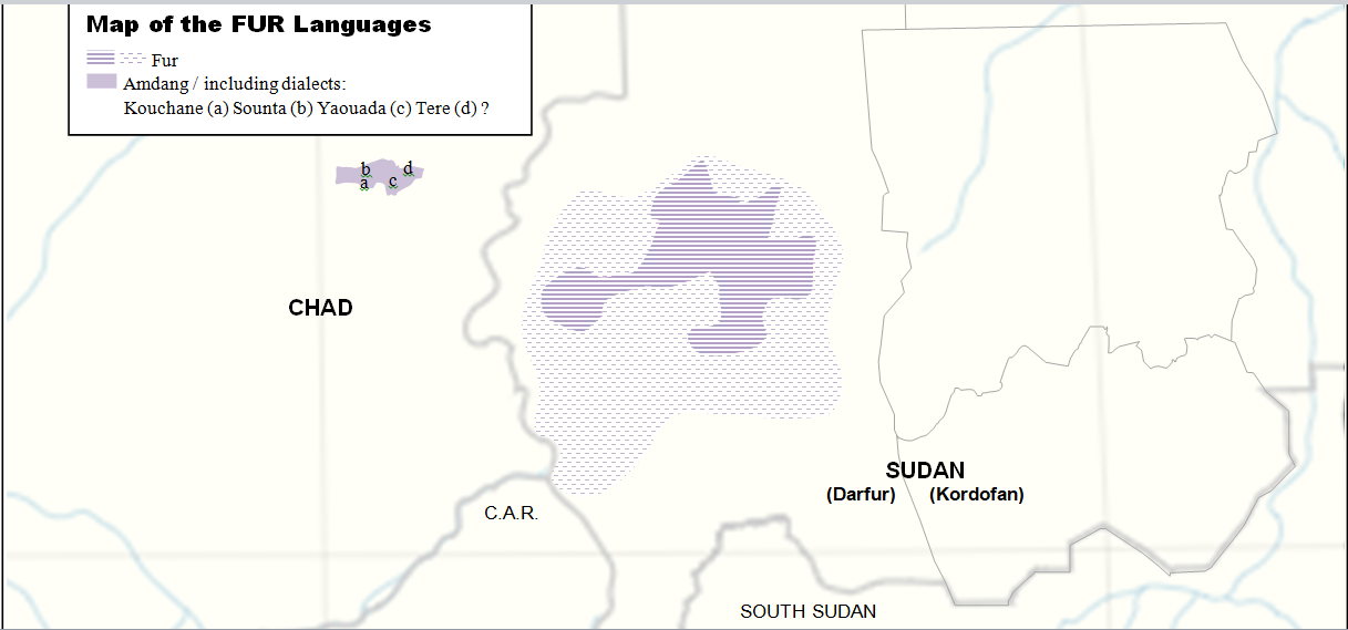
Area of Daju should be Fur in the north, here is modern distribution of both:
1736178234344.png

1736178212866.png

1736186608808.png

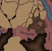
Also, Wadai should be a tribe, or SOP even, Daju probably should be a tribe too, while Makuria and Alodia should be Monarchies.

Also, Bilala should speak the same language as Baguirmi not as Toubou or Kanembu

Also, Gumuz are not Arabic speakers, they are language isolate.

1736181474643.png
 
Last edited:
  • 18
  • 7Like
  • 5
Reactions:
It might be a good idea to make a natural harbor in western Overijssel (modern day Kampen area), as its the mouth of the IJssel, a distributary of the Rhine river. It was used by multiple Hanseatic trading cities like Zwolle and Deventer.
 
  • 1Like
Reactions:
I also think the dev map mode is utter nonsense, if it is suppose to reflect human activity. Rain forests and deserts are more developed than urban centres. Take Sarai as an example and compare it to some no name places around/in the Gobi desert.

EDIT:

Please explain what dev is suppose to reflect. There were multiple discussions about it in the past and it goes to no where, because it is not clear what it is suppose to show.
Quoted from the tinto talks on dev:

"in Project Caesar development represents how cultivated the land is, and how much it is used by the pops living there. The higher the development, the more people can live there, and the more it can be exploited."

So it is how much of the land is used for agriculture. It is not wealth, nor population, nor technically urbanization nor infrastructure.

I do think the dev map is ridiculous and its distinctions are exaggerated. Yemen, Central Asia, Ethiopia and Mesoamerica being so low dev seems inaccurate and borderline biased, especially when compared with higher dev places that are random backwaters in say Balochistan or the rural middle east. To be clear, they obviously shouldn't be as developed as India/China and probably not as much as Europe, but still.
 
  • 16Like
  • 3
Reactions: