• We have updated our Community Code of Conduct. Please read through the new rules for the forum that are an integral part of Paradox Interactive’s User Agreement.

Tinto Maps Special Edition - 6th of January 2025 - The World

Hello, and welcome to a Special Edition of our Tinto Maps series! Today, as a Three Wise Men present (a quite important tradition here in Spain), we'll be taking a look at how the different map modes look like throughout the entire world. Without further ado, maps!

Countries:
Countries1.png

Countries2.png


Building-based Countries:
Building-based.png


SoPs:
SoPs.png


Dynasties:
Dynasties.png


Country Governments:
Governments.png


Court Languages:
Language Court.png


Locations:
Locations.png


Provinces:
Provinces.png


Areas:
Areas.png


Terrain:
Climate.png

Topography.png

Vegetation.png

Johan will talk this Wednesday about the effects of each terrain type.

Development:
Development.png


Harbors:
Harbors.png

European Harbors.png

We're also showing the map of European harbors, as that was not shown previously. Feel free to give your feedback!

Cultures:
Cultures.png


Languages:
Language Dominant.png


Religions:
Religions.png

The Animism split was completed, and the grouping into bigger families is almost finished (there's some pending work on Western and Eastern Africa, but that's it).

Raw Materials:
Raw Materials.png


Markets:
Markets.png


Population:
There is a total of 421M pops worldwide, distributed this way (and pending review, as we have identified some duplicates and errors that we have yet to fix, as in Germany, plus some additions in other places, as discussed in the different Tinto Maps threads):
  • 99.203M in Europe
  • 262.270M in Asia
  • 37.204M in Africa
  • 20.499M in America
  • 1.885M in Oceania
And that's it for today! Although there's pending work yet to be done in the new year, we think that the progress since we started the Tinto Maps series last spring is noticeable, something that we wouldn't have achieved without your feedback. We will keep gathering, processing, and implementing it in the Tinto Maps Feedback posts, continuing with the Maghreb review, which will be shown tomorrow.

And this Friday 10th we will start a new series, Tinto Flavour, in which I will show and talk about the content that we have been creating for Project Caesar. We hope that you will enjoy this new series and that you can keep helping us make this a fun and engaging game. Cheers!

PS: Today is a bank holiday in Spain, so I will reply to the comments tomorrow.
 

Attachments

  • Language Liturgical.png
    Language Liturgical.png
    3,8 MB · Views: 0
  • Raw Materials.png
    Raw Materials.png
    4,1 MB · Views: 0
  • Language Common.png
    Language Common.png
    3,9 MB · Views: 0
  • Language Common.png
    Language Common.png
    3,9 MB · Views: 0
  • 170Love
  • 75Like
  • 7
  • 3
  • 1
Reactions:
splitting IberoRomance, Occitan-Catalan, Italian-Cisalpine, Czech and Polish and not spllitting German is just double standards.
I don't have enough knowledge on these languages to judge whether they should be split (though from what little I know I'm under the impression Italian-Cisalpine and Czechoslovak and Polish during that time shouldn't be split).
I think languages should be split based on how people at the time thought of these languages, and whether they had to learn the other language when already fluent in a related vernacular - for example Charles V (who grew up in flanders) usually is referred to having been fluent in german (i once read him being fluent in "the german and french languages". which is a good example of how the people at the time thought of these languages - a family of vernaculars), not high german and dutch seperately.
I find the italian vernaculars quite difficult to pin down, for example sometimes I've seen them being regarded as the same as latin, but sometimes seperately.
In the end it's always a bit of a compromise between accurately representing the historic reality, modern sensibilities and gameplay.

For that perhaps using modern names which are used for modern standardised languages is suboptimal - in my opinion all these languages should have explicitly broad names making it clear they encompass multiple vernaculars, not just one language (like scandinavian).
 
  • 2Like
  • 1
Reactions:
Based on the colors...
there are >10 types of BBCs?!
They aren't types, they're just countries. So, e.g., there are more than 100 BBCs in Japan alone, as stated in its Tinto Maps.
 
  • 21Like
  • 2Love
  • 2
Reactions:
I am once again asking for:

- Susa to be assigned to the county of Savoy, not to the principality of Piedmont:
[Susa was always included in the territory directly dependent on the Count of Savoy, beginning in 1235, when Amadeus IV assigned to Thomas II Piedmont from Avigliana on down; thus the princes of Achaia had no interference there.] Source

- Acqui to be made independent and part of the Guelph League (alternatively, it should be assigned to the marquisate of Montferrat):
[Upon John's death, disputes arose over succession between Manfred of Saluzzo and Theodore I Palaiologos, called there by will by the late marquis and confirmed in 1310 by Emperor Henry VII. Robert of Anjou then seized Acqui in 1313 and held it until 1345, when the city returned to the Montferrat family.] Source
Please post it in the Tinto Maps Feedback for Italy, as we go to them from time to time.
 
  • 19Like
  • 2
  • 1
Reactions:
Splitting it into two is somewhat ahistorical in that during the time the west-germanic dialect continuum at least on the continent was perceived as part of one language - that being "dutch" or whatever local variation of that word you'd prefer. I personally don't like calling it "german" either, as it evokes the wrong association with the modern standardised language, but it's fine as a compromise.
I'd prefer either calling it "dutch", or using some historical spelling variation that's broad enough to get the point across, like "duytsch", or maybe the latinised "teutonic"
Yeah I don't know enough about the status of where the linguistic borders were back at that time and how people perceived it back then. But I guess using modern linguistic practices is still going to cause a debate on where the linguistic borders should be, mainly due to the dialect continuum. For example there is still a sorta dialect continuum between Dutch and Low Saxon. But most people agree that Dutch and Low Saxon are 2 separate languages. So where would you put that line? That is always going to be a debate I guess. I really like the idea of using the languages 'ancestors', so Dutch came from Low Franconian* and Low Saxon from Saxon*. And you can use that for every language and decide where you'd put the line. You could for example group all west Germanic languages together or use the subdivisions of that or that or that etc.
But also like I said at that point I'd say that having Frisian as a separate language is weird. As Low Saxon is closer to 'English' and Frisian. So where you draw the lines and group things is really up for debate, I just feel like the way they did it right now is not consistent between different examples.

But I'm not focused on splitting it that much, as I can fully see why you'd classify it as one language back then, no problem. It's just like you said that the name "German" is not good for the reasons you said. Only difference with that is that I don't think it's a fine compromise (using "German") due to modern problems. Something like Duytsch would probably be best yeah.
 
  • 3
Reactions:
Would you consider to increase the Klaipėda/Memel harbor rating. As it has a very decent geography for a nice harbor. It was just overshadowed by Danzig, Konigsber and Riga. Even merchants in 15 century from Danzig/Gdansk came to block with stones the river mouth in Klaipėda to stop the trading.
 
  • 1
Reactions:
On the Harbor's matter, Porto definetly needs to be a better Harbor than it is right now. I believe someone already made a detailled post about this.
I came here to see why only the Lisbon area had a Harbour. Especially when you consider that a lot of ships sailing to the New World also departed from the Algarve, and was the first port of calling on the Continent for those ships returning to Europe too.
So what is the goal here, that a Portugal player *must* build extra Harbours himself? If that's the case, it will only punish the newbie player...
 
My man are you deliberately shitting with me? Yes one province around Manchuria is not as high dev as the rest of China. Wow. Totally got my point here.
I literally responded to your arguments. You claimed that, specifically,
but it is the entirety of inner Mongolia that is high dev
And
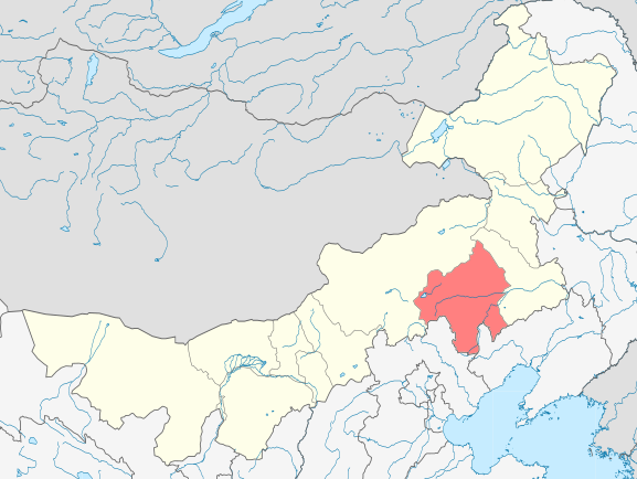
There is no reason for the inner mongolai to be that high dev, outperforming major agricultural and urban centres. If it was certain areas in inner Mongolai: Sure, but it is the entirety of inner Mongolia that is high dev. The area around Hulun Buir is barely populated. There is no major agriculture going on either, given its climate.
Which I rebuffed by showing you that
1. Development on the map shows that "the entirety of inner Mongolia that is high dev" is false
2. Hulun Buir is indeed low dev on the map, so your rant makes no sense
And since when is Chifeng bordering the Gobi desert?
First, your argument was, specifically, "So why is the area around the Gobi desert green/yellow?"
Second, it literally is located around the Gobi:
577px-Location_of_Chifeng_Prefecture_within_Inner_Mongolia_%28China%29.svg.png

753px-GobiTaklamakanMap.jpg

If you have a different definition of Gobi, (which I doubt since you literally linked this wiki page) you should've provided it.

And mind you I am not saying historic China should be low dev. I am saying:

If dev follows population, then there is inconsistency.

If dev is suppose to reflect agriculture, then there is inconsistency.

If dev is suppose to reflect monetary circulation, then there is inconsistency.

If dev is suppose to reflect human activity, then there is inconsistency.

Inconsistency not in China (might be as well, but not my point), but around the globe.
Ok then you should've said this from the beginning, instead of complaining about
Take Sarai as an example and compare it to some no name places around/in the Gobi desert.
And specifically complaining about Hulun Buir
 
  • 3
  • 1
Reactions:
I assume that the differently shaded ares in the commoners language are different languages. For Example with German: Low German, Low Franconian, Middle German, Upper German. If that's the case: very well done. I like it.
But I think that the eastern Netherlands should be speaking Low German instead of Low Franconian. So basically the ares that are culturally Westphalian. To this day there are still around 2 Million Dutch people speaking Low German. So to me it would make more sense for the Northeastern Netherlands to be Low German instead of Low Franconian.
 
I literally responded to your arguments. You claimed that, specifically,

And

Which I rebuffed by showing you that
1. Development on the map shows that "the entirety of inner Mongolia that is high dev" is false
2. Hulun Buir is indeed low dev on the map, so your rant makes no sense

First, your argument was, specifically, "So why is the area around the Gobi desert green/yellow?"
Second, it literally is located around the Gobi:
577px-Location_of_Chifeng_Prefecture_within_Inner_Mongolia_%28China%29.svg.png

753px-GobiTaklamakanMap.jpg

If you have a different definition of Gobi, (which I doubt since you literally linked this wiki page) you should've provided it.


Ok then you should've said this from the beginning, instead of complaining about

And specifically complaining about Hulun Buir
Just stop. You are literally just arguing for the sake of argument. My point was from the very begining clear: Inconsistencies of the development distribution compared to other areas of the world, such as Sarai and parts of China.

Yes Hulun Buir is not high dev, but Xilin Gol is, Zamyn-Üud is, Khangi is, Gashuun is, Bayan Nur is, Wuhai is, Ordos is, Hohot is, Ulanqab is, Chiefeng is. So how about we stop this "bUt tEcHnIcAlY yOu ArE wRoNg!" kindergarten, grow up and understand that my point is not the dev distribution of inner mongolia, but of inner mongolia compared to other urban areas within the development definition, the developers provided so far?

It is really not hard to understand my comment within the context it started. If you cant do that much, then dont start pointless irrelevant discussions, that clearly go over your head.

I even (and I did that deliberately) told you that we might as well take the syrian desert as another example in order to point out that my issue is not the dev distribution itself [of China], but the dev distribution in relation to other areas. I dont care about China in particular. I care about the global, inconsistent development distribution:

Bild_2025-01-07_194648122.png

Final Edit:

Just to point out the insanity of the discussion here, you are pointlessly kicking of: According to the devs, the development mapmode shows the agricultural performance of a region. The vast majority of inner mongolia is as much, if not higher dev than northern Italy. You think that is an accurate depiction of the development mapmode? And again: rural areas in Anatolia with 4-5 times the population of literal desert regions in Syira (east of Raqqa) are less developed. There is simply no consistency.

Again Sarai is appearently less developed, but Prag with not even half the population is somehow equal to inner mongolia. Like do you want to talk about the apparent issue screaming at the phase of everyone capable of using 2 brain cells or are we going to discuss how some parts of inner mongolia are "aCtUaLly nOt hIgH dEv!"?
 
Last edited:
  • 2
  • 1Like
Reactions:
Just stop. You are literally just arguing for the sake of argument. My point was from the very begining clear: Inconsistencies of the development distribution compared to other areas of the world, such as Sarai and parts of China.

Yes Hulun Buir is not high dev, but Xilin Gol is, Zamyn-Üud is, Khangi is, Gashuun is, Bayan Nur is, Wuhai is, Ordos is, Hohot is, Ulanqab is, Chiefeng is. So how about we stop this "bUt tEcHnIcAlY yOu ArE wRoNg!" kindergarten, grow up and understand that my point is not the dev distribution of inner mongolia, but of inner mongolia compared to other urban areas within the development definition, the developers provided so far?

It is really not hard to understand my comment within the context it started. If you cant do that much, then dont start pointless irrelevant discussions, that clearly go over your head.

I even (and I did that deliberately) told you that we might as well take the syrian desert as another example in order to point out that my issue is not the dev distribution itself [of China], but the dev distribution in relation to other areas. I dont care about China in particular. I care about the global, inconsistent development distribution:

View attachment 1240791
Final Edit:

Just to point out the insanity of the discussion here, you are pointlessly kicking of: According to the devs, the development mapmode shows the agricultural performance of a region. The vast majority of inner mongolia is as much, if not higher dev than northern Italy. You think that is an accurate depiction of the development mapmode? And again: rural areas in Anatolia with 4-5 times the population of literal desert regions in Syira (east of Raqqa) are less developed. There is simply no consistency.

Again Sarai is appearently less developed, but Prag with not even half the population is somehow equal to inner mongolia. Like do you want to talk about the apparent issue screaming at the phase of everyone capable of using 2 brain cells or are we going to discuss how some parts of inner mongolia are "aCtUaLly nOt hIgH dEv!"?
Got it, you've moved your goal post so far that you want me to stop talking about what you originally said
 
  • 4
  • 1
Reactions:
Actually, it wasn't so much the power of Mother Nature, as it was the incompetence of the people of Flanders. By building dikes to protect the agricultural lands in the early 1400's, they messed up the power of the tides causing sandbars all over the Zwin. Then they threw a lot of money at it and tried closing a gap near Cadzand, but it actually made things worse. It wasn't until 1566 that a canal was finished to fix these problems, but by then it was way too late. Traders had already moved to Antwerp and worse, the 80 Years war was about to kick off.

It may be too much for the base game, but I'm hoping a future Low Lands DLC will give the player some alt history choices to save the trade in Bruges.

Regarding the map, has it been confirmed it's 100% static? No events/decisions/missions/whatever it's going to be called that will increase or decrease the level? Either way, at the 1337 start date, it should be an A+ harbor location.
Dordrecht had the same problem with natural silting that was exaggerated by human actions, but this was the luck of Rotterdam within the same TT location. That didn't happen for Bruges and that TT location. My opinion is that to represent this correctly this location should not be a natural harbor (unless we are getting a non static map so natural harbors can appear, disappear and change value) but rely on investment in development to remain the dominant trade port within this market.
 
Don't forget that Sluis is also included in the location, and that Bruges' connection to Sluis was still maintained even after the 1500s. The sanding of the Zwin was actively being combated by 2 dedicated dredging ships ever since 1400s (one of them appropriately called 'the Mole'), and evolved more into a man-made canal rather than a true inlet.

Dredging became less and less of a priority during the Burgundian Sucession war of the 1480s, when the Zwin suffered a 10-year long Blockade. Bruges kept its sea connection however through the canalised version. The transfer of Sluis to the Dutch Republic in the late 16th century was the final nail in the coffin for Bruges.

So is Bruges a natural harbor post 1500s? No, to that I fully agree. But for the sake of the first 150 years of gameplay and massive relevance of Bruges at game start it should get a mid to low tier natural harbor instead of none, imo.
That is a can of worms I do not want to get opened, because Sluis is just a costal location and not really a natural harbor sot hat would result in 90% of all other coastal locations also to become 'natural' harbors. My opinion really is that to represent the Bruges location harbor situation correctly in PC this should be represented by development and the investment in harbor development should determine if it stays the dominant location within that market.
 
  • 1
Reactions:
I don't have enough knowledge on these languages to judge whether they should be split (though from what little I know I'm under the impression Italian-Cisalpine and Czechoslovak and Polish during that time shouldn't be split).
Cisalpine had way too much Gaelic influence to be lumped in with Italian.
Early 14th century Czechoslovak and Polish were already pretty distinct. More distinct than High and Low German.

I think languages should be split based on how people at the time thought of these languages, and whether they had to learn the other language when already fluent in a related vernacular - for example Charles V (who grew up in flanders) usually is referred to having been fluent in german (i once read him being fluent in "the german and french languages". which is a good example of how the people at the time thought of these languages - a family of vernaculars), not high german and dutch seperately.
Well, that's not how "people" thought about the languages; that's how aristocrats thought about them. This is the Court Languages map.
Kings weren't learning peasant languages.
 
  • 1
Reactions:
Well, that's not how "people" thought about the languages; that's how aristocrats thought about them. This is the Court Languages map.
Kings weren't learning peasant languages.
That's quite a sweeping statement. Certainly there were instances where aristocracy would speak a different native language than the local peasantry, but that's by no means the rule.
At least in the late medieval/early modern period, speaking the local vernacular at court was the norm in western Europe - which is why rulers like Charles V had to be so multilingual. Some examples out that time period: Charles V was criticised by local nobles for taking so long to learn castillian, and aragonese nobles complained about having to speak castillian because the king did not understand them. His brother Ferdinand I (who grew up in spain) in turn had his difficulties with having to learn german.
It's also during this time when documents started being written in their respective local languages, which serve as good examples of the dialect of the various regions at the time, and there is no reason to believe that the german in use by the local nobility or burghers was a different german than that of the peasantry.
Just from my region: we have city rights given by the nobility, and even some from the emperor, court documents by the local city burghers, and church records from the village priests - the german of the region of the early modern period is pretty well documented that way, and it was in use by all different social classes.
 
  • 2
  • 1Like
  • 1
Reactions:
The US states look extremely out of place in the whole world areas map mode. Even as someone who likes them in, I have to say they look too out of place and should be replaced with more natural areas.
 
  • 11
  • 1Like
Reactions:
The US states look extremely out of place in the whole world areas map mode. Even as someone who likes them in, I have to say they look too out of place and should be replaced with more natural areas.
Yes, the artificial straight boundary of the United States should appear on the ideal city of Stellaris on Earth, not on Turtle Island in 1337.(We are of the same age, which makes me feel a bit excited)
 
  • 1Like
Reactions: