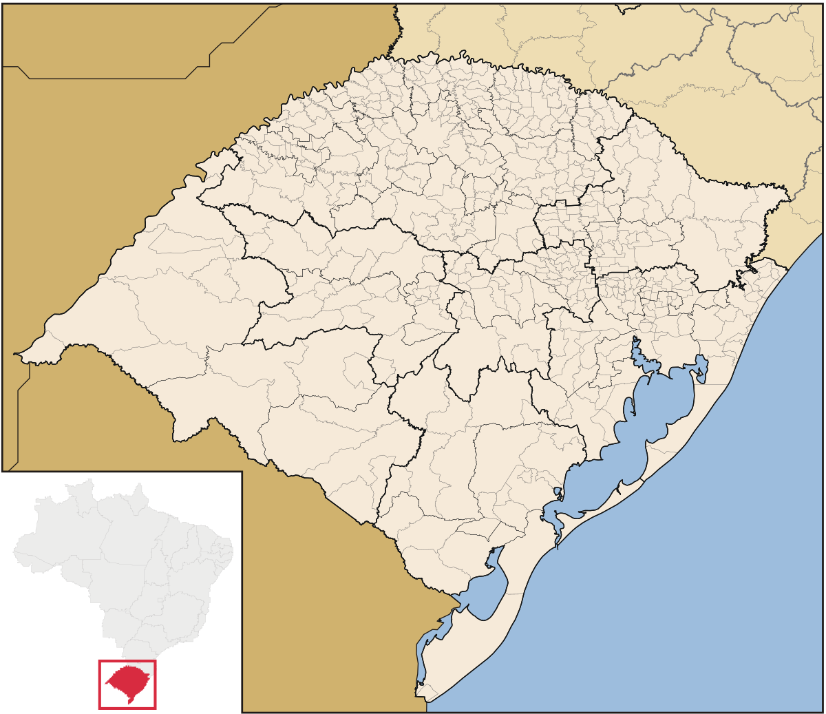
- e2: [Porto dos Patos, Laguna dos Patos, Patos, Laguna, Tubarão, Tuba-nharô]: this general region was called Porto dos Patos in the XVII century. The early name of the lagoon is Laguna dos Patos. This naming is, however, VERY confusing, as today the huge lagoon in Rio Grande do Sul (to the south) is called Lagoa(or Laguna) dos Patos. I would recommend the name Laguna. In this region in the early XVII century, the jesuits mentioned a native ruler called Tubarão that raided, enslaved and sold other natives. This name continues today to the river that divides it with e1 location, so this name is also appropriate.It is unclear to me if the river is named after the ruler, but it seems the opposite. Apparently, this name in Tupi-Guarani is something like "Tuba-nharô". Could have a connection to the west, as it was the (first) new path made by Cristovão Pereira de Abreu around 1730.
Harbor: Good harbor due to being a lagoon entrance
RGO: ???
Climate: Subtropical (Cfa)
Vegetation: Forest (Mata atlântica)
Topograhy: Flatland
Frontier:
south: the Tubarão river
east: coast
west: the highlands
north: not sure
- e1: [Ararangua, Campinas do Sul]:
Nothing to say.
Harbor: Not notable. Some harbor in the Ararangua river.
RGO: maybe Coal (not historically accurate, but geologically correct)
Climate: Subtropical (Cfa)
Vegetation: Forest (Mata atlântica)
Topograhy: Flatland
Frontier:
south: the Mampituba river
east: coast
west: the highlands
north: the Tubarão river
- 1: [Santo Antônio da Patrulha, Conceição do Arroio]:
In 1737 a garrison was created in the location of today Santo Antônio da Patrulha, at the time part of Viamão. I served as a toll in the recently opened road to São Paulo. Conceição do Arroio is the original name of today Osório.
Harbor: Not notable. Some harbor in the Tramandaí river.
RGO: ???
Climate: Subtropical (Cfa)
Vegetation: Quite varied, near the shore is more grasslands but it changes to Forest (Mata atlântica) far from the coast, with a transition with small sized trees and bushes. I would propose Forest for this location because it contains large parts far form the coast.
Topograhy: Flatland, but an argument can be made to marsh, as it has large marshy areas near the coast and between the numerous lakes.
Frontier:
south: division between Mostardas and Palmares do Sul
east: coast
west: extension of the mountain range line, basically the division between the micro-regions of Osório and Porto Alegre.
north: the Mampituba river
- 2: [Mustardas, Mostardas]:
Populated around 1770s by azoreans couples. Could be separated in two as in the preposition of POD012
Well, I could not keep myself from doing this, alas...
My last feedback post covered a lot of things, but it didn't really touch on locations too deeply. I have felt compelled to do so. As a preamble, I'd like to think of my suggestions here as regional and ancillary - Braziler and FleetingRain both are far more thorough in their offered maps, and I do quite like them. The impetus for this proposal was - chiefly - overeagerness, but also the intent to offer some dynamic location names and my own take on the southern states.
These maps are freehanded and quite messy, which is why I do not suggest relying on them aesthetically or for strict borders too much. Consider them semi-vibes-based maps.
LOCATIONS:
View attachment 1234897
Locations presented in Portuguese or Spanish - Some do have proposals for native names, even if only by taking the name of a nearby river.
The main considerations for locations were:
1. Did it exist as a settlement pre-1836? Bonus points if as a vila or seat of a município; (I did cheat a bit here with some of them)
2. Failing that, is it a river or other geographical descriptor that works?
I also wanted to work on the wastelands a bit. The Serra do Mar could not be ignored as the most obvious physical barrier from the coast. The Serra da Esperança (near Guarapuava) and the Serra do Espigão (in Santa Catarina) are far more fanciful and probably don't warrant being wastelands, though this depends on the approach taken for the rest of the country.
The province proposals are loose, as well, and here's a map with their names:
View attachment 1234899
No proposals for areas, really.
Which conveniently lets me lead into discussing my choices on a per-province basis!
N.B.: For the native name suggestions, multiple spellings may be offered. Your standards for tupi and guarani are unclear in the current map, so go for what you end up going for.
1. Rio Grande:
Roughly based on the original municipality of Rio Grande, and also somewhat resembling the littoral hyrdrographic region of the state. Easily hispanicised as Río Grande, but harder to pin down a native name for. The Cabaquã - or Icabaquã - river might work, though the spelling may have to be adequated, and the location also named after that river isn't part of this province in this proposal.
For the Locations:
- Rio Grande - The first capital of the captaincy/province, if one feels like being long it could be called "Rio Grande de São Pedro". Was a major colonial port, and should be quite a decent harbour as it sits at the estuary of the Lagoa dos Patos, though the sandy, wetland terrain detracts some points, I think.
- São José do Norte - A town at the end of the big, long, sandy peninsula of the Lagoa dos Patos. Despite a theoretically advantageous position, it was outcompeted by it's neighbour due to being at the end of a sandy, floody peninsula. Averages out to meh, in my opinion, but it might just be a bad harbour.
- Pelotas - Despite it's name, not next to the Pelotas river. Includes the river and location of the town of Piratini, which is at least a native-originated name - Piratinin, I should note, is an antiquated spelling. Piratiní, in castillian, if you'd like to take that. I think it should be a wetland, if only due to personal experience. Unremarkable coastline, so unremarkable harbour.
- Jaguarão - Named more for the river rather than the town. Yaguarón in castillian. A literal translation for a tupian name might be Jaguaraçu/Îagûarassu, though guarani would be more like Jaguara-guaçú - literally "big jaguar" in all cases. Might warrant being a wetland, too.
- Bagé - Technically officially mispelled. Name generally held to come from Ybajé, though this is dubious, and it may come from the charruan word baag, instead.
- Canguçu - A river and a town, which is to be the theme, really. Caaguaçu in guarani, give or take the spelling - I'm not sure what the standard would be. Meh port.
2. Campanha:
Started based on the original municipality of Rio Pardo, though it had half of that territory chopped off for two other provinces, more or less. Here, it takes up most of the brazilian pampa, and is consequently quite a good place for livestock - though it probably shouldn't have any at game start - and I'd also argue for at least having one horse-producing potential location, if that's in the cards. Coincides most with the Ibicuí's basin, for possible non-portuguese names - though maybe as Ybyku'y
. In that vein, the castillian could be Ibicuy, though Campaña would be the translation of the portuguese name.
- Sant'Ana do Livramento - officially spelled like that. Border town right next to uruguayan Rivera.
- Rio Pardo - One of the first four municipalities of the province of Rio Grande de São Pedro. Includes site of the San Joaquín reduction, which might serve as a name in castillian.
- São Gabriel - I'd go for the Vacacaí river for a native name, as you already have.
- Santa Maria - No notes.
- Alegrete - Take the river Ibirapuitã for tupi-guarani - Y'mbîra'pîtã (?).
- Uruguaiana - Another border town - Uruguayana in castillian, and the river Quaraí offers a possible native name - Quarahy/Kûara'y (?).
- Itaqui - Or Itaquí in castillian. This one can also be Ibicuí/Ibicuhy/Ybyku'y (?), like the province.
3. Missiones Orientales:
The land of the reductions - the seven famous ones, at least. Unsurprisingly, that means the portuguese would be
Sete Povos das Missões, whilst the Ijuí/Ijuhy river offers a convenient option for a native name. Only four of the seven made my cut.
- San Borje - Or São Borja, in portuguese.
- San Nicolás - Or São Nicolau, in portuguese. Perhaps Ijuí/Ijuhy, for a native name.
- San Miguel - the one with the cool ruins. São Miguel, in Portuguese.
- San Ángel - Santo Ângelo.
4. Porto dos Casais:
Based off of the two 1809 municipalities of Porto Alegre and Santo Antônio da Patrulha. Also half-lines up with the Guaíba's basin.
- Porto dos Casais - Right, this is Porto Alegre, but it was known by this name during most of the colonial period. Unsurprisingly, the river/lake/lagoon/water thing Guaíba's estuary is a damn good place for a port. Although it requires significant work for modern day ships to keep transiting into the lagoon, this was less of a concern back then. It's suboptimal position for a commercial port in an underpopulated region that traded it's goods primarily overland to the rest of the colony limited it's growth a fair bit, but it should still be a pretty damn good natural harbour.
- Viamão - A neighbouring town to Porto Alegre. It was the transitionary capital between Rio Grande and Porto dos Casais and is also older than PA, which is why it's even here. Definitely livestock, when that comes in. Allegedly, the name comes from "ibiamon", though there's controversy. A better native name may thus be simply taking lake Capivari's for it. Although the Lagoa dos Casados may at first glance look like a decent harbour, it's far sandier, shallower, and siltier than it's immediately neighbouring Guaíba, so it's never been really used for that. I'd argue it doesn't really make for much of a natural harbour, consequently, though a bit is fine.
- Guaíba - Both a (far later) town, and the body of water. It's side wasn't historically used much for port things, but I don't see why it couldn't still be a decent natural harbour. The coastal stretch from the river Jacuí - about the northern edge of this location - down to around Pelotas saw much cattle ranching and little else throughout the game's period. The name should actually fit for portuguese, castillian, and guarani, though one might still go for a spelling like Guahyba for guarani, or something.
- Camaquã - Another town named after a river. Meh harbour. Might go by the name of the Icabaquã river for guarani.
- Caí - Named after the river. A later period might make this Caxias do Sul or something else, but for this I think it fits. Even if you'd rather take a settlement's name for it in portuguese or castillian, Ka'y should remain an adequate pick for guarani at least.
- Mostardas - Possibly named after mustard, yeah. Existed as a military outpost, at least. Awful harbour, as it's utterly unprotected and very sandy either side of the peninsula. Might have potential for rice.
- Conceição do Arroio - Modern Osório. Might fit as Santo Antônio da Patrulha, if you stretch it a bit west and want all four original municipalities of the state named on the map. Regardless, might be named after the Tramandaí/Tramandahy river in guarani, and it does include the small estuary of that river, for what it's worth as a harbour.
5. Planalto Gaúcho:
Composed of the southern reaches of the brazilian highlands - though, really, it shares the riograndense part of it with the Missiones Orientales. More livestock, probably. It's remarkable how much cow and sheep people felt like having on this land - mind, the sheep more for the meat than the wool, though some RGOs of wool might not be amiss still. Awkward to pick alternative names for, unfortunately.
- Passo Fundo - Remember how I said a cheated a little with some of these? Passo fundo definitely existed as a link on the south-to-north trading of cattle, though it really wouldn't come into it's own until the mid-1800s. Unfortunately, there just isn't much else to go off of in that corner of the state in the period, and Passo Fundo is recognisable. For a native kaingang name, at least, one could be cheeky and use Erechim - as Rêsĩ - for it. The town certainly wasn't originally native or anything, but the direct translation as "small field" doesn't strike me as out of place.
- Jacuí - As usual, the river rather than the town named after it. Yacuí in castillian. Jacuhy/Îaku'y in tupi.
- Taquari - Another river. Ta'kwar'y (?) in tupi.
- Campos de Vacaria - Not Vacaria itself - which would've existed as a little settlement - but the fields around it. Very much cattle-rearing places. Campos de Cima da Serra might be more fitting, but is longer. Known to the spanish as Vaquería de los Pinares.
- Apuaê (misspelled as "Apunhaê" on the map, my bad) - Yet another river. Also known as the Ligeiro river.
View attachment 1235428
The four original municipalities of RS defined in 1809.
View attachment 1235728
Rivers and basins of RS.
View attachment 1235733
1751 map with settlements, chapels, forts and native groups.
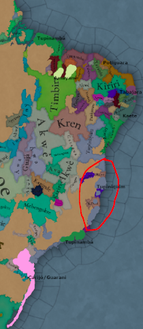
I'd offer a map of indigenous peoples, but you seem to have your sources very straight there and there really don't seem to be any particularly useful or detailed ones, either
6. Planalto Catarinense:
The highlands of Santa Catarina, now. This is really a state that sees next to no inland settlement in the period, so several rivers were appealed to. Here we run into Jê peoples more, and figuring out names became trickier - the tupi-guarani toponyms are generally better preserved and easier to find. As a show of hands, I've relied on a
1938 work on Kaingang toponyms and have attempted to adapt their spelling
with an ortography guide or
two. I'll readily admit this is rather slap-dash and that I can't claim they are fully reliable or properly spelled, but I didn't want to have nothing to propose. For the Xokleng, I'm afraid I just truly don't have anything. Again, my linguistic chops are not great, and I'd urge a search for better sources.
- Lages - An important inland city and, like many others, founded due to the tropeiros. The Serra do Mar is called Krinjijimbé in Kaingang, which might serve as an option of last resort for a dynamic name here or for other locations that include it. That spelling is almost certainly portuguesified, however. As as stretch, Urubysy - from, well, Urubici - might work for tupi, though it's a separate town. Edit: It may make sense to have a corridor between Araranguá and Lages.
- Curitibanos - You'll never guess where the guy who named this city came from.
- Canoas - The river, to be clear. Speaking of rivers, the Uruguay river starts roughly in this location, so it could use the Kaingang name for that river - Ngoi-ên.
- Rio do Peixe - Another river, though fully presented as such so people don't giggle at the proud location of "Fish" as much. The Kaingang name is known for this one - Ngoi-kupri.
7. Santa Catarina:
Nothing much fancy to note on this one.
- Desterro - The cool, old name of Florianópolis. Also stands in for the non-island settlements that eventually were absorbed into Greater Floripa. The island of Santa Catarina - where the city started - was apparently called Meiembipe by the local Carijós. The island offers a bay, justifying a decent natural harbour score, I'd say. Oh, and island - it's quite close to the shore and has been bridged to thoroughly, but it'd be nice for the island to not be connected to the continent on the map.
- Laguna - One of the oldest settlements in southern Brazil, and by far the most important city with the most significant reduction in importance in this proposal. From it, settlers and explorers would found many other settlements, - especially in Rio Grande do Sul - but it's mostly just a quaint, small historical coastal city these days, even if it's a really nice place to live in. It sits by a small lagoon, surrounded by hills - a geographical condition which justifies a good harbour score, in my opinion. The river Tubarão flows into the lagoon and was named Tubá-nharô by the local guarani, which could serve as a name for the location. The actual city of Tubarão, though extant as a settlement during the period, wouldn't be of much note at all 'til after the game ends.
- Araranguá - River and settlement, once more. Meh harbour. The settlement itself was called Campinas do Sul during the period. For a native dynamic name, it might be spelled as A'rarãguá, and probably a half dozen other ways.
8. Vale do Itajaí:
The valley for the river Itajaí, it represents a relatively accesible range of the Serra do Mar, though it only really saw inland settling in the 1800s. Just Itajaí/Itajahy/Itaîa'y, or maybe Tajahy/Taîa'y might work for a native name. The etymology of the name is not entirely clear.
- Itajaí - The settlement, this time. Similar deal to the province in regards to naming - I recommend being consistent with it, regardless of ortographic standard choice. The city is (originally) on the southern bank of the Itajaí-Açu's mouth. That should justify some harbour score, at least.
- São Francisco - Another old coastal city. It sits on the northern bit of the homonymous barely-island, facing the Babitonga Bay, the largest navigable bay of the state. That both should give it some Good Harbour Points™, and offers a possible native name, give or take the spelling as usual. A later period game might just call this location Joinville instead, for the curious.
- Itajaí-Açú - The river. Depending on how you'd rather translate Itajaí it may come out as Itajaí-Açú/Taîa'y'assu/Itaîa'ygûasu, though that wouldn't really fit the Xokleng or Kaingang. Blumenau is probably the most notable city that'd emerge in this location later.
- Canoinhas - The little Canoas river. For a Kaingang name at least, one might take the Iguaçú river, as the location is largely in it's drainage basin, as the base. That'd turn out as Ngoi-kovó, probably. Many other locations throughout the course of the river could justifiably take that name, however.
View attachment 1235920
1872 municipality map of SC. They're coloured by what municipality they were dismembered from/were originally part of, to be clear. I believe Joinville is about the only settlement here that wouldn't already exist by 1837.
View attachment 1235919
Rivers and basins of SC.
9. Paranaguá:
Representing the littoral of Paraná . The bay and city's name comes from Paranãguá/Paranãkûá -
"Sea Cove". An important locus of settlement in southern Brazil.
- Paranaguá - The city itself, as well as the fellow coastal town of Antonina, also on the cove. The naming is covered, and I hope the harbour suitability is obvious enough - it's a large bay, surrounded by hills and site of one of the largest ports in the country these days. The port would see some growth as a center for processing and shipping off gold during the time that was big around Curitiba, and would later grow with the state as the obvious exit point for products.
- Guaratuba - Another early coastal settlement. Though known mostly for the beaches these days, it does have a port and was settled on a small bay, for what that's worth. Guarátyba in guarani, I think.
- Morretes - Squeezed in there, but it's the main town on the historical route to Curitiba, which I found noteworthy enough to include it. A single-location passage between the coast and Curitiba through the Serra must be preserved regardless of it's inclusion, in my opinion. Early littoral gold mining could be represented here, though it'd be fair enough to just have the one location in Curitiba for gold if you believe it'd be too much.
10. Curitiba:
Roughly equivalent to the first plateau of Paraná in extension, this is was the main inland region of the state to see settlement in the period, primarily due to gold mining. Curitiba's name is probably from the guarani Kuri'ytyba.
- Curitiba - The city of pines itself. This was easily the most bemusing of the wastelanded locations in the south, given it's importance. As I've already noted, I believe it should be a gold-producing location. The native name is already covered.
- Arraial Queimado - Early name of the settlement that'd give rise to Bocaiúva do Sul. Something of a people-sparse corner of the state even today. Though definitely a stretch, Bocaiúva comes from the tupi mokaie'yba, and is also the name of a palm.
- Castro - Another tropeiro town. The region of the city is said to have been inhabited by guarapiaba tupis, so there's something of a possible name there.
- Vila Nova do Príncipe (somehow misspelled as "Vale Novo" do Príncipe on the map, dear lord) - This is the modern city of Lapa, though it wouldn't get that name during the game's period. A notable center of mate harvesting during the period, and yet another tropeiro pitstop.
11. Ponta Grossa:
Congruent with the second plateau, and an area of sparser interest during the period. Still, there are some settlements around, though this really is about as far as it got before the 1800s. It also covers the paranaense Campos Gerais, if naming the province after a city bothers you.
- Ponta Grossa - The Princess of the Fields and a city with a real funny name to people not from it. Like most inland cities in the region, I'm sure you can guess who's to blame for it starting - tropeiros.
- Tibagi - Another river-settlement name situation, Tibagi is interesting due to diamond mining - so, I'd argue for gems as the goods here. Tibajy/Tybaî'y in tupi-guarani, I think. The river by this name is known as Venh Róg to the Kaingang. The river's banks were also the site of a massacre (PT).
- Jaguariaíva - Again, the river and the town. Jaguaryahiba/Îagûar'yaíba in tupi.
- Palmeira - Capão da Palmeira, after the tropeiro cow-stop, may be more appropriate, given the town hardly saw itself reach the rank of vila 'til 1870.
- Villa Rica del Espíritu Santo - here named after the incipient spanish settlement. Just Vila Rica may work for portuguese, though the actual municipality that now sits over it's ruins is, fittingly enough, Fênix.
12. Paranapanema:
Named after the river between São Paulo and Paraná, this one was a pain to find things for, so I appealed to jesuit reductions. I cannot stress how little people cared about this bit of country until the coffee boom. The "Great, Useless/Unlucky River" truly is a fitting name, given how troubling it was to find locations for it.
- San José - Jesuit reduction. Maybe just call it Paranapanema if not in the hands of the perfidious spaniards?

- Nuestra Señora de Loreto - This one's name is quite fun, at least. Closest to Londrina, for modern cities.
- Jesus Maria - Another one. Closest to Maringá, I believe.
13. Guayrá:
Named after the spanish colonial territory, it contains the western edge of the state, closely tied to the Paraná river itself. In portuguese, it'd be Guaíra, and the spelling of Guahyrá might serve for a native term depending on the standard you use. Otherwise, Paranã - the possible original term for the river in guarani - may well work. Much of this side of the state would've seen plenty of
mate harvesting,
*wink, wink, nudge, nudge*.
- Guayrá - Which is to say, the Ciudad Real del Guayrá, - what a name! - the capital settlement of the governorate. Like most of the things in the territory, it was somewhat destroyed by bandeirantes during the Iberian Union, and it's exact location is unclear. As presented, it overlaps with modern Guaíra and, although that city is not named after this city, they share a spelling and that works as a period name for a location otherwise not really touched by the portuguese or brazilians with constructive intent at that time.
- Ivaí - This time especially not the town, - it'd be way over next to Guarapuava! - but rather the river that enters the big Paraná at that location. The modern city of Umuarama is in there, too, though just the river name works. You've got your pick of castillianifications, - Ibahy/Ybahy/Huybay - with the spelling of Yva'y probably fitting for guarani.
- Ontiveros - Another spanish settlement of unclear position, but it could've been there and is a name to give to a place. For portuguese, just Iguaçu would work, though Foz do Iguaçu, whilst also a later settlement from an imperial military colony, is also a delightfully descriptive term for what that river does at that place. This, of any Brazilian location, feels the most deserving for getting named after that river. Ngoi-kovó in Kaingang again, and Ygûasu in tupi-guarani.
- Santa Maria - another jesuit reduction. Bit of a space-filler, I'll admit - the most notable modern feature of that location is the Iguaçu national park.
14. Campos de Guarapuava:
We're getting to the end. The most notable settlement here is the one that lends it's name to the province, though it barely existed in the time frame. At the start of the 1800s a whole campaign was launched to pacify the region, and it became a receptacle for
degredados in a bid to quickly colonise and get a hold of the place. Predominantly inhabited by the Kaingang. Those people, incidentally, called these lands Koranmbângrê, while the Língua Geral
Agûarápuaba could also serve for tupi and guarani.
- Guarapuava - The only real settlement here. Similar names from the province as a whole may be used.
- Piquiri - A river, once more. Pikyr'y, in tupi. The Kaingang territories west of Guarapuava were called Nerinhé - almost certainly portuguesified, again - which may work as a dynamic name here with some work.
- Campos do Mourão - Not Campo Mourão the city, though the name there is very much related. Term used for the region before it was really settled.
15. Campos de Palmas:
In a very similar spirit to the previous province, this is an undersettled inland territory during the period, this time south of the Iguaçu. Takes territory that was once contested between the modern states of Santa Catarina and Paraná. The Kaingang called these fields Kreiembângrê.
- Palmas - Another late settlement, but the name fit well enough. Like the province, Kreiembângrê should work.
- Chopim - As in the river. The name may have come from the Kaingang Sopĩ.
- Chapecó - Again, the river, although the city would be in the location there too. The name of the river is known to be from Kaingang, though I could annoyingly not locate a proper spelling of it - it might be Esapekó, or something like it, but I'm not sure. The settlement itself, though anachronistic, started from the military colony of Xanxerê, which is also from Kaingang - as Sãsãrê - and may be an alternative.
- Peperi-Guaçu - A river in western Santa Catarina, known in castillian as Peperí Guazú. Includes what would be the city of Campo Erê, a field the Kaingang called Kempe-rê.
View attachment 1236027
The three plateaus, Serra do Mar, and coastal plains of Paraná.
View attachment 1236034
1876 map of the province. Yeah, it's a little wonky.
View attachment 1236036
Rivers and basins of PR.
That's all.
I hope it helps!
.
Harbor: Not notable.
RGO: ???
Climate: Subtropical (Cfa)
Vegetation: Same situation as Location 1. For this location I propose grasslands because it is much nearer the coast.
Topograhy: Flatland. Similar to 1.
Frontier:
south: Channel to the Patos Lagoon
east: coast
west: Patos Lagoon
north: division between Mostardas and Palmares do Sul
- 3: [Rio Grande de São Pedro, Rio Grande]:
The fort was founded in 1737.
Harbor: Rather good. The biggest harbor and shipyard in today Rio Grande do Sul. It is the mouth to the Patos Lagoon (the name Rio Grande (big river) is from mistaking the lagoon for a river).
RGO: Maybe sea-related?
Climate: Subtropical (Cfa)
Vegetation: Same situation as Location 1 and 2. For this location I propose grasslands because it is much nearer the coast.
Topograhy: Flatland. Similar to 1 and 2.
Frontier:
south: Channel to the Patos Lagoon
east: coast
west: Lake Mirim and São Gonçalo Chanel
north: Channel to the Patos Lagoon
- 4: [Bom Jesus, Santa Vitória]:
Late colonization, but a toll called Santa Vitória was established here in 1770 in the major cattle road that passed through.
RGO: ???
Climate: Oceanic (Cfb)
Vegetation: Grassland or even Sparse. However, as noted in [3], the temperature and precipitation should allow forests. In [6] it is mentioned that this vegetation is affected by human practices, manly cleansing with fire.
Topography: Plateau or flatland. Height ranges from 900m to 1200m (I eyeballed from a map) and is very flat. I ended up deciding that it this is not high enough to be a plateau.
Frontier:
south: Antas river(further down named Taquari river)
east: canyons/mountain range
west: division between Bom Jesus and Vacaria
north: Pelotas river
- 5: [São Francisco de Paula]:
Late colonization. Nothing to note other than the major cattle road that passed through. Virtually is equal to the municipality of São Francico de Paula
RGO: ???
Climate: Oceanic (Cfb)
Vegetation: Grassland. Similar to location 4.
Topography: Plateau or flatland. Similar to location 4, but has more oscillations in the south and west. An argument weak can be made to hills. I ended up deciding that it this is not high enough to be a plateau.
Frontier:
south: Southern end of São Francisco de Paula municipality
east: "mountain" range
west: division between São Francisco de Paula and Caxias do Sul
north: Antas river(further down named Taquari river)
- 6: [Porto dos Casais, Viamão, Porto do Dorneles, Porto D’Ornelas, Porto Alegre]:
Main region of the Campos de Viamão. Seat of power since 1763. Porto dos Casais is today Porto Alegre. The names Porto do Dorneles and Porto D’Ornelas are from the name of Jerônimo de Ornelas, an early colonizer around 1730s/40s, but was changed to Porto dos Casais around late 1750s with the arival of azoreans couples. The city of today Porto Alegre was officially created from Viamão in 1772 as São Francisco do Porto dos Casais(or São Francisco dos Casais), and a year later was renamed to Nossa Senhora Madre de Deus de Porto Alegre. Both Viamão and Porto dos Casais are important names in history, it would be nice to have both. I propose to call the location "Porto dos casais" as it was the name associated to the later proper city and "Campos de Viamão" the name of the Province, as it was a vague name of the region. Funny enougth, the name "Porto dos casais" was, apparently, official only for a year and existed unofficially only for two decades, but is very known as the old name of the city.
RGO: ???
Climate: Subtropical (Cfa)
Vegetation: Forest or Grasslands
Topography: Flatland or even Marsh. Very flat and has floodplains in the western half(Porto dos Casais and other cities along the rivers). Even has quite a few rice fields nowaday. (well, based on last year flood, it is definitely marsh). The eastern part (Viamão proper and other cities) is not very marshy. In an ideal world, Viamão would be a flatland location in the east and porto dos casais a marsh in the west.
Frontier:
south: Patos Lagoon
east: extension of the mountain range line, basically the division between the micro-regions of Osório and Porto Alegre.
west: Caí River
north: Southern end of São Francisco de Paula, Três Coroas, Gramado and Nova Petropolis municipalities (vaguely)
- 7: [Triúnfo]:
Early village around 1750s.
RGO: ???
Climate: Subtropical (Cfa)
Vegetation: Forest or Grassland. IBGE shows a transition between Forest(north of location) and Steppe(south and west of location). As the center of the location, and main historical point of colonization is around the Jacuí river, in the forest, I would classify as forest.
Topography: Flatland. Some marshes, but mostly not.
Frontier:
south: Around the southern end of the municipalities of Barra do Ribeiro and Sertão Santana. Very vague
east: Caí river
west: basically, the division between macroregions "Metropolitana de Porto Alegre" and "Centro Oriental Rio-Grandense", west frontier of the current Triunfo municipality. I also kept the line through the Jacuí river. Similar to the old division of the municipalities of Porto Alegre and Rio Pardo back in 1809.
north: division between macroregions "Metropolitana de Porto Alegre" and "Nordeste Rio-Grandense"
north: to the northeast, the southern end of municipality of Carlos Barbosa. To the northwest, the Jacuí river.
- 8: [São João Batista de Camaquã, Camaquã]:
Early village around 1760s.
RGO: ???
Climate: Subtropical (Cfa)
Vegetation: Grassland. Mostly steppe, but has a line of forest cutting through the middle.
Topography: hills or flatland. The east is flat near the lagoon, but the middle and west is part of the formation called Escudo Rio Grandense (Rio Grande's shield). It is a slightly hilly formation that rises to 450/500 meters. Seems weird to call it flat, but it is definitely no more than hills.
Frontier:
south: Camaquã river
east: Lagoon
west: around the municipality of Encruzilhada do Sul
north: south end of location 7, vaguely around the southern end of the municipalities of Barra do Ribeiro and Sertão Santana. north of municipality of Encruzilhada do Sul
- 9: [Pelotas]:
Early village around 1750s/1760s.
RGO: Later (around 1790 to 1830) would become a very rich and symbolic production center of Charque (salted and dried meat)
Climate: Subtropical (Cfa)
Vegetation: grassland. Has a notable region of forest in the center, but it's mainly grassland.
Topography: flatland or hill. Similar to location 8, is largely inside the Escudo Rio Grandense.
Frontier:
south: Paratini river
east: lagoon, Lake Mirim and São Gonçalo Chanel
west: west frontier of the municipality of Piratini
north: Camaquã river
- 10: [Espírito Santo do Cerrito de Jaguarão, Jaguarão, Guarda da Lagoa e do Cerrito]:
Spanish side of treaty of San Ildefonso. City developed around a Spanish military post in the end of XVIII century.
RGO: All of the Pampa could have cattle after the Columbian exchange.
Climate: Subtropical (Cfa)
Vegetation: grasslands. It is the beginning of the Pampa
Topography: Flatland or hills, again. Flatland near the lake, hills more to the northwest, as it is par of the Escudo Rio Grandense.
Frontier:
south: Jaguarão/Yaguarón river (current frontier of Brasil and Uruguay)
east: Lake Mirim and São Gonçalo Chanel
west: The idea is the line of the Madrid treaty, that is defined as the watershed between the rivers that go to the Mirirm/Patos lagoon and that go to the Black and Uruguay river. I took the line of the jaguarão river, that turns north in the direction of Bagé.
north: The idea is the line of the San Ildefonso treaty. Following the Paratini river and than goes to Bagé.
- 11: [Vacaria]:
Late colonization. Named after the Spanish expression "vaquería de los pinares". This was the name given by the jesuits to this highland region and the cattle herd they left/created there. They basically left a lot of cattle on their own far away from the cities and came to take some of it from time to time. Something like a huge open pasture.
RGO: named after a cattle herd of the early 1700s, so should definitely be able to have cattle.
Climate: Oceanic (Cfb)
Vegetation: Grassland. Similar to location 4.
Topography: Plateau or flatland. It is flat and around 1000 meters. I ended up deciding that it this is not high enough to be a plateau.
Frontier:
south: Antas river(further down named Taquari river)
east: division between Bom Jesus and Vacaria
west: west frontier of the municipalities of Pinhal da Serra, Muitos Capões and Ipê. Designed to follow the changes in climate and vegetation.
north: Pelotas river
- 12: [Caxias do Sul]:
Late colonization by Italians in late XIX century. I divided in it's own location due to the topography being a transition from the highlands to the river valleys. Lots of small river valleys and ripples in the terrain.
RGO: Some sort of food to represent the the pines from the Araucaria Forest. It was consumed by natives.
Climate: Oceanic (Cfb)
Vegetation: Forest. The highland's steppes gives place to the Araucaria Forest (a forest named after a notorious pine. Schematic figure in [4])
Topography: hills or even mountains. The highlands here are fragmented with numerous river valleys that are rather deep. From wikipédia about only the Caxias do Sul municipality : "The city's main riverbeds are the Maestra Stream (north-northeast direction), the Biondo Stream (northeast), the Caravaggio Stream (southwest) and the Pinhal Stream (south). This network of valleys has extensive intervals that vary from 50 to 60 km in width. To the south, however, there are small and relatively branched valleys, with reduced intervals that vary from 4 to 5 km in width. The interfluvial spaces of these southern valleys are generally located approximately at the same height as the Caxias plateau, varying between 670 and 790 m in height, while the bottom of the gorges, where red sandstones outcrop, is generally less than 200 m in altitude."
Frontier:
south: with location 6, southern end of São Francisco de Paula, Três Coroas, Gramado and Nova Petropolis municipalities (vaguely). with location 7, southern end of municipality of Carlos Barbosa
east: division between São Francisco de Paula and Caxias do Sul
west: the division between the macroregions of Nordeste Rio-Grandense and Centro Oriental Rio-Grandense. West frontier of Boa Vista do Sul and Coronel Pilar.
north: Antas river(further down named Taquari river)
- 13: [Taquari]:
Yey, my home region. Late colonization. Taquari itself is from azorian colonization around 1750s, but most of the region was colonized by germans in the late XIX century. Apparently a wooden fort was build somewhere next to the river in this region in 1768.
RGO: Some kind of farming is adequate. The region is mainly river valleys that are very fertile. Also, the hymn of Lajeado mentions the extraction of amethyst, although it seems more of a late XIV century thing.
Climate: Subtropical (Cfa)
Vegetation: Forest. Different kind of forest form location 12, but it is forest.
Topography: flatland or maybe hills. The rivers valleys are flat, but in the northern part they are carved from higher formations, creating very inclined topography.
Frontier:
south: Jacuí river
east: with location 12, West frontier of Boa Vista do Sul and Coronel Pilar. with location 7, west frontier of the current Triunfo municipality.
west: vaguely in the west frontier of the municipality of Venâncio Aires. Similar to the west border of the district of Taquari in the 1800s, then part of the municipality of Rio Pardo.
north: Not sure. Vaguely around the southern frontier of the municipality of Arvorezinha. Again, similar to the north border of the district of Taquari in the 1800s, then part of the municipality of Rio Pardo.
- 14: [Rio Pardo]:
Late colonization. A wooden fort was build there in 1751 to 1754, in order to ensure the new lands granted by the Madrid Treaty. The fortification had the same name of the fort in Rio Grande, fort Jesus, Maria e José.
RGO: ???
Climate: Subtropical (Cfa)
Vegetation: Forest, same as location 13.
Topography: Flatland. Even thought is river valleys, some parts are slightly hilly, but not as hilly as other locations (12 and 16, for example).
Frontier:
south: along the line of the northern frontier of Encruzilhada do Sul.
east: vaguely in the west frontier of the municipality of Venâncio Aires. Similar to the west border of the district of Taquari in the 1800s, then part of the municipality of Rio Pardo.
west: part of Jacuí river, western frontier of Paraíso do Sul municipality and the cutting through the middle of Cachoeira do Sul municipalilty.
north: around the topography lines. North of Candelária and Sinimbu.
- 15: [Santa Maria, Santa Maria da Bôca do Monte]:
Late colonization. Santa Maria is the name of the biggest city in the location. According to wikipédia, this settlement originated from a camp made by the San Idelfonso Treaty demarcation commission around 1797, thought the name's origin is not given. I don't have a better name. Santa Maria da Bôca do Monte is the XIX century name.
RGO: ???
Climate: Subtropical (Cfa)
Vegetation: Kinda hard. According to IBGE, half of the location is forest and half is grasslands. So Forest, Grassland or even Woods to symbolize the transition.
Topography: Flatland. Similar case to location 15, it is wavy terrain, but way less than other locations classified as hills.
Frontier:
south: vaguely frontier of north of Caçapava do Sul and Lavras do Sul.
east: Jacuí river, western frontier of Paraíso do Sul and Agudo municipality and the cutting through the middle of Cachoeira do Sul municipality.
west: The idea is the line of the San Idelfonso Treaty, that is defined as the watershed between the rivers that go to the Mirirm/Patos lagoon and that go to the Black and Uruguay river. I took the line of the jaguarão river, that turns north in the direction of Bagé.
north: mostly topographical division between the river valleys and the (at this point not so high) highlands. I drew along the southern frontier of Pinhal Grande, cuting through Júlio de Castilhos.
- 16: [Caçapava do Sul]:
Late colonization. According to wikipédia, the city originated from a military encampment placed where previously was a native village. Also acording to wikipédia, the name is tupi in origin, being written "ka'asababa".
RGO: You can't go wrong with cattle, but that's after the Columbian exchange. Apparently had copper in 1950s
Climate: Subtropical (Cfa)
Vegetation: Grassland. Here we enter the Pampa. A huge vegetation area that goes into Uruguay and Argentina. All basically grassland, although big bushes can be found in some regions.
Topography: Hills. Part of the Escudo Rio Grandense.
Frontier:
south: Line of San Idelfonso Treaty. From the spring of the Piratini river directly west, cutting through the municipality of Pinheiro Machado, going through the north of Candiota and Hulha Negra municipalities up to Bagé.
east: west frontiers of Pinheiro Machado and Encruzilhada do Sul municipalities.
west: Line of San Idelfonso Treaty. Watershed between the Jacuí and Uruguay basins.
north: vaguely frontier of north of Caçapava do Sul and Lavras do Sul.
- 17: [Bagé, Santa Tecla]:
Late colonization. Santa Tecla was the name of a shortly lived fort build in the 1770s. San Idelfonso treaty demarcation commission passed through it's ruins. In EUIV they used the name Santa Tecla, but it was shortly lived, 1774 to 1776 and again from 1778 to 1801, so I'm not sure it's the best name. Another problem with this name is that it comes from the jesuit ranch/outpust in this region and it seems that it was mostly north of the fort, so I also proposed this name for the location 20. Bagé is a native-derived name, at least, although the origin is unknown.
RGO: All of the Pampa could have cattle after the Columbian exchange.
Climate: Subtropical (Cfa)
Vegetation: grasslands. Pampa
Topography: Flatland. Some hilliness, but not much. somewhat similar to location 14.
Frontier:
south: Today's Uruguay-Brasil borders.
east: Line of Madrid Treaty.
west: west frontier of the municipality of Dom Pedrito.
north: Line of Madrid Treaty.
- 18: [Lagoa Vermelha]:
Horrible name, but very late colonization. According to wikipédia, had a nasty influence/political fight with Vacaria(location 11), that was more than once classified as part of Lagoa Vermelha but refuse to accept it.
RGO: Some sort of food to represent the the pines from the Araucaria Forest. It was consumed by natives. Later, it was the end of the "vaquería de los pinares" in the XVIII century, so maybe cattle after the Columbian exchange, but the pines are still important today, I wouldn't like to see them replace.
Climate: Subtropical (Cfa)
Vegetation: Forest (Araucaria Forest)
Topography: Flatland or hills. generally flaty in the north, slightly less to the south.
Frontier:
south: Taquari/Antas river in the southeast, following the frontier between the highlands and the valleys, part of the Guaporé/Pulador river. Somewhat vague, designed to be mostly the natural frontier of the highlands and the valleys.
east: west frontier of the municipalities of Pinhal da Serra, Muitos Capões and Ipê. Designed to follow the changes in climate and vegetation.
west: Actually very vague. Literally just a line vaguely in the middle of provinces 18 and 22, just to dived them somewhat equally.
north: Pelotas and then Uruguay rivers (Pelotas becomes Uruguay when fused with the Canoas river)
- 19: [Soledade]:
Haven't found much history before XIV century, although it seems that the region was already populated with Spanish farms.
RGO: ???
Climate: Subtropical (Cfa)
Vegetation: Forest. Mixture of grasslands with some Araucaria forest in the northern higher part and forest in the southern lower part.
Topography: Hill. northern part is higher, southern part is lower.
Frontier:
south: Vaguely the division between the highlands and the valleys. North of Candelária and Sinimbu.
east: Vaguely the division between the highlands and the valleys. Somewhat following the old division of Taquari district when it was part of Rio Pardo municipality in the 1810s.
west: Jacuí river (it makes a north turn)
north: Jacuí river and Guaporé/Pulador river and the a line connection both springs.
- 20: [Santa Tecla, Cacequi, Dom Pedrito]:
Actually hard to name. Santa Tecla is the name of a ranch of the jesuits reduction that was in this region. It's hard to find mention of it, but I've seen in some sources. The territory is part of today municipalities of Cacequi, Rosário do Sul, São Gabriel, Lavras and Dom Pedrito, but only Cacequi and Dom Pedrito cities seem to be in the territory and they are both right next to the border. At least Cacequi is a name derived from native language. This location is rather important as it is between the line of the Madrid and San Idelfonso treaties.
RGO: All of the Pampa could have cattle after the Columbian exchange.
Climate: Subtropical (Cfa)
Vegetation: grasslands. Pampa
Topography: Flatland.
Frontier:
south: Madrid treaty line. Watershed between the rivers that go to the Mirirm/Patos lagoon and that go to the Black and Uruguay river. Near northern frontier of Bagé municipality.
east: San Idelfonso treaty line. Watershed between the Jacuí and Uruguay basins. One point really clear in the map is named "Coxilha do Pau Fincado" (is literally just a named hill), but you clearly see it's the watershed. This hill is basically in the northeast end of this location.
west: Madrid treaty line. Santa Maria river. In my theory, they considered Santa Maria River as the Ibicuí river, but is unclear.
north: south of São Vicente do Sul, following one of the tributaries of the Ibiuí river(supposedly Ibicuí mirim, but called just Ibicuí also). Connects the line of Madrid and San Idelfonso treaties.
- 21: [Santana do Livramento, Sant'Ana do Livramento]:
Late colonization. Normally written Santana, but apparently the official name is Sant'Ana (I checked the city hall website).
RGO: All of the Pampa could have cattle after the Columbian exchange.
Climate: Subtropical (Cfa)
Vegetation: grasslands. Pampa
Topography: Flatland.
Frontier:
south: Uruguay/Brasil frontier
east: in the southeast, the western frontier of the municipality of Dom Pedrito. In the northeast, the line of the Madrid Treaty, as discussed in location 20.
west: west frontier of municipalities of Sant'Ana do Livramento, Rosário do Sul and Cacequi.
north: Ibicuí river
- 22: [Passo Fundo]:
Late Portuguese colonization, but was part of the Jesuit territory in the XVIII century, although with no proper city in the location.
RGO: Maybe some sort of food to represent the the pines from the Araucaria Forest, although it is only partially present in this location. It was consumed by natives. Contains regions that are largest producers of amethyst in the world, but it started in the XX century.
Climate: Subtropical (Cfa)
Vegetation: Forest or grasslands. Mix of grasslands and the Araucaria Forest.
Topography: hill of flatland. Although large parts are hilly fields(large hills of less than 50 meters (eyeballed)), the rivers flow in very deep and rather narrow valleys.
Frontier:
south: Jacuí river to the east. To the west, basically along the east frontier of Selbach and Colorado, west frontier of Carazinho and southern frontier of Chapada.
east: Actually very vague. Literally just a line vaguely in the middle of provinces 18 and 22, just to dived them somewhat equally.
west: San Idelfonso treaty line, along the Guarita river.
north: Uruguay river
- 23: [Cruz Alta]:
The municipality of Cruz Alta is named after a cross build by the jesuits in the late XVII century. The San Idelfonso treaty line passed through the today municipality of Cruz Alta, so this city is in the border of the location, but it seems the best name still. In the late XVIII century there was cattle roads passing through it.
RGO: ???
Climate: Subtropical (Cfa)
Vegetation: grassland. In the west of the location we just start having forest.
Topography: hills
Frontier:
south: mostly topographical division between the river valleys and the (at this point not so high) highlands. I drew along the southern frontier of Pinhal Grande, cuting through Júlio de Castilhos.
east: Jacuí river
west: San Idelfonso treaty line. Watershed between the Jacuí and Uruguay basins up to the source of Garita river.
north: Actually very vague. Literally just a line vaguely in the middle of provinces 18 and 22, just to dived them somewhat equally.
- 24: [São Miguel Arcanjo, São Miguel, São João Batista]:
This location had two late XVII century jesuit reductions, São Miguel Arcanjo and São João Batista. Today, São Miguel is the most known and has the best preserved ruins. Home to Sepé Tiaraju, a (rather dramatized) native leader in the Guerra Guaranítica (Guaraní War). São João Batista was also important, specially because it was founded by Anton Sepp von Rechegg(Antonio Sepp), a priest that is responsible for encourage the arts, specially musical production and bringing metallurgy to the region. The actual cities were in the northwest of the location.
RGO: Due to the well recorded jesuits reductions, we can make arguments to more elaborate RGO, such as Iron. However, wikipédia cite that São Miguel had cattle ranches. More trustful sources agree that the jesuits had quite a wealth in cattle and their ranches were almost half of today Rio Grande do Sul.
Climate: Subtropical (Cfa)
Vegetation: grasslands. It is the beginning of the Pampa
Topography: Flatland.
Frontier:
south: southern frontier of Capão do Cipó and Tupanciretã
east: San Idelfonso treaty line. Watershed between the Jacuí and Uruguay basins up to the source of Garita river.
west: western frontier of municipalities of São Miguel das Missões and Capão do Cipó.
north: Ijuí river
- 25: [Jaguari, São Vicente do Sul, Santiago]:
Was part of the reductions territory and ranches, but late proper colonization. São Vicente do Sul is the oldest city, created in 1876. Santiago is the second oldest, created in 1884. Jaguari is the name of a river that passes in the middle of the location and also a more recent city. I propose the name Jaguari because it passes in the geographical middle and is a native name.
RGO: ???
Climate: Subtropical (Cfa)
Vegetation: grasslands. It is the beginning of the Pampa, but has a strip of forest in the middle and is grassland in the north and south.
Topography: Flatland.
Frontier:
south: south of São Vicente do Sul, following one of the tributaries of the Ibiuí river(supposedly Ibicuí mirim, but called just Ibicuí also). Connects the line of Madrid and San Idelfonso treaties.
east: San Idelfonso treaty line. Watershed between the Jacuí and Uruguay basins up to the source of Garita river.
west: western frontier of Santiago and eastern frontier of São francisco de Assis.
north: southern frontier of Capão do Cipó and Tupanciretã
- 26: [Alegrete, Uruguaiana]:
Late colonization. Alegrete is from the early XIX century, Uruguaiana was founded in the late 1840s.
RGO: All of the Pampa could have cattle after the Columbian exchange.
Climate: Subtropical (Cfa)
Vegetation: grasslands. Pampa
Topography: Flatland.
Frontier:
south: Quarai river. Today frontier of Brasil and Uruguay.
east: southern and eastern frontier of Quaraí and Alegrete.
west: Uruguai river. Today frontier of Brasil and Argentina.
north: northern frontier of Alegrete.
- 27: [Santo Angelo, Santo Ângelo Custódio]:
Last of the late XVII century reductions. The city is located in the very southern border of the location. This location could be separated into two. Was resettled in the 1830s.
RGO: ???
Climate: Subtropical (Cfa)
Vegetation: forest.
Topography: flatland, although an argument of hill is possible
Frontier:
south: Ijuí river.
east: San Idelfonso treaty line. Watershed between the Jacuí and Uruguay basins up to the source of Garita river and then following the Garita river up until the Uruguai river.
west: Uruguai river. Today frontier of Brasil and Argentina.
north: Uruguai river. Today frontier of Brasil and Argentina.
- 28: [São Lourenço, São Lourenço Mártir, São Luiz Gonzaga]:
Two of the late XVII century jesuit reductions. São Lourenço Mártir was apparently one of the biggest reductions, although São Luiz Gonzaga still exist today.
RGO: All of the Pampa could have cattle after the Columbian exchange.
Climate: Subtropical (Cfa)
Vegetation: grasslands. It is the beginning of the Pampa
Topography: Flatland.
Frontier:
south: Southern frontier of Bossoroca
east: western frontier of municipalities of São Miguel das Missões and Capão do Cipó.
west: western frontier of São Luiz Gonzaga and Bossoroca.
north: Ijuí river.
- 29: [São Nicolau]:
One of the late XVII century reductions.
RGO: All of the Pampa could have cattle after the Columbian exchange.
Climate: Subtropical (Cfa)
Vegetation: grasslands. It is the beginning of the Pampa
Topography: Flatland.
Frontier:
south: following the southern border of Santo Antônio das Missões, cutting through the municipality of São Borja.
east: western frontier of São Luiz Gonzaga and Bossoroca.
west: Uruguai river. Today frontier of Brasil and Argentina.
north: Ijuí river.
- 30: [São Borja]:
One of the late XVII century reductions. According to wikipedia, it's the only to be continuously settled since it's foundation in 1687, being the second oldest continuous settlement in all of Banda Oriental(Rio Grande do Sul and Uruguay).
RGO: All of the Pampa could have cattle after the Columbian exchange.
Climate: Subtropical (Cfa)
Vegetation: grasslands. Pampa
Topography: Flatland.
Frontier:
south: Ibicuí river.
east: western frontier of Santiago and eastern frontier of São francisco de Assis.
west: Uruguai river. Today frontier of Brasil and Argentina.
north: following the southern border of Bossoroca and Santo Antônio das Missões, cutting through the municipality of São Borja


 (18).jpeg "images (1) (18).jpeg")
.png)