• We have updated our Community Code of Conduct. Please read through the new rules for the forum that are an integral part of Paradox Interactive’s User Agreement.
@Vilochka
One small thing i've noticed in several map mods (though much less in this one), is the occasional appearance of "fake borders". Do you know what's the source of that bug?
1717916908805.png
 
@Vilochka
One small thing i've noticed in several map mods (though much less in this one), is the occasional appearance of "fake borders". Do you know what's the source of that bug?
I pointed this out in a separate post. There may be a problem with the borders files. It doesn't depend on colorscales. I checked them all and it always appears on the third zoom. Perhaps I understood the problem with the too dark palette of the topographic map. The fact is that the original DH images are gray, E3 is white. The gray color shades the topo map and prevents the image from being too dark. But this is just a theory. In general, the color of the topographic map in DH and E3 was 100% the same. I don't have time to check this yet
 
I'm wondering, would someone be willing to help me out with one specific task. Namely, correcting the IC and resource distribution?

The current E3 map that I have seems like it's a bit unfinished in this regard. Needless to say, when I load the game and I see that the Germany starts out with greater base IC than the US, I know that something is off.
1718008019507.png


By contrast, in DH-full, the ratio of base IC between Germany and US at the start of the game is 150 to 500.
Clearly whoever worked on distributing the IC and resources on the E3 map did not quite finish the process, unfortunately.

So, there's a number of ways to approach this. One is opening up the vanilla DH province.csv file and porting over the IC and resources to the equivalent provinces on to the new map. With enough excel tricks, perhaps this process can even be automated. But there are a couple of problems. 1st is obviously that the old map has far fewer provinces than the new one, so if we just port over the old provinces and leave everything else at zero, there will be a ton of provinces with zero IC, zero resources, zero manpower, etc. Not very fun or realistic. The other problem is that it assumes the vanilla 1936 mapping is historically accurate, which it is not necessarily so (i.e. it has next to zero IC in all of africa despite Africa having some decent GDP even during this period).

I've also thought about taking the GC_1914 mod as reference, but, looking at it, I'm not confident that their distribution is correct either, and even if it was, it would only be accurate for 1914, not 1936. Things have changed somewhat in those two interim decades and it would have to be reflected in some way.

And the third one is actually just doing independent research or going by some online reference which has the distribution already mapped out. That would obviously take a lot of time, but also potentially be the most accurate approach. So i'm just curious if anyone reading might be willing to lend a hand in figuring this thing out. Otherwise, the game will be awfully unbalanced.
 
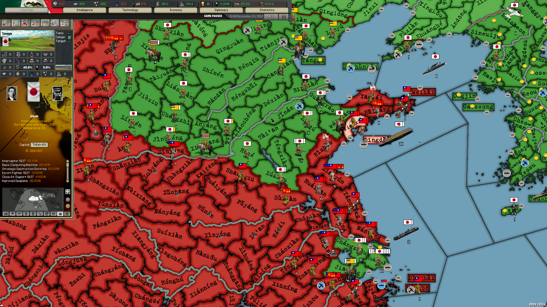
yep. also, whoever picked the shade of red to use for enemy nations in that GC mod, it works kind of okay on the lower levels, but on upper levels with topo it becomes almost black. Look at that Germany, it basically became a black hole haha. I might need to change the colors slightly.

Anyway, if you find time to make an English version of the map and fix minor things like stitches and misaligned rivers, that would be awesome and greatly appreciated :)

View attachment 1145003
Use default red color in Colorscales for Darkest Hour and lightmap4 without borders - map is too fade
 

Attachments

  • map layer4.rar
    89,3 MB · Views: 0
  • colorscales.csv
    2,3 KB · Views: 0
Last edited:
  • 1Like
Reactions:
Use default red color in Colorscales for Darkest Hour and lightmap4 without borders - map is too fade
Interesting! Yes, I see what you mean. Why do you think that is? The vanilla DH topographic map doesn't seem to have the same problem. I know next to nothing about topography mapping - what do you think they're doing differently? Also, somehow it feels like it became even darker than before lol.

1718178951192.png
 
The layer is darker because the opacity is set to 100%
What if you keep the opacity at 50 for layer 4? Or at least 60? I don't think it really needs to be much more pronounced than it is in layer 3 necessarily.

The vanilla DH topography layer feels really really subtle even on layer 4. especially when it comes to landmasses - landmasses look almost solid.
1718362237266.png

also is there any option so simply "turn up the brightness" on the topo map that you are using? how would it look if you did that?

By the way, regarding provinces.csv, i found one in this post and tried it out it is actually a much better distribution altogether than the one i was working with previously. Still far from ideal, but something i can perhaps work with. At least Germany doesn't start out with more IC than the US, that's already an improvement :)
 
Last edited:
Hello! I'm in the tundra now and can't compile the map and fix errors. But they exist. Now I am making an ID card using DH ProvinceEditor from Bizon, 80% completed.
View attachment 1157952
Sample with low resolution
Good, and this is one of the closest thing to a blank map of e3 everyone has ever posted, thank you. These maps are rare. I found only one a year ago but now it seems it was removed. I used it to paint it for fun.
 
Last edited:
Same here, still working on the 1936 adaptation on E3 map, it's proceeding fairly well overall. I got a little sidetracked with a couple of multiplayer DH games plus I could not resist reworking a few things about the game which really didn't suite my fancy, which took a fair bit of time, but it's getting there. Getting the balance right and ironing out all the bugs will be the hardest part, no doubt.
1720430510891.png
 
  • 2Like
  • 1Love
Reactions:
You don't happen to have a mapping spreadsheet between the provinces in the vanilla DH with the corresponding (or closest) provinces on the E3 map, do you? There's one particularly big file i'm trying to get through where being able to automatically map from old province to new one would save me a lot of manual work, if there was such a mapping. :)
 
Last edited:
You don't happen to have a mapping spreadsheet between the provinces in the vanilla DH with the corresponding (or closest) provinces on the E3 map, do you? There's one particularly big file i'm trying to get through where being able to automatically map from old province to new one would save me a lot of manual work, if there was such a mapping. :)
I don't have one. Such a file exists, I remember Novapaddy mentioned it when they ported the DH scenario to E3, ask him or Bizon (mmc Bizon's - conventer scenario from DH to E3).
P.S. But it is possible that there are comparisons to the E3FN map. Don't forget that we are leaving messages in a non-profile topic:)
 
Last edited:
Thanks, this is actually very helpful! While the translation table linked there is an E3->E3FN mapping file, separately I also have another translation table for DH->E3FN. Putting those two together, I should be able to translate DH->E3 fairly accurately.
Fine! How to make a DH-E3 conversion file, please post it, I will attach it to the appropriate topic. I think it’s better to post working materials on such a little-studied map.
 
Fine! How to make a DH-E3 conversion file, please post it, I will attach it to the appropriate topic. I think it’s better to post working materials on such a little-studied map.
This is what I got when I put them two together. Land provinces are 100% covered. For sea provinces there are some gaps - the reason is because the "DHtoE3FNmapIDs.ods" file that came with the FN map didn't cover all the sea provinces for some reason, I don't know if they just didn't get around to finishing that spreadsheet or something. Either way for my purposes this result is more than sufficient because I was mostly interested in land province mapping only.
 

Attachments

  • DHE3mapping.csv
    91,6 KB · Views: 0
  • 1Like
Reactions: