• We have updated our Community Code of Conduct. Please read through the new rules for the forum that are an integral part of Paradox Interactive’s User Agreement.
Status
Not open for further replies.
You'd need to separate commands. The first would be "cd D:\Doomsday\MapUtility v1.1.2\" to get to the directory that MapViewer is in, the second would be "MapViewer -extract" to actually do the extraction.
 
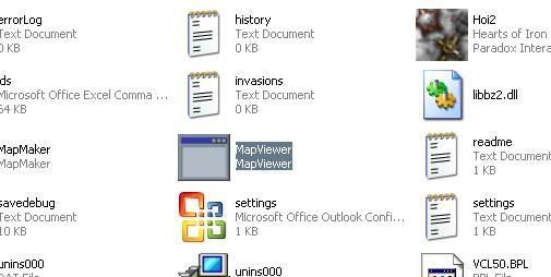
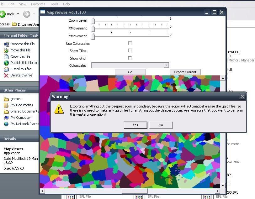
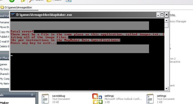
I'm posting a screenshots and I want to know where I make it wrong:

I'm starting MapViewer:
untitled-25.jpg


Exporting the map:
untitled2-12.jpg


Copying the files from "exported maps" to the hoi directory (where map maker is)
untitled3-3.jpg


And when I try to start "MapMaker" this appears:
untitled4.jpg


I only want to know how to change the province names. Please explain with simple words because I have poor english :(
 
IndoEsia45 said:
Oh..it's a success ! I changed Beiping into Peking for my warlords mod.
Did you figure out what font they use?
 
IndoEsia45 said:
I just copy paste another province font to combine Peking, since i don't need too much modification and no special character.

Anyway do the adjacent.tbl works ?
Adjacent.tbl should work IF 1) You have at least 1.1.1, and 2) You downloaded adj-mod.txt and put it in the same folder as MapMaker.


And does anybody know the font for HoI, Victoria, or CK?
 
Small problem

Hi Jamie

I tried out your mapmaker tool and it looks very good.

However i wanted to remove the weird vertical seazone border graphics in the middle of province Alesund in norway. This buggy border is only seen in zoom 2. Its not in the borderfile, but in colourscales map file so its a pure graphics bug.

So i did the normal -extract and then manually extracted the right map part with Alesund.

Then i opened the file and removed the borderline. and did the rest of the process excatly as described. Did not do 4.

when i try to load the game (hoi.exe) it says plz install latest milestone after reimporting the vanilla lightmap files it works again.

What do you think i have done wrong, the error log has nothing, since the process went without a hitch. Must i extract the intire set of zoom 2 files like the default does with the fully zoomed in map ?

Is there another way to do this besides manually extracting all files, just like extracting all zoom 0 can be done with one command ?

EDIT: I useed beta version 1.1.1 now i see a 1.1.2 version is out will that solve anything ?
 
Gormadoc said:
Hi Jamie

I tried out your mapmaker tool and it looks very good.

However i wanted to remove the weird vertical seazone border graphics in the middle of province Alesund in norway. This buggy border is only seen in zoom 2. Its not in the borderfile, but in colourscales map file so its a pure graphics bug.

So i did the normal -extract and then manually extracted the right map part with Alesund.

Then i opened the file and removed the borderline. and did the rest of the process excatly as described. Did not do 4.

when i try to load the game (hoi.exe) it says plz install latest milestone after reimporting the vanilla lightmap files it works again.

What do you think i have done wrong, the error log has nothing, since the process went without a hitch. Must i extract the intire set of zoom 2 files like the default does with the fully zoomed in map ?

Is there another way to do this besides manually extracting all files, just like extracting all zoom 0 can be done with one command ?

EDIT: I useed beta version 1.1.1 now i see a 1.1.2 version is out will that solve anything ?
MapMaker only operates on lightmap1, so simply by rebuilding the lightmaps, that line will disappear.

But the crash is strange. Do you have at least MapUtility 1.1.1 or the downloadable MapMaker fix for HoI? Did you download adj-mod.txt and place it in MapMaker's directory?

Try using the old adjacent.tbl, and see if the lightmaps and boundboxes work.

EDIT: Don't think so, but you can try if the other stuff fails.
 
OK, so if i understand you correct any error on any other lightmap than the depeest zoom lightmap gets fixed by auto extracting and then just rebuild the map without making any changes. ?

Assuming offcourse the error is not on lightmap 1.

Will try that with 1.1.1 and with 1.1.2 if the first fails and report back.
 
Gormadoc said:
OK, so if i understand you correct any error on any other lightmap than the depeest zoom lightmap gets fixed by auto extracting and then just rebuild the map without making any changes. ?

Assuming offcourse the error is not on lightmap 1.

Will try that with 1.1.1 and with 1.1.2 if the first fails and report back.
You understand correctly
 
Jamie550 said:
And does anybody know the font for HoI, Victoria, or CK?


AFAIK no one has figured that out yet. I wonder if a Paradox official would be willing to answer...
 
Does anybody want modify this for HoI? ObjectEditor (not yet released) reads this to determine how to modify province.csv object positions.

Code:
object = 
{
	name="Fort"
	xColumn=13
	yColumn=14
	image=
	{
		path="gfx\interface\eyr\small_forts.bmp"
		bounds={x=120 y=0 width=20 height=14}
		transparency=
		{
			color={R=0 G=255 B=0}
		}
	}
}
object = 
{
	name="Army"
	xColumn=15
	yColumn=16
	image=
	{
		path="gfx\map\units\bmp\T-ARMY C-MIN A-FIRE D-NE.bmp"
		bounds={x=0 y=0 width=64 height=64}
		transparency=
		{
			color={R=0 G=255 B=255}
			color={R=255 G=0 B=255}
		}
	}
}
object = 
{
	name="Port"
	xColumn=17
	yColumn=18
	image=
	{
		path="gfx\map\harbour.bmp"
		bounds={x=0 y=0 width=32 height=40}
		transparency=
		{
			color={R=0 G=255 B=0}
		}
	}
}
 
Here we go:
Code:
object = 
{
	name="Fort"
	xColumn=13
	yColumn=14
	image=
	{
		path="gfx\map\fortification.bmp"
		bounds={x=0 y=0 width=32 height=32}
		transparency=
		{
			color={R=255 G=0 B=255}
		}
	}
}
object = 
{
	name="Army"
	xColumn=15
	yColumn=16
	image=
	{
		path="gfx\map\units\bmp\T-INFANTRY A-STAND C-MIN L-1.bmp"
		bounds={x=0 y=0 width=96 height=96}
		transparency=
		{
			color={R=0 G=255 B=255}
			color={R=255 G=0 B=255}
		}
	}
}
object = 
{
	name="Port"
	xColumn=17
	yColumn=18
	image=
	{
		path="gfx\map\harbour.bmp"
		bounds={x=0 y=0 width=32 height=32}
		transparency=
		{
			color={R=255 G=0 B=255}
		}
	}
}

object = 
{
	name="Airfield"
	xColumn=19
	yColumn=20
	image=
	{
		path="gfx\map\airfield.bmp"
		bounds={x=0 y=0 width=32 height=32}
		transparency=
		{
			color={R=255 G=0 B=255}
		}
	}
}
object = 
{
	name="Antiair"
	xColumn=21
	yColumn=22
	image=
	{
		path="gfx\map\antiair.bmp"
		bounds={x=0 y=0 width=32 height=32}
		transparency=
		{
			color={R=255 G=0 B=255}
		}
	}
}
object = 
{
	name="Radar"
	xColumn=23
	yColumn=24
	image=
	{
		path="gfx\map\radar.bmp"
		bounds={x=0 y=0 width=32 height=32}
		transparency=
		{
			color={R=255 G=0 B=255}
		}
	}
}
object = 
{
	name="City"
	xColumn=25
	yColumn=26
	image=
	{
		path="gfx\map\city.bmp"
		bounds={x=0 y=0 width=32 height=32}
		transparency=
		{
			color={R=255 G=0 B=255}
		}
	}
}
object = 
{
	name="Counter"
	xColumn=27
	yColumn=28
	image=
	{
		path="gfx\palette\counter.bmp"
		bounds={x=0 y=0 width=32 height=34}
		transparency=
		{
			color={R=0 G=255 B=255}
		}
	}
}

Will this be changeable in an ini or txt file, because different mods use different graphics with different sizes?
There also should be an entry for the beach graphics, but I don't know if it's possible with the editor right now, because there are 48 different beach graphics for all kinds of directions.
 
Last edited:
Hey i have problem, i have extracted, changed a province name and done steps 1-6 without errors, but when i copy the files from the map folder (the ones that the editor has created) to the map folder of the game, when i click on the .exe the error "install the latest milestone appears", it doesn't happen if i backup the original map files.

Do you know the cause?
 
ADukes: Thanks :) Yes, that will be editable. I plan on having three downloads of objects.txt, depending on the game, and of course it is still modifiable after download. For beaches, could we just use one of the beach graphics, or would that be too difficult?

GanguGengu: Look at the link Help on the first post

Kretoxian: Did you download adj-mod.txt and place it in the same directory as MapMaker?

Does this look right to everyone? (Washington DC)

hoiobjsqh3.png
 
Last edited:
Status
Not open for further replies.