• We have updated our Community Code of Conduct. Please read through the new rules for the forum that are an integral part of Paradox Interactive’s User Agreement.


The Atlas of Persia & the Caucasus in 1337


Here is my attempt at detailed feedback on the review, mostly using information from posts in the first Persia & Caucasus thread.


Maps

The following maps should give the most accurate picture of what the countries and borders of this region are. Very easy to compare to the in-game map using the arrow keys.

I've kept the independent colours, so that the countries' borders can be seen easier. You can find subject relations in the table further below.


The Reviewed Map compared to the Community Feedback Map:

View attachment 1282930 View attachment 1282944

Locations:

View attachment 1282945


Zoomed in Maps:

Here you can see the countries in close-ups, labeled with their names.

Caucasus:

View attachment 1282946 View attachment 1282947

South-West:

View attachment 1282948 View attachment 1282949

South-East:

View attachment 1282950 View attachment 1282954

Khorasan:


View attachment 1282955 View attachment 1282956


Country Information:

Here are some of the compiled countries, with their titles, types, rulers, dynasties, their rulers' cultures and religions. Many of them are empty due to lack of information, and some I've filled with guesswork.

NOTE: Cultures & Religions are those of the RULER, not necessarily the population

NOTE:
Vassal relations are represented by indentations.


Development

I feel like the area circled in white below (Khorasan and Transoxiana) should have more development, especially when compared to Arabia and Kurdistan.

View attachment 1282970

It has been 80+ years since the Mongol invasion, and many of the previous Ilkhans initiated several reconstruction, repopulation and agricultural projects to revitalize the devastated regions, having imported labour from across the Mongol empire, such as Khitans/Chinese.

"Nomads as Agents of Cultural Change - The Mongols and their Eurasian Predecessors" (2014):


View attachment 1282971


Court Languages

The court language of the Qasarids, Jalayirids and Hüleguids should definitely be Mongolian. It continued as a language of the ruling elite (Mongols) and as a liturgical language for the Tengri, while Persian was the bureaucratic language (liturgical?).


Raw Materials

Astarabad was known for silk production at this time

"Cambridge History of Turkey Volume 1" (2010):


View attachment 1282972

"Cambridge History of Iran Volume 6" (1986):

View attachment 1282973
Great work although the Hazaraspids where a kurdish dynasty they are even depicted as such in CK3


The Ilkhanate IO - Spheres of Influence


The below custom map represents the spheres of influence of each claimant to the Ilkhanate. The custom map also includes states which recognized their "overlord's" claims only nominally, such as the Kurdish tribes and Armenian principalities, who could be likened more to tributaries/military access, rather than vassals.

You will notice a stark difference to the current in-game map, which represents the "idea" of an Ilkhanate, and not necessarily the politics of the time. Most of the states had practically zero interaction with the civil war factions, although some of them would be drawn into the civil war through later diplomacy, such as the Muzaffarids of Yazd aligning with the Chobanids, conquering Kerman and Fars, and being "granted" said territories by the Chobanids.

So it is clear, you shouldn't need to conquer 75% of the current in-game Ilkhanate IO to form the Ilkhanate.

You should only need to defeat the other claimants, and to conquer the central pastures (and capitals) of Arran, Mughan, Tabriz and Soltaniyeh. As a claimant, you're reclaiming the throne, not conquering the empire. Reclamation of the peripheries should come afterwards, not before.

This would ideally then allow the Ilkhan to demand fealty (as vassals or tributaries) from the remaining members, who can decline, leaving the IO and giving a subjugation CB to the Ilkhan.

Ilk IO.png
1745160748844.png


And below is what the starting diplomatic WAR-mapmode should look like (from the Qasarid/Hüleguid perspective). I have included only the states which we know from sources were actively involved, or can assume to have been involved through their subject-relation to their overlord.

Togha Temür Ilkhan (Qasarids) and Musa Ilkhan (Hüleguids) had struck a temporary truce, and essentially became co-belligerents against the powerful Hasan Buzurg (Jalayirids), and Hajji Taghay (Sutayids), who had sided with Hasan Buzurg from the start.

In April 1st 1337 (game start), Togha Temür & Musa have gathered their forces at Soltaniyeh, captured from the Jalayirids only recently. In June 1337, they would advance towards Tabriz and meet Hasan Buzurg in battle at Maragheh, just south of Tabriz. So it is likely that Hasan Buzurg's forces are raised near Tabriz at game start.

Personally, I think the Qasarids and Hüleguids should be depicted as being in two separate wars with the Jalayirids, but with both countries' armies starting at/near Soltaniyeh and sharing military/food access. After all, they were both still rival claimants to the throne, and Togha Temür likely betrayed Musa by withdrawing early at Maragheh and leaving him surrounded.

1746967721374.png


Last edited:
  • 6
  • 4Like
  • 3Love
Reactions:
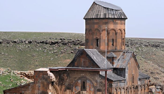
Not making a comment about who/how controls Ani city/state/region but just adding a source about it: https://dergipark.org.tr/en/pub/ataunigsed/issue/2568/33087

View attachment 1283362
It would be helpful to have more sources of information about the situation in the city of Ani in the years 1300-1337, but it is likely that it was under some Mongol control.
The sack of Ani was probably in 1239?
Later, in 1239, during the reign of Ogeday (1129-1241), Ani, which was captured by the Mongols, was easily conquered and destroyed by the army led by the Chingizids' governor-general of Iran, Charmagan-Noyan, but finally, peace was restored when the queen of Georgia, Rusudan, announced that she was ready for an agreement. Despite this, the Chingizids caused great damage to the buildings and people in Ani. Kirakos of Ganja writes about the conquest of Ani by Charmagan-Noyan (Carmagun) as follows.
Zrzut ekranu 2025-04-21 003436.png
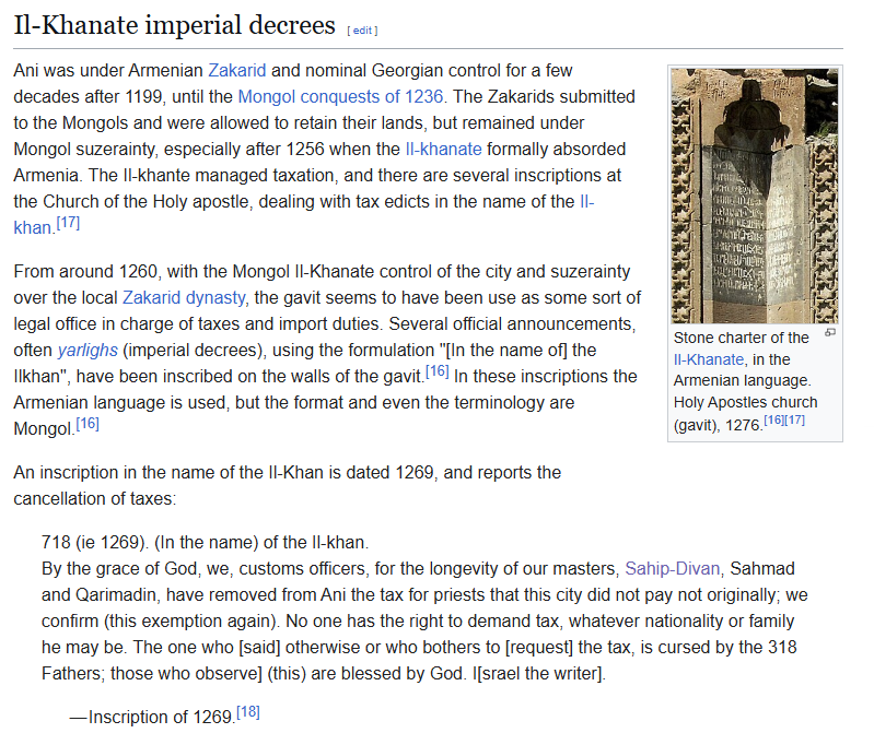
Although according to some sources the city of Ani was sold by the Zakarids in 1261 to some wealthy man named Sahmadi.
But this man was probably a subject of the Zakarids rather than the Mongols, so these territories are still property of the Zakarids.
It is also possible that the Zakarids became Mongol vassals.
Zrzut ekranu 2025-04-20 232951.png

Zrzut ekranu 2025-04-20 233002.png

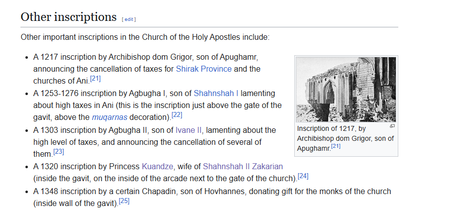
It also seems that Kuandze buried her husband Shahnshah II in Ani in 1320.
Zrzut ekranu 2025-04-21 093305.png

Zrzut ekranu 2025-04-26 215902.png

Kuandze's mother was Khoshak(1235-1299) who was the daughter of Avag Zakarian(1227–1250)

Church of the Holy Apostles (Ani)​

Zrzut ekranu 2025-04-26 212423.png

Zrzut ekranu 2025-04-26 212429.png

Zrzut ekranu 2025-04-26 212358.png
 
Last edited:
  • 1
Reactions:
I was playing Imperator for the first time in months and I noticed something

The devs haven't changed the subject-overlord colours in 5+ years

(and yes I was playing Iberia, how stereotypical of me)

uncanny.png
Ilkhanate.png
 
  • 9Haha
Reactions:


The Ilkhanate IO - Spheres of Influence


The below custom map represents the spheres of influence of each claimant to the Ilkhanate. The custom map also includes states which recognized their "overlord's" claims only nominally, such as the Kurdish tribes and Armenian principalities, who could be likened more to tributaries/military access.

You will notice a stark difference to the current in-game map, which represents the "idea" of an Ilkhanate, and not necessarily the politics of the time. Most of the states had practically zero interaction with the civil war factions, although some of them would be drawn into the civil war through later diplomacy, such as the Muzaffarids of Yazd aligning with the Chobanids, conquering Kerman and Fars, and being "granted" said territories by the Chobanids.

So it is clear, you shouldn't need to conquer 75% of the current in-game Ilkhanate IO to form the Ilkhanate. You should only need to defeat the other claimants, and to conquer the central pastures (and capitals) of Arran, Mughan, Tabriz and Soltaniyeh.

View attachment 1283673 View attachment 1283669


And below is what the starting diplomatic WAR-mapmode should look like (from the Qasarid/Hüleguid perspective). I have included only the states which we know from sources were actively involved, or can assume to have been involved through their subject-relation to their overlord.

Togha Temür Ilkhan (Qasarids) and Musa Ilkhan (Hüleguids) had struck a temporary truce, and essentially became co-belligerents against the powerful Hasan Buzurg (Jalayirids), and Hajji Taghay (Sutayids), who had sided with Hasan Buzurg from the start.

In April 1st 1337 (game start), Togha Temür & Musa have gathered their forces at Soltaniyeh, captured from the Jalayirids only recently. In June 1337, they would advance towards Tabriz and meet Hasan Buzurg in battle at Maragheh, just south of Tabriz. So it is likely that Hasan Buzurg's forces are raised near Tabriz at game start.

Personally, I think the Qasarids and Hüleguids should be depicted as being in two separate wars with the Jalayirids, but with both countries' armies starting at/near Soltaniyeh and sharing military/food access. After all, they were both still rival claimants to the throne, and Togha Temür likely betrayed Musa by withdrawing early at Maragheh and leaving him surrounded.

View attachment 1283699


Forgot to mention, but the conclusion is that to form the Ilkhanate, you shouldn't need to conquer 75% of the members' lands.

You should only need to defeat the other claimants, and to capture the summer/winter pastures/capitals in the central region (Arran, Mughan, Tabriz, Soltaniyeh). You're reclaiming the throne, not conquering the empire. Reclamation of the peripheries should come afterwards, not before.

This would ideally then allow the Ilkhan to demand fealty (as vassals or tributaries) from the remaining members, who can decline, leaving the IO and giving a subjugation CB to the Ilkhan.


Last edited:
  • 8
  • 2
Reactions:
Most of the states had practically zero interaction with the civil war factions, although some of them would be drawn into the civil war through later diplomacy, such as the Muzaffarids of Yazd aligning with the Chobanids, conquering Kerman and Fars, and being "granted" said territories by the Chobanids.

Given rebellions are their own tags in EU5, this gives me a bunch of ideas. One is that during civil wars, vassals should get an event to choose a side, neutrality or independence. Furthermore, parts of one's country (determined partially by control, partially proximity, partially acceptance of local cultures and partially randomly) ought to become neutral zones which don't support either side. These can be invaded by both sides, and will tend to flip quickly towards whoever invades, though specific conditions like being close to a revolt or joining the opposite side will cause them to actively do such. The longer the civil war drags on, the faster revolt type factions in the neutral zone progress. If the Civil War ends before they pop, knowing the odds of victory are lower they lose the extra progress. If the rebels pop during the war, they end up in a defensive war with both factions of the civil war.

What do people think?
 
Last edited:
Given rebellions are their own tags in EU5, this gives me a bunch of ideas. One is that during civil wars, vassals should get an event to choose a side or neutrality (the most common option). Furthermore, parts of one's country (determined partially by control, partially proximity, partially acceptance of local cultures and partially randomly) ought to become neutral zones which don't support either side. These can be invaded by both sides, and will tend to flip quickly towards whoever invades, though specific conditions like being close to a revolt or joining the opposite side will cause them to actively do such. The longer the civil war drags on, the faster revolt type factions in the neutral zone progress. If the Civil War ends before they pop, knowing the odds of victory are lower they lose the extra progress. If the rebels pop during the war, they end up in a defensive war with both factions of the civil war.

What do people think?

Ideally vassals would have a great window to break free during a civil war.

While the Ilkhanate in real terms is a civil war, I don't think it can be represented in-game using the current civil war mechanics. So instead each faction is their own tag and play within those rules.

As the factions fought eachothers and depleted eachothers resources, the vassals broke free of the "Ilkhanate" pretty much without a fight, such as the Eretnids and Kartids.
 
  • 1
Reactions:
While the Ilkhanate in real terms is a civil war, I don't think it can be represented in-game using the current civil war mechanics. So instead each faction is their own tag and play within those rules.
I wasn't intending my suggestion apply to the Ilkhanate; given it's happening at game start, it's logical for it to get special treatment for both fun and accuracy.

As the factions fought eachothers and depleted eachothers resources, the vassals broke free of the "Ilkhanate" pretty much without a fight, such as the Eretnids and Kartids.
I was intending for that sort of thing to be able to happen in other civil wars as a subset of the vassal neutrality option; I hadn't articulated that so I've edited the post.


@Ispil from your readings, do you have an idea of how accurate the current distribution of development is in the Kurdish zone? To me it looks very odd.

I'm feeling like starting to work on a general development map

Untitled.png


  • 1Like
  • 1
Reactions:


@Ispil from your readings, do you have an idea of how accurate the current distribution of development is in the Kurdish zone? To me it looks very odd.

I'm feeling like starting to work on a general development map

View attachment 1285041


Personally, I also took issue with such a depiction of "Kurdistan" upon first sight, but as 1. I am not even remotely knowledgeable about the region in the time frame, and 2. I didn't find the Georgian part of the map disagreeable, I didn't write more about it myself.

As a total layman: I feel as though the regions of Isfahan and Tabriz/Soltaniyeh (Iranian Azerbaijan) should be significantly more developed, at the expense of the Zagros and Upper Mesopotamian regions. Eastern Persia looks fine. Transoxiana is very underdeveloped, though that may be deliberate, perhaps done to represent the devastation caused by the Mongol conquests.

In Georgia, the development is nearly perfectly done. Though perhaps Kakheti-Hereti should be bumped up a little, along with Tao-Klarjeti (province of Meskheti). Tskhumi (location of Sukhumi) was also a very busy port, and the seat of the Genoese consulship, so maybe it should be bumped up as well.
 
  • 3Like
  • 2
Reactions:


@Ispil from your readings, do you have an idea of how accurate the current distribution of development is in the Kurdish zone? To me it looks very odd.

I'm feeling like starting to work on a general development map

View attachment 1285041


Nusaybin was in ruins. Sanadajah was effectively nonexistent (the Kurdish tribe currently occupying it were effectively described as "squatters"; it wouldn't flourish until seized by Ardalan). Kermanshah declined severely during the Ilkhanate period to the point of being described as a mere "village" by the end of it.

I'd say that the development map is more apt of trade and development at the very outset of Mongol rule. In reality, we should see development instead focus away from Baghdad in general.

1745513773895.png

1745513869415.png
 
  • 4
  • 2Like
Reactions:
I traced over the map from the Historical Atlas of Georgia and overlaid it onto the locations map from the thread.

I aligned the map to the locations to the best of my abilities. As you can see, it's far from perfect, but I digress.

Locationsmap.png


I think this map serves as a useful tool to see which locations need adding, splitting, or remodelling. Most notably, Nakhichevan, Syunik, and Khachen in Armenia, and southwestern Dagestan to the north.

I hope this can be of some use to the developers. Thank you.
 
  • 4Like
  • 1
Reactions:
I traced over the map from the Historical Atlas of Georgia and overlaid it onto the locations map from the thread.

I aligned the map to the locations to the best of my abilities. As you can see, it's far from perfect, but I digress.

View attachment 1285697

I think this map serves as a useful tool to see which locations need adding, splitting, or remodelling. Most notably, Nakhichevan, Syunik, and Khachen in Armenia, and southwestern Dagestan to the north.

I hope this can be of some use to the developers. Thank you.

On the zoomed location map of Caucasus, you can see the river running through Surmali, Igdir and Khor Virap. I quite liked the border I drew along it for the zoomed in Caucasus.
 
Last edited:
  • 2
Reactions:


Here is a preliminary map of the reworked development of Iran and the peripheries, including a map of towns & cities:

I used Mustawfi's contemporary accounts on infrastructure and revenues, to index the different locations and surroundings in comparison to Tabriz, the biggest city of the region. For Arabia I mostly used the existing development, cuz I don't know much about the region. Keep in mind that Mustawfi himself admitted that he is no expert, but was encouraged by friends to write his work.

Feel free to give any suggestions to the maps


New development compared to the Old development:

Justifications: https://forum.paradoxplaza.com/foru...ersia-caucasus-feedback.1733834/post-30311111

Development.png
1745761502096.png


Towns & Cities:

Towns & Cities.png


Locations:

ALL LOCATIONS.png


Last edited:
  • 10Like
  • 6Love
  • 1
Reactions:
I have revised my Armenia map suggestion one last time
I improved the impassable areas by widening them a bit and reducing them in other places.
Zrzut ekranu 2025-03-21 200003 (1) (1).png
Locations2 (1).png


The Yernjak/Alinja location should be under the control of the Orbelian dynasty/Proshyan dynasty? or the Jalayirid dynasty.
Zrzut ekranu 2025-04-27 152018.png

The capital of the Proshyan princes was probably the Proshaberd/Boloraberd fortress in 1337.
The capital of the Orbelian princes:Yeghegis/Smbataberd
gigf.png

karta-istoricheskogo-Syunika.jpg

 
Last edited:
  • 3Like
  • 2
Reactions:


Here is a preliminary map of the reworked development of Iran and the peripheries, including a map of towns & cities:

I used Mustawfi's contemporary accounts on infrastructure and revenues, to index the different locations and surroundings in comparison to Tabriz, the biggest city of the region. For Arabia I mostly used the existing development, cuz I don't know much about the region. Keep in mind that Mustawfi himself admitted that he is no expert, but was encouraged by friends to write his work.

Feel free to give any suggestions to the maps


New development compared to the Old development:

View attachment 1286311 View attachment 1286280


Towns & Cities:

View attachment 1286309


Locations:

View attachment 1286310


What are your criteria for towns and cities?

I also think you should export your maps to a more programmable format. Like a table „location name“ - „development“. For at least the most important cities. I think even if map is great at visualising it is extremely hard to act on in this case. Also in the table you can post in a third field for areas/provinces/locations general/specific argumentation on why you assigned such values.
 
Last edited:
  • 3Like
Reactions:
What are your criteria for towns and cities?

I also think you should export your maps to a more programmable format. Like a table „location name“ - „development“. For at least the most important cities. I think even if map is great at visualising it is extremely hard to act on in this case. Also in the table you can post in a third field for areas/provinces/locations general/specific argumentation on why you assigned such values.

Criteria is how the locations were described in the accounts of Mustawfi and others, and trying to align it with how Paradox has decided on towns and cities in the glimpses they have shown, which is basically haphazardly.

For development, I filled in the locations that Mustawfi talks about, and filled in the rest using information from elsewhere or just filling irrelevant locations with likely development.


Drawn from "THE GEOGRAPHICAL PART OF THE NUZHAT-AL-QULUB COMPOSED BY HAMD-ALLAH MUSTAWFI OF QAZWIN IN 740 (1340)":

Tabriz is index of 100, due to being the largest city of the region at the time, and is hence the reference point for all the rest. (Tabriz isn't max development in-game wise, only the max development of this region).

FactorWeightSource inside Mustawfī
Urban scale & monuments40 %walls, citadel, Friday mosque, colleges
Fiscal strength40 %tax figure when given; if not, ratioed from “towns of like type” (his own phrase)
Strategic / commercial role20 %location on royal roads, ports, silk-road crossings


1. Ādharbayjān & Arrān​


City / districtRevenue (dīnār)Index
Tabrīz≈ 300 000100
Sultāniyya (court season)≈ 300 00090
Marāgha70 00070
Ardabīl185 00055
Khoi40 00060
Marand24 00050
Mi‘yālij & Mīyānijnot stated (orchards, rice)40
Dizmar (orchard zone)40 80045
Nakhchivān35 00045
Ujān / Shahr-i-Islām10 00040
Khalkhālrural estate35
Darbands of Aras (Khudā-Āfarīn)toll only30

2. Jibāl (Persian ʿIrāq)​


CityRevenueIndex
Isfahān≈ 500 000 (province)85
Qazvīn55 000 (city)55
Rayy (mostly ruins)40 00045
Hamādān105 00070
Sāvah45 00045
Abhar8 00035
Zanjān48 00050
Qum40 00040
Kāshān42 00040
Aveh & Rūdbār-e-Alamūt (Ismāʿīlī castles)8 00035

3. Fārs & Gulf Hinterland​


City / districtRevenueIndex
Shīrāz≈ 150 000 (city)80
Fasāin Fārs total 2 871 200 d.50
Darābjird27 00040
Kāzerūnnot stated – sugar & palm duty45
Sarvistānrural35
Maymand (wine)small craft duty30
Muḥū • Hamjān • Kabrīn (roadside)very small30
Istakhr district (Persepolis ruins)symbolic35
Hormuz (New)customs farm (≈ 250 000)85
Larcaravan head50
Bandar-e Māh-shahr & Abādānriver toll45
Qays islandpearl-fishery tithe60

4. Khūzistān​


CityRevenueIndex
Shūshtar58 00050
Ahvāz52 00050
Dizfūlwater-wheel dues45
Rāmhormoznot stated40
Askar-Mukramnot stated35

5. Kirmān & Makrān​


City / oasisRevenueIndex
Kirmān / Gūwāshīr28 00040
Bam-Jīruft30 00040
Sirjānstated “half of Kirmān”35
Maymand-i Bamsmall30
Makrān ports (Tīz, Fannazbūr)customs only35

6. Khurāsān & Quhistān​


City / districtRevenueIndex
Nīshāpūr≈ 90 00065
Herātnot stated – “359 colleges, 444 000 houses”80
Fushanjgrapes & wind-mills50
Asfūzar (Isfīzar)fruit duty45
Bakharzmelon plain45
Jamshrine town40
Zāranj (Sīstān)not stated45
Qāyingrain + saffron40
Tūn & Qā’inātunderground-channel tax40
Tabas (Gīlakī & Masīnān)date tax35
Birjandcarpet-wool40

7. Arrān, Shirvān, Gorjestân​


CityRevenueIndex
Ganjah“rich silk-tythe”55
Baylaqānborder fortress40
Bakuoil, fire shrine45
Shamakhiwine trade50
Tbilisi (Tiflis)baths, tolls55
Ani (ruined)pilgrimage levy35

8. Jazīra & Northern Mesopotamia​


CityRevenueIndex
Mosul65 00065
Amid (Diyarbakr)not stated55
Mardintoll castle50
Sinjārwheat plain45
Jazīrat Ibn ʿUmar (Cizre)river duty45
Mayyāfāriqīnleather & iron50
Harrānruined star-temple35
Hisn Kayfābridge transit40

9. ʿIrāq-i ʿArab​


CityRevenueIndex
Baghdād150 00078
Najaf / al-Mashhadshrine endowment60
Kūfaagricultural dues45
Wasitriver trade50
Baṣra60 00063
Abādānfisheries45
Hil(l)ah (on Euphrates)weaving, shrine48
Sāmarrāpalace rent, cluster villages50

10. Anatolia (Rum)​


CityRevenueIndex
Sīwās (Sebasteia)caravan convergence60
Erzurumfrontier fortress55
Qayṣariyyatrade with Aq Sarā55
Quniyah (Konya)Sufi capital60
Malatīyahcereal depot50
Aksarātextile45

11. Khwārazm & Transoxiana​


CityRevenueIndex
Samarqand“eight-day orchard belt”75
Balkh“upper town ruins; shrine”60
Bukhārāimplicit65
Khuttalān & Tāliqānrural40
Urganj (Gurganj)silk-road port70
Khujandfruit city55

12. Afghanistan & Indus fringe​


CityRevenueIndex
Ghazna / Ghaznīntreasury city50
Qandahārgrain basket60
Kābulcastle and fruit55
Zābul / Rukhajpasture & vines45
Bannū / Multān (Sind entry)trade50

13. Persian Gulf & Arabian Coast​


CityRevenueIndex
Qays (Kīsh)pearl customs60
Bahrayn towns (al-Qaṭīf etc.)date tax45
Qulzum (Suez)canal toll45


Last edited:
  • 5
  • 4Like
  • 1Love
Reactions: